We were getting tired by the afternoon and frustrated with the terrain traps we encountered, which kept adding miles on to our trip. Here is a short clip Norm took after my, umm, classic faceplant.
Shortly after the faceplant, we realized we were not going to make it out. Fortunately, our walkie-talkies were able to reach Haley and Jeannie just for a moment, and we notified them we would be staying overnight. We tried not to seem alarmed so they would not worry. That worked. We did the same for ourselves, and just tried to make the best of the situation.
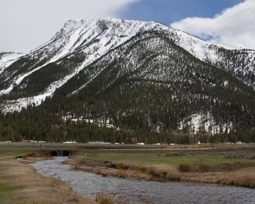
The base of Hell Roaring Canyon, and on down the creek of the same name.
I am sitting in the Shack in Twin Bridges on Tuesday, May 7, a layover day for me after 6 days on the Beaverhead River. I really want to post some photos for my blog followers before I head down the Jefferson River tomorrow. I am running short on time so I will do the best I can here. Of course, my Facebook page contains much more frequent updates. Please like the page if you can. Thanks, all! I appreciate your interest in my adventure!
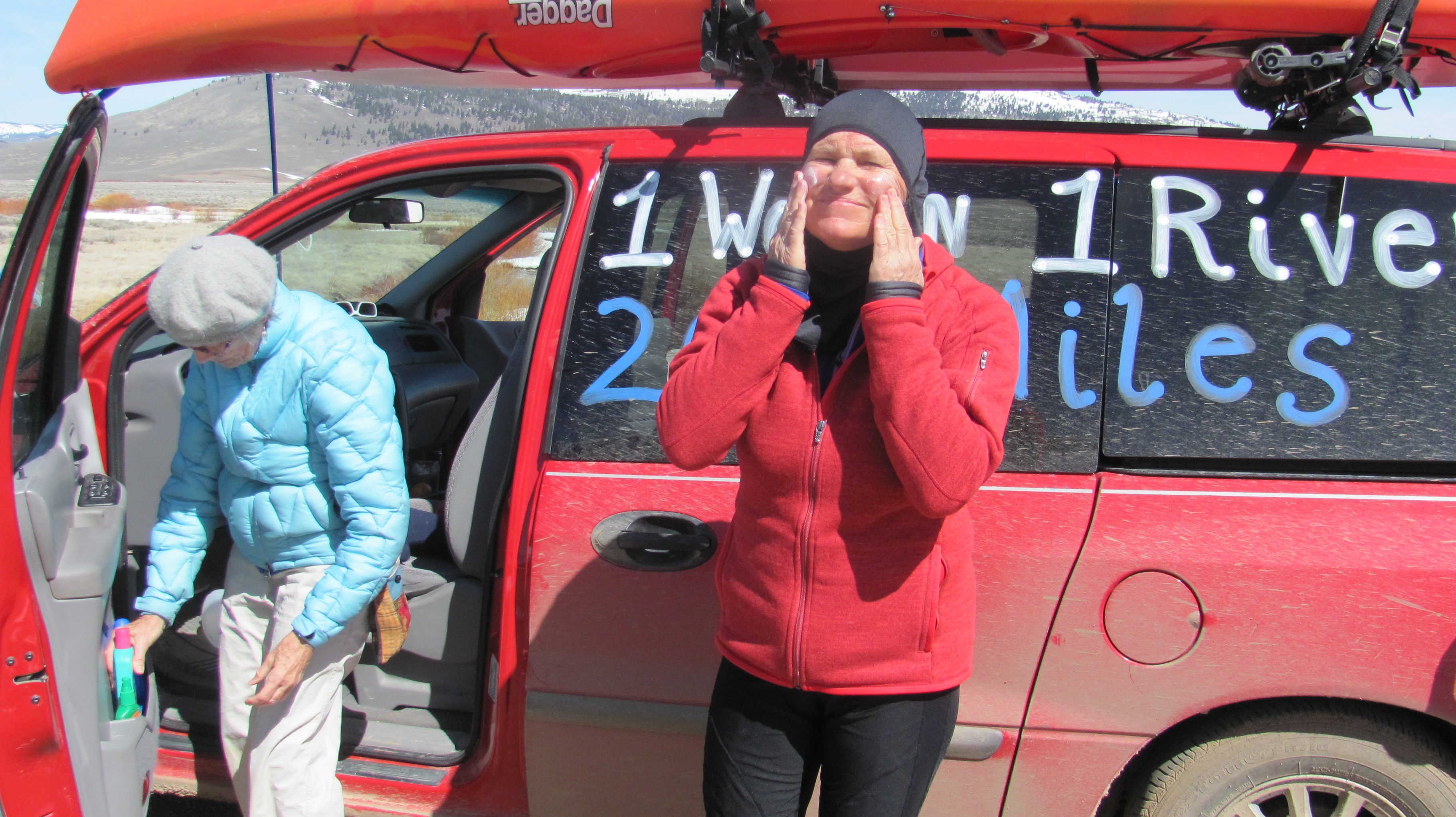
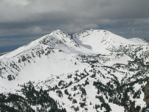
Long stretches of exquisite beauty. And, a little bit of push, as in stamina.Starting at the base of Hell Roaring Canyon, and on down Hell Roaring Creek.Beautiful vistasWhat an incredible bike ride! Just breathtaking!Long gorgeous and gradual downhills.Our stop at the end of the first day. Red Rock Creek below the Red Rock Lakes National Wildlife Refuge.
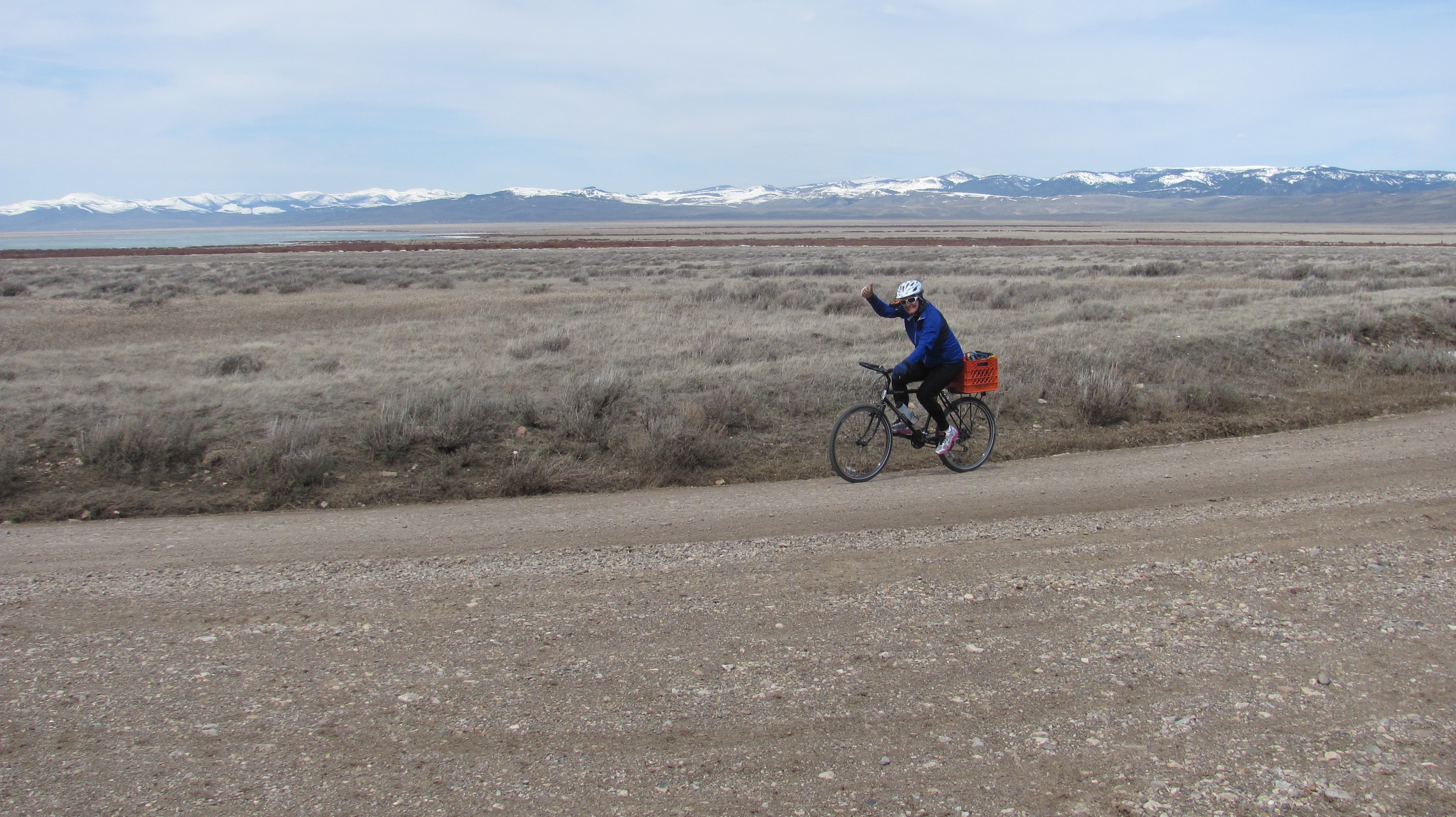
The start of the second day began with a, yes, flat tire out in the middle of NOwhere! We got ‘er done, though. Survival of the fittest.
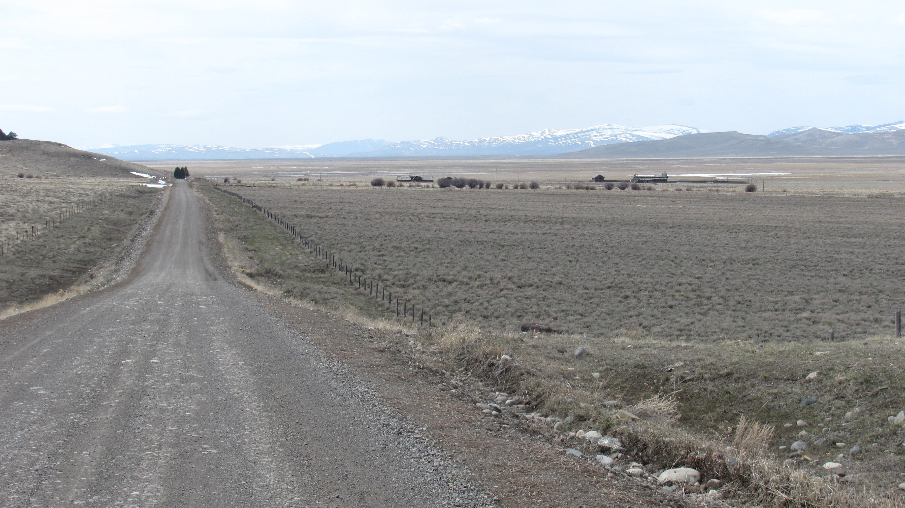
Long stretches of exquisite beauty. And, a little bit of push, as in stamina.Finally made it to Lima Dam. Still, onward to the town of Lima.Lima DamThe windy, as in lots of turns, Red Rock River.From the town of Lima I followed the old Highway 191 all but seven miles of the 31 mile stretch to Clark Canyon Dam. Very peaceful. My support crew followed me closely.Two bison mommas and their babies. They had their eye on my from afar.Finally, after 90-somethin’ miles, we made it to Clark Canyon Reservoir and Dam in 3 days.Clark Canyon Reservoir
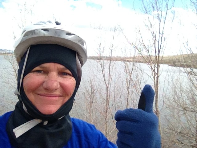
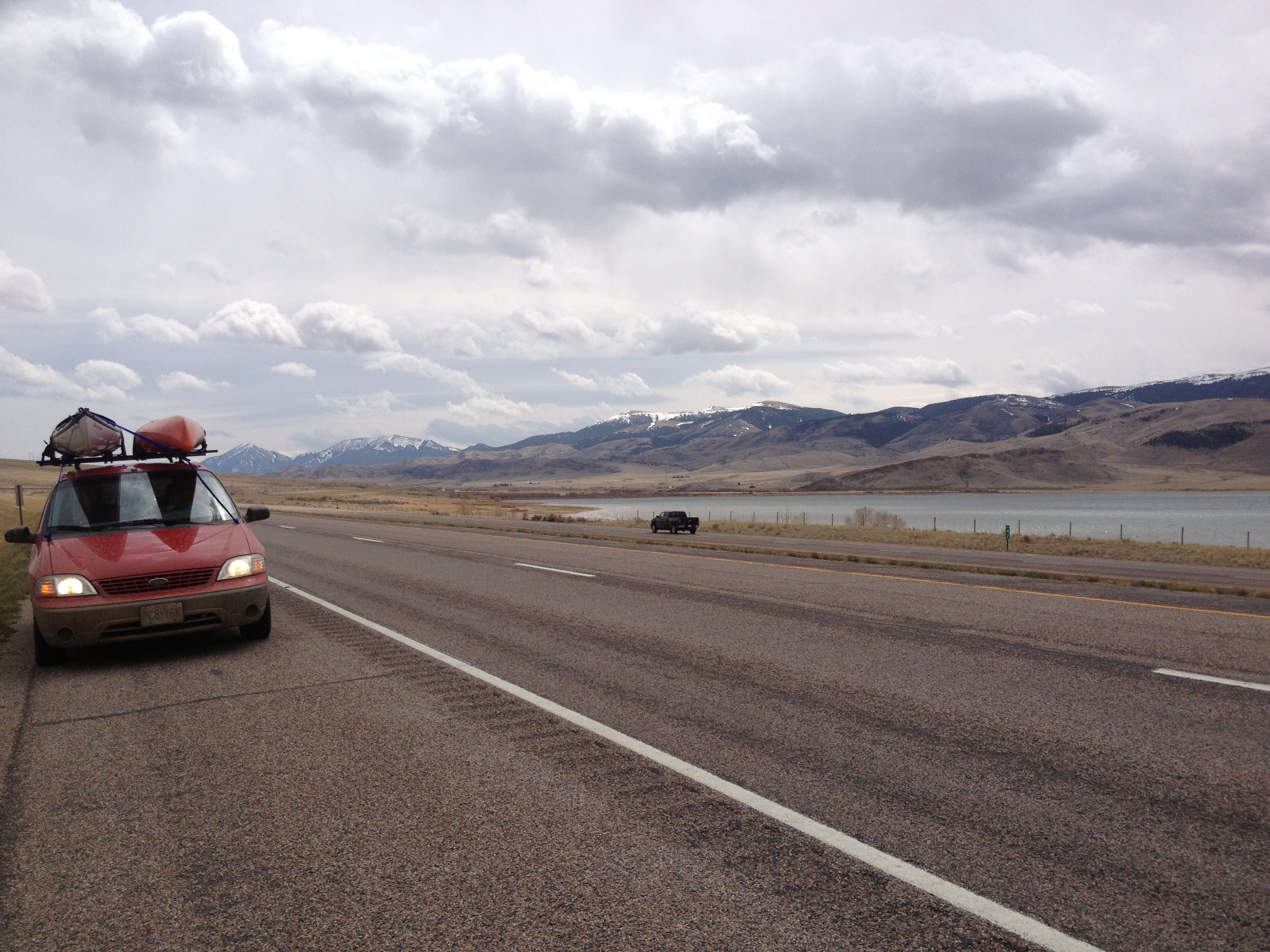
Finally, on Wednesday, May 1st, I started paddling. The Beaverhead River was quite a challenge. It is shallow with tight turns and lots of brush producing strainers in which to get entangled if not careful. I came close to dumping my first day, but was saved by the wheel of my wheeleez, my portaging device. I may have sprained my hand in the entanglement, but still paddling. I was worn out for the first three days trying to save Blue Moon from sheer destruction. I have two holes from the second day just above waterline. Duct tape is the miracle cure!
After 3 days of hard paddling, on Saturday I had 25 mph headwinds challenging me. I stayed strong and true to course, though, and after a 9 and a half hour paddle, and close to Beaverhead Rock, I finally found an island to camp on. Turns out that Robert and Donna were out cruizing around on Robert’s property and they ended up inviting me up for cocktails and chicken dinner. And, a shower, laundry, and place to sleep on their couch! What a wonderful miracle! Strangers are TRULY an opportunity to make friends. What a great visit we had, which included Paul, too. The three of them are long-time friends from Helena.
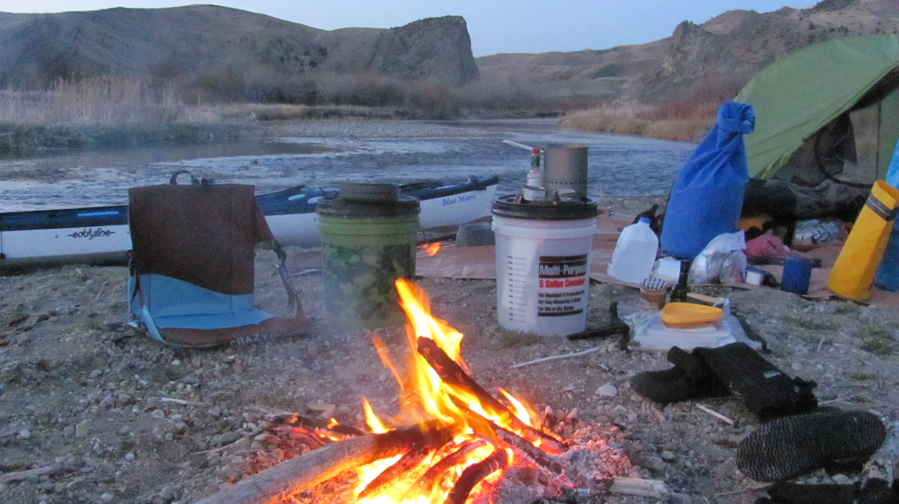
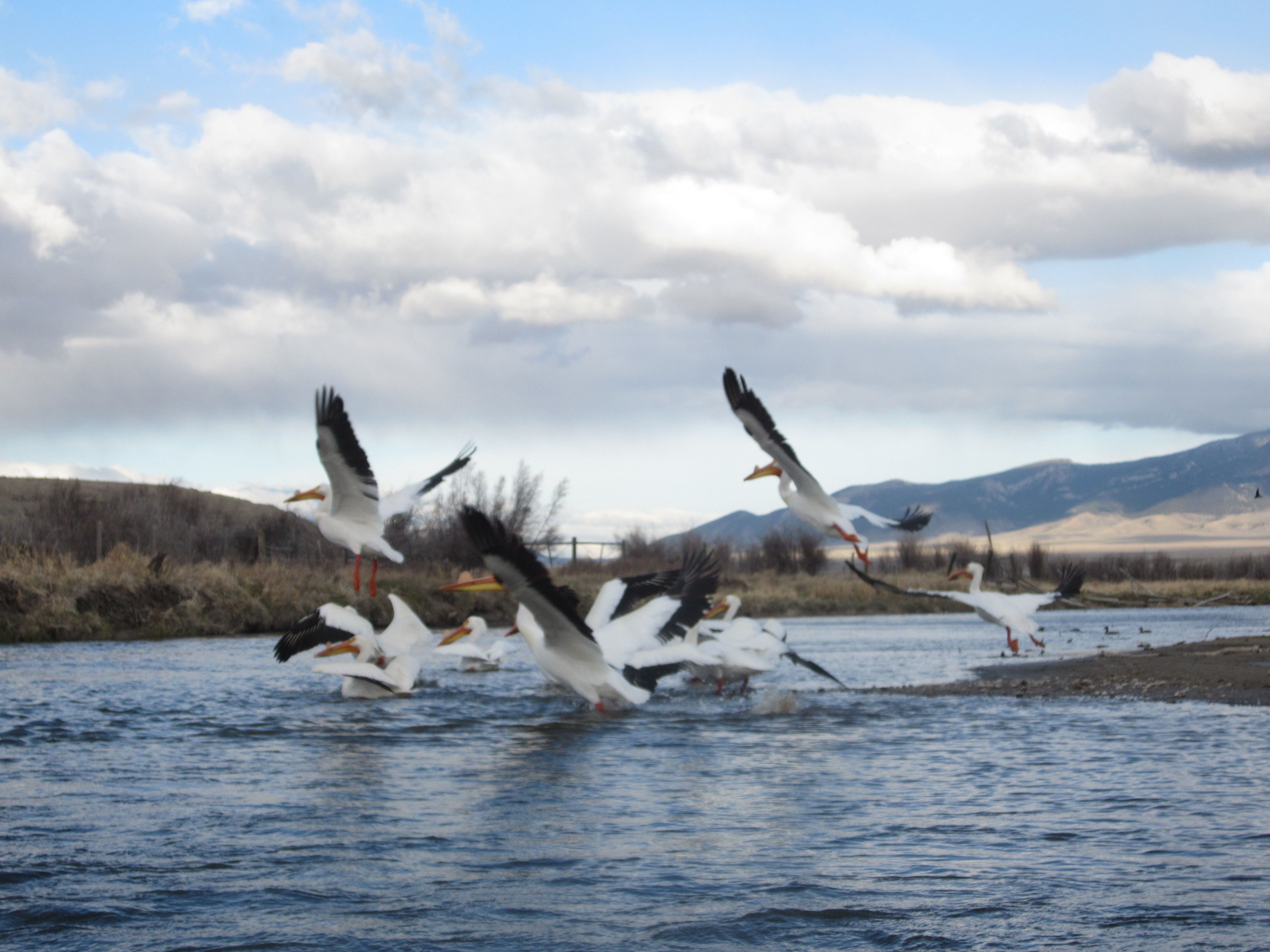
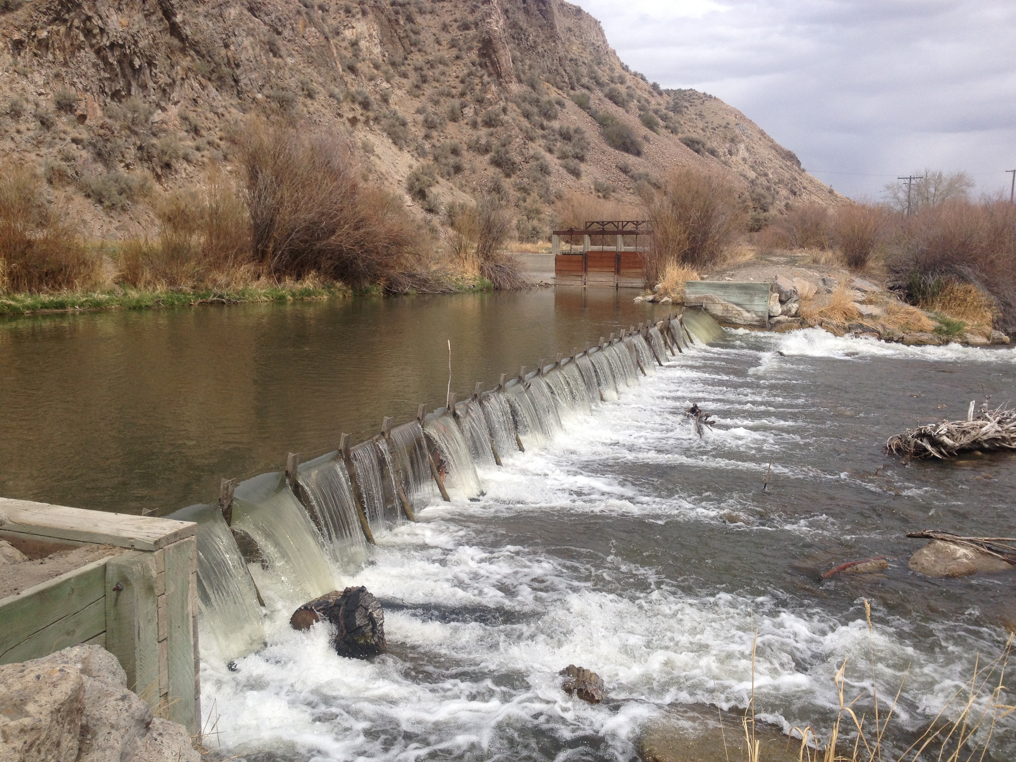
My first night out. Cozy camp!My first rapids. I skipped the upper and paddled through the lower parts of this.Strainers, Grrrr! They can flip you over, swamp your boat, punch holes in your ship, and twist your hands and arms. I am happy to be through this challenging part of the Beaverhead River.My pelican friends followed me all day Saturday, and after many bends, they finally decided I was okay. They stayed put until I got this photo. Then, they split for the day. Good companions they were.Good bye, my friends.Diversion dams force me to unload, carry stuff to the other side, place my boat on my wheeleez, pull it over, reload stuff, and take off again. This particular easy portage took me an hour and a half.AFter a long day of paddling on Saturday against 25 mph winds, Robert and Donna happen to be cruizing Robert’s property adjacent to Beaverhead Rock when I found an island to camp on. After seeing their Private Property signs, with notice that the property was patrolled, I was concerned and so immediately set off to do some peace talking. Turned out they invited me up for cocktails, dinner, laundry, shower, couch, and steak and eggs for breakfast. What a wonderful find these folks were, however it happened. L-R, Robert, Donna, and Paul.
View of Beaverhead Rock from Robert’s “cabin”And, another view from the cabin.Not sure what’s up with this rancher. Makin’ life difficult.Besides the pelicans, the muskrats, and sometimes beavers, are my favorite companions. The muskrats are the dolphins of the river. They lead you around the bends. I adore them!Onward towards Twin Bridges. Tomorrow, Wednesday, May 8, I head out on the Jefferson River, my long awaited premium stretch of river.
Finally, I have successfully updated this blog. You are a concern of mine, and I want to keep you posted. It is getting dark now. I have finished most of my pizza, a couple of glasses of wine, had a shower earlier today, and have a nice cozy tent to sleep in tonight. I look forward to resuming paddling on the Jefferson River tomorrow. Twin Bridges is an awesome small town of 400. Come and stay if you ever have the chance. I understand the fishing cannot be beat!
My camp at this very cool Bike Park on the waterfront in Twin Bridges, MT. Loved my stay here. Hope to come back. Plus, Mayor Tom is totally laid back, hence the mellow river community of 400 people. Love it!
I hope you are enjoying my adventure. I am comforted knowing you are following me and interested in my journey. It has truly turned out to be an epic adventure, and it has only just begun.
Live fast ~ Paddle slow. Be safe and cherish the moment!
White Cliffs in Missouri River Breaks National Monument (Photo by Norm Miller)
From The Journals of Lewis and Clark -edited by Bernard DeVoto
[Lewis] Friday May 31st 1805
“The hills and river Clifts which we passed today exhibit a most romantic appearance…The earth on the top of these Clifts is a dark rich loam, which forming a graduly ascending plain extends back from ½ a mile to a mile where the hills commence and rise abruptly to a hight of about 300 feet more.
…in other places on a much nearer approach and with the help of less imagination we see the remains or ruins of elegant buildings; some columns standing and almost entire with their pedestals and capitals; others retaining their pedestals but deprived by time or accident of their capitals, some lying prostrate an broken othe[r]s in the form of vast pyramids of conic structure bearing a serees of other pyramids on their tops becoming less as they ascend and finally terminating in a sharp point.
White Cliffs (Photo by Norm Miller)
Nitches and alcoves of various forms and sizes are seen at different hights as we pass…As we passed on it seemed as if those seens of visionary inchantment would never have and [an] end; for here it is too that nature presents to the view of the traveller vast ranges of walls of tolerable workmanship…These walls rise to the hight in many places of 100 feet, are perpendicular, with two regular faces and are from one to 12 feet thick, each wall retains the same thickness at top which it possesses at bottom.”
(Photos by Norm Miller)
White Cliffs in the Missouri River Breaks National Monument, MT
White Cliffs (Photo by Norm Miller)
I still have a lot to learn, but I cannot for the life of me think of a reason why anyone would NOT want The Missouri River Breaks National Monument preserved as a wilderness area for future generations. Nope, cannot think of one reason.
The seed displays are out at the stores, and that can mean only one thing: SPRING is right around the corner!! So, WOW, it will be time to go soon. Am I nervous? Sometimes yes, and sometimes yes.
And, speaking of seeds, I have a crazy idea to grow some leafy greens on the trip. I mean, 3 ½ months on the river? Some leafy greens would be nice. That said, the planting season in Montana doesn’t start until the first two weeks in June. My little portable terrarium might be ideal for some early planting! I have been brainstorming the perfect container for such a thing and currently have narrowed the choices down to a couple of good ones. Any suggestions out there? I’ll take them.
Today, I am going to build a “kayanoe” cradle for my kayak. The design is Michael Clark’s of Big Muddy Adventures. I took a picture while there so that I could build a set just like his. Once complete, I can lay my boat in it and get started removing the keel strip that needs replacing, and install the rudder. Eddyline Kayaks gave me a new strip to apply, and I am to call them when ready to put it on. Today is supposed to be 70 degrees, so I have picked up the lumber and will begin cutting wood this afternoon.
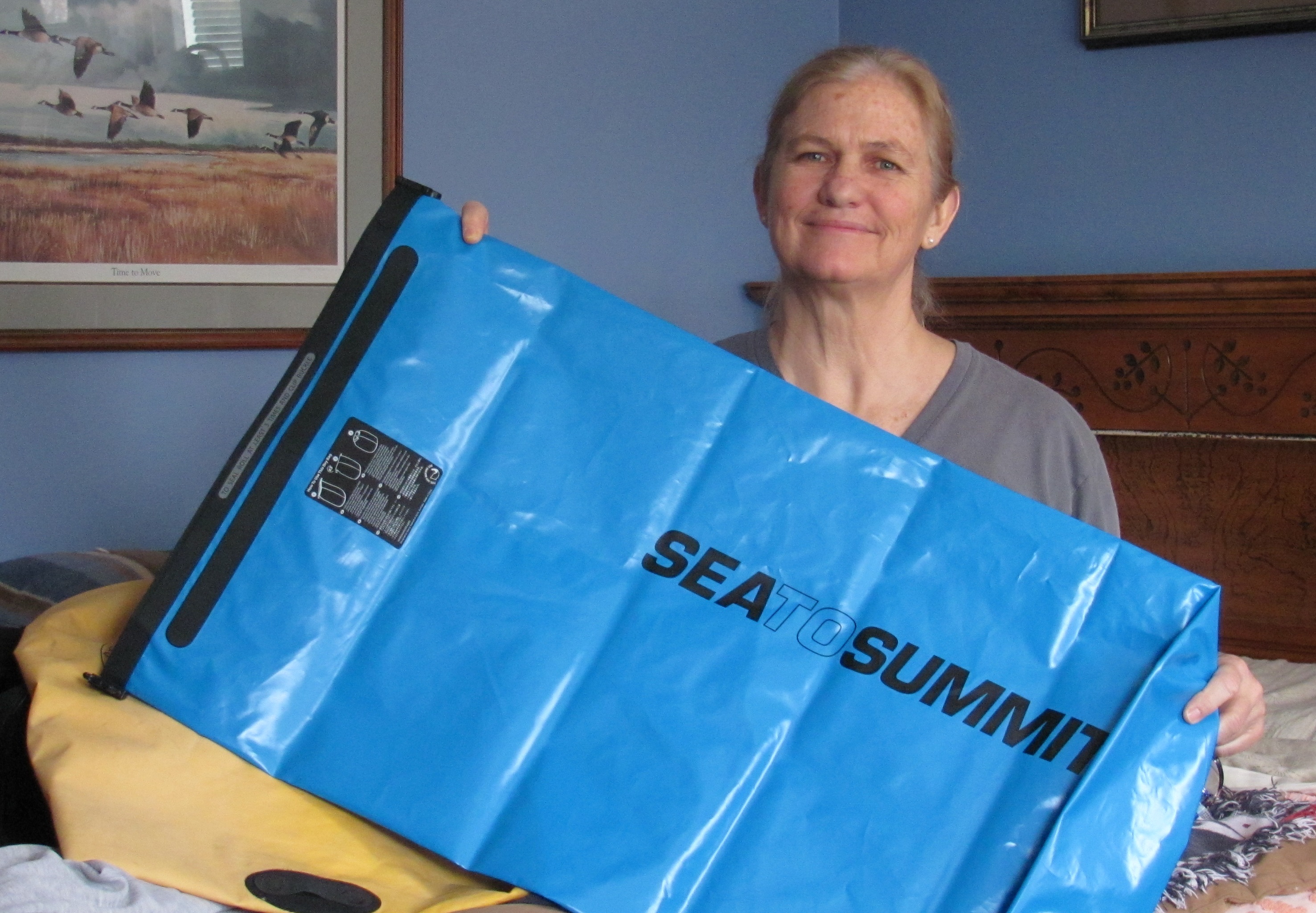
Thanks to Steve Schnarr and Melanie Cheney, my new neighbors and humble managers of Missouri River Relief, for the use of their large detached garage and electrical power. Another HUGE THANKS to them for giving me a dry bag. And Maryellen Self, THANK YOU, GIRL, for purchasing a new large dry bag for me from Sea to Summit. I am very grateful for all of your generosity.
Thank you, Maryellen! Maryellen is a Kentucky kayaker and enthusiastic supporter.
Bill West of Red Rock Lakes National Wildlife Refuge, located in the Centennial Valley just below Hell Roaring Canyon (the route to Brower’s Spring), sent me a link in which one can look up current snow depth Lakeview Ridge Snowtel Site as well as historical data from years past (also mentioned in a previous post). This will help me determine how much snow is in the area, and if we can drive up to the base of Hell Roaring Canyon, where it appears as though we will have to ski in the seven miles to Brower’s Spring, and out again.
Sawtelle Peak Road
The lookout road on Sawtelle Peak will undoubtedly be snow-covered and we have no way of getting up the switchbacks in order to ski over to Brower’s Spring. [Unless someone out there has snowmobile contacts in Montana, Idaho, or Yellowstone…?? Helicopter ride? Of course, it would have to be an in-kind donation :)]
The Rock Creek basin area on Sawtell’s west side. Hell Roaring Canyon, and Brower’s Spring, would be a little south of here and off to the left. (Wow, I’m seeing some good backcountry skiing in this photo.)
These photos of Sawtelle Peak were taken from the website SummitPost.org
The following photos are taken from the Refuge Virtual Tour site that is not yet official. Bill Smith provided me with this link as well. You really should check it out. James Perdue has some gorgeous photos on that site.
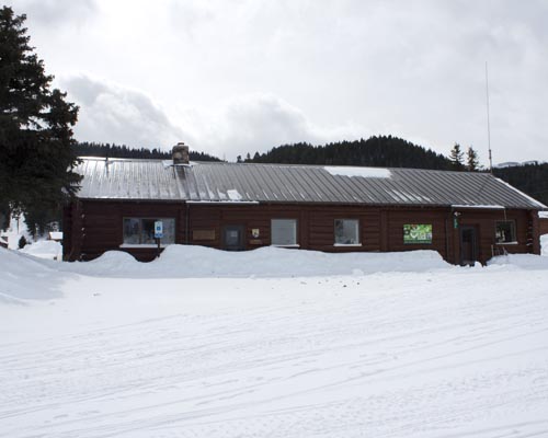
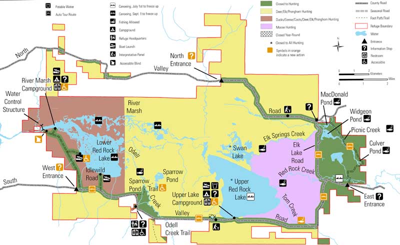
Trumpeter Swans (photo by James N. Perdue)Headquarters at the Red Rock Lakes National Refuge (Photo by James N. Perdue)Hell Roaring Canyon is off to the East, or right, of this map, up Centennial Valley. The road I will hopefully bike ride down snow free runs along the bottom of this map.
Down in the Centennial Valley, the upper and lower lakes in the refuge will more than likely be frozen until May, so I am planning on riding a bike from Hell Roaring Canyon down to Clark Canyon Reservoir. The road follows right alongside the waterway. The ride will be approximately 80 miles. Praying that the road into that area is free of SNOW and not muddy sloshy. Plus, we REALLY need to be able to drive up to the base of Hell Roaring Canyon. The snow data link that Bill sent me is my life-line to the start of my expedition. In 2012 on April 20, the area had 11 inches of snow. In 2011 on April 20, the area had 47 inches of snow, nearly four feet! What will 2013 have in store for us???
South Valley road in winter is often only passable using a snowmobile. This is looking east into the refuge. Lakeview is in the distance. (photo by James N. Perdue)
My new motto for the expedition: GO WITH THE FLOW!
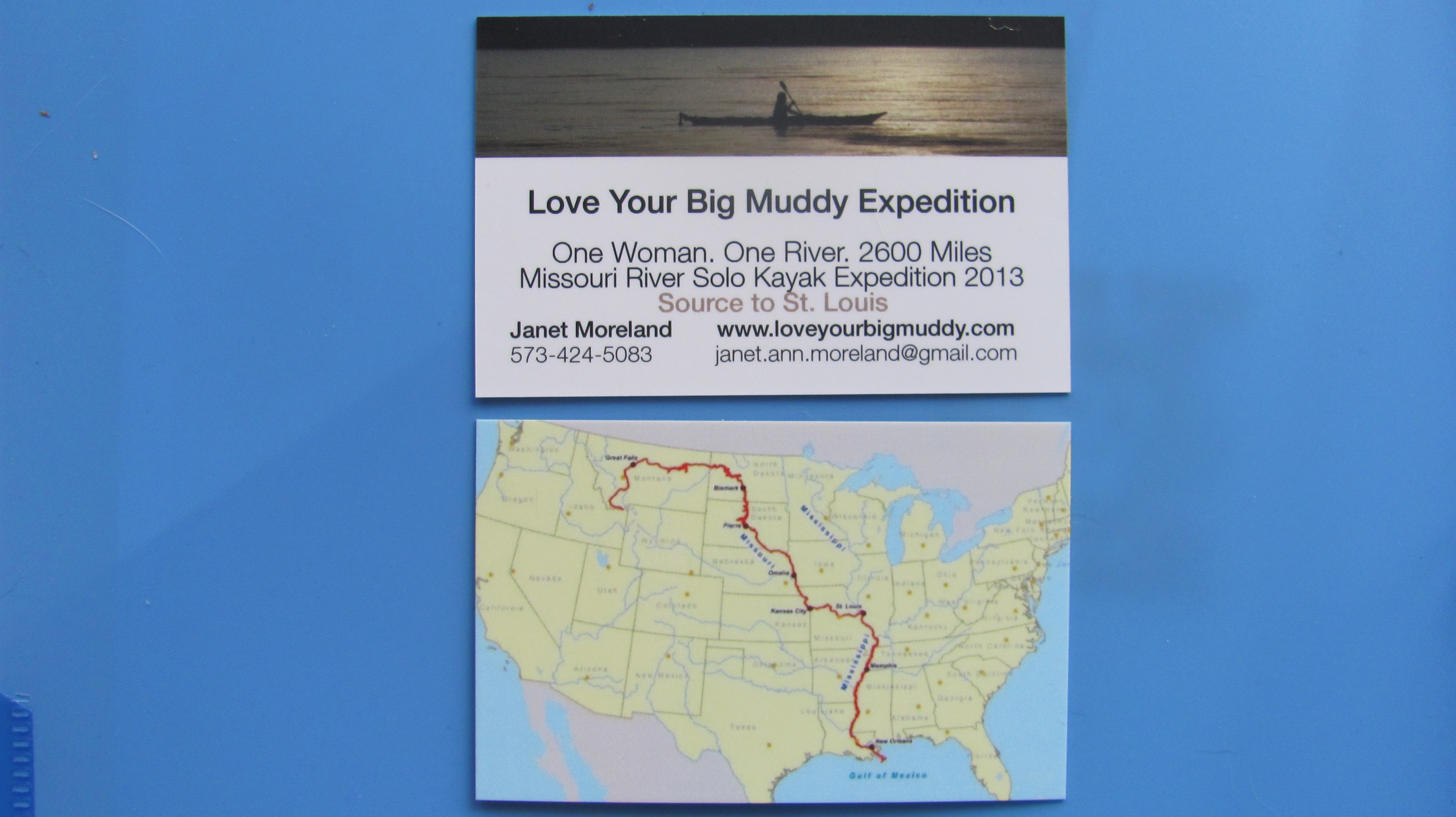
My new expedition cards
A draft of the promotion video will be sent to me on Friday. My new expedition cards came in last week, and I have a new batch of stickers with a larger web address for bumpers. Did I tell you about my terrarium? Crazy, I know. However, having something that is alive to take care of may be good for the soul. We’ll see. Nothing is set in stone. Heck, I may not have room. I am just going to GO WITH THE FLOW! 🙂
View of Lower Red Rock Lake in February. The lake is frozen over and looks like one large flat meadow.
Based on my camping experience in Missouri, I know that the threat of cold weather is present in mid-Missouri until AT LEAST after Mother’s Day, which is usually end of May (last hard frost date is late April). So, starting my trip in mid-April in the Montana Centennial Mountains at the Continental Divide pretty much necessitates winter conditions planning. Okay, got that. However, I did not really consider the Centennial Valley being covered with snow down to the Red Rock Lakes National Wildlife Refuge.
I received an email response from Bill Smith, project leader at the Wildlife Refuge, which is located down the Centennial Valley from where I’ll exit the mountains after skiing to Brower’s Spring. He writes: The refuge is not closed in April, it is just closed to boating. In addition, the two big wetland lakes (Upper and Lower Red Rock Lakes) are still frozen until about May 1st. I suggest you snowshoe to Brower Spring from the Centennial Valley floor. Then you could cross country ski down the valley if there is still snow available. No refuge restrictions on ski travel.
(Norm Miller and I are planning to ski in to Brower’s Spring from Sawtelle Peak, a two-mile ski to the spring, and seven miles down to the valley floor.)
Nemesis Mountain The exit from Brower’s Spring, Hell Roaring Canyon, is on the right side of Nemesis Mt. (out of this photo) where Hell Roaring Creek empties into the valley, and soon becomes Red Rock Creek.Hell Roaring Canyon and Creek, exiting the mountains. (Nemesis Mt. on the left)Winter view of the Centennials here. Wind blows frequently to obscure the road completely with snow in February.
SO, the good news is: The refuge is not closed to paddlers in April, only motorized boats. Yay!
And, the not necessarily bad news: The entire valley MAY be covered in snow and the lakes covered with ice until May 1st. Dang, this is starting to become quite the adventure. And, I like it!
Centennial Mountains cloaked in a winter storm. (All of these photos taken from the virtual tour site-link below)
Bill sent me some valuable links that are critical to my planning of this upper upper portion of the expedition. Here is what he wrote:
I’ve attached two web sites. The Lakeview Ridge Snowtel site will allow you to look at graphs and charts of average snow depth during the annual cycle here. Look at historical April. It will also give you the current year.
The 2nd link is to the water gauge on Red Rock Creek. It will give you historical and real time measurements of stream flow in the creek. The gauge is on the Creek at the very Eastern boundary of the refuge.
NRCS is upgrading this website this weekend so it may not work well until Monday.
Virtual tour!!? How awesome is that! I hit every spot on the tour, and let me just say this, “It IS the next best thing to being there!” When you click on the link, the map on the left has a white dotted line sweeping along the bottom and then up towards Henry Lake. That dotted line is the Continental Divide, and Brower’s Spring is inside the lower right-hand u-turn area where the white line starts to head north. On the right side of the page, the names of the mountains will show up when you scroll over them. You can sweep 360 degrees! Enjoy! It is a fantastic site. Big huge thanks to Bill West and his willingness to help me out. We will talk by phone soon.
All photos on this post are taken from the virtual tour site.
That’s all I got for now. Lots to think about.
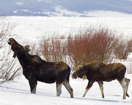
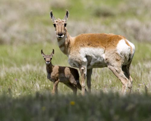
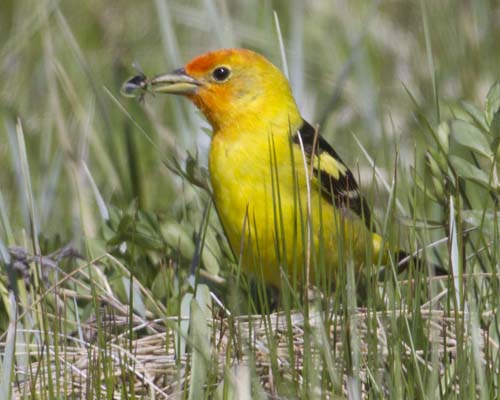
The willows growing from Tom Creek provide browsing for Moose in the deep of winter here. In summer, moose are attracted to marshes and creek banks to both collect suitable vegetation to eat and water to wet and cool themselves in. Moose are not usually aggressive towards humans, but can be provoked or frightened to behave with aggression. Due to their disposition and size, it’s best to keep a wide berth from them.Pronghorn and calfThe beautiful Western Tanager (Piranga ludoviciana) has found a bug in the grasses near Red Rock Creek. The tanager is classified in the same family as the cardinal. Western tanagers eat fruits (~18%) and a wide range of insects (~82%) They are a welcome visitor in the spring and early summer here in the refuge, though not especially numerous (like the blackbirds or sparrows, etc).
…Woke up midnight last night and imagined Brower’s Spring with perfect spring corn snow skiing conditions in April, which is when we used to ski peaks on the east side of the Sierra Nevada Mts in the 80’s. I broke out into a huge smile. Then, repeating over and over, “pray, believe…pray, believe…”, I drifted back to sleep.
I will be starting at the source. That’s it. No more wavering.
My stickers are in the mail. I modified them by changing the color to blue, from black, and the miles to 2600, from 2300.
Met with Jim Karpowicz today and we are on the move to create a promo video in order to generate some wide-reaching support and, hopefully, funding. It’s going to be great!
If you haven’t already, please “like” my loveyourbigmuddy Facebook page. I can post little updates there with a bit more spontaneity.
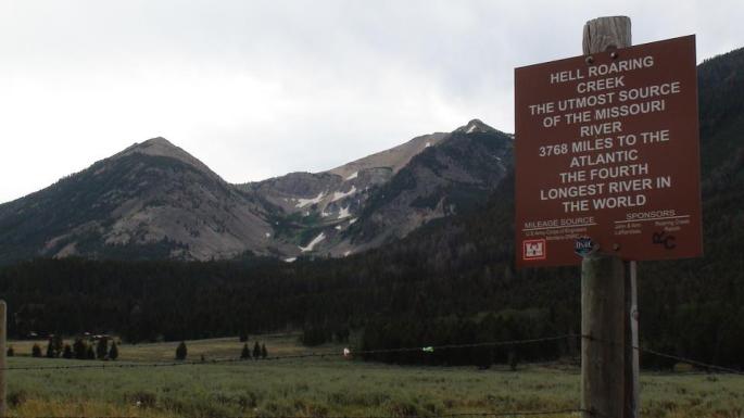
Starting at the source of the Missouri River will entail getting to Brower’s Spring, which is at the top of Hell Roaring Canyon. From the bottom of the canyon (left-center) the hike is seven miles in and seven out, over SNOW in April. If Sawtelle Peak access road is plowed (doubtful) in April (right), the ski over is only a couple of miles along the Continental Divide, then down the canyon. I see ski-mountaineering revisiting my life this spring. Breaking out the 3-pin bindings!
Canadian paddler Rod Wellington passed through Cooper’s Landing last Monday and Tuesday, Dec 17-18. He is paddling from the source of the Missouri River at Brower’s Spring, MT, to the Gulf of Mexico, all self-propelled. This is the longest river system in North America, and fourth longest in the world. Rod will be the first Canadian to paddle the MO from source to sea. Australian paddler Mark Kalch completed the route earlier this year.
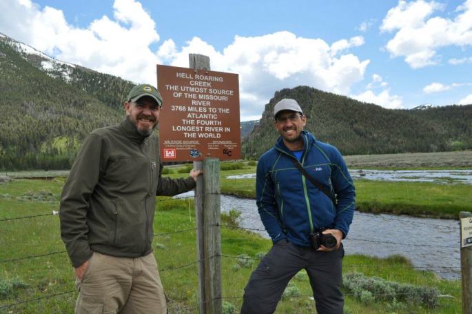
Norm Miller (left) and Mark Kalch (right) at Hell Roaring Creek in June 2012
Altogether, Rod will paddle seven of the longest rivers on seven different continents. The Missouri River is his first. He has been on the river since June, a total of six months. His river systems project could take up to 15 years.
Photo by Rod Wellington
After a pot luck dinner and visiting with many interested locals, he graciously sat with me and poured over photos and a map from the Brower’s Spring area, the Missouri River source, to Three Forks, the headwaters of the MO Riv, a 298 miles stretch and one in which I am debating whether to include on my trip.
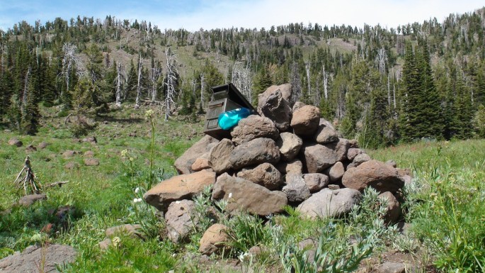
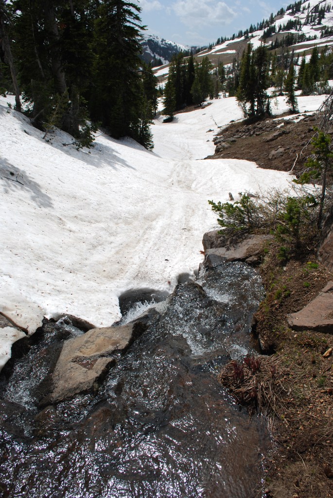
Cairn at Brower’s Spring with Continental Divide behind. Photo taken in August 2011 while scouting the source (photo by Rod Wellington)Continental Divide at Brower’s Spring in June 2012 (photo by Rod Wellington)Looking down from the spring in June 2012. Undoubtedly, April will have a LOT more snow. (photo by Rod Wellington)
No firm decisions yet as there are a few dicey stretches, like hiking/skiing/snowshoeing over snow for seven miles into Brower’s Spring, and seven miles out. And, a few days of dodging and portaging around farmers’ barbed wire/electrical/corrugated panel fences which cross a mere 20′ wide water way below the Lima Reservoir on the Red Rock River. Not to mention that the Red Rock Lakes Wildlife Refuge, located above the Lima Reservoir, is closed in April.
At least now I have a greater understanding of what my obstacles and options are. I have an unrelenting desire to capture some of that 298-mile stretch for its sheer beauty. Some of it may have to be biked. Thanks, Rod, for spending that time with me.
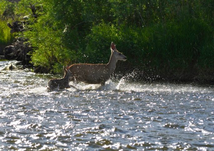
Jefferson River below Twin Bridges (photo by Norm Miller)Deer on Jefferson River (photo by Norm Miller)Rain approaching Jefferson River (photo by Norm Miller)
Understandably, Rod needed to leave Cooper’s Landing and continue
Rod and Jonathan at Cooper’s Landing. Notice the wood-carved hawk that is Jonathan’s handiwork.
paddling towards the Gulf of Mexico. However, our first major storm
of the season hit yesterday, the day after he left. Winds gusted to 50 or 60 mph, and snow was blizzard-like. One caring and supportive local, Jonathan Lauten, set out to find Rod and make sure he was okay. He found him across the river below Jefferson City, but was not able to make contact. We learned that Rod was hunkered down in his tent, warm and dry.
Rod laying low in a miserably cold, very windy, and snowy storm (you can see the wind plowing into the side of his tent). (photo by Jonathan Lauten)
Jonathan’s comment from Facebook:
I found him, but I couldn’t get to him! This pic was taken from a bluff across the river 4:00 12/20/12. Of course, it was hard to pick him out amongst all those other campers on the Missouri River in a blizzard with 50 mph winds…
Here is a post from Rod yesterday morning, much to our relief:
Dec. 20, 10am – Currently hunkered down in my tent on a sandbar near Jefferson City, Missouri. Outside: blowing snow, sustained winds of 35-40 mph with gusts of 50 mph or more. Unable to keep tent and tent fly anchored. I’ve arranged heaviest gear on windy side of tent to act as a buffer. I’m warm and dry. No paddling today. Expected low tonight: 5F with windchill. Thanks to Steve Schnarr, Gary Leabman, Robin Kalthoff and Jessica Giard for checking on me via phone. Still smiling!
Great meeting Rod and spending some time together. I think I speak for lots of other folks who met him as well.
Rod and me (photo by Jonathan Lauten)
You can read posts and watch videos from his trip thus far, and track his current progress on his FB page: “Rod Wellington.”
Not a day goes by that I don’t think about my trip down the Missouri River. Most days, I long for the start day to arrive, even though I still have much preparation left to do. I think about some of my conversations with Missouri River paddlers, as we visited on their stops at Cooper’s Landing, and the advice to “just go put your kayak in the river and go.” This simple advice helps me keep the trip in perspective: just enjoy the paddle and the “country”side. Of course, there is the challenge, too. My self-efficacious nature says, “bring it on”! I absorb every piece of information and all video clips I can find on our Facebook Paddlers pages. I make note of much advice from Norm Miller, my go-to expert. I read about paddling expeditions, or expeditions in general, to learn about experiences requiring mental durability, physical stamina, and personal validation for embarking on extraordinary missions.
Thomas Walker, Tyler Ranes and Bob Bellingham passing through Cooper’s and sharing their stories.Enjoying Mark Kalch’s enthusiasm at Cooper’s during his stop-over.
Expeditions are not for everyone. But for some, the need to set goals beyond the borders of your box and the zones of your comfort are always within mental range. In my twenties living in the Sierra Nevada Mountains, my peers and I were always pushing the limits of security by skiing where most people don’t, high up on the mountain tops or across the mountain range. In my thirties, my peers and I on the coast endeavored to break through windsurfing securities by attempting to sail the uncompromising waves at Ocean Beach and, of course, at the mouth of San Francisco Bay (you DON’T want to break down with an outgoing tide, just sayin’.) Perhaps it is a matter of insecurity, always striving for the satisfaction of defying your personal limits. I don’t know. Perhaps it is growing up with two older brothers and always believing I could do ANYthing they could do. I once climbed out on a limb of a tree when I was five years old, my brothers watching, undoubtedly on a dare. The challenge ended with a fall and a mild concussion (maybe that’s it!). Perhaps it is a love for the wilderness and the need to get access to it. Part of it HAS to be the challenge.
Mt. Williamson group from Bear Valley in early 80s. Took two days, half of us made it to the summit. Glad we made it safely up, then down.Chute skiing in Tuolumne Meadows, Yosemite (before road opening).S.F. Bay-sailing with the big dogs.
Self-efficacy:
“People with high assurance in their capabilities approach difficult tasks as challenges to be mastered rather than as threats to be avoided.”
–Albert Bandura
Looking down at the Brower’s Spring drainage (in the middle) from Sawtelle Peak. Photo by Norm Miller.
My mental challenge right now, which I have been confronted with since I committed to this expedition: where do I start? Do I make it a river “source” start, which adds 300 miles, two weeks, major expedition conditions (skiing in to Brower’s Spring at 8,800 ft in April?), and access to some incredibly beautiful wilderness, including a wildlife refuge? Or, do I just put my kayak in the river at the mouth of the Missouri and start paddling?
Hell Roaring Creek below Brower’s Spring. This would be a ski or snowshoe stretch (I think 7 miles in and 7 out), not to be paddled.Norm Miller (left) and Mark Kalch (right) at Hell Roaring Creek below Brower’s Spring, which is back up in the mountains behind them.
Watch Norm Miller’s video of Mark Kalch sharing his experience as he made his way down the stretch from the “source” to the “headwaters” of the Missouri River. Much of this section leaves little to be desired… Click here
Mark heading off just below Three Forks. Plenty of incredible wilderness to behold. Photo by Norm Miller.
I can’t help but think I would regret not starting at the ultimate source at Brower’s Spring, being soooo close. However, the thought of just putting in at Three Forks gives me a more peaceful easy feeling as well as an assurance of some incredibly beautiful wilderness, without the expedition extremes. Oh, the burden of a self-efficacious nature! 🙂
Do I start at the Missouri River’s source, Brower’s Spring, or do I start at the Missouri River’s mouth, Three Forks, where the Jefferson, Madison, and Gallatin Rivers merge to become the mighty Missouri? Approximately 300 miles separates the ultimate source and the river’s official mouth, and about 10-12 days of paddling. At one time, with all due ignorance, I pictured that 300 miles to be pristine Montana wilderness, kayaking through isolated Rocky Mountain Wilderness on a sweeping clear water creek, just me, the mountains, and the wildlife. Not so, I have learned. Here is Mark Kalch’s account of paddling from the source at Brower’s Spring to Three Forks:
The Red Rock River issues forth from the lake and winds endlessly and listlessly out of the valley. Snaking back on itself time after time with negligible flow meant forward movement out of the area was slow. A coyote wandered to the river’s edge to investigate my kayak and I. His boldness surprised me. Cattle followed me along the river’s meander. Slowly, slowly I carried on.
On to Lima Reservoir the wind picked up and forced an early camp. Overnight my tent was buffeted by its strength. Across the still body of water and a short portage later I once more hit river. Now things hit up a gear. The river, narrow, shallow but running super fast was an interesting encounter. Trees fallen in the water loomed as sweepers and strainers. Turning a 17 foot kayak on a fast corner in an 18 foot wide river takes some doing. Soon man made his presence felt. Fences, of barbed wire and electric lurked in possibility around every corner. Out of my boat, dragging under the lower wire, submerging myself in the icy water, back on board and away again. Repeat for days at a time.
The river finally spewed onto Clark Canyon Reservoir, much to my relief. Another crossing and dam portage on to the Beaverhead River. Now wider, flowing fast, this river looked the part. Appropriately, fisherman now lined it’s banks in drift boats and suited in waders. A quick heads up alerted them to my presence. Non-plussed about my appearance the immediately returned to their labour. Just one guide questioned me – “You headed to New Orleans?”. My reply had him genuinely stoked!
The Beaverhead wound it’s way to Dillon and on to the small town of Twin Bridges. At times beautiful and peaceful, at others endless ranches, cattle and excrement runoff. But it was all about to change. 20 minutes paddling beyond Twin Bridges, the Big Hole River enters from river left. Behold, the formation of the Jefferson! Truly, one of the most beautiful paddling experiences I have ever had. If only the past week could have been so. The river, lined with forest, the water running deep and swift. Now this is a river journey. Alas, it was over all to quickly. In no time with a final hard push I approached the town of Three Forks. A few miles beyond the Madison joins the Jefferson from river right. A few minutes later, the Gallatin as well. A hundred feet beyond, a boat ramp and now this river which issued forth from a snow choked spring had finally become the mighty Missouri! The first, difficult, demanding and ultimately tiny stage of my river descent was complete. With a root beer in one hand and pizza in the other I was tired but happy. Time for a resupply and washing of muddy clothes. In a couple of days it is back on the water and to the sea I go. I am ready.
This is Mark Kalch just below Three Forks (photo by Norm Miller). I think this looks like a fine place to start. Yep.
Mark is paddling seven rivers on sever continents. You can follow his adventure here:
And, Bob Bellingham is paddling from Three Forks to St. Louis and will be passing through Cooper’s Landing in about a week. You bet I’m going to pick his brain. He knows. You can follow his blog here:
Then again, Norm Miller got me thinking about a bike/hike to the town of Dillon, then put in. I understand the Jefferson River below Twin Bridges is gorgeous. sigh…