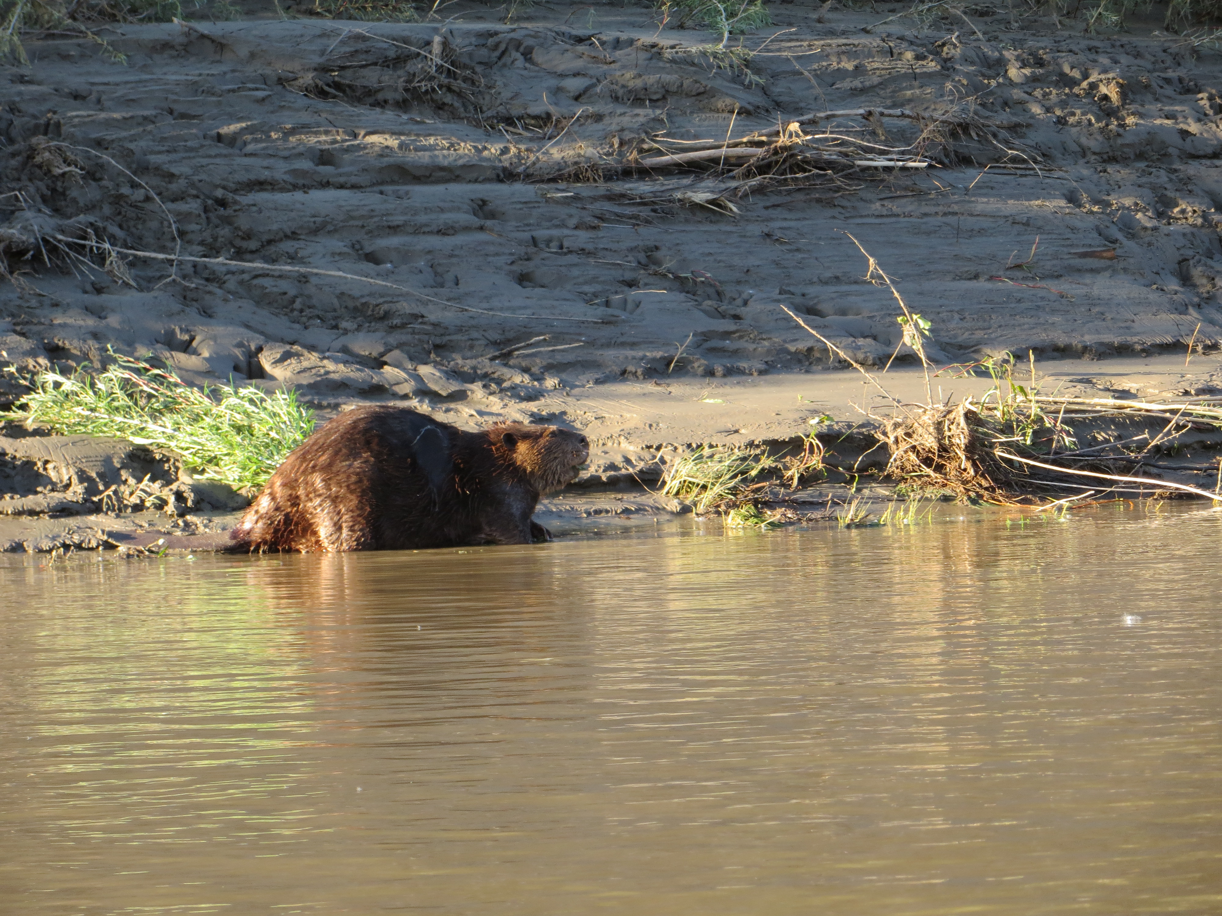
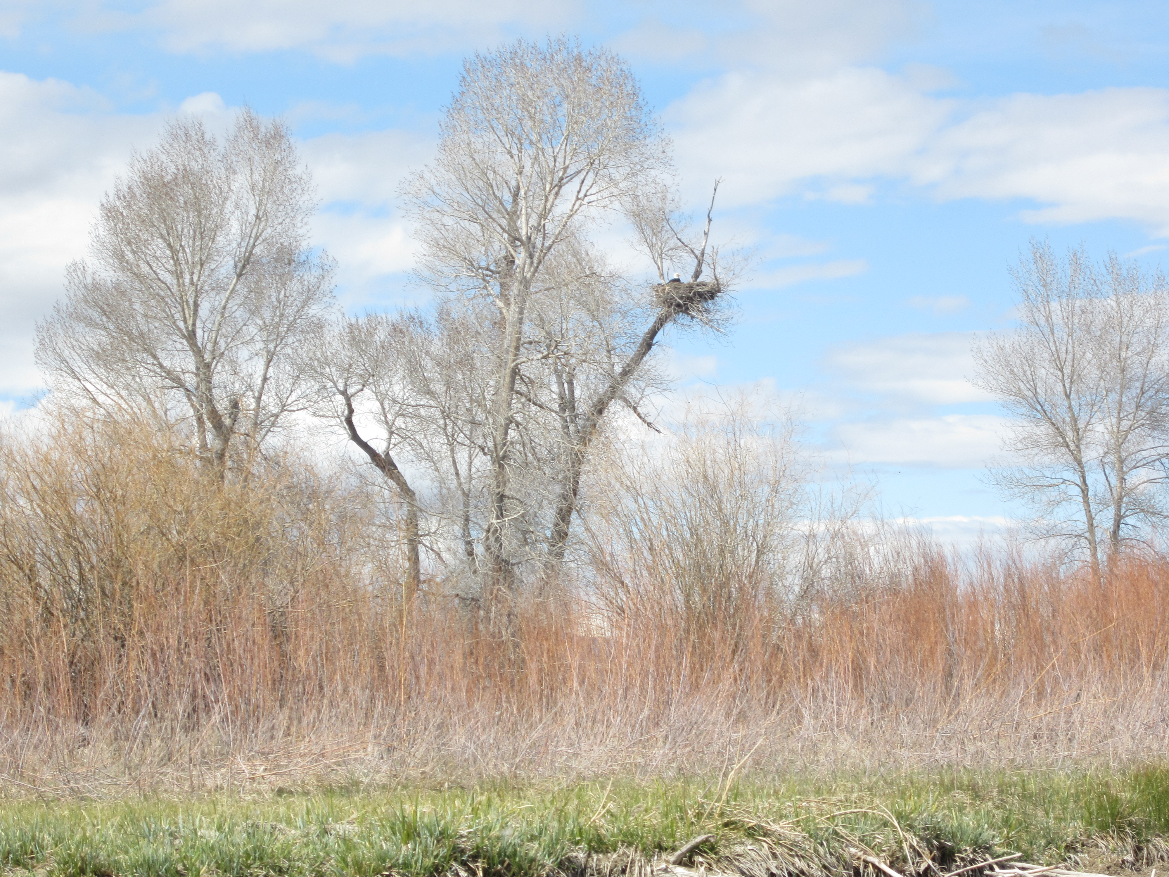
Plenty of beavers in the refuge. And, they are BIG! They pretty much own that refuge.
A beaver swimming out to size me up. I’m ready for their water slaps these days. I’ve seen and heard many of them trying to warn me not to mess with them or their dens.
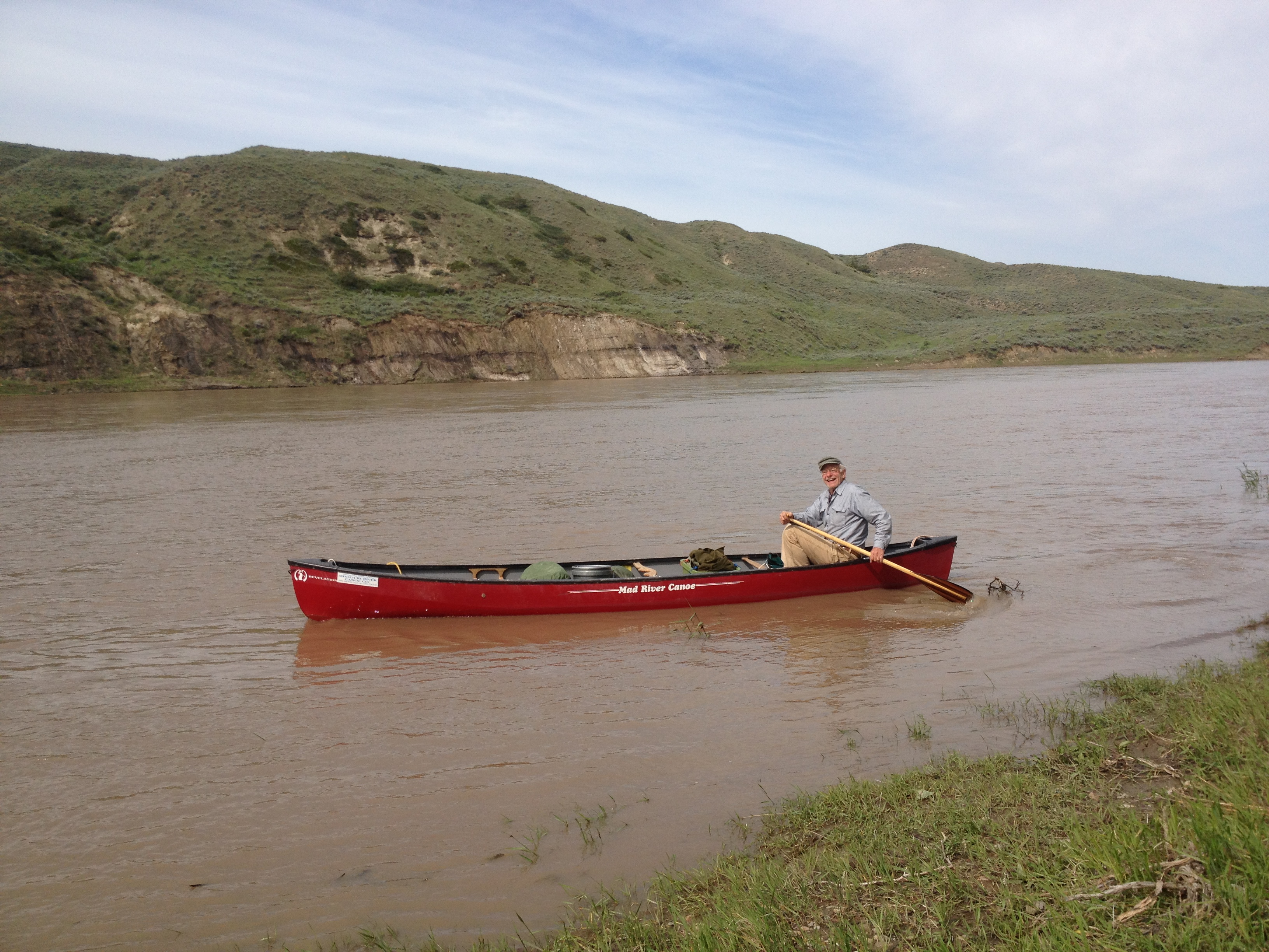
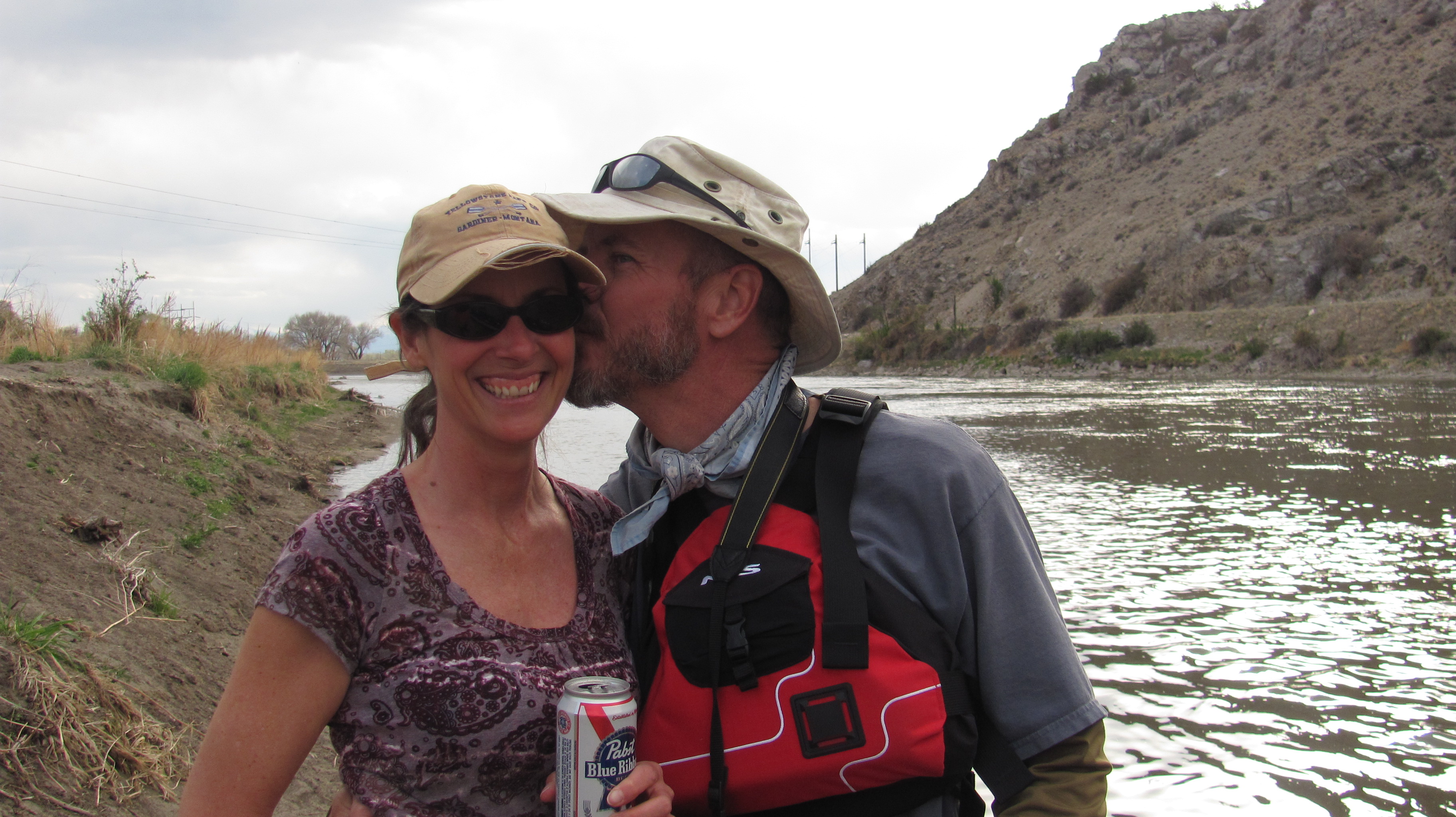
I hated to leave the Roundup boys without saying good bye, but I had to get on the water early in order to make it through UL Bend on Fort Peck Reservoir, approximately 48 miles away. UL Bend is the river-to-lake transition area, and not without its challenges. I was packed and in my boat at 7:00 AM. As I was pushing off, Eli appeared on the shore. I was so happy because I got to say good bye. I also let him know that I left my card on the ice chest for him. It is always bittersweet leaving new friends and river brothers. These boys, young men, are my river brothers.
I packed up early and was on the water at 7:00. The air was still, but the banks were muddy for miles. I was extra thankful I had found the RoundUp Boys last night.
Nowhere to pull over for miles and miles.
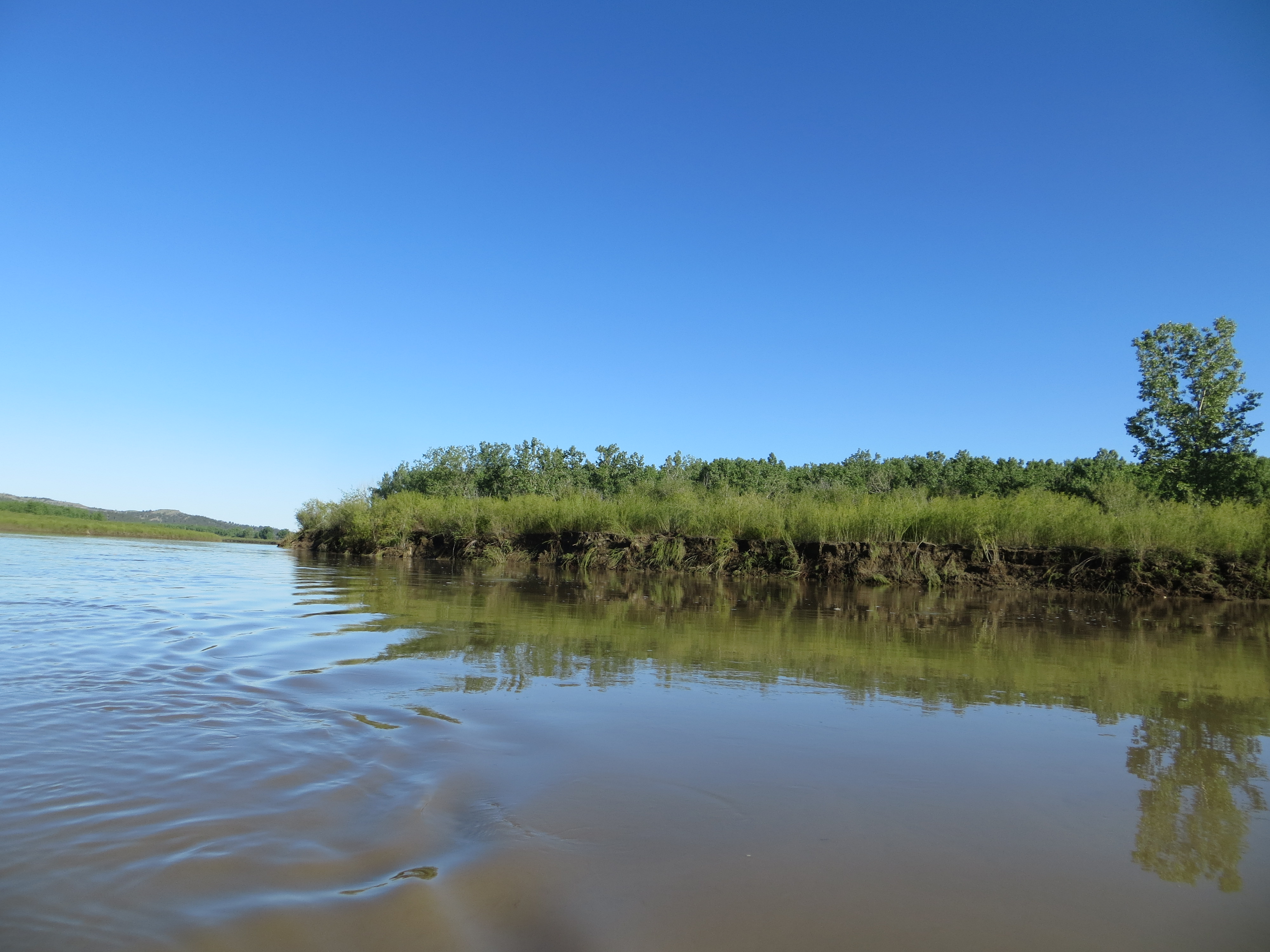
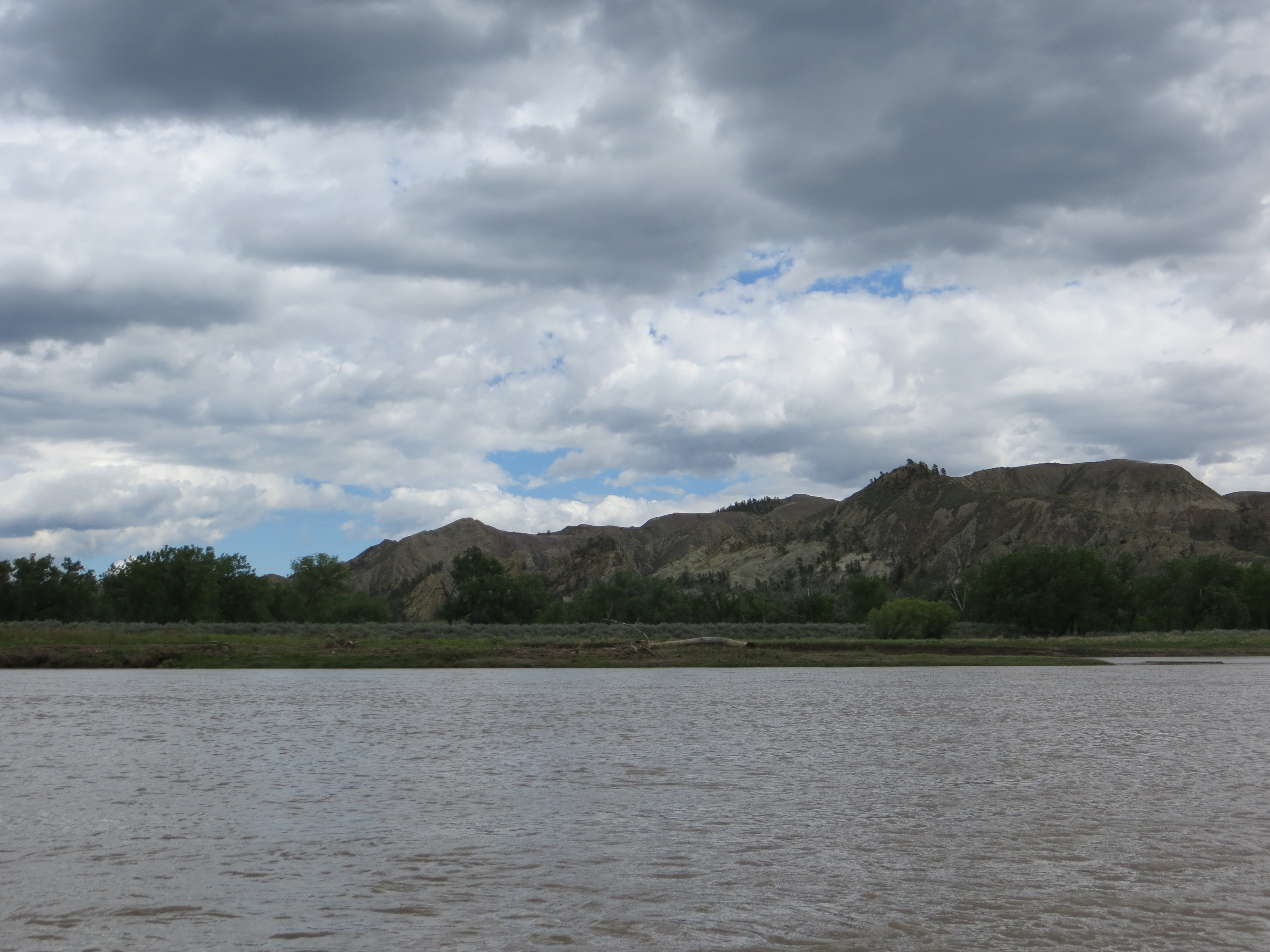
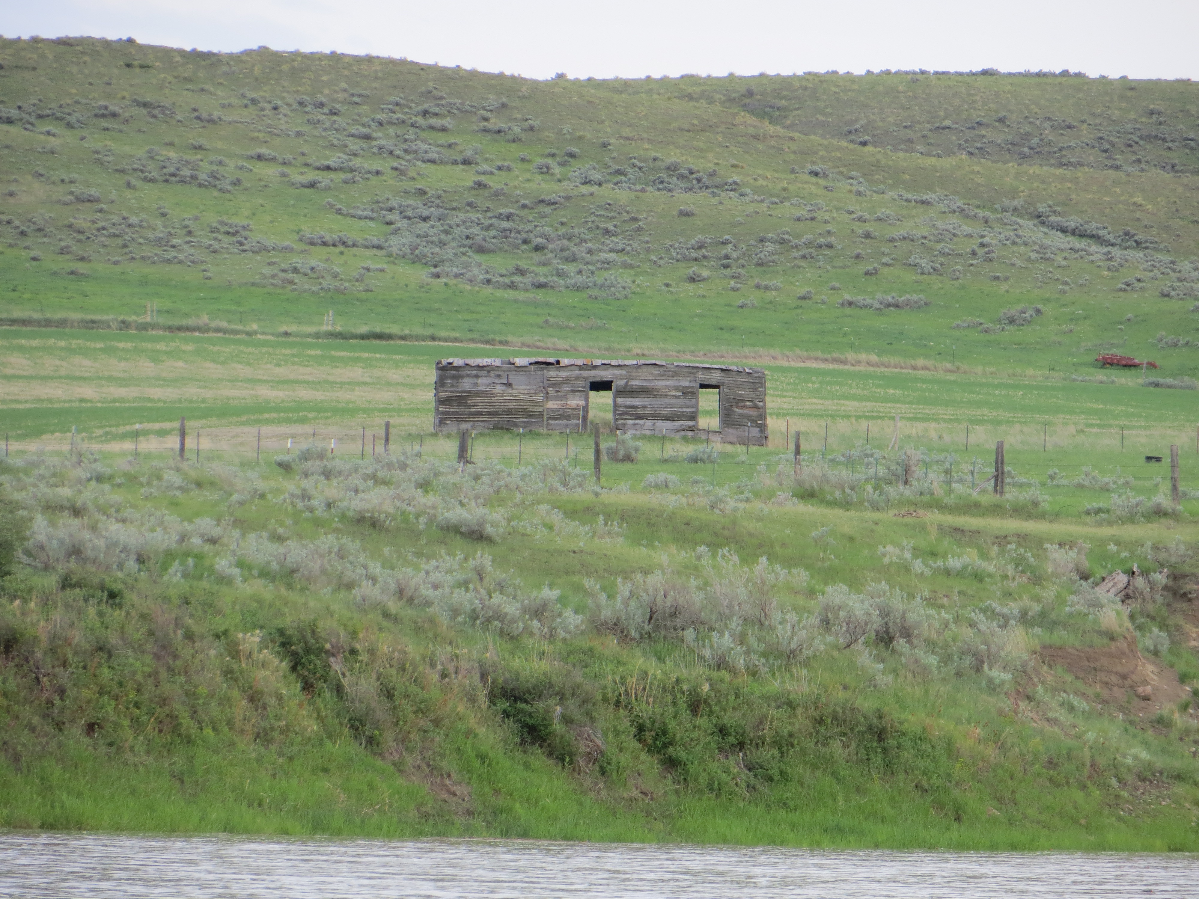
This was a typical site for many miles of the river below the Breaks, and in the refuge. There was nowhere to land the boat, let alone camp. Thankfully, the glassy conditions helped me to paddle 10.5 hours and 48 miles this day.
The relentless rain in the previous weeks had saturated the land. This big landslide had occured recently.
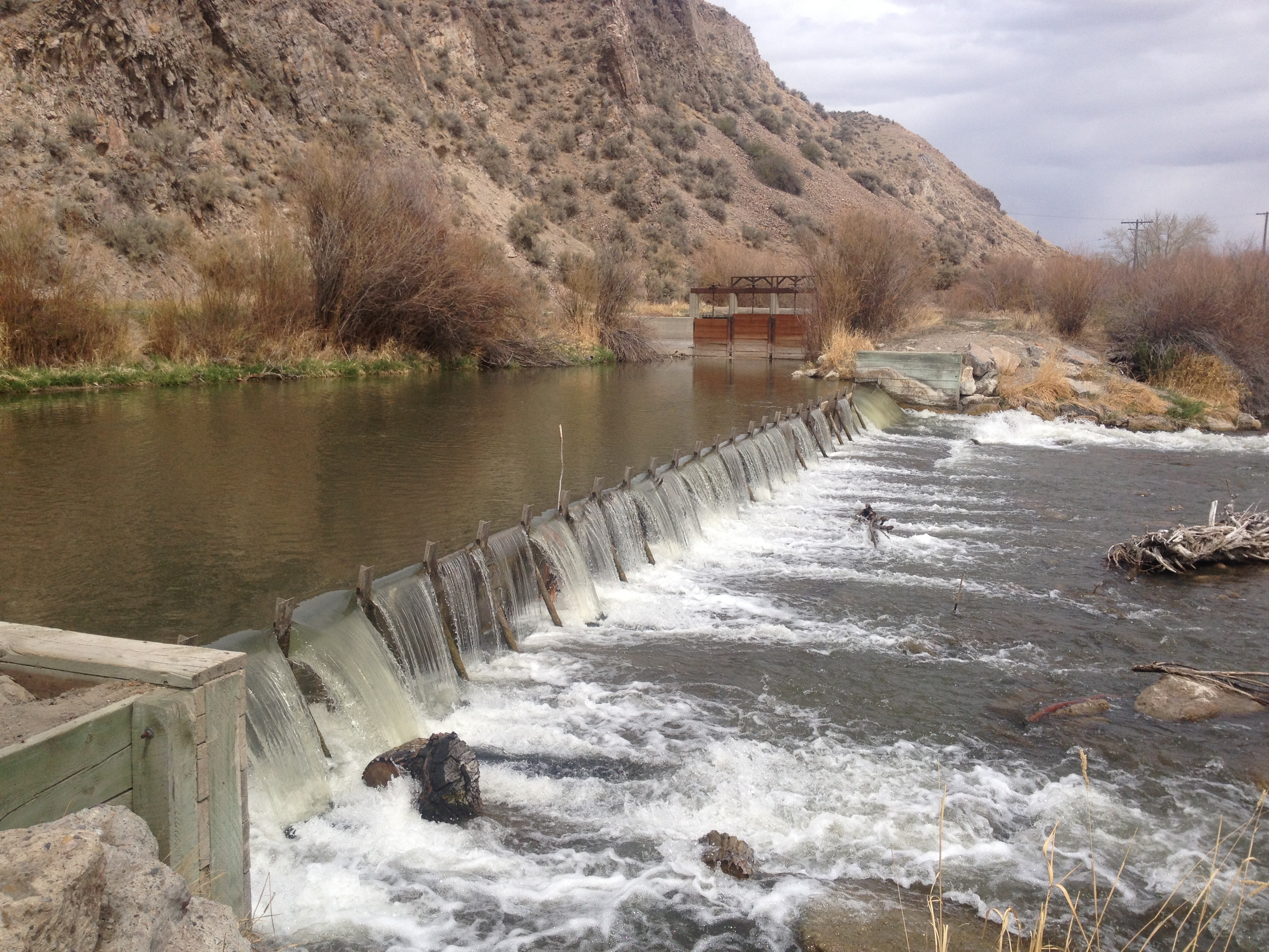
On the approach to the lake their were numerous springs flowing into the river.
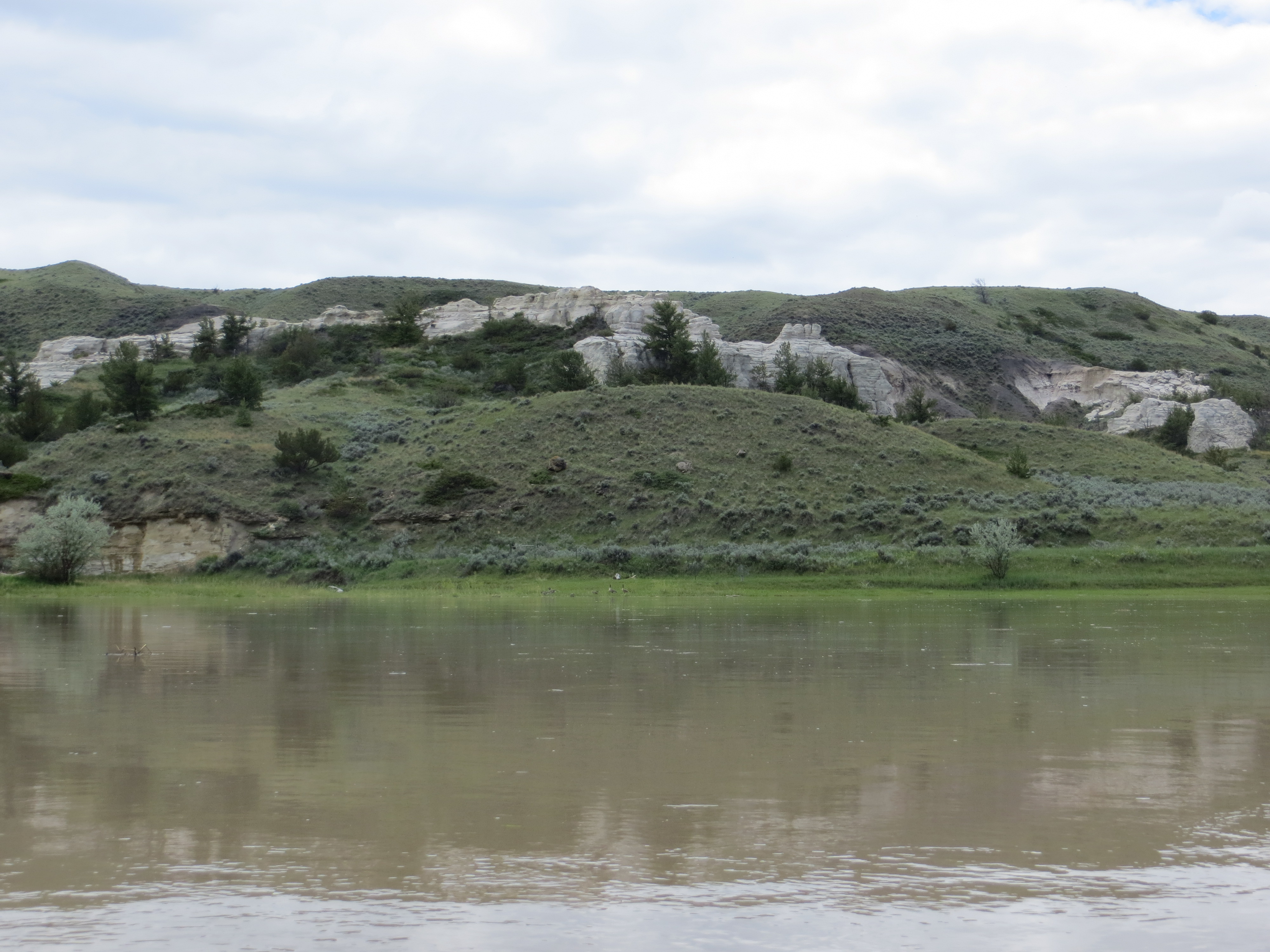
The Fort Peck Reservoir is 245,000 acres in size. Extending up 125 miles from the Fort Peck Dam is the Charles M. Russell National Wildlife, which encompasses 1,100,000 acres and all of the Fort Peck Reservoir. The refuge contains a multitude of habitats which include native prairie, wooded coulees, wetlands, river bottoms and badlands. “Given the size and remoteness of the Refuge, the area has changed very little from the historic voyage of the Lewis and Clark expedition…” [http://www.fws.gov/refuges/profiles/index.cfm?id=61520]
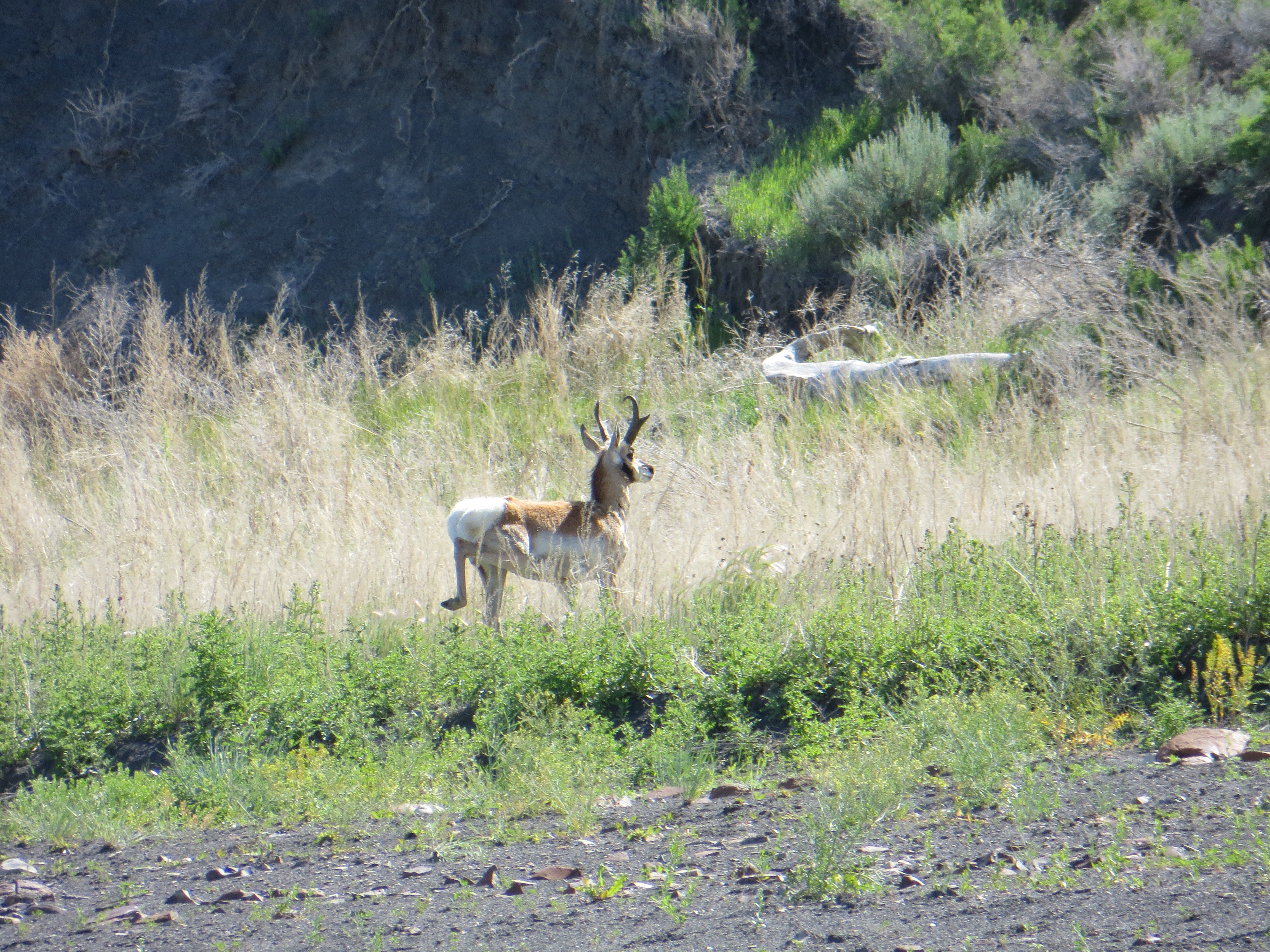
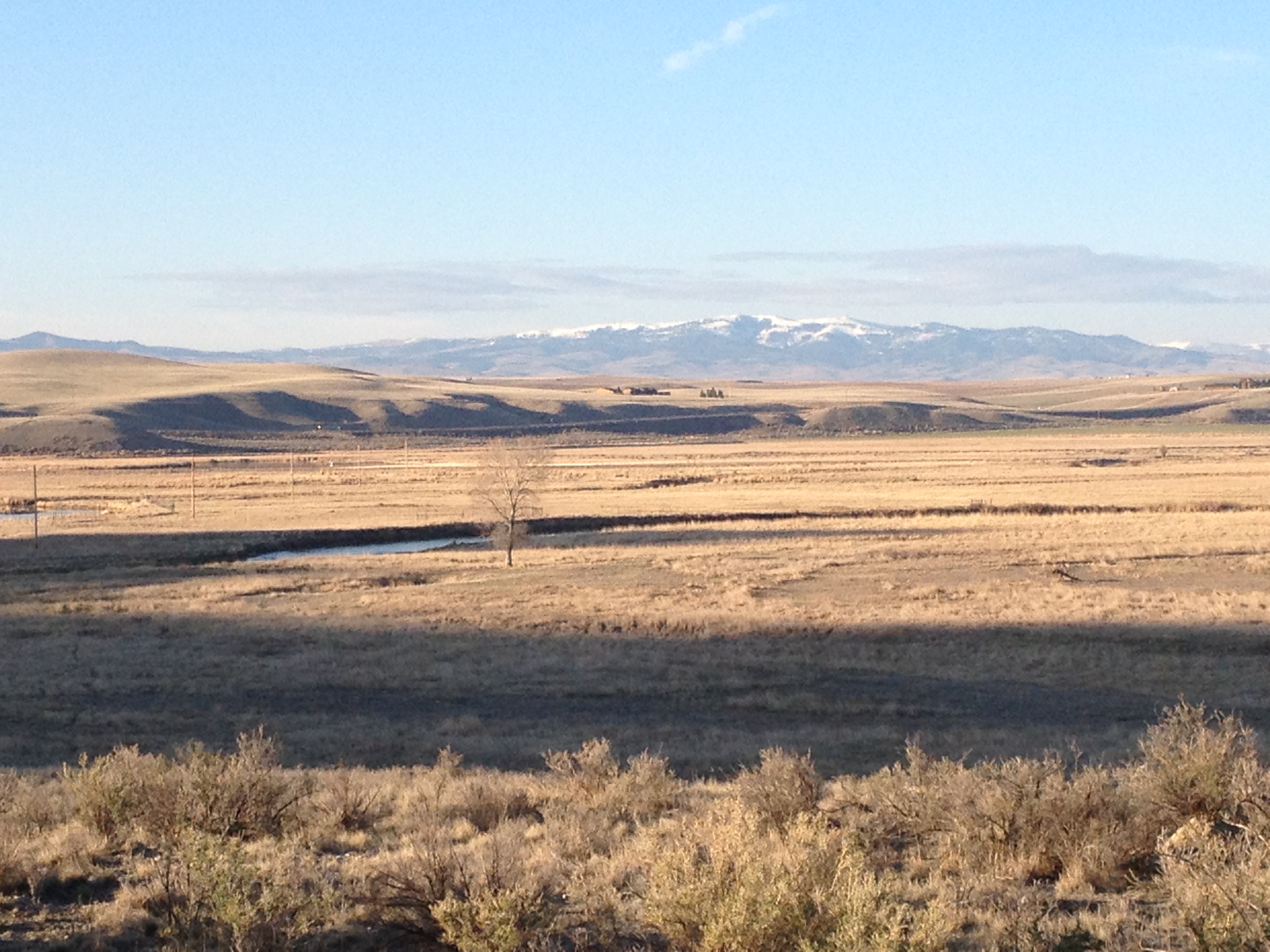
I enjoyed a warm and beautiful day with glassy waters all day.This is a gorgeous Pronghorn deer buck, also known as an antelope (but there is some controversy about that). He had a herd of six females with him. He was not comfortable with my presence.
Here is the buck’s females (I assume they were all females). The buck was very protective of them and they were very obedient to his signals to stay clear of me. I was so happy to get pictures of these beautiful animals.
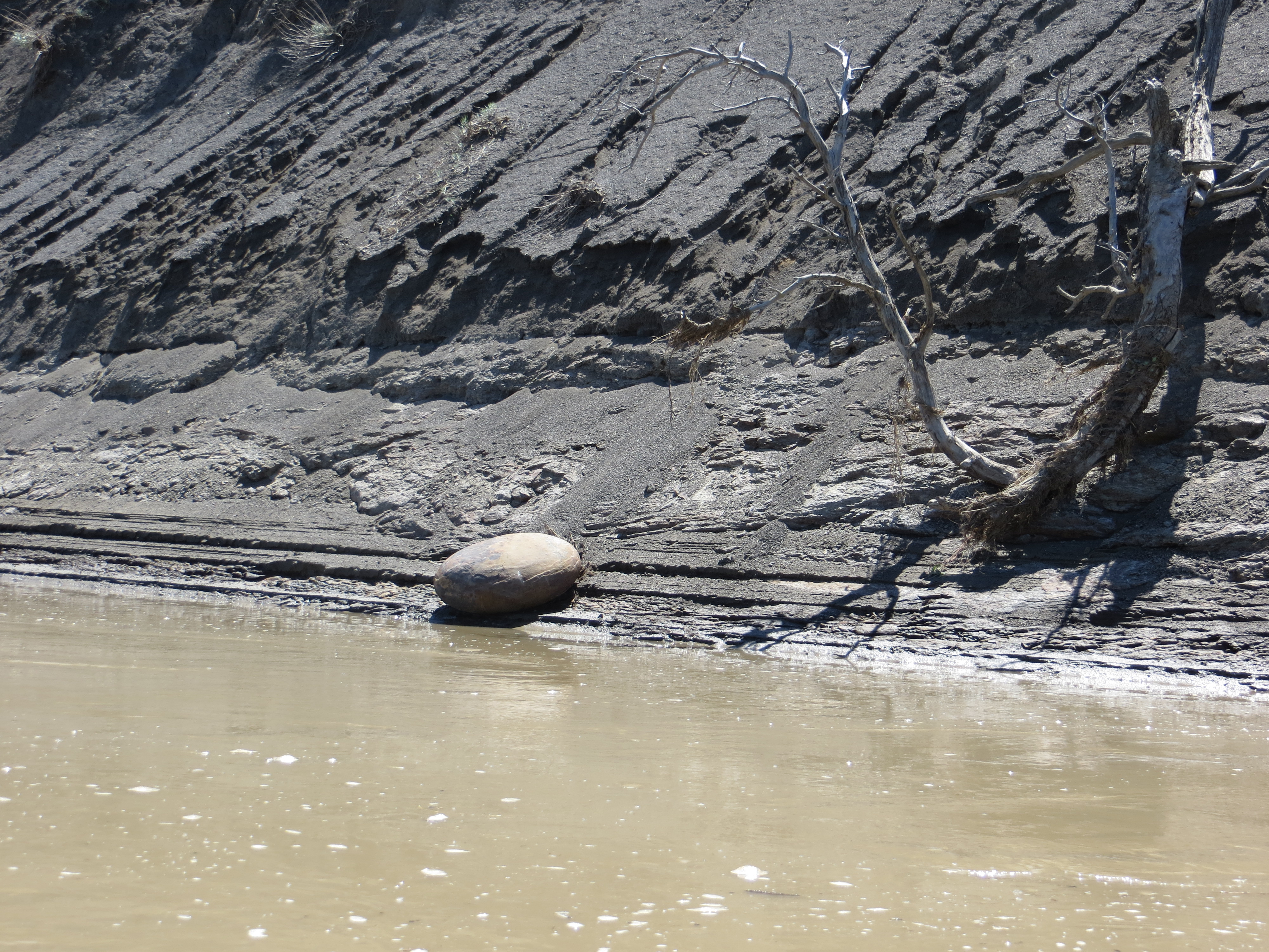
This smooth oval rock struck me as peculiar sitting at the base of a dark muddy-looking hillside.
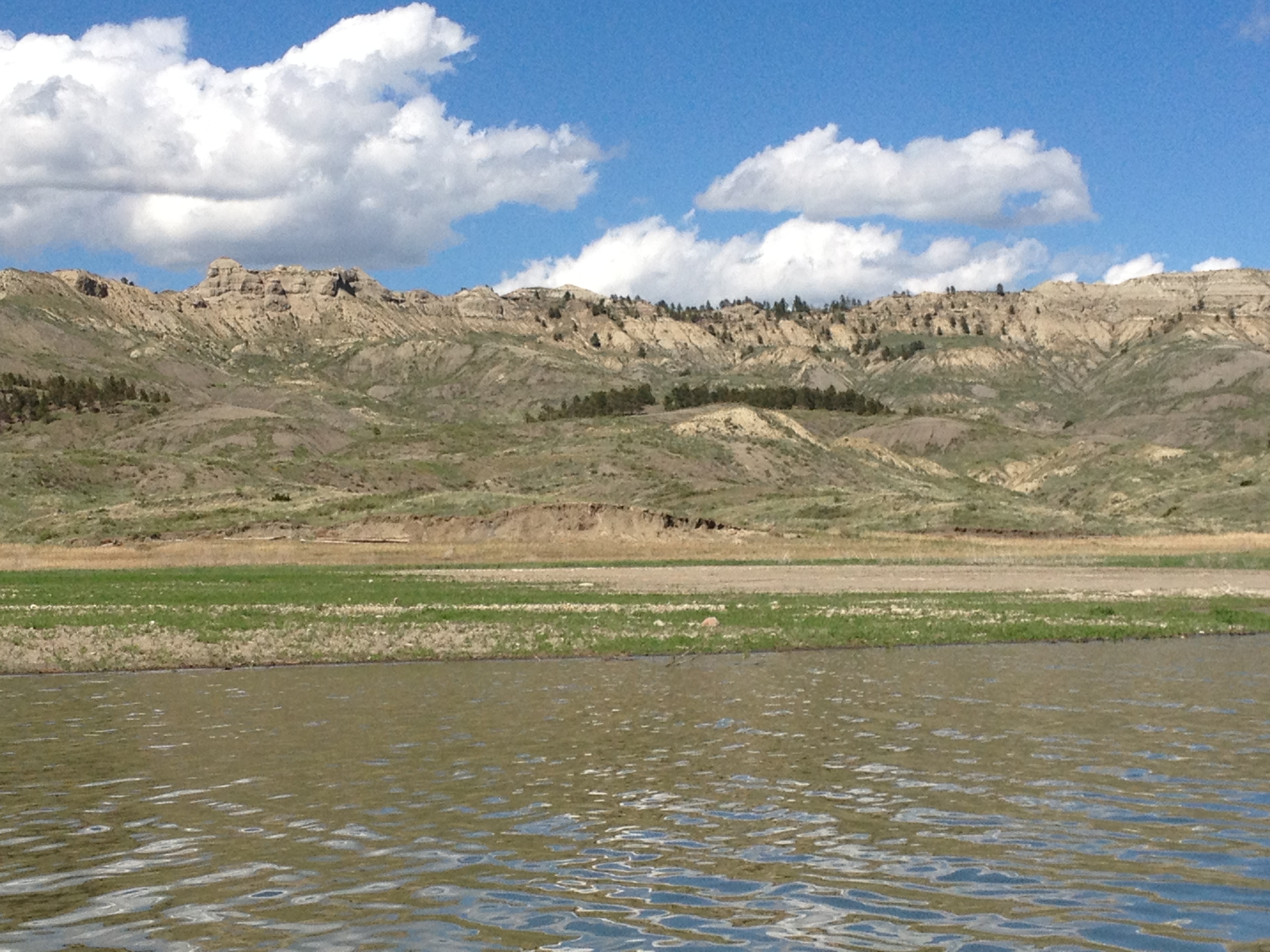
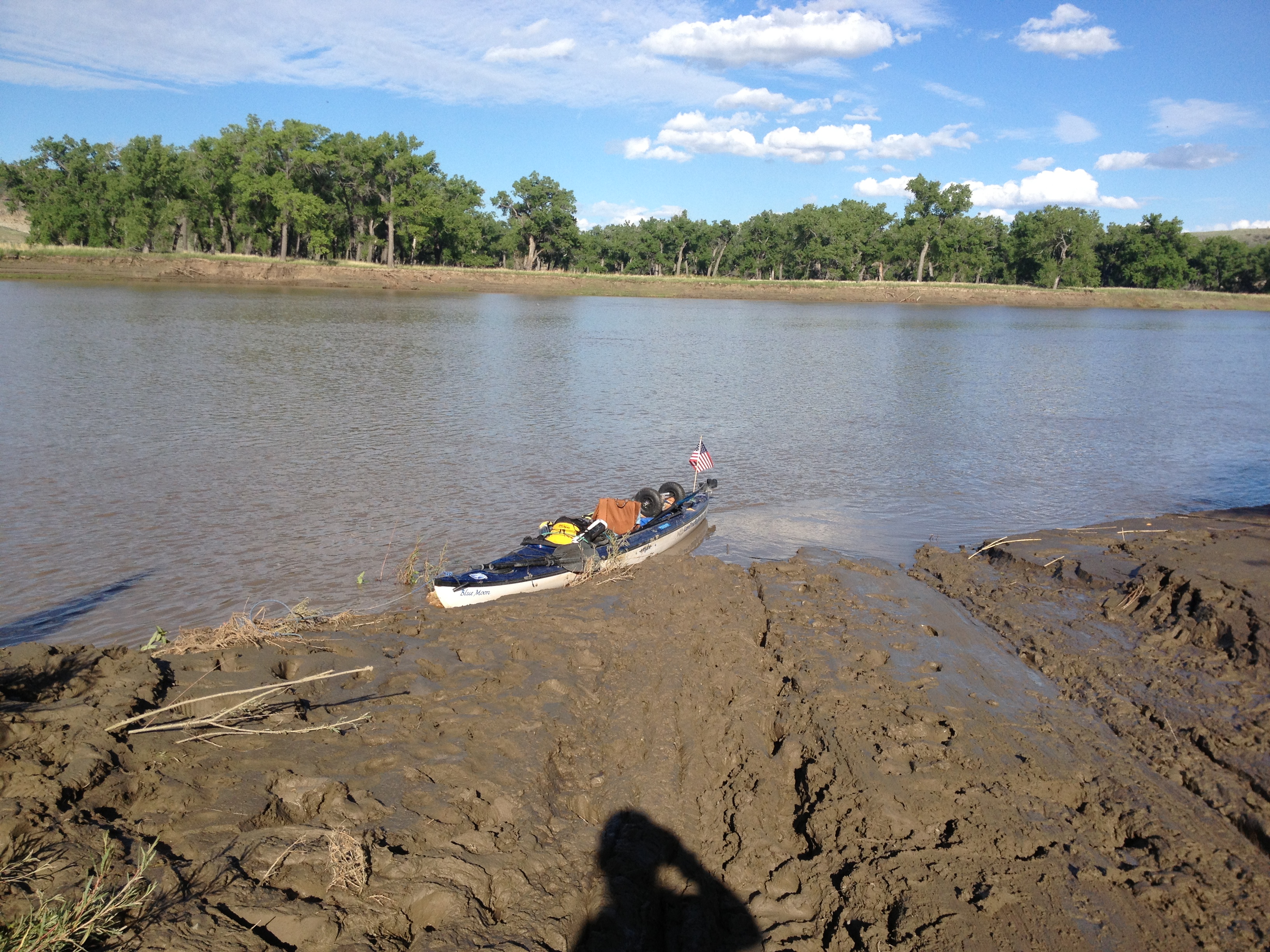
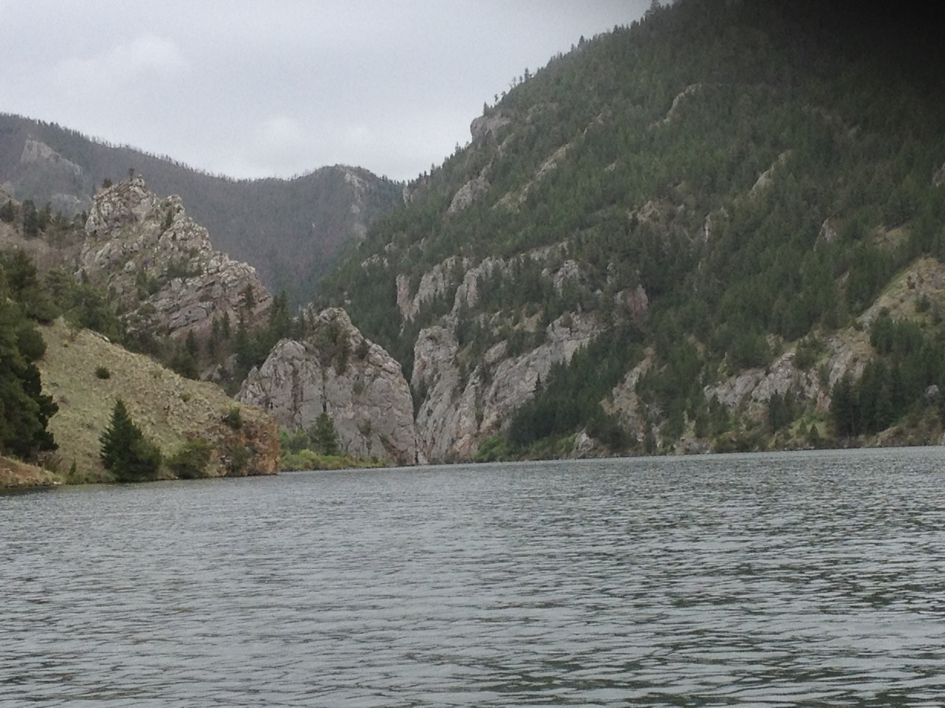
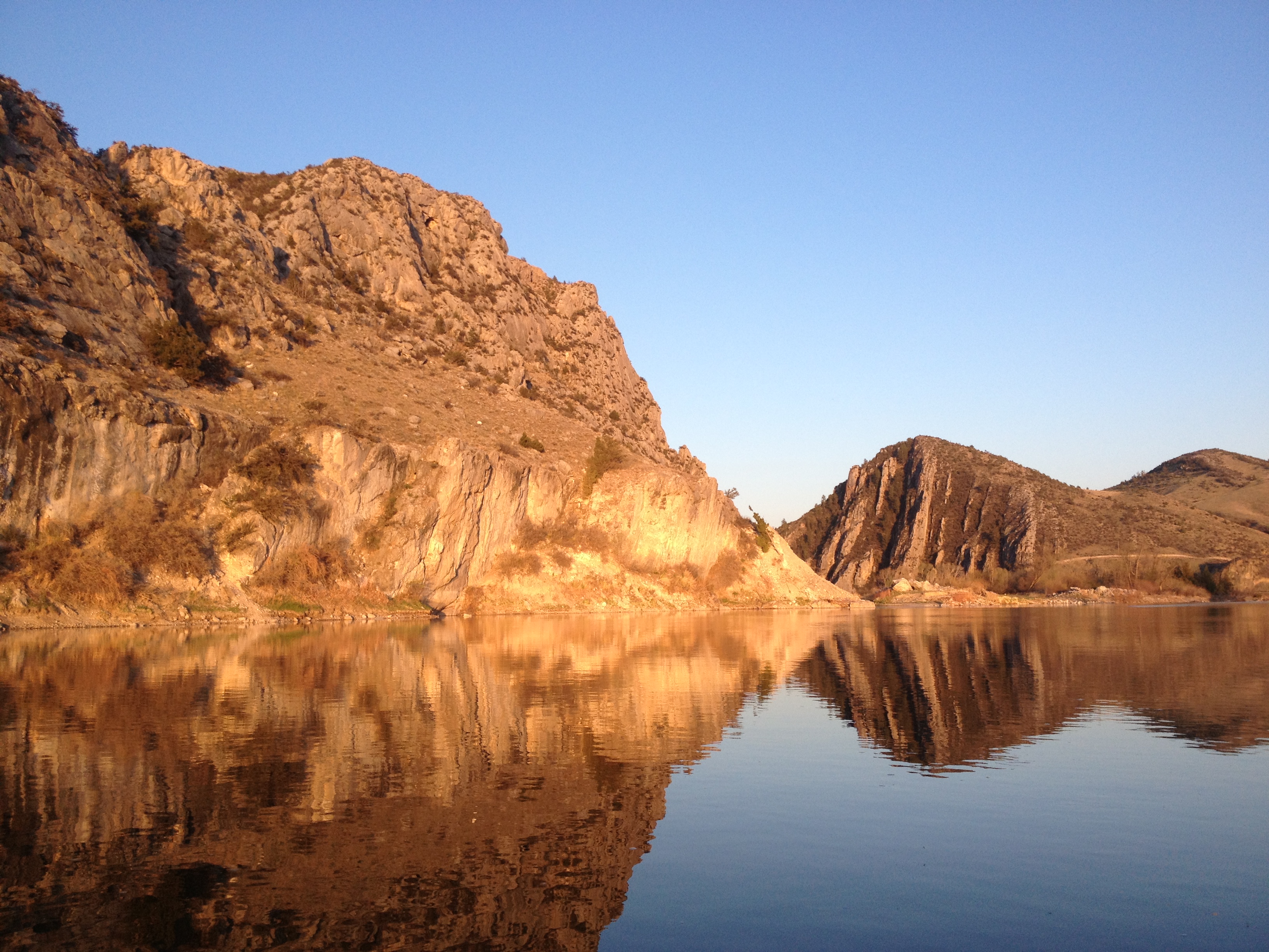
These river-to-lake transition areas are kind of spooky because the river shoreline slowly disappears into the water and before you know it, you are out in the middle of a lake. This can be daunting if the wind is blowing. Fort Peck Reservoir’s transition section also has shallow sand bars and mud to deal with. Thankfully, I was somewhat unaware of these things or else I would have been intimidated and stressed. They say ignorance is bliss. In this case, this was true. It did not take long, however, before I realized I had to pay close attention so I would not get stuck on a sand/mud bar.
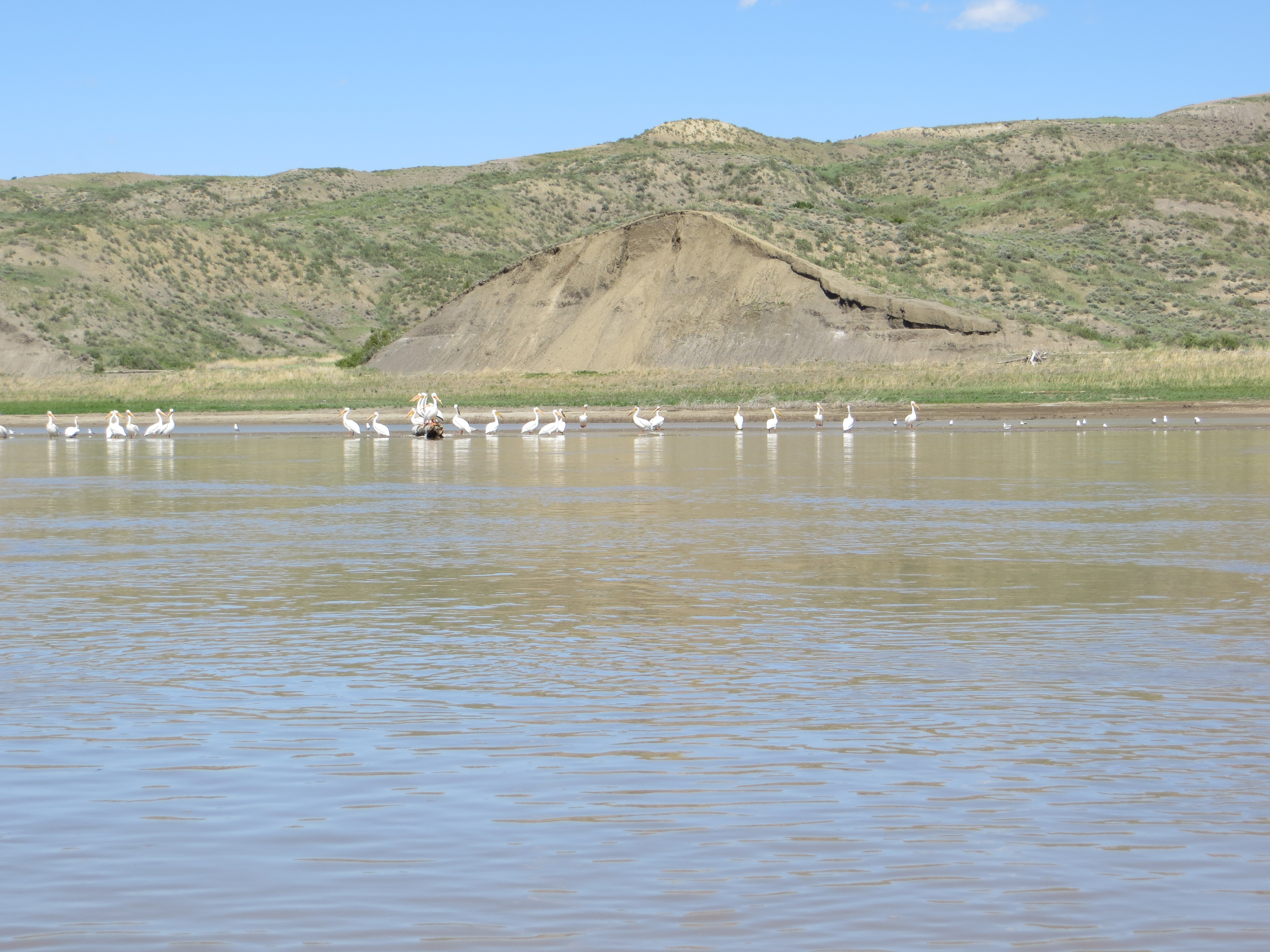
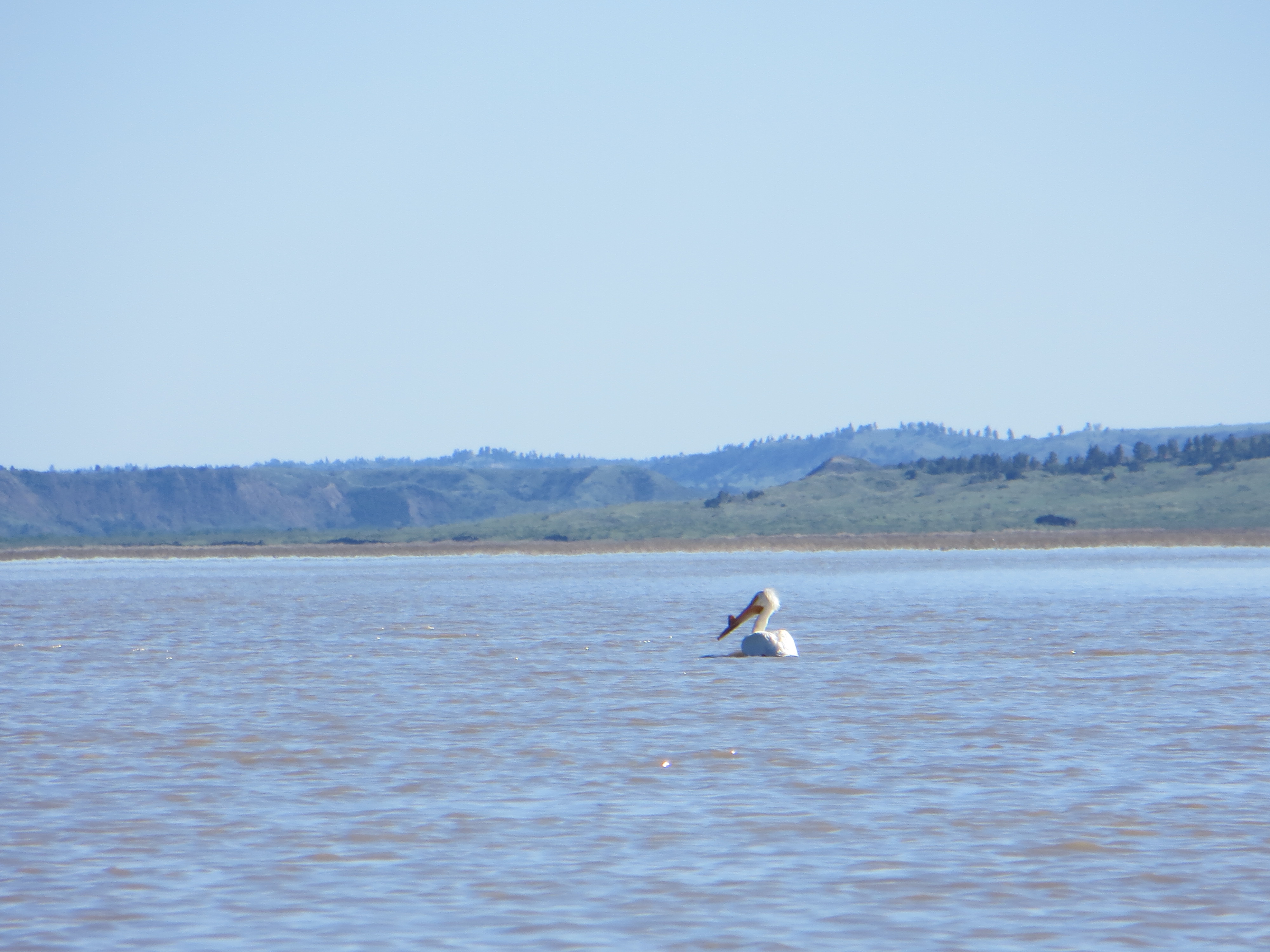
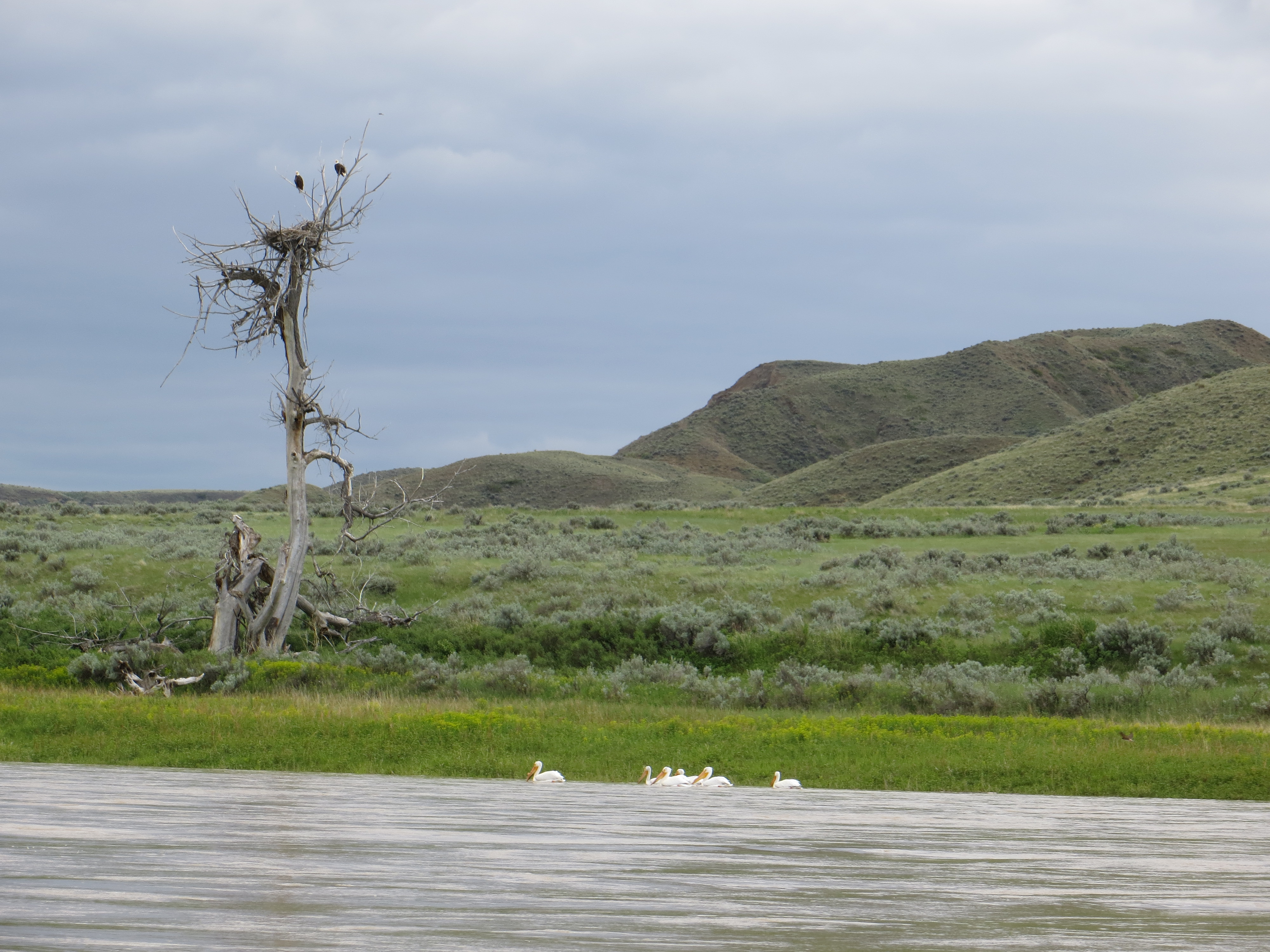
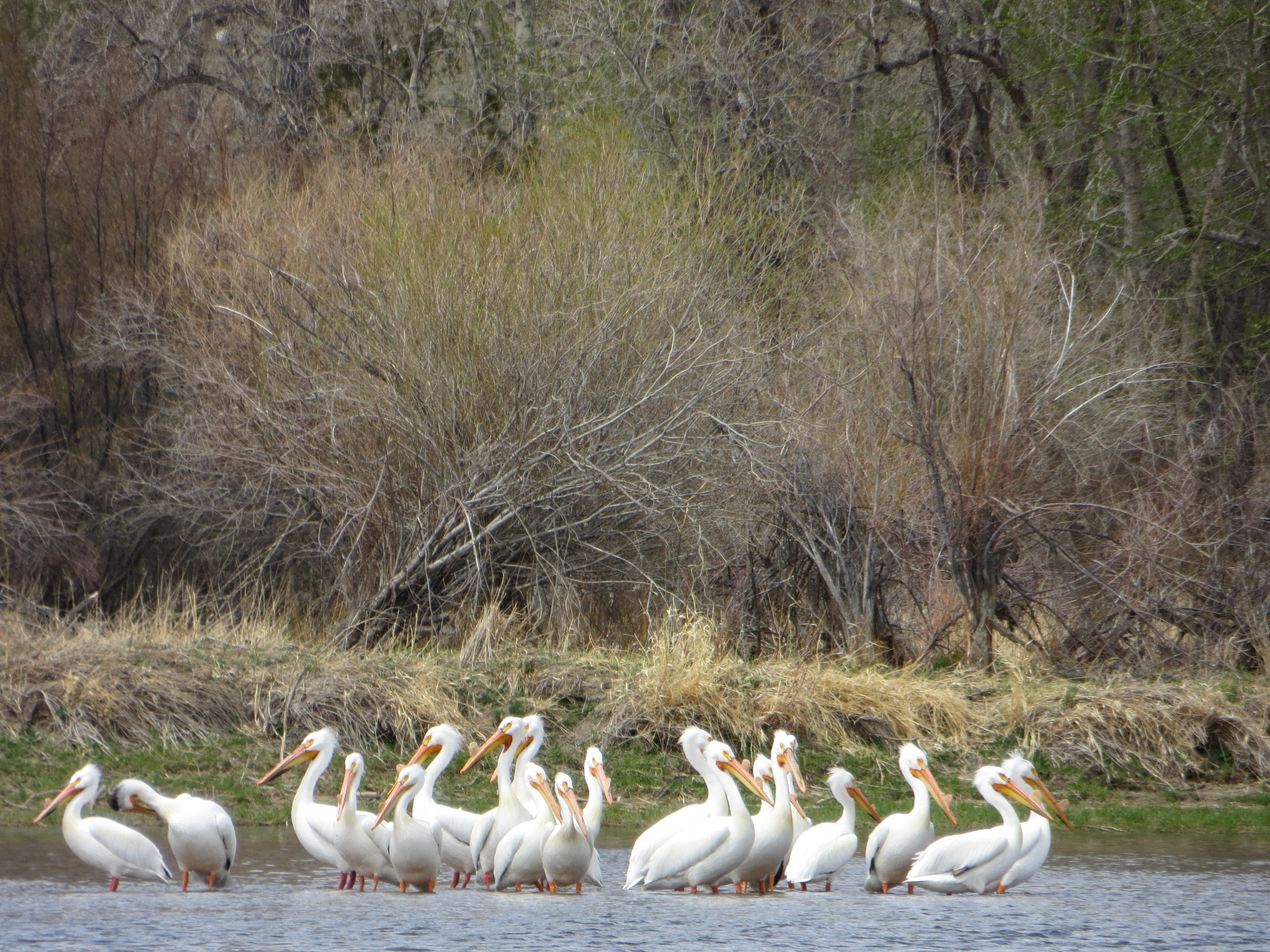
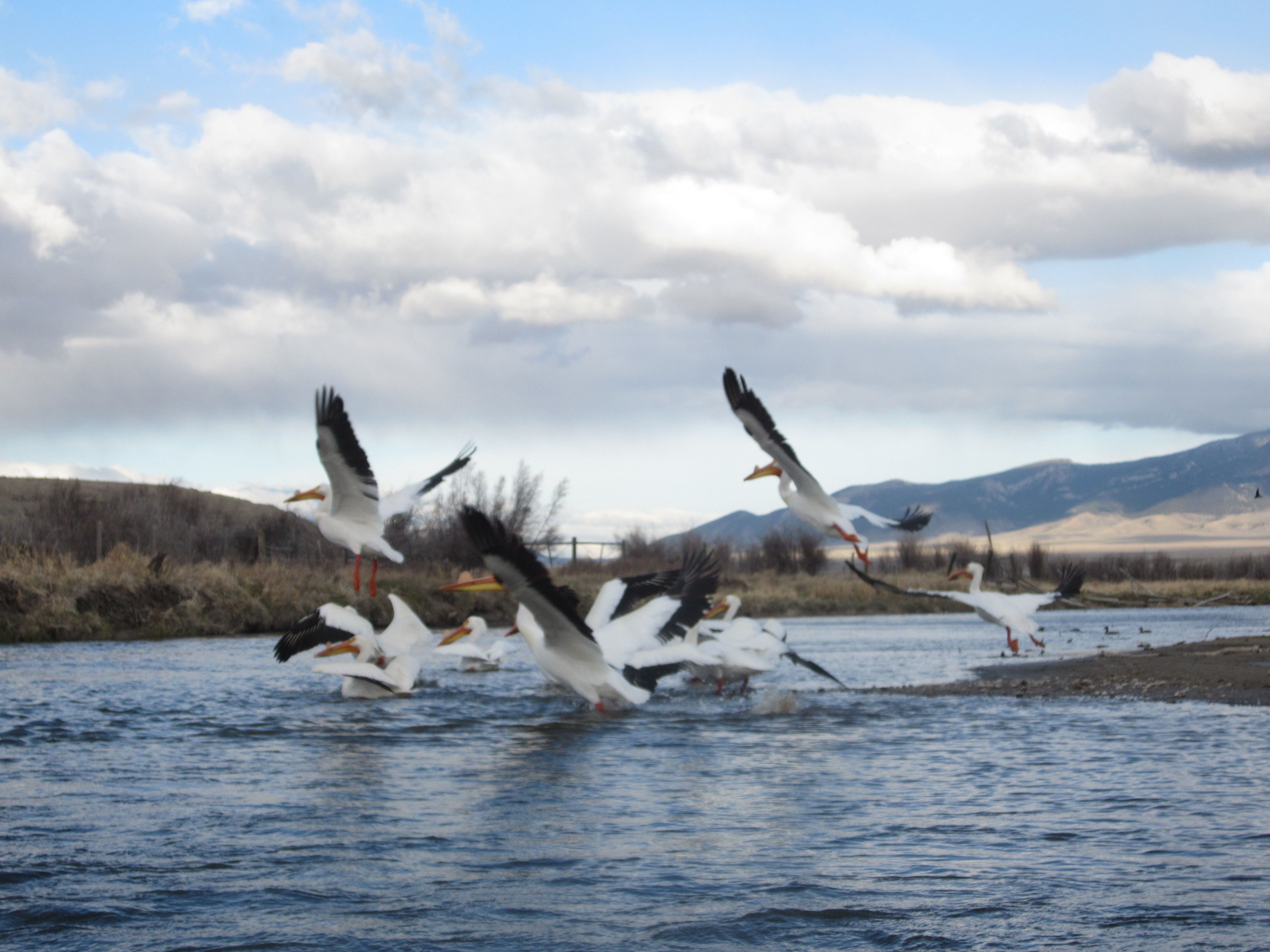
These pelicans were a good indication of shallow waters around me.
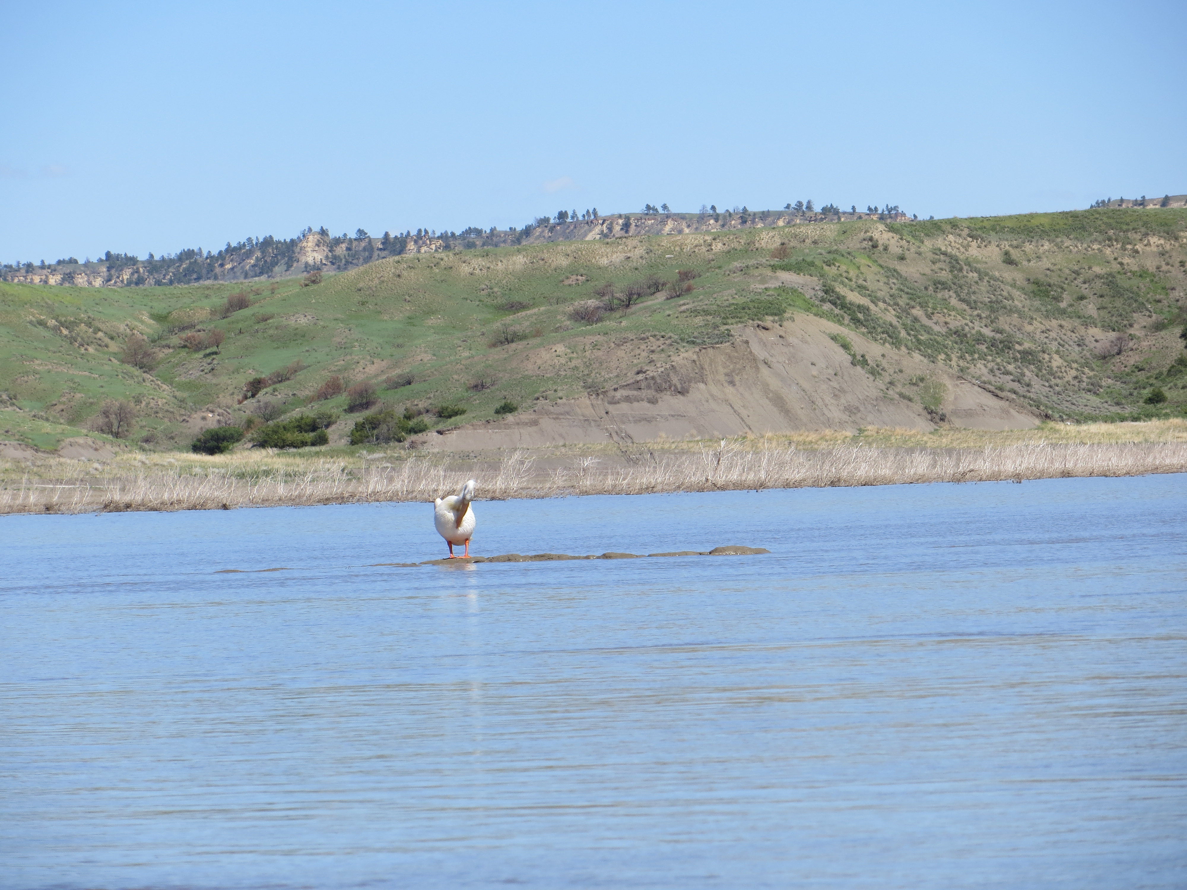
Pelican sitting on a sandbar that was just barely showing.
Once the shoreline has disappeared, it can be very difficult following the channel of the river, especially when the current is slowing down and spreading out, and the river transforms into a lake. This pelican, I believed, helped to show me the way and I made it around the daunting UL Bend to a campsite.
This was my river angel. Once the shoreline disappeared, this guy led the way for me when I found myself in the middle of a lake with shallow sand/mud bars all around me. He was a guiding white light for me, and one of the reasons I hold pelicans dear to my heart.
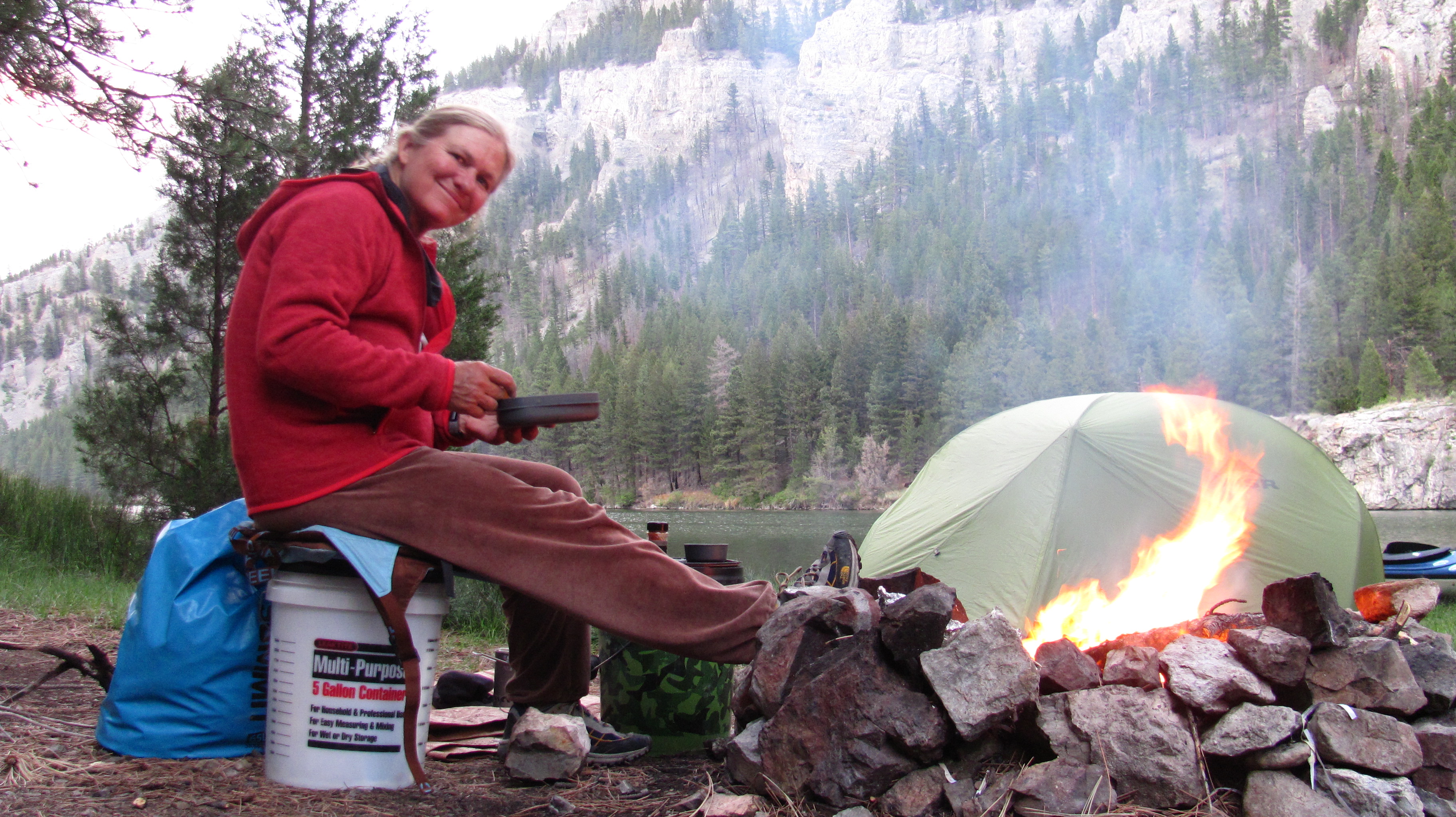
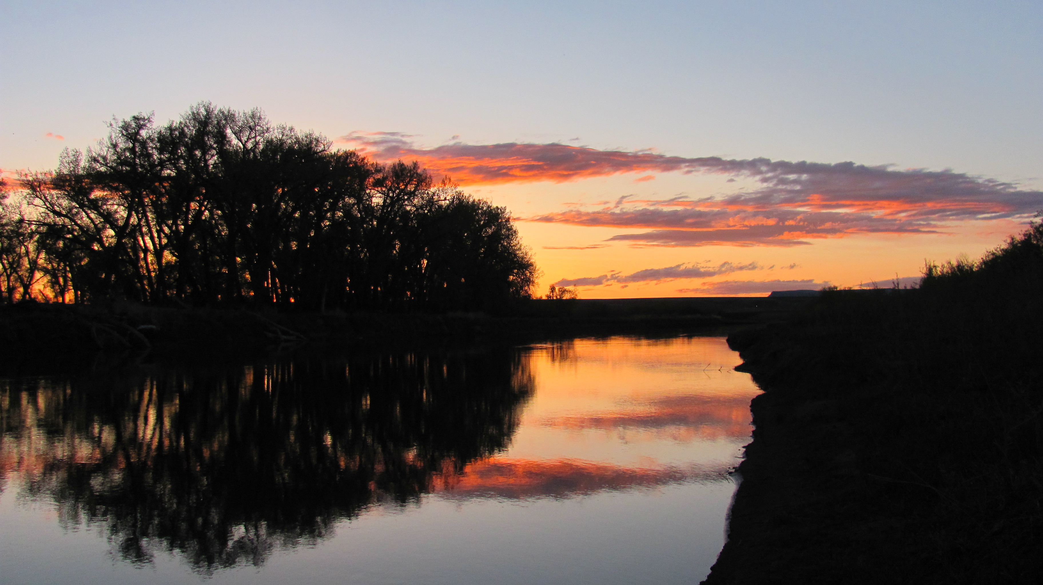
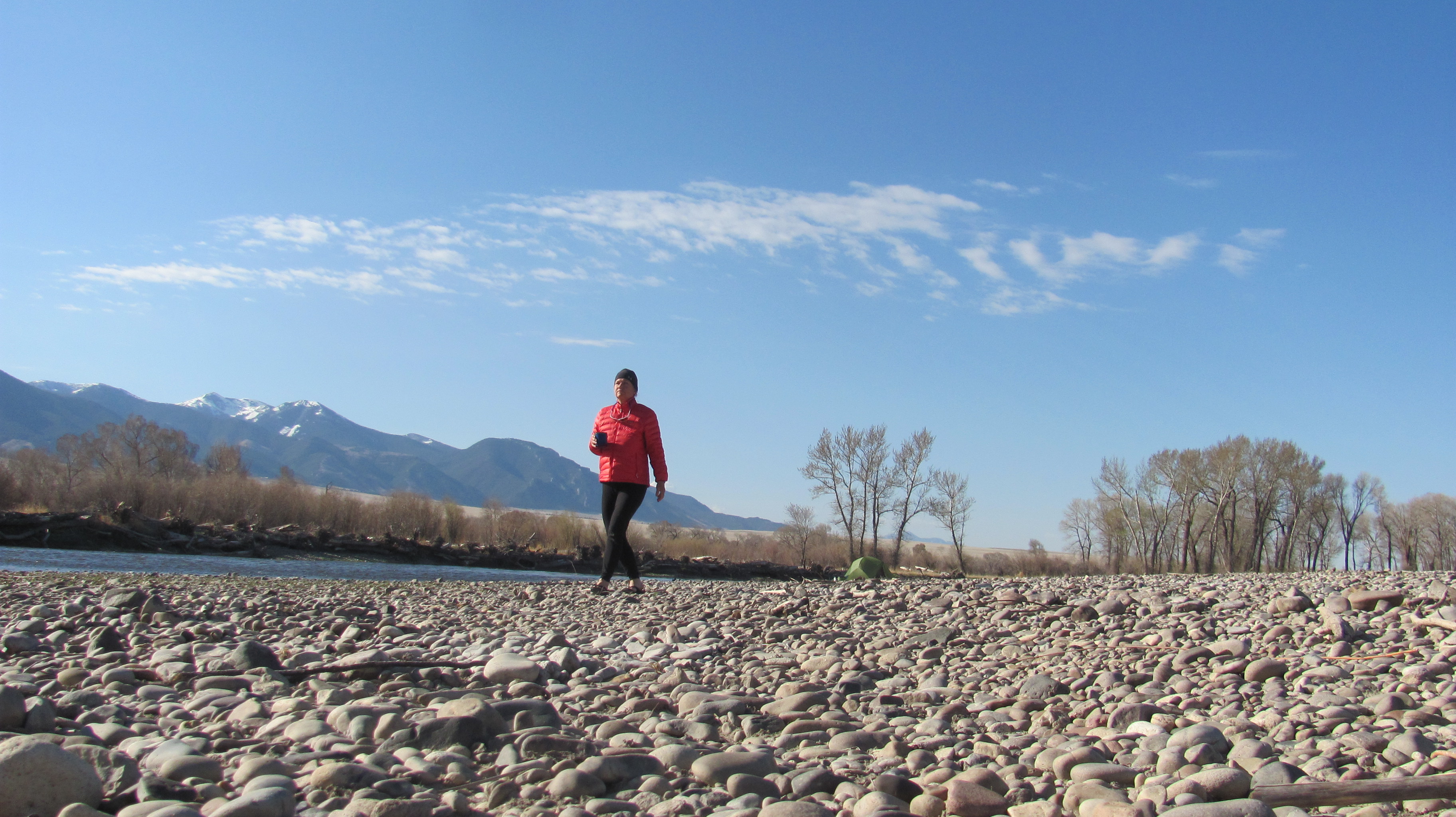
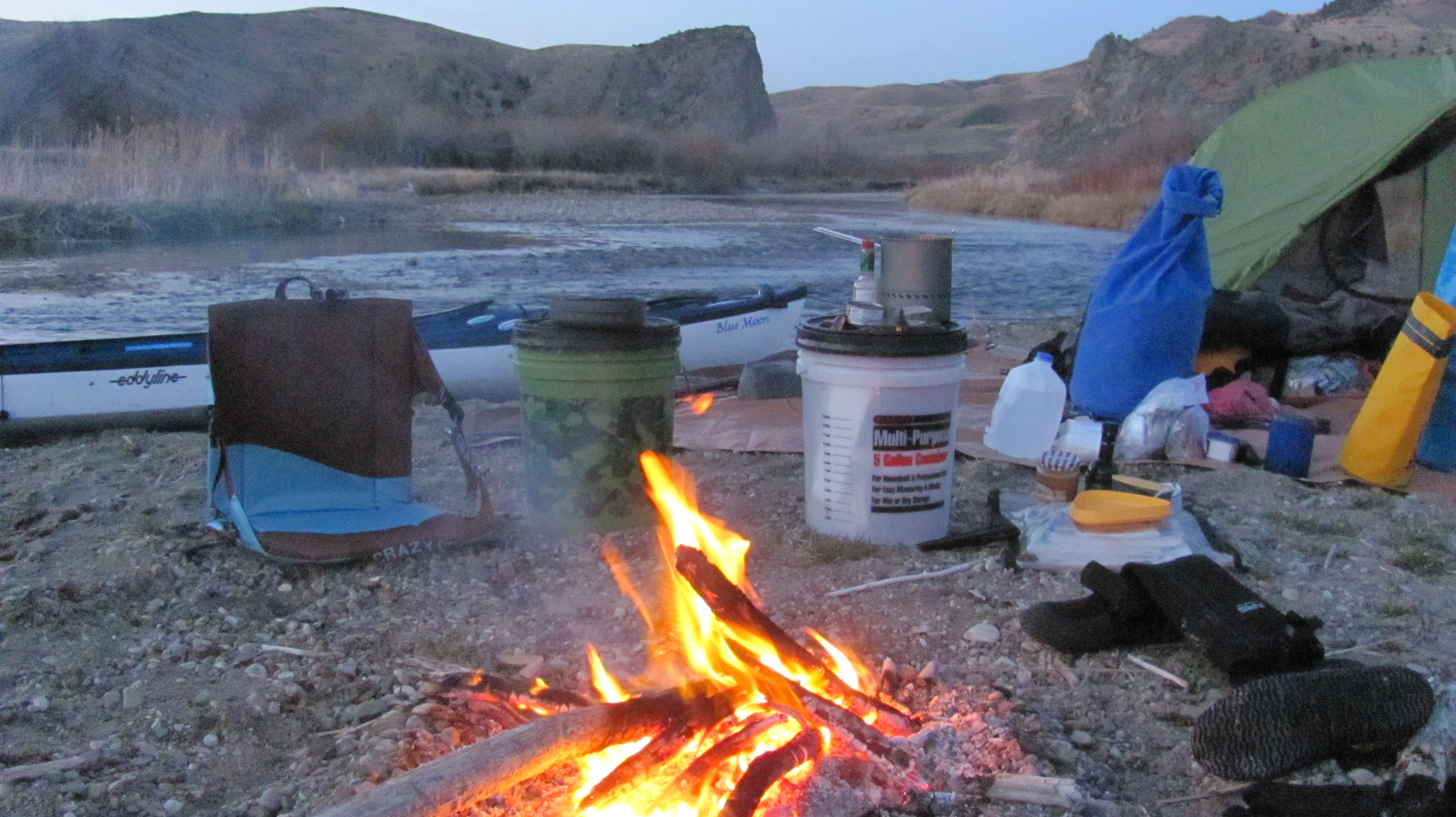
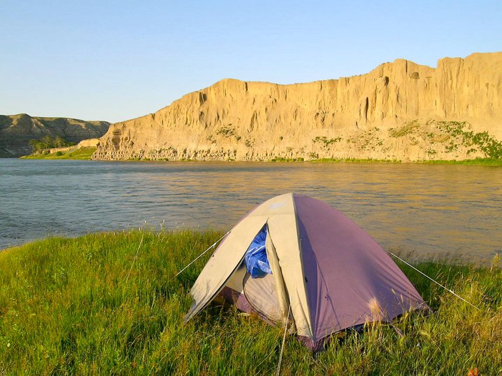
I made it to Fort Peck Reservoir! I paddled 48 miles for 10.5 hours. This was a really productive paddling day and, boy, was I tired, but very very happy. I was especially joyful because my campsite was not muddy. Well, not too bad, anyway.
My first campsite on Fort Peck Reservoir, photo taken from my tent. I took a sponge bath here and washed some clothes. I was feeling really good.
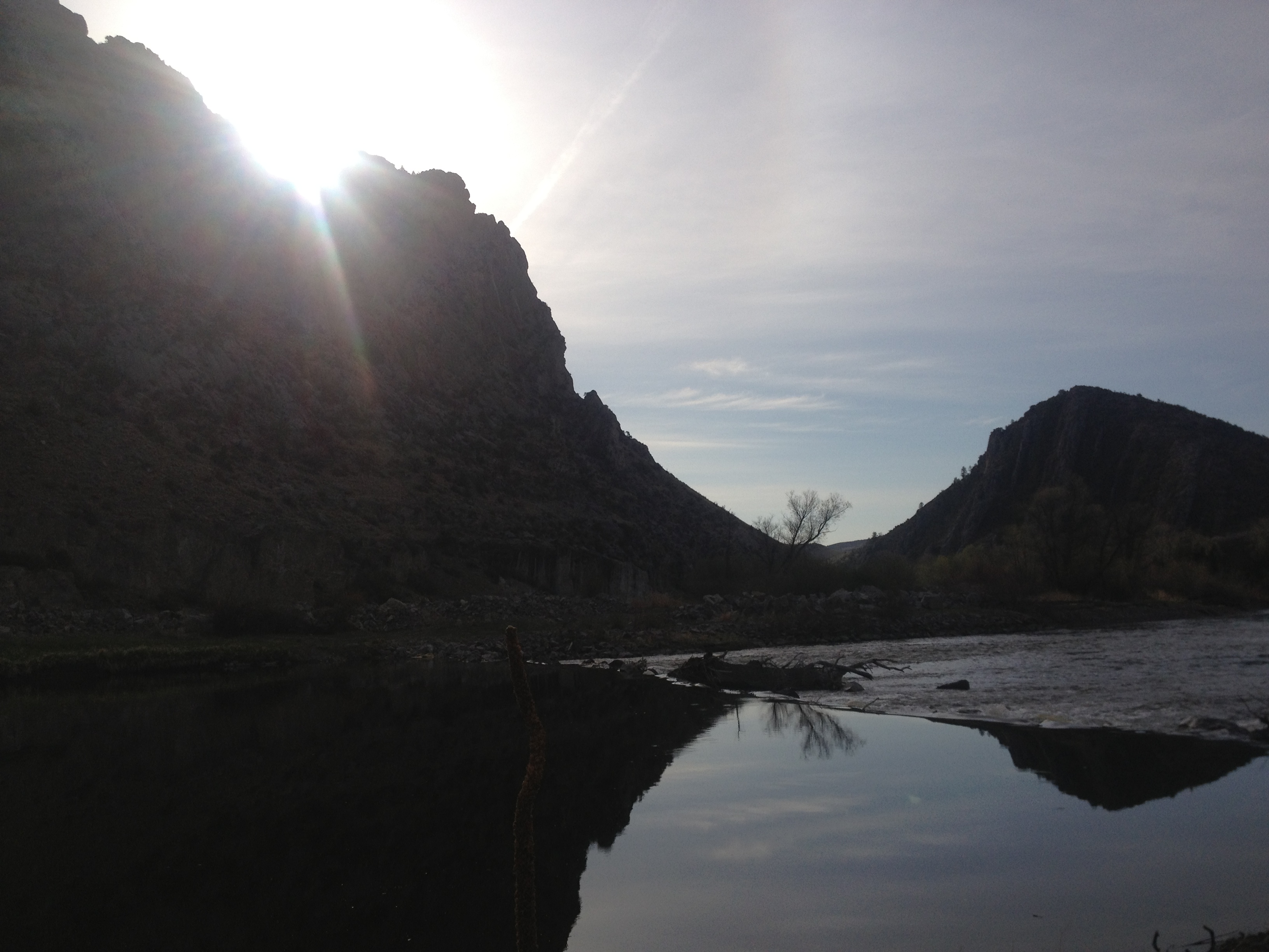
Later this evening I witnessed the power of a northerly squall line coming across the lake. I had been warned about sudden fierce winds coming out of nowhere. Thankfully, I was safe on shore with my tent and Blue Moon secure. At first it sounded like a motor boat across the lake, then it grew louder like a truck, then a train, and finally a jet plane. It was awesome to watch the wind line move rapidly over the water toward me. I knew what was happening, so I was intrigued, rather than fearful. Seeing this occur helped me to be cautious, aware, and respectful of the wind and water while on this lake.
A northerly wind appeared suddenly and engulfed the entire lake near me. Paddlers must keep one eye looking toward the north at all times.
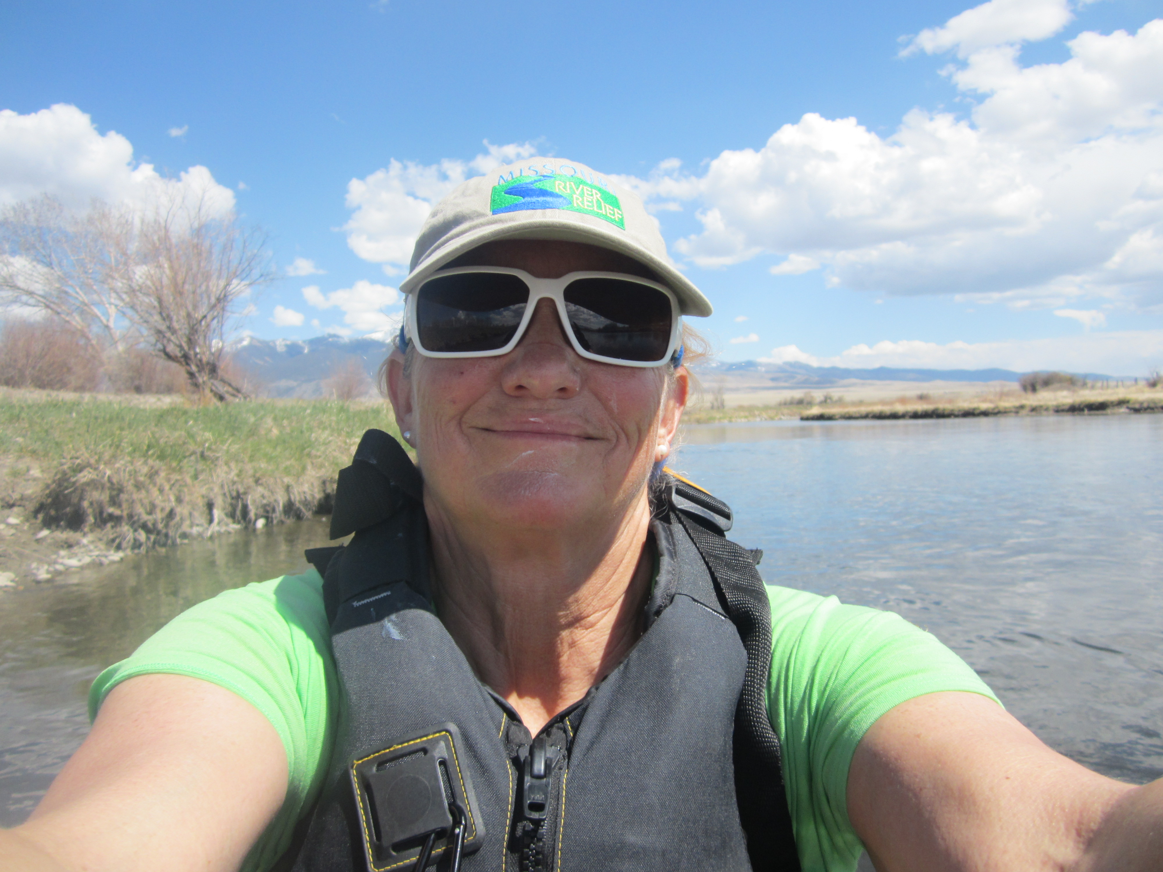
I left the RoundUp boys on June 9 and made camp the same evening on the Fort Peck Reservoir 10.5 hours later. I would journey across this 135-mile lake for the next eight days. A lot can happen in eight days. I was immersed in wilderness and forced to use my own judgment and decision-making skills in order to progress safely to the dam. High winds, snakes, electrical storms, wildlife, zero cell service, hours of waiting out the wind, picturesque scenery, and the giving hearts of the few people I met would make this one of my most memorable experiences of my life. Stay tuned for part two, the next eight days to Fort Peck Dam, through some awesome and incredible wilderness.
I decided not to stop at Judith Landing, the approximate middle of the Breaks. I regret that move a little, but I was yearning to get in some solitary camping. I knew that all of the others on the river were getting out at Judith because of the James Kipp closing, so I kind of felt that I would have the lower section to myself. I saw James and Klaus loading up at the Judith Landing boat ramp, and we were able to wave and say our last good-byes.
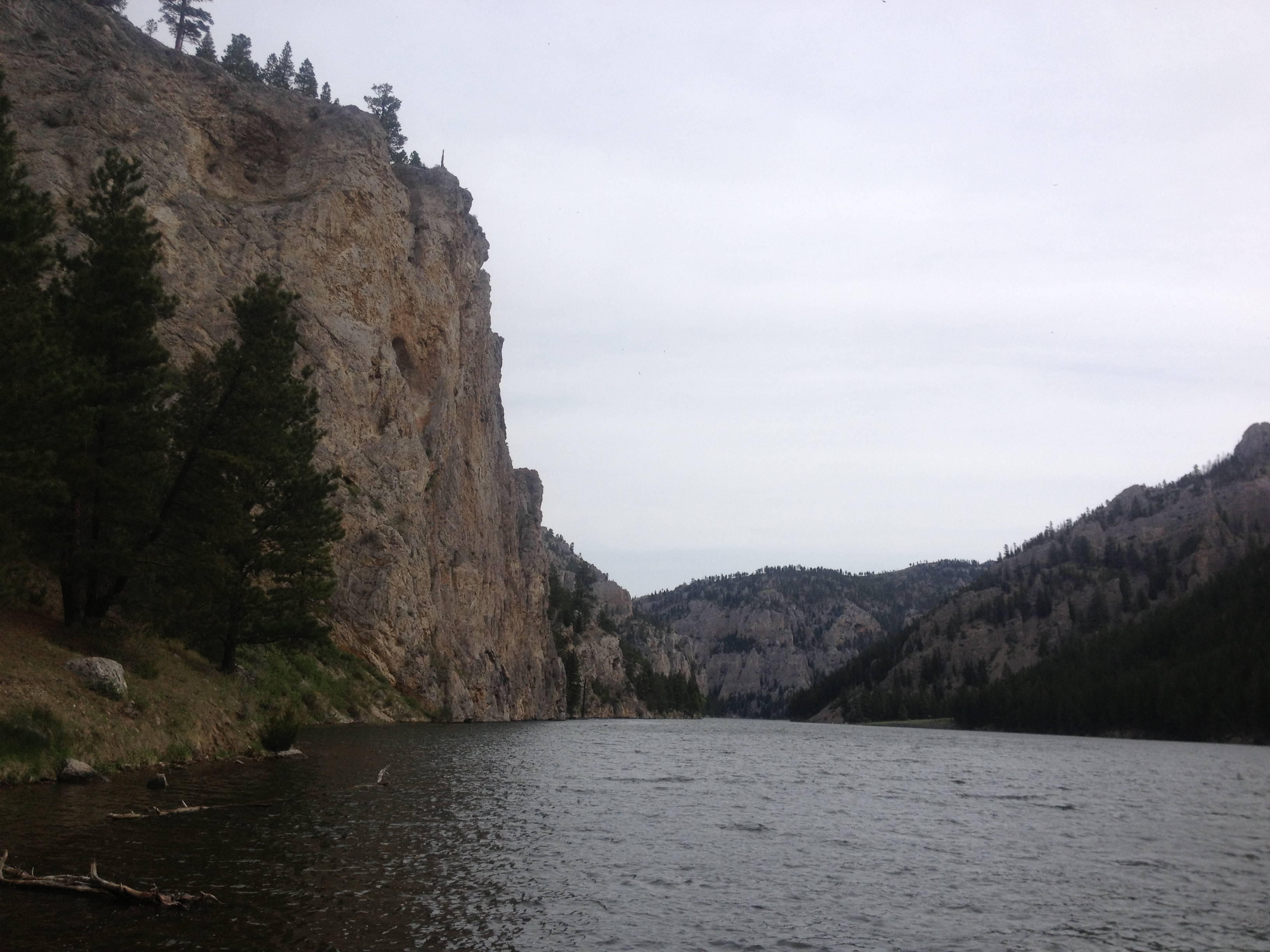
I decided to camp at Gist Campground. I was right. No one was around beyond Judith Landing. The campground was located on a beautiful stretch of river with a steep rock wall that plunged straight down into the river. I knew then that I was going to like this place.
The wall across the river from Gist Campground
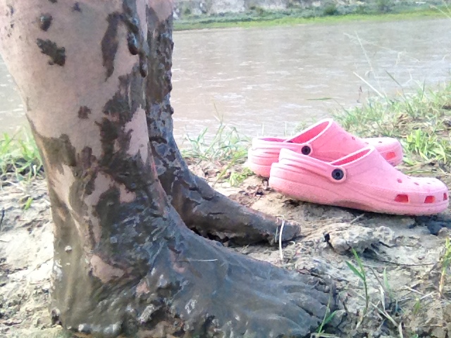
The river banks were muddy because of the recent rains. I decided I could not avoid it no matter what, so I just took off my shoes and let it squish between my toes. The Big Muddy’s mud is actually soft and silky and washed off the skin quite easily. What are you gonna do? You just have to deal with it. No sense in getting anxious and frustrated about it.
The mud at Gist Campground was extensive. The river had flooded during all of the rain, and now the river was dropping leaving a lot of shoreline with mid-calf to knee-high mud.My camp at GistThis is the river as it runs down towards the front of Gist Campground. I was very much isolated in this area. However, in the afternoon as I was leaving on another hike, I saw a solo canoer approaching. It is amazing I happened to see him. Although, I always keep one eye on the river and can spot any living thing that is nearby. Had I left a minute earlier, I may have missed seeing him upriver. I went ahead and took off on my hike. He was not there when I got back. He must have paddled on.This is the view from the campsite looking inland downriver. I wanted to walk up to the lookout in which Lewis claimed he saw the Rocky Mountains for the first time. I would have to walk a mile and a half in that direction. No problem.These are the Gist Homestead remnants just behind the campground. It was fascinating to see inside and imagine what life was like living out here in the 1800s. I was electrified considering these things as I used to dream about being an early settler.When I walked the mile and one half down towards the lookout hiking area, this weather blew in and looked ominous. It proved to be nothing, but I canceled my hike to the top so as to avoid thundersorm and hail trouble.
After staying for two nights and several small hikes later, I moved on. The river had dropped three or four feet since I had arrived. This beached my boat fairly high above the waterline, and you know what that means? It was time to get muddy again. Off came the shoes and I moved the boat up the river to where I was camped since there was no difference now in the mud situation. The riverbank was muddy everywhere. I would soon find out that the mud was prevalent for miles and miles to come. Finding campsites downriver would prove to be extremely challenging.
Yes, the river dropped. I knew it would, but never thought it would look like this.You can make up your own caption for this one.
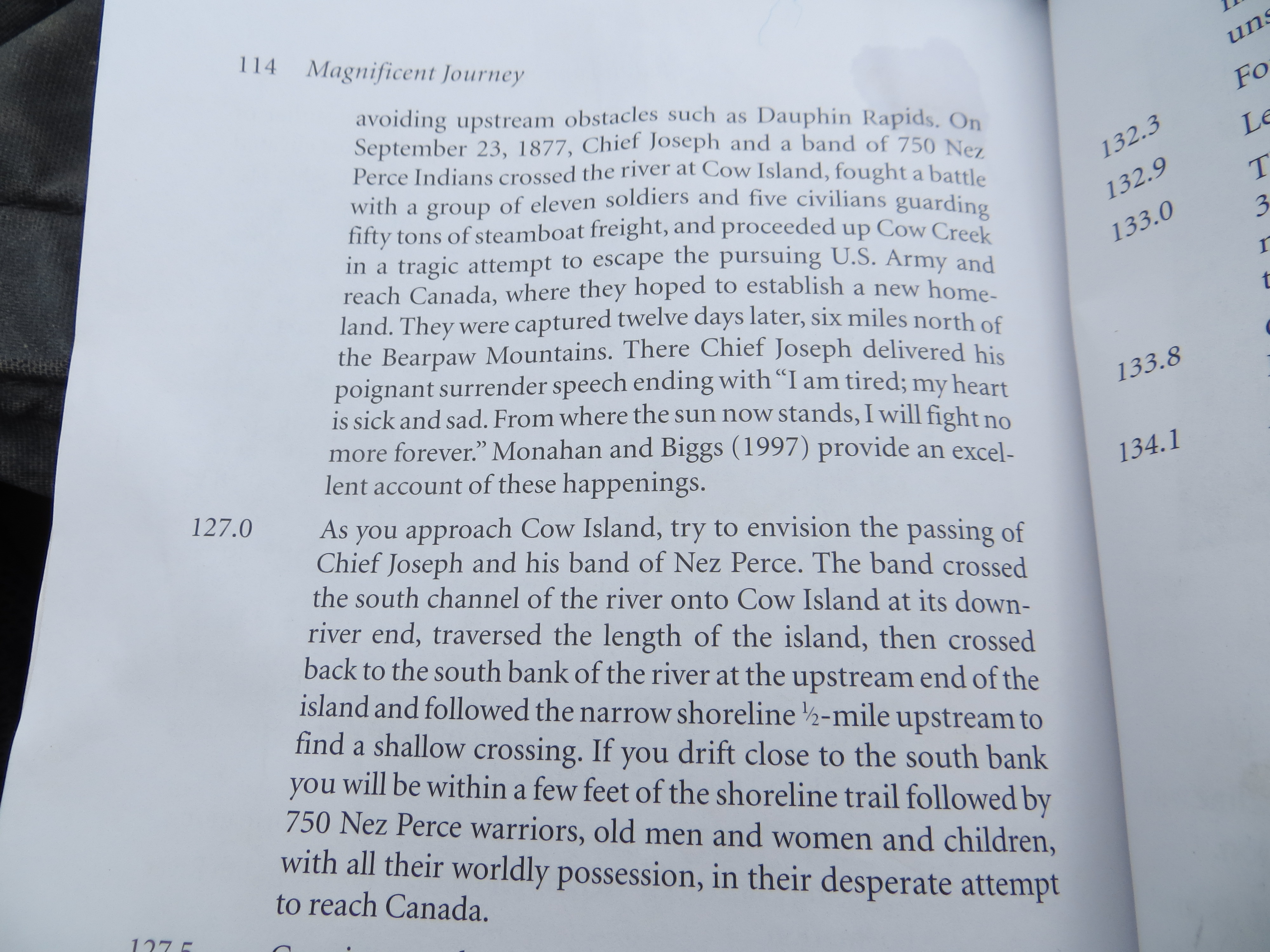
I learned about some historic events as I was actually paddling down the river. The Cow Creek Crossing was one such event. As I read about the Nez Perce Indians, led by Chief Joseph, marching towards Canada in order to escape confinement to a reservation, I was moved. 750 men, women and children, now refugees in their own country, trying to escape the American military and the inevitable tragedy that would follow. Unfortunately, they were close to Canada, but not close enough to escape. I followed their trail through this entire section and stopped every so often to just imagine where exactly they walked and what they must have looked like. I was filled with emotion.
A page from Otto Schumacher and Lee Woodword’s Magnificent Journey, providing a little information about the Nez Perce Crossing of Cow Island.
I paddled slowly past the Nez Perce National Historic Trail where, in 1877, approximately 750 men, women, and children of their “nontreaty” tribe tried to make their way to Canada to reach asylum. I saw the many water crossings they likely took, and a narrow trail along the river on which they walked near Cow Island. They were so close to freedom before they were stopped and 200 Nez Perce braves fought to defend the fleeing tribe. My heart bleeds for them. This section proved to be very melancholy for me, and unforgettable.
The trail of the Nez PerceThe Nez Perce likely walked along this narrow shoreline and through that flat area on their way to the Cow Island Crossing. The geography of the river and mountains is still very similar, based on the map of the route they walked.The Nez Perce Trail comes this way from those mountains and their journey involved many river crossings. The trail seems to cross right at the most narrow spots, indicating the river must still be similar to what it was it was like then.The Nez Perce crossed Cow Island and headed north towards Canada in attempt to escape the American military.
My plan was to stop at the James Kipp Recreation Area. This is considered the end of the road for the Upper Missouri River Breaks National Monument. I planned on refilling my water here, and camping the night. I had no idea the flooding wreaked such havok on the campground. Not only were the roads closed just a few days previous, but the electricity was still out and that meant the water pumps were not working. A fisherman took me around to find water to no avail. But in order for him to do that, I had to get up this boat ramp. “Apparently, they have not cleared the ramp yet.” I chided. That got a good laugh. The camp host eventually came to the ramp with a ten-gallon bottle of water and filled my five gallon bottles.
The James Kipp Campground boat ramp“What a bloody mess,” as they would say in England.
It’s 4:00 PM and I’m outta here, I thought. I’ll just paddle on down the river and find myself a campsite. Oh dear. That turned out to be the greatest challenge of this trip. It took about 15 minutes for me to realize I better start looking hard. Four hours later there were still NO sites to be found, and I had stopped to investigate several areas. This was the first time I thought I might have to sleep in my kayak. OMG!
Just as dusk was falling on the land, I came around a bend and saw something unusual. Three men were walking, yes walking, on the riverbank. How are they doing that?! I exclaimed to my brain. Is it not muddy in that spot. I paddled in a straight line over to their boat, and them. I made friends fast. Actually, I had no intention of going any further. Thankfully, Eli, Brandon, and Travis turned out to be river angels, river angels from Roundup, Montana.
Eli, left, and Brandon on the riverbank. They had been paddlefish fishing there all day long. They stomped out a sizable trail down the riverbank. I’ve never been so happy to see anyone in my life!Travis, Brandon’s older brother. These guys turned out to be so wonderful! I’ll never forget them.
Soon, darkness was upon us, and Eli helped me carry my gear down the bank, through the willow forest, and up the hill where I set up my tent with a gorgeous view of the river. I went from rags to riches, and was thrilled. The boys ended up camping at their truck that night, which was located at the top of the hill, and we had a fire and passed around a bottle of JD (only a couple of times). When in Montana, you do as the Roundup Boys do. I was so happy! And, Brandon gave me his Leatherman to take with me. Now, THAT’S special!
Eli helped me carry my tent and gear down the bank, through the willows and up the hill where I set up my tent overlooking the river. I was so thankful. He also explained to me that the screaming animal I kept hearing during the evenings was merely a toad. Whew!
I had a long day of paddling the next day in order to get to Fort Peck Lake. I rose up at sunrise and was in my boat at 7:00 AM. I waved to Eli from the shore. I was sad to leave these river angels.
The RoundUp boys’ fishing boat and Blue Moon on the shore of our oasis.
It is so easy to get attached to kindred spirits that share their life with the river. There is a bond that is undeniable. We share riverblood.
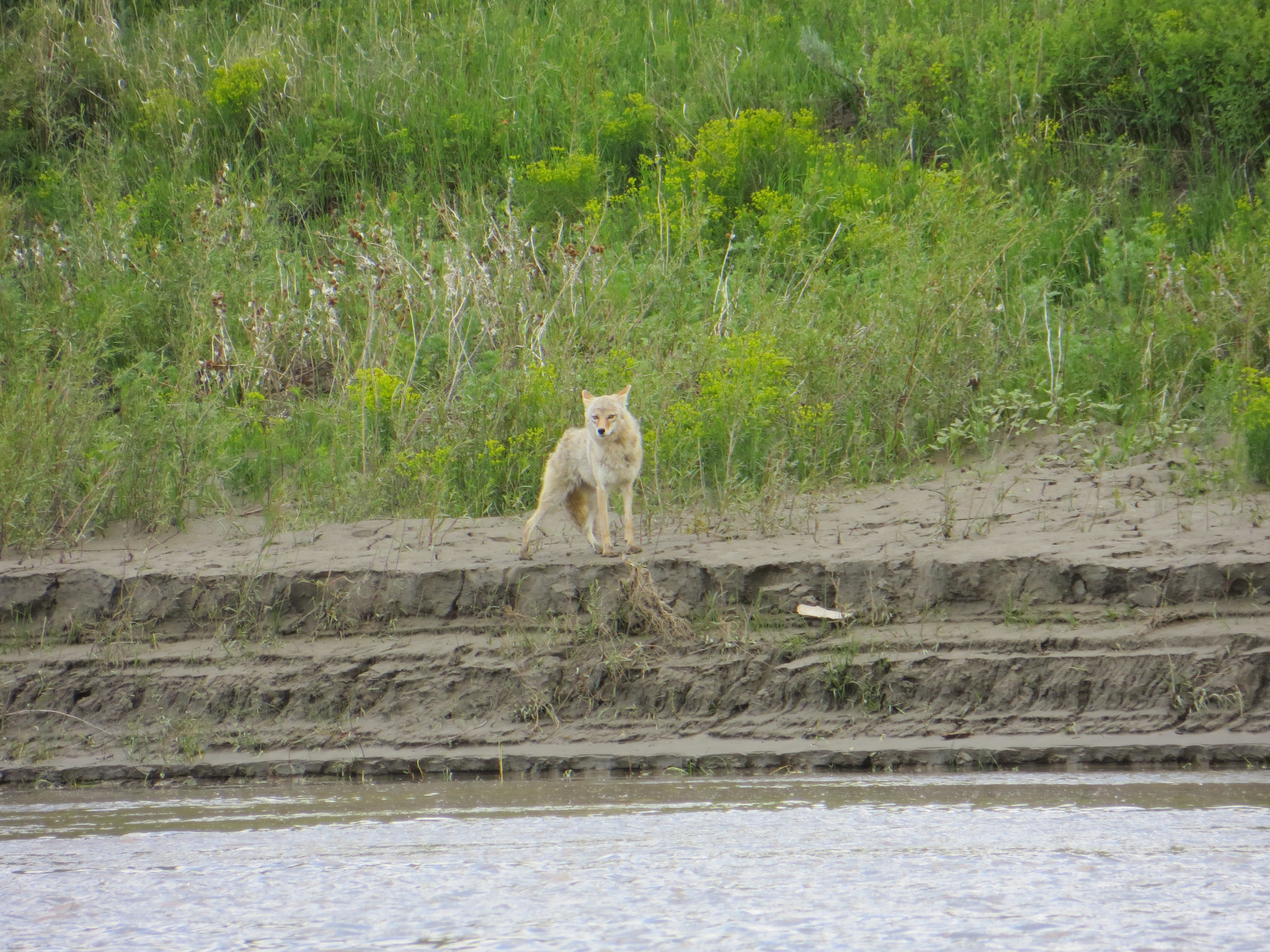
Beautiful coyote
43 miles later this day, I arrived at Fort Peck Lake. I had had no internet service for nearly a week, and would not for almost another. I found myself immersed in mountainous wilderness. I was in heaven.
My dear friend, supporter and river brother from Columbia, Missouri, Jonathan Lauten, produced this slide show of my trip thus far. It is very special to me as the memories provoked are fond and special. I think it is kind of funny that the slideshow brings back so many memories of a trip of which I am still in the midst.
Please take a moment to enjoy these very unique and special moments from LoveYourBigMuddy Expedition 2013.
I will try to continue my documentation of my expedition on this blog as soon as I am able, likely as soon as I get across Lake Oahe, of which I am over half way on this 230 mile lake (as of July 25, 2013).
Click on the photo below to access the slideshow. Thanks for your support! -Janet
Bub and Tinker with one of the St. Louis/Fort Collins’ family members.
A busy morning at the Coal Banks Landing boat ramp once the storm left. The ramp was bustling with boats, paddlers, gear, and excitement. Special thanks again to Bub and Tinker Sandy for taking care of all of us wet river rats and opening up the visitor’s center to everyone for the lasts two days. I decided to hang back and wait for everyone to leave before I got ready to go. When I left, there was not a soul in sight. That’s the way I wanted it. I wanted to take it all in without a lot of external distractions. I had been waiting for this nearly a year.
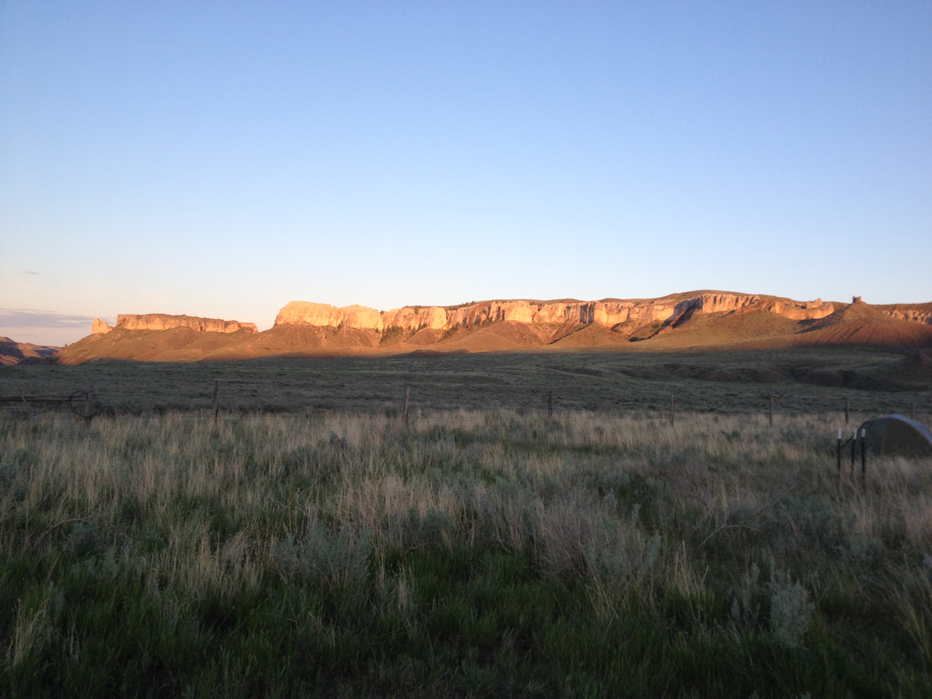
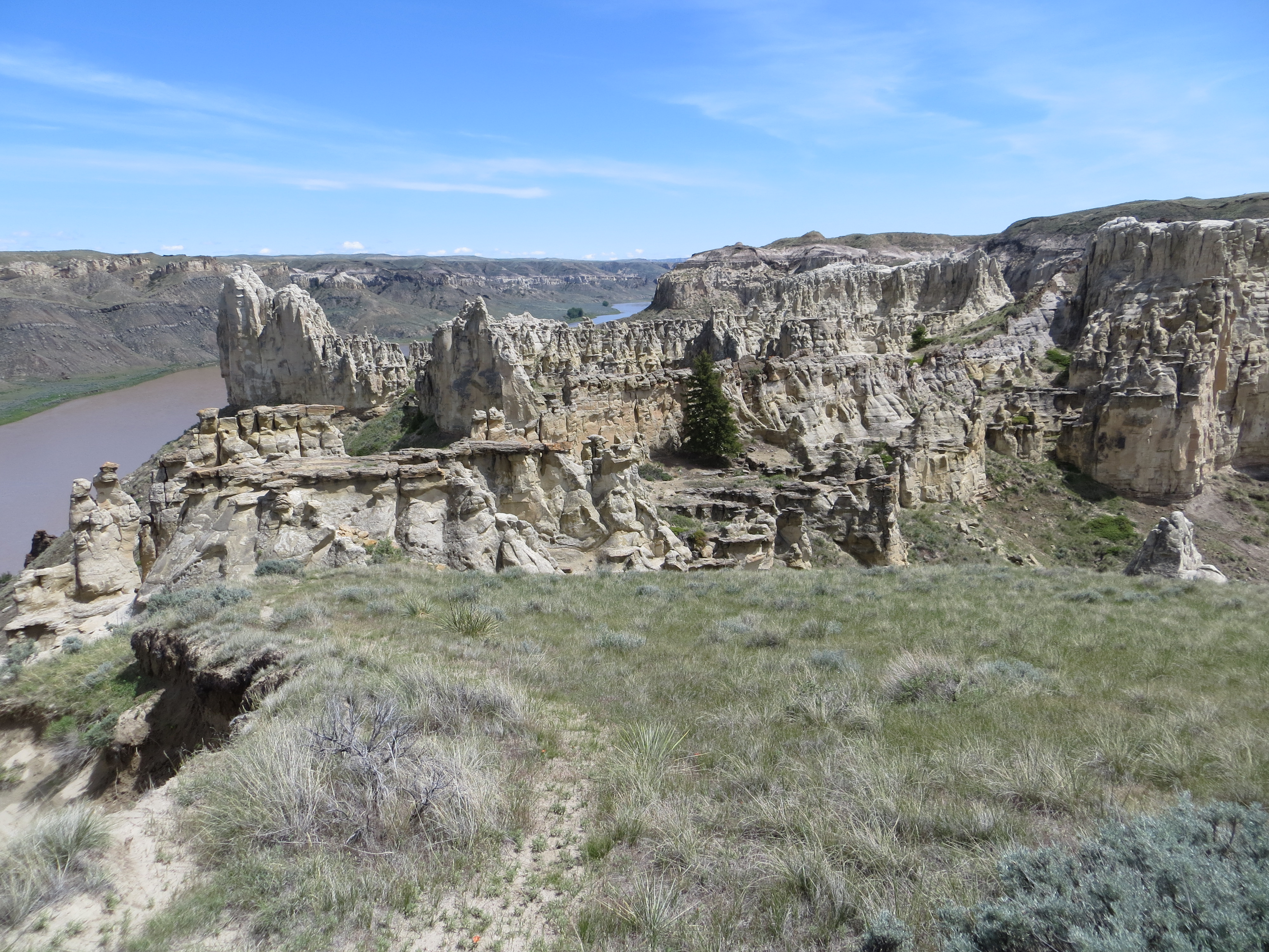
The White Cliffs section of the Upper Missouri River Breaks National Monument evolves as you paddle in to this stretch of river. The anticipation keeps you on the edge of your seat. Will there be cliffs around the next bend? They show themselves gradually. And, before you know it, you are immersed in this fabulous wonderland of rock castles, spires, hoodoos, magnificent walls and lone sentinals.
Leaving Coal Banks I could sense that something incredible, geologically, was going to unfold.I barely got my camera out in time to snap this photo. This looks like an old homestead cabin. My imagination soars when I see structures like this. What must it have been like over a century ago settling in the wild west?The cliffs gradually appeared in the riverside environment. It was somewhat like a geologic transformation.Some of the first signs of white cliffsWhite Cliffs emergingThe Boy Scouts made camp early in a beautiful area that was wide open with smaller cliffs surrounding the area.The surrounding area around the Boy Scouts first camp, just upriver from Eagle Creek camp. It was beginning to get interesting!
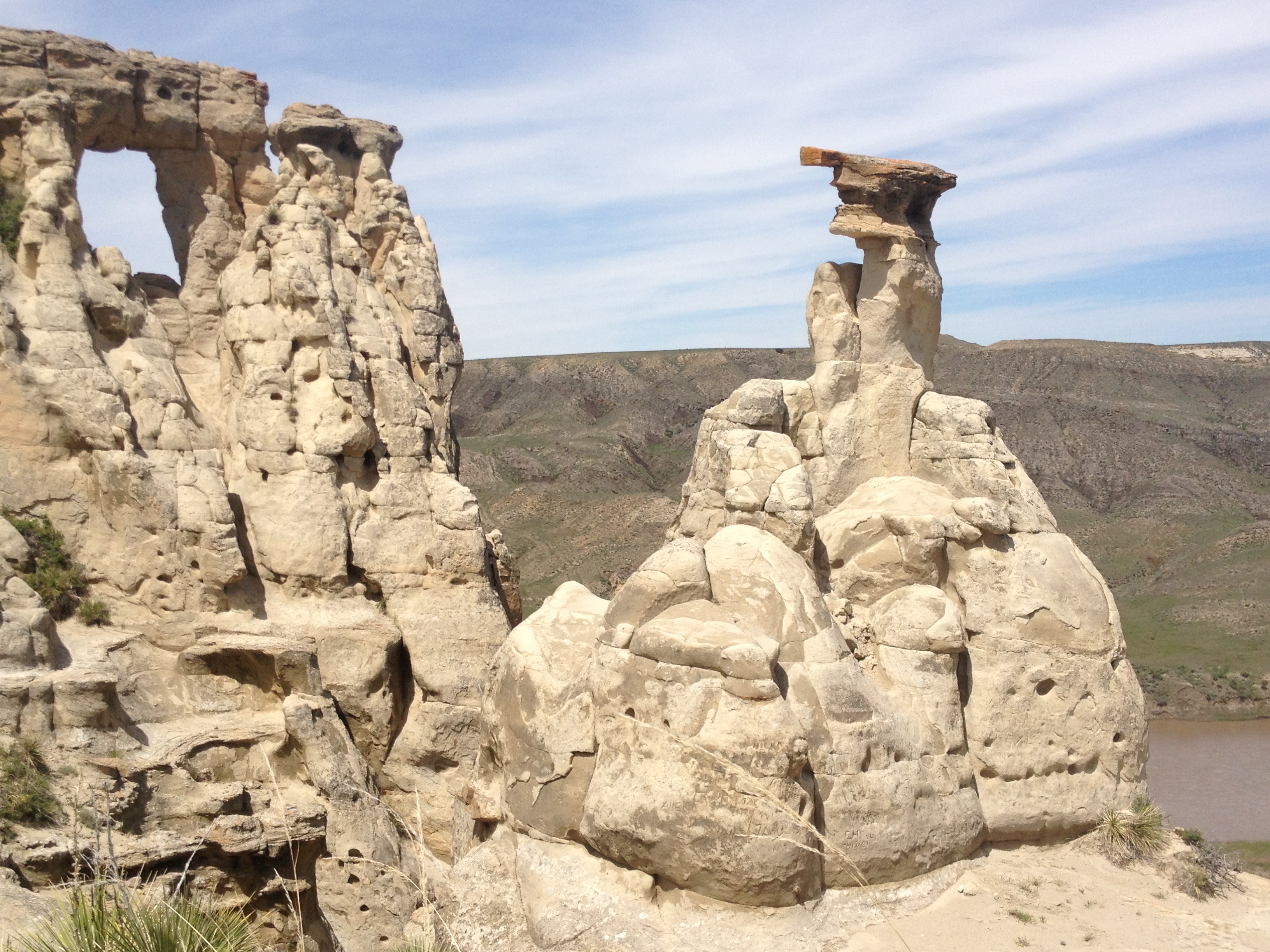
Labarge Rock is the dark rock outcropping in the distance. The rock was named after Captain Joseph LaBarge, one of the most famous of steamship captains. He never had an accident in his career commanding ships up to Fort Benton. This is remarkable after seeing a million snags downriver waiting to take the ships down at any given minute.Classic white cliffs with LaBarge Rock in the distance.Beautiful white cliffs, like a fortress or castleLaBarge Rock is an instrusion of dark igneous shonkinite. That’s about all I can tell you without getting technical and boring to the non-geologist.The Grand Natural Wall. This is an incredible sight to behold.Grand Natural WallCool looking, I think. Now that’s a grand white cliff!Eagle RockEagles at Eagle Rock?And, my best friends, the pelicans.
I arrived at Hole in the Wall thinking that everyone else would stay back at Eagle Creek, which is a popular camping area with great hiking and historical significance. The environment around Hole in the Wall is grandiose and quite spectacular. I was the only one there! I would have a wilderness experience in the midst of incredible beauty!! Well, not exactly. Withing an hour two paddlers arrived. Then, a party of seven or eight men showed up. Oh well, I can share. I will just set my tent off to the side and have my own wilderness experience. I learned something this day. When you meet good-hearted people, nothing else is really more desirable. The benefits are great when you share a part of your lives together. The experience becomes unforgettable. This day I met Klaus and James. I am so happy that I did.
Klaus (L) and James
I loved meeting Klaus and James. Klaus came over and invited me to sit around the fire with them that night. They said it wouldn’t be a long fire because firewood was scarce. That sounded good to me. After a couple of hours we gathered for a fire. Klaus had cups and wine and we toasted to my expedition. Then we spent a couple hours just enjoying each others’ company and conversation. THAT beats a solitary wilderness experience, any day. I am thankful for the time we had together.
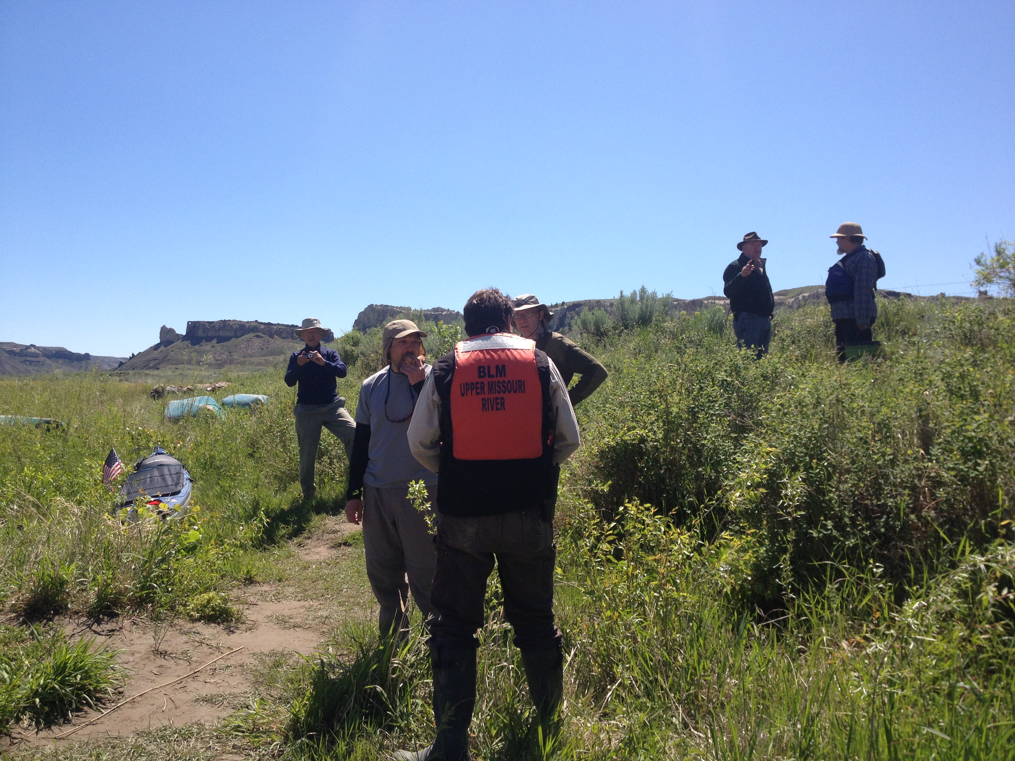
The next day I met some of the others who had camped in the area. They were all very interesting gentlemen. One was from Bozeman, another from the Seattle area, and one also from San Diego, among others. The Bureau of Land Management officers showed up. They told us stories and were helpful in showing us good camping areas down river. Apparently, James Kipp Recreation Area had opened back up, at least the roads leading into the area. Because of all the rain, though, we could expect a lot of mud downriver. Oh well.
I was excited to hike to the top of Hole in the Wall. I said good by to Klaus and James. They were going to camp at the Wall camping area. I did not know if I would stop there. We took pictures to make sure we didn’t miss out on that opportunity, and we exchanged addresses.
Klause James and myself. Hole in the Wall is in the background.
And, off I went to hike to the top of the Hole in the Wall. Wow, what a grand experience!! Unforgettable.
I thoroughly enjoy my hike up to the top of Hole in the Wall. While I was standing up there looking around, I thought, I think I am experiencing breath-taking beauty. I had to stop and calm down I was so excited.
I paddled on and came to Klaus and James’ camp. It was getting late and they invited me over. I was happy to stop there. The camp was one of the best and most peaceful I have experienced thus far. Not to mention my new friends. We had another tremendous night telling stories, jokes, and laughing freely. When it was time for them to shove off the next day, I was truly sad. I’ve got their number. Happy about that.
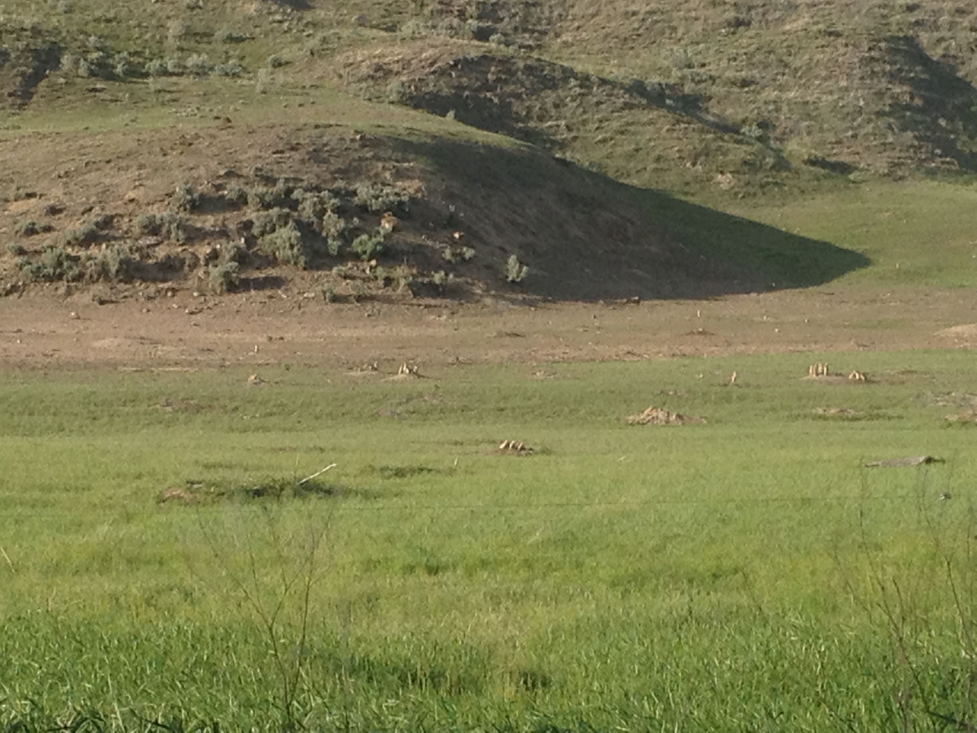
The Wall Camp, 7 miles before Judith LandingPrairie dog town in back of the camping area. How cool is that!?
See ya, James!See ya, Klaus!See ya, everyone! Fair sailing to all!
I left Lakeside on Hauser on Tuesday morning, May 21. I said good bye to Conrad and Cheryl Hale, and their restaurant and bar. What a wonderful layover. Turns out the night before Kelley’s video piece was aired on NBC’s Beartooth Affiliate in Helena. You can view the Weather Wise segment by clicking on the link below: http://www.beartoothnbc.com/weather/weather-wise/35309-weather-wise-paddling-the-missouri-river.html I had a lot of fun paddling down Hauser Lake because I had a tailwind for the first time and was able to break out my sail. Oh boy, was that fun! Right around here a man in a boat hollered out to me, “Hey!” I waved and said Hi. He asked, “Are you paddling to St. Louis?” I said, “Yes, how did you know?” He answered, “I think I just saw you on television last night.” Oh. My. Word. I couldn’t help but laugh. Kelley had interviewed me on her cell phone and, apparently, had written up a story that was aired on their Weather Wise segment of the news. Funny. Good job, Kelley. I made it to Hauser Dam in no time. Will Garvin was waiting for me there. He had told be that he would help me with my portage. Ron Lukenbill would be there as well, but could not make it until 2:30. I believe I pulled in at around 1:45. As it turned out, I saw a Pennsylvania Power and Light employee in a truck and thought, what the heck, I will ask him if he wouldn’t mind throwing my gear on the back of his truck and driving it down to the put in. He said, “Of course I will.” Then Dave drove up and they loaded my boat into his truck. Turns out the PPL offers portage service, you just have to call ahead if you need it. We had no idea!
Dave and Dan who work for Pennsylvania Power and Light helped with the portage.Dave (R) and Dan (L) of PPL. We had a great time talking to them. Dave’s uncle works at the next dam, Holter Dam, and he said he would call ahead and let them know I was coming. Awesome!Will was surprised at the assistance we received from PPL, and, well, Ron was surprised that the portage was complete by the time he showed up. All good!
I had a fun time floating on down with some current, but it was a only a short time before the river soon became Holter Lake. I was excited about proceeding on because the Gates of the Rocky Mountains was just ahead. Plus, seeing my pelicans made me feel at home and in good company.
My faithful companions the pelicans.Approaching the upriver entrance to the Gates of the Mountains.The Gates of the Mountains is a special place for me because of the Alpine environment. I am very much at home in this type of environment after living 11 years in the Sierra Nevada Mountains of California.
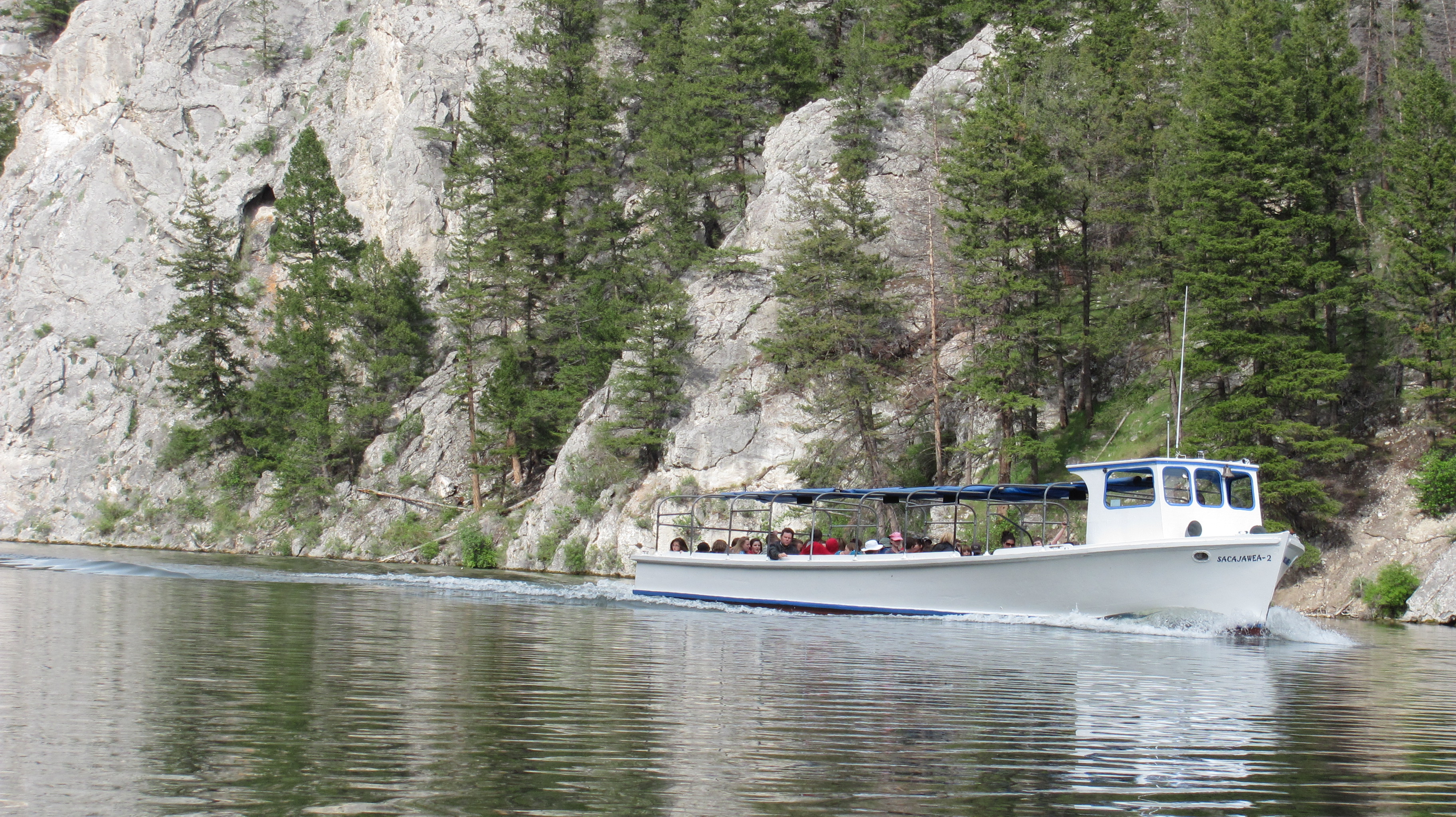
I paddled through the gate and immediately felt as though I was in an enchanted land. I knew where Lewis’ camp was so I paddled ahead to check it out. Perhaps, I would camp at the very same spot? I felt somewhat like a kid in a candy story. Until, of course, the tour boat passed by. Seemed rather odd in such a magical place, but tours have frequented this area for many years. I am happy that lots of people get to experience such a special place on the river.
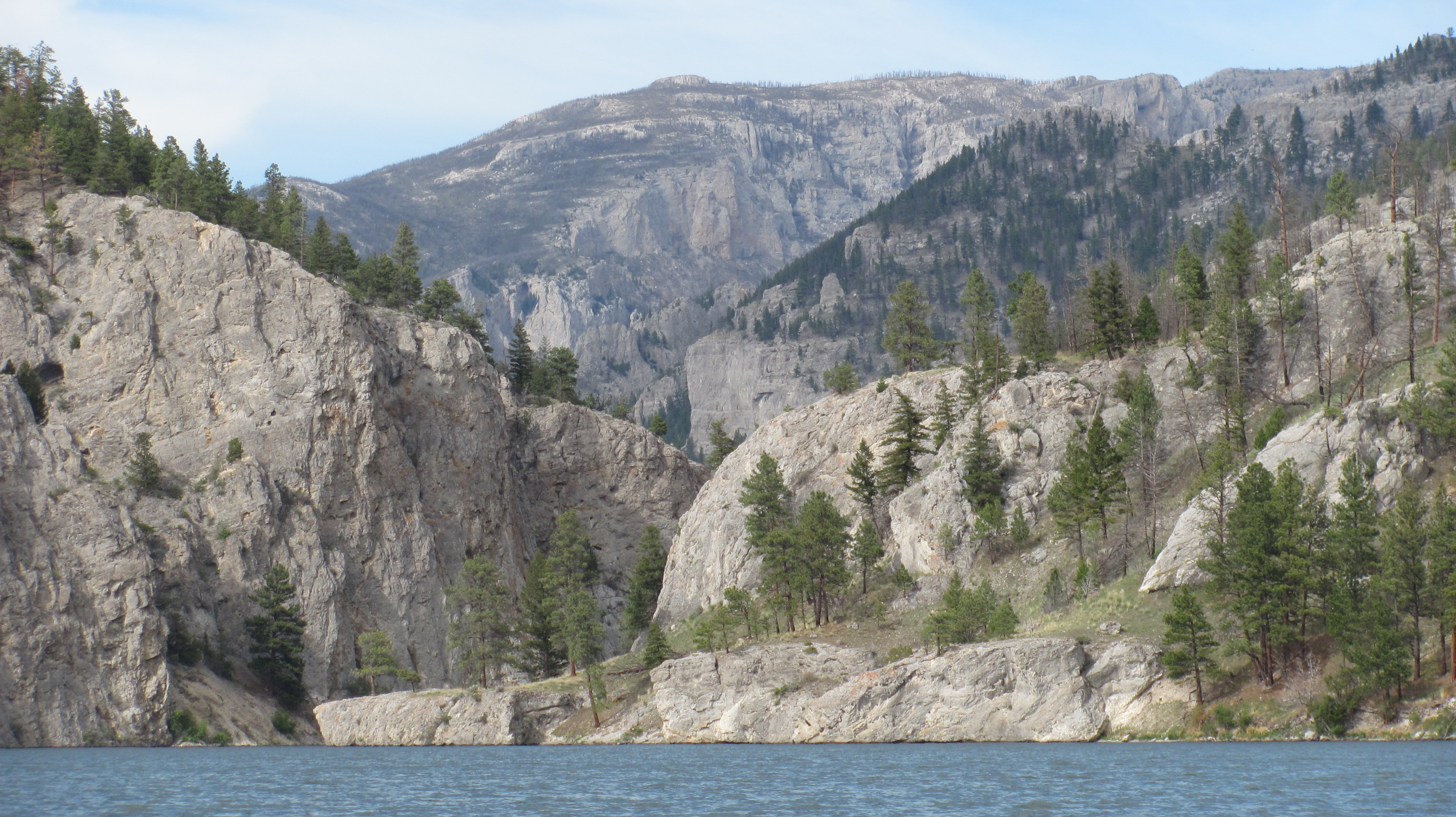
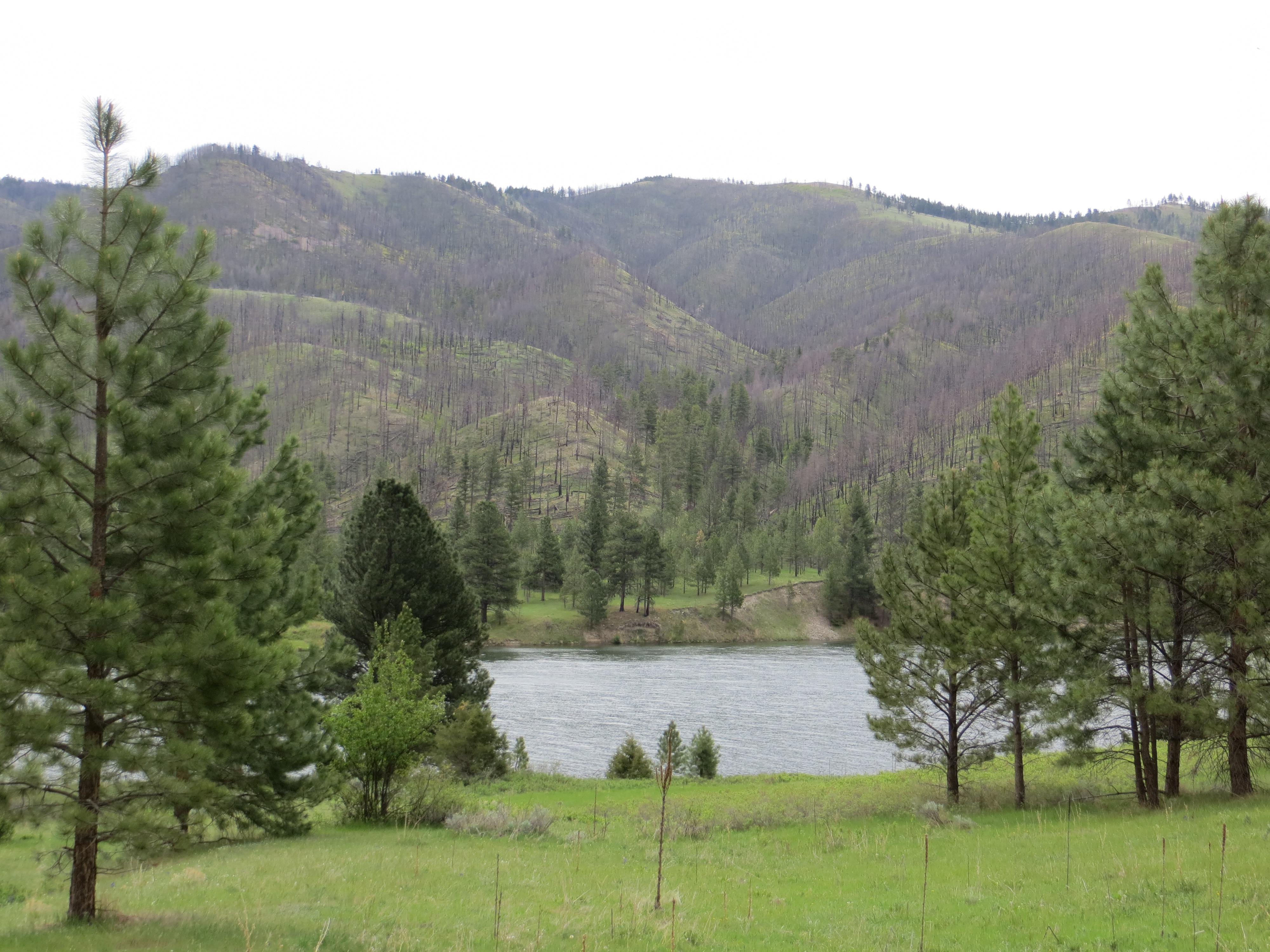
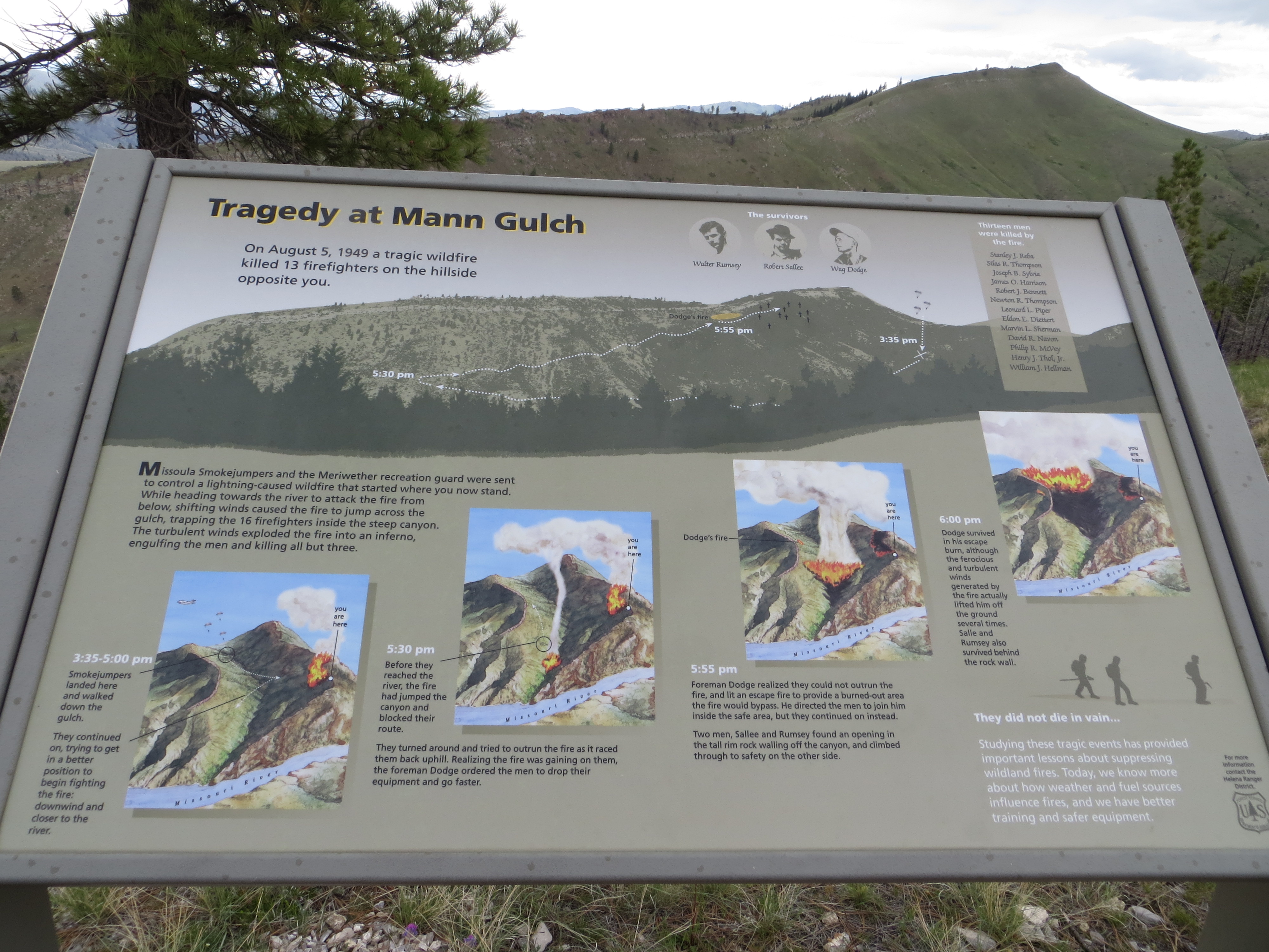
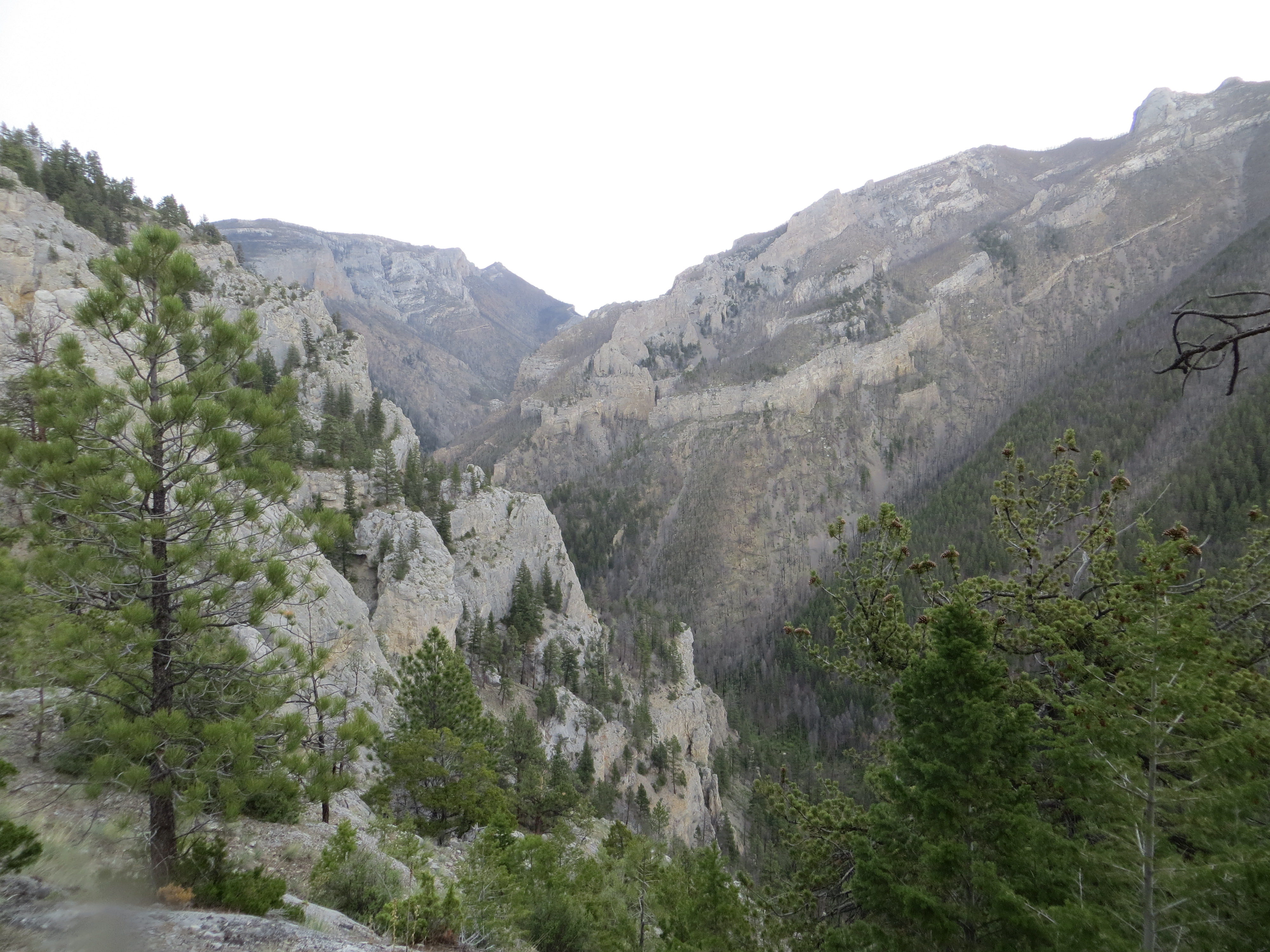
Not unusual in the Gates of the Mountains: the tour boat.I ended up finding a fantastic campsite in the trees on the left. Right across the river is Fields Gulch where Lewis and his party camped on July 19. 1805.This is the view looking out from my camp. Amazing!This is a photo I took the next morning with that early morning special light. It was magical in the canyon.During the afternoon, after the rain stopped, I paddled down to Meriwether Rec Area and hiked up the trail to the overlook. What a lovely way to spend the day, high up into the mountains.Looking down on the river where I began my hike.Near the topSome information at the overlook about the Mann Gulch Fire, in which 13 men lost their lives.Mann GulchIncredible vista where I stopped on the way down and took some photos. This is the reason the area is called Gates of the Mountains. These are some incredible mountains.After my hike up to the Mann Gulch lookout, I decided to have a fire. I had collected firewood earlier that morning. Meriwether Lewis, July 19, 1805 (he camped right across the river): “…this evening we entered much the most remarkable clifts that we have seen yet. These clifts rise from the waters edge on either side perpendicularly to the hight of 1200 feet. Every object here wears a dark and gloomy aspect. The towering and projecting rocks in many places seem ready to tumble on us. The river appears to have forced it’s way through the immense body of solid rock for the distance of 5 3/4 miles and where it makes it’s exit below has thrown on either side vast columns of rocks mountains high.”
I loved my stay here in the Gates of the Mountains.On the way out I turned around and took a picture of the Gates on the down river side. Here, the Gate looks open.But, just a little further down, the Gate looks closed. It is somewhat of an optical illusion, hiding the fact that the river flows right through the magnificent canyon ahead.
The fact that I was at the Gates of the Mountains only one week ago is hard to believe. I have traveled through Holter Reservoir and portaged around its dam. I then paddled down the river through what is referred to as Mid-Canyon. I have many photos of this stretch all the way to Great Falls. My next stop is Fort Benton today. I have a portage ride around the Great Falls dams today by John. You will get to meet some wonderful river friends that I have met in the last week. I hope to be able to put up another post before I leave Fort Benton. I want to stay there a couple of days and absorb some of its history, which is vast. I will leave you here with a sunset photo from Friday night, an extraordinary evening of paddling with lots of special light, and one of my favorite camp spots (there are a lot of them!)
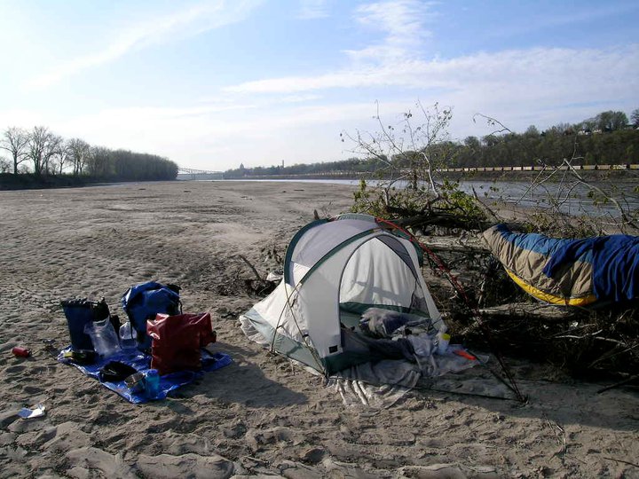
Friday (May 24) night’s camp between Cascade and Ulm, on the way to Great Falls. I was camped on a sandy beached island across from a large natural bird sanctuary (lots of tall trees).
See you again soon. Keeping the hollow side up. Do what you love, and love what you do! Live fast ~ Paddle slow Janet
On Wednesday, May 8, I left my very public, yet cozy, camp at Twin Bridges. It was a little strange camping right on the river in a town park, but the park was designed for bik deners, so worked well for this paddler, too. I took my time packing so I would be rested, and well prepared, for this stretch on the Jefferson River. I grabbed a tomato, apple and three avocados, along with some cinnamon raisin English muffins, before I left. I also charged all of my electronic devices.
Leaving Twin Bridges after a pleasant two-day layover.Couple of local Twin Bridges fisher guys. They said fishing is just an excuse to get out on the river. I could totally relate. Really nice guys, kindred river spirits.
Danger of further harm to Blue Moon has diminished because of the much higher volume of water. The Ruby River empties in just upriver from Twin Bridges, and the Big Hole River just downstream. Now we are talking gorgeous and pleasurable paddling from here to Three Forks, which is where I anticipate arriving on Saturday. I have been looking forward to this stretch of river since I first decided to do a source start. I did not want to miss out on paddling the Jefferson River. I think you will see why:
Really fun river to paddle, the Jefferson.Thunderstorm brewingMontana mountainsTeepee on the Jefferson RiverTook this after applying suntan lotion to my face. As you can see, without a mirror I am kind of a mess.Eagle’s NestA beaver has just about nailed this tree.A beaver denA beaverI saw a lot of deer, but was never able to get my camera out in time. This one sure is pretty.Gorgeous scenery abounds!I thought these birds were snow geese, but it turns out (after we researched a little) they are Trumpeter Swans. Fantastic!A Great Blue Heron sitting in its nest high above in the trees.Nice man on the Jefferson, Jim Hicks, invited me up to his custom cabin once he found out I was headed for St. Louis. That about floored him.Jim Hicks’ custom cabin on the Jefferson River.Jim Hicks’ rescue dogs. Jim has 800 yards of Jefferson River frontage, three cabins, some horses, and is ex-military and currently employed as Ted Turner’s horticulturalist. Cool guy.Camped on a huge rock bar, I decided to take a walk before heading out for the day.Flock of pelicans sitting in the water.I love this bald eagle photo. He is looking right into your eyes, it seems!This is where I camped Friday night, at the diversion dam. Camping here made the portage around the rocks much easier. Plus, it was spectacularly gorgeous.This beaver came to greet me as I pulled into my diversion dam camp Friday night.Sun peaking out from behind the rock at my diversion dam camp. Everything is always better with a little sunshine.
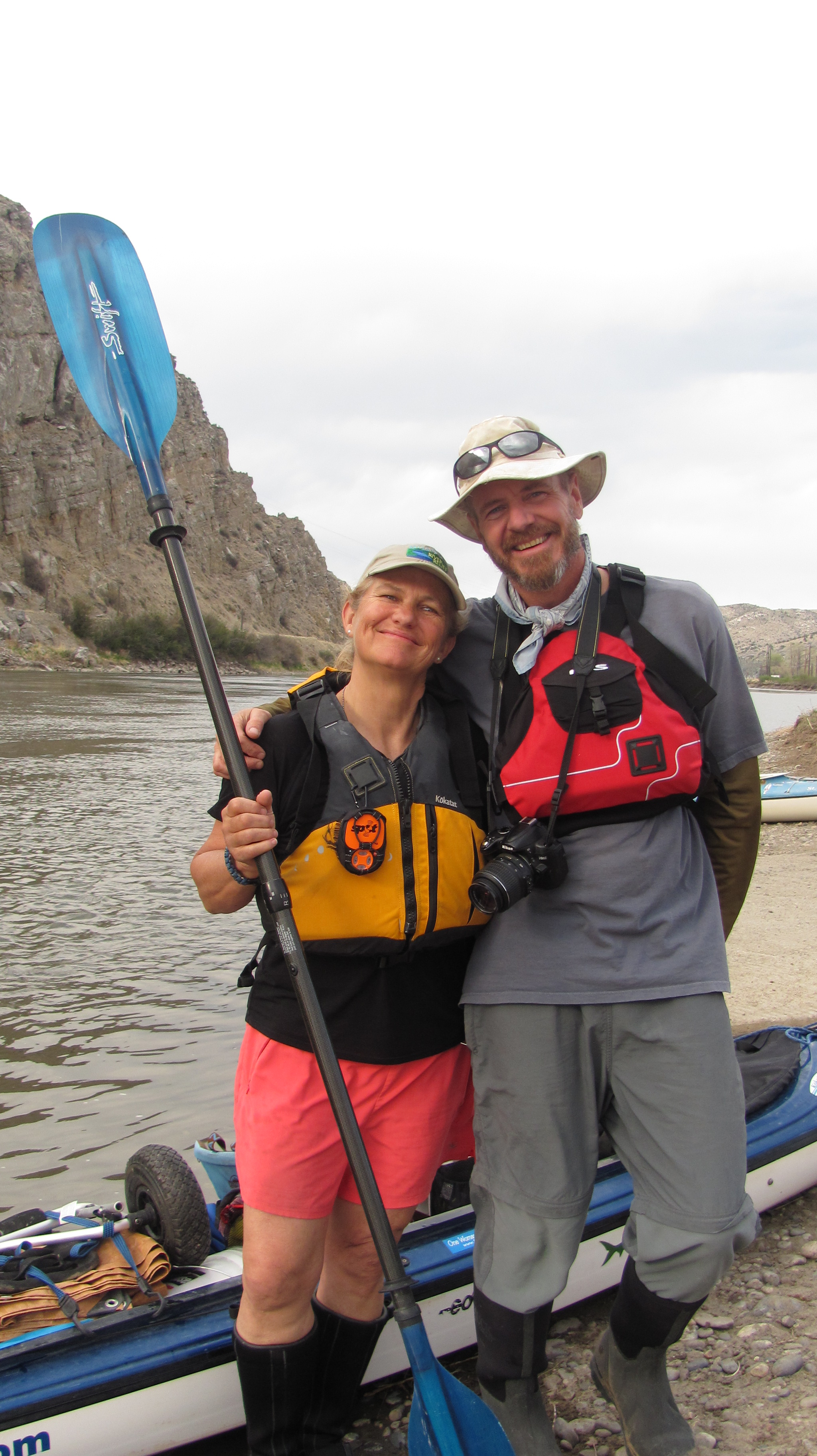
At 2:00 Norm and I met, miraculously within 4 minutes of each other, at Drouillard Bridge. Drouillard was a civil interpreter for Lewis and Clark. He was also half French and half Shawneed Indian from his mother’s side. There is a lot of history surrounding him in this area. Norm and I had about a 2 1/2 hour paddle together before we met Kristin at Three Forks, the headwaters of the Missouri River where the Jefferson, Madison, and Gallatin Rivers converge.
My pelicans even took to Norm and did not mind his photographing them.As a result, Norm got this beautiful photo of a pelican lifting off.
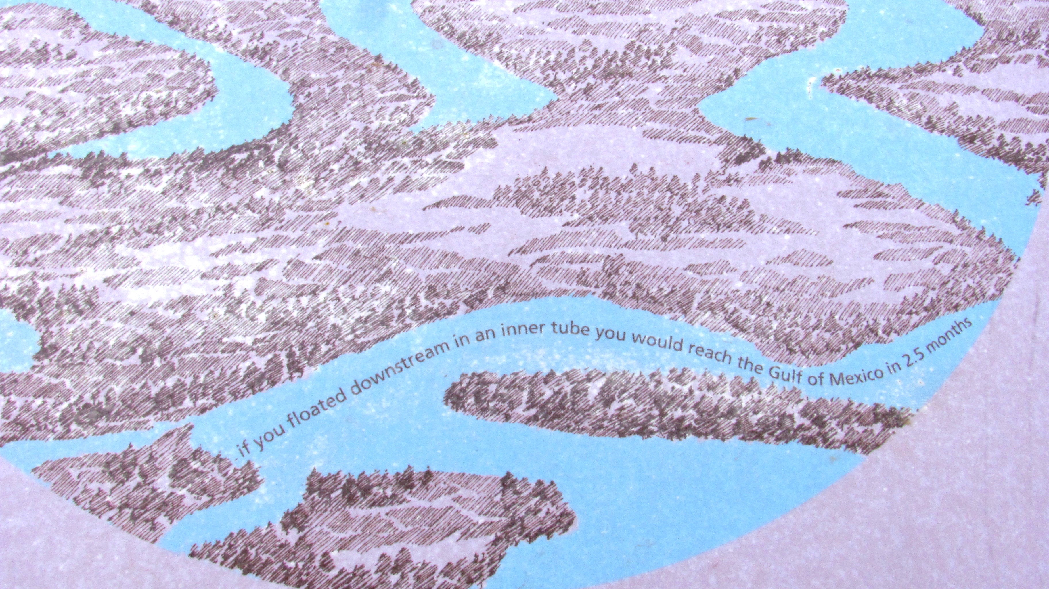
Norm and I at Three Forks, the headwaters of the Missouri River, after paddling together for about three hours.The lovely Kristin Walker, Norm’s girlfriend.Norm and girlfriend Kristin. I LOVE these guys!! Founders of the wonderful Base Camp International in Livingston, MT.Me and Norm. This moment we have been envisioning since last July.This sign at Three Forks claims you can reach the Mississippi in 2.5 months by inner tube. Umm, really?A glance at the first part of my paddle tomorrow, Wednesday, May 15.
I’ll be leaving tomorrow from Three Forks to head down the Big Muddy! I am not sure when I will be able to update with photos again. Please visit my Facebook Page, LoveYourBigMuddy Expedition, to stay tuned in.
The base of Hell Roaring Canyon, and on down the creek of the same name.
I am sitting in the Shack in Twin Bridges on Tuesday, May 7, a layover day for me after 6 days on the Beaverhead River. I really want to post some photos for my blog followers before I head down the Jefferson River tomorrow. I am running short on time so I will do the best I can here. Of course, my Facebook page contains much more frequent updates. Please like the page if you can. Thanks, all! I appreciate your interest in my adventure!
Long stretches of exquisite beauty. And, a little bit of push, as in stamina.Starting at the base of Hell Roaring Canyon, and on down Hell Roaring Creek.Beautiful vistasWhat an incredible bike ride! Just breathtaking!Long gorgeous and gradual downhills.Our stop at the end of the first day. Red Rock Creek below the Red Rock Lakes National Wildlife Refuge.
The start of the second day began with a, yes, flat tire out in the middle of NOwhere! We got ‘er done, though. Survival of the fittest.
Long stretches of exquisite beauty. And, a little bit of push, as in stamina.Finally made it to Lima Dam. Still, onward to the town of Lima.Lima DamThe windy, as in lots of turns, Red Rock River.From the town of Lima I followed the old Highway 191 all but seven miles of the 31 mile stretch to Clark Canyon Dam. Very peaceful. My support crew followed me closely.Two bison mommas and their babies. They had their eye on my from afar.Finally, after 90-somethin’ miles, we made it to Clark Canyon Reservoir and Dam in 3 days.Clark Canyon Reservoir
Finally, on Wednesday, May 1st, I started paddling. The Beaverhead River was quite a challenge. It is shallow with tight turns and lots of brush producing strainers in which to get entangled if not careful. I came close to dumping my first day, but was saved by the wheel of my wheeleez, my portaging device. I may have sprained my hand in the entanglement, but still paddling. I was worn out for the first three days trying to save Blue Moon from sheer destruction. I have two holes from the second day just above waterline. Duct tape is the miracle cure!
After 3 days of hard paddling, on Saturday I had 25 mph headwinds challenging me. I stayed strong and true to course, though, and after a 9 and a half hour paddle, and close to Beaverhead Rock, I finally found an island to camp on. Turns out that Robert and Donna were out cruizing around on Robert’s property and they ended up inviting me up for cocktails and chicken dinner. And, a shower, laundry, and place to sleep on their couch! What a wonderful miracle! Strangers are TRULY an opportunity to make friends. What a great visit we had, which included Paul, too. The three of them are long-time friends from Helena.
My first night out. Cozy camp!My first rapids. I skipped the upper and paddled through the lower parts of this.Strainers, Grrrr! They can flip you over, swamp your boat, punch holes in your ship, and twist your hands and arms. I am happy to be through this challenging part of the Beaverhead River.My pelican friends followed me all day Saturday, and after many bends, they finally decided I was okay. They stayed put until I got this photo. Then, they split for the day. Good companions they were.Good bye, my friends.Diversion dams force me to unload, carry stuff to the other side, place my boat on my wheeleez, pull it over, reload stuff, and take off again. This particular easy portage took me an hour and a half.AFter a long day of paddling on Saturday against 25 mph winds, Robert and Donna happen to be cruizing Robert’s property adjacent to Beaverhead Rock when I found an island to camp on. After seeing their Private Property signs, with notice that the property was patrolled, I was concerned and so immediately set off to do some peace talking. Turned out they invited me up for cocktails, dinner, laundry, shower, couch, and steak and eggs for breakfast. What a wonderful find these folks were, however it happened. L-R, Robert, Donna, and Paul.
View of Beaverhead Rock from Robert’s “cabin”And, another view from the cabin.Not sure what’s up with this rancher. Makin’ life difficult.Besides the pelicans, the muskrats, and sometimes beavers, are my favorite companions. The muskrats are the dolphins of the river. They lead you around the bends. I adore them!Onward towards Twin Bridges. Tomorrow, Wednesday, May 8, I head out on the Jefferson River, my long awaited premium stretch of river.
Finally, I have successfully updated this blog. You are a concern of mine, and I want to keep you posted. It is getting dark now. I have finished most of my pizza, a couple of glasses of wine, had a shower earlier today, and have a nice cozy tent to sleep in tonight. I look forward to resuming paddling on the Jefferson River tomorrow. Twin Bridges is an awesome small town of 400. Come and stay if you ever have the chance. I understand the fishing cannot be beat!
My camp at this very cool Bike Park on the waterfront in Twin Bridges, MT. Loved my stay here. Hope to come back. Plus, Mayor Tom is totally laid back, hence the mellow river community of 400 people. Love it!
I hope you are enjoying my adventure. I am comforted knowing you are following me and interested in my journey. It has truly turned out to be an epic adventure, and it has only just begun.
Live fast ~ Paddle slow. Be safe and cherish the moment!
By Norm Miller, in his own words….continued from Part I
I recently followed a group of young guys paddling down the Mississippi. I don’t think they made it a week before the whole adventure fell apart. I’m not sure why as I don’t know the whole story, but I got the sense that there were many factors from personality conflicts, mental battles of the mind, and lack of “outdoor” experience. For the most part we have lost touch of our hunter gatherer traits. We in today’s society look at modern adventure as a novelty. When in fact just a 150-years ago it was a common thing. We hunted, worked the land, lived a more nomadic lifestyle, our entire day was survival or just getting by. The pioneers on the wagon trains, the early explorers and missionaries, etc., everything they did in the course of their day was what many now think of as hardship. We spend so little time now in the outdoors. If it rains or snows we seek the comforts of our houses never really experiencing nature and missing out on a lot of great things.
Red Rock Lakes National Wildlife Refuge (photo by James N. Perdue)
PLANNING:
The internet has changed everything! There is so much information out now that it shortens the planning by weeks and months. When I began my planning for my 2004-Lewis & Clark redux the internet was fairly new. I spent about 5 -years planning. Now with the help of paddling website, Facebook (“Missouri River Paddlers” site), books and the speed of finding information one can get all they need quickly.
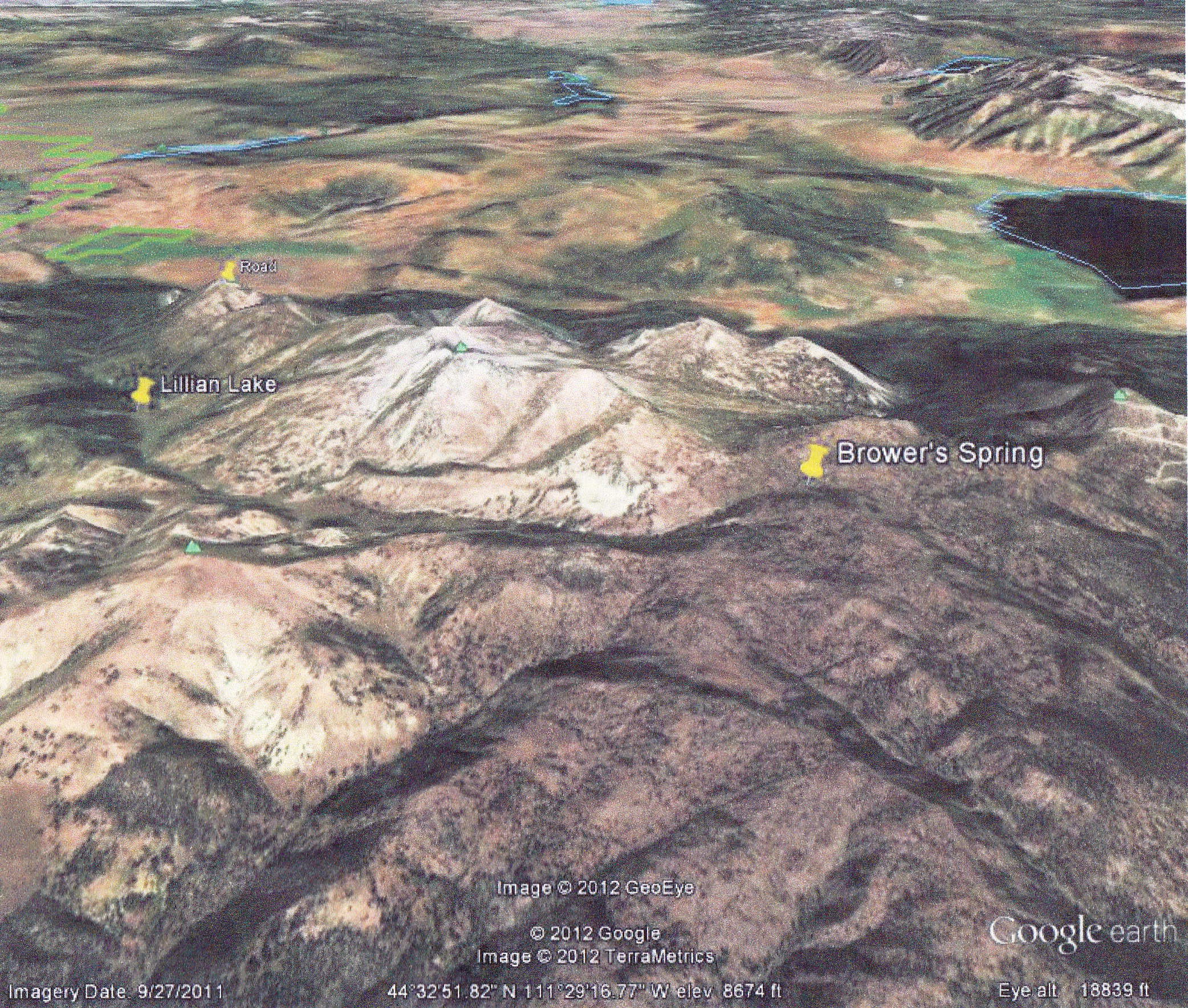
Google Earth 3-D map of Brower’s Spring area. (photo by Janet)
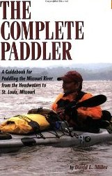
For starters buy David Millers book; The Complete Paddler!!! It is the bible for Mo River paddlers….more information than you can absorb! The book is broken down into 3-parts: The upper, middle and lower river sections, which are basically three different trips in many ways. The book contains a wealth of logistical information including valuable phone numbers, re-supply points, drinking water locations, map info etc., etc. However last year the river experienced a huge flood which destroyed many locations that are mentioned in the book. So this Mo Paddlers FB page probably helps “update” some of that information, with recent paddlers in 2012 blogging about these changes, such as Bob Bellingham and Dom Liboiron, to name two.
Buying maps/charts should be one of the main priorities however in hind site I would feel confident paddling the entire route without a map or at least a Rand McNally road atlas would work. I know paddlers who only used such maps and they were fine. In 2004 I may have went overboard with maps. I used the Corp nautical charts for the lower river….they are awesome and show all 5000+ wing dikes and every mile in DETAIL…which is helpful when paddling upstream, but not as critical when paddling downstream.
Rand McNally Map of Upper Missouri River
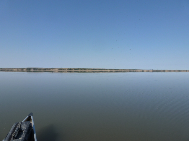
Going upstream I had to stay very close to shore….so this is where the real hazards are located. So knowing all these wing dikes helped me. The Corp maps of the big lakes are good too. Those lakes are huge!!! You can get lost. Some of the bays open up to a 30-mile wide expanse of water and on a flat horizon it is almost impossible to tell where the hell you are at.
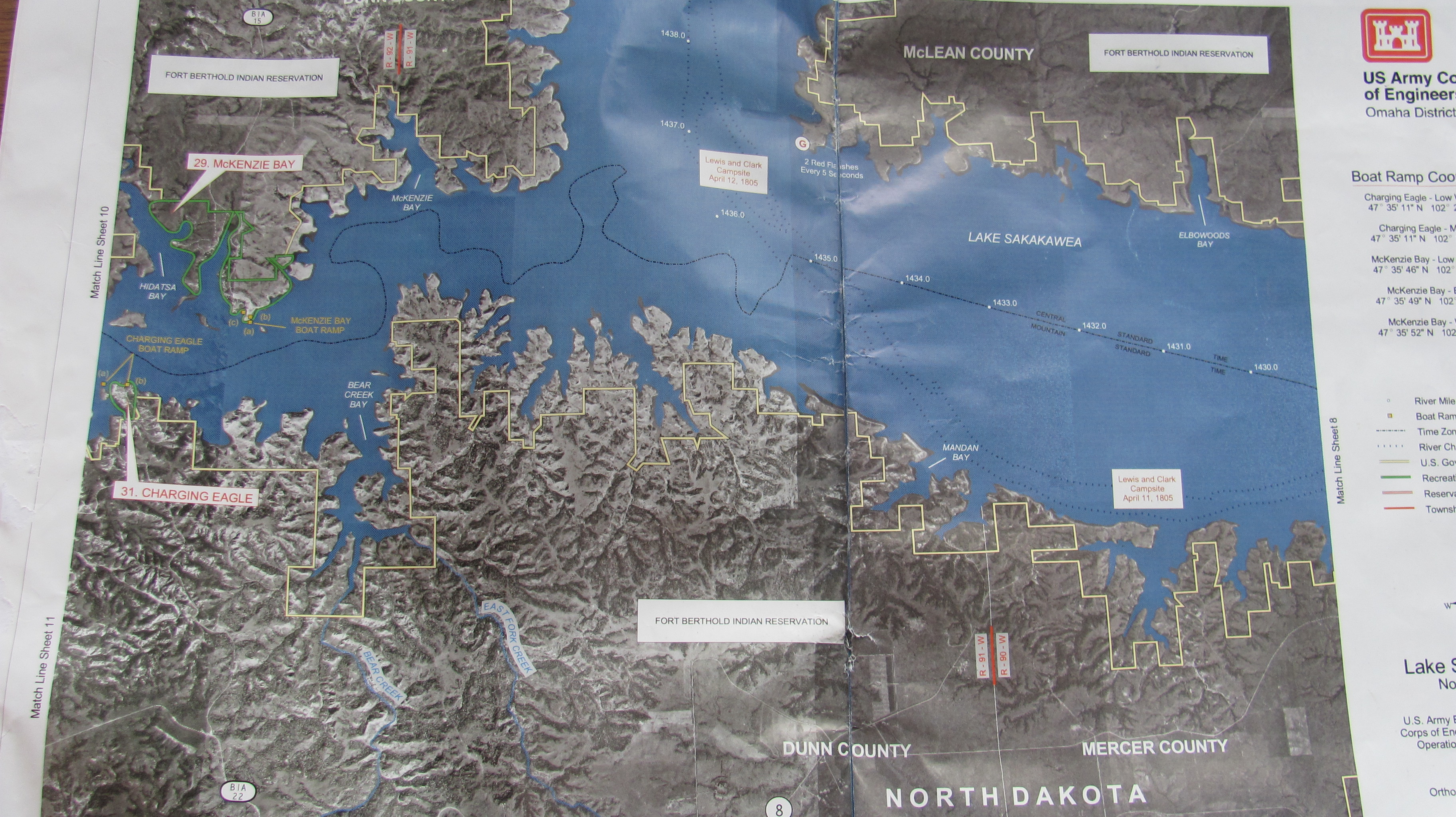
Army Corps of Engineers Map – Lake Sakakawea, North Dakota
The Montana section is great…I made copies off of a map program. There are many bends and fast currents in Montana. The maps helped me find camping areas AWAY from people and or private property. I always preferred to stealth camp! During my 200-day trip I camped downtown in St. Charles, Washington, Kansas City, Ft. Yates and nobody knew I was ever there!!! The art of stealth camping is an art form for sure. After 12-17 hours of paddling I was not in the mood to be social most of the time. So being away from people allowed me to do what I needed to do and get the proper rest.
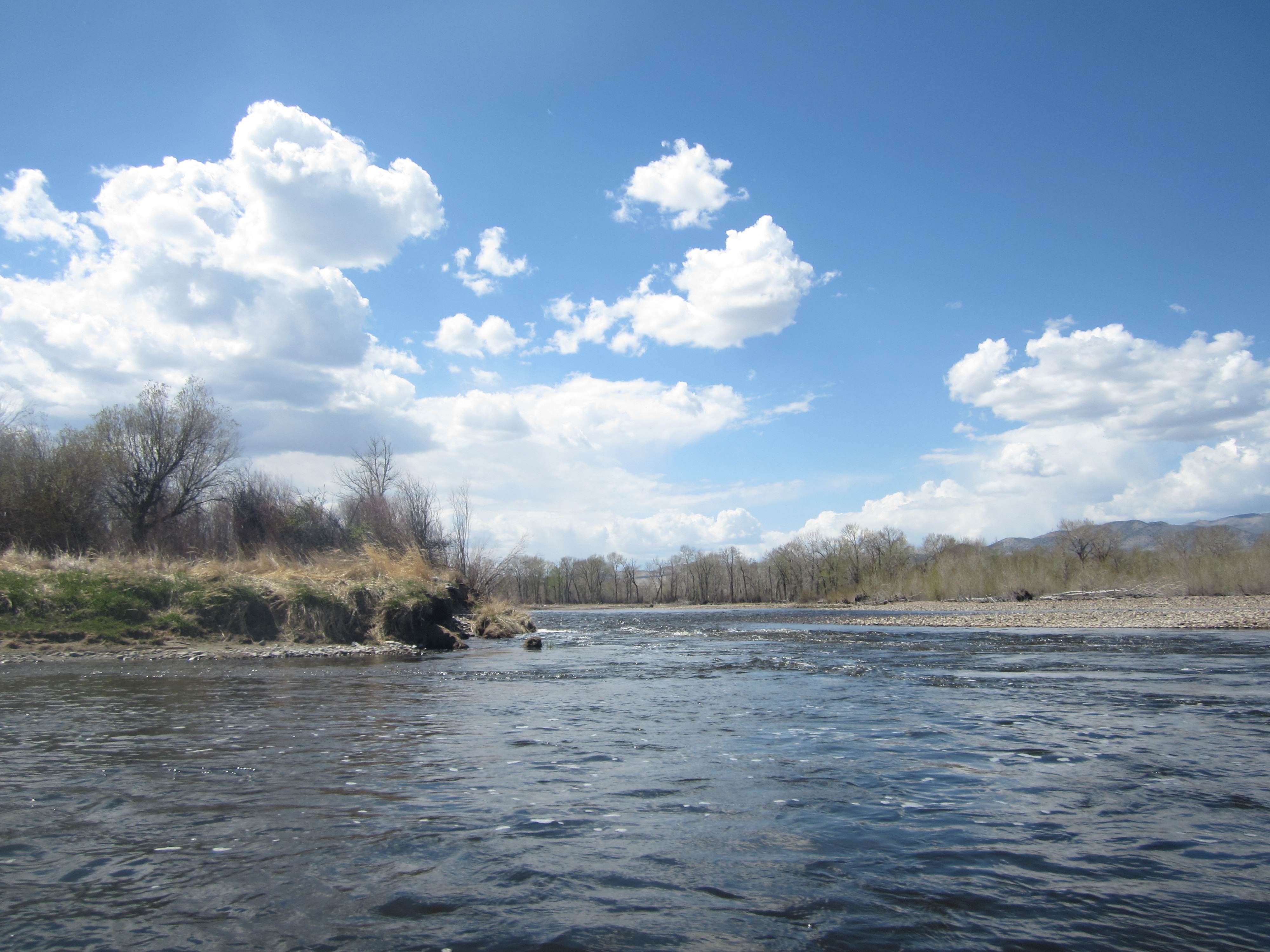
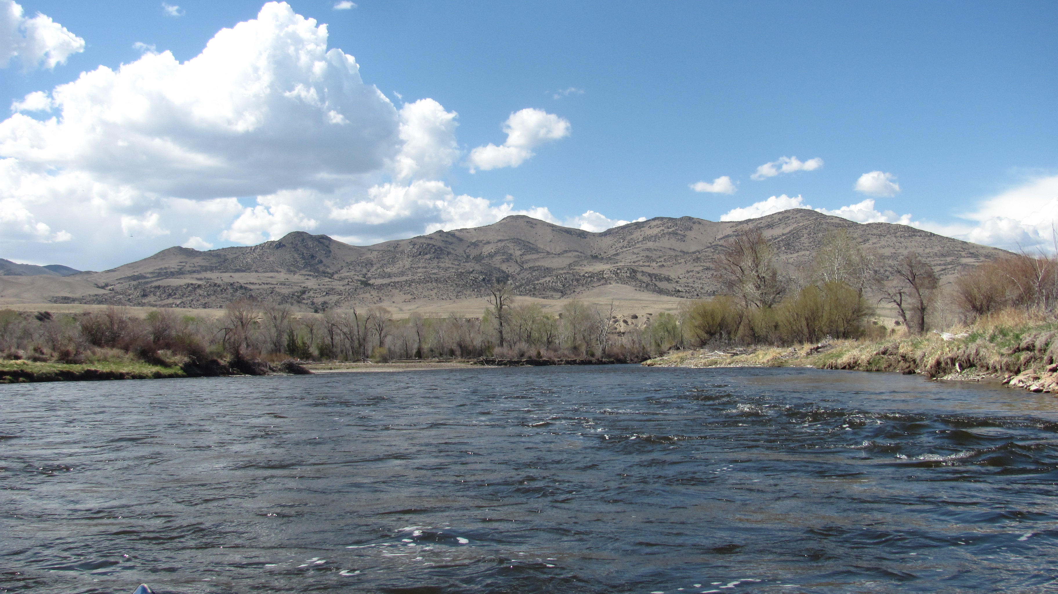
As far as travel speed goes…that depends on the weather and how much you want to paddle. It’s not a race, but some paddlers prefer long long hours and to cover many miles…which is my style. Others are so slow, I have to wonder if walking would not be faster. It’s all a personal issue. However ON AVERAGE…from Three Fork to St. Louis, those that have paddled down the last 8 years have done it in about 90-120 days! That’s a good average. I had a friend in 1981 go from Three Forks to St. Louis in about 30- days!!!! The state of Montana is a huge state with some big bodies of water…in particular Ft. Peck Res. I would allow about a month to get through Montana. The slower you go the better. Why? Montana is beautiful with so many interesting places to check out….why rush? We have the only mountains you will encounter! Montana is very scenic, lots of wildlife, historic unchanged river sections, interesting towns such as Ft. Benton too.
The Dakota’s can be a mental test. You have Lake Sakakawea and Oahe and, boy let me tell you, they can drain you mentally. Expect WIND and …more WIND….then a couple minutes of calm and then more WIND! It also blows in all directions…not just from west to east. The winds can change direction every hour. What I noticed in 2004 was the wind would really start to kick up about 8 am….die down a bit between 11 am and 2pm, then pick up hard from 2pm until the sun set. Once the sun set it is rather calm until morning…sometimes it is like glass on the water. A good time to make up lost miles is paddle in the dark under a full moon when the water is placid. During the day time hours you just have to keep moving whenever there is a break. Sometimes you may have to sit on shore 1/2 hour, 4-hours or all day….just be ready when it abates to jump in your boat and start paddling. I was wind bound 4-days on Oahe without moving an inch. The winds were 40-60 mph and the seas well over 10 feet high.
Lake Sakakawea video by Dom Liboiron
Lake Oahe (Photo by Dom Liboiron)
During those wind bound moments I usually read a book, slept, ate, fixed or cleaned gear or hiked around. Sometimes I would walk the shore for an hour or so to see what I could find. Near Ft. Yates I found a human skull in the sand. It was most likely that of a Native American from centuries ago, which was a cool find.
The Lower River from Yankton to St. Louis is fast moving if you are going downstream. One can paddle 40-80 miles a day through there depending on your energy level and river flows. Watch out for the barges, especially from behind…they can sneak up when the winds blowing and you will never hear them. It’s good to tuck behind a wing dike and let them pass before proceeding on.
FOOD AND WATER:
Don’t expect to filter water!!!! For one thing, there is so much agricultural runoff that you won’t want to drink it for fear for getting sick. Pesticides, herbicides, fertilizers, and toxic pollutants are dumped or flushed into the river daily….my words of wisdom are…..DONT BOTHER. Why do a trip of a lifetime and get sick the first week? Every town, house, marina, store and campground has drinking water. (David Millers book mentions about every possible place to get drinking water.) It’s not a remote trip like it was for Lewis and Clark.
You will encounter plenty of places to obtain water. I carried 4 one-gallon jugs which I filled every couple of days….or whenever I saw a pump I would top them off. I filled water in bars, people’s houses and even the government office buildings attached to the State Capitol of Missouri. One thing to consider is early season such as March-May most campgrounds DO NOT HAVE their pumps working yet so you will have to rely on towns and houses to fill up.
In 2004- I did food drops at post offices. I researched which Post Offices were close to the water and had a box of food mailed there…General Delivery to me. I spent the previous winter dehydrating food and preparing meals so I did not have to always buy from stores. This saved me a lot of money! One thing to consider with the post office drop is the hours of operation for each office. You will have to plan on picking your box up when they are open and make sure you consider that they are closed on weekends and holidays. I ran into this issue in Yankton where my package did not arrive when I got there on Friday…I had to wait until Monday before it opened up.
Here is one of Norm Miller’s re-supply packs from his trip UP the Missouri River.
Many people purchase food along the way. There are plenty of places to do so. However the variety may not be what you want or need. I tell everyone they should carry about 2-weeks at a time. ESPECIALLY the section when leaving Ft. Benton….there is a big gap of NO stores until you get to Wolf Point or Culbertson Mt. The town of Ft. Peck is LIMITED….basically a party store is all you have. That’s fine for some, not for me.
You will also have plenty of opportunities to get food at restaurants or from generous river angles. Just read Bob Bellingham’s blog and you will see that he ate well and drank plenty all from the great people he met along the way. I too had people buy me dinner or make me breakfast along the way.
CANOE OR KAYAK?
I’m not going to get too involved with this topic, but I will mention a few things.
The route has been done in aluminum Grumman Canoes, Home made dug out canoes, high tech kevlar canoes and kayak and everything in between… even a 1000 mile section on SUP boards.
I highly recommend something comfortable!! After all why be miserable sitting from 10-17 hour a day in for two months in something you are not comfortable in? I used a Sea Wind decked canoe built by canoe legend Verlen Kruger who holds many world records in distance paddling including the longest paddle trip ever by anyone…a 2 1/2 year 28,000 miles trip through N. America.
Norm’s Kruger canoe
His boats, in my opinion, are the best solo expedition canoes on the market, as mentioned above…these boats hold THE records of distance travelling. They are strong, comfortable to sit in and hold a lot of gear without having to cram gear into small hatches like you would have in a sea kayak. I am never cramped in my boat. I oft times sat in it for 17-hours without ever get out. I never need to get out and stretch like I have to in a sea kayak. I’m biased on my choice but just make sure you know your boat. COMFORT should be maybe your #1 feature. If you have questions about boats…send me a message and I will go into more detail.
Bob Bellingham in his Shasta, which is now my Shasta, and my ride down the river.
GEAR:
Have a good tent. It will most likely not be any good when you finish. I recommend a NEW one when you start…..not one that you have had for the last 5 years. Think about this, if you are out 90-days…that is like 45 weekends of camping….or nearly 4 summers of camping– ever weekend!!! I went through 2 tents….both were NO good when finished. One was destroyed by a tornado in the Dakotas…my second one…just plain wore out!!!
One TIP with any tent is also a large plastic tarp. I used the tarp almost everyday. I would put the tarp overtop my entire tent many times during a hard rain….to not only keep leaking water out but it kept me entire tent dry, so I never had to pack it away wet. This is very important because if you pack it away wet each day, it never dries out and begins to mold and decay!! A tarp will cover everything you have from getting wet….so always a dry packed boat every day!!
Norm’s tent
GOOD rain gear is important and I now even bring an umbrella!!! They make great sails and you don’t have to get out of the boat to put rain gear on for a 10-minute rainstorm. Just pull out the umbrella….pop it open, stay dry and put away after the many short rain storms. They make great shade too when in the Dakotas if you happen to be sitting around waiting out the wind….just sit under and enjoy the shade. Believe me there are no trees to block the 100-degree heat in the Dakotas.
Bob Bellingham demonstrating his sail when taking a break at Cooper’s Landing. The sail is now mine.Dom Liboiron using his sail.
One of the best things I brought was a pair of knee-high boots!!! Waterproof is a must. You will encounter a LOT of mud on the lower Mo and I hate wet feet!!! These boots kept me dry and from getting trench foot which can be common if your feet never dry out.
Clothing:
I personally hate to get sunburned. In fact I’ve been burned too many times and go to a dermatologist every 6-months to get pre cancer spots removed. Sun is very damaging, just look at what it does to your tent after a short time….now imagine what it does to your skin. If you plan to paddle or be out in the sun for 3-months then cover up!!! You will get plenty of sun even if you cover up. I hope we as humans have moved beyond the “tan look” vanity thing. The benefits of sun protection are—
You will be less dehydrated and your need to drink water will be less. Don’t forget even though you are on a river, the availability of clean drinking water is not that common. SO by covering your body, you won’t require as much water and you will be less fatigued. I am amazed how many people paddle with no hat, short sleeve shirts and shorts! A 100-day trip with 10 hours of sun exposure each day adds up to 1000 hours! If you were to take two apples, one whole, the other peeled, the one that is peeled will dry up 10-times faster than the one that is unpeeled. So think of your clothing as an apple peeling! One of the first rules in desert survival is to put cloths ON! You never see Middle Eastern cultures or people wearing shorts and t-shirts do you? They are sometimes covered head to toe, long shirts, pants, etc., etc. I wear long sleeves and long pants, a brimmed hat, a handkerchief around my neck and gloves to protect myself from the sun. I also use 75 to 100 SPF sunscreen at all times. It makes your paddling more comfortable when you are not fried!!
A TYPICAL DAY:
Not sure there is a typical day, but at times they can be very repetitive. You may awake before the sun and start paddling before the wind begins….say 6-8 a.m. each day…..so you at least get a couple hours of paddling in before the wind starts. I was so comfortable being in my boat that I would oft time be in it for as much as 17-hours without ever getting out…even to go to the bathroom….which I did in a pee-bottle! When I wanted to eat/snack I would just stop paddling and dig into my lunch/food bag that I kept close by. If I was wind bound I would try and find shade. Sometimes I set up my tent in order to have shade or use and umbrella. Other times I would walk around and explore the countryside or go into a town, grab a burger or even do laundry. Wind bound moments was when I would use my solar rechargers. I carried two solar panels for my satellite phone, camera and laptop, which I carried.
Your hot showers may be weeks apart, same with your laundry. I wore the same cloths almost everyday! You can periodically rinse them out in the river which also helps cool you down. A daily dip in the river is great for you.
Norm Miller Campsite from his Lewis and Clark Bicentennial paddle UP the Missouri River-2004
Expect temperatures near 100F often through eastern Montana and the Dakotas. It’s very uncomfortable paddling, just keep plugging along! I would stop for the evening ONLY when the sun dropped below the horizon. I would then pull over right where I was at….and sometimes it was a stealth camp. Once the sun dropped below the horizon I would have about 1-hour before it was too dark to see. This hour of twilight allowed me to set up camp, cook, clean up, and update a blog….all without needing a head lamp. This method allowed me to go without a headlamp for all but about 2 hours in 6 months time! I was plenty tired after that and would fall immediately to sleep and usually not even wake the entire night. The following day was then repeated. Get use to being uncomfortable, hot, wet, smelly, soar, irritated, hungry, wind burned, and parched, yet happy as a clam!
Tom and Tyler from Great Falls, MT. Paddled from Great Falls to New Orleans.
I would typically look over my maps each night and try to imagine the next day’s terrain ahead. I would plan a “route” that took into consideration the wind directions I anticipated. Since I did not carry a weather radio I would often ask fishermen along the way if they heard of the weather forecast. When doing so, realize you will get 20-different answers for 20 different people. I would then compile all the info and then used deductive reasoning to come up with my own forecast. Same goes for “river conditions”!!!
Most people you meet will NOT BE CANOERS OR KAYAKERS, so they have NO clue as to what you require or your ability. TAKE ALL THEIR INFO with a grain of salt! Bob Bellingham told me he talked to some fishermen in North Dakota who told him upon he telling them that he was paddling to St. Louis….their response was, “YOU better check your maps, because this river doesn’t go to St. Louis!” Can you believe that!! I too had a similar situation whereas someone told me that Lewis & Clark didn’t pass through here. Writer Edward Abby is quoted as saying that “the reservoir fisherman is the lowest form of life on earth.” Well, I hate to say this but it sure is a different culture for sure.
SAFTEY: Be street smart and level headed. You are not in a race. It only takes one hair raising moment to put you in your place. Typically EVERY first time Thru-Paddler gets cocky and takes too big of risk especially at open water crossings….usually the first reservoir of Peck. You will get half way across and the wind will begin to blow and create huge waves. Be smart, not stupid!
Your biggest concern, besides the weather, is humans! The most dangerous thing you may encounter will be man. I prefer to camp away from people, away from campgrounds or anywhere where there is road access and potential for a lot of beer drinking. Dead end roads at the rivers edge are a mecca for high-school kids on Friday night to have huge parties. Find those little hide-a-ways tucked along the shores of the reservoirs or in the trees along the river. You will have plenty of social opportunities if you need that. I personally am more of an introvert and seek out the stealth and remote camps.
Norm Miller Stealth Camping
It’s good to check-in each night if you have a cell phone or SPOT beacon. This saves a lot of worrying on the home front. It also gives a reference point if you get hurt the following day as to where your last check-point was. Your friends and family back home will be concerned, so be considerate of them and let them know. There are some big gaps in cell-coverage especially in Montana. You may go a week or more. I don’t recommend Cellular One as a service. They suck!!! Mark Kalch had a C.O. phone and could not use it for almost 6 weeks! In 2004 I used a Satellite phone which has coverage anywhere.
As far as your personal safety, you have more of a worry if you are solo than if paddling with a partner. I recommend a can of Bear-Spray over a gun, but that is another topic I don’t care to get into. Just be smart and listen to your gut feelings. Be aware and observant.
I’m sure I forgot a lot but this will give you an idea what is involved in paddling from Montana to St. Louis. Everyone is different. It’s best to create your own experience using the skills and knowledge passed along by others. They have a lot of good information. I highly recommend contacting the Through-Paddlers on this face-book site and ask them as many questions as you can think of. I’m just 1-mans experience. The things that worked for me may not work for you and visa-versa. One thing that is very important is to be adaptive and able to adjust to your changing conditions…either daily or hourly.
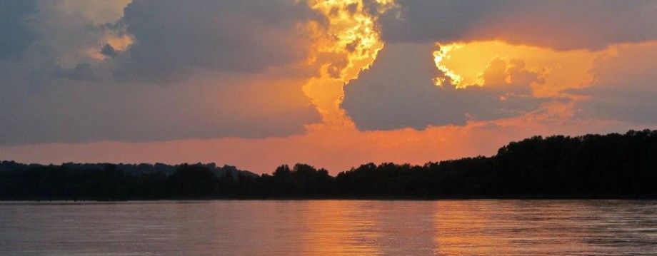
Sunset on the Lower Missouri River (Photo by Jonathan Lauten)
Every morning of every day I think about my trip with great anticipation and longing to get on the water. I look forward to the solitude and the simplicity, waking in the morning near the water, starting the stove for coffee, searching for whatever wildlife will come my way, taking photos, reading, or writing in a journal. Perhaps I have set up my tent facing the river so when I wake up I can lay in my sleeping bag gazing at the river and dream about the day ahead, or the day behind. I have backpacked alone before. I am comfortable in the wilderness.
Camping alone (1983) in the Mokelumne River Canyon, Sierra Nevada Mountains.Sheltered Bay on Lake Francis Case (photo by Bob Bellingham)
In three weeks I will have an education degree in social studies and science. So, this morning I’m thinking about how I can make this trek and this degree work together. I glance over at my NSTA (National Science Teachers Association) monthly newspaper I get in the mail. I see a photo of a man on top of a snow-covered mountain. The caption reads, “Minnesota high school science teacher…uses photographs taken during his world travels to stimulate inquiry in his classes.” Sweet! As I read the article, I learn that his photograph introduces a topic, prompts a story, generates student interest, provokes questions to which the students want answers, initiates a real life connection, brings the mountains into his Minnesota classroom, and creates a teachable moment. BINGO! I can do that! My past experiences can provide lots of material. My upcoming trip will create a file full of opportunities.
Windsurfing S.F. Bay. That’s me in the middle heading out towards the cruise ship from which my brother, Jim Sullens, took this picture. Certainly, a teachable moment somewhere in there.
As an example, on all of his experiences this teacher records basic weather data (temperature, precipitation, cloud coverage, wind speed and direction) which provides a transition into graphing and analyzing data. Great idea! Now I am thinking, hmmm, the ecology aspect of being on the river and the exposure to wildlife and, of course, environmental stewardship are teachable opportunities. And the dams, the many dams, can provide ample high-powered subject matter. How about the geology and geography between Montana and Missouri? And, oooh, the moon phases and constellations? Hey, what about bringing into the classroom the sights and scenery experienced by Lewis and Clark and their crew, and the Native Americans with whom they came in contact? My head is spinning with possibilities!
Moonrise (photo by Dom Liboiron)Gavin’s Point Dam (photo by Bob Bellingham)This monument is on Standing Rock Sioux Reservation and is dedicated to two missionaries who worked with the Lakota. It features Christian and Native cultural and religious symbols. The stones also had many fossils imbedded in them. (photo/caption by Dominique Liboiron)
So much food for thought! If I am not able to have an outdoor classroom, I will strive to bring the outdoor classroom inside.
178-mile long Lake Sakakawea, held back by Garrison Dam, home to extremely high winds. (photo by Dominique Liboiron)No, it is not the ocean. These are waves produced by winds on Lake Sharpe. (photo by Dom Liboiron)
Yes, I look forward to the solitude, but the simplicity may be more multifaceted than I thought.
If you are reading this, and you have some teachable moment ideas for me to think about on my trip, I encourage you to comment. Thanks!
“I had enjoyed the rest in Inuvik. For a moment I had been lulled by the comforts, but the restless feeling had returned. I longed to be on my way. I had missed the solitude terribly.”
-Victoria Jason, author of Kabloona in the Yellow Kayak – One Woman’s Journey Through the Northwest Passage.