Dang, I am REALLY in the Wilderness! -Fort Peck Lake (June 10-17)

IMG_1834

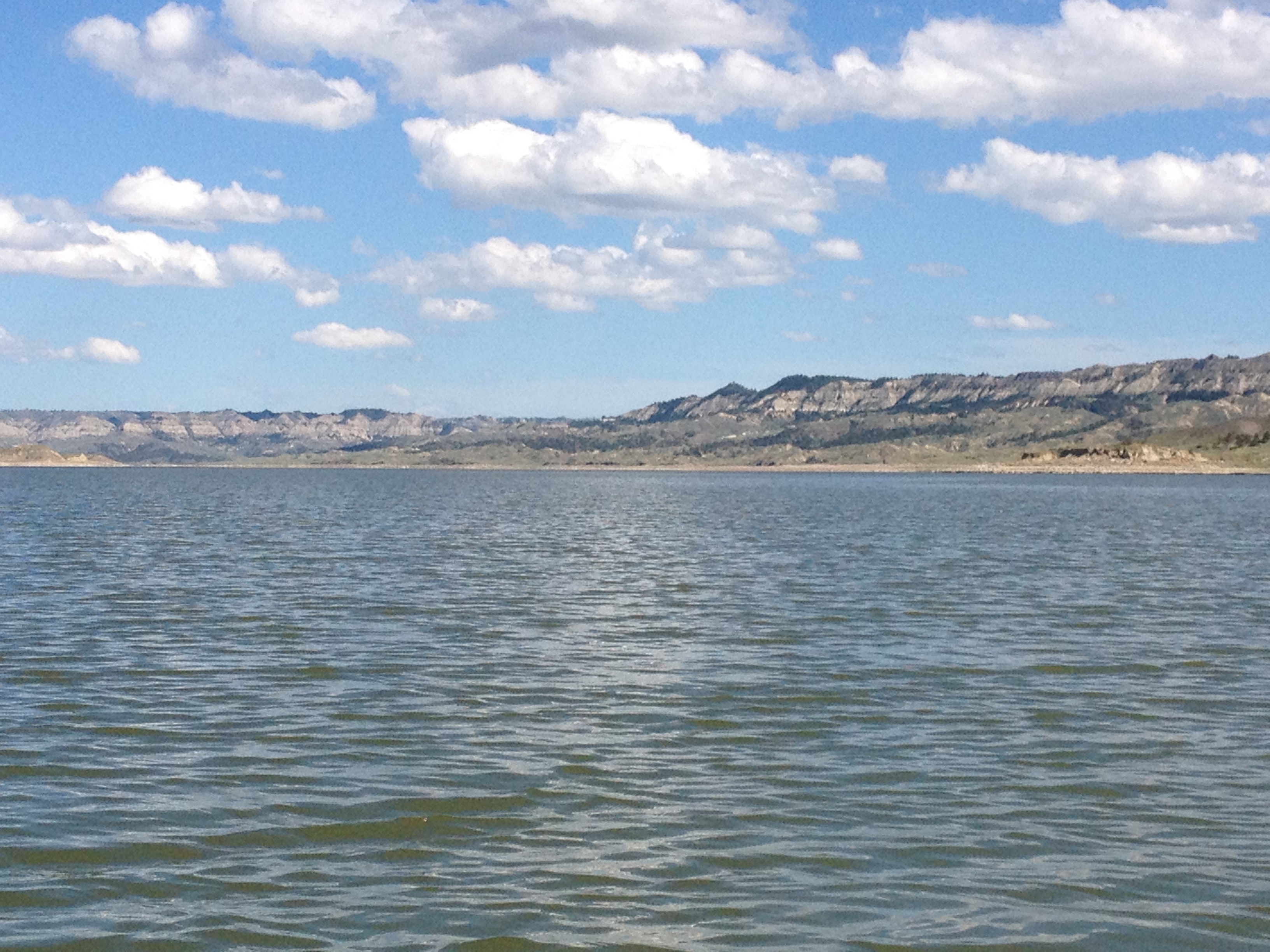
I paddled ten hours and 48 miles to get around UL Bend on Fort Peck Lake. I woke in the middle of the night and took some Advil. My muscles were stiff. It hurt so good. I felt like I had accomplished a lot by travelling so far. Now I would have to deal with the lake that I had heard so much about, and had been warned about by so many, friends and strangers: “Be safe through Fort Peck!! No big crossings unless way before 8AM!  You need to take advantage of the lake telling you it’s safe to go…not when YOU say it’s safe to go. Watch for quicksand!!”  Or, “Fort Peck is a very dangerous lake. Motor boats get swamped out there. The waves can come up fast. Don’t get caught out in the middle of the lake. People die on this lake.”  Gee whiz, people.  I wish I could enjoy the ride more instead of worrying about making unsafe decisions or passages across the lake. My journal reads, “I need to stop wondering if I’m making the right decision and just trust my judgment. I can SO do this!”

IMG_1833

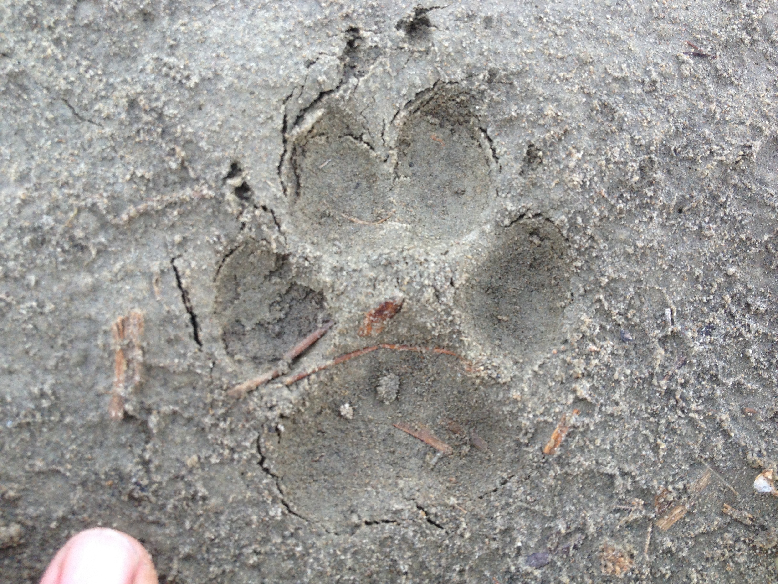
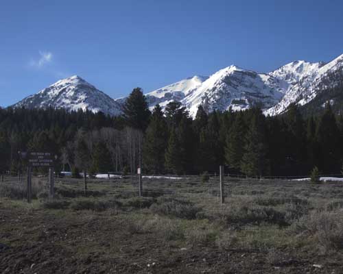
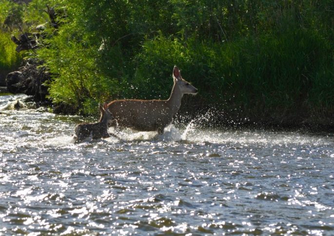
I was more concerned with the possibility that there might be mountain lions around.  I think I saw mountain lion tracks. Or, maybe they were coyote or wolf tracks, not sure. In hindsight, probably coyote, or racoon, or even badger. I had a little Montana Survival booklet with me. That was a really good purchase for five bucks. The nail imprints in the tracks indicated they were more likely the tracks of a badger, racoon or fox.

IMG_1831

At first, all I could think about was if this was a mountain lion track. I knew it was too small, but my mind was trying to justify it as such. Then, I took out my survival guide and saw that the nail prints indicated something different. Probably just a coyote or a desert fox.

IMG_5663

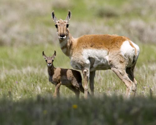
That very night, after I was zipped up in my tent, some animal made a loud noise right around dusk just outside my tent. Holy mackerel! It was a honk, cough, yell, growl, screech, or something, I don’t know what.  “Stay calm,” I told myself. “What do you need to do to survive?”  I took the safety off of my bear spray, got my buck knife out, grabbed my machete, and put my whistle around my neck.  I was hoping it was not a mountain lion. This area just seemed so mountain lion-ish with the desolation and rocky mountains all around. I also had my bottle of Advil next to me as I was preparing to down a couple to prevent stiff and sore muscles that night. I know, I’ll shake this bottle of pills and the animal outside will surely be startled, not having a clue what that noise is. I shook the bottle so it was loud and annoying. I heard the noise again, along with a couple of hoof stomps, and then it was quiet. My final deduction was that the animal was an elk. It was not a deer, but something similar that I was not familiar with. I’m sure it was an elk, or maybe an antelope. I was camped at their water hole, no doubt.

IMG_1842

AlpinGlow on the mountains. I love this rugged mountainous country!

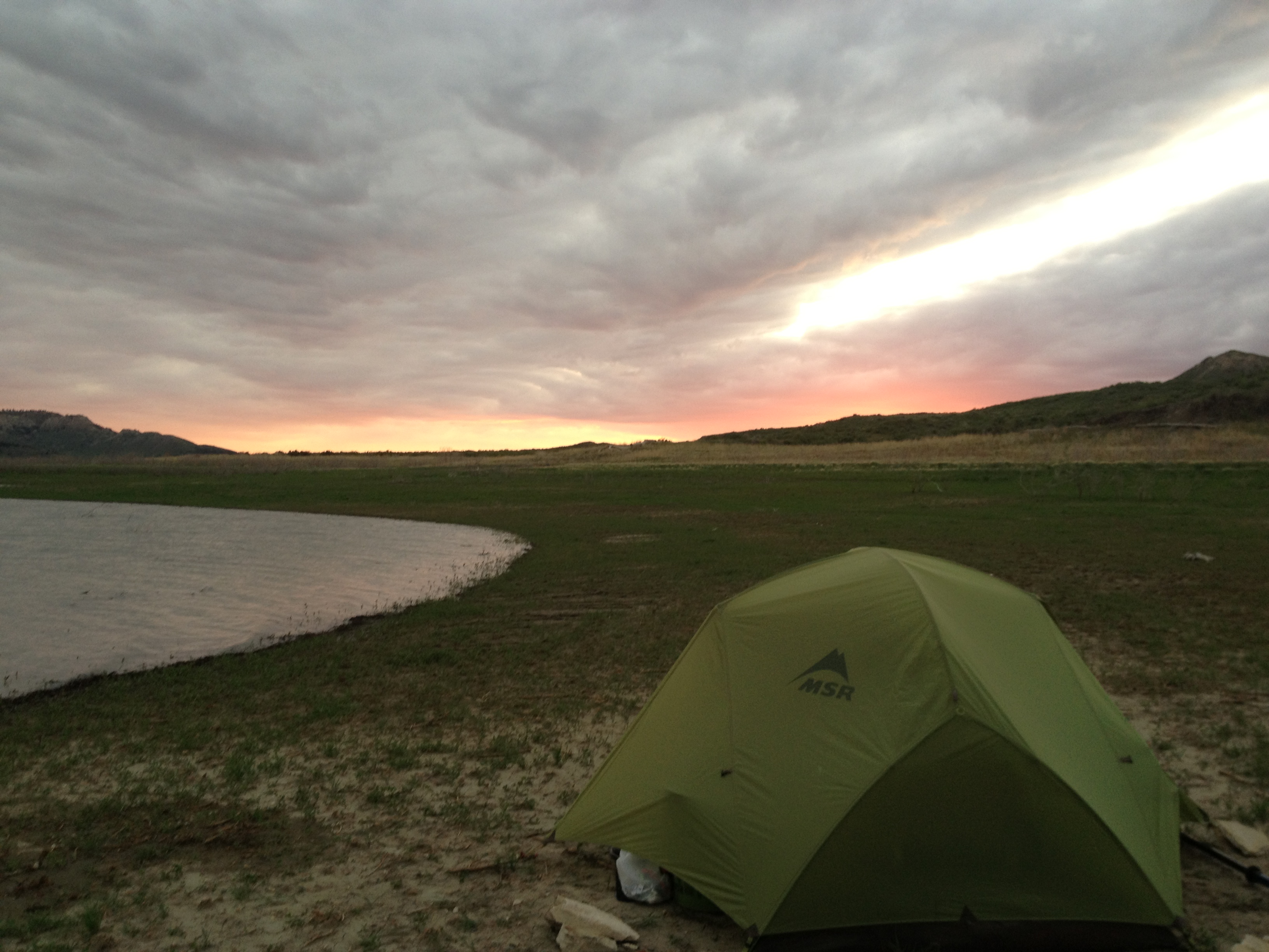
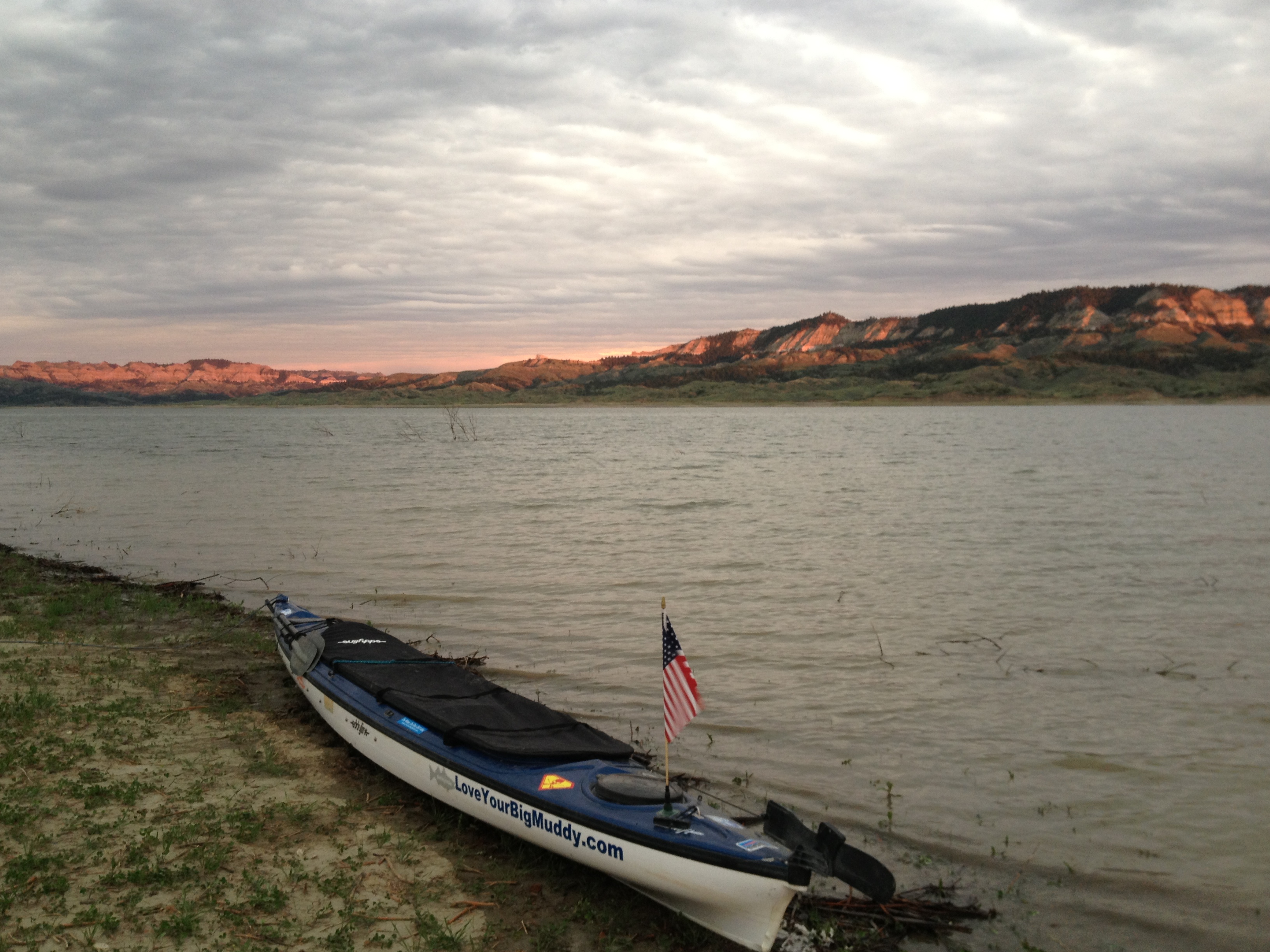
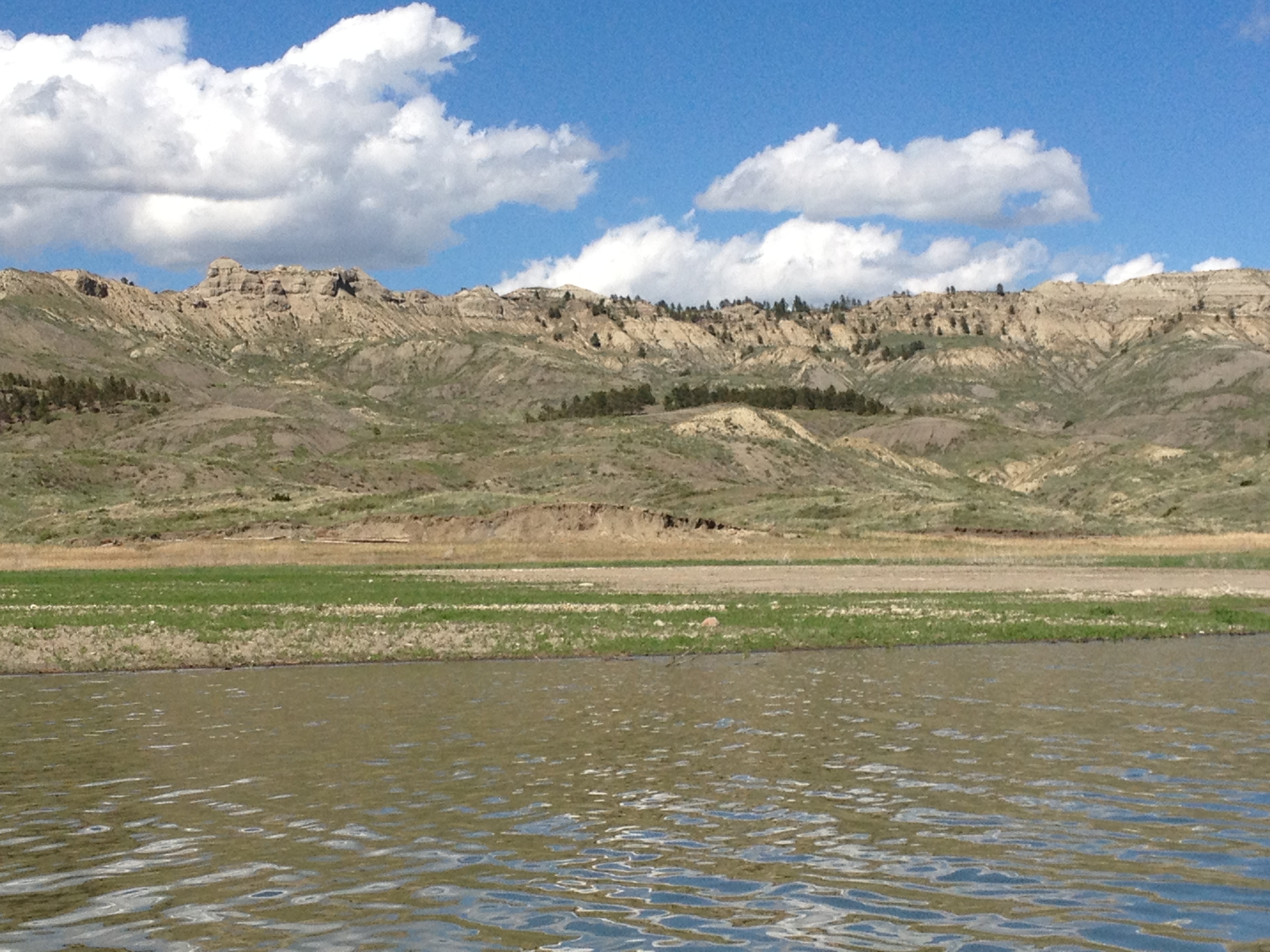
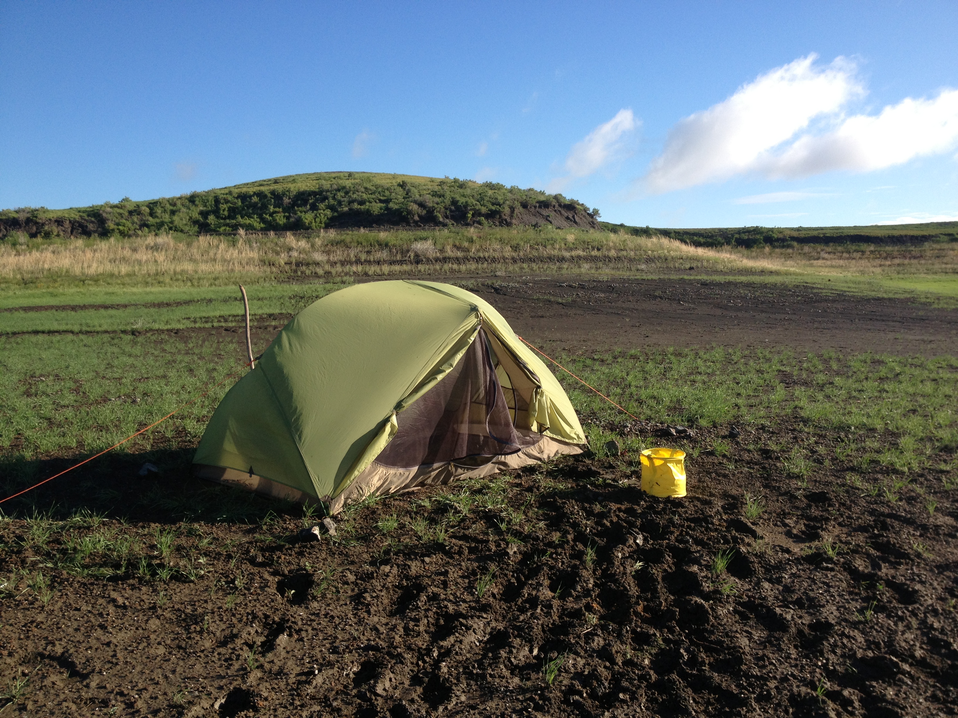
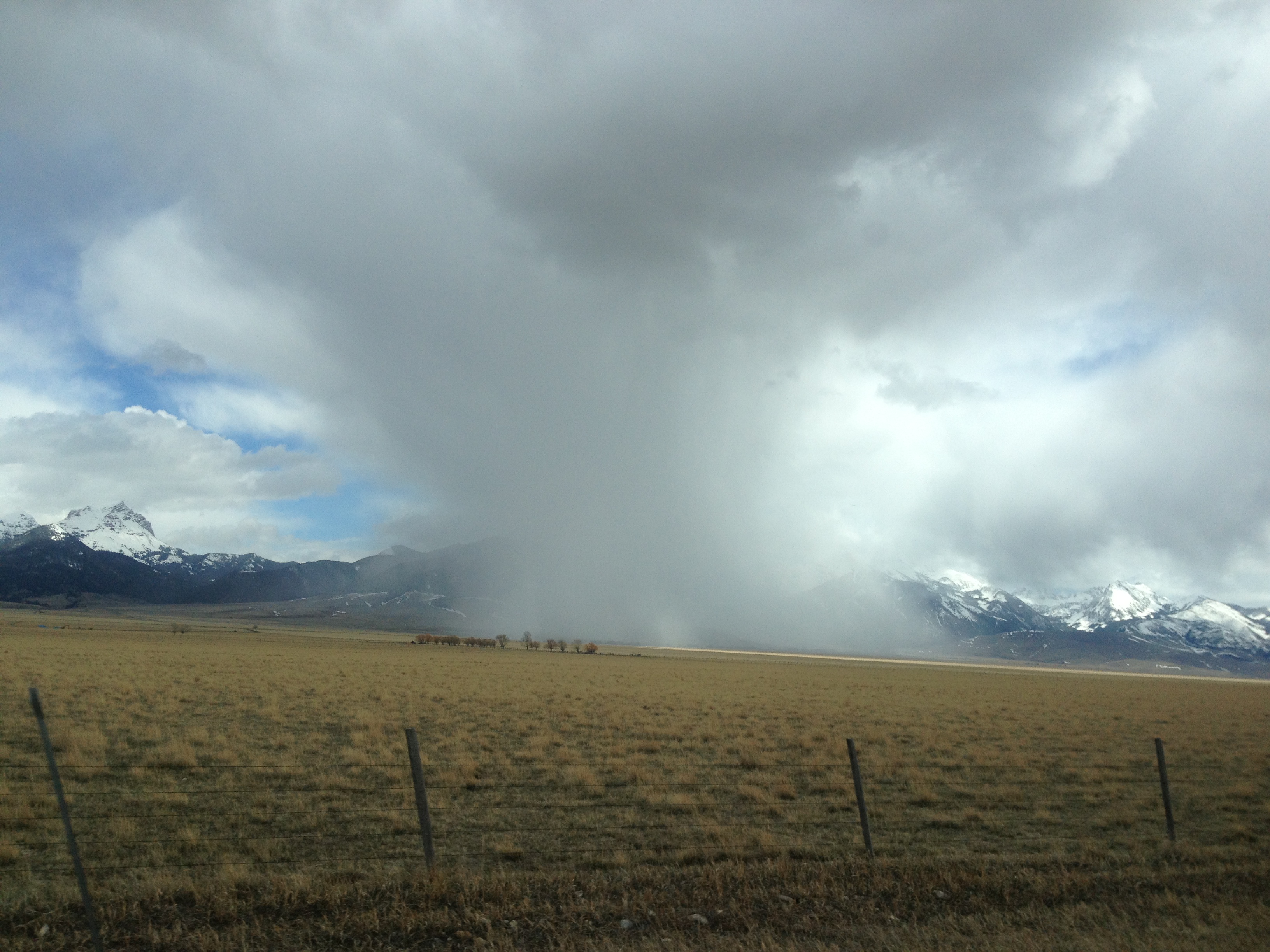
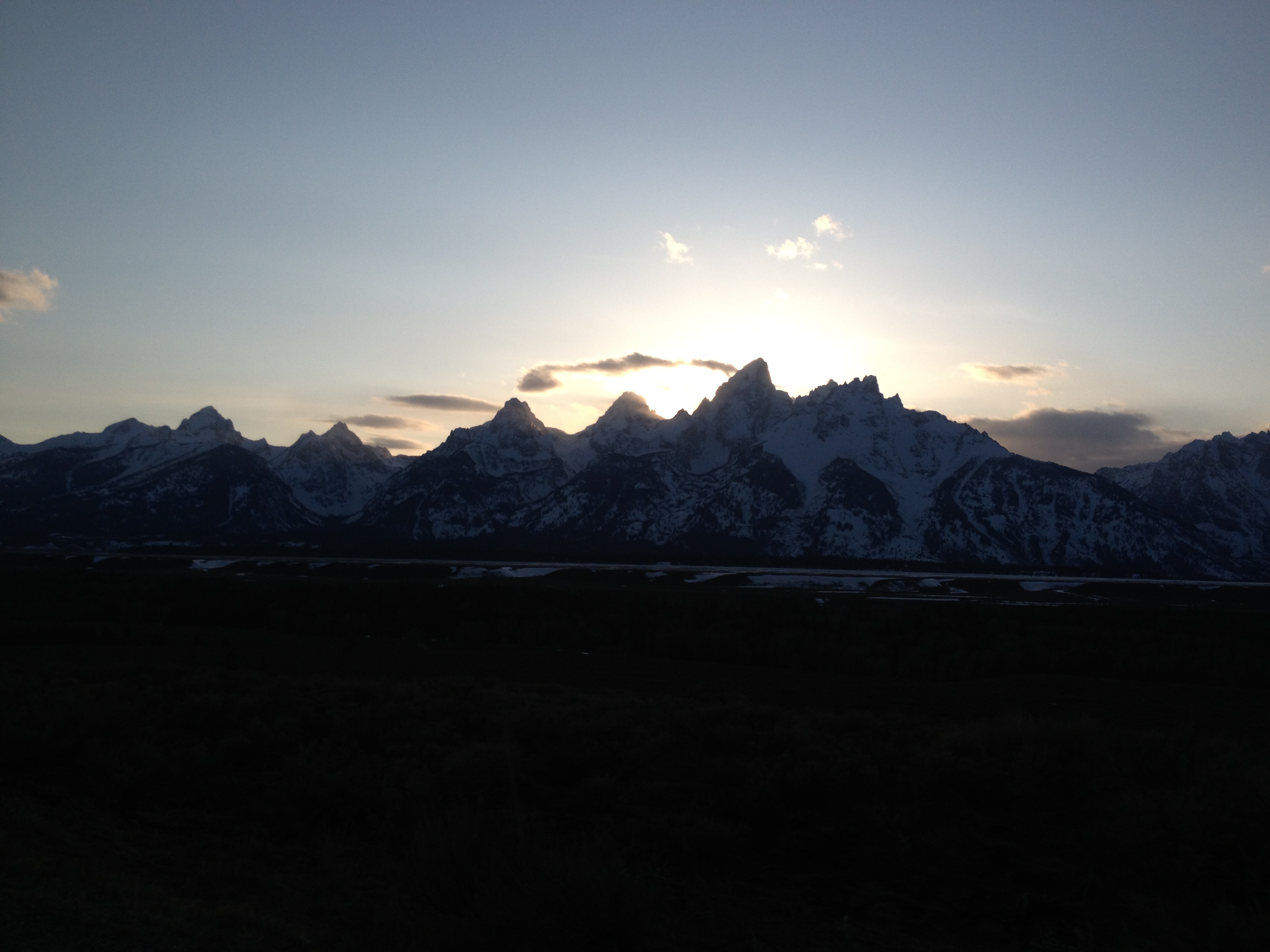
I was ready to knock out another 10-hour day. The weather report was calling for NE/East winds and some weather rolling in from the Pacific Northwest. Darn! I was loving all that sunshine and glassy water. I traveled up the North-South arm and reached the East-West body of the lake. The winds were indeed blowing at me. I would have to wait. There were whitecaps everywhere. I decided to hike around and take some pictures. As it turned out, I set up my tent just before a thunderstorm rolled through. I would be here until tomorrow.

IMG_1911
I just love the desolation and beauty!

IMG_1878

IMG_1886

Prickly Pear Cactus, IN BLOOM! So beautiful
Well, hello there! A young Timber Rattler
An indication of the storm to come.
An indication of the storm to come. This is looking toward the direction I needed to go.
IMG_1893
From whence the storm would come
The storm kicked up some high winds and big waves. Yep, pretty happy I was not out on the lake.
The storm kicked up some high winds and big waves. Yep, pretty happy I was not out on the lake. But rather, I was drinking orange pekoe tea and eating dark chocolate. 🙂

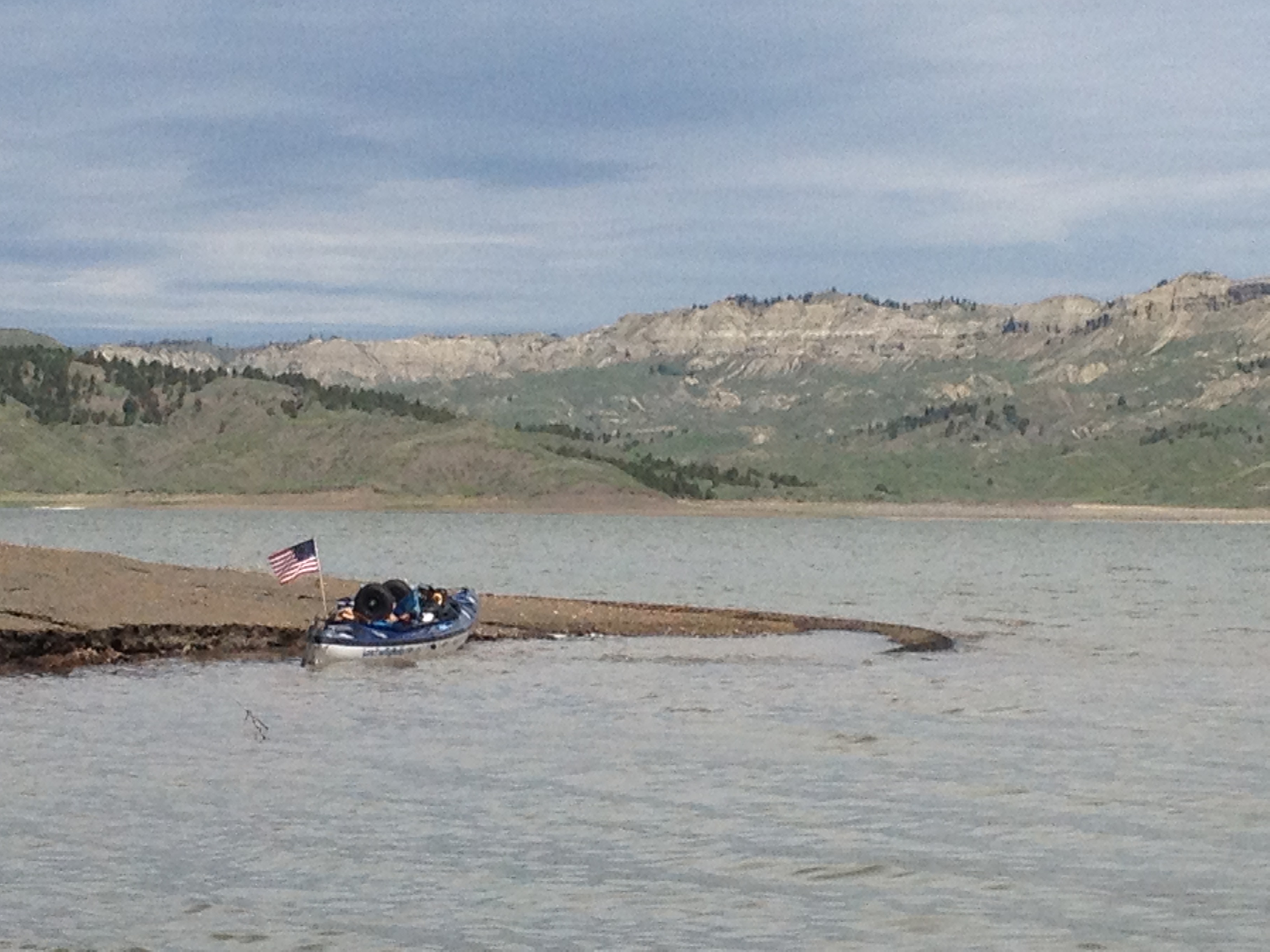
I would not paddle any more big 10-hour days on Fort Peck Lake. Winds blew every day. I paddled some mornings, and even some afternoon and evenings. I was comfortable at one spot where I landed, mainly because there was no mud, but it was also a very beautiful cove, and I was ready to wait out a big electrical storm forecasted and coming my way. However, the winds layed down unexpectedly and the wind advisory got cancelled. I wanted to stay put but I knew if winds were calm I needed to paddle. I packed up.

So happy to not get out and step into mud

IMG_1919

IMG_1934
The water was getting more clear the further down the lake I went.
The lake water was almost as clear, before filtering, as my drinking water.
The lake water was almost as clear (bottle on right), before filtering, as my drinking water.

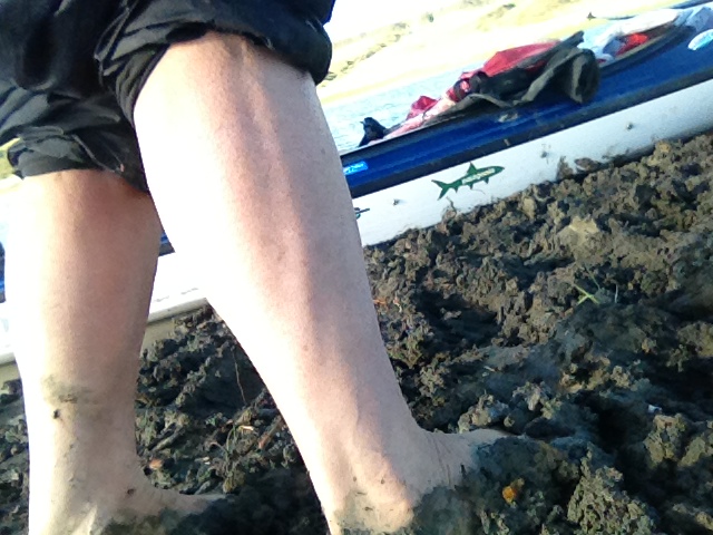
I made some progress, but was NOT pleased with my camp that night, the camp at which I was forced to ride out the predicted electrical storm, which was severe. I was exposed inside a bay that was treeless and low lying, and extremely muddy. This was, literally, the low point of my Fort Peck Lake experience.

IMG_1942

I ended up surviving the storm that packed a major north wind, ripping the tarp off of my tent. I reached out and caught a corner of it just in time to keep it from flying into the water.  The winds flattened the north side of my tent and ripped my tent stake out of the ground.  I had to get the stick four foot that was still on the bow of my boat.  I ran out of my tent and grabbed the stick off of my boat. Thankfully, I had not been struck my lightning.  I secured my fly with the stick stuck deep into the mud. What a relief to have my tent upright again.  Of course, I couldn’t help but think I had just inserted into the ground a lighting rod, which seemed to be the high point on shore, and right outside my shelter.  Oh well, there was nothing more I could do.  I had to wait out the storm, and I did it squatting with only my feet touching ground and my hand on my SPOT “SOS” button.  I thought if lightning struck me, my reflex would press the button.  When the storm ended, I was so thankful to be alive.  I did not concern myself with the two inches of rain that was falling outside.  I was dry inside, and alive.

Yuk
Yuk

IMG_1941

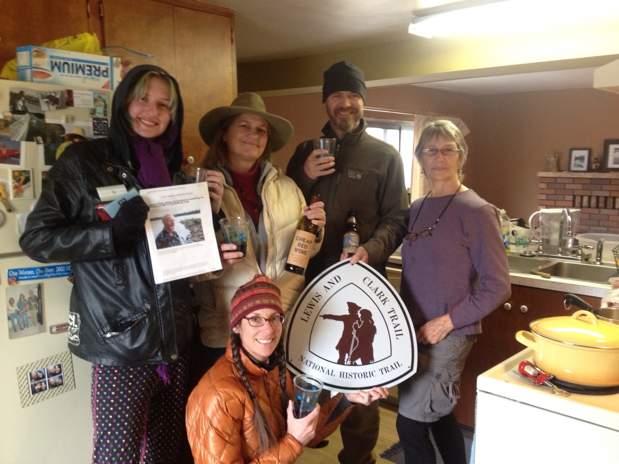
I got out of there at dawn the next morning. I wanted no part of this campsite any more.  I paddled several half-days and eventually made it to the Pines Recreation Area, a location in which Lewis and Clark wrote about as having the first pine trees they saw. I met a wonderful couple, Matt and Carol Williams, and their son and wife, Bill and Tammy. What friendly people. They first brought me watermelon, which was a delicious treat, then later invited me to their camp for steak dinner, wine, and a marshmallow roast. I was so happy to have met these people. They added a warm human social element to this desolated lake leg, and their company and generosity was comforting. I was amazed the next morning when they assembled a cold pack with fresh walleye fish and fruit salad for me to take to fix for dinner that night. We drank coffee together and shared stories before we all parted our ways.

L-R: Tammy, Bill, Carol and Matt, I believe they are all from Shelby, MT.
L-R: Tammy, Bill, Carol and Matt, from Shelby, MT.

I

I spent the windy hours hiking to the ridge tops. The views were always spectacular.
I was able to get cell service, finally, but not internet. I called home. What fun it was talking to a dear friend after no internet service for two weeks. I was invigorated.

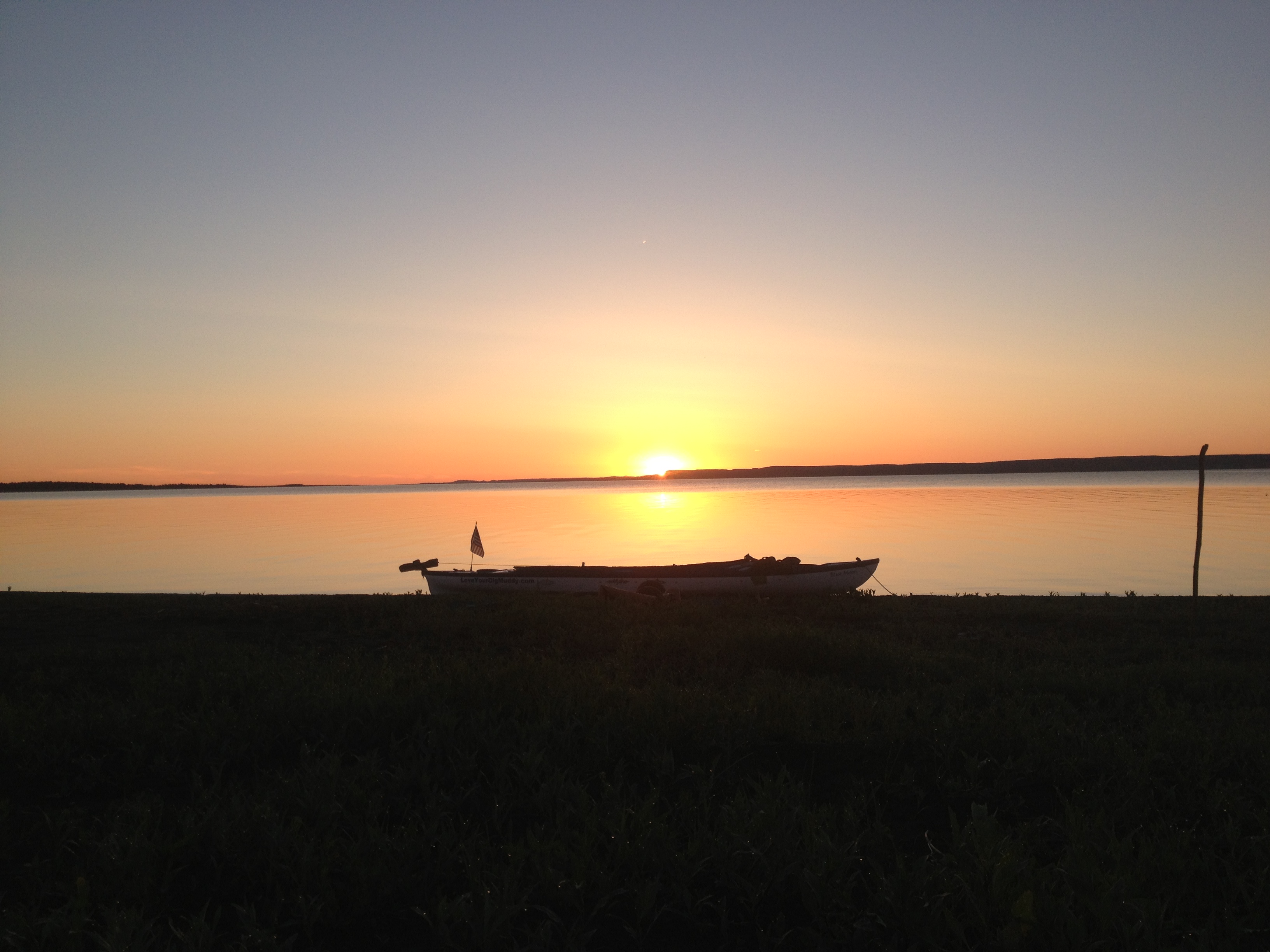
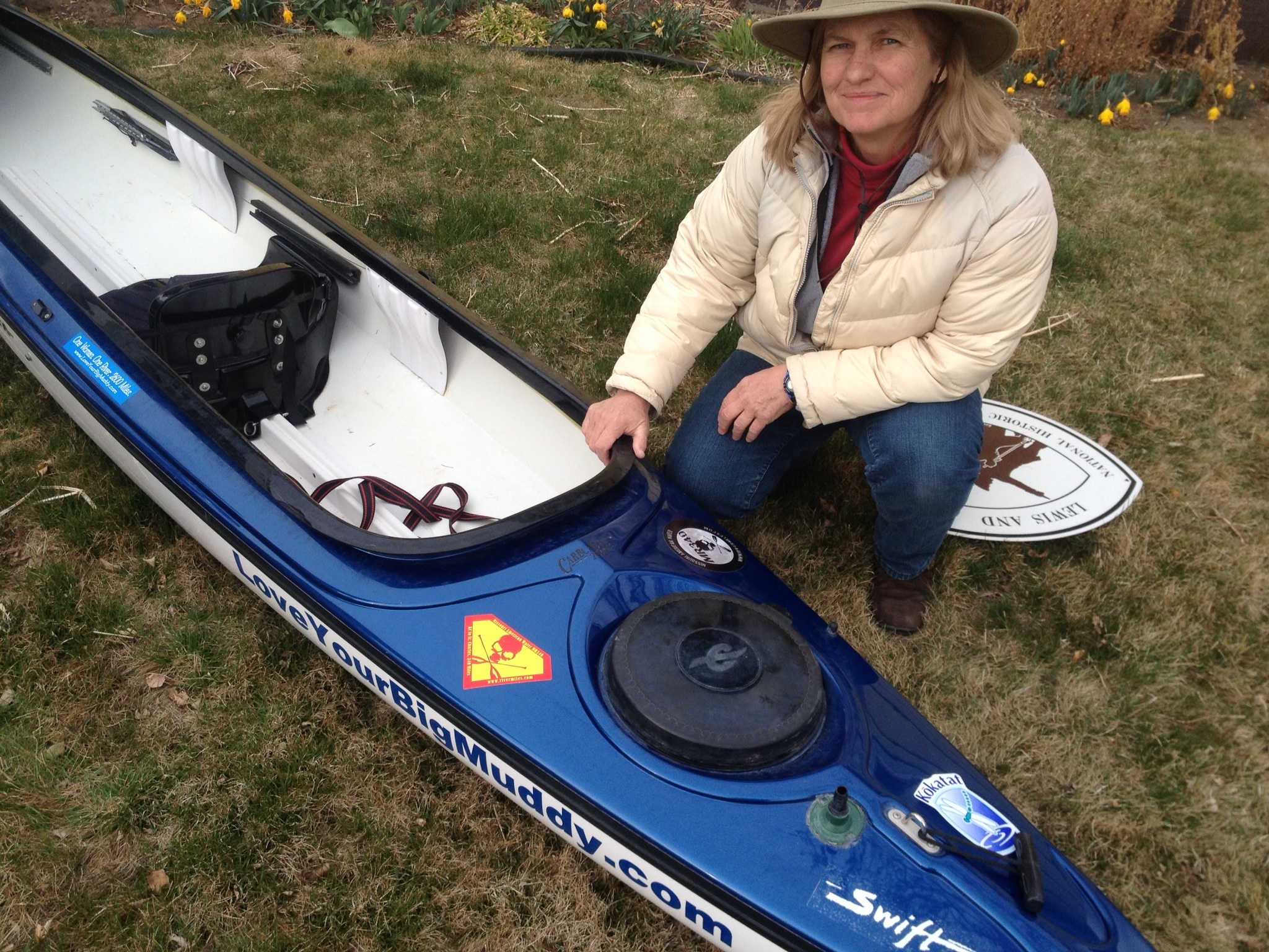
This day was a Sunday, and the Williams family headed home. I ended up waiting out a big wind day just down the shoreline. I met a man while hanging out on the point who was looking around for a mountain lion as tracks had been spotted inside the recreation area. I knew it! This WAS mountain lion country! I was on guard after that, but I came back that night and camped at the same spot as the previous night. This was a first for me, to camp in the same spot two nights in a row. I did not worry too much as calm winds were forecasted for the morrow, and I was up before dawn to paddle my last day on the lake. I woke to a gorgeous orange cloudless sky and glass waters. These conditions would remain all day long. What a wonderful way to end this lake experience. I felt like I was leaving a good friend whom I had gotten to know personally, and for whom I had the utmost respect. Yes, that would be Fort Peck Lake.

So long, Fort Peck Lake. It has been a pleasure.

Do what you love, and love what you do.
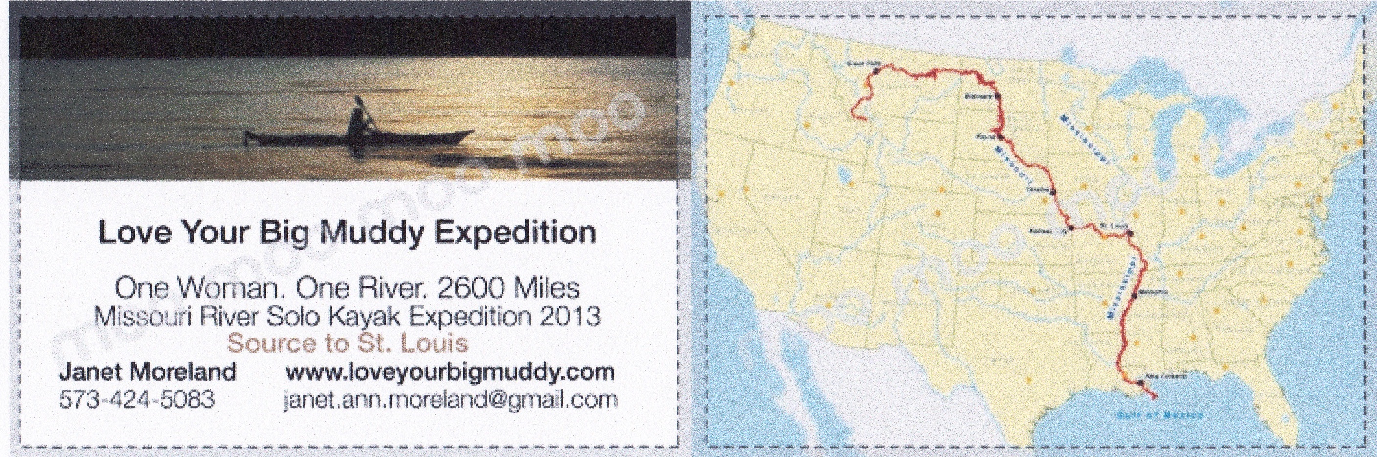
Love Your Big Muddy

Drivers, Are You Ready? Start Your Engines!

On Sunday, April 14, we enjoyed the warmth of our river community as they sent us on our way from Cooper’s Landing on the Missouri River. I find it intriguing that I will be paddling down the entire length of the river for the next 3.5 months beginning in Montana. I have been dreaming about this journey for over seven years. The time had actually come.

Last minute detail: loading the boat, with Dave Bandy.

We have been on the road for nine days. The trip thus far has been fantastic. We have driven on two-lane highways nearly 98% of the trip. Before we actually got out of town, Haley decorated the van.  “I got this, Mom, I used to be a cheerleader.” IMG_0155 We drove through some gorgeous countryside in northern Kansas and southeaster Nebraska.

Gorgeous country. Beautiful Haley.

In Phillipsburg, KS, we had a radiator leak which appeared to be a major obstacle.  The only radiator repair shop in town was completely booked for two days.  I had to drive over and talk to the owner, and tried to convince him that WE REALLY NEEDED HELP.  But, he just could not take us in, and so referred us to Wick’s Muffler and Auto Repair. What a wonderful referral THAT was! IMG_0166 Galen Wickham and his son Gabe got right on it!  Galen brought the car in the shop immediately to try and find the leak. The two of them traced it back to a pinhole leak in a steel hose off of the water pump.  A call was made to Hays, NE, 60 miles to the south.  We crossed our fingers…

IMG_0165
Galen Wickham, left, and son Gabe. Thanks again guys!

Yes, they had the part but all deliveries had already left town.  The best estimate for departure after car work would be about 5:30 that evening. However, I offered to drive to Hays myself and, as it turned out, that is what happened.  Galen loaned me his truck so I could pick up the part. Galen estimated a possible 1:00 departure as a result.  WOW!  Ending up at Galen’s shop was just short of a miracle!  We were back on the road by 2:00. Not only that, he was so intrigued by our expedition, he told his mom and dad and brother about it, and they all chipped in to pay for the repair.  Now, when does THAT ever happen?? Thanks again, Wickham family.  You guys ROCK! I will be telling this story for years. Ron from the local paper, The Advocate of Phillips County, stopped by to ask a few questions about the expedition. Off we went and arrived in Scottsbluff, NE, that night. We got a lovely room and Holiday Inn Express, and enjoyed a hot tub, swim, and had pizza delivered.  The next morning we watched the weather channel very closely while sitting in the breakfast nook at the hotel.  A winter storm was coming up through the panhandle of NE starting today, Tuesday, which is right where we were.  We debated for a couple hours, literally, whether to try and outrun the storm going north, as some guests had already left for Casper, WY.  Eventually, we decided to go for it. Turns out the storm would envelope the entire southeastern portion of WY, and over a foot of snow fell.  We ended up making it as far as Orin Junction, WY, and the roads all around us began to close.  We were 60 miles short of our Casper, WY, destination.  Fortunately, there was a small truck stop at the junction, and we immediately settled in once we knew forward progress was no longer available.

Sinclair Truck Stop at Orin Junction, WY
IMG_0296
The glorious Teton Mountain Range!
IMG_0316
The Grand Teton

We thoroughly enjoyed our layover at the truck stop, despite the fact we had to sleep in the car that night.  The truck stop closed at 10:00 and reopened at 5:00 AM.  We spent seven hours in the car as the snow fell all around us. The car turned into a makeshift igloo, it appeared, and we stayed warm and cozy wrapped in down sleeping bags, jackets, and a comforter.  What an adventure! image image Strangers are just an opportunity to make friends, and that’s what we all did at the truck stop.  We were thankful that we had such a pleasant and cozy place to hang out, and the food was to beat all. IMG_0201 IMG_0227 IMG_0230 IMG_0237 IMG_0245 Finally on Wednesday the road opened up to Douglas, which was 12 miles up the road.  We opted to make the drive and get a hotel.  Being able to sleep on a bed was nice, but the hotel was less than desirable.  We got out of there first thing in the morning and drove all the way to Jackson, Wyoming.  Our progress was somewhat slowed because of the photo opportunities along the way.  We found it difficult to pass up such beautiful countryside without stopping to take pictures.  I am sure we will not regret the many stops we made. IMG_0251 IMG_0262 IMG_0269 Jackson was a significant destination that we were all looking forward to, and very excited about.  We were finally in some serious mountain country! We were grateful for the chance to view the Teton Mountain Range, which appeared through the clouds majestically and with great grandeur! IMG_0272IMG_0288 IMG_0276 IMG_0306   We loved our stay in Jackson, and our accommodations at the Parkway Inn.  Because this time of year is considered the off-season, we were able to get discounted rates at the hotel.  We loved it!  We stayed two nights and refreshed ourselves by going for a walk, swimming, sitting in the hot tub, and doing laundry. IMG_0331 IMG_0345 IMG_0333 Saturday morning we embarked upon a full ‘day of travel.  We drove north up to Sawtelle Peak so I could check out the conditions of the road we plan on driving up to begin our ski into Brower’s Spring.  We then started driving down Red Rock Road towards Red Rock Pass, which is very close to the exit point of our ski.  Since it was 1:30 PM and temperatures were mild, we opted to stop short of the pass because of the mud.  We stopped and walked down the road and enjoyed a snack lunch while viewing the awesome mountains around which we were surrounded.

IMG_0394
We will be skiing in to Brower’s Spring from Sawtelle Peak tomorrow morning! The spring is behind the mts on the right.
IMG_0415
This was spotted out my car window in Idaho.
IMG_0398
The muddy road into Centennial Valley, where our ski trip will end at Hell Roaring Creek.
IMG_0421
Mountains are everywhere in Montana! Madison Range
IMG_0445
Jefferson River
IMG_0439
Beaver head River at Three Forks

We then drove up towards the Beaverhead and Jefferson River so I could take a look at the rivers I will be paddling within a week, or so.  This was a chance for me to connect with my route and visualize the environment of which I would soon become a part. Finally, we arrived at Base Camp International, Norm Miller and Kristen Walker’s house in Livingston, MT, where all paddlers of the Missouri River, or any river, are welcome to stop and regroup before setting out on the river.

image image image image image image

Norm and I have been in email and phone contact since I decided to embark upon this adventure, so despite the fact we had never met, I felt like we were good friends already.  Our stay here has been nothing less that warm and cozy.  We immediately felt like family, and have enjoyed each others’ company immensely.

Tomorrow we begin our journey into Brower’s Spring. Then, the bike ride to Clark Canyon Dam and finally, Blue Moon hits the water.

image

Preparations: Gear, Food, and Fundraising

I am totally immersed in preparations for the trip while still trying to substitute teach enough days to ‘pay the rent,’ so to speak.  Spring Break comes next week so I will not be able to work.  This will be a good time to tie up a lot of loose ends.

NewBlueMoon
My beautiful Eddyline Shasta

We brought my Eddyline Shasta kayak into the house the other day because I needed to apply a keel strip for protection and the weather has been too cold.  The temperature needs to be at least 70 degrees, so into the house it came.  I went ahead and applied the new boat name letters, too.  I am very pleased with the outcome.  Next, I will apply this blog’s web address on the side along with some of my sponsorship decals.  Isn’t it pretty?  Handsome?

Alpine Shop in Columbia is sponsoring me with some significant gear items.  Thank you, Brennan!  He has donated a camp stove-MSR Reactor system (yes!), a Thermarest mattress (3 in thick. excellent!), and a Sea to Summit sleeping bag liner.  They will also communicate my links and updates on their social media sites and to their email recipients.  You should stop by the shop and check out their new expanded paddling section.  They are becoming a premier paddling retailer in mid-MO.

AlpineShop_logo

I ordered my tent, a Hubba Hubba 2P tent from Walt’s Bike & Wilderness Shop.  Besides a Patagonia balaklava, polarized sunglasses and SealSkinz paddling gloves, they were able to give me a 10% discount on my tent.  Every little bit helps.  Thanks, Sarah.

Copy of waltlogowebidea23

After four of my emails were ignored by PowerFilmsSolar, I talked to Julie on the phone, mainly because I needed to purchase my solar charging system and a friend, Barb Giles, offered to donate funds to purchase it.  We weren’t sure what exactly what I needed, so when I talked to Julie, she ended up apologizing for them ignoring me, and offered me a pro-discount on a 14R roll up solar charger.  Thanks, Julie! And, THANK YOU, BARB!

PowerFilmSolar_r14a

I’ll order my sleeping bag today, and a GoPro camera.  GoPro has not responded to my sponsorship proposal, nor has Cascade Designs for a sleeping bag.  That’s okay, though.  I am content with all the things I have been given.  Oh, and I will probably purchase a GPS device, but not sure yet.  Norm Miller will have one we can use to get to Brower’s Spring.

My Kokatat gear should be arriving any day.  That will complete my paddling gear.  I’m excited about looking it all over.  Once I have all of my gear, I will need to start puzzle piecing everything into the boat.  That will be the biggest challenge.  I normally carry everything but the kitchen sink with me, everywhere I go.  My first backpacking trip, when I was 16-years old, was unforgettable because I was ribbed extensively due to all the stuff I had to unload out of my pack. I cannot remember details, but somewhat recall a big tube of Crest toothpaste being the brunt of long-lasting jokes.  Hey, one has got to keep their teeth brushed, right?

Veteran paddlers have offered a lot of good advice about food to bring.  I posted a request for their thoughts on the “Missouri River Paddlers” Facebook Group as well as the “Expedition Canoe and Kayakers” Facebook Group.  I received a lot of great ideas, a few of which I have included here:

Dale Sanders:  Tortillas – most any eatable food can be roled into them, very satisfying meal and they have long “shelf life” and available at most grocery stores. Try Nutella rolled in – delicious.

West Hansen Keep it simple: instant oatmeal with Starbucks Via for breakfast. Mid morning sip 1200 calorie bike bottle of SPIZ (half vanilla/half chocolate). Lunch: can of tuna with Cholula sauce and some dehydrated fruits. Mid afternoon – same SPIZ drink. Supper, dehydrated meal with some canned meat mixed in for calories. When racing, I up my SPIZ mix with some extra maltodextrin electrolytes. Sometimes I add a Starbucks Via to the SPIZ. Then we call it SPAZ.

Kathy Norpell Kurzhals: Tuna, tortillas wraps ( cheese sticks, pb&honey, foil chicken breast), brown minute rice with any seasonings, chicken helpers and tuna helpers, pita bread with pepperoni and squeeze tomato paste and cheese-pizza!, polenta, quinoa, even mac’n cheese…….

Marin Medak:   Beef jerky is one of my favorites. Then mini Snickers, and also some fruits – bananas, oranges, apples.

I will include other “good advice” contributions in an upcoming post.  I learned a lot from all of these experienced paddlers.  As a result of the good advice, I have purchased a dehydrator and seal-a-meal machine to vacuum seal the food.  So far I have dried beef, apples, bananas, pineapple, and blueberries.  Next, I will dry vegetables, more beef, some fruit roll-ups, and some sauces.  Yes, you can dry spaghetti sauce like a fruit roll up, and just add water bring it back to sauce.  Cool, eh?


Samplings of my first round of drying foods.
Apples, beef jerky, pineapple, bananas and blueberries.

I have just started throwing interesting food items in my basket when I come across them.  Mostly, they are side-dish pastas and rice, which will be wonderful to have after long days of paddling.  I will also make my own trail mix.

Some of the food items I have begun collecting.  I will make my own trail mix.
Some of the food items I have begun collecting. I will make my own trail mix.

I am going to buy some Tanka Bars, too, made and sold by the Oglala Lakotas on the Pine Ridge Reservation.  The bars, and bites, are made with buffalo and cranberries, and are all natural (and delicious, too).  Check out a location that sells them near you and HELP SUPPORT the Pine Ridge Reservation Oglala Lakotas!  The Tonka Bars will serve as my energy protein bars.  I’ve never been ‘into’ Cliff Bars or other types of energy bars.

55-34-9-13-4-112-000920804-TankaBarforfrontpg

Fundraising continues with the hope that I can be financial sustained during my 3 1/2 month excursion.  I am looking forward to the Love Your Big Muddy Blues Benefit on Wednesday, March 27.  The event will be held at a local pub, MoJoe’s (THANK YOU, MOJOE’S!!), on a full-moon night with some of the best blues musicians in Columbia, MO.  It is a jam, so musicians can step up to the stage and contribute their talents.

Poster

The host musicians include John D’Agostino, Dennis Ternamian, Alan Loshbaugh, and Charlie Waddell. Other musicians playing music are Scott McCullough, Zed Zardoz, and Debbie D’Agostino, John’s sister. The D’Agostino family have been blessed with beautiful voices.  Johnny D will be taking names for the jam.  Naked Dave will be MC for the event (Go Dave!), so YOU DO NOT WANT TO MISS THIS EVENT!  Free appetizers made with tender loving local care will be provided.  And, buy lots of raffle tickets because you get to choose your own reward!  The more tickets, the more chances to win a great prize!  Big thanks to the committee, headed by Heidi Brunaugh.  Love you guys!

If you would like to sponsor me with a financial donation, please visit my “Donation Opportunities” page, or my GoFundMe page on the web.  To see who has contributed thus far, visit my “Financial Contributors” page on this blog.

Thank you for your support! You are making this happen!

Live fast ~ Paddle slow

See you on the river!!!

Updates on Sponsorship, Funding, Promotion, & Preparation

I spent nearly all day on the computer yesterday.  I find that easy to do these days.  Writing a single letter of request for a donation takes a lot of time.  I try and carefully consider what I am writing to each company.   Much time is taken just to research company websites, find a product that best meets my needs, search out a place to apply for sponsorship/product donation for that company, and/or find a marketing manager’s name to address on a letter.  Then, a clear and concise letter of request is composed (and they are all different) to personally address that company and their product.

RealityBudget

These days gear companies are pretty organized with their online sponsorship request systems (sign of the times).  Some companies will let you know that if your purpose does not fall into their provided categories, don’t even bother to apply (like REI and North Face).  Others will let you know that they will try and respond within 48 hours, five to ten business days, or within four months.  I realize that it is important to apply to several companies, however, you have to plan for many hours in order to search for sponsorships.

I found out pretty early on that some companies won’t bother with you if you are not a “celebrity” athlete.  I understand that.  That is why the companies that have chosen to help me out are incredibly special and I hope to reward them with ample promotion.  I am determined that my partnership with them will be a win-win situation.  Thanks again to big company in-kind donations from Eddyline Kayaks/Swift Paddles, SPOT, title nine, and Patagonia for supporting my expedition.

Eddyline-croplogo_swift

patagonia-logoSPOT_logo_2c_sm_tag_URL_ol

So, yesterday I requested donations from Katadyn Group (Optimus stove and freeze-dried/dehydrated foods), Sea to Summit (sleeping bag and dry sacks), GoPro (camera), and Smith Optics (sunglasses).  I spent quite a bit of time trying to find a Marketing Manager for Apple to request a Mac Book Pro.  I know, what are the chances?  But, if you don’t ask, you don’t even get a shot.  I will have to send them a snail mail letter, pretty sure, and that doesn’t mean it will get read.  I will also ask Sprint if they will give me six months of all-data service for an I-Phone that I can’t buy yet.  A long-shot but, again, it doesn’t hurt to ask. Think BIG!

Other companies I have sent requests to are Garmin (GPS), Marmot (sleeping bag), InReach (denied because I’m not a celebrity adventurer), Cascade Designs (tent, stove, Thermarest pad), PowerFilm, Inc. (solar-powered roll-up panel), Kokatat (paddling clothes), and KC Paddlers.  Still waiting for a response from these folks.  Others yet to contact are Seal Line (dry bags, PFD (life jacket)), Teva (sandals), other tent and sleeping bag companies, and a backpack company.  I will need to find more paddling companies to research for gear.

I have not asked any companies for money.  I think they like to see some successful accomplishments before they sponsor an expedition with cash.  Hopefully, someone will connect with what I am doing and jump on board…soon.

Even more special are some of my dear friends who have donated financially.  Thank you Bill and Anne Diehl, and Karen and Ric McCann – good friends from Bear Valley days.  Also,  my dear friend Deb Miller and best friend, Dave Bandy.  You are the first.  Thank you so much!!!

I am beginning to try some foods to bring along.  I have a few Knorr side dishes to try at $1 a pop, which include mashed potatoes, rice dishes, and pasta, of course.  I want to make sure I have plenty of comfort foods.  I will try and contact some companies for food donations.  Not sure who yet.

IMG_1816

So, this is the bulk of the work I have to do.  Hopefully, I will not have to purchase a tent and sleeping bag.  After five months of not working due to student teaching, and substituting part time for $70/day, I will soon need to take out a loan, or launch into a fundraising campaign, or both.  I’d like to avoid another loan.  My student loans are enough to keep me occupied.

My boat is all set except to remove the old keel protection strip and apply a new one, which Eddyline has provided.  I need to sand some scratches and fill them up.  And, I need to set up my rudder.  Oh, I have to rechristen the boat with the new name:  Blue Moon.

Shasta-gear_Bob

I have ordered 200 more stickers after giving away the first 100.  The blog address will be larger on the new ones.

L-R, Dave Cornthwaite, Rod Wellington, Dale Sanders

I  also designed a new business card last night because the first batch did not turn out visually as nice as it appeared on the computer screen.  No surprise.  You get what you pay for and they were cheap.  Here is a picture (a little fuzzy) of my new design I created with MOO.  They should arrive in about a week.

business-card-MOO-autoEdit-crop

The promo video will be ready in a week or so.  Thank you Jim Karpowicz and Tom Newcomb of Black Truck Pictures.  I hope to start an organized fundraising campaign then, perhaps with GoFundMe, or something of that nature.  You can visit my Donation Opportunities page, which I have set up with tier-level rewards for financial donations.  Please consider donating financially to help with the success of the expedition.

This sign points to Red Rock Mountain and Mount Jefferson, situated on the Continental Divide. This sign is visible here at the entrance to Alaska Basin in Montana. Looking east.
This sign points to Red Rock Mountain and Mount Jefferson, situated on the Continental Divide. Sawtelle Peak is behind and to the right and will be our entry into Brower’s Spring.

Norm Miller will be skiing into Brower’s Spring with me and has tracked down a pair of skis and boots from his friend who is loaning them to me.  I am thankful for that.  I may try and find a bike donation, or just bring my own.  It is nothing special, and pretty heavy, but it is a comfortable ride.  Someone may have to talk some sense into me to try and get a good bike to ride the sixty or more miles from the Red Rock Lakes National Wildlife Refuge to Clark Canyon Reservoir where I am planning to put in a boat.

Pronghorn and calf
Pronghorn and calf at wildlife refuge

The Red Rock River on that stretch is complicated by private land with barbed-wire fences crossing through the river, electrical fencing doing the same, corrugated sheet-metal dams, and snag piles forcing numerous portages and body submerges.  The road follows that stretch on which I will ride my bike.

Hell Roaring Canyon and Creek, exiting the mountains. (Nemesis Mt. to the left of canyon.)
Hell Roaring Canyon and Creek, exiting the mountains. (Nemesis Mt. to the left of canyon.)  This is where we will come out of the canyon.  Our route heads back and winds way up to the left.

Finally, I spend a fair amount of time on my blog posts.  I try to make them interesting with good visual accompaniments.  They take much longer, sometimes hours, than my more spontaneous updates on my Facebook page:  Love Your Big Muddy Expedition.  If you have not, please like my FB page.  Sponsors like to see lots of page “likes.”  Of course, I like to see the support.  You actually are supporting my expedition indirectly by liking and following my pages and blog.  THANK YOU!

Love Your Big Muddy Expedition

So, if you are wondering when this epic adventure begins, it already has.  I will be leaving for Montana with my daughter and a friend on the morning of April 14, the day after my Science Teacher Certification Exam.  I hope to start the trek with my ski into Brower’s Spring on or near April 20th.  Maybe I will find myself at Three Forks on May 1st.  That would be ideal.   I cannot wait to see the mountains and begin the adventure of my lifetime.  Or, perhaps the first of many.  Cheers!

Winter view of the Centennials here. Wind blows frequently to obscure the road completely with snow in February.
Winter view of the Centennials here. Wind blows frequently to obscure the road completely with snow in February (hopefully, not April!).

2012 in review

The WordPress.com stats helper monkeys prepared a 2012 annual report for this blog.

Here’s an excerpt:

600 people reached the top of Mt. Everest in 2012. This blog got about 3,000 views in 2012. If every person who reached the top of Mt. Everest viewed this blog, it would have taken 5 years to get that many views.

Click here to see the complete report.

Canadian Paddler Rod Wellington & a MO Riv Source Start

Rod-photo_Coops_12-18-2012
Photo by Rod Wellington

Canadian paddler Rod Wellington passed through Cooper’s Landing last Monday and Tuesday, Dec 17-18.  He is paddling from the source of the Missouri River at Brower’s Spring, MT, to the Gulf of Mexico, all self-propelled.  This is the longest river system in North America, and fourth longest in the world.  Rod will be the first Canadian to paddle the MO from source to sea.  Australian paddler Mark Kalch completed the route earlier this year.

Norm Miller (left) and Mark Kalch (right) at Hell Roaring Creek in June 2012

Altogether, Rod will paddle seven of the longest rivers on seven different continents.  The Missouri River is his first.  He has been on the river since June, a total of six months.  His river systems project could take up to 15 years.

Photo by Rod Wellington

After a pot luck dinner and visiting with many interested locals, he graciously sat with me and poured over photos and a map from the Brower’s Spring area, the Missouri River source, to Three Forks, the headwaters of the MO Riv, a 298 miles stretch and one in which I am debating whether to include on my trip.

MAP_Browers-ThreeForks-USA

MAP_Browers-ThreeForks_flip

Browers-August
Cairn at Brower’s Spring with Continental Divide behind. Photo taken in August 2011 while scouting the source (photo by Rod Wellington)
Continental Divide at Brower's Spring in June 2012-by Rod Wellington
Continental Divide at Brower’s Spring in June 2012 (photo by Rod Wellington)
Looking down from the spring in June 2012.  Undoubtedly, April will have a LOT more snow. -by Rod Wellington
Looking down from the spring in June 2012. Undoubtedly, April will have a LOT more snow. (photo by Rod Wellington)

No firm decisions yet as there are a few dicey stretches, like hiking/skiing/snowshoeing over snow for seven miles into Brower’s Spring, and seven miles out.  And, a few days of dodging and portaging around farmers’ barbed wire/electrical/corrugated panel fences which cross a mere 20′ wide water way below the Lima Reservoir on the Red Rock River.  Not to mention that the Red Rock Lakes Wildlife Refuge, located above the Lima Reservoir, is closed in April.

At least now I have a greater understanding of what my obstacles and options are.  I have an unrelenting desire to capture some of that 298-mile stretch for its sheer beauty.  Some of it may have to be biked.  Thanks, Rod, for spending that time with me.

Jefferson River below Twin Bridges
Jefferson River below Twin Bridges (photo by Norm Miller)
Deer on Jefferson River (photo by Norm Miller)
Rain approaching Jefferson River (photo by Norm Miller)

Understandably, Rod needed to leave Cooper’s Landing and continue

Rod and Jonathan at Cooper's Landing.
Rod and Jonathan at Cooper’s Landing. Notice the wood-carved hawk that is Jonathan’s handiwork.

paddling towards the Gulf of Mexico.  However, our first major storm

of the season hit yesterday, the day after he left.  Winds gusted to 50 or 60 mph, and snow was blizzard-like.  One caring and supportive local, Jonathan Lauten, set out to find Rod and make sure he was okay.  He found him across the river below Jefferson City, but was not able to make contact.  We learned that Rod was hunkered down in his tent, warm and dry.

Rod laying low in a miserably cold, windy, and snowy storm. -by Jonathan Lauten
Rod laying low in a miserably cold, very windy, and snowy storm (you can see the wind plowing into the side of his tent). (photo by Jonathan Lauten)

Jonathan’s comment from Facebook:

I found him, but I couldn’t get to him!
This pic was taken from a bluff across the river 4:00 12/20/12.
Of course, it was hard to pick him out amongst all those other campers on the Missouri River in a blizzard with 50 mph winds…

Here is a post from Rod yesterday morning, much to our relief:

Dec. 20, 10am – Currently hunkered down in my tent on a sandbar near Jefferson City, Missouri. Outside: blowing snow, sustained winds of 35-40 mph with gusts of 50 mph or more. Unable to keep tent and tent fly anchored. I’ve arranged heaviest gear on windy side of tent to act as a buffer. I’m warm and dry. No paddling today. Expected low tonight: 5F with windchill. Thanks to Steve Schnarr, Gary Leabman, Robin Kalthoff and Jessica Giard for checking on me via phone. Still smiling!

Great meeting Rod and spending some time together.  I think I speak for lots of other folks who met him as well.

Rod and me -photo by Jonathan Lauten
Rod and me (photo by Jonathan Lauten)

You can read posts and watch videos from his trip thus far, and track his current progress on his FB page: “Rod Wellington.”

Happy paddling!

So, You Want to Paddle Down the Missouri River?

By Norm Miller, in his own words…

Norm Miller paddling UP the Missouri River in 2004, retracing the Lewis & Clark Trail: STL to the Pacific.

What does it take to paddle down the Mighty Missouri River from Montana to St. Louis?

I personally don’t think there is a formula as in hind sight, the experiences of others who have taken the challenge are all different. I think it maybe more of a personality type that can just go and take off for weeks or months…especially alone.

I am very comfortable being alone, which is not the same as being lonely. Some people are more secure with themselves than with a group of people. I’ve had friends tell me that they could never paddle and camp for weeks alone. When I hear this I get the sense that they don’t know themselves well enough. For me, it’s always been a way of life. I’ve been very independent all my life. Don’t get me wrong, I had plenty of friends to roam the neighborhood as a child, building forts, playing army, hiking and fishing and just plain escaping from our parents. I also spent many hours alone, comfortable being solo.

Norm’s expedition from St. Louis to Three Forks, MT, over the Rockies, and down to the Pacific Ocean took six months.

I often wondered that if everyone who has gone on a long paddle trip took the same personality profile, if we would all score the same rating? For the most part I am very shy, which some people find hard to believe. As a child I use to hide under my bed when relatives would come over, only to come out after they left. Now that I’m near 50-years old I feel more at ease around people, especially groups. But there are times when I must seek the shelter of my cave and go run off solo somewhere.

I personally feel more at ease when life is simple. I often feel I was born 200-years too late. I love to camp and enjoy the peace that I find along rivers or travelling abroad solo. I’m comfortable being in foreign countries and not knowing the language. I get by easily with sign language and drawing pictures to communicate to people.

To me if you can paddle all day, set up camp, cook your food, clean up your mess, go to bed, get up in the morning and repeat everything, then paddling two-three months is not that big a deal. It becomes far more of an emotional, spiritual, and psychological journey than a physical one. My mind is always at battle wondering about things, my well being, what if’s, do’s and don’ts. In 2004 while paddling up the Missouri I was at a constant battle with myself. The main issue was the slow pace in which I moved. I could have easily walked much faster than I was paddling. In the strong currents of the lower river, 2-mph hour was my tops speed. So, living in the 20th century with all the high-speed fast paced lives we all lived, slowing down to a snail’s pace was very difficult. I had to concentrate on the small picture, never the final destination. My mantra was “one stroke at a time will get you to the ocean.” I had to stay focused on the bend ahead, the distant tree or bridge and never the Pacific! I would have gone insane had I not slowed my mind set. “River Time” is what many paddlers talk about; slowing down the pace of the world, the natural environment and not the speedy rate that most follow.

Being able to adapt to changing conditions is another factor that is helpful. On my first big paddle trip I started off very set in my beliefs as to how the day should go. I didn’t accept change very easy. Well, that only lasted about a week and I knew that nature dictated much more than I ever imagined. The weather was the biggest factor. Wind and storms will tell you when you can and cannot paddle. So get use to watching the sky, feeling the wind, observing the weather. It truly tells a lot. After a week or two you can get much better than the weatherman at determining what the forecast will be for the day. There will be times when you just have to wait it out. I’ve spent days wind-bound to a tent, waiting for a break to proceed onward. Don’t be in a hurry. Enjoy the storms, the hail, the tornados, the flooding, the snow, the lightning and the intense sun. Explore the surrounding shore, the distant hillsides. I’ve spent hours in N. Canada on a remote river on my knees looking at stones. I’ve found some amazing things while wandering around waiting for the wind to abate; from Inuit burial grounds, old buildings, rare animal sightings, hot springs, and even a family gathering with plenty of cold beer. Being stranded in the wind is also a good time to rest, to catch up on that needed sleep. I’ve come to love the wind! It has become my friend. I no longer curse it but enjoy its gifts and wonder.

Wind-bound on Canyon Ferry Reservoir

to be continued…