Based on my camping experience in Missouri, I know that the threat of cold weather is present in mid-Missouri until AT LEAST after Mother’s Day, which is usually end of May (last hard frost date is late April). So, starting my trip in mid-April in the Montana Centennial Mountains at the Continental Divide pretty much necessitates winter conditions planning. Okay, got that. However, I did not really consider the Centennial Valley being covered with snow down to the Red Rock Lakes National Wildlife Refuge.
I received an email response from Bill Smith, project leader at the Wildlife Refuge, which is located down the Centennial Valley from where I’ll exit the mountains after skiing to Brower’s Spring. He writes: The refuge is not closed in April, it is just closed to boating. In addition, the two big wetland lakes (Upper and Lower Red Rock Lakes) are still frozen until about May 1st. I suggest you snowshoe to Brower Spring from the Centennial Valley floor. Then you could cross country ski down the valley if there is still snow available. No refuge restrictions on ski travel.
(Norm Miller and I are planning to ski in to Brower’s Spring from Sawtelle Peak, a two-mile ski to the spring, and seven miles down to the valley floor.)


SO, the good news is: The refuge is not closed to paddlers in April, only motorized boats. Yay!
And, the not necessarily bad news: The entire valley MAY be covered in snow and the lakes covered with ice until May 1st. Dang, this is starting to become quite the adventure. And, I like it!

Bill sent me some valuable links that are critical to my planning of this upper upper portion of the expedition. Here is what he wrote:
I’ve attached two web sites. The Lakeview Ridge Snowtel site will allow you to look at graphs and charts of average snow depth during the annual cycle here. Look at historical April. It will also give you the current year.
http://www.wcc.nrcs.usda.gov/nwcc/site?sitenum=568&state=mt
The 2nd link is to the water gauge on Red Rock Creek. It will give you historical and real time measurements of stream flow in the creek. The gauge is on the Creek at the very Eastern boundary of the refuge.
NRCS is upgrading this website this weekend so it may not work well until Monday.
http://waterdata.usgs.gov/mt/nwis/uv?site_no=06006000
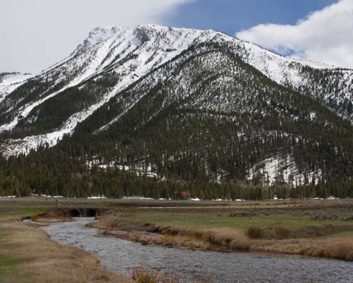
I assume you have the refuge website. Here is a link to a virtual tour of the Centennial Valley.
http://www.fws.gov/redrocks/virtualtour/
Virtual tour!!? How awesome is that! I hit every spot on the tour, and let me just say this, “It IS the next best thing to being there!” When you click on the link, the map on the left has a white dotted line sweeping along the bottom and then up towards Henry Lake. That dotted line is the Continental Divide, and Brower’s Spring is inside the lower right-hand u-turn area where the white line starts to head north. On the right side of the page, the names of the mountains will show up when you scroll over them. You can sweep 360 degrees! Enjoy! It is a fantastic site. Big huge thanks to Bill West and his willingness to help me out. We will talk by phone soon.
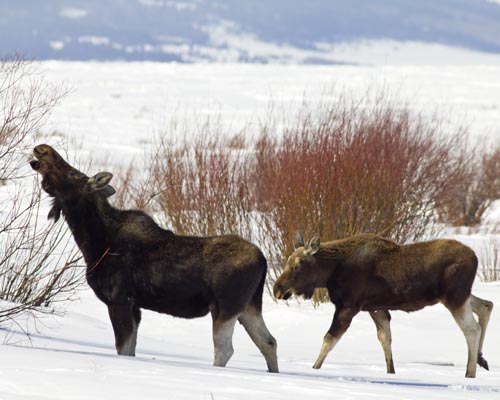
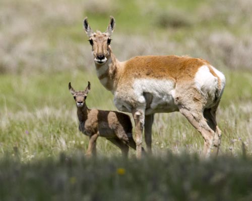
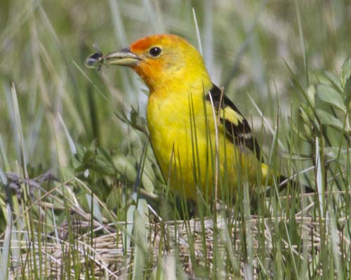
All photos on this post are taken from the virtual tour site.
That’s all I got for now. Lots to think about.