Expect the unexpected. Changes come in all sizes and shapes. Our lives are dynamic, and so are our blogs…Since I imported all my content from 1Woman3GreatRivers last weekend, my blog appearance got knocked out of whack. Turns out this theme has been discontinued. I appreciate your patience while I play around with new themes and take on new changes.
A lot of chapters have opened up in my life since completing the three Great Rivers Expeditions. I’ve been teaching 7th grade Science, changing school districts, guiding on the Mississippi, participating in river cleanups, visiting friends and family in California, and suffering through four years of chronic back pain.
I’ve exported all of my posts from the other site, 1Woman3GreatRivers, back home to LoveYourBigMuddy. The last post I added on the other blog site was two years ago yesterday, April 27, 2017, when I left Whitehorse, Yukon Territory, for Atlin Lake and the Llewellyn Glacier, British Columbia, the Yukon River’s source. It was nearly impossible to post anything while on the Yukon because of its remoteness. Satellite posts were accomplished on my Expedition Facebook page, but I could not post photos unless I had WiFi, and that was a struggle to get access to as well. (You can visit that FB page and go to 2017, June through July, to follow that trip.) SO NOW, I am consolidating and going full-scale LoveYourBigMuddy blog again. It is hard enough maintaining one blog, but TWO? Impossible for me.
This summer I am going to start writing my book about the LoveYourBigMuddy Expedition. I’ll be recovering from back surgery beginning in two weeks, so the time is right. My brother, Jim Sullens, will help me with editing, and I’ve received a lot of good advice from author friends of mine. Also, sharing stories from the journey recently have made me realize that I HAVE A LOT of stories to tell. Then, there are the Mississippi AND the Yukon Rivers, too!
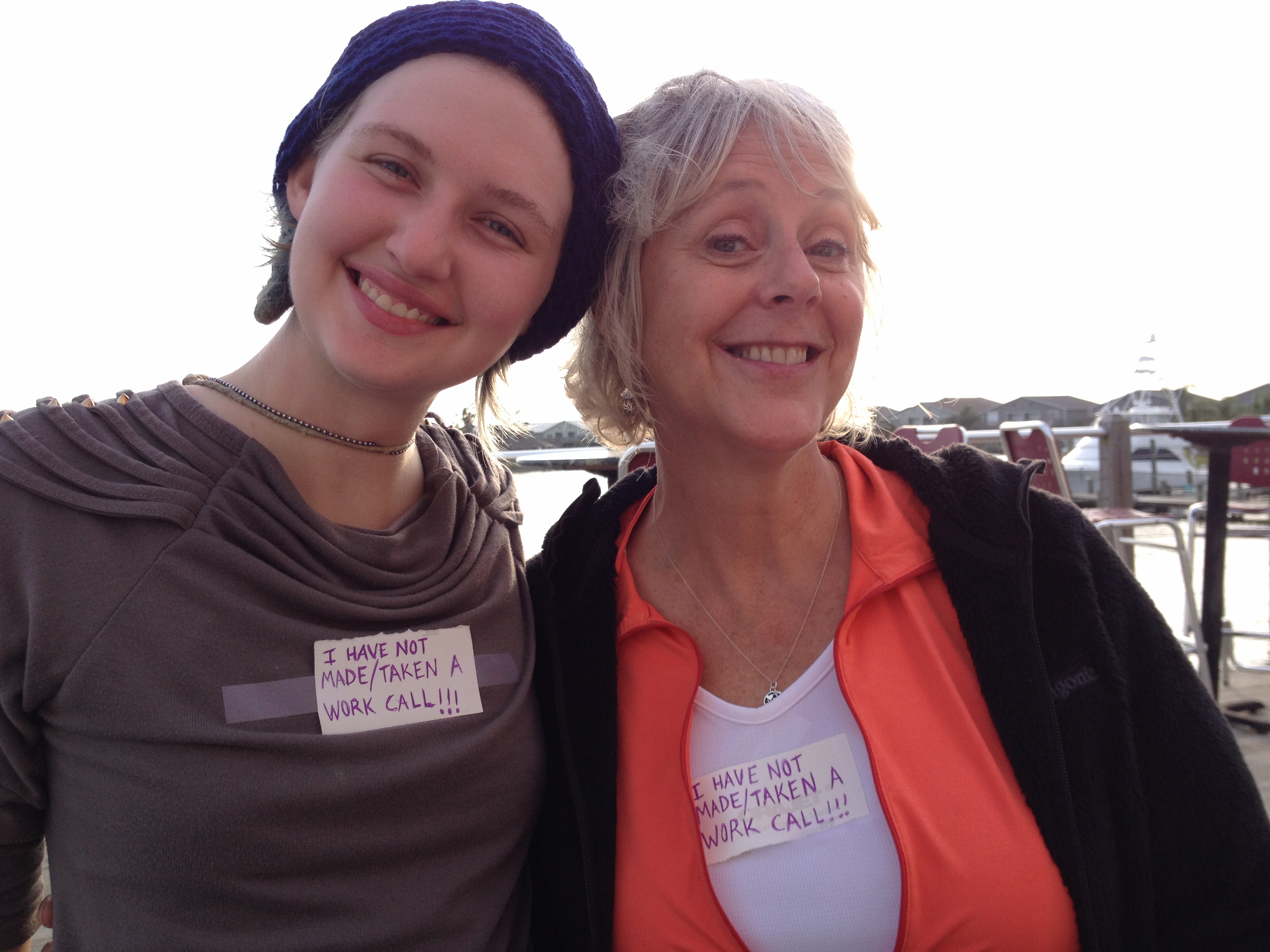
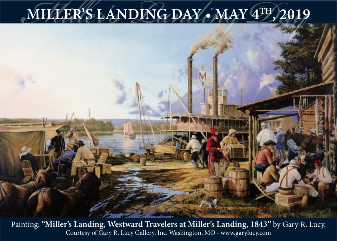
I’ll be in the river town of New Haven, MO, this weekend (May 4, 2019) for Miller Landing Days, a celebration of their historic culture and river history. I am listed as ‘story telling’ so that will be another avenue of review and preparation for writing. I’ll have t-shirts available to give away, or for a small donation.
I hope to share my progress on this LoveYourBigMuddy blog, hopefully getting it revved up again. I hope to post stories and photos to document further the adventure of it all. It may very well be that I have several chapters just on the first few days of the trip. I mean, a broken radiator, sleeping in our car at a truck stop in Wyoming after taking a wrong turn in a blizzard, a 6-hour ski into the source at the Continental Divide turned into 30 hours with no means for fire, food, or sleeping gear, day one on the water I nearly swamped my boat in a strainer and sprained my hand getting out of that mess, and the next day I ran into a shoreline snag on two different occasions, and popped TWO holes in my boat! SO MANY STORIES!
Welcome back to this LoveYourBigMuddy Expedition blog site. Please feel free to provide comments and ask questions. I will no longer be posting on 1Woman3GreatRivers, and will delete it soon. See You On The River!!!
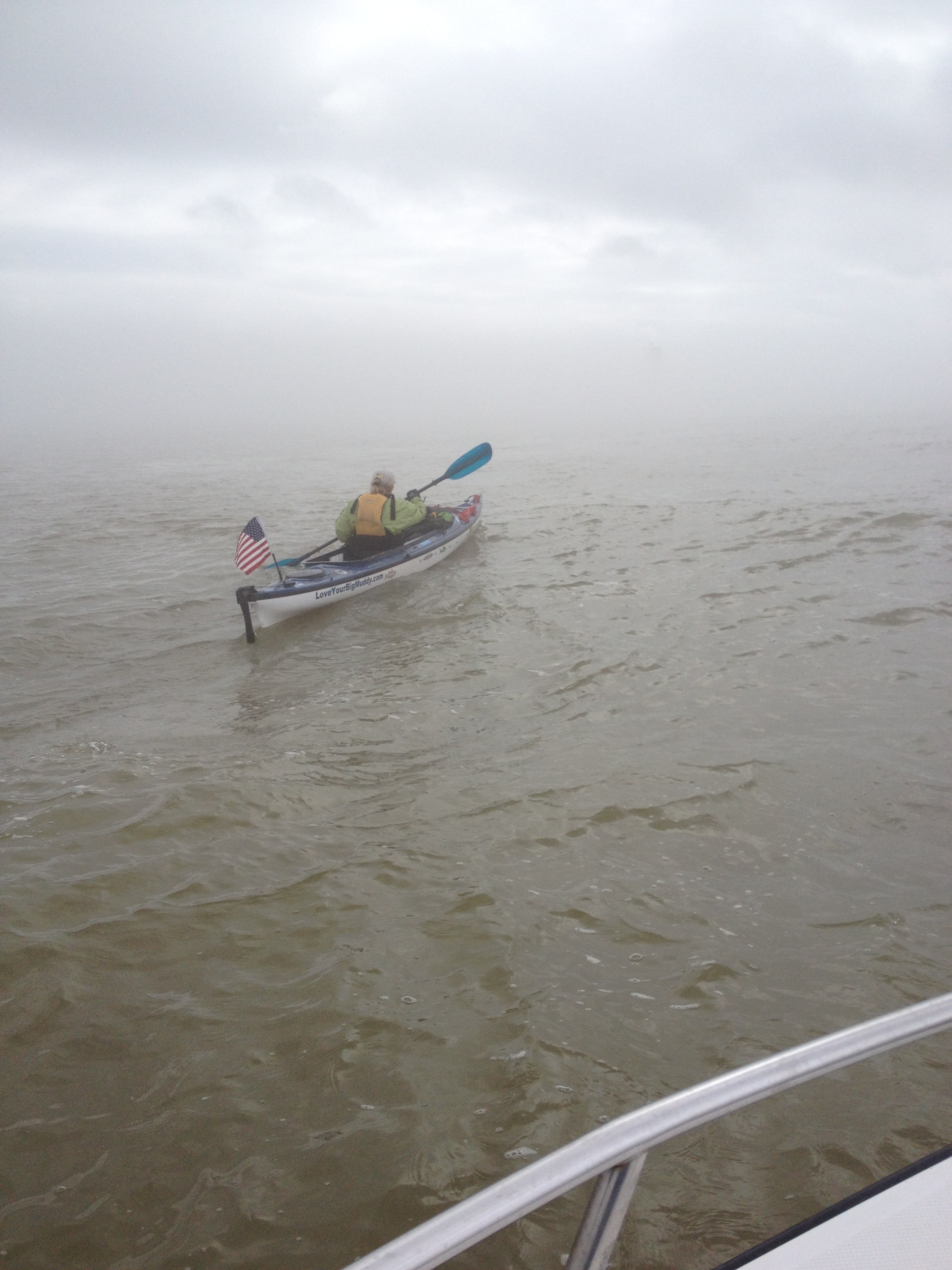
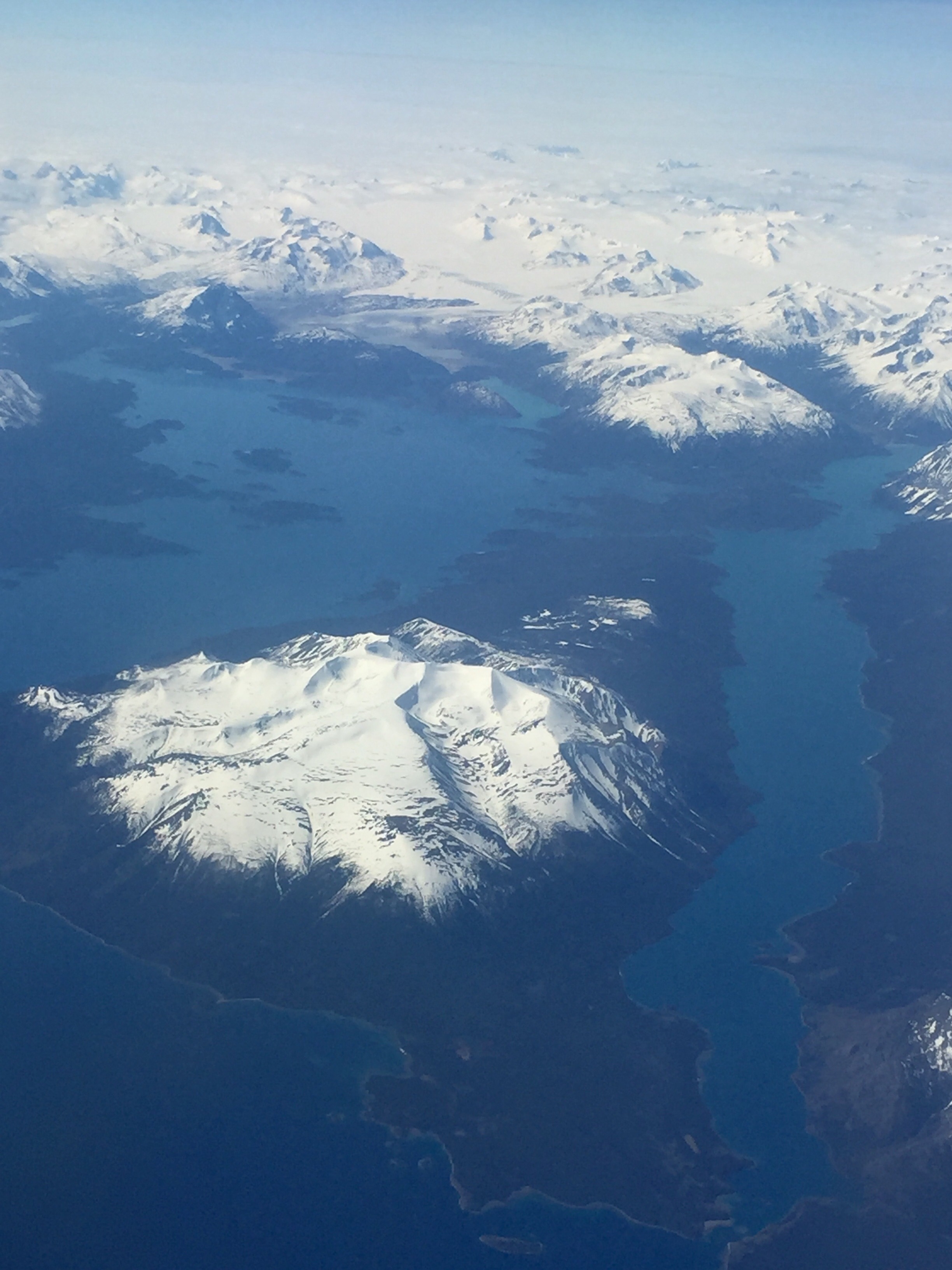
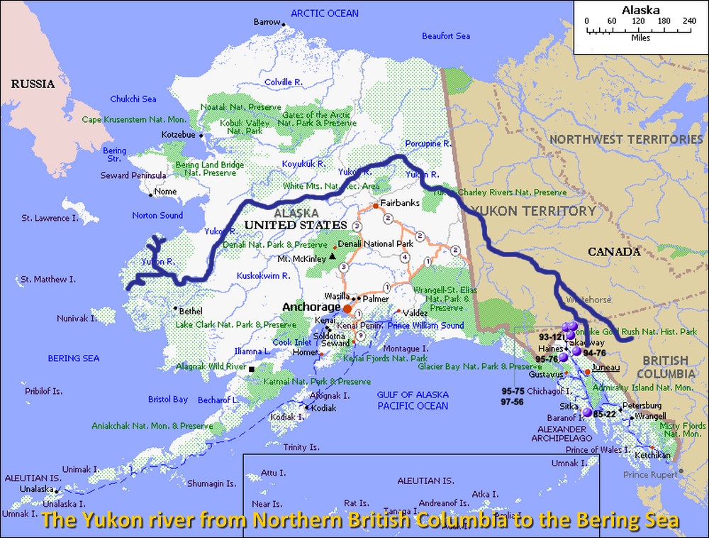
I will be traveling right to left, beginning at the source on Atlin Lake and the Llewelyn Glacier, and ending in the Bering Sea near Norton Sound, looks like.
Lots to do, lots to do. Last day of school was last Thursday, so there was only so much I could do while school was in session. Teaching is an overtime job, with barely enough hours in the day. I have been taking care of a few major planning details over the last month, though.
I have activated my Inreach-Garmin satellite communicator. I will have lots of time in the airports during layovers to fuss with it. My flight to Whitehorse is 19 hours on three planes, so I am looking at a lot of down time. I have sent a test message to my Facebook Page so I am on my way to being prepared.
I’ll be carrying the start manual with me so I can work this thing to the max.
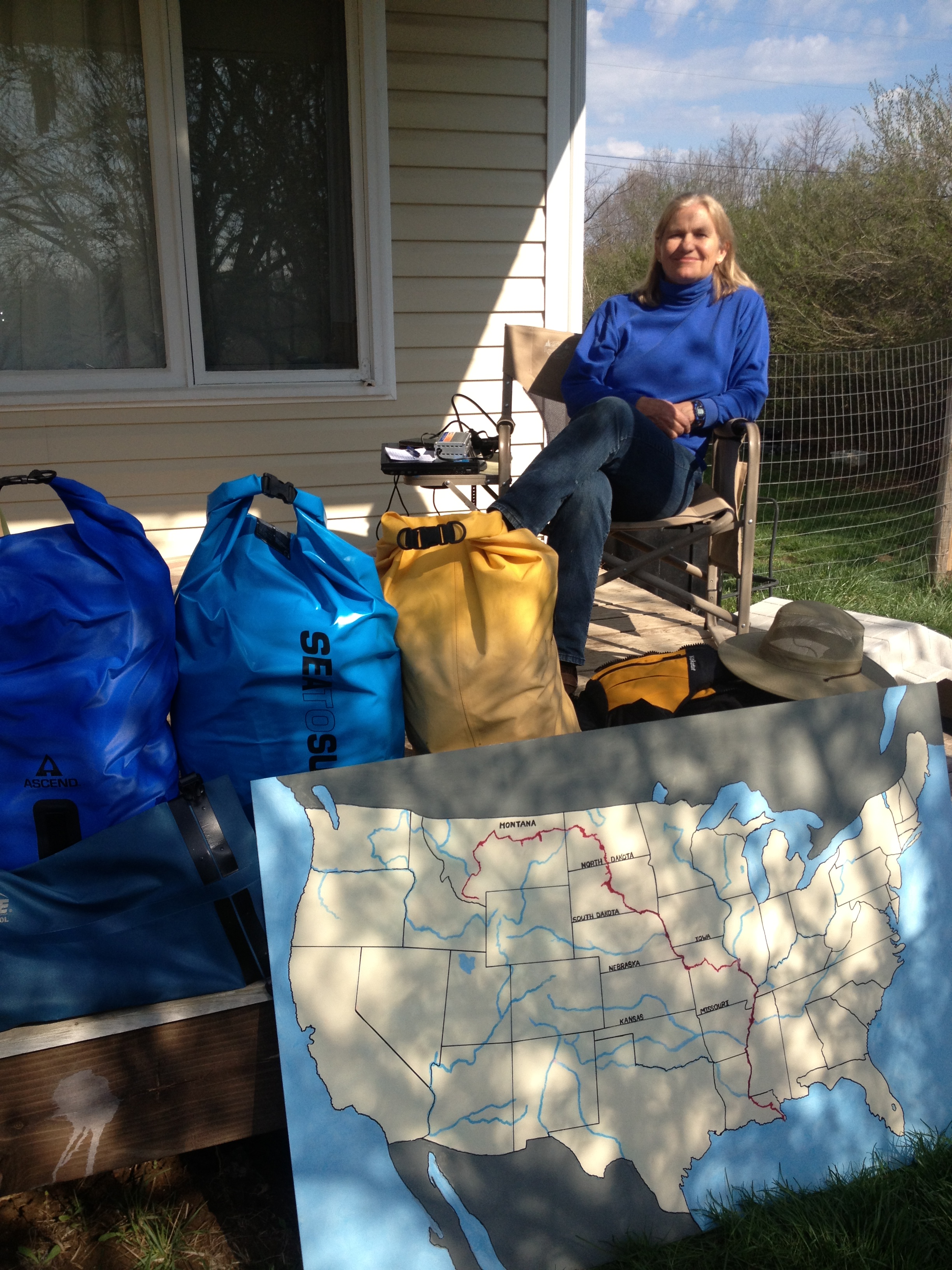
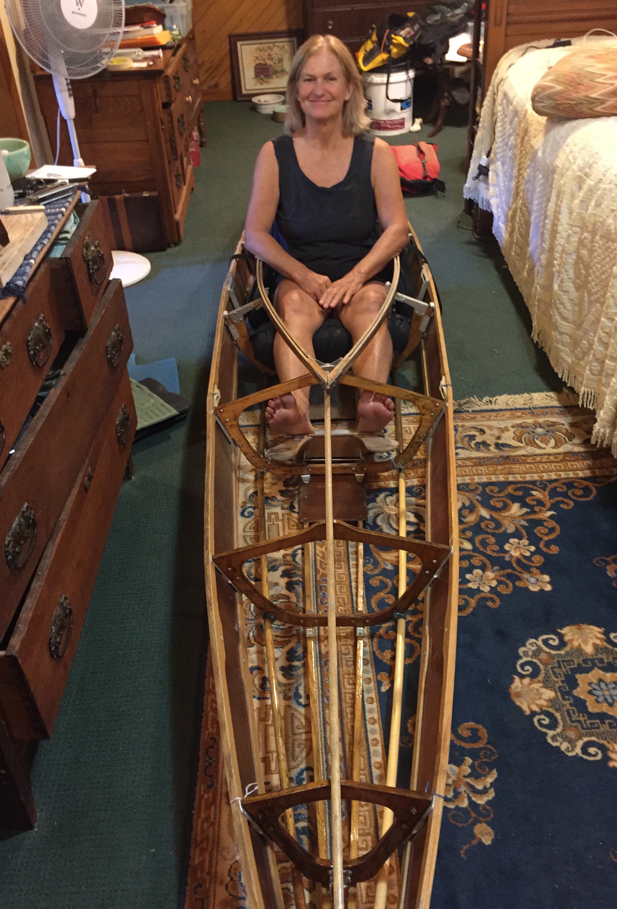
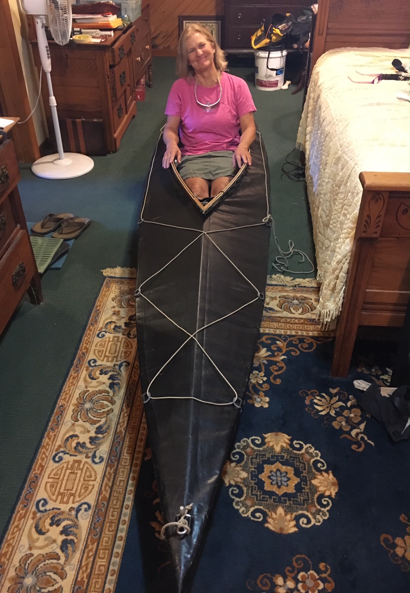
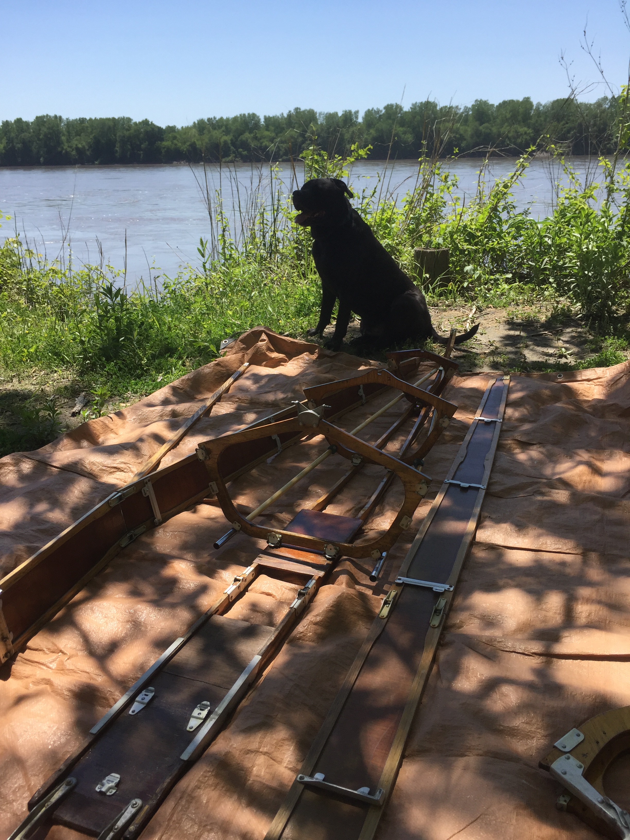
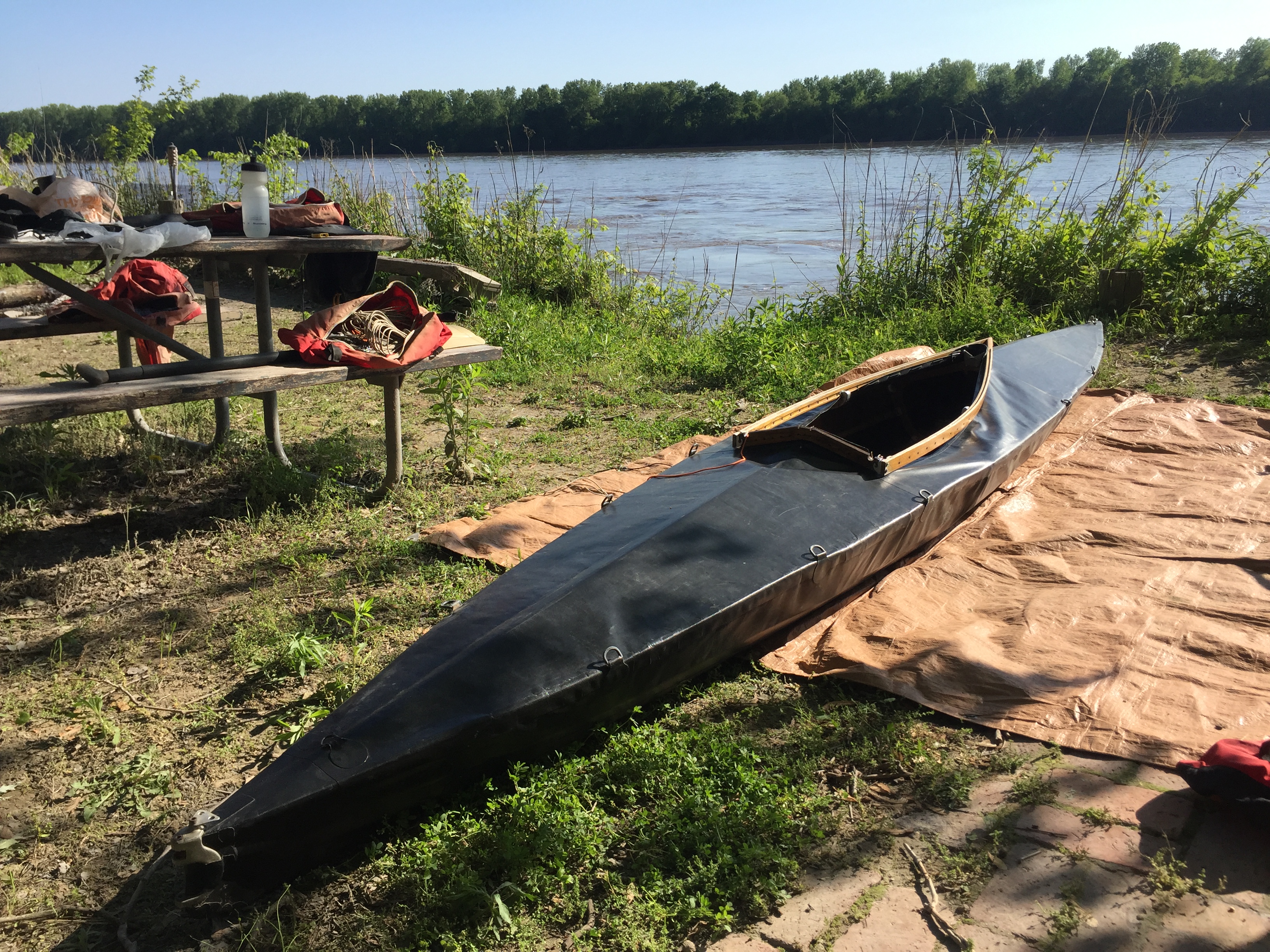
I have spent time twice in the last month assembling the Klepper T9 foldable kayak. I have a pretty good handle on it now. Today I will assemble one last time before leaving on Tuesday. I need to pack all my gear in little dry bags and figure out how everything will fit into the bowels of the boat. There are a lot of ribs to work around, making packing and unpacking a challenge in and of itself.
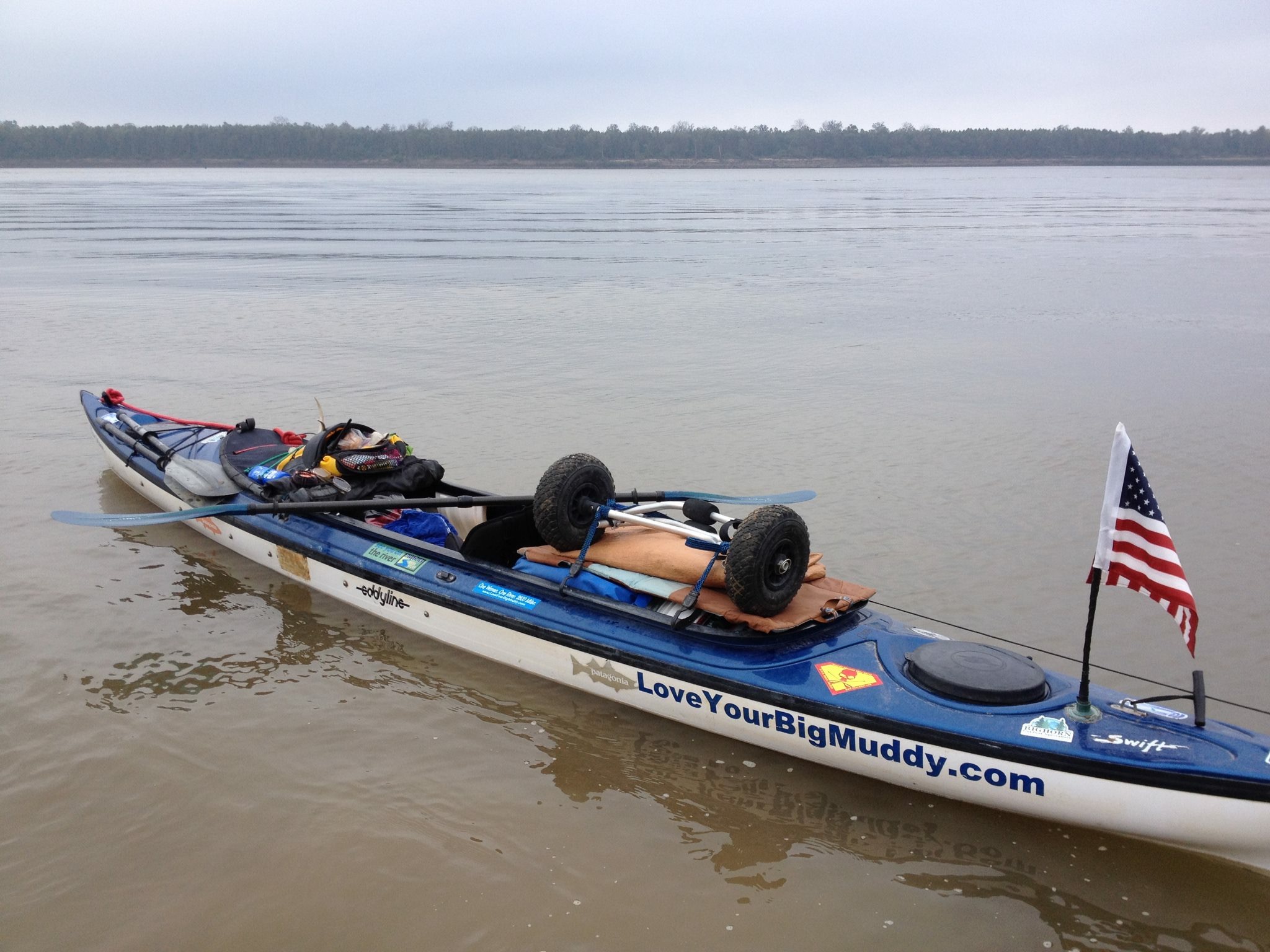
Small holes leading into small compartments. With only 14 feet of boat instead of 17 feet, I will be downsizing before I even start. Minimalist mentality.
Big thanks again to Cascade Designs for allowing me continued access to their PRO Discount for all of their gear companies: MSR (they make my tent and stove), Thermarest (the best sleeping pads), and Seal Line (source of my new dry bags).
Honestly, I am thinking the 20L bags won’t fit through my frame ribs. I need to figure this out today.
My assistant, Rio, keeping me focused on the task at hand. Is HE focused? On the river maybe…
I put together most of it on this dry run. A week later a did a full assembly, including lacing up the combing around the cockpit, and even took it for a little spin on a pond. Yes, this is indeed going to be an adventure…
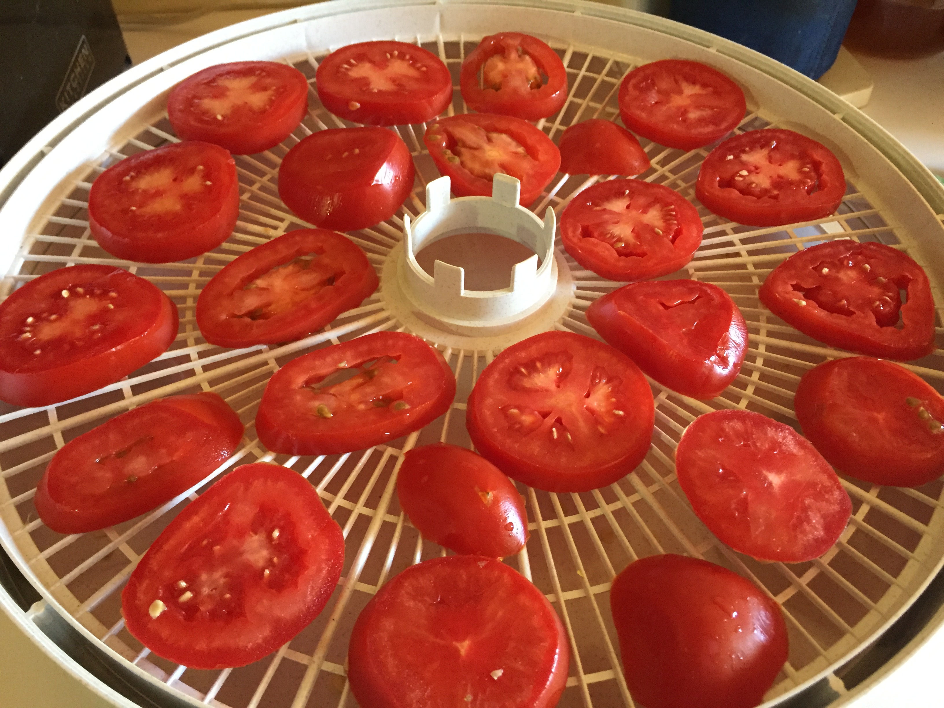
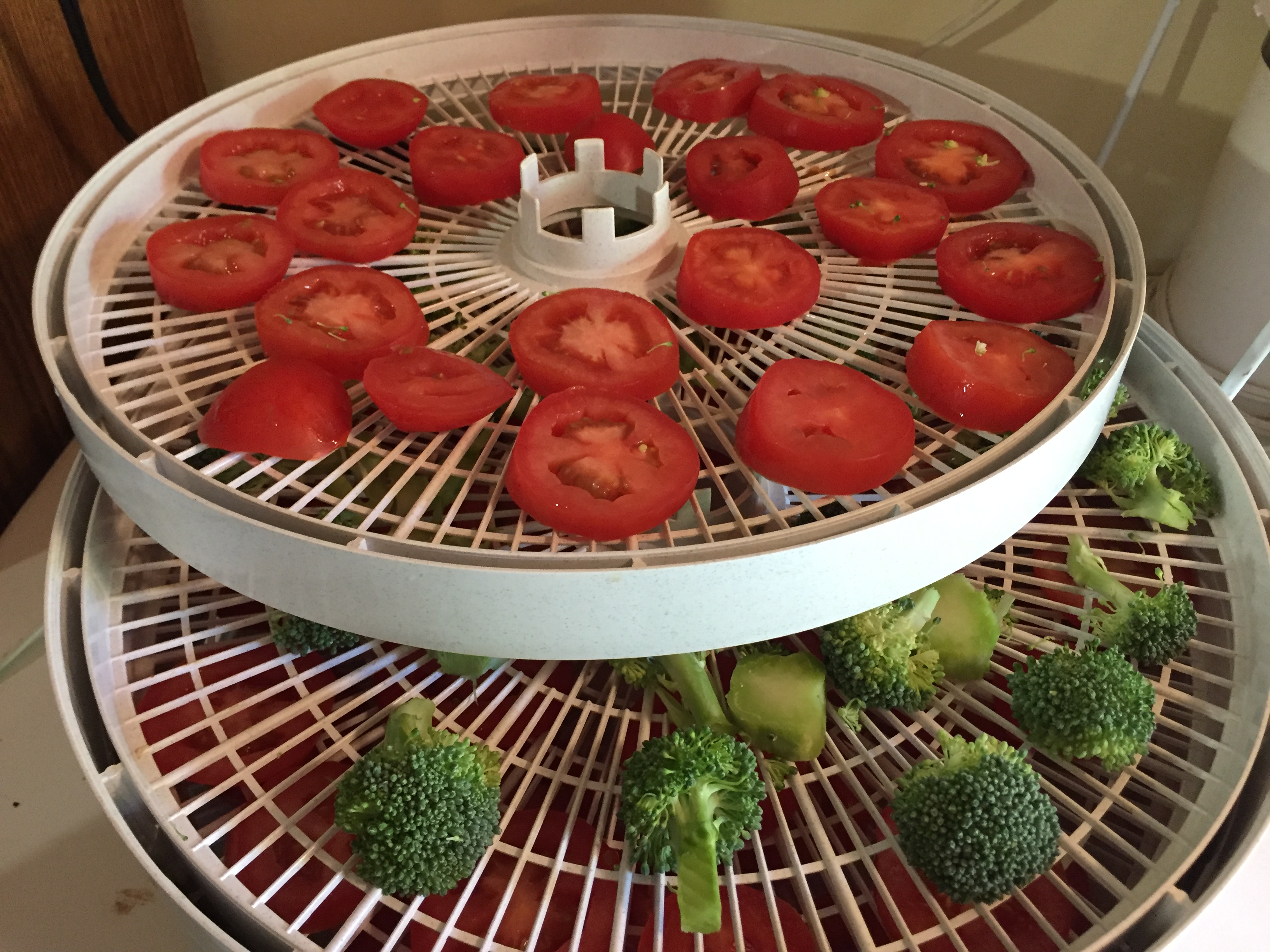
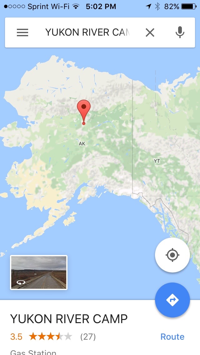
I have been dehydrating vegetables, fruit and jerky 24-7 this past week. A drying session can take anywhere from 6 to 12 hours, so the assembly line must keep moving. I am trying to dry enough so that I can pack a bunch in my resupply box being mailed to the Yukon River Camp located where the Dalton Bridge crosses the river. I estimate it is a little under half way. Veggies, Knorr Sides, dry milk, coffee, dark chocolate are a few of the resupply items I’ll be mailing away.
First batch includes two of my favorites, broccoli and tomatoes. I am also drying onions, sweet peppers, jalepenos, mushrooms, yellow squash, carrots, apples, strawberries and beef jerky. Vacuum sealing completes the job.
Approximate location of the Yukon River Camp at the Dalton Bridge where I will be shipping a resupply package.
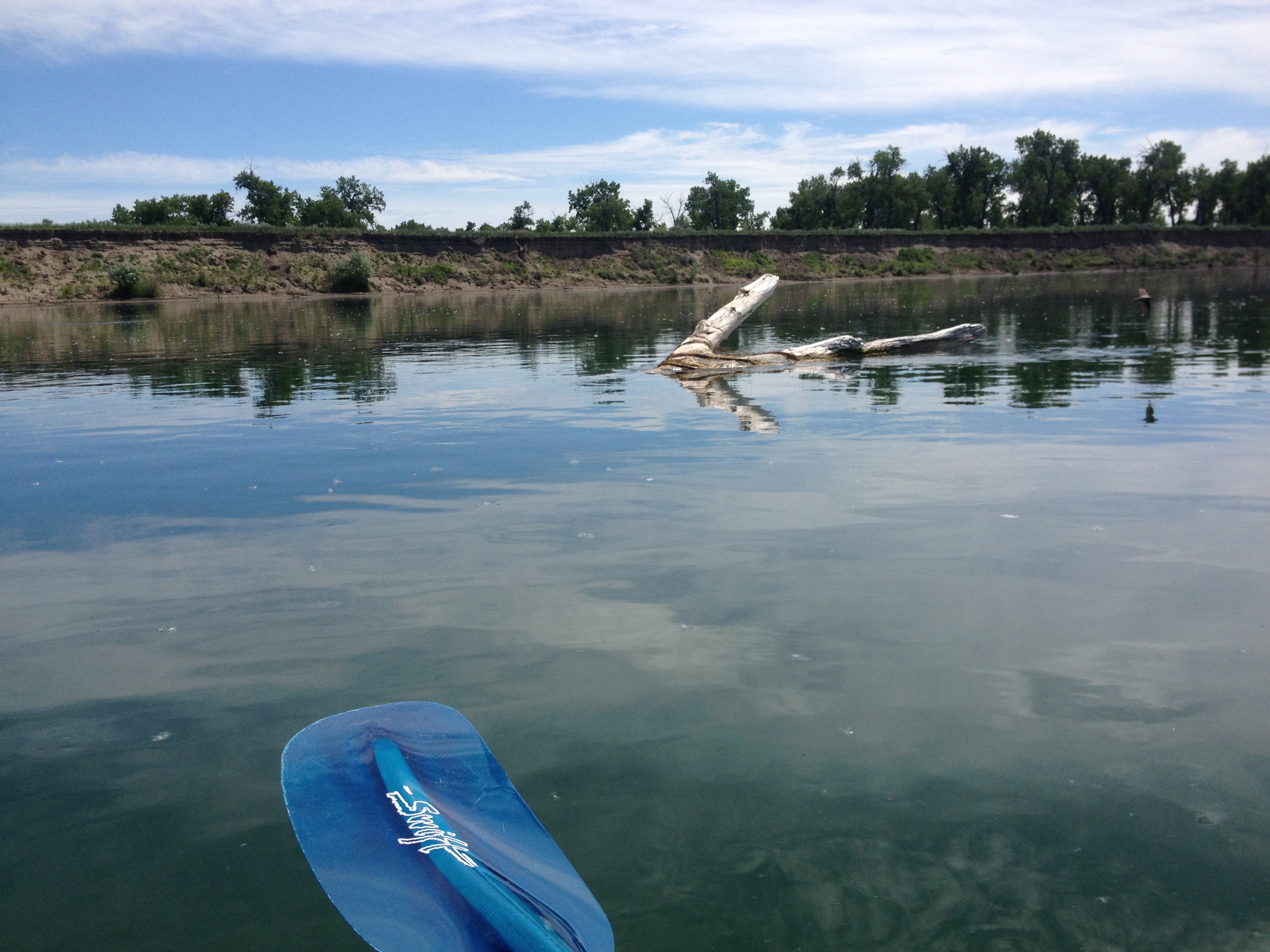
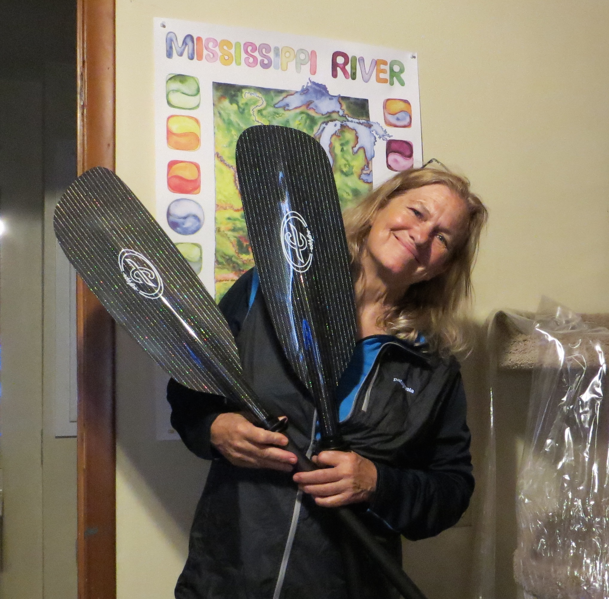
EDDYLINE KAYAKS-I’m just saying, I wasn’t going to pursue corporate sponsorship for this expedition, but Eddyline Kayaks, they’ve supported me all the way. They are the sweet friendship every expeditioner should have with a company. We weren’t able to feasibly work out boat support, but paddles have been a key component of their contribution to my success. Carbon paddles are extremely important for me as the feather weight makes so much difference in my case (more about that at another time). I asked them for a new carbon paddle and, without hesitation, I was granted one.
Thank you Lisa, and everyone at Eddyline, for your continued support of my loveyourbigmuddy expedition and, now, 1woman3greatrivers project. You have always been there to help me out, and for that I am hugely grateful.
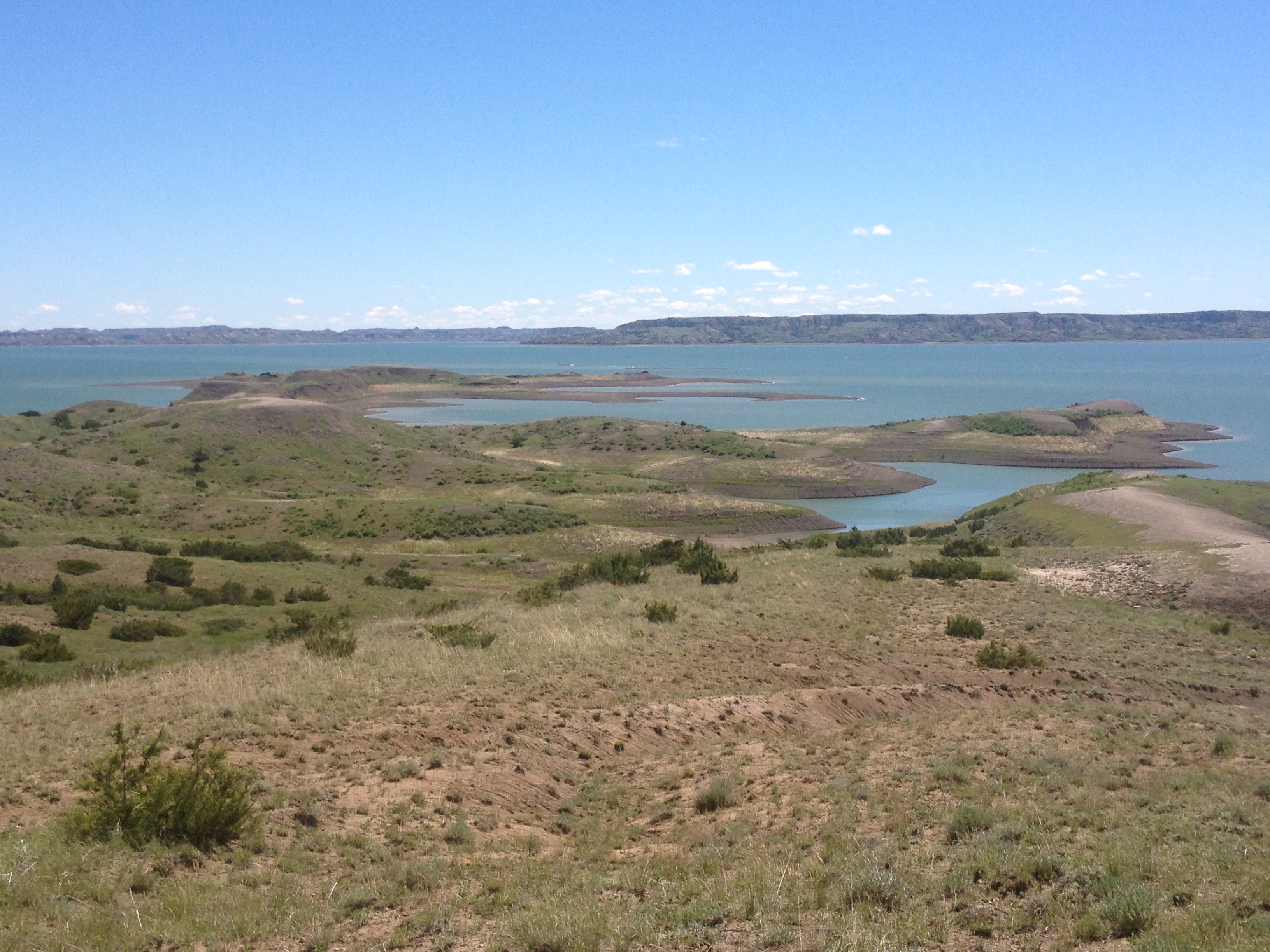
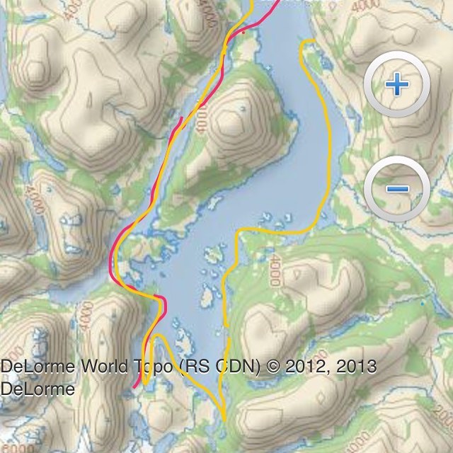
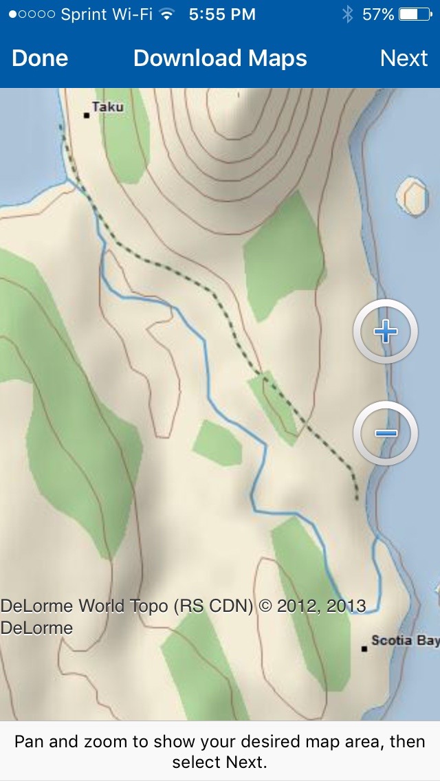
Here is a map of two potential starting routes. I can paddle a loop (gold route) down to the glacier on Atlin Lake, or travel down behind Teresa Island (pink route) with maximum wind protection. I would backtrack to get out, so I’m partial to the loop (gold). The road goes right to Warren Bay and a campsite is located there. I will find someone in Whitehorse to shuttle my rental car back to town after dropping me off. I am welling up with excitement at the thought of this stunning section of the trip. Taking it slow and easy to absorb and enjoy the beauty will be my MO–method of operation. 🙂
Once I get back up to the top of Teresa Island, I will head down the Atlin River to begin the long journey to the Sea.
Archie Satterfield, author of “Exploring the Yukon River,” writes: “It is recommended that you hire a guide in Atlin to help you down the Atlin River. The 3-km-long river drops 15 meters and runs at about nine knots; it is filled with rapids, boulders, backwashes and shallows. It is very dangerous for canoes and kayaks, less so for larger boats.” He goes on to say, “Obviously, many boats and canoes have run the river with absolute safety, and this is not intended to scare everyone away from it, but it is meant to encourage caution.”
I have already had conversations with some Atlin locals. I intend to have more. If it were easy, everyone would do it. We’ve got ourselves an adventure here, folks! Climb aboard!
ONE MORE THING: My Atlin contact and now known as, Atlin Lake River Angel, Hans wrote in an email to me yesterday:
“Hi Janet,
Good to hear from you!
Atlin Lake started opening up a few days ago – there is no longer ice from town all the way south as far as we can see. After next week it should be all melted and ready for any adventures.”
Music to my ears, Hans. Thanks so much!
ATLIN WEATHER FOR NEXT WEEK??? Sweet stuff…
I should arrive to glorious weather in Atlin around Saturday. All systems GO! Ya Ya! Doin’ the Happy Dance. Cheers!
Do what you love and love what you do. Until next time…
Don’t forget to follow along on my Facebook Page: LoveYourBigMuddy Expedition. And, I am going to try and post on Instagram, too, for my students who are following me. #loveyourbigmuddy
I am attempting to transition from LoveYourBigMuddy.com to my new site. Please visit and follow my new blogsite for the 1Woman3GreatRivers Project. I will be launching at the Mississippi River’s source, Lake Itasca, MN, on or about May 25. And, well, you know the routine…I will try and post more blog entries this trip along with my Facebook posts.
Change is Good. [Logo design by Jonathan Lauten]Expedition planning and spinning plates have a lot in common. Both are overwhelming, both require diligence and focus, and both will reward you with success and accomplishment, despite the intermingling with falls, drops and crashes. A plate spinner is persistent and does not ‘bag it’ when plates fall and shatter. An adventurer does not ‘bag it’ when planning confronts obstacles. Nope. They get back on the path called “onward” and forge ahead, come hell or high water! [idiom meaning “no matter what”]
Decision is the key! Decide to take a risk, and pursue an adventure. Decide to spin the plates, and keep picking them up, try again, spin ‘em, drop ‘em, try and try and try again. DECISION spawns DESIRE. This is the dynamic duo one needs to accomplish grandiose goals, pursue the unattainable, and conquer the impossible! Yes, spin plates and dance at the same time…
I have created a new blog site, 1Woman3Great Rivers Project @ 1woman3greatrivers.com, for my next adventure package. This new project will have me paddling from source to sea the three longest rivers on the continent: The Missouri River (done), The Mississippi River (2016), and The Yukon River (2017).
I am very excited about paddling these rivers and rigorous planning will begin soon. Actually, I’ve been working on it for several months. I do not want to lose you as followers, so please consider following my new blog site. I will try to arrange my new posts to copy over here, but I am still learning much about navigating between these two websites.
Here is a copy of my first and only post on my new site. Stay tuned for more to come.
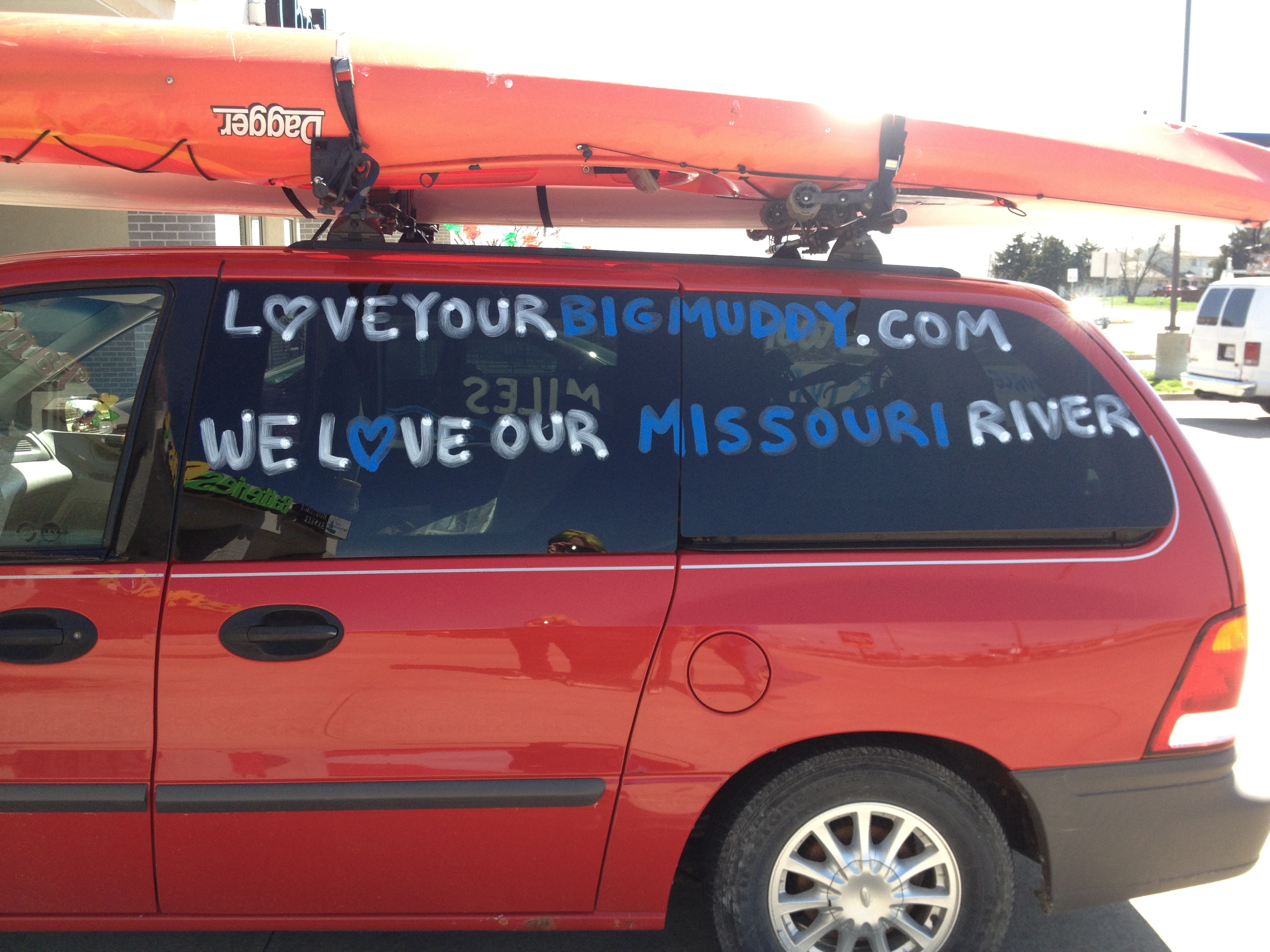
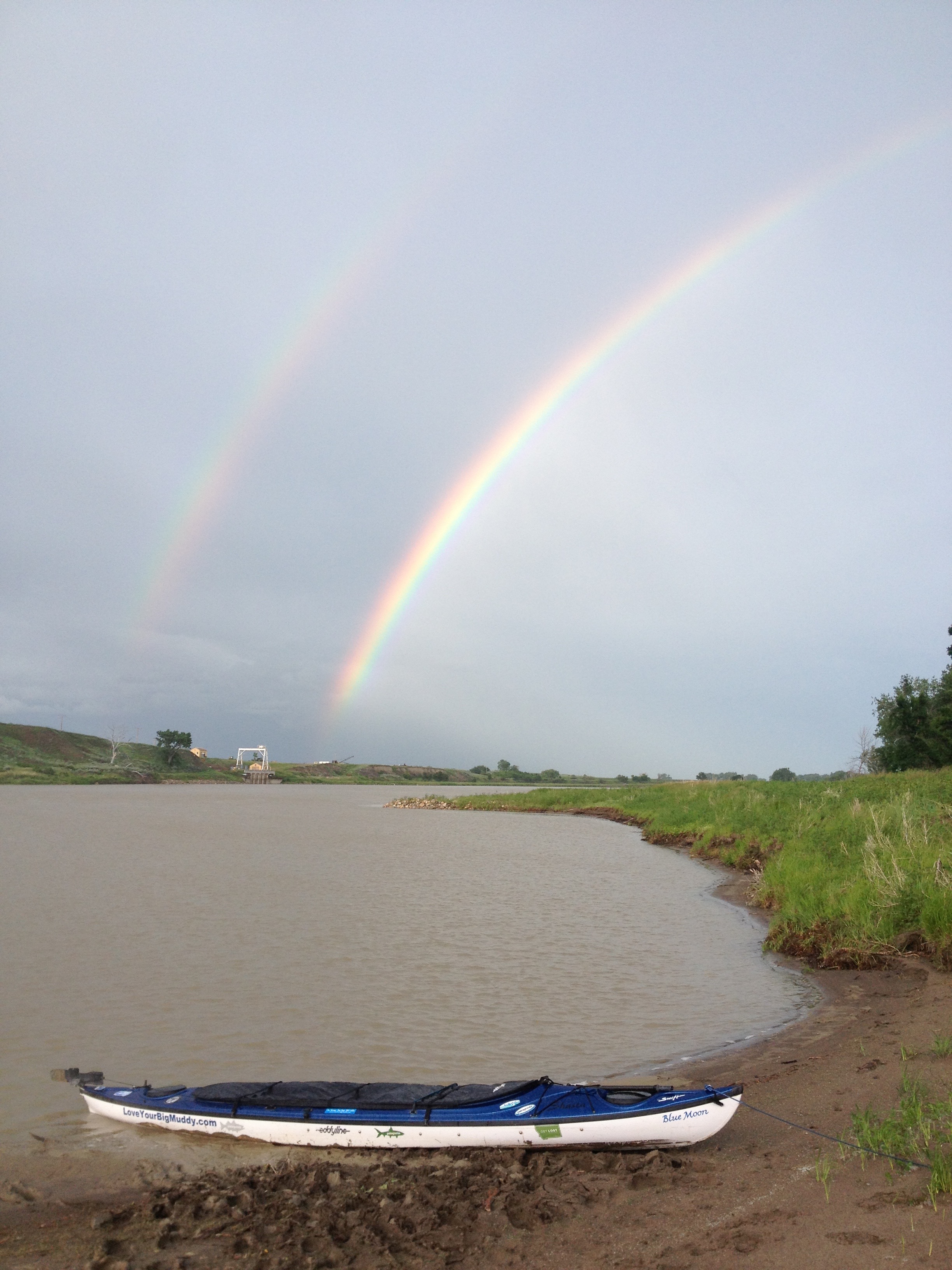
They don’t call it the “Big Muddy” for nothing, that’s for sure. Haha!
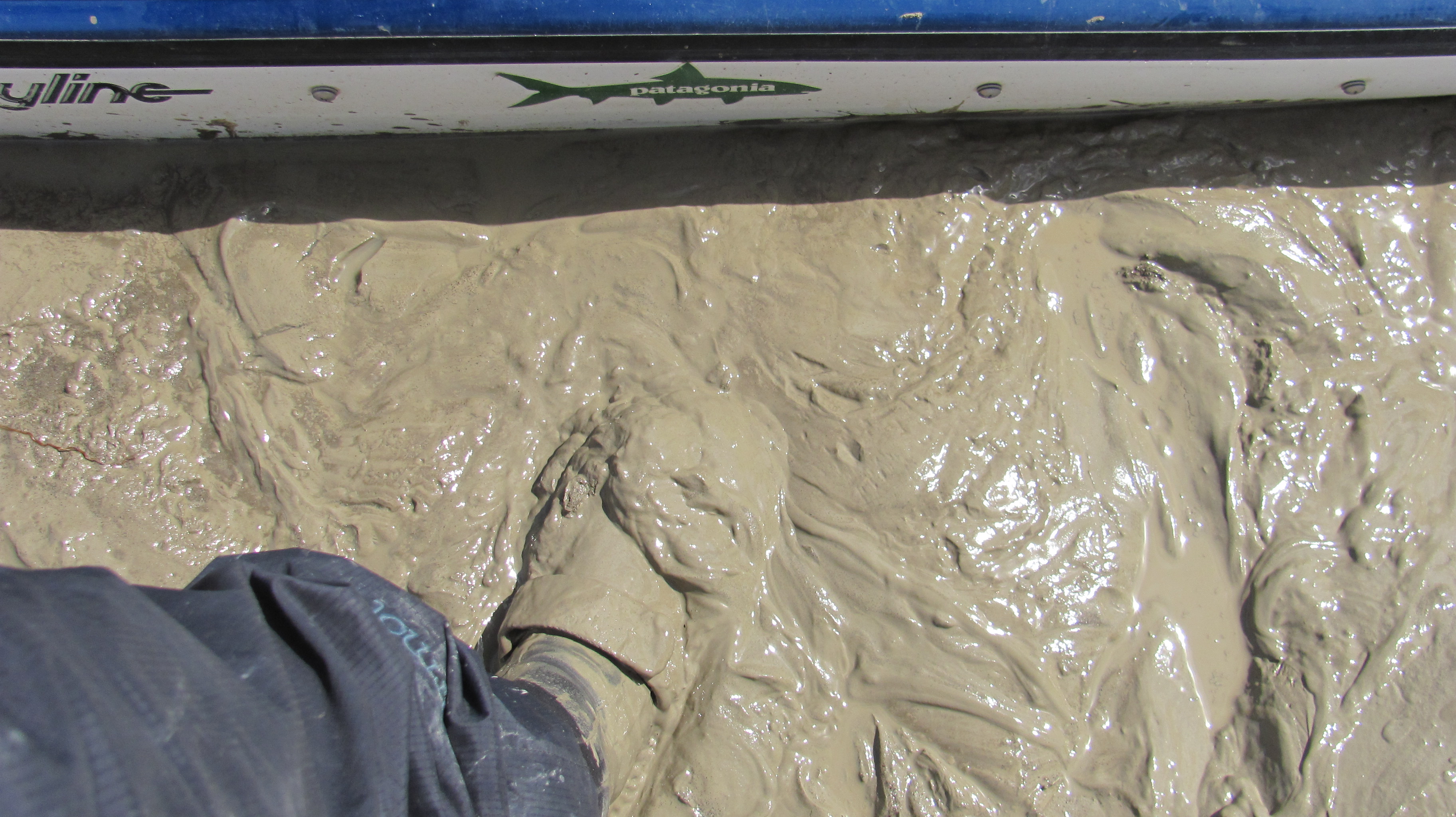
The Great Missouri River is referred to as the Big Muddy. But, hey, so is the Great Mississippi River. As numerous paddlers of both rivers know quite well, these two rivers can be, indeed, quite muddy. While paddling down the Missouri River on my LoveYourBigMuddy Expedition in 2013, I have to admit the mud was abundant on the upper stretches, but silky soft and rather clean. I know, right?! “That’s impossible,” you say. I actually found that going barefoot in this mire of mud was the best way to go. Once in the boat my feet washed off easily, and off I went. That’s not to say that I wasn’t glad when the earth hardened up. Joy filled my soul with the simple pleasure of dirt, rocks and sand replacing the squishy brown muck.
In the Upper Missouri Breaks National Monument following a multi-day rain deluge
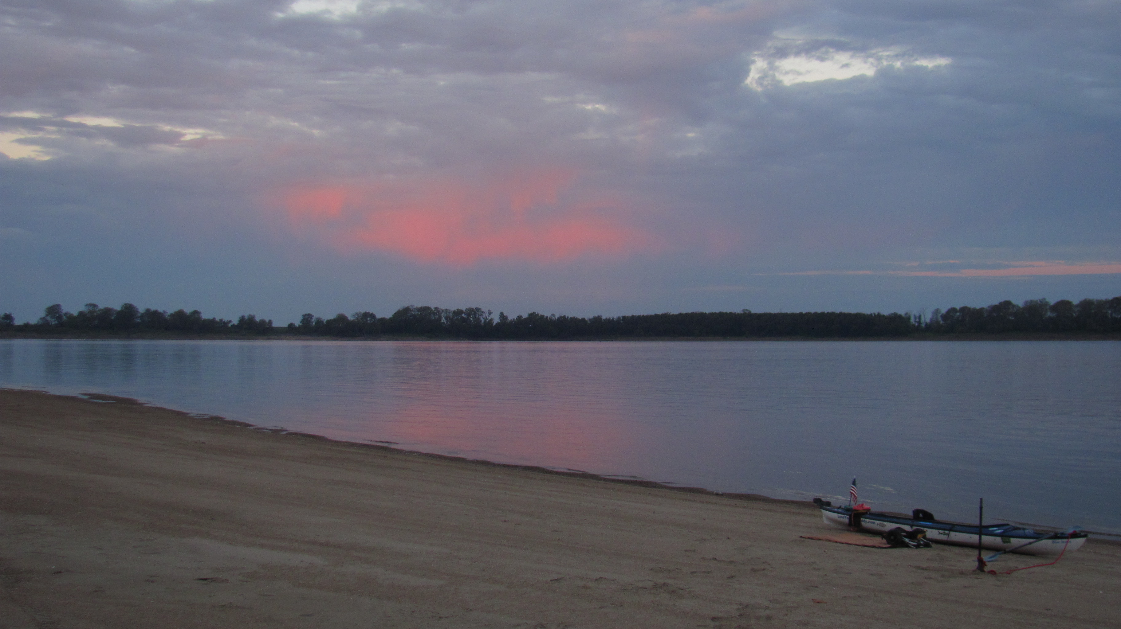
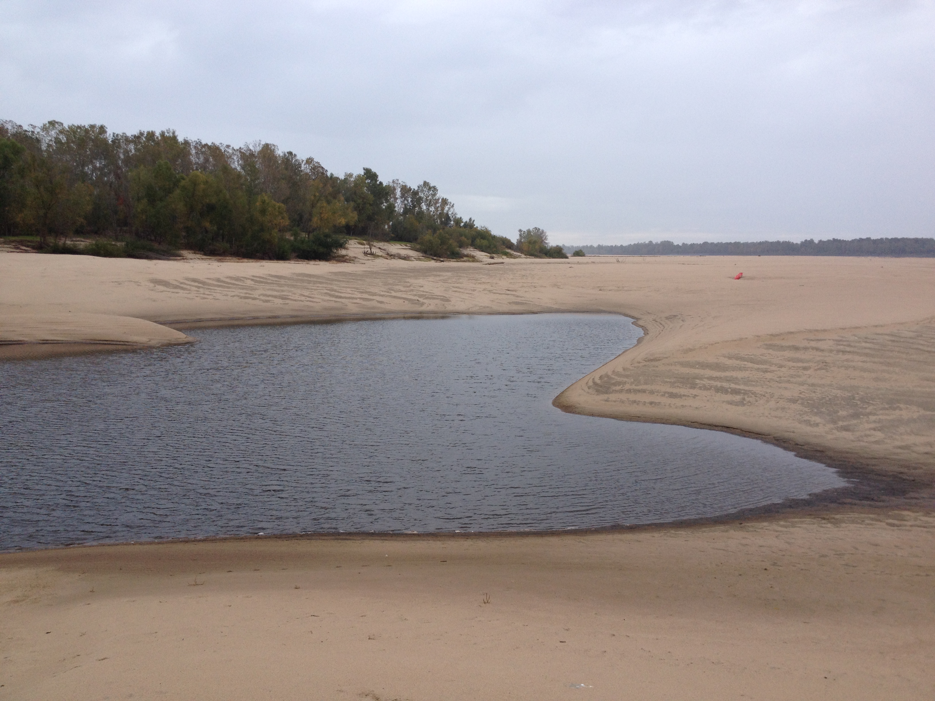
Ahhh, yes, the glorious sandy beaches of the lower Mississippi. Well, in 2013 they were glorious. 2015 was quite a different story with the river running flood stage all summer, and paddlers scrambling for dry land on which to sleep.
A Mississippi Blue Hole is great for a refreshing swim and/or careful bath. Blue Holes are created when the main river drops below the level of the sand bar, losing its connection with the pool. What a sand bar!!
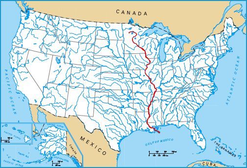
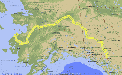
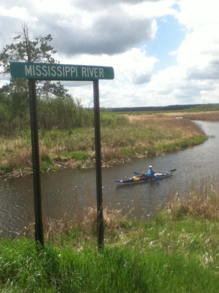
I will be heading north to Lake Itasca, MN, the source of the Mississippi “Big Muddy” River, this May to begin a source-to-sea paddle of this other great river as part of my 1Woman3GreatRivers Project. My goal is to solo paddle the three longest rivers in North America. The Missouri River is the longest river on the continent at 2,540 miles, according to the United States Geological Survey (USGS), with the Mississippi coming in a close second at 2,320 miles (per Environmental Protection Agency-EPA). The third longest river is the Yukon River at 1,980 miles (per USGS), which I will attempt to paddle in 2017 from its source at Atlin Lake’s Llewellyn Glacier, to the Bering Sea. Yukon River means “Great River” in the Gwich’in language. “The Gwich’in are the northernmost Indian Nation living in fifteen small villages scattered across a vast area extending from northeast Alaska in the U.S. to the northern Yukon and Northwest Territories in Canada .” (http://ourarcticrefuge.org/about-the-gwichin/) More about the Gwich’in Nation, the Arctic National Wildlife Refuge, and my 2017 Yukon Pursuit later.
Yukon River
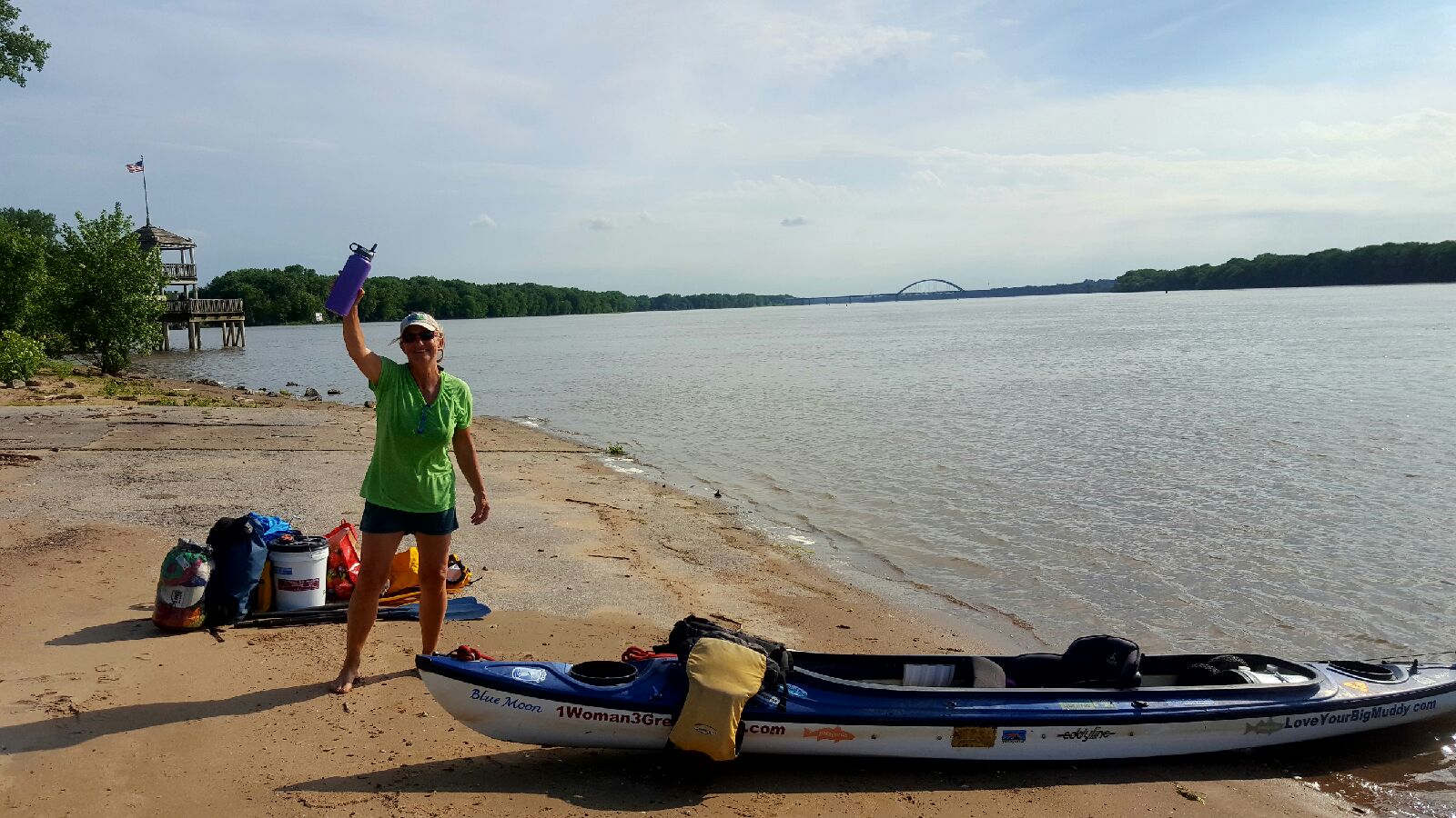
I look forward to paddling the entire Mississippi River this trip so I can understand more about our nation’s historic and cultural monument, and to build upon that very magical and personal relationship we started in 2013. Here is a video snippet from LoveYourBigMuddy Expedition taken in early November on the Lower Mississippi. Love Your Big Mississippi 🙂
Now that I am teaching full time, my challenge is to complete my adventure in 60 days (70 days, perhaps, if we have no snow days), during my summer break. I am confident that my outcome will be successful and full of celebration, but my tempo will be vastly different from my Missouri River expedition, being challenged in strength, both physical and mental, and in endurance and stamina. Dictionary.com defines endurance as: “theabilityorstrengthtocontinueorlast, especiallydespitefatigue,stress,orother adverseconditions.”
I say, “Bring it on”!!!
I hope you will join me on this journey down our continent’s Great River to the Gulf.
Live slow ~ Paddle fast
Peace and Love, Janet
Know your river. Touch your river. Love your river.
Arrival at the Gulf of Mexico on December 5, 2013.
On April 14, 2013, I left Columbia, MO, and set out on an extraordinary solo kayak voyage down the 4th longest river system in the world, the 3,800-mile Missouri-Mississippi River System. Upon completing the expedition on December 5, 2013, I became the first American, and first woman, to traverse the entire river system from source to sea.
Okay. One step at a time. Breathe…
Packed up and ready to go on April 14, 2013
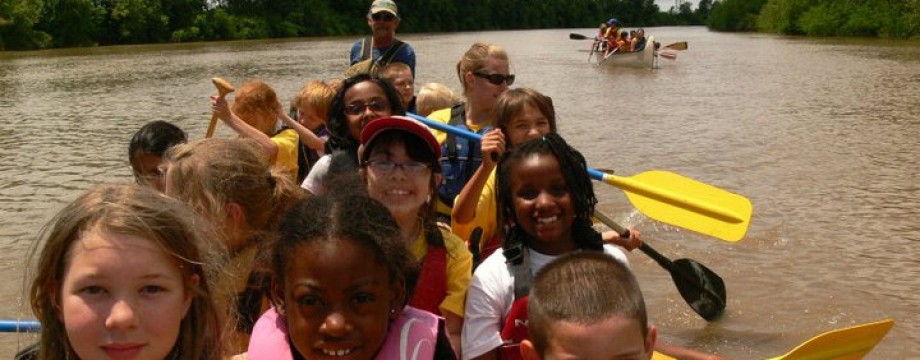
My mission began as an empowerment model for our nation’s youth, showing them that dreams can be achieved through decision, desire, and details (and hard work). The mission soon flourished into an empowerment model not only for youth, but for adult women and men as well. At 57 years old, I was living proof that neither gender nor age should prevent you from pursuing your dream. Not only that, the expedition embraced education and environmental stewardship by bringing awareness to Missouri River Relief, a not-for-profit river clean-up and education organization. Our hope is to bring the Missouri River into the classroom, and the classroom out to the river. Touching the river, knowing the river, and loving the river are key ingredients to sustaining the health and vitality of our planet’s veins and arteries.
Welcoming party in Memphis, TN
Bringing the classroom out to the river. Photo by Missouri River Relief
The next generation-Photo by Missouri River Relief
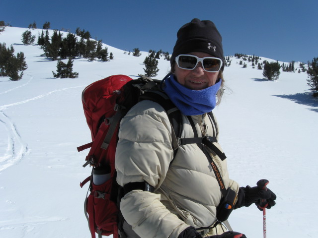
The adventure began on April 24, 2013, when Norman Miller and I skied into the ultimate source of the Missouri River, Brower’s Spring, in southern Montana near West Yellowstone. We planned for 7 hours and finished in 31 hours, much to our surprise. We spent the night in the mountains with no sleeping gear, food, or fire. Let the adventure begin!
After a 30-year absence I was delighted to be ski mountaineering again.
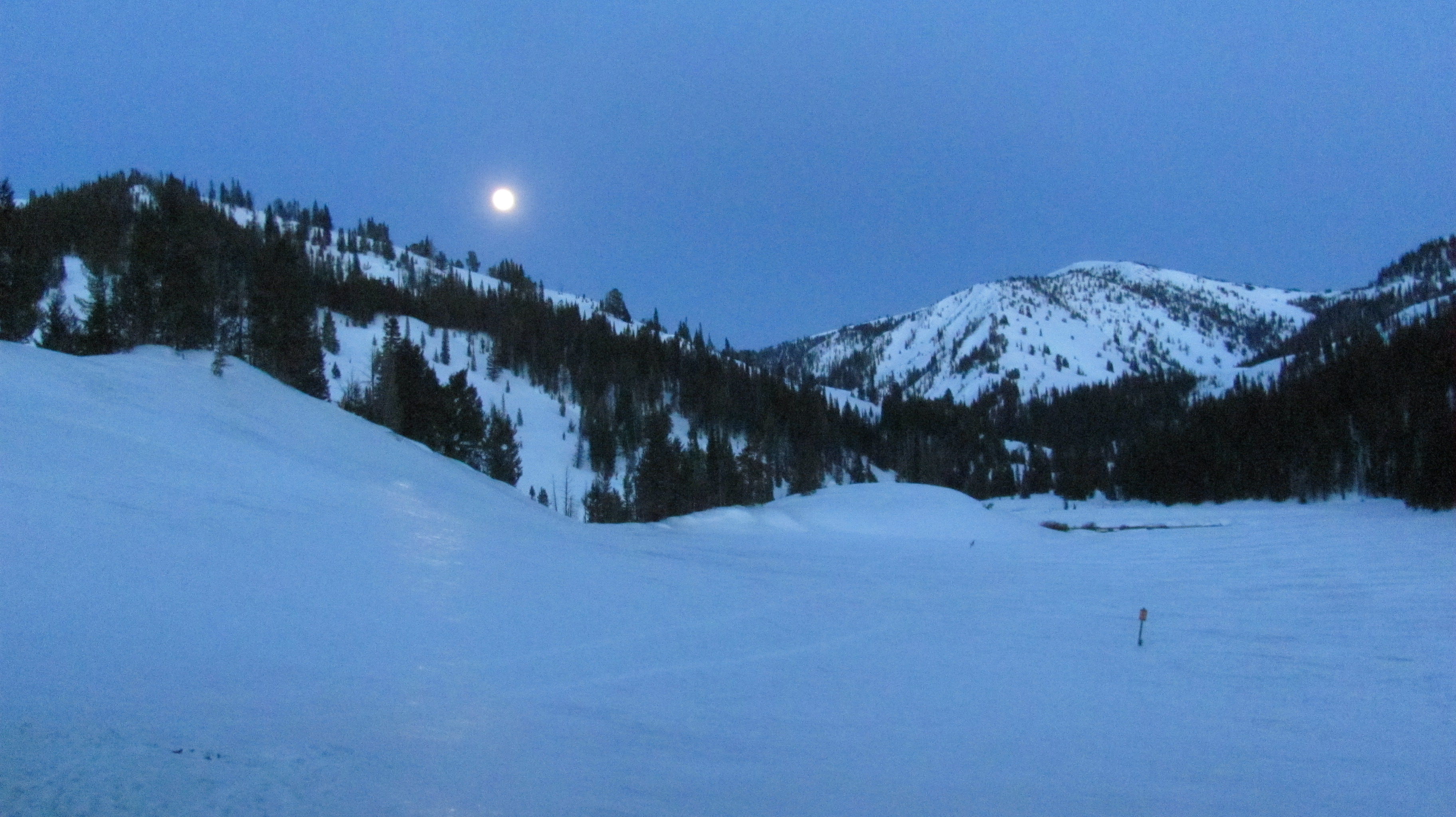
Our impromptu shelter and our celebratory beer, now turned carbo provider.
Conditions could have been life-threatening with any kind of weather. As it was, we just layed awake all night shivering.
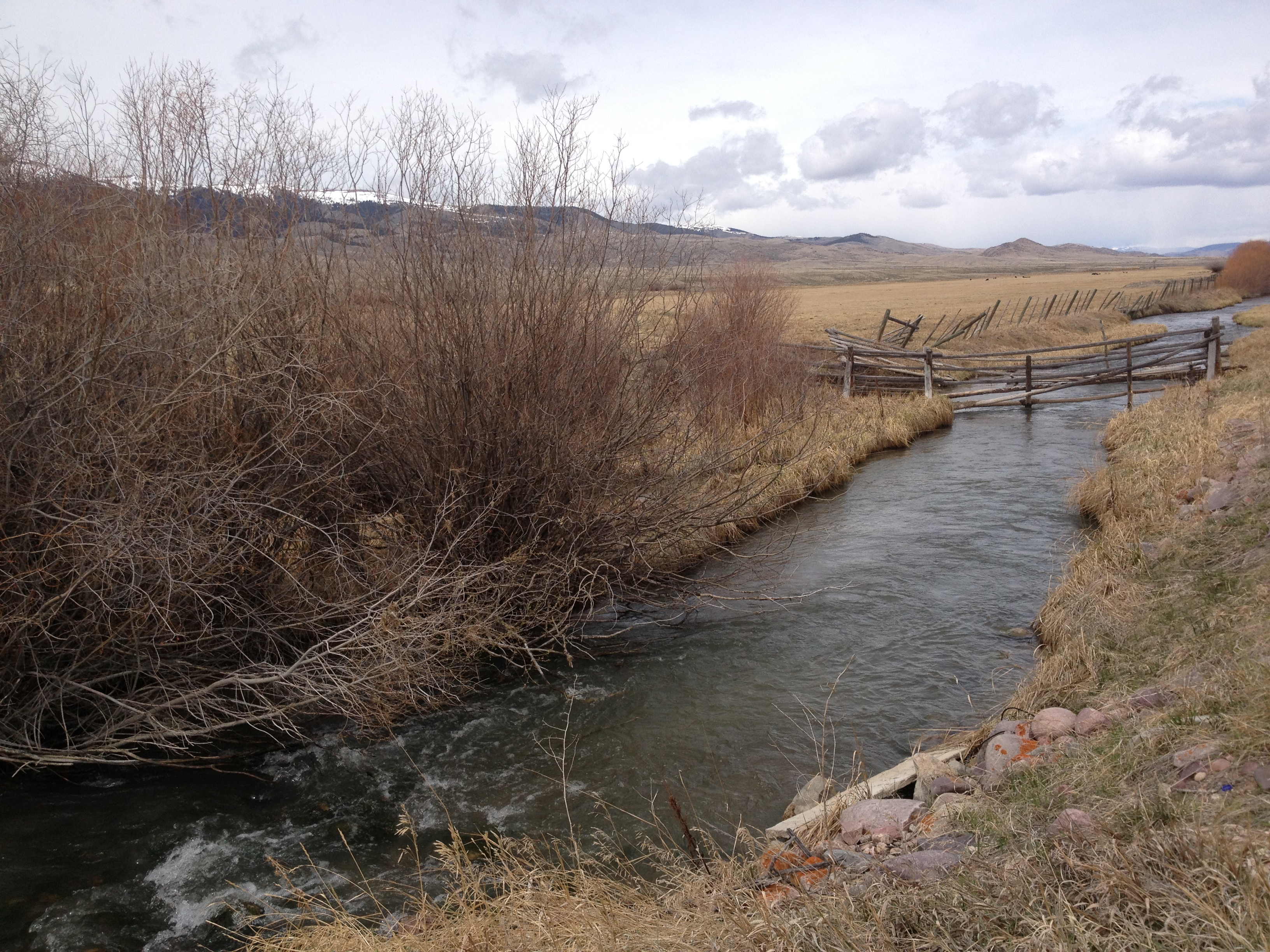
The next leg involved biking 100 miles through the Centennial Valley. This dirt road traversed Red Rock River to Clark Canyon Dam. The Red Rock River is not paddler friendly as it is full of man-made dams composed of barbed wire, wood, electrical wire, and corrugated sheet metal. I put my kayak in the Beaverhead River below Clark Canyon Dam on May 1, 2013. The Beaverhead eventually turns into the Jefferson River, which becomes the Missouri River about 200 miles downstream at Three Forks, MT.
Any amount of rain would have rendered this road useless for travel, car OR bike, because of the mud. My expedition was blessed with ideal weather conditions.
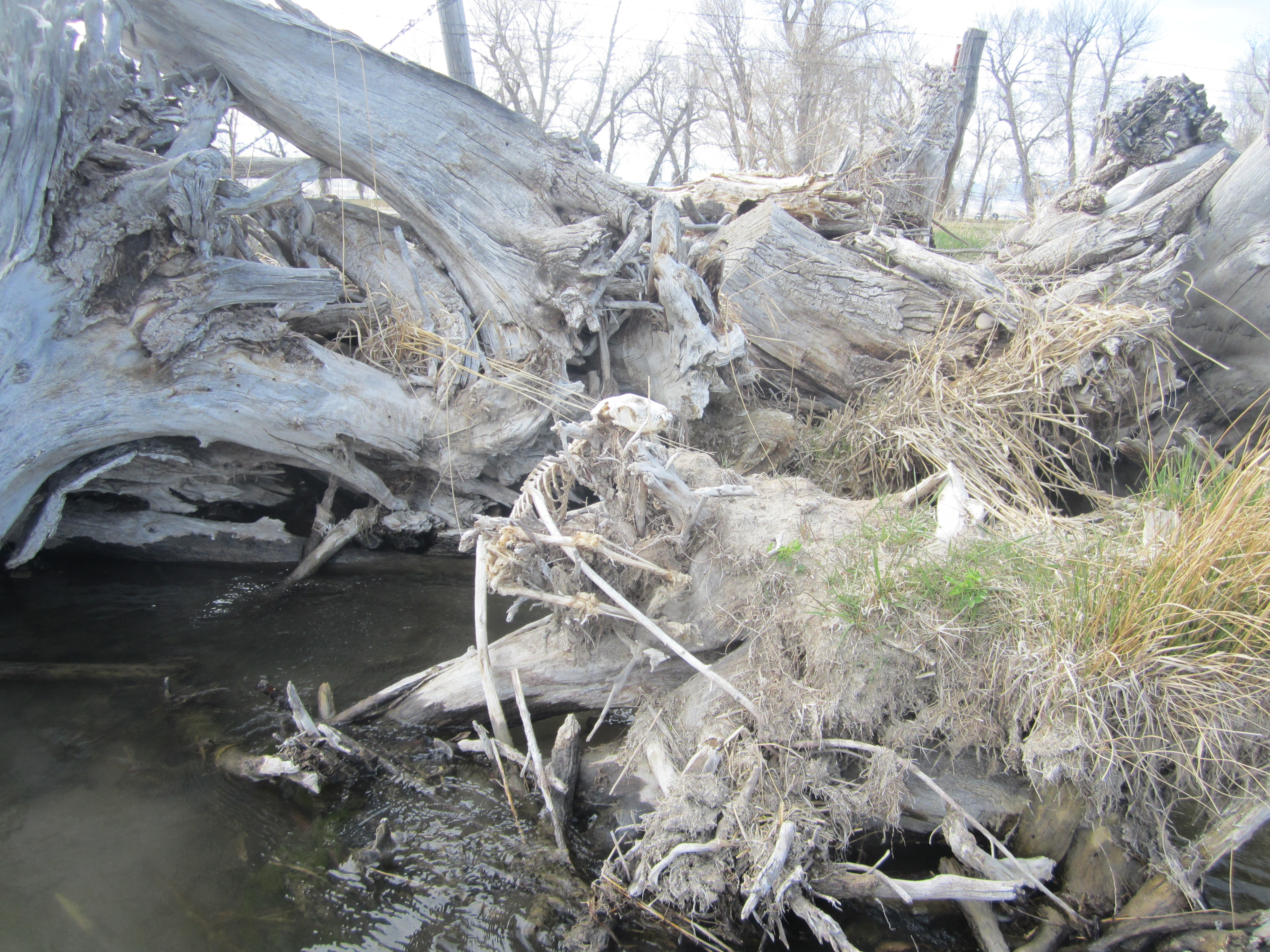
Red Rock River obstruction, one of dozens, making paddling slow, laborious, and dangerous.
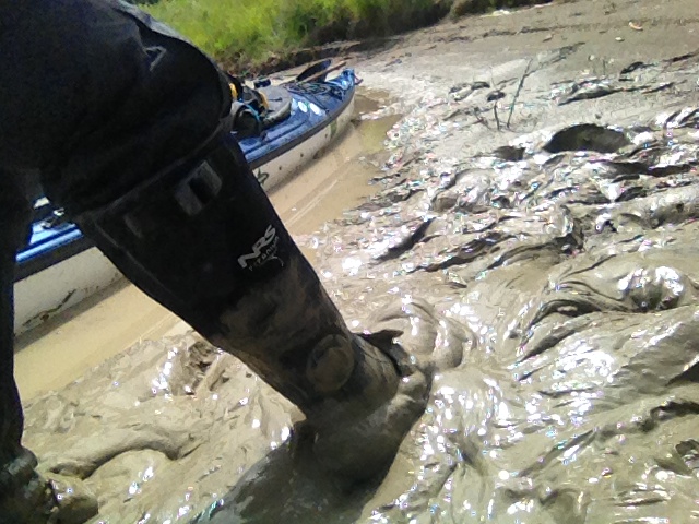
My first day was a test of will as I became entangled in a tree strainer, spraining my hand and nearly dumping my boat. On day two, I put two holes in my boat, thankfully above water line, as the swift and narrow Beaverhead River made it difficult to avoid collisions with snags along shore. Nothing a little duct tape couldn’t fix! After 11 days of paddling I arrived at Three Forks, where I then regrouped at Norm Millers’ Base Camp International in Livingston, MT, patched the holes in my boat, and set off down the Missouri River at Three Forks on May 15, 2013. The rest, really, is history as I proceeded to live life on the river, with simplicity and joy, for the next seven months.
A bad omen? Perish the thought. Onward! On the Beaverhead River
The Beaverhead River, where you can find a predicament around every corner.
First-time fiberglass patcher-two holes, no less.
On the Jefferson River (with duct tape patches). Photo courtesy of Norm Miller
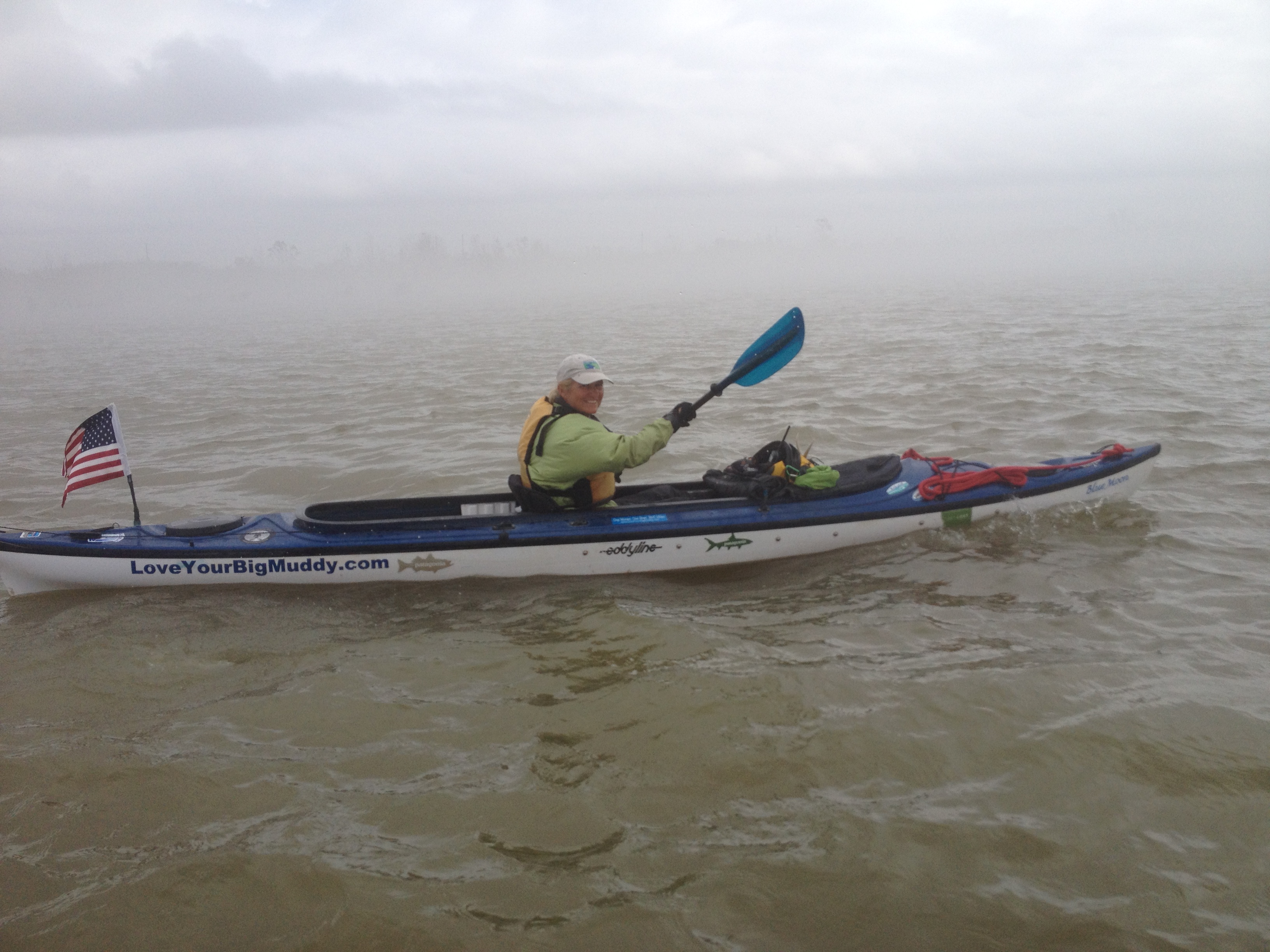
I will cherish this expedition until the day I die. I experienced challenging decision-making, marvelously mellow mornings, exasperating electrical storms, wild wind and waves, stunning sunsets, random acts of kindness, unforgettable human river angels, the wonders of wildlife, big huge barges, even bigger and huger freighters ;), and frightening fog. Last but not least I met a whole world of beautiful and extraordinary supporters up and down the river to whom I cannot give enough thanks, and whom I now consider river family.
Please enjoy a few expedition photos I picked out, in no logical order, but which are among some of my favorites. You may remember…
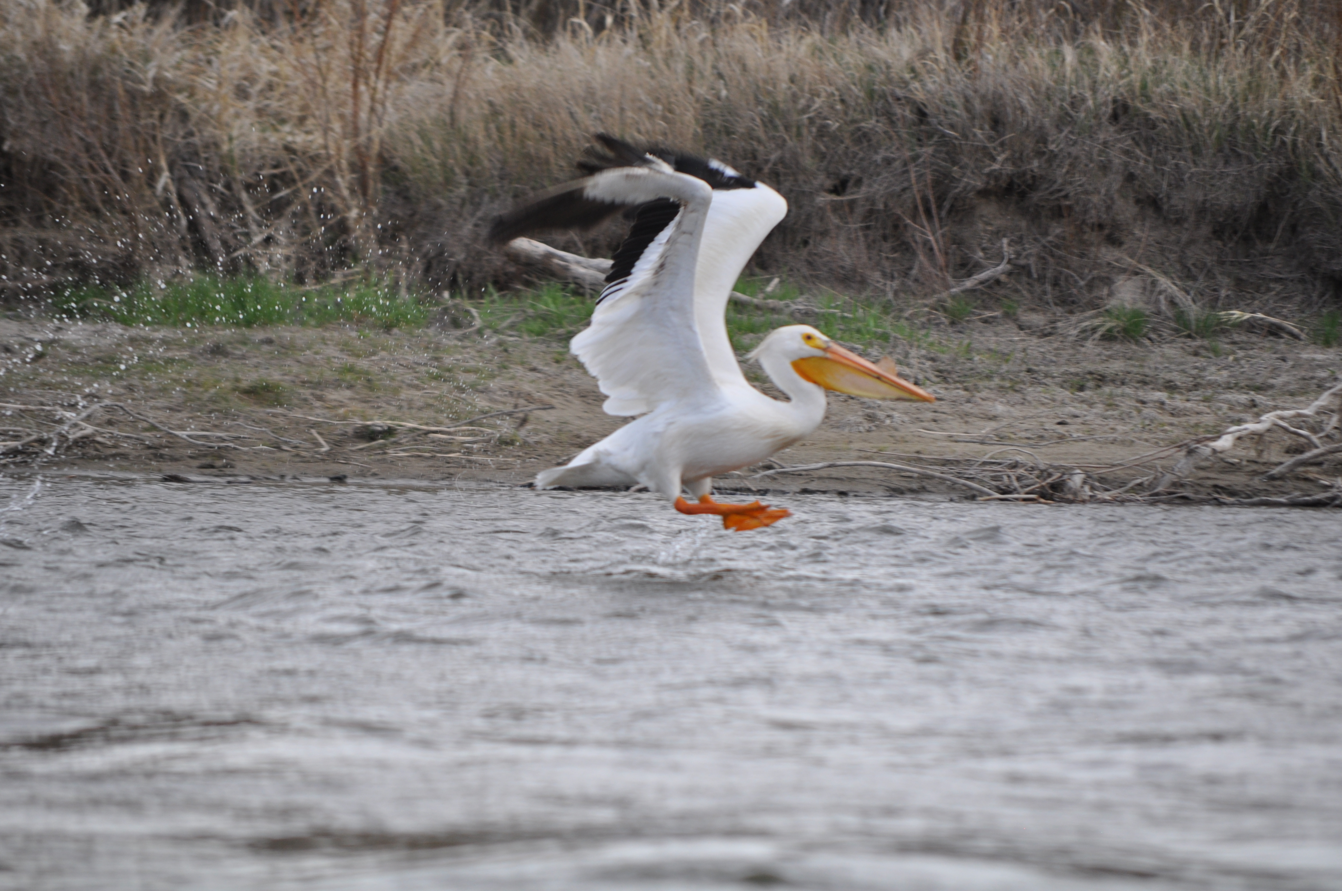
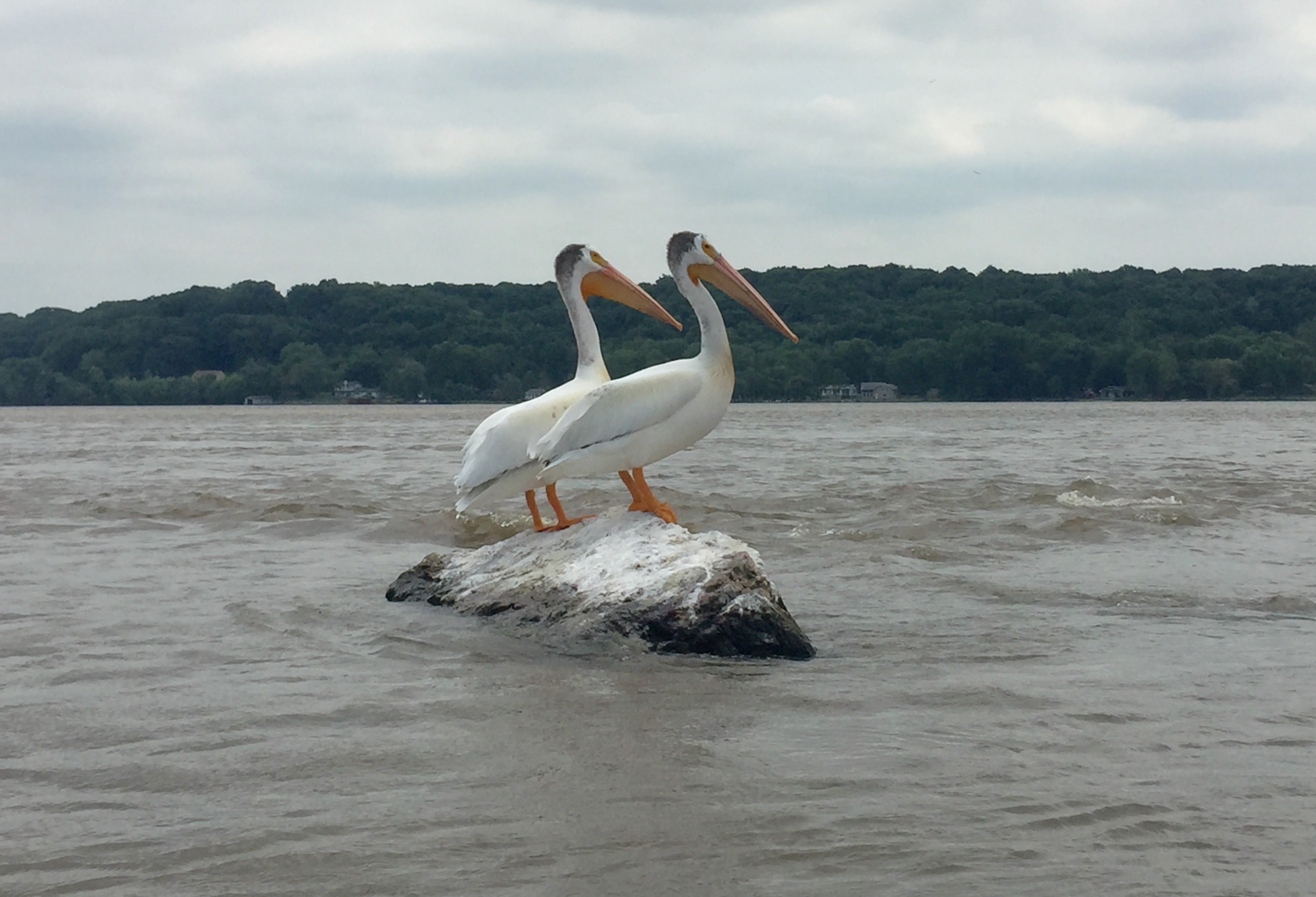
Friends from the first day to the last. Love my pelicans.
Hiking on windy Fort Peck Lake
Have never seen another quite so stunning as this sunset
Well, it IS the Big Muddy!
The morning after the worst electrical storm of the trip. Fort Peck Lake
Below Fort Peck Lake, I think. Still muddy, but getting better.
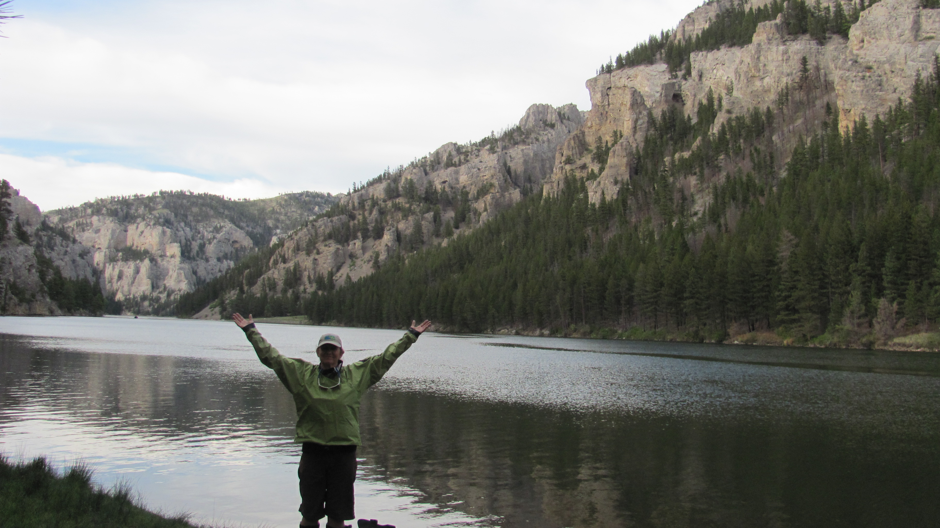
Gates of the Rocky Mountains – Holter Lake, MT
Gates of the Rocky Mountains. Hard to leave this wondrous place. Corps of Discovery camped right across the river.
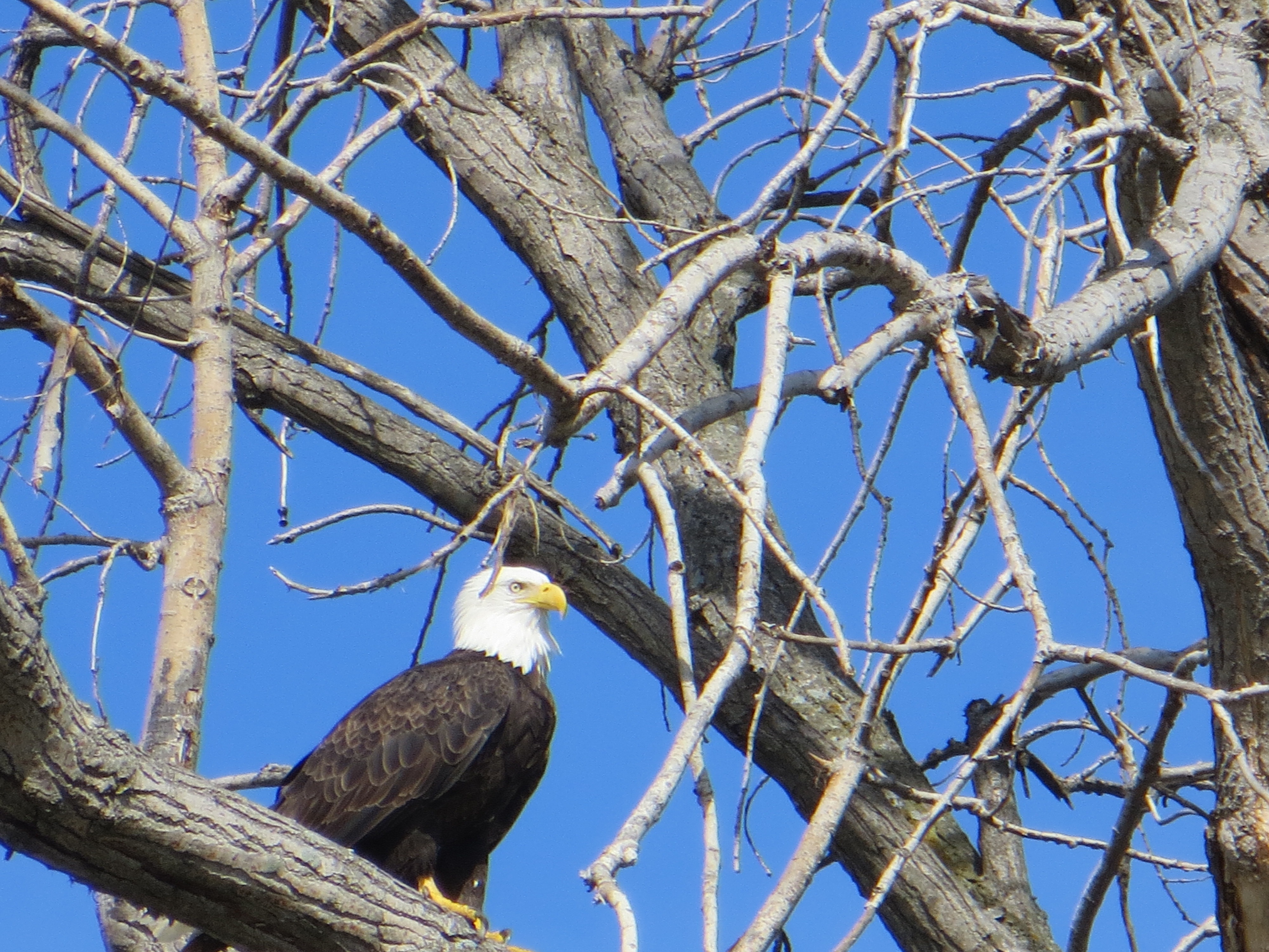
The stoic bald eagle
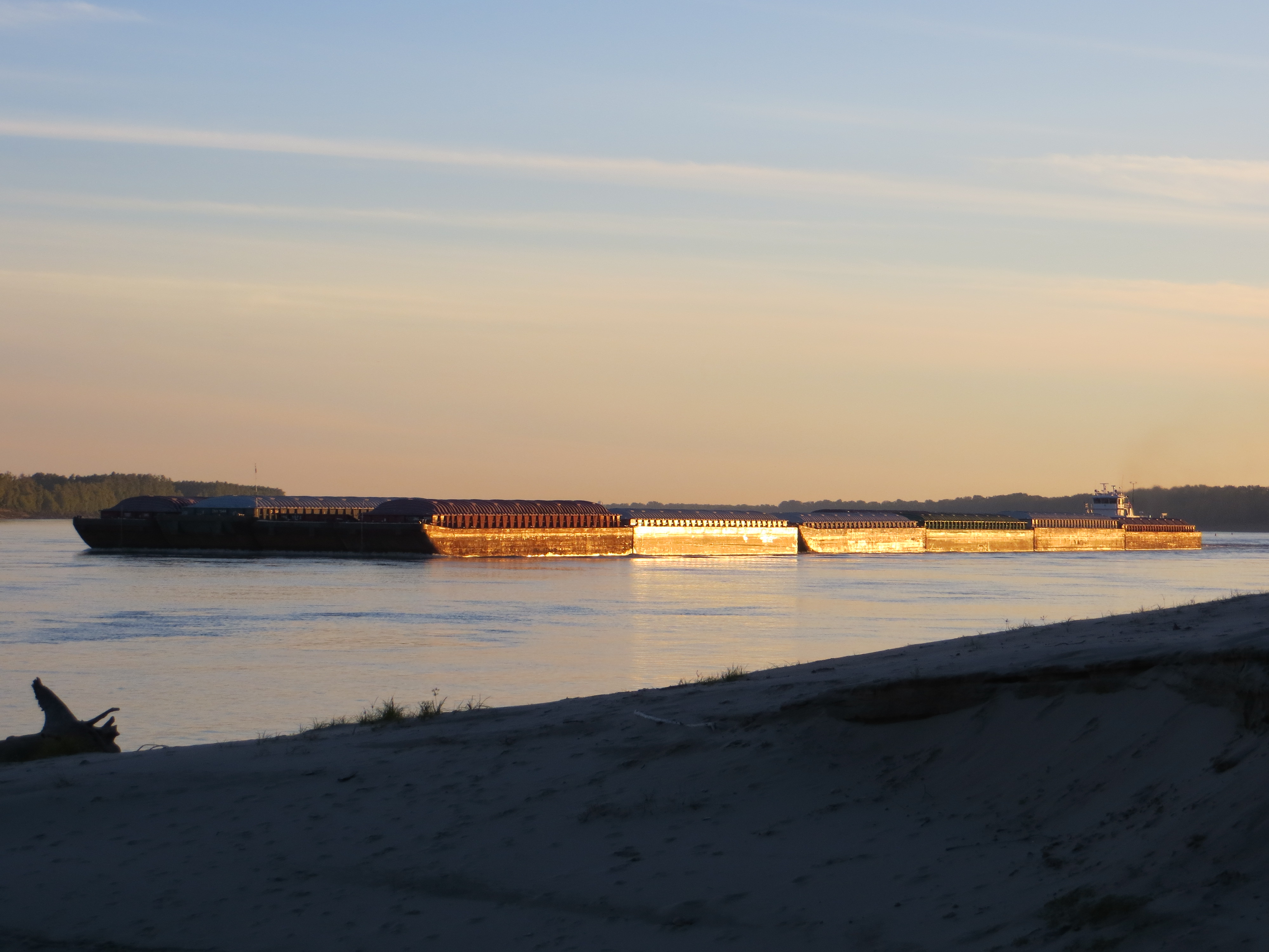
Tow and barge on the Mississippi River
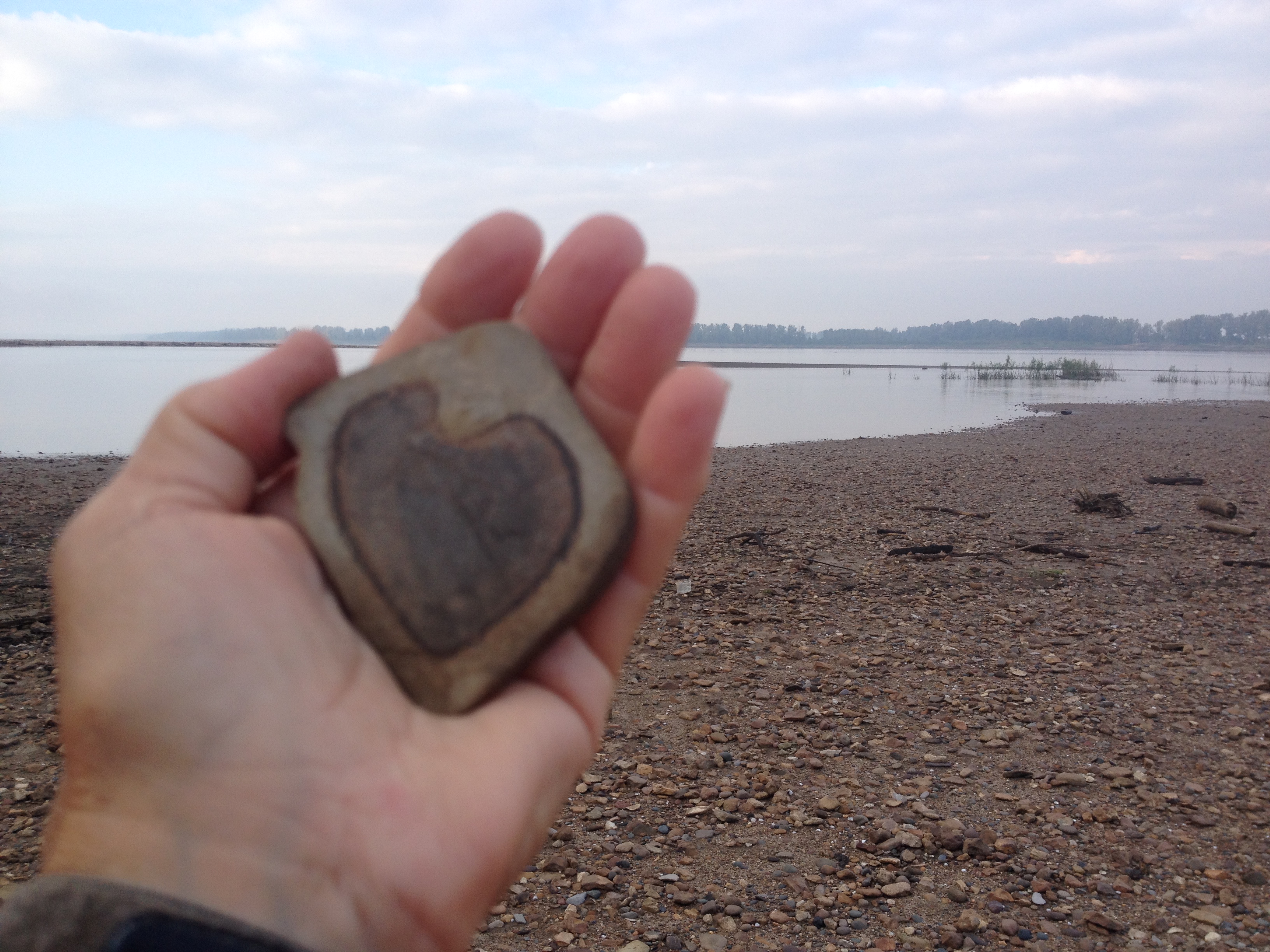
A very special heart stone found just below the Ohio River confluence
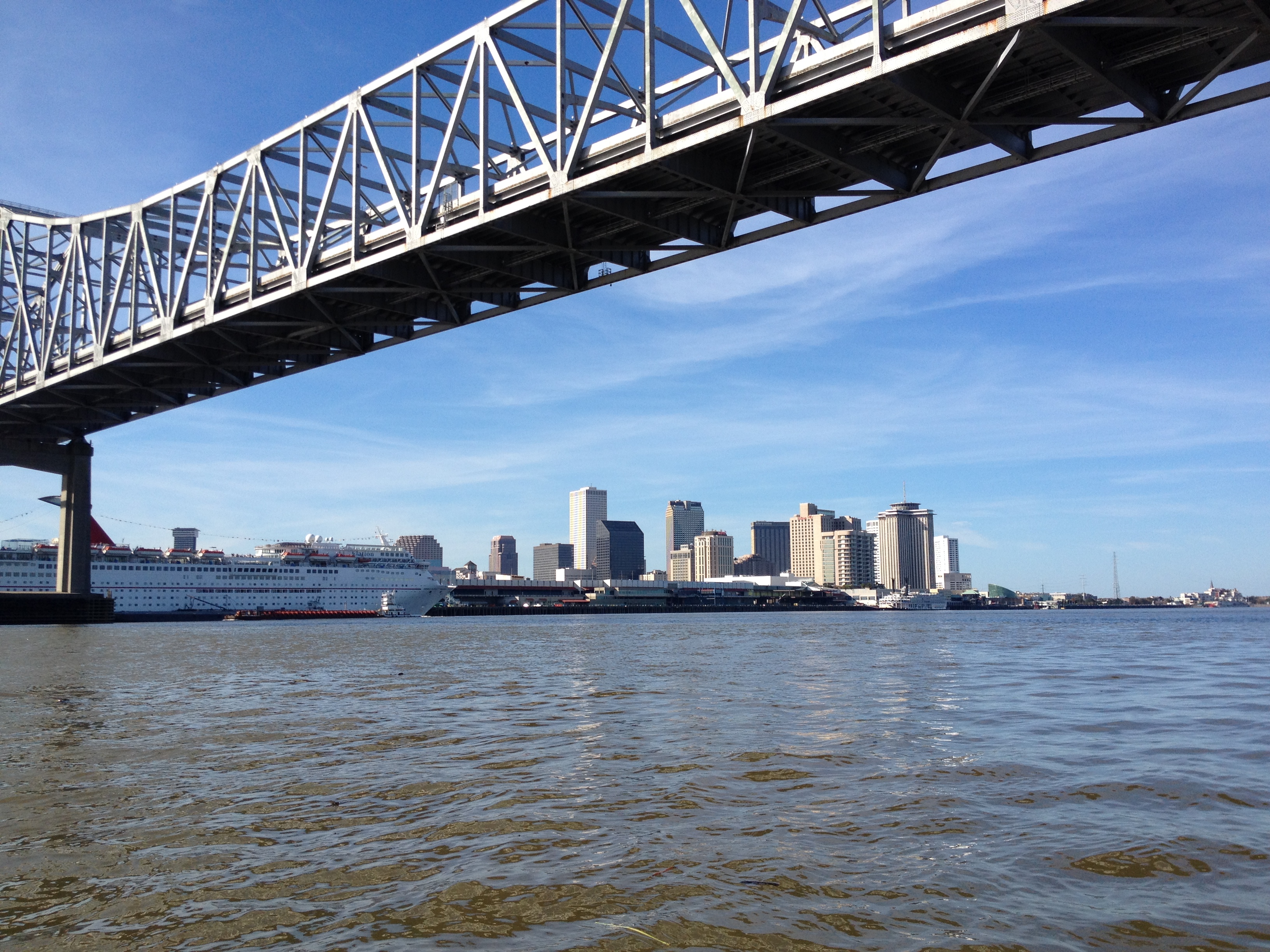
New Orleans
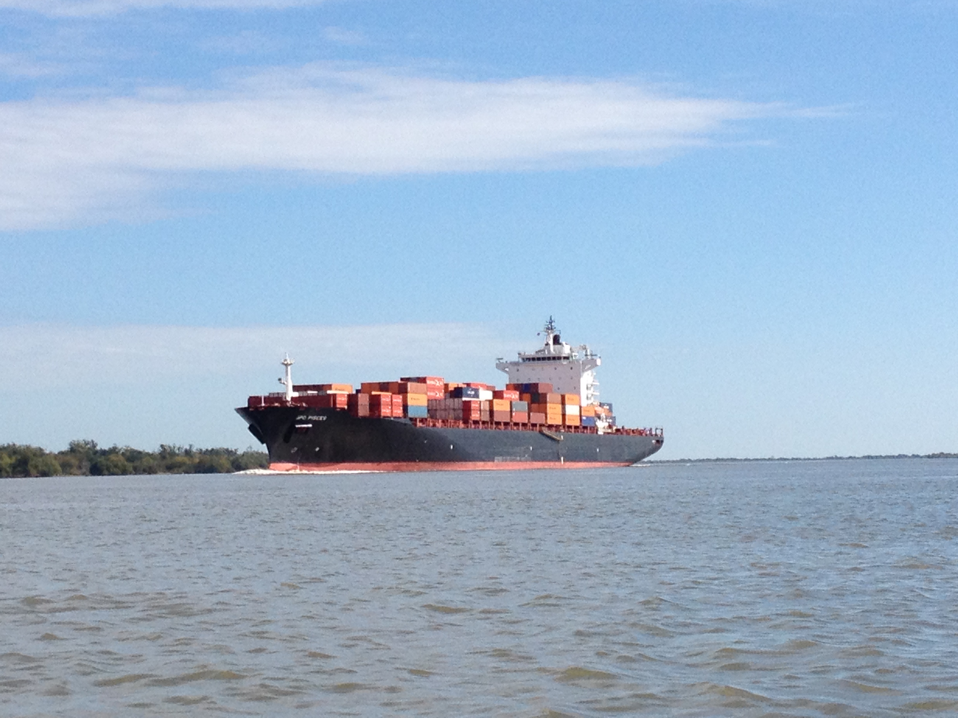
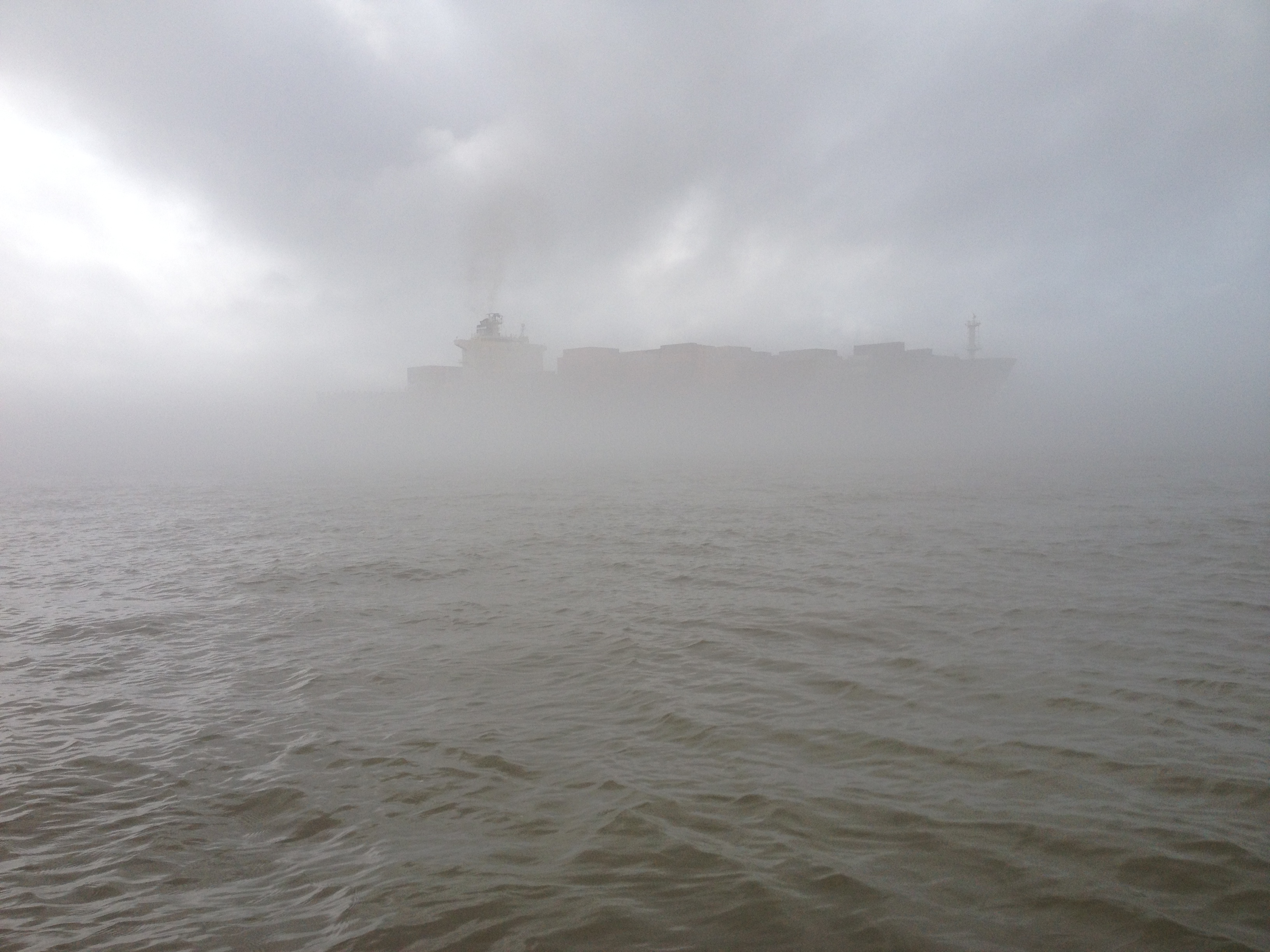
Sharing the lower Mississippi River with tankers and freighters, always keeping one eye in front and one eye to the rear. They are quiet vessels.
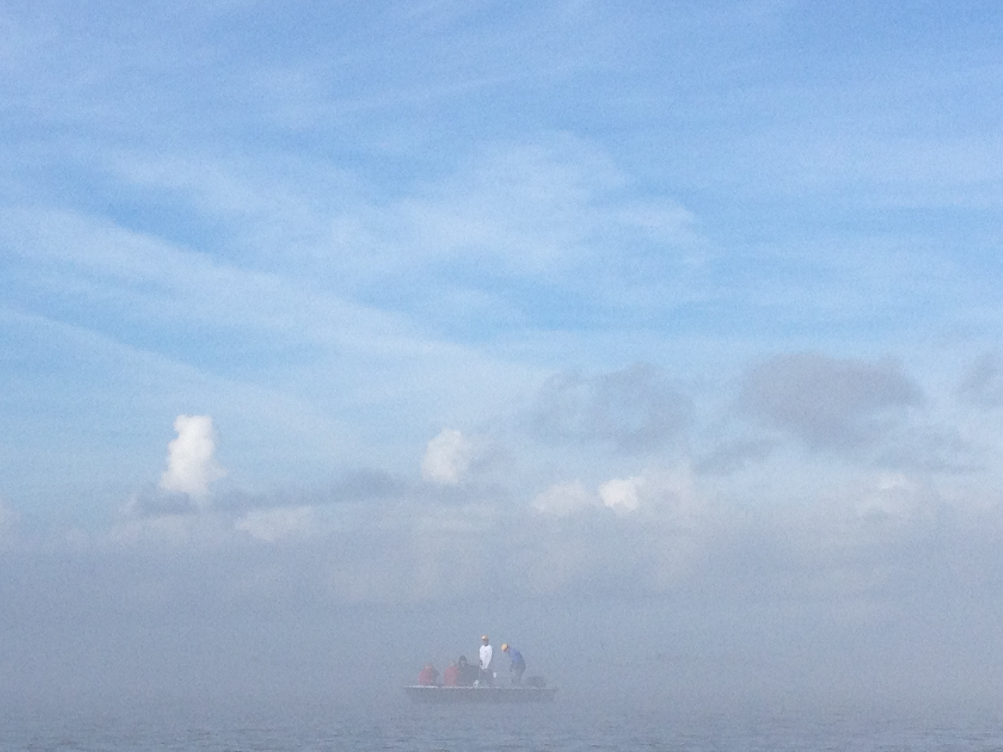
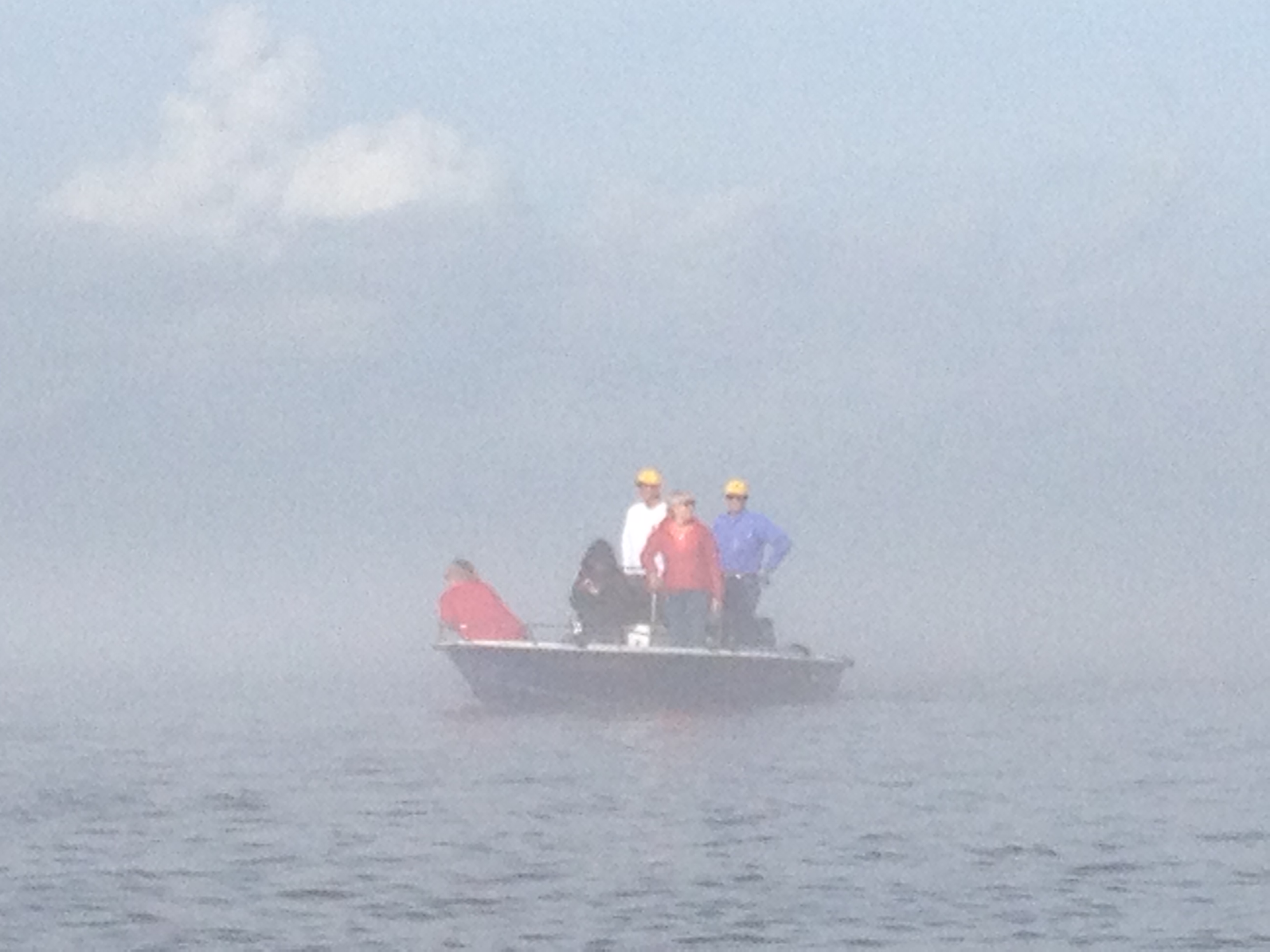
My stellar Gulf support crew in the Gulf fog
The fog just lifted as we began crossing the Head of Passes using a hand-held GPS device. This was a super exhilarating moment. Unforgettable. Even the ship pilot crossing the pass remembers the moment I came into view.
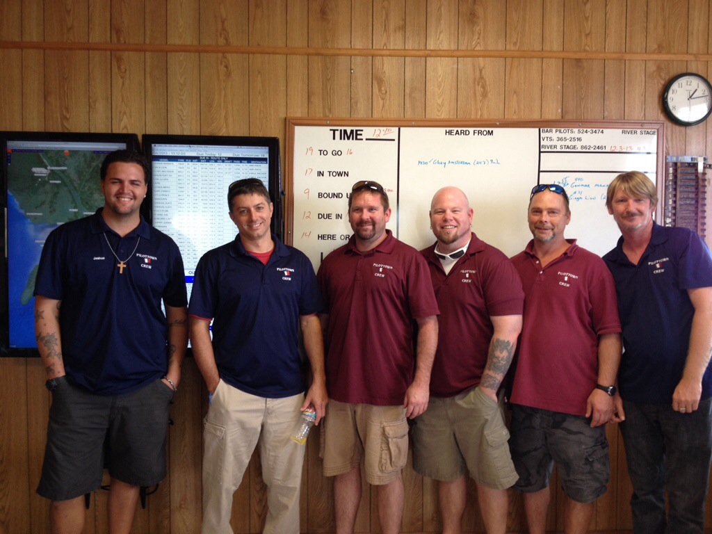
Yes, the pilot of this ship. Pilottown crew provided much comfort on this stretch with their radio communication and hospitality. I am so thankful for them.
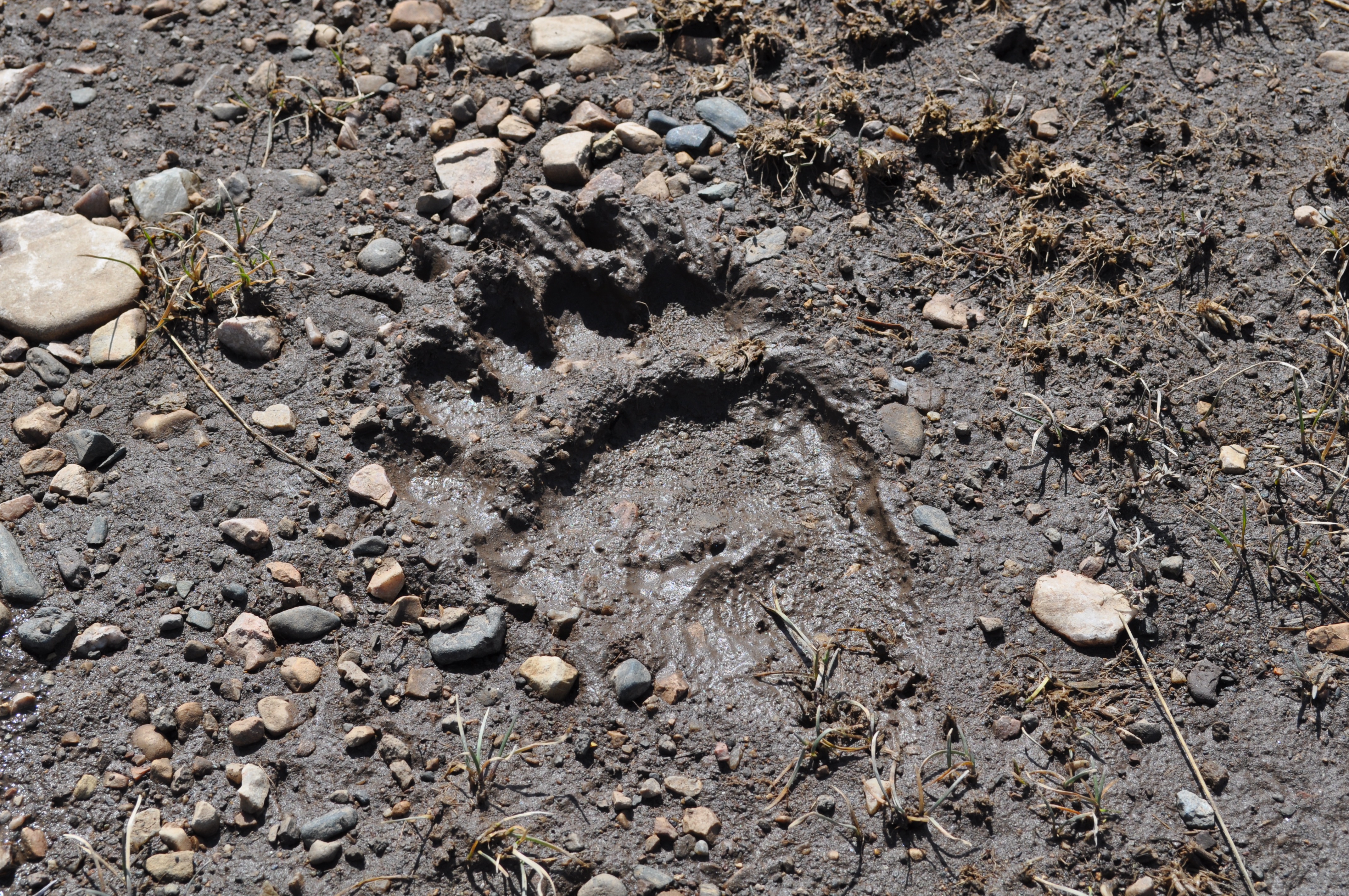
Grizzly bear track below Hell Roaring Canyon. Photo taken by my daughter Haley who was sleeping in a car with Jeannie, waiting for us to come out after a 24 hour delay.
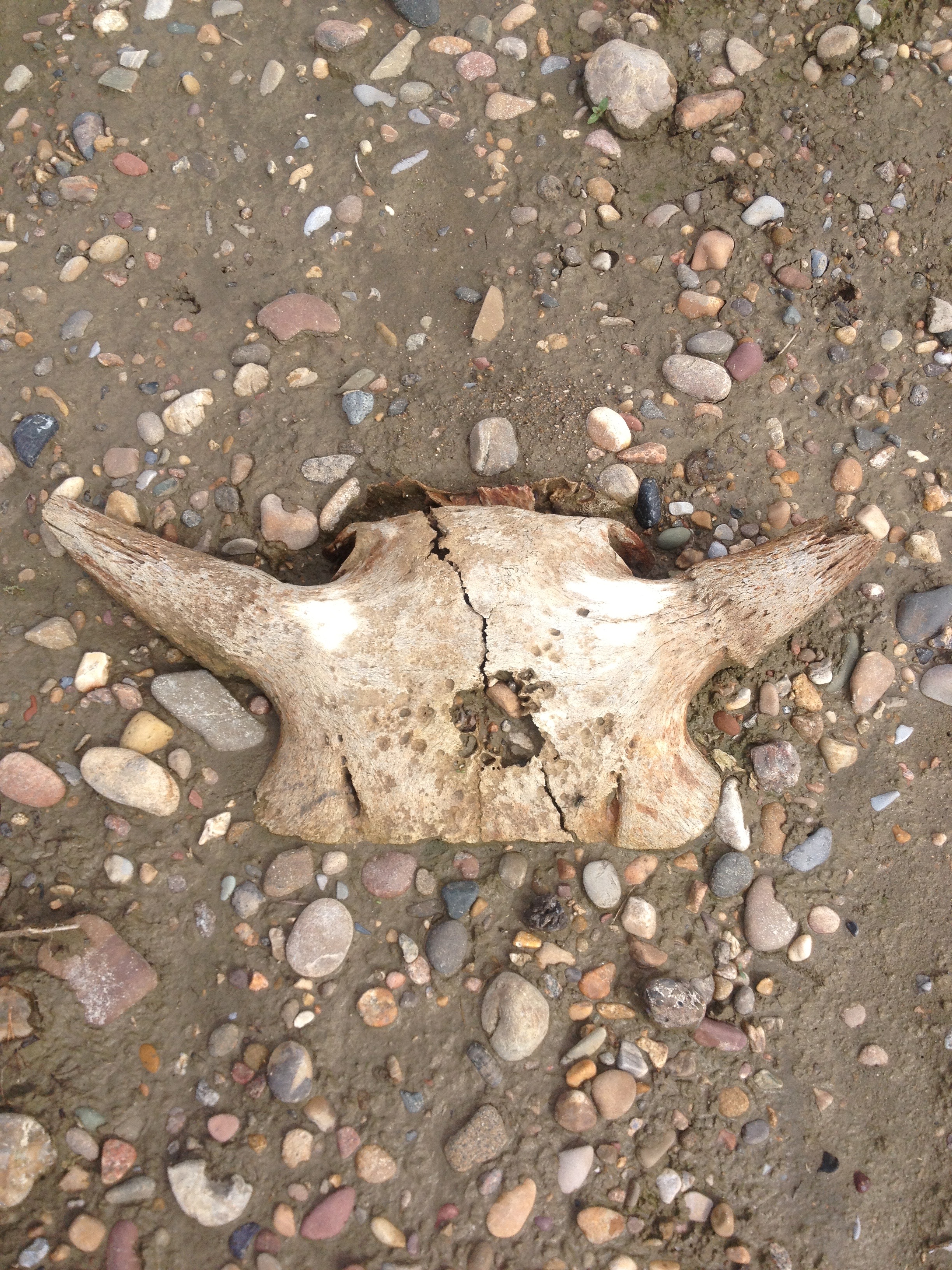
Buffalo skull found next to my camp below Fort Benton, MT, that speaks historical volumes.
Bridge City Marina in Mobridge, SD, home of very special river angel, Michael Norder and his lovely family.
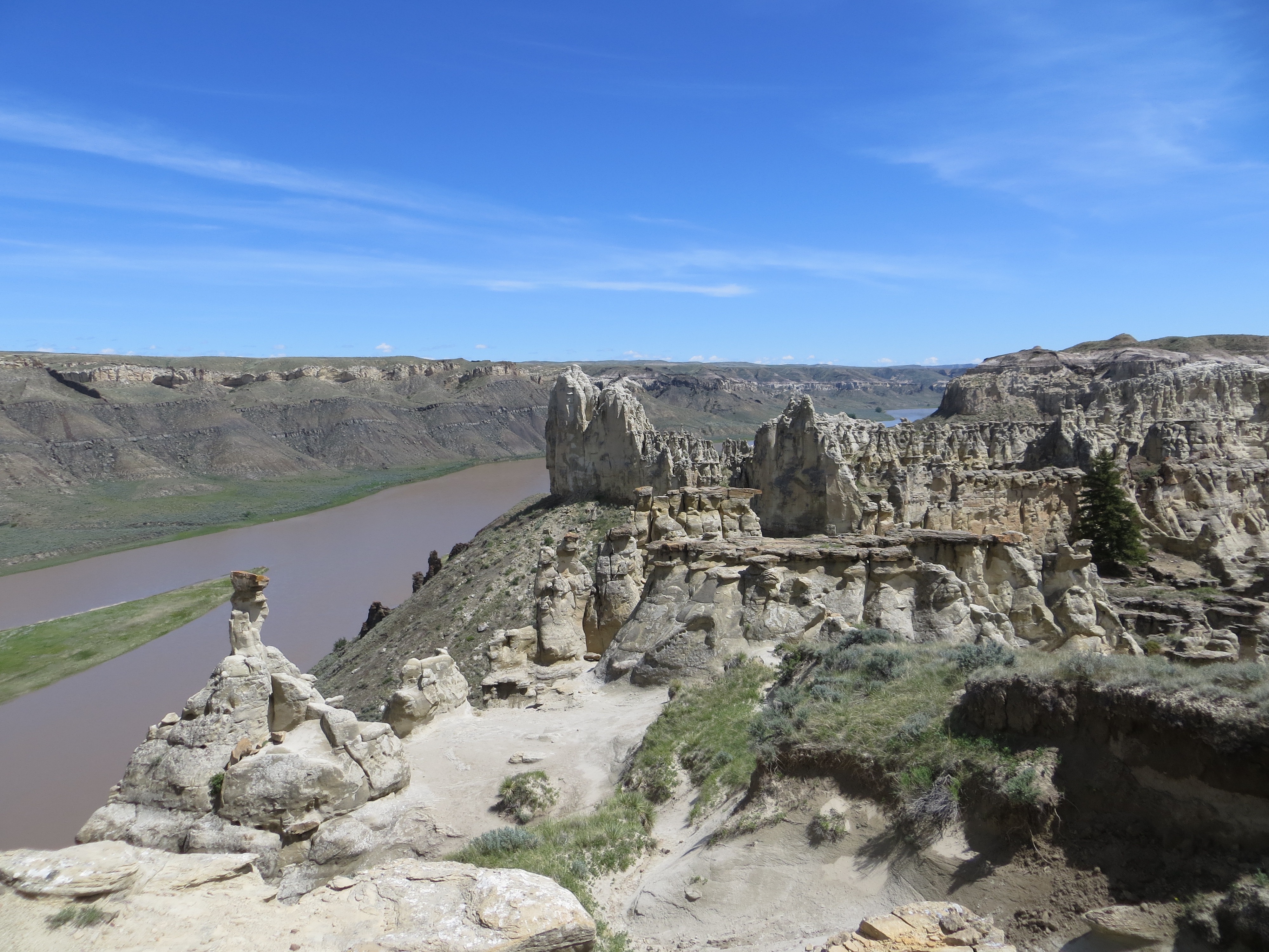
Hole in the Wall, Upper Missouri River Breaks National Monument, MT
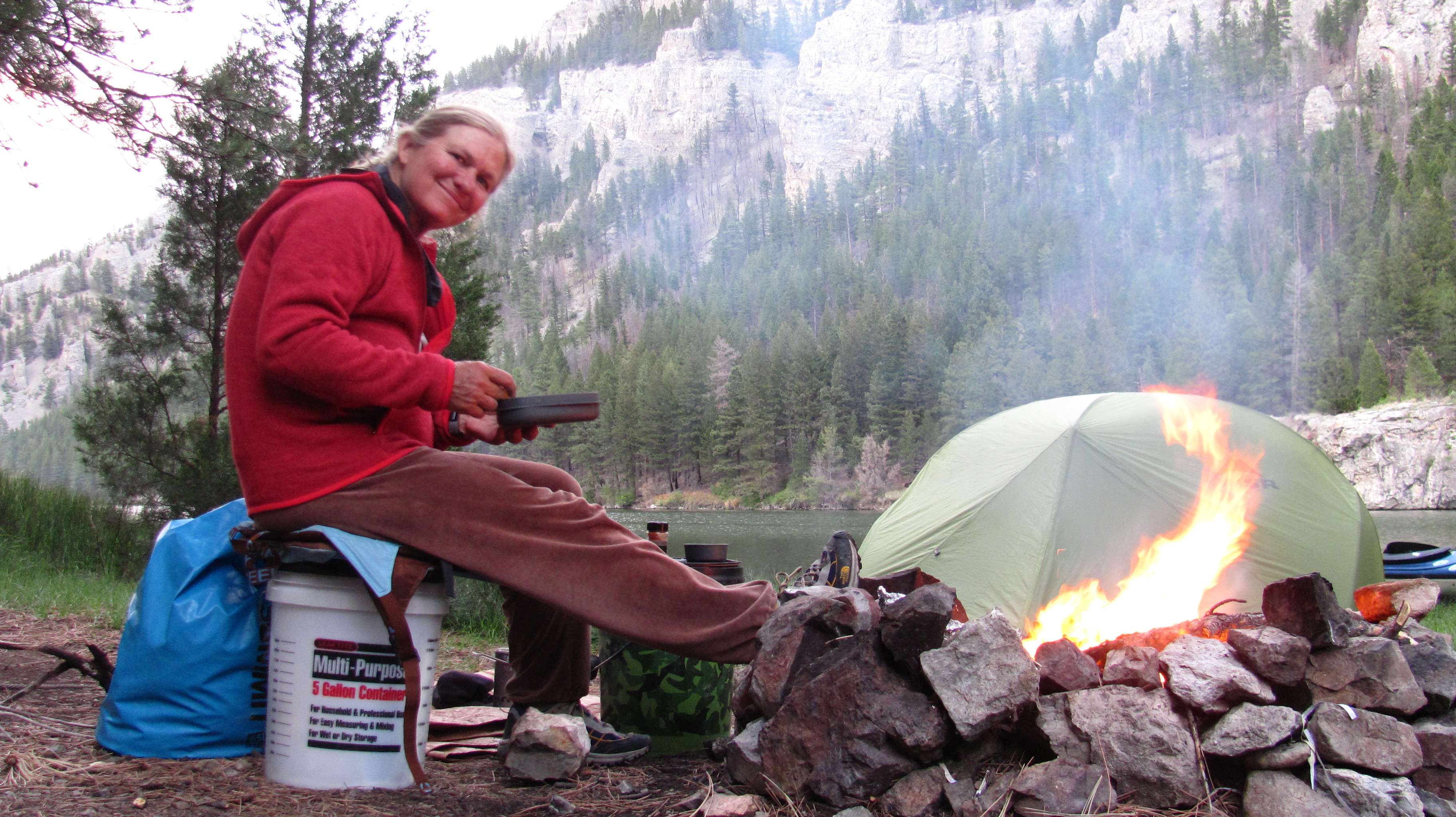
Making camp
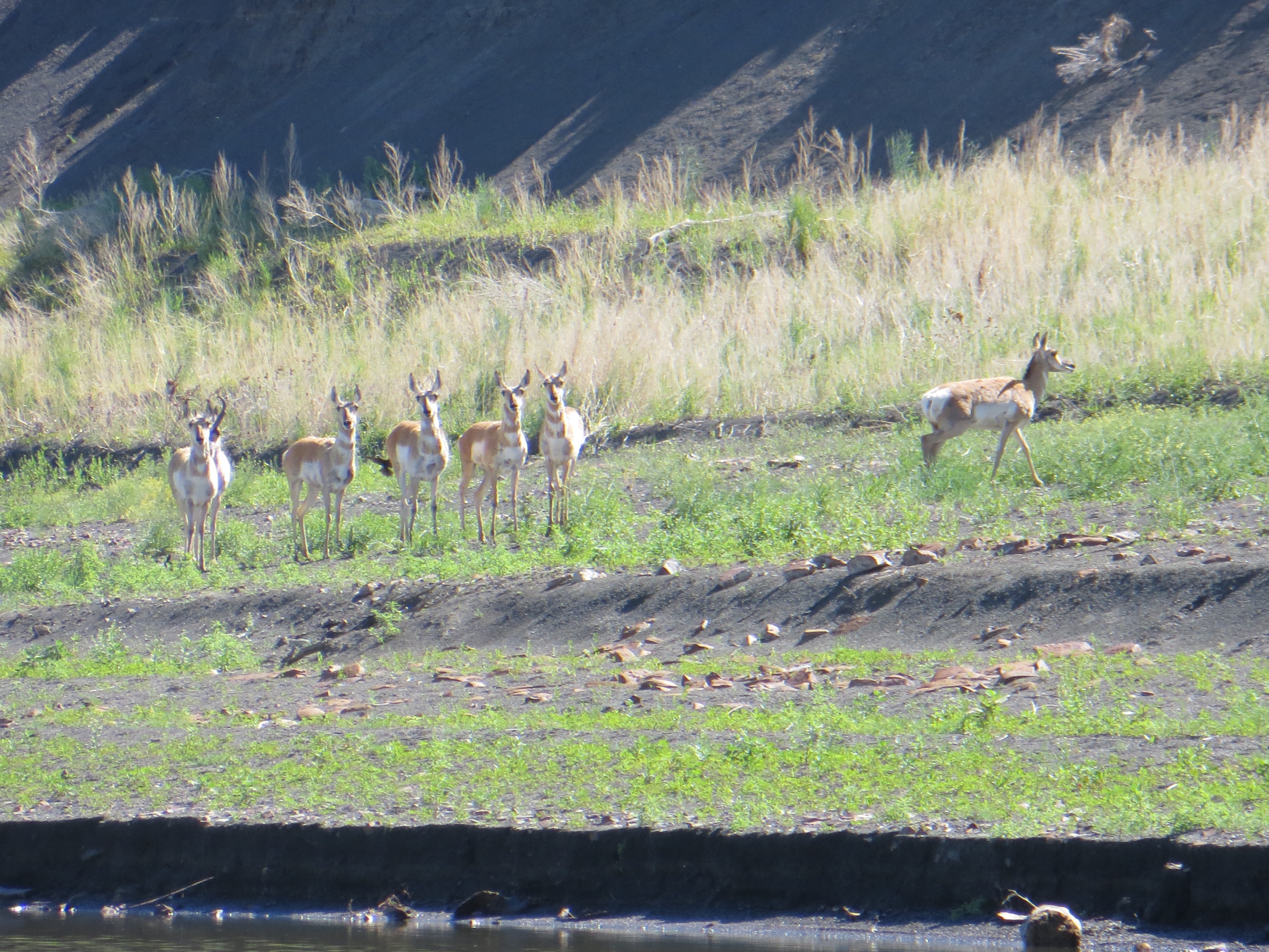
Curious pronghorn antelope in Charles M. Russell National Wildlife Refuge
Sweet heart blue hole on the middle Mississippi River
The Natchez of New Orleans.
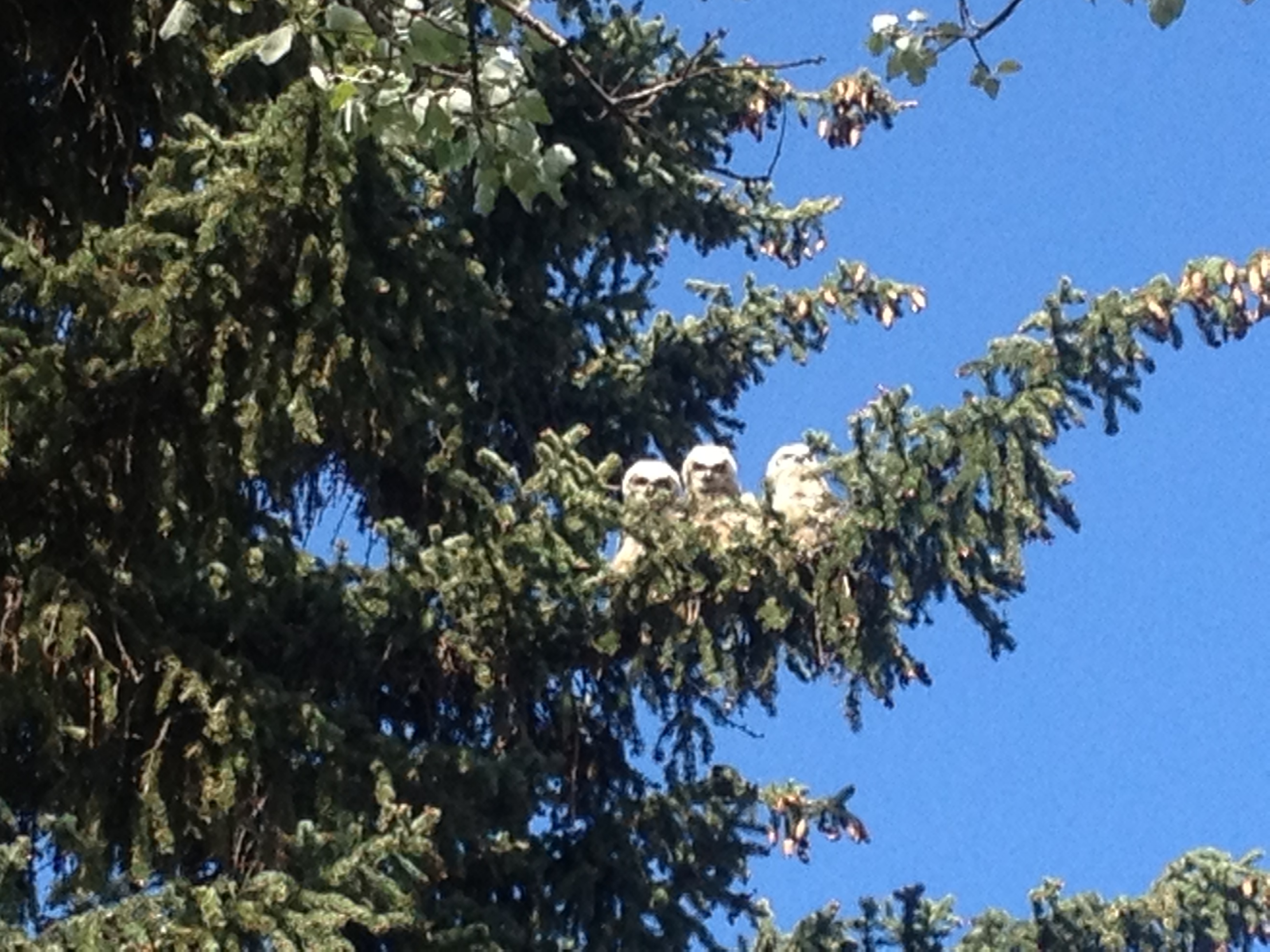
Great Horned Owl Babies in Great Falls, MT
One of several lone pelicans escorting me down the South Pass to bid me farewell. BFF
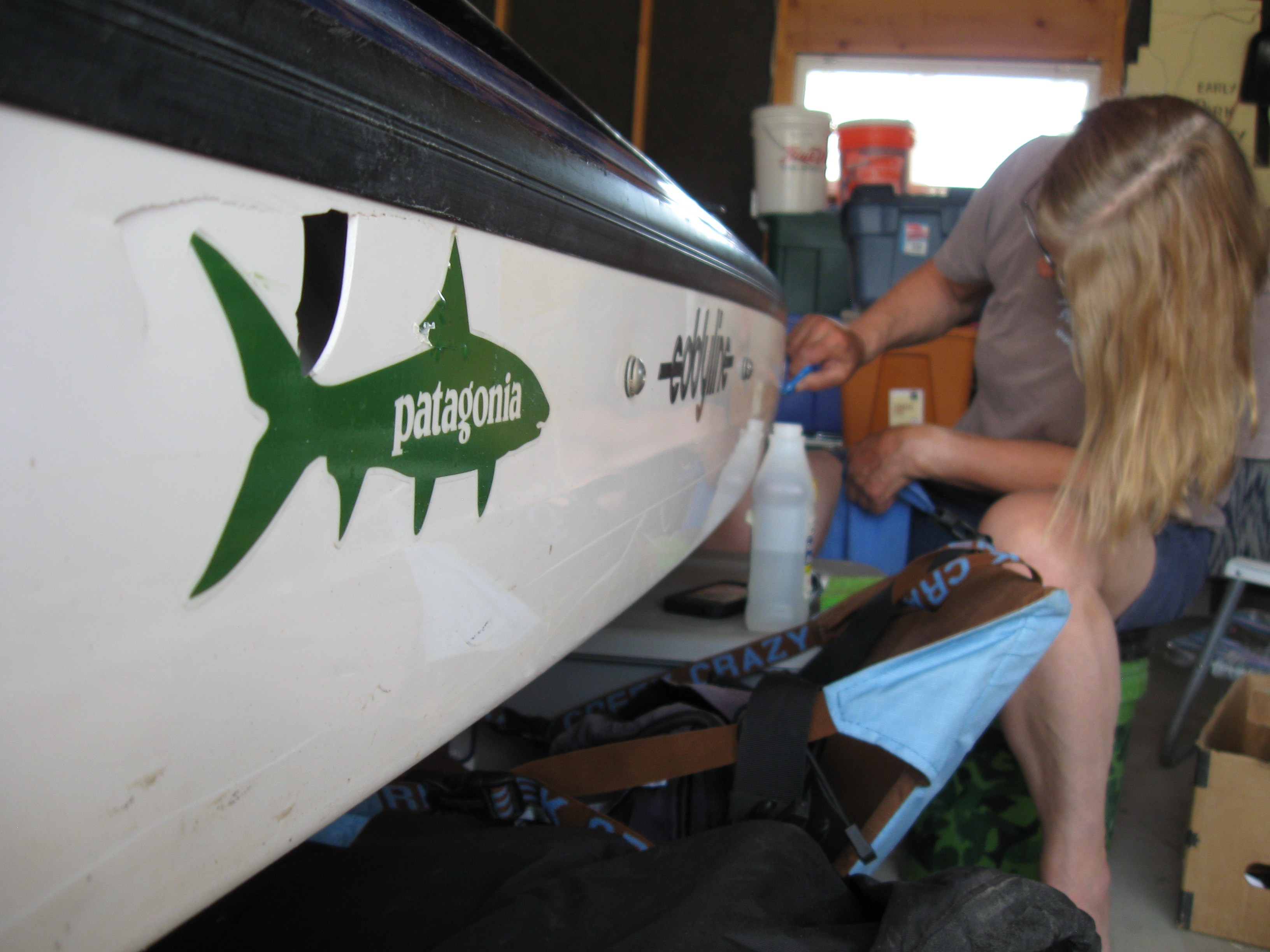
Please visit my sponsor page at the top of my site to see the wonderful companies that believed in me and helped me out in some way to ease the financial burden. Special thanks to Patagonia for their generous clothing sponsorship. Eddyline for their excellent service with my boat as well as donating the best paddle I could ever imaging taking, a Swift Paddle. Many heart-felt thanks to all of Columbia, Mo’s outdoor shops for donating items to LoveYourBigMuddy. Huge thanks especially to our Klunk Bikes for re’cycling’ me a bike, which I love very much to this day.
And to every person that was able to donate financially, I know who you are and you will NOT be forgotten. Particularly my local Riverbilly family and those contributing to the Blues Benefit. Click here to see who these tremendous supporters of LoveYourBigMuddy are. This was YOUR expedition! THANK YOU! If you see a photo you would like on this post and it is part of your donation reward, please email me and let me know. I will be posting more photos shortly.
For a comprehensive view of media articles and podcasts, click here to visit my media page, located at the top of the site.
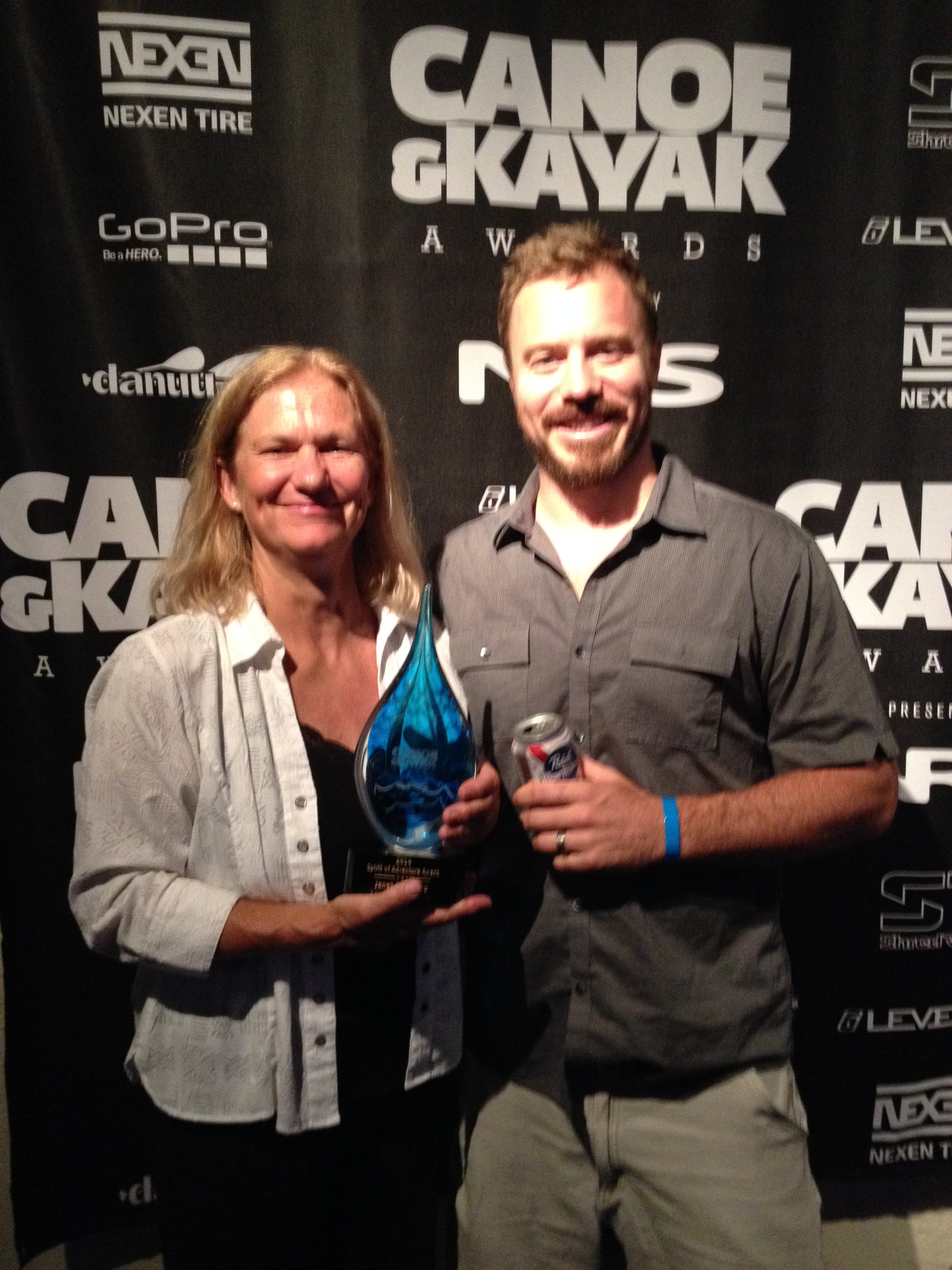
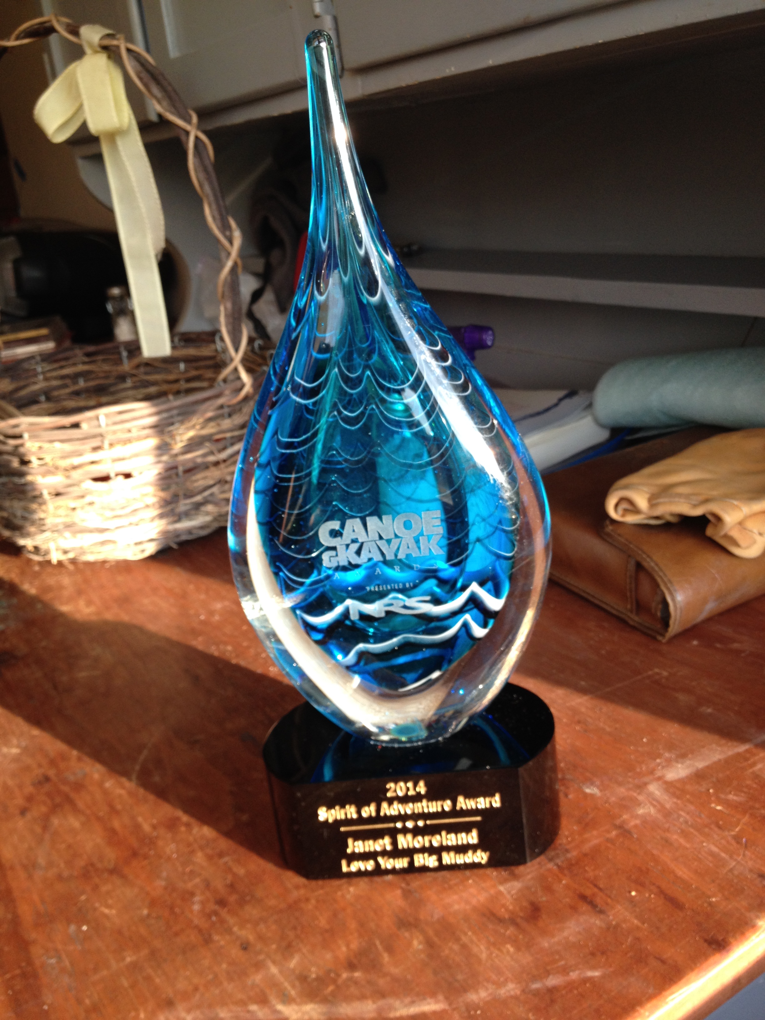
Lastly, warm thoughts go out to the crew at Canoe and Kayak Magazine, and to all of the individuals who took a moment to vote LoveYourBigMuddy Expedition into the “Spirit of Adventure” Award arena for 2014. Certainly, the honor was all mine to receive the award in the midst of an incredible paddling family. YOU, too, can be a candidate for such a cool recognition. Just…
Dave Shively, editor, and one of many very cool people who have created this outstanding paddling magazine and helped to create an international paddling family. Three cheers!!! Click here to visit the award ceremony.
…remember to keep your eyes on the road ahead. Don’t quit your DayDream. And, dream BIG!
LoveYourBigMuddy Expedition on Facebook. see what’s up…
“So, Janet, what’s your next adventure?” A popular question about which I have been asked many times. For awhile there I began to believe I could go on another expedition. I began researching the Amazon River and contacted my friends on Facebook who have paddled it already, namely Mark Kalch and West Hanson. Man oh man, what an awesome adventure THAT would be! Not only do I have an interest in South America, but to paddle the second longest river in the world??? Solo?! We are talking real-deal adventure! Too bad about the Class V+ white water on that 500-mile section…hmmm, do I REALLY want to risk my life? How could I ever pay for such a thing? How long will it take? How DO those adventurers DO it???
Back to reality. Spending 7.5 months on an expedition is costly. I am so thankful for my supporters along the way who carried me through financially, but the money hole that awaited me post-expedition was, or is, enormous. I left on my expedition with pocket change, and came home with the same.
That said, I began researching an adventure that was drifting around in the back of my mind, something I have always been interested in and have wanted to learn more about. I needed to find an adventure during which I could work and make some money. To begin my inquiry I made the initial phone call to the Lower Brule Sioux Indian Reservation School in south-central South Dakota. I wondered if they needed any teachers. This could be a cultural journey for which I could get paid while immersed in it. I had started the ball rolling, one that is currently moving right along at a pretty good clip. In fact, I will be moving to South Dakota next month to teach 6th-grade at the Lower Brule Day school. Now, ask me what my next adventure is going to be! 🙂
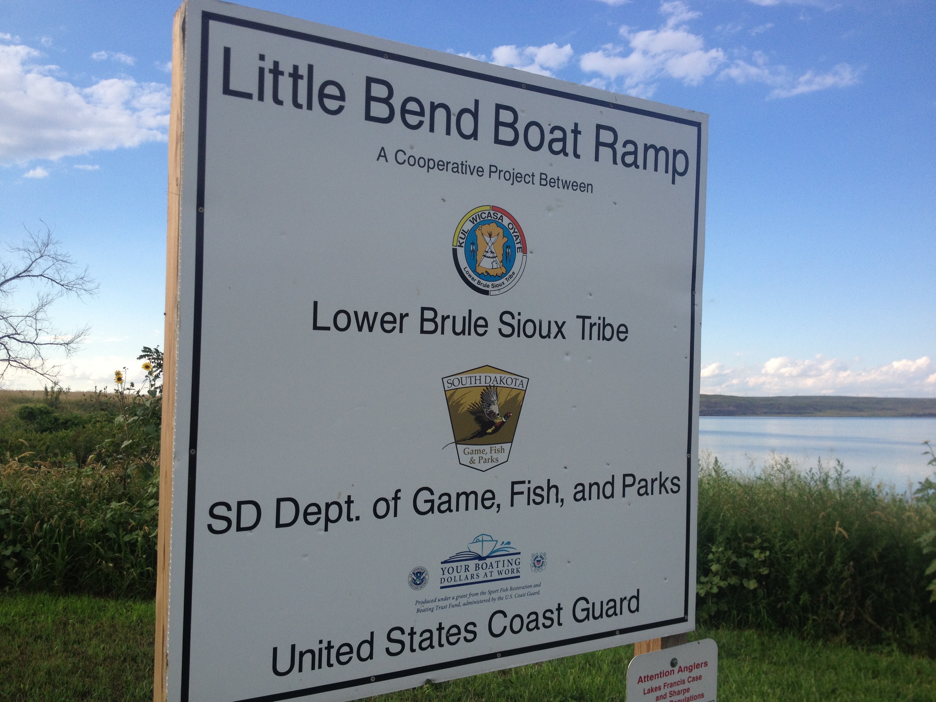
Upriver from the town of Lower Brule, this boat ramp was not on my map but a welcome sight since I did not have time to make it to Lower Brule this day.
This boat ramp was so beautiful and a pleasant place to camp.
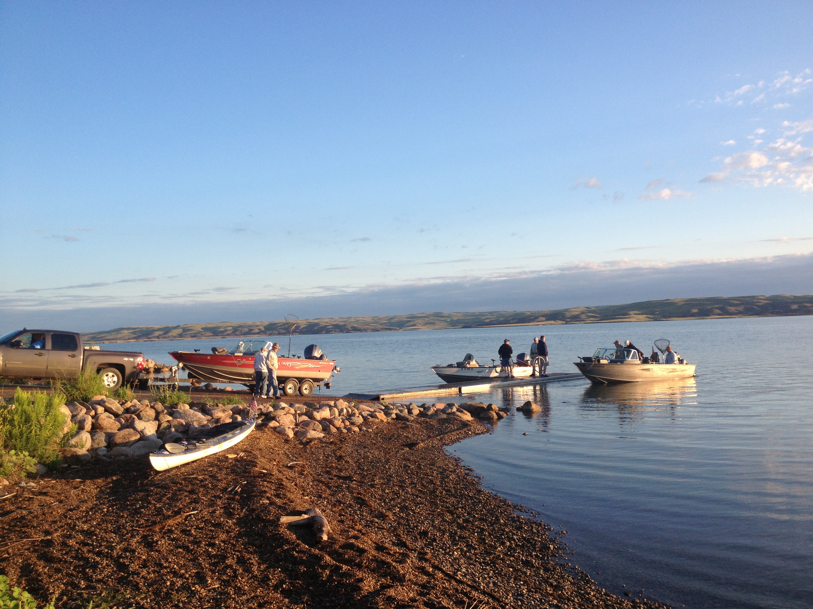
Not a whole lot to do once I set up camp at the Little Bend Boat Ramp, so I picked up trash.
I had lots of company at the boat ramp camp
Busy boat ramp popular with the fishermen and families. Everyone was very friendly, that night and the next morning. The fishermen were there at the crack of dawn, as I recall.
I visited Lower Brule Sioux reservation while on expedition. I landed in Chamberlain, South Dakota, on Thursday, August 9, 2013, which is downstream a few hours, below Big Bend Dam. My campsite was at the beautiful American Creek Campground located on the waterfront shore of Lake Francis Case. Jessica Giard was my river contact in Chamberlain, at that time the editor of the local town paper. We enjoyed each other’s company very much and made arrangements to drive to the Powwow at Lower Brule on Sunday, August 11, 2013.
A photo of me during expedition taken by fellow long-distance paddler David Forbes. We met at Big Bend Dam and paddled to Chamberlain together.
David Forbes, me, and Jessica Andrews Giard, Chamberlain River Angel, enjoying dinner together at the Marina in Chamberlain, SD.
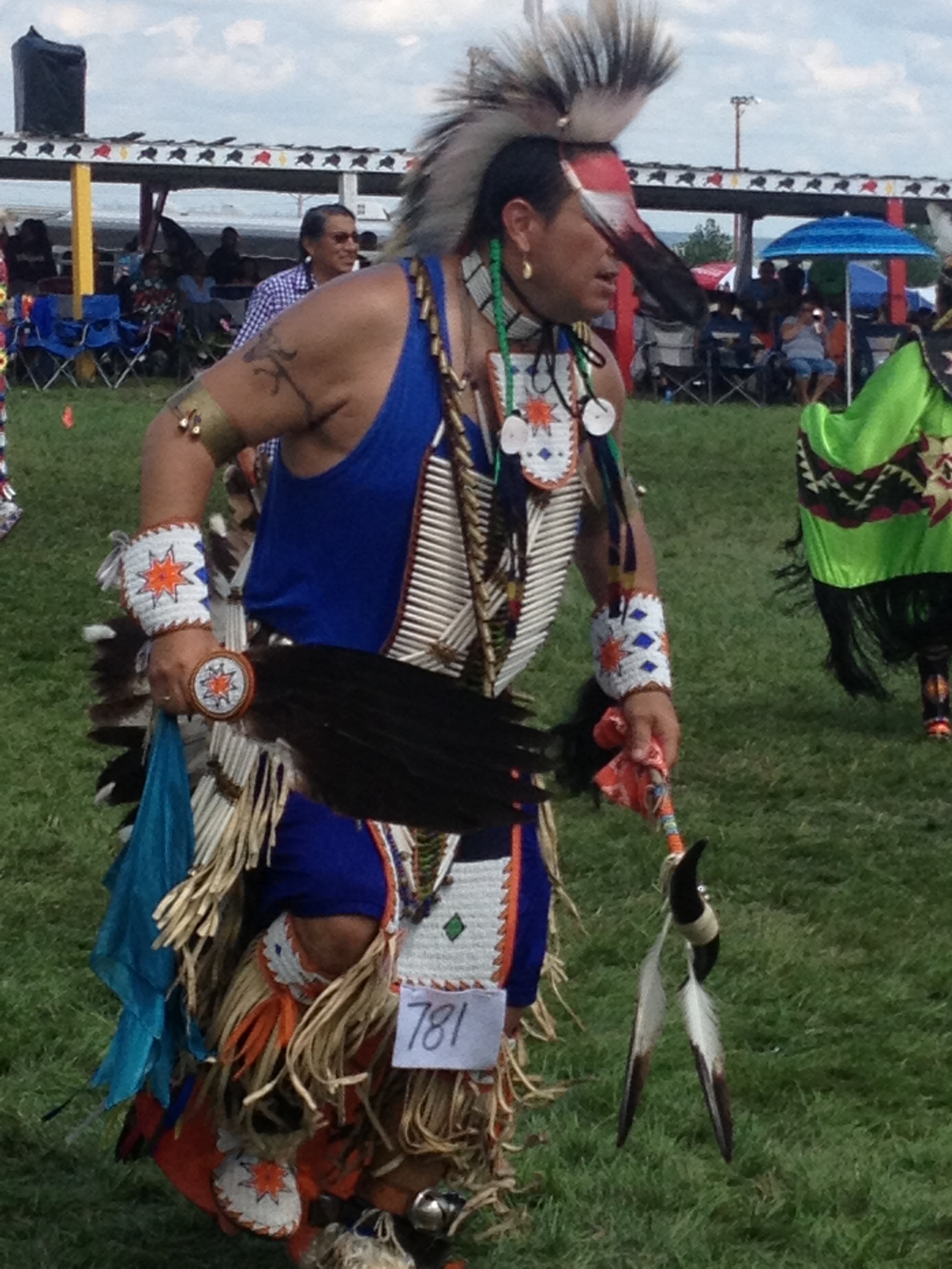
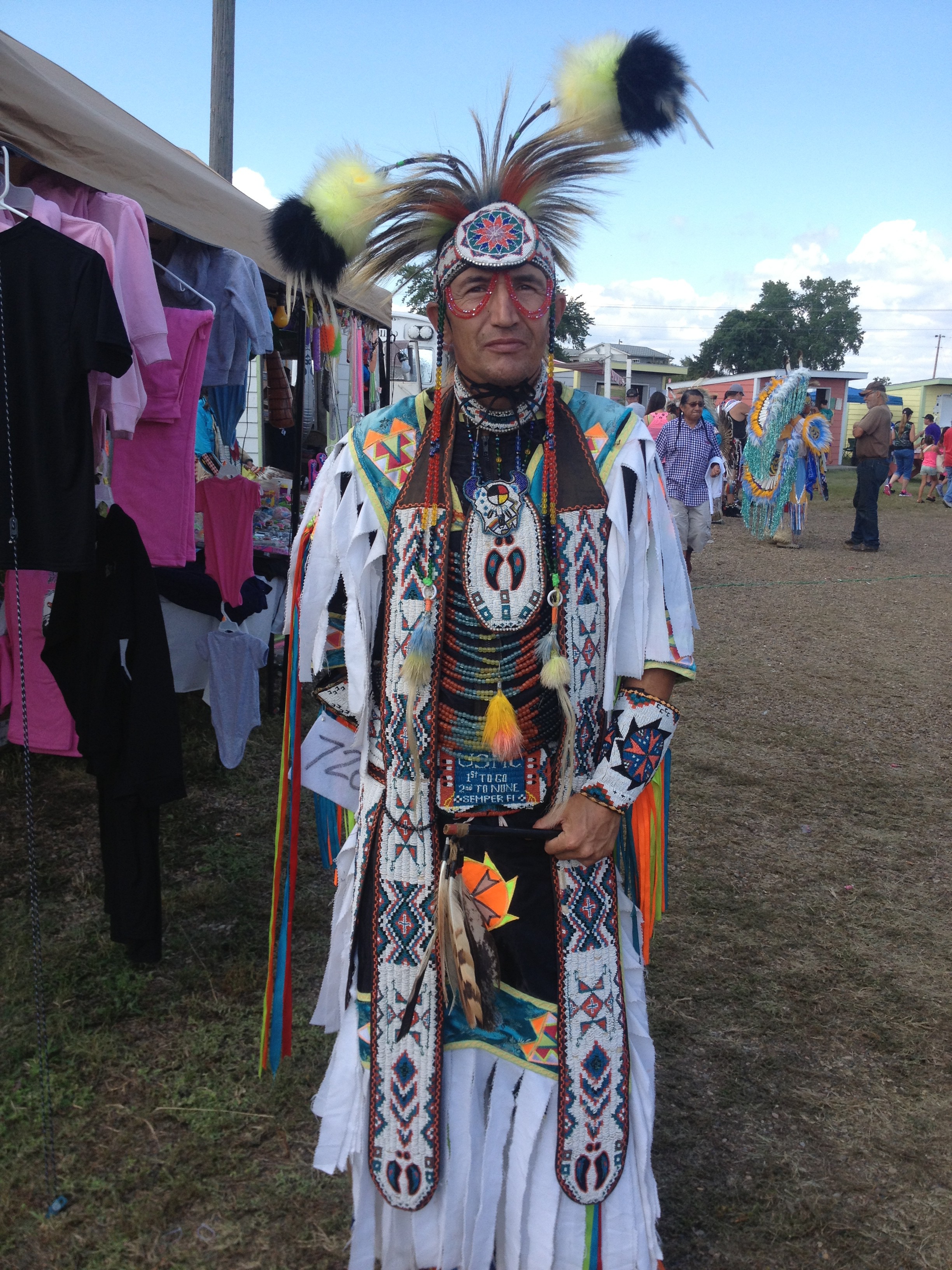
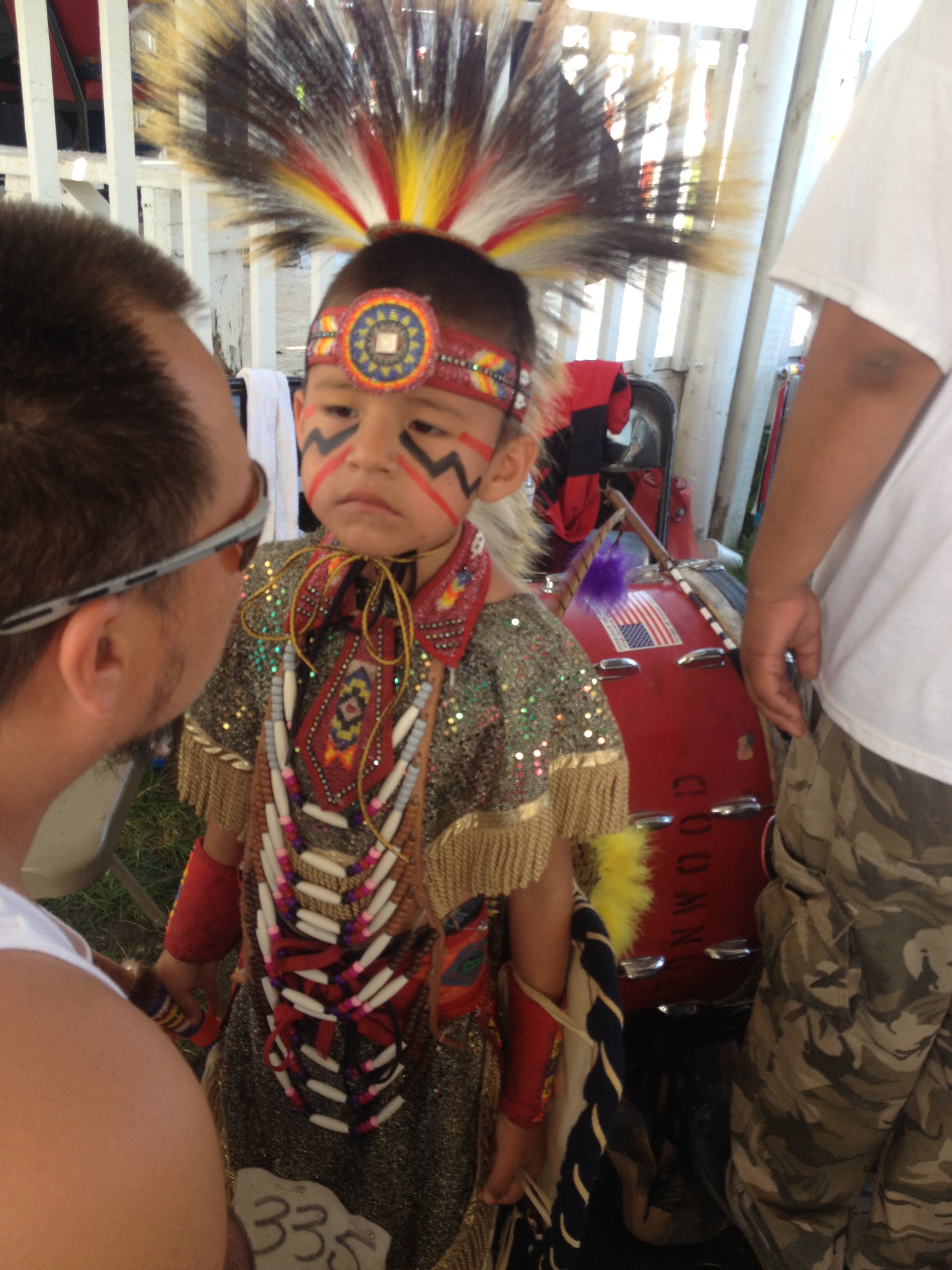
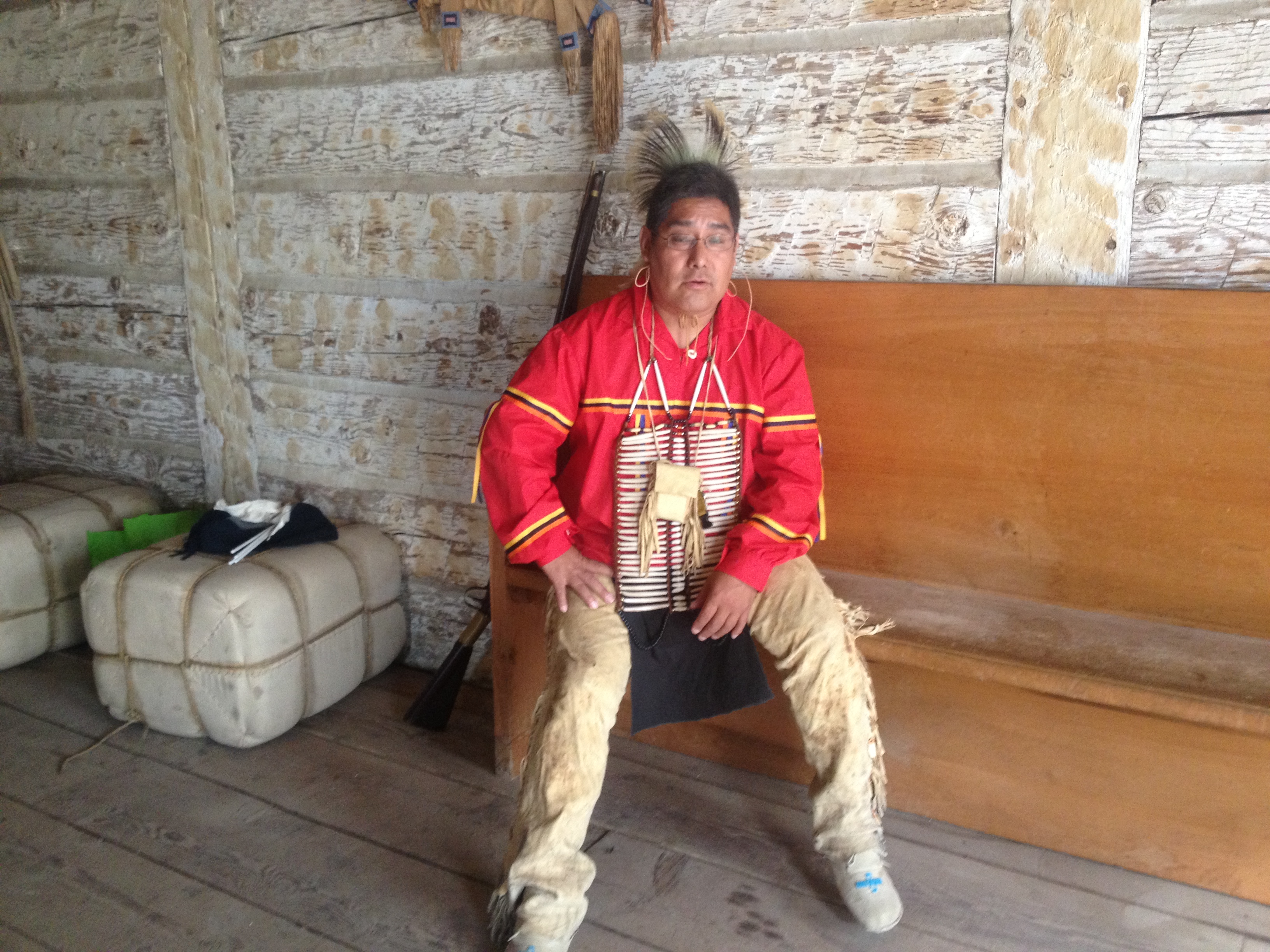
I was intrigued with the Powwow event and the display of American Indian culture. Lower Brule reservation is located right on the shores of Lake Sharpe. I took lots of photos, met some unique and interesting individuals, and thoroughly enjoyed the regalia, dancing and music at the event, the latter of which consisted of many different drum circles. This was a highlight of my expedition.
My favorite photo of the journey, these American Indian girls smiled so big for the photo. They appear to be near the age I will be teaching this year, which is 6th grade.
I think this was the opening dance when all participate. Spectacular!
The regalia, drums and dance made for some spell-binding events.
One of the many drum circles competing at the Powwow
Jessica Andrews Giard, Chamberlain river angel, asking a few questions for a write-up in the Chamberlain newspaper.
I was awestruck at the traditional regalia on display this day.
Truth be known, this one melted my heart.
Lower Brule is reorganizing its school system to achieve sustainable success. The Tribal Council is working with AIII (A-Triple i), the American Indian Institute for Innovation, making uplifting and relevant changes to achieve post-secondary attendance by graduating high school students who will, ultimately, return to the reservation with their education, leadership skills and innovative ideas. The schools are hoping to achieve an increase in performance standards. I believe the changes in-progress will manifest success and benefits to the Lower Brule community.
Preferring not to commute the 30 minutes to Chamberlain to live, leaving school at the bell and returning at 7:00 AM, I asked the consulting team leading the reorganization if they could find me housing on the reservation. Indeed, they DID find for me a modest inexpensive home to rent just a few blocks from the school. I felt this arrangement was important for immersion with the community and building relationships.
LoveYourBigMuddy Expedition was a life-changing journey like I never expected. After seven and one-half months living simply on the Missouri and Mississippi Rivers, I now know that my days will continue to be unique while trying to avoid ordinary affairs. Living life outside of the box is stimulating and rewarding. I refuse to melt into an armchair positioned in front of a television or a desk chair in front of a computer screen (well, maybe a little of the latter). Life is so short and at 57 years I can feel the pressure of time passing. So much to do and so little time!
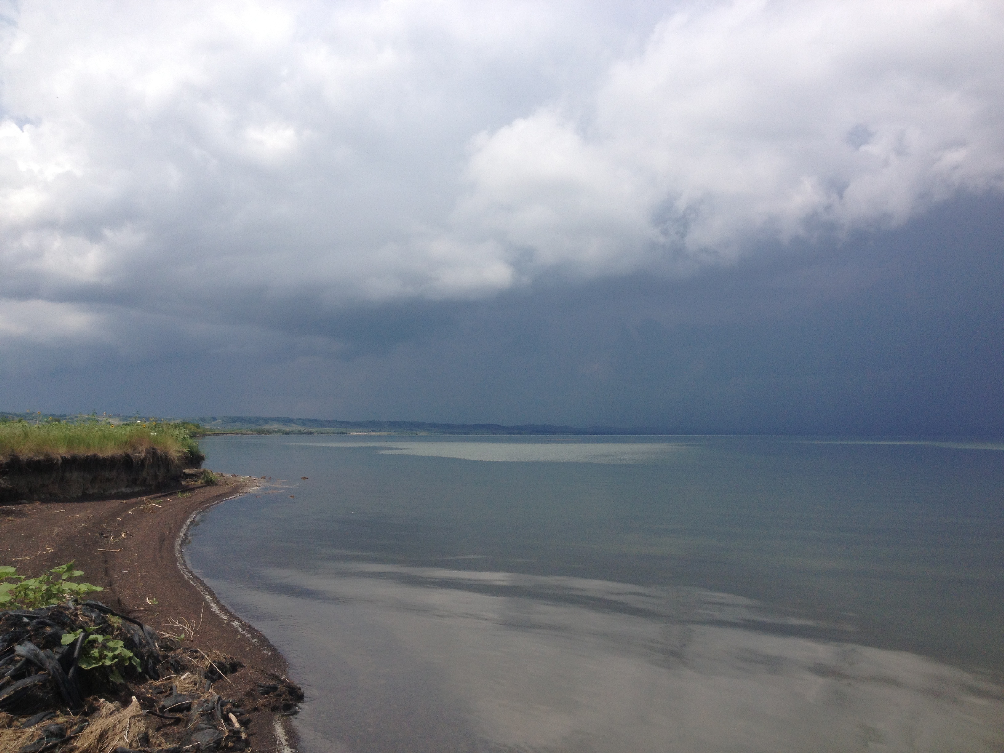
I took this photo on glassy waters as I paddled past Lower Brule.
It did not take long for this northern squall to move in. Luckily it broke up over the river after I had moved my boat and gear and me away from the water.
The journey is not over until the mission bears fruit. The goals of LoveYourBigMuddy Expedition include 1) empowering youth (women and men) to confidently pursue their dreams and desires 2) conducting effective education in the natural environment, which includes bringing the Missouri River into the classroom and the classroom out to the river and 3) preparing the next generation for impactful stewardship of our nation’s waterways. Purposeful living embodies the spirit of adventure. Yep, that’s my story and I’m sticking to it.
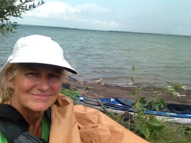
Coming out from under my tarp which I used to cover myself in a squall.
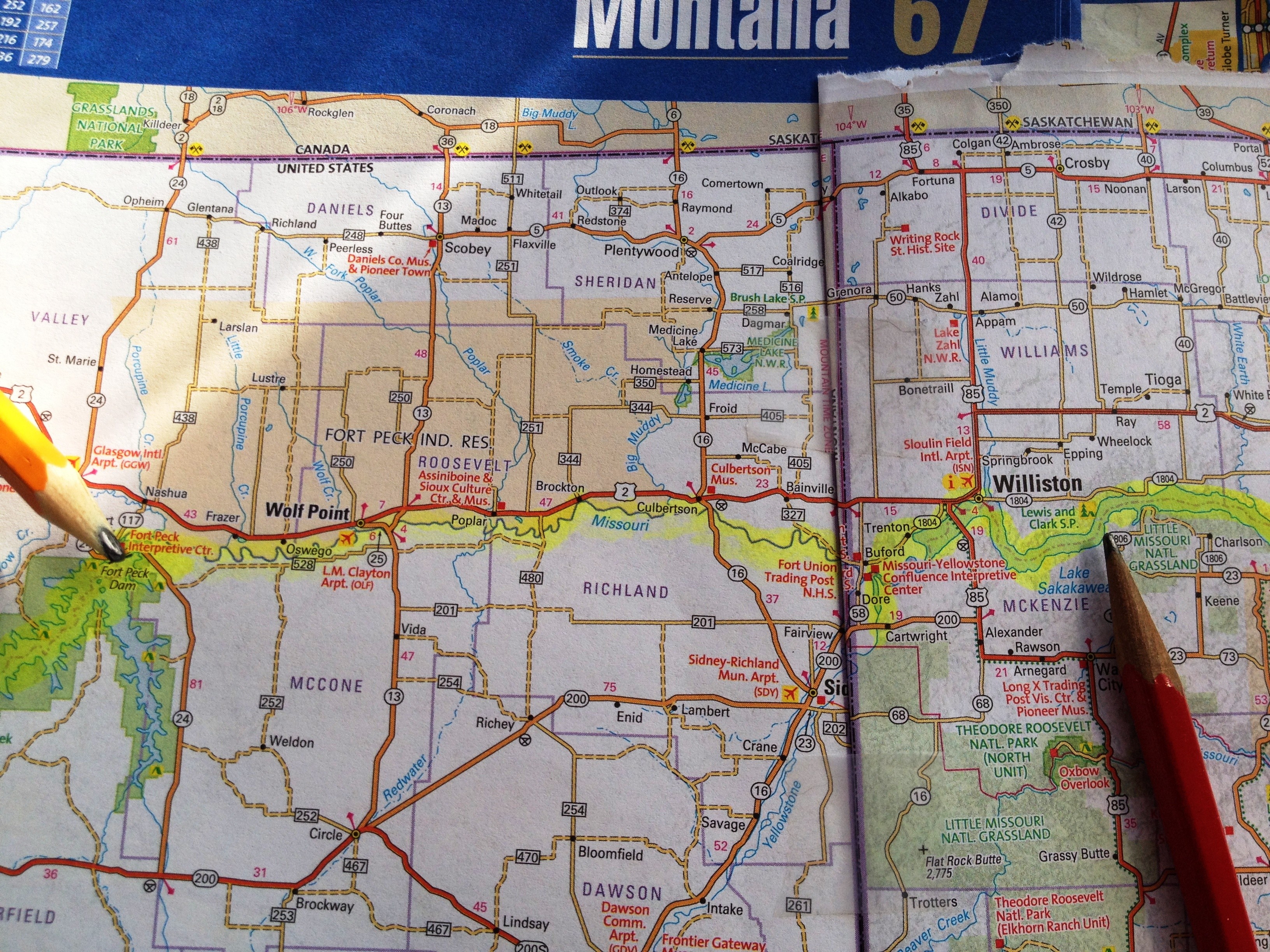
The Missouri River between Peck Lake Dam and Lake Sakakawea. The border of Montana and North Dakota is located right on the crease of the Road Atlas. I crossed the border at Fort Union on June 26.
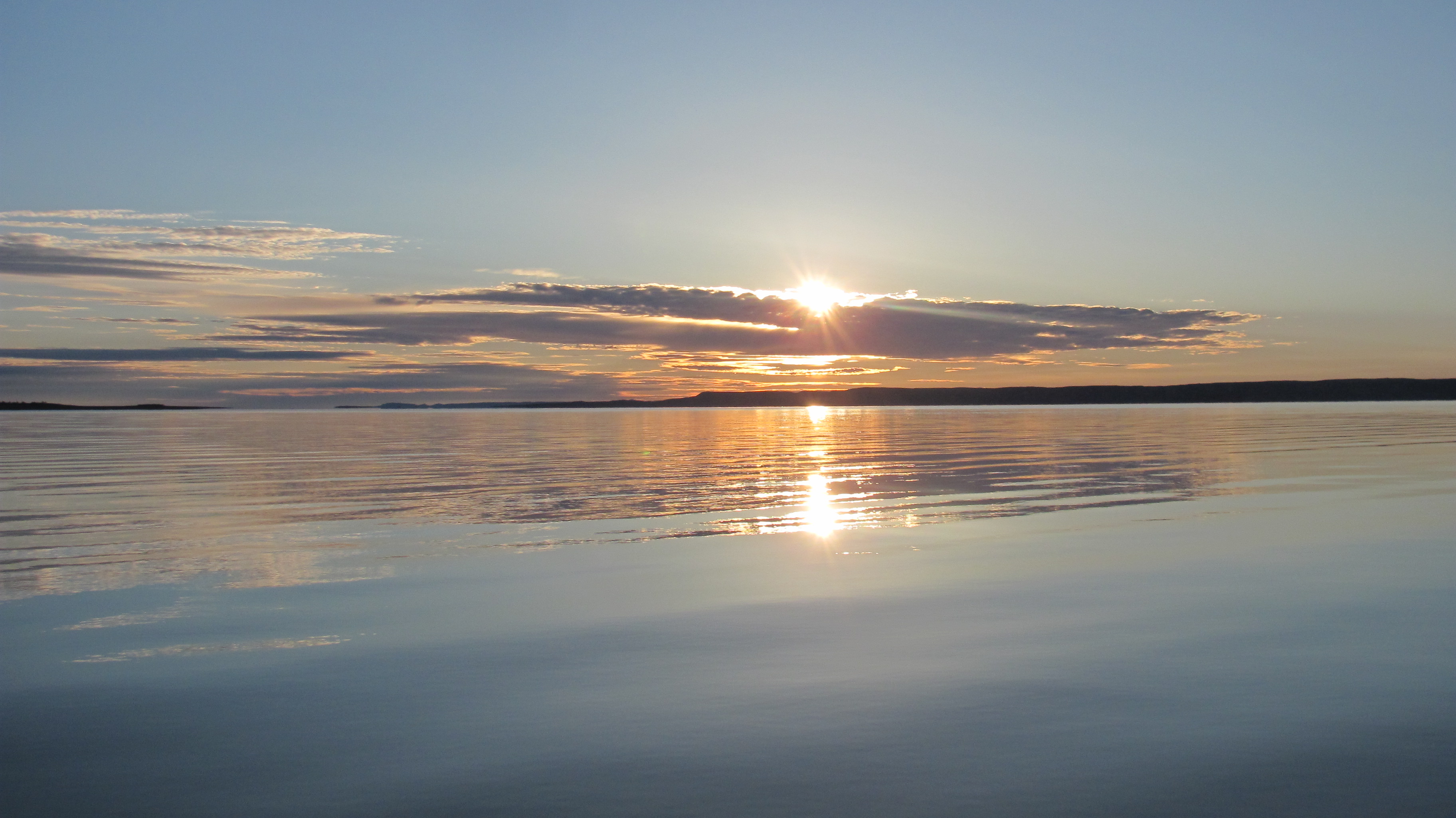
On Monday, June 17, I paddled my final day on Fort Peck Lake. The winds were dead calm and the water so glassy I could see myself in the reflection. I owned the lake that day. I could go anywhere without fear of swamping. I felt I could cross to the opposite shore all morning long if I wanted, a feeling never before experienced on Fort Peck Lake. This lake is intimidating. We left with a mutual respect for each other. Yes, friends.
Sunrise on my last day on Fort Peck Lake
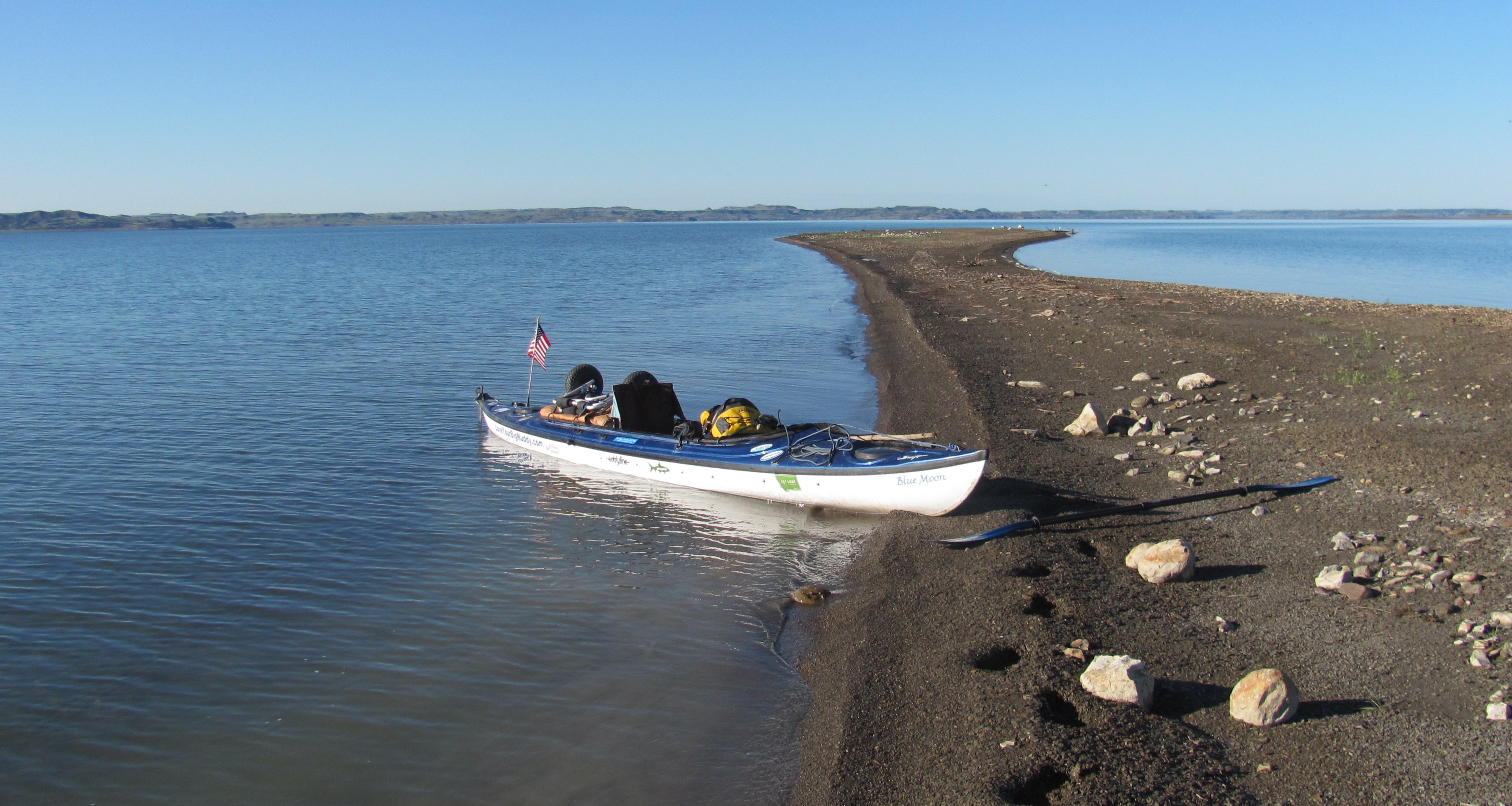
Nearing the end of my Fort Peck Lake journey
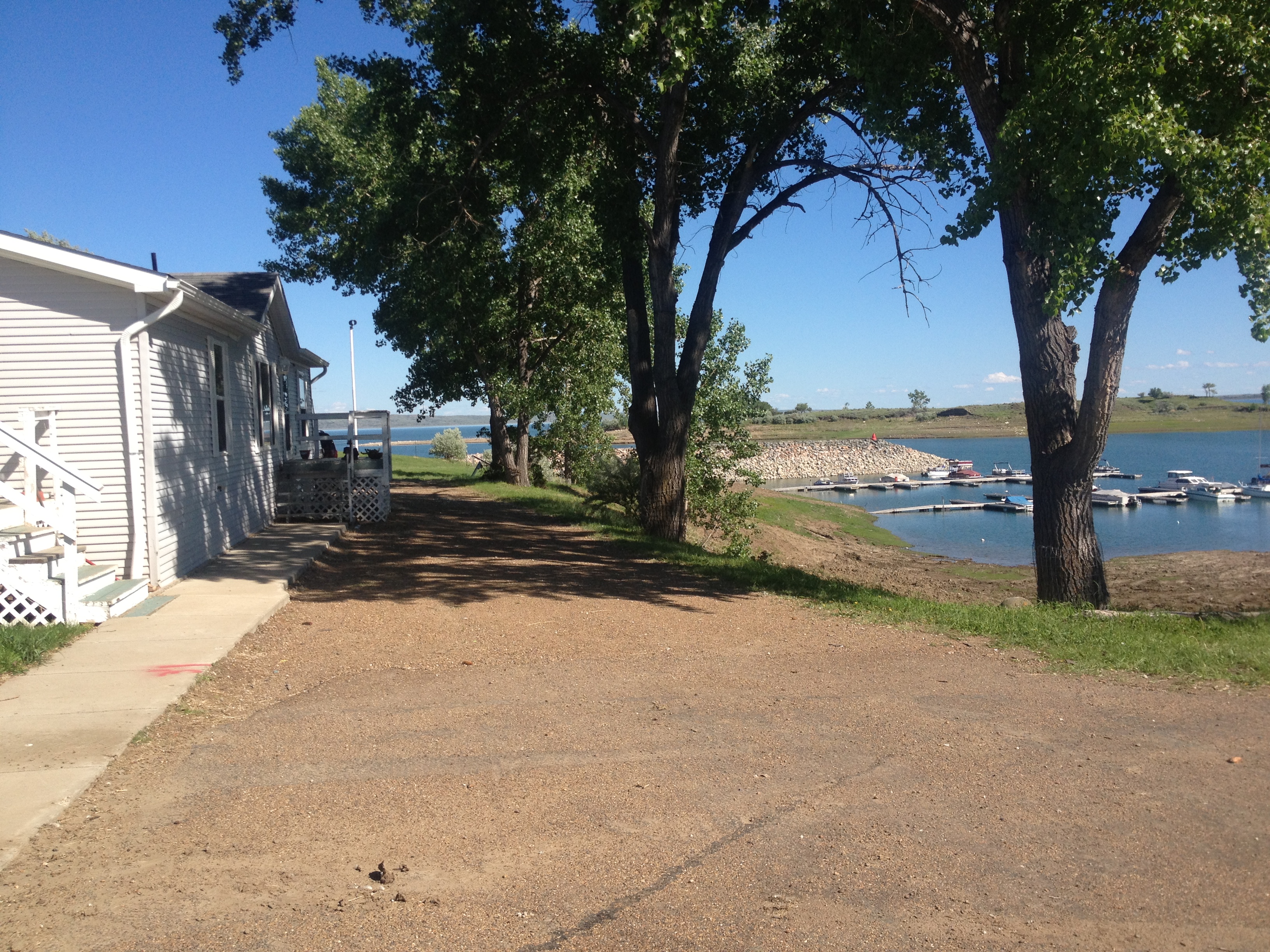
I knew from Dave Miller’s “The Complete Paddler” that the owner of the marina rented out some RVs with showers. I longed for the moment I could shower and relax. It had been a couple of weeks since I immersed myself in the luxury of running hot water. I did take a sponge bath the first day on the lake, but that was a looooong time ago. Immediately upon pulling in next to the ramp I headed for the office.
I asked for the owner, expecting an elderly lady who had been managing the resort for, well, at least ten years. I was surprised to find the owner to be a young woman.
“I am paddling the entire length of the Missouri River and I have not taken a shower in a couple of weeks. I really need a shower and a place to sleep and do laundry. Can you help me”? I asked with determination. “Please say ‘yes.’”
Michelle, the new owner, no longer provided the RVs to accommodate overnight visitors. She did have a house, however, in which she was not living. She and her daughter, and husband when he was here, stayed in a large recreational vehicle and used the house for storage, laundry, and showering. Her husband spent half his time working in nearby Sidney, a town near Williston that was also experiencing a massive oil and gas boom. The marina was a new purchase and investment for this young family. And, they relocated Michelle’s mom, DeeAnne, to live with them and help take care of their young daughter, Allison. I sure appreciated them letting me hang out for a day or two.
Me, Michelle, DeeAnne, and Allison
The house Michelle let me stay in. I helped out with cleaning, babysitting and laundry in return.
The wind blew hard the day after I arrived. I could have cared less… 🙂
I enjoyed feeling safe and secure and out of the elements after the two long weeks on the lake and in the Breaks. However, by the third day I was ready to get going. I arrived at the marina on June 17. Today was June 19. An intense wind and electrical storm was forecasted to sweep through the area tonight, and I was strongly advised not to go until it passed. Jack, retired Air Force and new staff at the marina, helped me put my boat in their warehouse. Winds were forecasted to blow 75 mph that night. I survived the storm easily, but soon got word that campers at Eagle Creek in the Breaks did not fare so well. Their tents got ripped to shreds, and a paddler on the Marias River lost his canoe and all his gear, including a case of beer(!) when the wind swept it up and away. The owner neglected to tie his boat down, a first-time and devastating mistake. I never left Blue Moon unsecured after this night.
I was grateful for Jack as he took the time to show me around Fort Peck on Tuesday, June 18, and also took me to the Lewis and Clark Interpretive Center below the dam. It was here that I saw the most incredible dinosaur skeletons! Unfortunately, my phone ran out of juice and I couldn’t take any photos. Oh well. Today was Jack’s day off and I was happy he offered to show me around. He also agreed to drive me to the put in below the dam the next day, but this was delayed one day due to the big storm forecasted to hit our area, a perfect example of living on “river time.” You just go with the flow and try to stay flexible.
Jack Willis
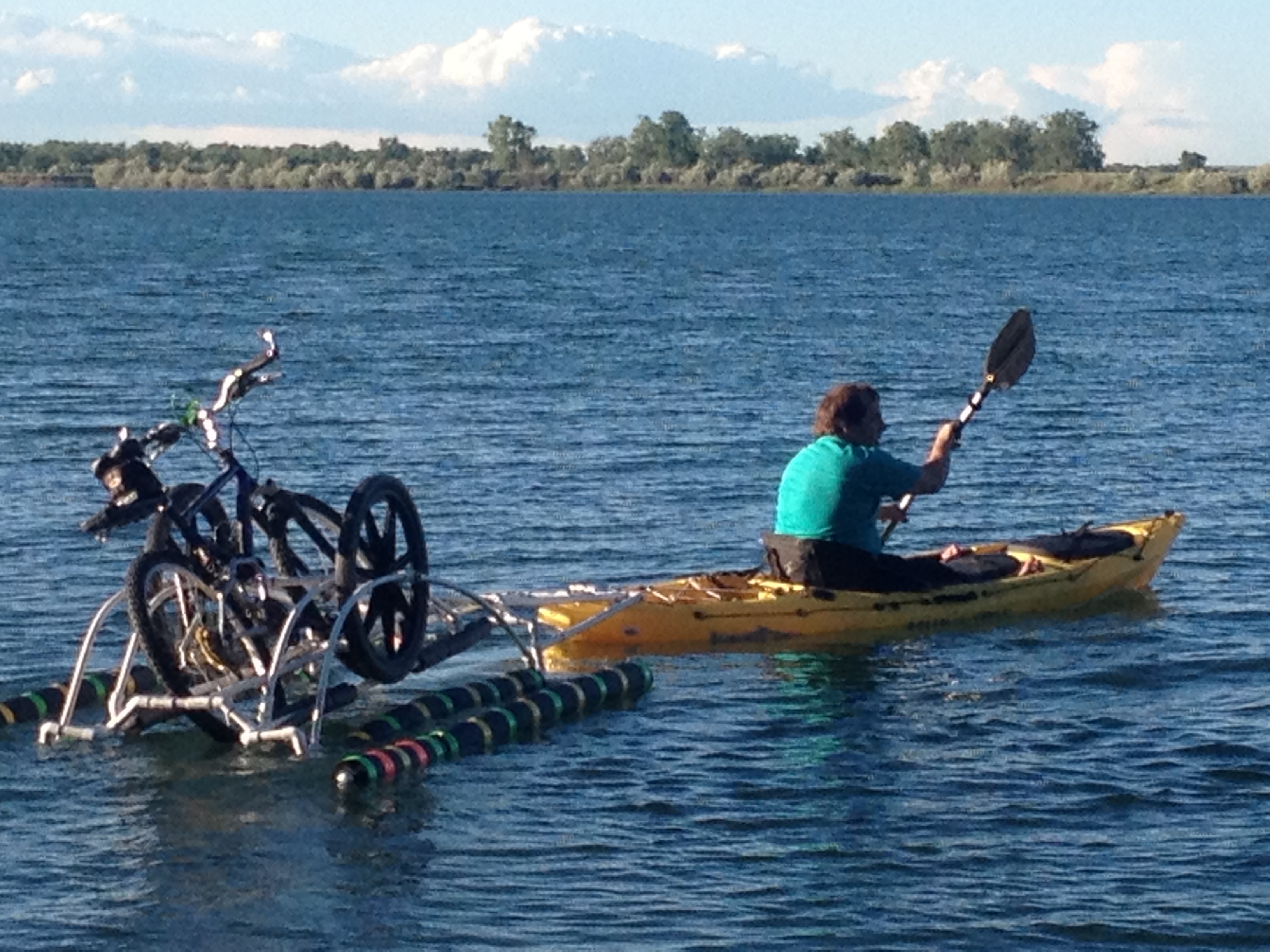
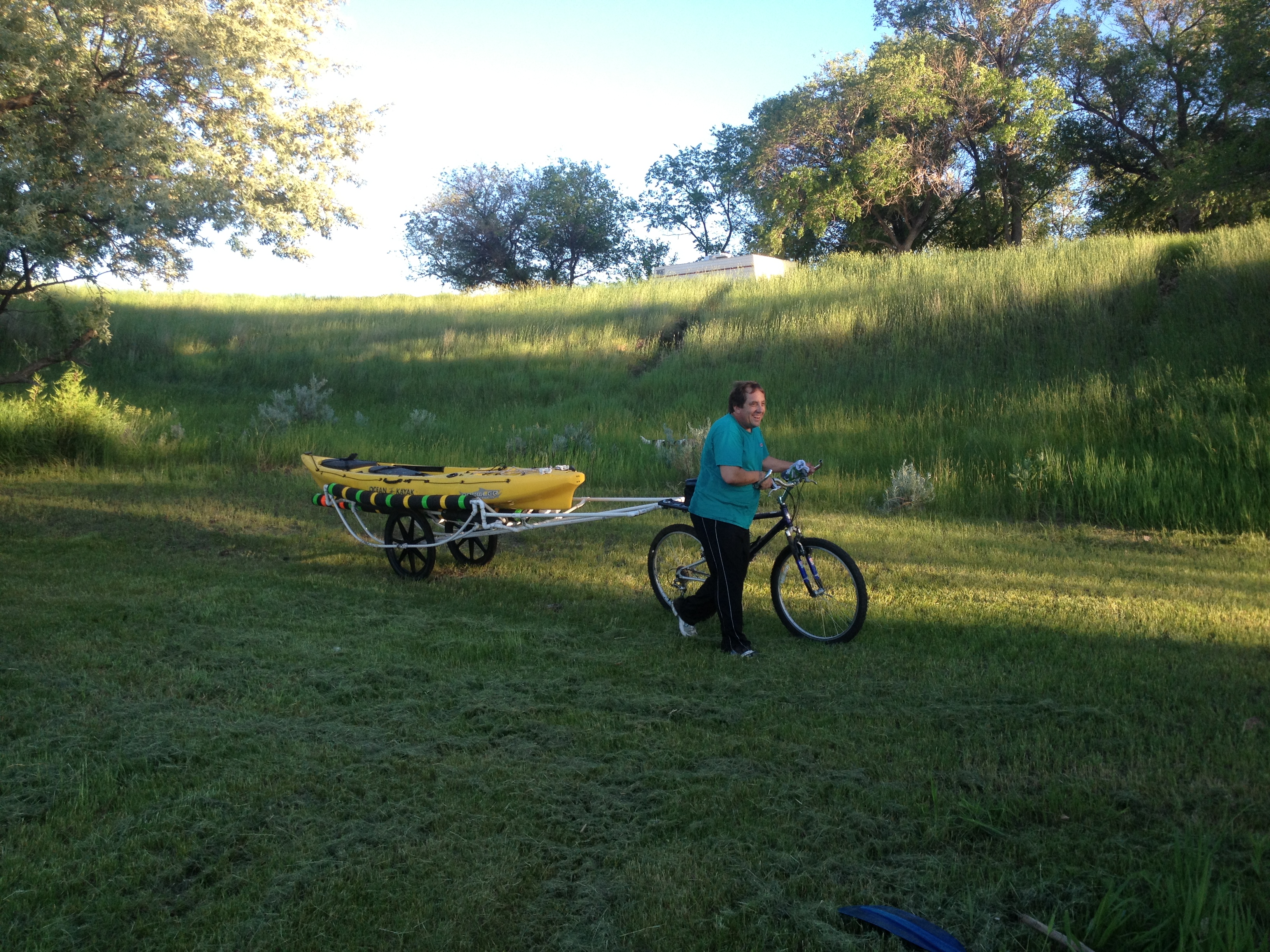
We arrived at the campground below the dam around 6:00 PM on Thursday, June 20. I planned to take off on the river early the next morning. I was getting very excited in anticipation. The thrill of adventure is intoxicating and addicting. But, the mosquitos were sobering and annoying. All part of the total experience. Jack and I sprayed Deet on ourselves and finished our beers sitting on the tailgate of his pickup truck. Hot summer fun! Next thing I knew I was being entertained by a local who had brought his new invention down to the beach to test the waters, so to speak…
My best friend on the Missouri River. Don’t leave home without it.
Local testing his new invention.
Seemed to work just fine.
I left about 9:30 in the morning with sunny skies and glassy water, my favorite conditions. From my journal I wrote, “Good paddling today…The first day back on the water it seems like there are soooo many miles you just want to knock some out. Paddled all day. Saw lots of ship sinkers (my name for snags in the river with pointed ends facing down river) and two shipwrecks, one in the river on a sandbar, the other laying on shore…I paddled about 30-35 miles. The current is about 5 mph, so very quick. I found a decent sandy campsite with creamy mud at the shore. I guess that’s because of the Milk River, it is sooo creamy! Marginal cell, but got some postings up.”
I looked forward to passing the Milk River. One reason was because I had heard of the stark contrast in clear water of the MO and the milky water of the Milk. I also looked out for it because my friend, Dominique Liboiron, who had paddled a canoe down from Saskatchewan the summer before, had camped right on the point at the confluence. I remember he told me that he was so intimidated by the Missouri River that he camped for three days at the confluence before paddling on down. Of course, all of his fears disappeared once he started downstream and realized the Missouri River was actually just one big “lazy river.”
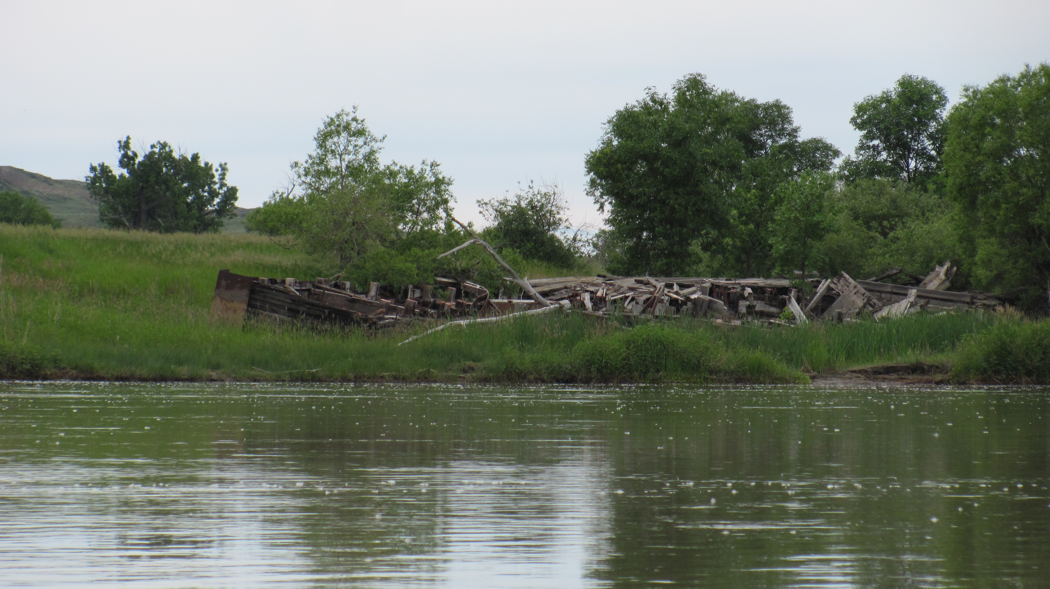
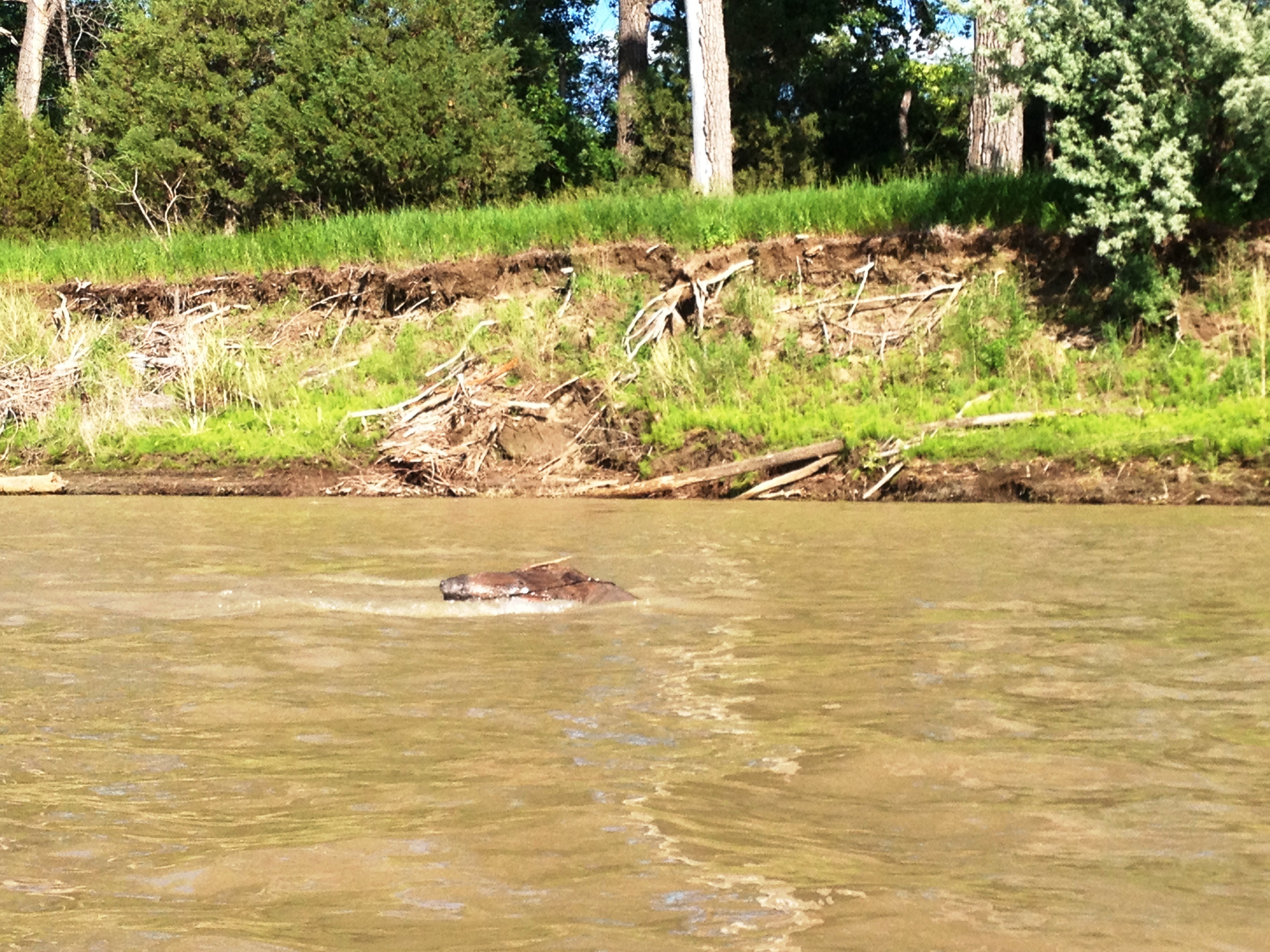
I call these snags “shipsinkers.” 300 steamships met their demise because of the damage caused by these snags.
Believed to be the remains of a steamship
Steamship that met its demise
Clear waters before the Milk River
Contrast in water after the Milk River enters the Missouri River
Camp the first night back on the river
Creamy mud
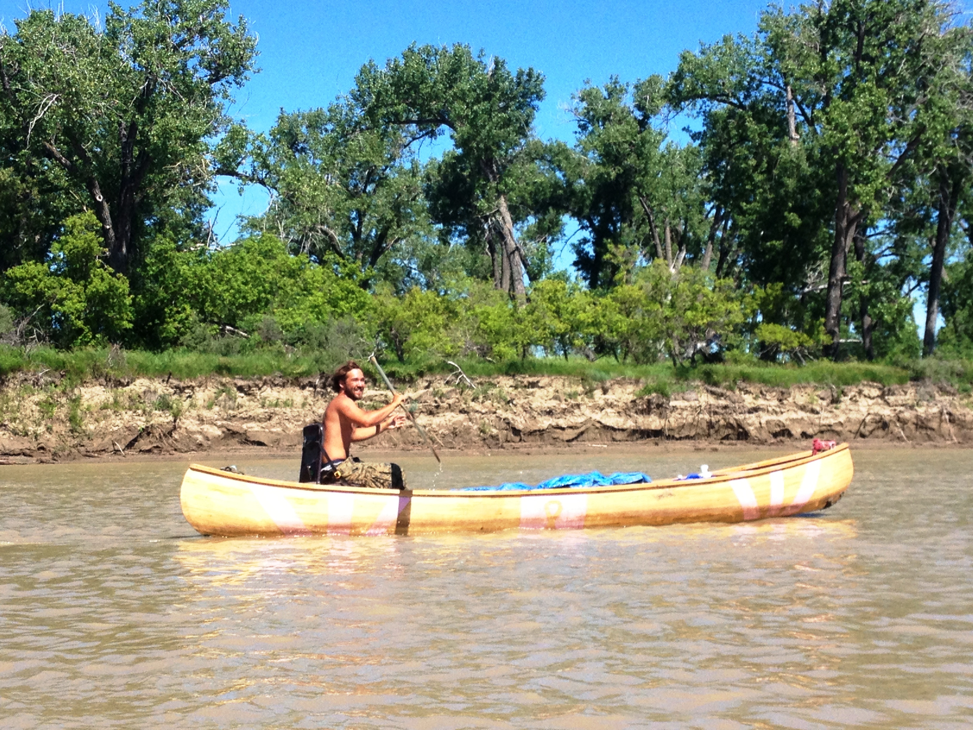
I spent about a week or so paddling the stretch of river between Fort Peck Lake and Lake Sakakawea. I had heard a lot about Wolf Point on the Fort Peck Indian Reservation, and that it was probably not best to stop there. Well, I passed by at 5:00 in the afternoon on Saturday with no real reason to stop. I did not see anyone around, either. Well, I saw one guy. He was in a big beautiful canoe paddling down the river. Wow! Who are you?? I asked , surprised to see another paddler of whom I was totally unaware.
“I’m Shawn Hollingsworth,” he replied.
“Where are you from, paddling from, and to where are you paddling?” I asked, standard questions asked of any paddler you meet on the river.
“I am from Virginia Beach, VA, I started at Three Forks, and I am paddling to the Gulf of Mexico.”
“Wow, all by yourself in that big canoe?”
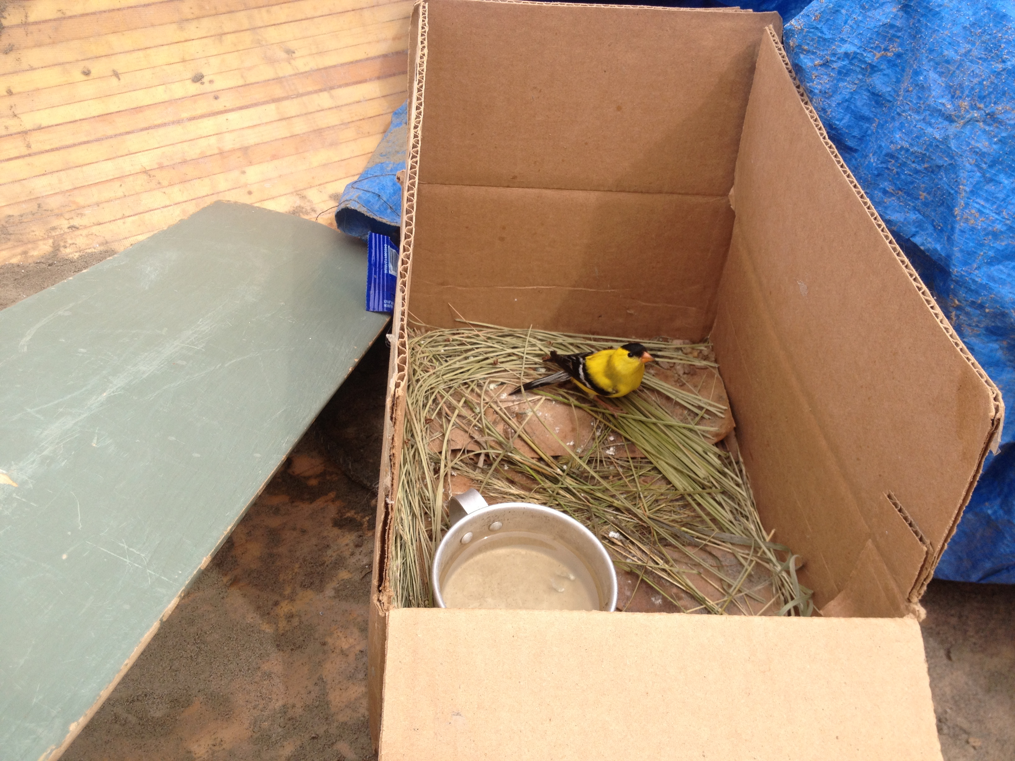
“No, I’ve got a travelling companion.” He then told me about his little bird in a box inside his canoe. He picked up the injured bird while walking down the street in Fort Peck. “He has an injured wing, and his name is Bob (Bird On a Boat).”
He asked me if I was a school teacher. “Actually, I am. Umm, how did you know?”
“Ya, my mom is following you on Facebook.”
“Really? That is too funny!”
This was the beginning of a real sweet friendship. Shawn and I paddled off and on for the next week, until we were both situated on windy Lake Sakakawea. I remember Shawn telling me that Bob finally flew off when Shawn was behind me, paddling through the river-to-lake transition onto Lake Sakakawea on June 28. Most days we did not paddle much together since he was slower in the canoe, but he always seemed to make it to my camp in the evening, much to my delight. He was such good company and, at 23 years old, was on the adventure of his life.
Shawn Hollingsworth in his self-made canoe. Shawn was raising awareness for breast cancer.
Bob
I loved spending time with Shawn. I was so proud of him embarking on this adventure alone after his two buddies left him. One left him two weeks before leaving Virginia Beach, the other left him after a harrowing crossing of Fort Peck Lake. Shawn had never paddled before and now was left to skipper a three-man canoe, which he made all by himself. Plus, he was raising awareness for breast cancer.
The Pink Canoe
I was happy to share with him some tips on reading the river and waiting patiently during high winds, the latter of which guys find most challenging. Paddling in extremely high winds on Fort Peck Lake nearly killed Shawn and his paddling partner. They ended up getting towed off the lake and his partner decided to call it quits. Another paddler had swamped a couple of weeks earlier in big swell generated by high winds. He lost his tent, sleeping bag, cell phone, and his adventurous spirit. He nearly died from hypothermia, and ended up leaving his partner as well. Waiting through big wind sessions on these big lakes is all part of the game. Impatience must be replaced with going for a walk, reading a good book, exploring the beaches and hills, or whatever else one does to entertain themselves. It is a matter of life and death on these big lakes.
Fort Peck Lake-Hiking the hills was a good way to wait out the wind.
Fort Peck Lake-Patience is a virtue, difficult to master at times, but necessary. Great hiking areas help.
On my second night of camping back on the river I saw the most exquisite sunset I had ever seen. I almost missed it while putting up my tent and battling the mosquitoes. I think this is the worst mosquito deluge of the whole trip. Thank God for my 98% Deet. And, for the stunning sunset that night. I think this photo generated more hits on Facebook than any other during my whole trip. Well, except for the skeleton plastered up against the snags on the Beaverhead River. That was a good one, too.
This photo, along with the sunset pic below, were the most popular expedition posts. Taken on the Beaverhead River, Day 1 on the water.
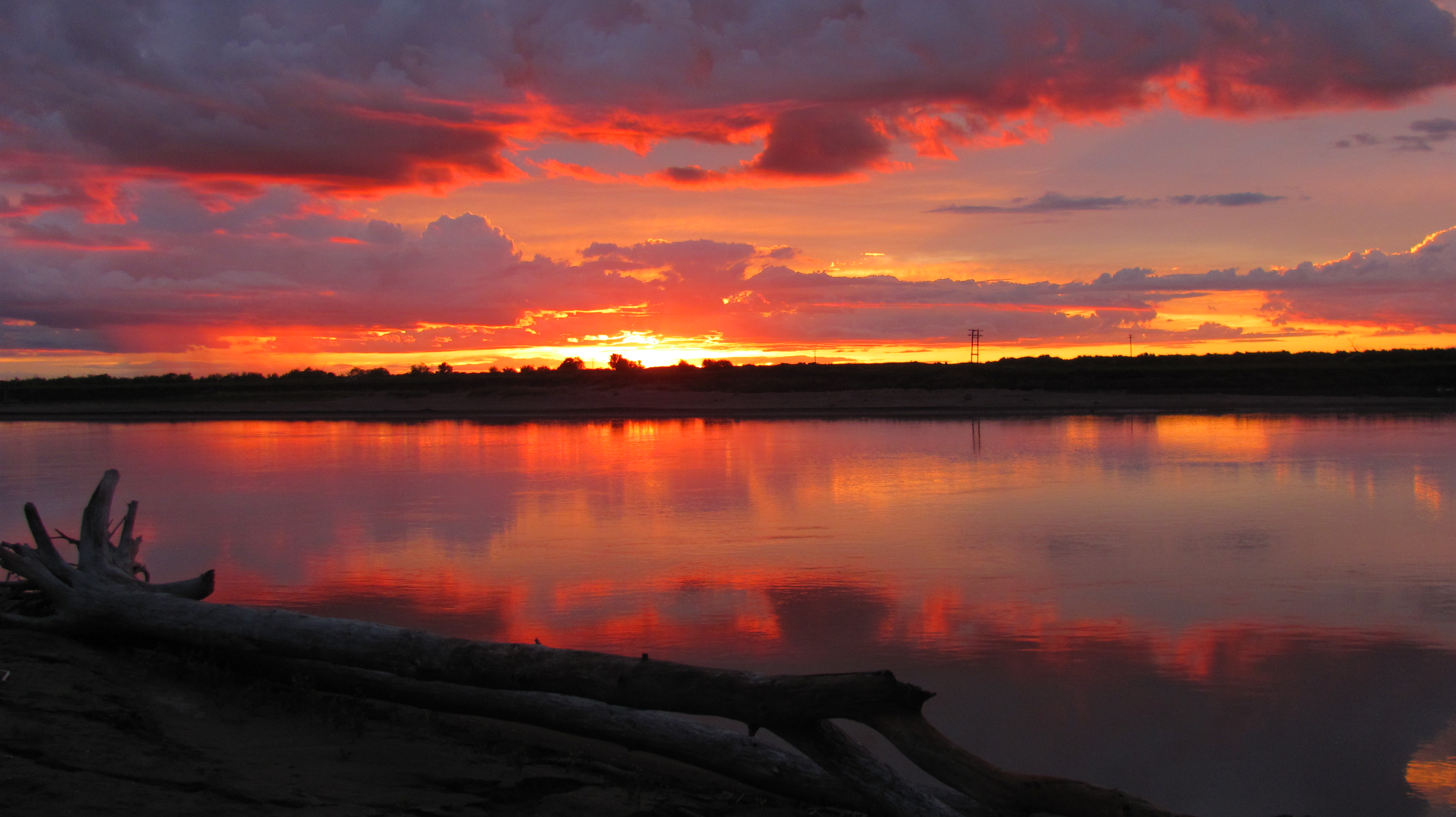
Sunset near Frazier, MT
Here is a little video I shot just prior to taking this photo. After the little video, I began setting up my tent and packing everything in it. I just happened to turn around and noticed the sunset was in full swing. I grabbed my camera right away and got several good shots. I was stunned at the magnitude of colors displayed.
I made it to the Highway 16-Culbertson Bridge on June 24th. Situated just past the reservation, I decided to camp here after some locals said they thought it would be safe. Not long after I landed I met Glenn Stewart, who hollered down from atop the bridge. He was working on the road crew and, after talking to him, he immediately became interested in my journey. If you need to go into town and have breakfast or go to the grocery store, we’ll be here tomorrow and you can just take my car into town. Wow! A true river angel with a generous heart to help. Thanks, Glenn! Glenn and his son, Kelly, and his wife ended up following the rest of my trip on Facebook. Shawn showed up the next morning when I was getting ready to leave. Glenn offered him his car and he was able to make it into town, too. Shawn wanted to stay here and rest up. I did not know when I would see him again.
Highway 16 Culbertson Bridge camp
Kelly (left), Glenn and fellow road crew coworker. Good people!
Beautiful terrain around Culbertson, MT
I ended up going into town the next morning after a pretty good storm hit. Some kids came down to the bridge that night and played some decent country music and lit off fireworks. I almost got up to join them, but didn’t want to spoil their summertime river experience. I’m old, you know…LoL! It’s what memories are made of, right? I slept good after they left, woke up with sand in my tent, but forgot about any discomforts as I ate my ham and eggs breakfast at the Wild West Diner in town.
The day was cloudy and a bit windy from the west, which is not too bad. Once paddling, I got out my iPod and listened to music, which is so much fun, but I hesitated to do it too often. As I wrote in my journal, “I listened to more music, just for a little while. I don’t want to get lulled into complacency while on the water, too dangerous.”
I loved singing along to river songs while on the river. Too fun!
Crocodile, hippo or snag?
I camped just a few hundred yards from the Montana/North Dakota border. Also situated at this location is Fort Union. Norm Miller encouraged me to bushwack into the fort, which I did, and had the pleasure of meeting Yellow Bird, an Arikara Native American working at the Fort. I spent an hour or two visiting with him. I enjoyed immersing myself in the history that surrounds this mighty Missouri River.
Yellow Bird of the Arikara Tribe. Yellow Bird holds two college degrees and is the father of five.
“The Grandest Fort on the Upper Missouri River
Between 1828 and 1867, Fort Union was the most important fur trade post on the Upper Missouri River. Here, the Assiniboine and six other Northern Plains Indian Tribes exchanged buffalo robes and smaller furs for goods from around the world, including cloth, guns, blankets, and beads. A bastion of peaceful coexistence, the post annually traded over 25,000 buffalo robes and $100,000 in merchandise.” -http://www.nps.gov/fous/index.htm
Fort Union looking easily accessible. It is an illusion. You cannot see the muddy water-swamped mosquito-infested slog that you will encounter if you start walking toward the fort. Poor Shawn. He was not a happy camper.
Norm had sent me aerial photos so I could find the easiest access to the Fort. After two attempts, I followed the deer trail up to the outskirts of the Fort property. Some water but not bad with boots. This was 1/4 mile up river from the other photo.
Approaching Fort Union
A look from the inside
An artist’s rendition during the Fort’s hay day
An underground resident enjoying the safety of a gated community. Watch out, or someone might get your hide!
The confluence of the Yellowstone River is just a short paddle away. The staff at the Fort Buford Interpretive Center, located there, were kind enough to buy my camp site for me. I will continue my next blog post at the confluence. I will then be just a couple of days away from starting my trek across Lake Sakakawea. Shawn and I will meet up for the next few days, but then we begin our own journeys down the Mighty Missouri River. Sad parting with him, but not without a promise to reunite and share stories someday.
I just received an email from Virginia Marshall today letting me know that they had published our Q & A interview conducted last month. I like it. Hope you do to.
Also, look for another expedition post soon about the Missouri River stretch between Fort Peck Dam and Fort Union (at the Montana-North Dakota Border). Still going through lots and lots of photos and videos. Oh, and I made my first iMovie video short. I’ll post that once I figure out how to do it.
Cheers! Hope you enjoy the interview…
On the Jefferson River. Photo courtesy of Norm Miller
Q&A with Big Muddy Paddler
Janet Moreland paddled 3,800 miles down the Missouri River. She’s just getting started.
Janet Moreland believes it is never too late to pursue your passions. The 56-year-old mother from Columbia, Missouri, graduated from university with a degree in education in December 2012. Less than four months later, she set out in Blue Moon, her 17-foot Eddyline Shasta tandem kayak, on a 3,800-mile expedition from the headwaters of the Missouri River at Brower’s Spring, Montana, to the Gulf of Mexico. On December 5, 2013, she became the first woman to complete a solo, source-to-sea descent of the Missouri/Mississippi River system, the fourth longest river in the world.
Who is Janet Moreland?
I love the outdoors and strive to immerse myself in the natural environment whenever possible. I spent much of my youth in California’s Sierra Nevada Mountains ski mountaineering, and windsurfing the northern California rivers, bays and waves. I began canoeing rivers when I moved to Missouri in 1994, and started kayaking the Missouri River in 2001 after moving to Columbia, MO, in 1996.
You can often find me three miles down the road from my house on or near the Missouri River at Mile 170, Cooper’s Landing, where I spend much of my time walking my dog, paddling, or enjoying the company of our large river community.
Do you remember the moment you decided to walk out your door to take on a solo Missouri River source to sea? What was the biggest factor that motivated you?
One of the biggest motivating factors was the notion that I would be the first woman to paddle the entire length of the Missouri River solo. This turned out to be very inspiring for many women, students, and men, following my expedition. Later, I realized I would also become the first American to journey from source to sea.
You write on your blog that your mission for this trip included empowerment, education and environmental stewardship. How do you meet these lofty goals and paddle 3,800 miles?
Well, the journey is not over until the mission bears fruit. I am still actively working on realizing these goals. The first step in my trip was to complete the paddle successfully. Many who followed my trip on Facebook or on my blog were very inspired that a 56-year-old woman was attempting such a grand and challenging expedition. Also, I wanted to model for school-age children that they can overcome challenging obstacles and be successful in achieving their goals. Many of my students from last year were excited about my attempt, and followed me on social media.
Regarding education, I tried to share as much of my experience on the river as I could, including some cultural and historical information. I wanted to increase awareness of Missouri River Relief, a dynamic non-profit organization dedicated to the stewardship of the Missouri River, as well as educating our youth and communities about the river, on the river. While I was on my expedition, River Relief was conducting river cleanup events on the river from St. Louis to Washington to Kansas City to Omaha.
Who are your paddling heroes, who inspired you and who continues to?
Well, Norman Miller was my go-to guy when deciding and planning this expedition. He was a motivating factor as well. He paddled up the Missouri River in 2004 for the Lewis and Clark Bicentennial celebration. He followed their route up the river, over the Rocky Mountains, and back on the water to the Pacific Ocean.
I made a point of meeting all of the 2012 long-distance paddlers (LDPs) on the Missouri River when they passed by Cooper’s Landing. I enjoyed talking to all of them about their journey and took mental notes. So, some heroes include Dave Miller, author of The Complete Paddler, and the one who planted the seed in 2005 when he passed through Cooper’s Landing (Norman Miller watered that seed last summer), Bob Bellingham, Mark Kalch, Dave Cornthwaite (swimmer), Rod Wellington, and Dominique Liboiron. The LDPs I paddled with this year, Reed and Josh, Shawn Hollingsworth, and Scott Mestrezat are also my heroes, and I consider them my river brothers.
The MR340 paddlers are also my heroes. Anyone who immerses themselves in a 340-mile race across the state, on the Missouri River, is inspiring to me and a hero in my book. Stand-up paddle boarder, Shane Perrin, is my hero in this regard.
What kayak did you use to take on the Beaverhead, Jefferson, Missouri and Mississippi rivers during your Source to Sea expedition, and why?
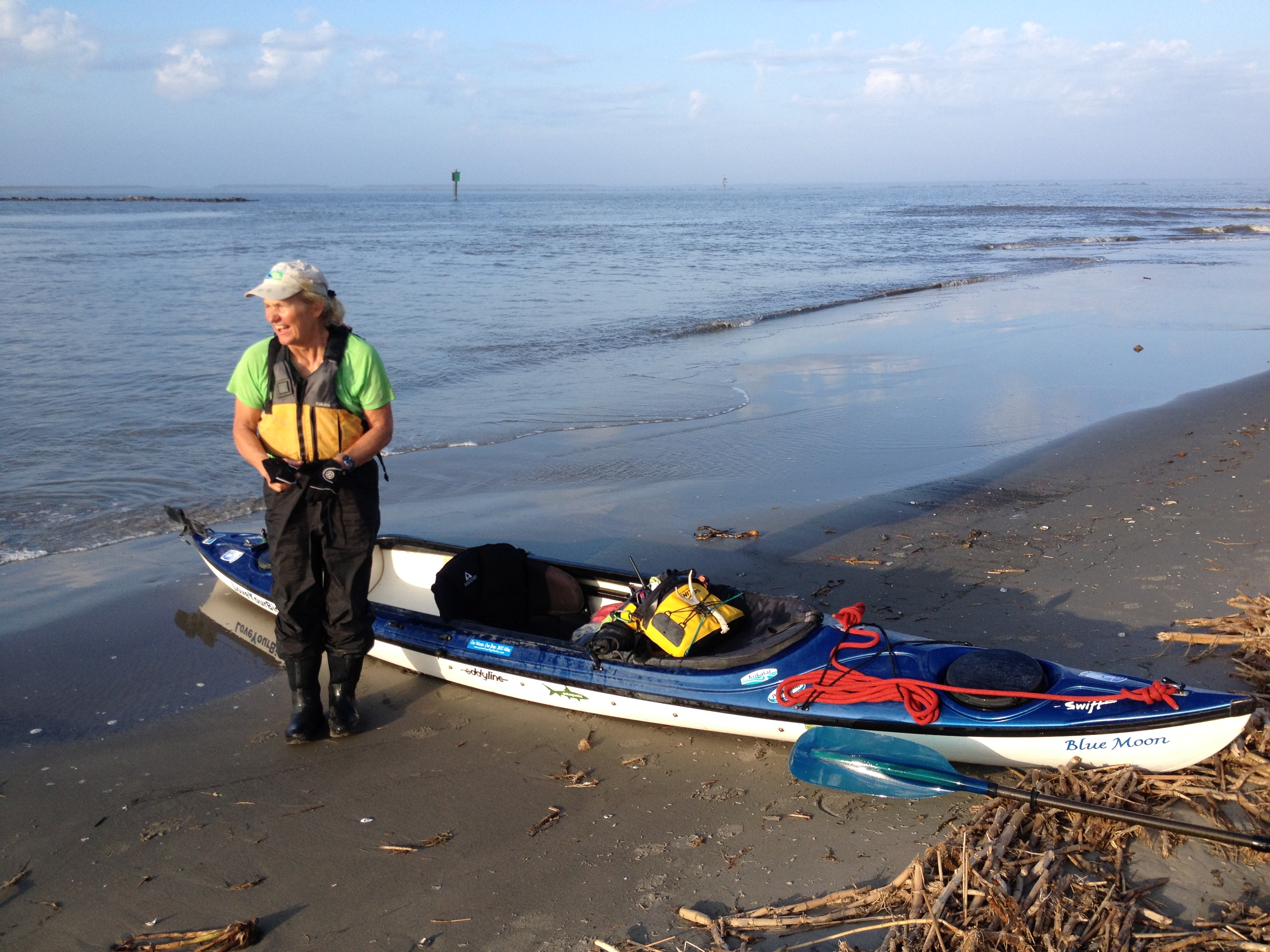
I paddled an Eddyline Shasta kayak on my journey. Paddlers Andy Bugh, 2011, and Bob Bellingham, 2012, paddled the same kayak. In fact, I bought Bob’s kayak from him before he flew home to Australia. The boat is a 17’ tandem open cockpit carbonlite kayak and very stable. And, the open cockpit makes it more roomy that the standard plastic mold sea kayak. I did not want to be cramped inside a tight cockpit. I love my boat. We could go anywhere in extreme conditions and I never felt nervous about capsizing.
The Shasta was challenging on the Beaverhead because the river is narrow, windy, swift and shallow. I had a 12.5’ plastic kayak with me, but my support crew needed to head back to Missouri so I just put in with Blue Moon, my Shasta, and went for it. I put two holes in it on the second day. Oh well, they were above water line and duct tape fixed it until I stopped over at Norman Miller’s house near Three Forks and I fiberglass patched the holes.
Photo courtesy of Norm Miller
What were the highlights of this journey? Was there anywhere along the route that you would highly recommend to paddlers that they might not know about?
There are so many highlights of the journey that I cannot name them all. I will say that the ski in to Brower’s Spring at the source was a highlight. We planned on a seven-hour ski, but it took us 31 hours. We were totally unprepared to spend the night, but we managed. The Jefferson River in Montana was a beautiful stretch of river. Fort Peck Lake was some serious wilderness paddling. I had already gone two weeks without internet in the Missouri River Breaks National Monument, and then another two weeks on Fort Peck Lake. I felt very isolated and exposed to wilderness. I loved it. I have had wilderness yearnings all my life, and that experience fulfilled them. And, the Mississippi River turned out to be a wonderful romantic experience. I fell in love with the sandbars, the tow and barges, the freighters, the wildlife, and the river. My Mississippi River experience far surpassed my expectations.
Favorite location you pitched your tent? Least favorite?
Numerous favorite locations I called home for a night, or two. One that sticks out was on the Mississippi River just below the Arkansas River confluence across from the Chicot City navigation light. I camped on a sandbar shelf, which positioned me up, and looking out, over a narrow bend in the river. I was protected from the north by a long hedge of willow trees. I love being up high, and I love having the tow and barges passing close by. The tow and barges have a romantic feel to me because I believe the pilots of these boats would be navigating the river in steamboats if they were living in that era. The river is their life, so I felt at home navigating amongst them. The fog on the river the next morning was exquisite and I managed to capture the moment with photography.
Least favorite camp was on Fort Peck Lake in a low-lying cove with no trees and covered with mud. It was here that I experienced one of the several severe electrical storms on my trip. I bolted out of this site first thing in the morning, wallowing in mud. Ugh.
Reading your blog, one is struck by the many helpful, hospitable folks you met along your journey. Can you tell us about a few who stand out most in your mind?
This is a very difficult question to answer. There are sooooo many river angels. People up and down the Missouri and Mississippi Rivers were very supportive and wanted to be a part of my success. People were constantly asking me if I needed anything, offering food and a place to sleep, gear needs, coming out to paddle with me, picking me up off the river and taking me into their homes, sharing their lives and families with me. Some were strangers who just gave me cash because that was the only way they had to support me and help me. It was unbelievable. The people who cared about me and my success are the greatest memories of this expedition.
Did you ever come across people who just didn’t get what you were doing, or told you it was dangerous or foolish?
On the drive up to Montana we had to replace a windshield wiper and the manager of the store, upon explaining to him what I was doing responded by saying, “Well, THAT seems like a big waste of time. Why would you want to do THAT?” Then, his employee came out and replaced the wiper, and offered kind words of encouragement. I learned early on that such an expedition is not for everybody.
All of us LDPs this year can tell the same story of people warning us about Fort Peck Lake and how people die on that lake. They all told us the same warnings: winds come out of nowhere and huge swells and waves will swamp you and people drown on the lake all the time. Very discouraging messages, and taken with an element of caution. Fort Peck Lake made us all stronger and wiser for Lake Sakakawea, 178 miles long, and Oahe Lake, 230 miles long, the two huge lakes still ahead on our journeys.
Was there ever a point you would rather have been doing something else, or a place you just couldn’t wait to escape due to unhappy circumstances?
I never experienced unhappy circumstances that discouraged me. I never felt that I would not complete this expedition, or that it was a burden. I loved every minute of this journey and was very sad when the river ran out and I had no more paddling to do. I can never duplicate this journey. It is over. I want to share it, though, in presentations and writing, and will get a book out there in due time.
What advice would you offer to anyone contemplating a long trip or solo journey?
Do what you love and love what you do. If there is any doubt as to the journey you are embarking on, and whether you will be content or successful, take some time to consider if you are doing the right thing. Consider your reasons for doing it. Your mission is an important motivator. If you are inspiring others, you will likely succeed and be fulfilled while doing it.
What’s next for you?
I have lots of things I am thinking about, including writing a book, teaching school full time, and presenting my experience around the country. That said, I am scheduled to be the featured speaker at the Quiet Water Symposium on March 1, 2014, in East Lansing, Michigan. I also have [another] major river expedition I have begun researching.
I finally did it! I made it all the way to the Gulf if Mexico, but not without some very harrowing and tense moments in the Southern Louisiana fog. Fog? Who knew? That was an oversight on my part. Forgot about the fog.
This is my amazing support crew that helped get me through the fog, through the Head of Passes, down South Pass to the Gulf, and back to Venice in a thick fog bank. What an epic finish to an unforgettable journey. Big THANKS to my support crew, the Bar Pilots and their crews in Venice and Pilottown, and to all of my supporters who cheered me on every single day!
My unforgettable crew and dear friends and daughter:
L-R: Mark Dierking, Denise Goforth, Mwah, Jamie Stevenson, Haley Moreland (my sweet daughter), and Deb Miller. Extraordinary!!
And the stellar crew at Pilottown:
Pilottown Crew to the rescue! L-R: Josh, Eric, Adam, Booher, Leon and Shawn. What a comfort these guys were after being in a very uncomfortable fog. Thank you, gentlemen! You are the best!
Pilots at Venice Bar Pilot’s Association:
Bear (R) and Allen (L)
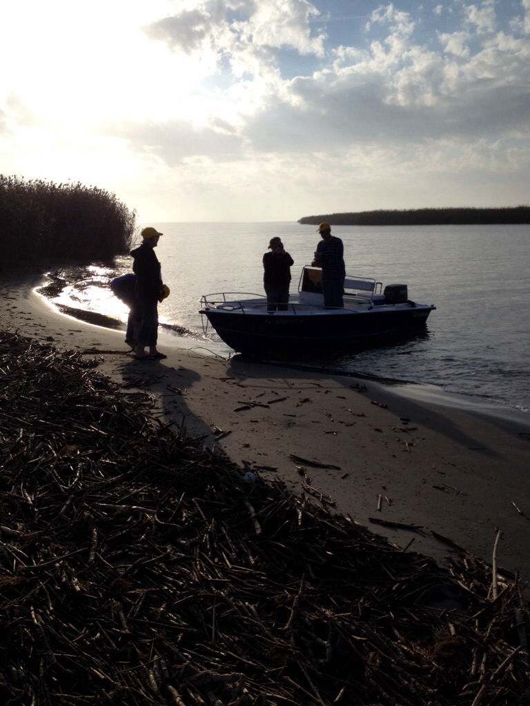
Our first attempt to make it to the Gulf was on December 4. We were doing pretty good on the East shore, although the fog was lingering on that side. By the time we passed Pilottown in the fog, we were engulfed. At one point we all heard a boat coming right toward us. I was out of the channel, and so was my support boat, but I didn’t know it. They were in only three feet of water. Hearing the boat coming closer and closer, but not seeing it, I was terrified they would be run down by a big fishing boat. I screamed at them to turn around. They appeared to be frozen staring into the fog. Oh. My. God. Will I witness their demise???? Thankfully, no. After the boat passed us by, we all knew we were finished for now. I got on the phone to Pilottown and asked them if we could come ashore.
“Of course, we will be expecting you,” they replied.
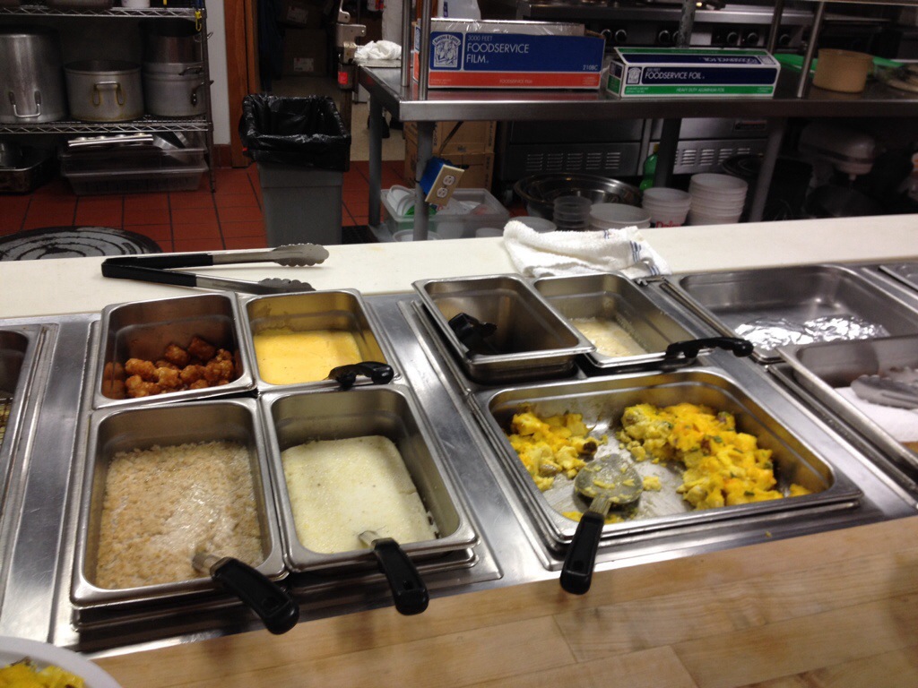
When we arrived 15 minutes later, they immediately took us under their wing, brought us inside, fed us from a smorgasborg outlay of food, shared their ‘mission control,’ and educated us on their system for bringing big ships up from the Gulf to New Orleans. Most importantly, they explained the Fog Predictor, which indicated a lift in the fog at 9:00AM until midnight tomorrow, December 5. We set our goal to the Gulf for tomorrow. They invited to breakfast, too. So nice and comforting, these river angels.
The Pilottown crew directed us to the back room where we feasted. From sadness to gladness, comfort on many levels.The fog predictor. The gap in the red and green lines on the top indicates our window to shoot the pass and get back home. I tell ya, adventure in its purest form.
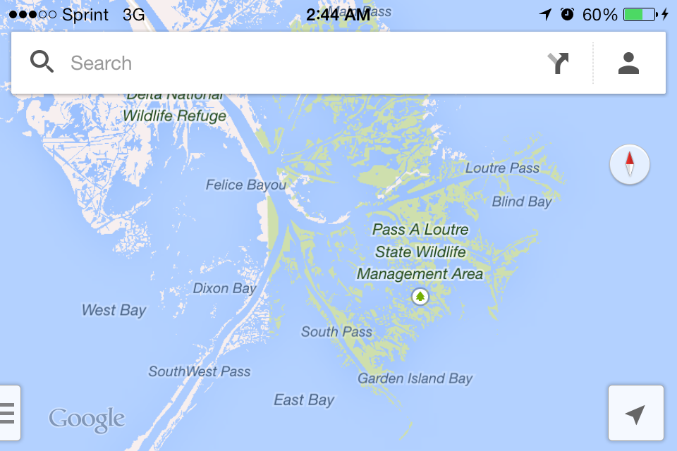
As you can imagine, I was VERY ready to reach the Gulf of Mexico the next morning.A tiny portion of the breakfast offered to us by the Pilottown crew.The fog was thick the 10 miles from Venice to Pilottown, which is located one mile above Mile Zero. The Gulf of Mexico is 12 miles from Mile Zero down South Pass. South Pass is the route I had chosen to reach the Gulf.
On the final dash to the Gulf, my greatest concern was the fog in the Head of Passes. This is a wide open space from which three branches of channelized water run to the Gulf. The Southwest Pass is the shipping lane for tankers, freighters, and container ships, Loutre Pass is mainly small craft and fishing boats, and South Pass fishing craft. Tankers come up SW Pass and cross through the Head of Passes to the West Bank near Pilottown. As you can imagine, in the fog, this is a dangerous route through which to paddle.
Just prior to leaving Pilottown, three Plaquemines Parish Marine Sheriffs pull up in their boat on their way down to Port Eads, located one mile upriver from the Gulf down South Pass. When I found this out, I somewhat pleaded with them to guide us through the fog through the Head of Passes with their radar. As you can see in this photo, I was gravely concerned. I could not get them to commit, for whatever reason, so we determined to just go for it with the support we had from the Pilottown crew, and the Venice pilots, who drive the ships up the Pass.
I asked them if they would guide us through the Head of Passes with their radar. They could not commit. We had to go ahead on our own.Off we went with great apprehension coupled with extraordinary determination.I took this photo the day before. But, you get the picture. Tense moments to say the least.
The Pilottown crew were phenomenal in communicating our whereabouts to the best of their ability. However, when they began asking the ship pilots if they had seen us, I knew we were on our own, so to speak. We had to navigate wisely through this stretch or catastrophe would be imminent. What we did know from my marine radio, was when a ship was coming up through the fog out of SW Pass, or down into the Head of Passes past Pilottown. Mark used his depth finder to try and avoid the channel, but at some point we had to cross.
Ship coming into view through the fog.
There was a moment when we were immersed in fog and very vulnerable. I began to paddle with my GPS as my guide, which is what the crew told us to do. How scary is that in the fog???? Very! As my heart began to sink further into my gut, I mustered everything I had to keep my composure, as we all were doing at that time. At that very moment, we heard a boat coming right for us. Oh my God! Will it see us in time to stop??? All we can do is wait as it gets closer. Then, appearing as though angels from the spiritual realm, the Sheriff’s boat appears and immediately they begin pointing out the channel light at South Pass.
Marine Sheriffs of Plaquemines Parish. I couldn’t believe my eyes.
Miraculously, the fog began lifting at that moment and we could then see all three passes! What a moment of joy and relief that was, never to be forgotten.
Extreme JOY! I can see all of the Passes!
I paddled harder than I had paddled on the entire journey, the 12-13 miles down South Pass. I took out my iPod and played river songs and sang at the top of my lungs, particularly Black Water by the Doobie Brothers. Playing music always gives me a much-needed boost of energy.
The highlight of my entire trip had to be when I saw my white pelican near the shore in South Pass. I couldn’t believe my eyes! He had come to see me through to the end, and provided that quiet comfort we both understood, that he had provided since day one of my paddling journey. I still shed a tear when I think about how perfect and complete this trip has been.
The perfect good bye and congratulations. I was immersed in joy and supercharged with energy after seeing my pelican friend.
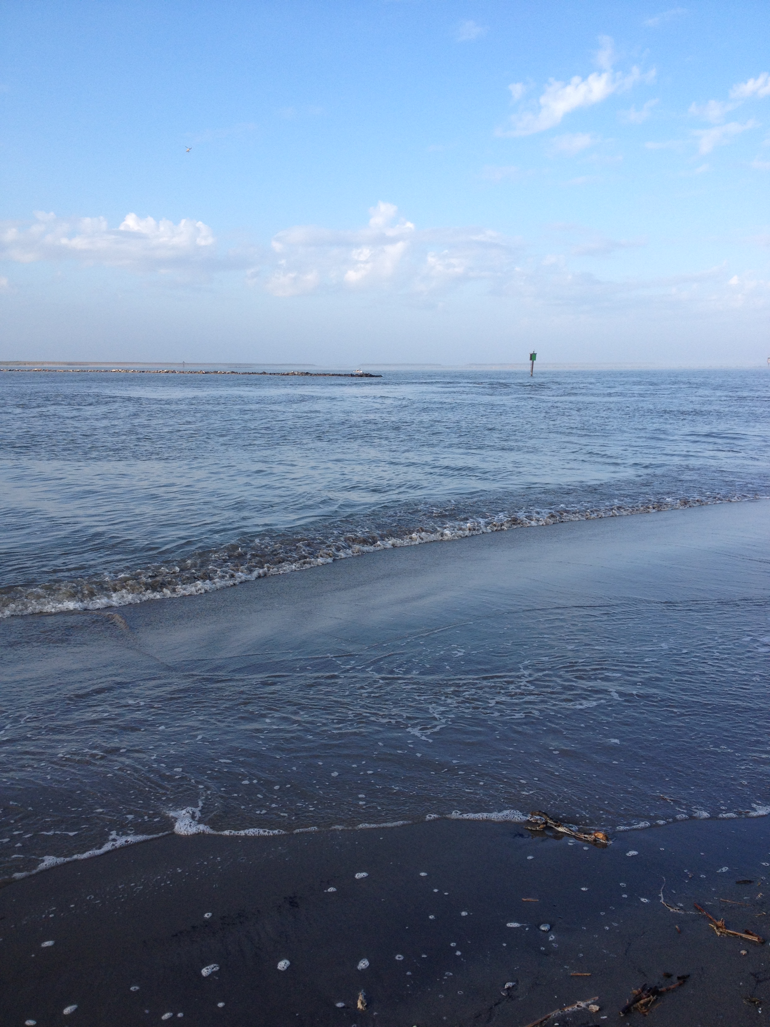
We had a clear shot to the Gulf, and most of the way back up the pass. We were not out of the woods yet. But we had made it to the Gulf of Mexico!
The crew landed before me so they could scope it out and take some photos of my arrival.The Gulf of MexicoWhat a sweet moment of victory, seasoned with a dash of bittersweet. I had run out of river. A new chapter in my life was about to begin. I was thrilled.Champagne, a swim in the water, and a big heartfelt thank you to all of my dear supporters. Then, we were “outta there!”
We made it about 2/3 the way up South Pass when the fog settled in again. We were on a race against time and fog. We absolutely HAD to get back to Venice before dark. We moved as one with eyes and minds on high alert. As you can imagine, the victory was oh so sweet.
We made it back to Venice safe and sound, just in the nick of time. It was dark when we pulled up to the dock.My faithful horse, Blue Moon, an Eddyline Shasta Kayak. What a sweet ride and loyal companion. I love my boat.Thank you, Mark Dierking, for a stellar job piloting the support boat and keeping us all safe and alive. You are the best!Jamie Stevenson, Denise’s boyfriend, was the premium first mate and pillar of strength throughout. LoL! No, really, he was. We all were. (Inside, we were all feeling like he looks.)Haley (L) and Denise (R) We were bonded and quite frankly, family, after these few days together. What an unforgettable experience!Deb, one of my dearest and closest friends. Wow, what a ride, eh girlfriend?! We did it!
Our home away from home in Venice, Louisiana. The Lighthouse Lodge and Villas comped our villa for all but one night, the night that April donated to the expedition. Big thanks to April Durnin for donating to the expedition two free nights of lodging (one night for two rooms) at this fabulous hotel. We could not think of one single complaint. The villa was extraordinarily lovely.
The Lighthouse Lodge and Villas in Venice, LA. We give the villas five bright and golden stars. Loved it!
I will be updating this blog in the days to come. That will help me sort through my photos and videos, and reminisce on the pleasures of this incredible journey. Then, of course, I will write a book, or books. I would like to write a memoir, a curriculum book with lesson plans and activities focused on the rivers and natural environment, and a coffee table book with some of my best photographs. Oh, and T-shirts. I want t-shirts made ASAP. Maybe a calendar right away. So much to do!
I will follow up this post with some videos as soon as possible. Until then, I hope you enjoyed the adventure of my final days. I’ll be back to fill in the gap.
Shouting out a huge THANK YOU to each and every one of you who believed in me, the expedition, and who gave their heart and soul to support the journey. MWAH!! Much love to all, Janet Moreland XOXO
Yep, paddle through to the Gulf. It just makes sense. Photo taken August 21, 2013
Do what you love and love what you do.
Love Your Big Muddy Expedition
3,700 River Miles
April 24, 2013 – December 5, 2013
First American Source-to-Sea Missouri River
First Solo Woman Source-to-Sea Missouri River
The Missouri River is the Longest River in North America
The Missouri/Mississippi River System is the Fourth Longest in the World.


![Change is Good. [Logo design by Jonathan Lauten]](https://loveyourbigmuddy.com/wp-content/uploads/2016/03/img_2053.jpg)