The first thing we needed to do to get the Brower’s Spring was to get throught the Federal Aviation Administration gate that guards the road up Sawtelle Peak. We needed to ske from one of the switchbacks over to Jefferson Peak and up and over the Continental Divide into the Hell Roaring Creek Drainage where the spring is located.
Curt Judy unlocked the gate for us so we could ski over to Jefferson Peak from the road switchback. Thanks, Curt!Mount Jefferson from on top of the bowl.
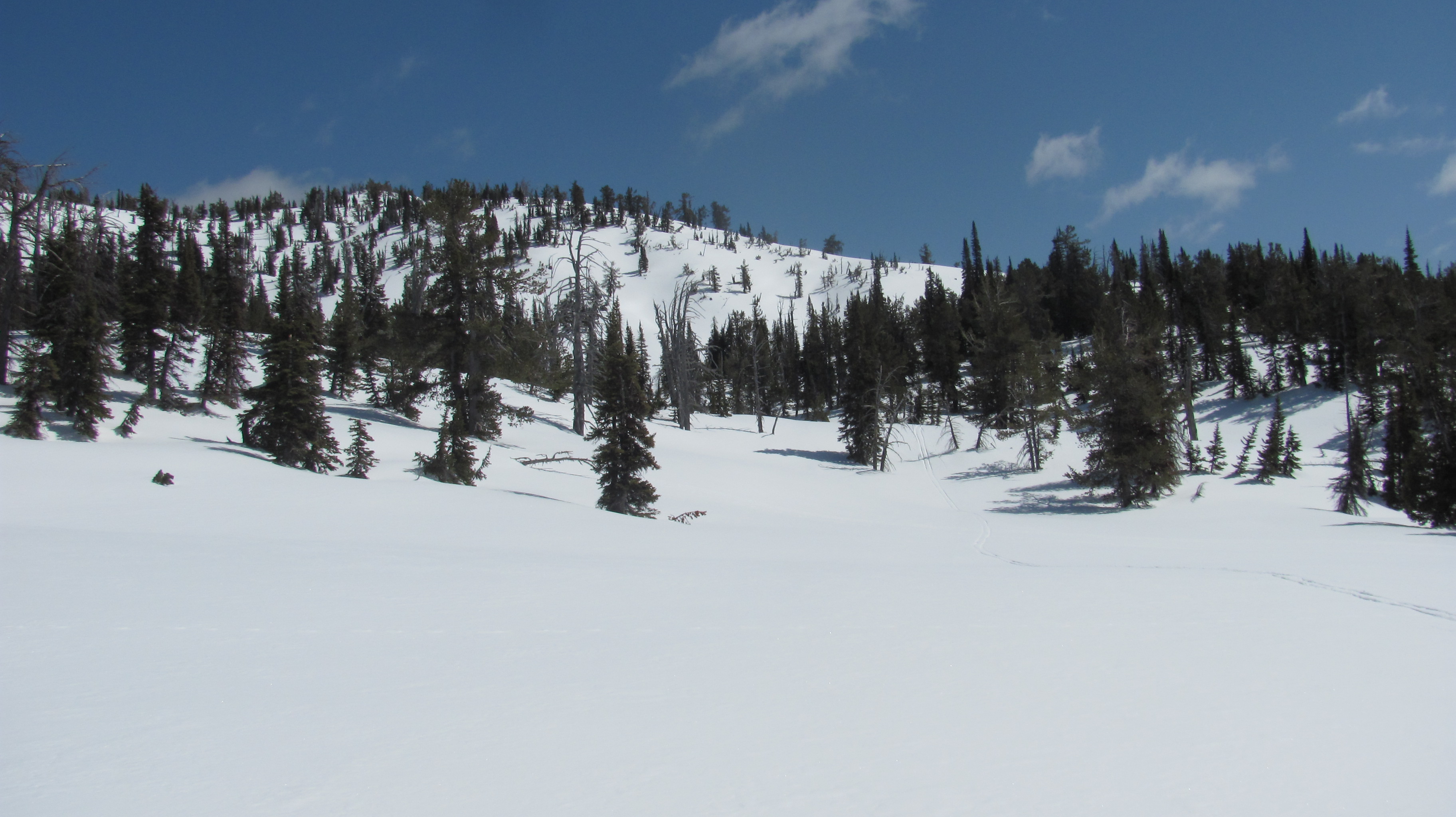
This is the top of Mount Jefferson which stands at 10,200 ft. We traversed the top of the bowl and dropped into the Hell Roaring Creek drainage off to the left. This was a spectacular moment in the ski.
You can see the Teton Range from on top.Sometime at the beginning of our ski in to the spring.Your can see the triangle where I am standing and the push pin where the spring coordinates are, almost touching.
GPS showed me I was soooooo close to the spring. The surroundings indicated to me that I was likely standing on or near the spring. I could feel it in my heart and soul. My heart was racing and I was excited.
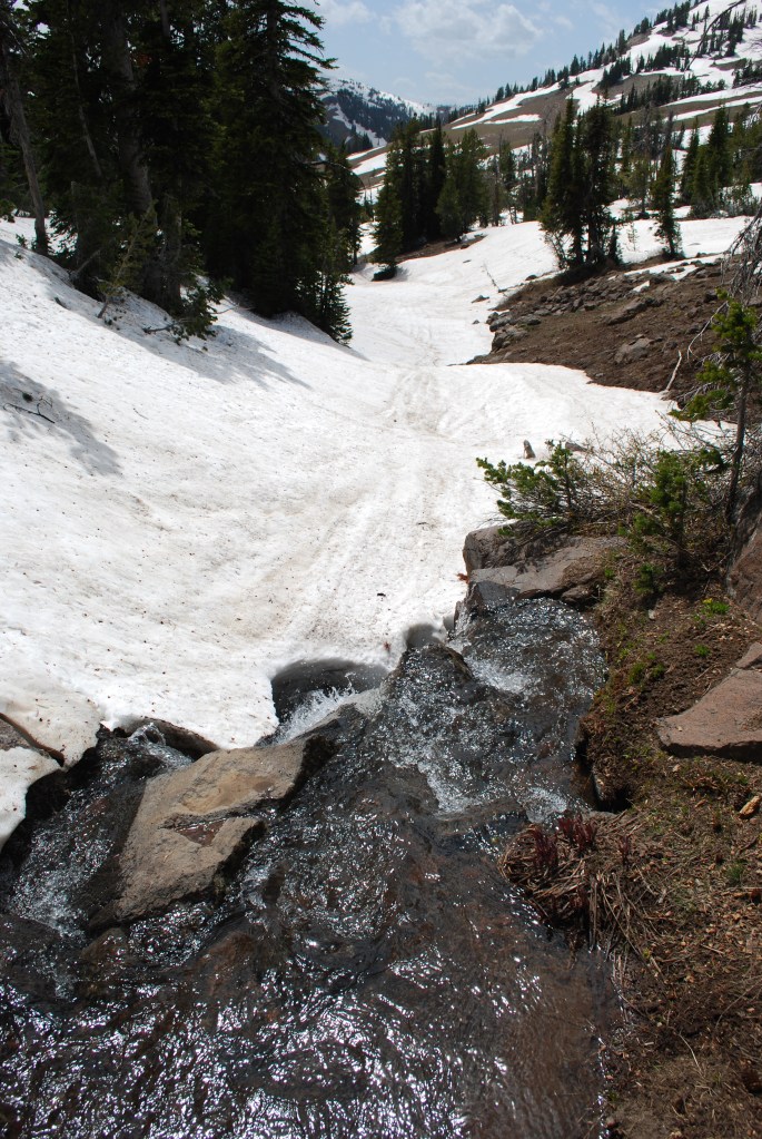
Brower’s Spring just inside the trees in center of photo.
I skied out of those trees where I am sure I was on or near the spring. Rod Wellington, who has also been there, confirmed that the area looked familiar to him.
We even got some turns in. Unfortunately, no photos of our figure eights. Darn!
We assumed that the trip would entail an easy seven-mile ski out of Hell Roaring Canyon. We were mistaken. Because of the snow cover, we needed to be cautious of avalanche danger, and often fell prey to terrain traps, which produced steep drop-offs, false canyons, and unskiable gulleys. Because of this, we were destined to stay over night, which neither of us prepared for. In fact, we absent-mindedly left the car with no means of fire or sleeping gear. We were both tense until we gave in to the fact we were staying the night. Then, our priority switched to surviving the night. We never doubted our ability to do so.
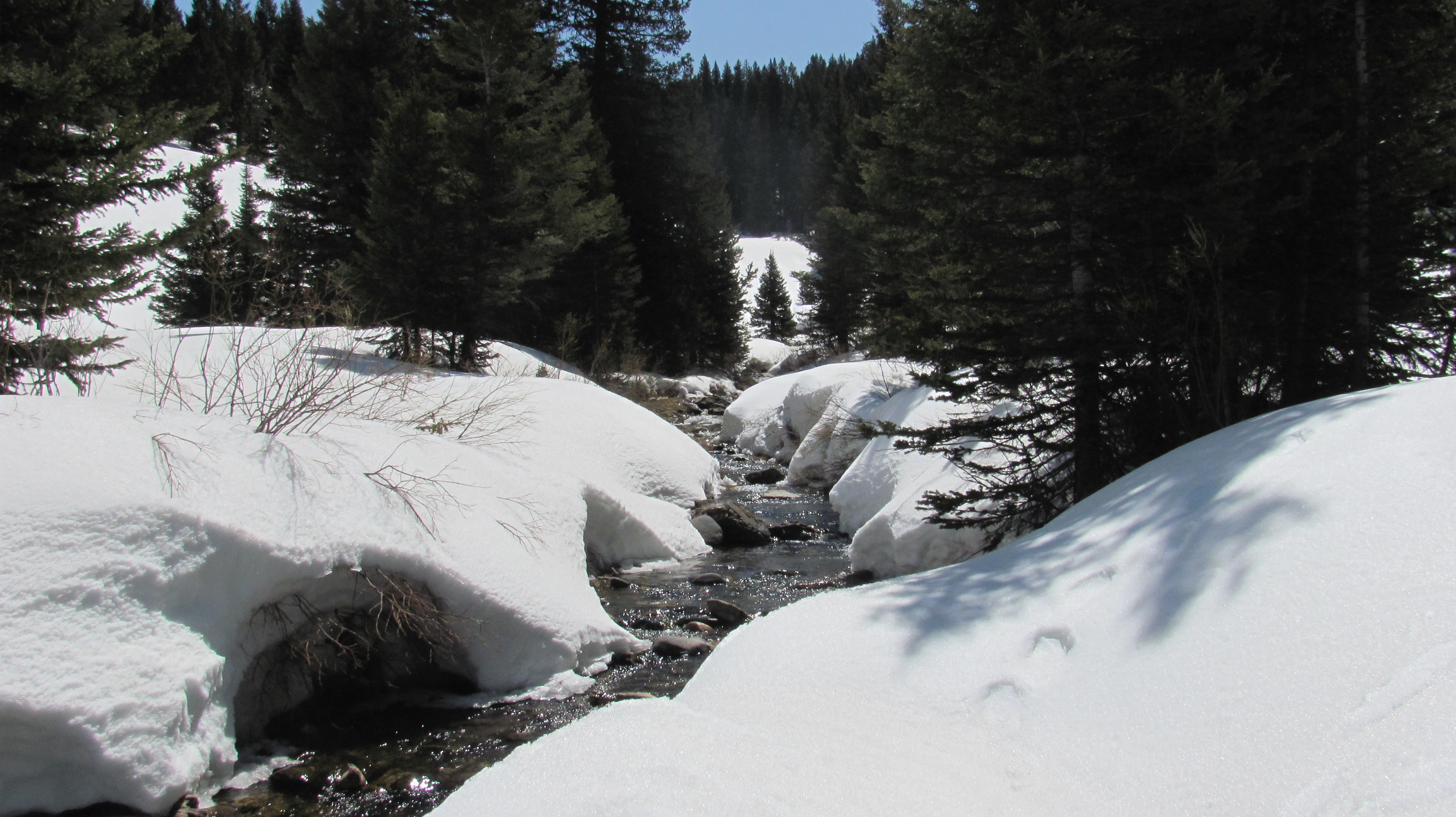
We were at the top of that distant ridge at one point. You could see the Sawtoothe Range in Idaho. We had to be vigilant about avalanche danger.Norm getting water from Hell Roaring Creek. At this point we knew we were sleeping in the mountains.Norm building the shelter. We both took part in this important project.The PBR Haley threw in our pack. Happy we had the extra calories before a long cold night.
I shivered uncontrollably all night. I was only able to sleep for about five minutes. Norm was the same way. Somehow, the hours past and it was time to go. I am thankful to have survived and avoided hypothermia. I had trailmix to eat and a granola bar which we split. I had to eat one of the granola bars for calories just after going to bed. Perhaps, it helped, I could not tell.
Beautiful full moon night, despite the situation.Hell Roaring CreekWe skied 12 miles instead of 7 because of terrain traps that forced us to back up and go another way.Grizzly tracks. We made ourselves known by talking at the bear for the last couple hours of our ski.The end finally in sight. And, so were the bear tracks, which came up from the valley where Haley and Jeannie were sleeping in the car.Haley and Jeannie, support crew, waiting patiently for us. We had minimal contact with walkie talkies that we brought, so we were able to notify them of our overnight stay.Here is the grizzly track Haley took a photo of at the base of Hell Roaring Canyon, where we came out.Oh my God, we did it! Good job!
Next came the bike ride, 90-some miles from the base of Hell Roaring Canyon to Clark Canyon Dam. The ride took three days. The ride of all rides, the vistas were spectacular.
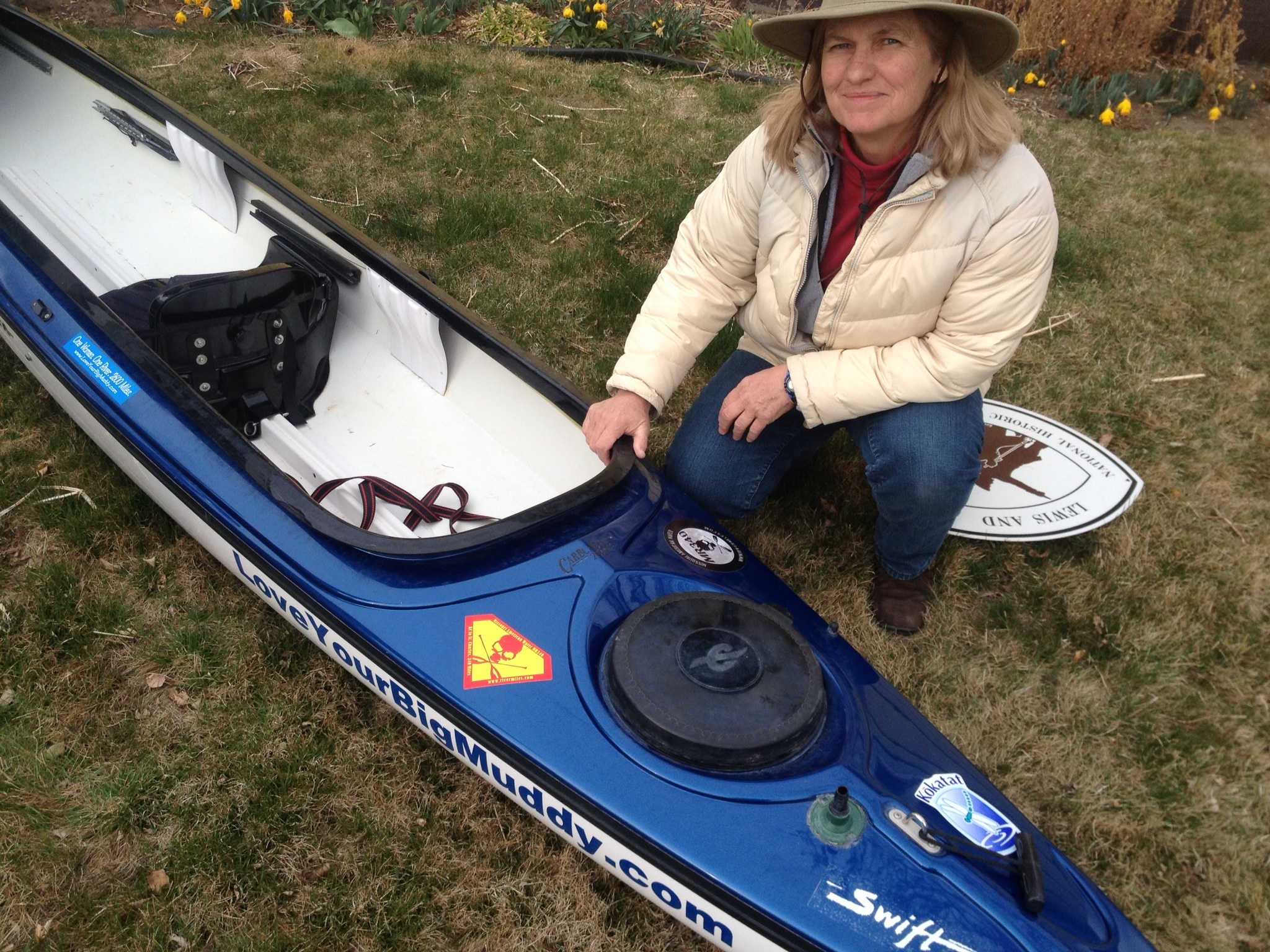
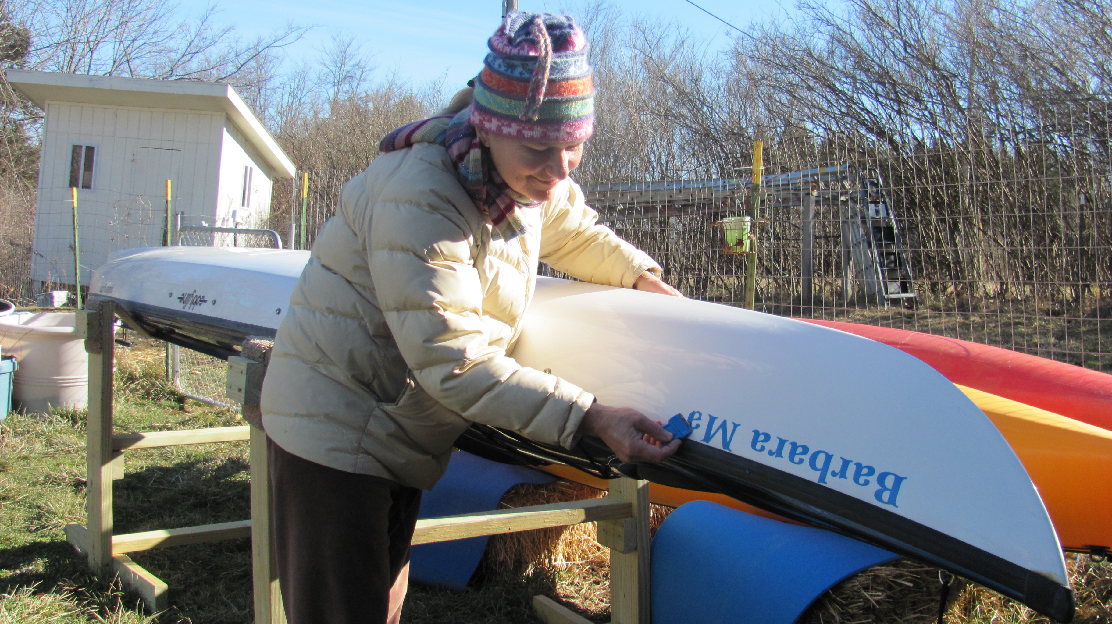
Compact fit. Of course, ther is a lot of stuff in the hatches, too.
We practiced packing the boat yesterday. Thanks to Norm Miller, I’ll be running a pretty tight ship. At least it looks pretty trim.
Norm demonstrating how to get out of the spray skirt should The boat tumble over.
Sail simulation.
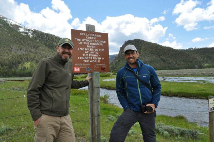
we are heading to Sawtelle Peak for the ski in to the Missouri River’s ultimate source, Brower’s Spring. We will be skiing, and not paddling. The spring is just below the Continental Divide.
Our visit with Norm and his girlfriend, Kris Walker, has been heartwarming and incredibly fun. We will take away some very memorable moments lasting a lifetime!
Please be patient with me as I transition my computer tool from a laptop with Vista Business to an iPad. It is my first Mac experience aside from an iPhone I’ve only owned for two months. I hope to be able to keep you better updated.
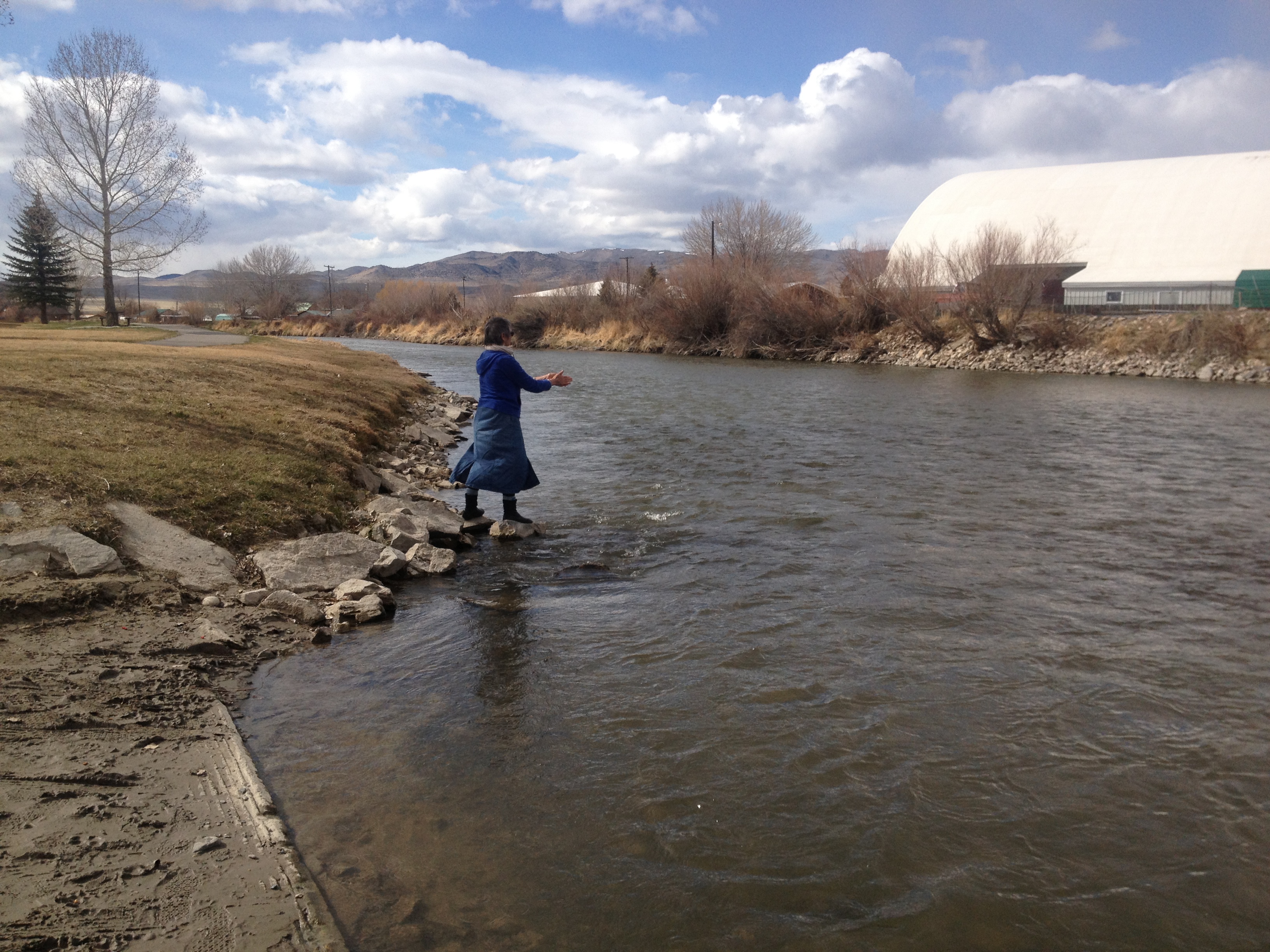
On Sunday, April 14, we enjoyed the warmth of our river community as they sent us on our way from Cooper’s Landing on the Missouri River. I find it intriguing that I will be paddling down the entire length of the river for the next 3.5 months beginning in Montana. I have been dreaming about this journey for over seven years. The time had actually come.
Last minute detail: loading the boat, with Dave Bandy.
We have been on the road for nine days. The trip thus far has been fantastic. We have driven on two-lane highways nearly 98% of the trip. Before we actually got out of town, Haley decorated the van. “I got this, Mom, I used to be a cheerleader.” We drove through some gorgeous countryside in northern Kansas and southeaster Nebraska.
Gorgeous country. Beautiful Haley.
In Phillipsburg, KS, we had a radiator leak which appeared to be a major obstacle. The only radiator repair shop in town was completely booked for two days. I had to drive over and talk to the owner, and tried to convince him that WE REALLY NEEDED HELP. But, he just could not take us in, and so referred us to Wick’s Muffler and Auto Repair. What a wonderful referral THAT was! Galen Wickham and his son Gabe got right on it! Galen brought the car in the shop immediately to try and find the leak. The two of them traced it back to a pinhole leak in a steel hose off of the water pump. A call was made to Hays, NE, 60 miles to the south. We crossed our fingers…
Galen Wickham, left, and son Gabe. Thanks again guys!
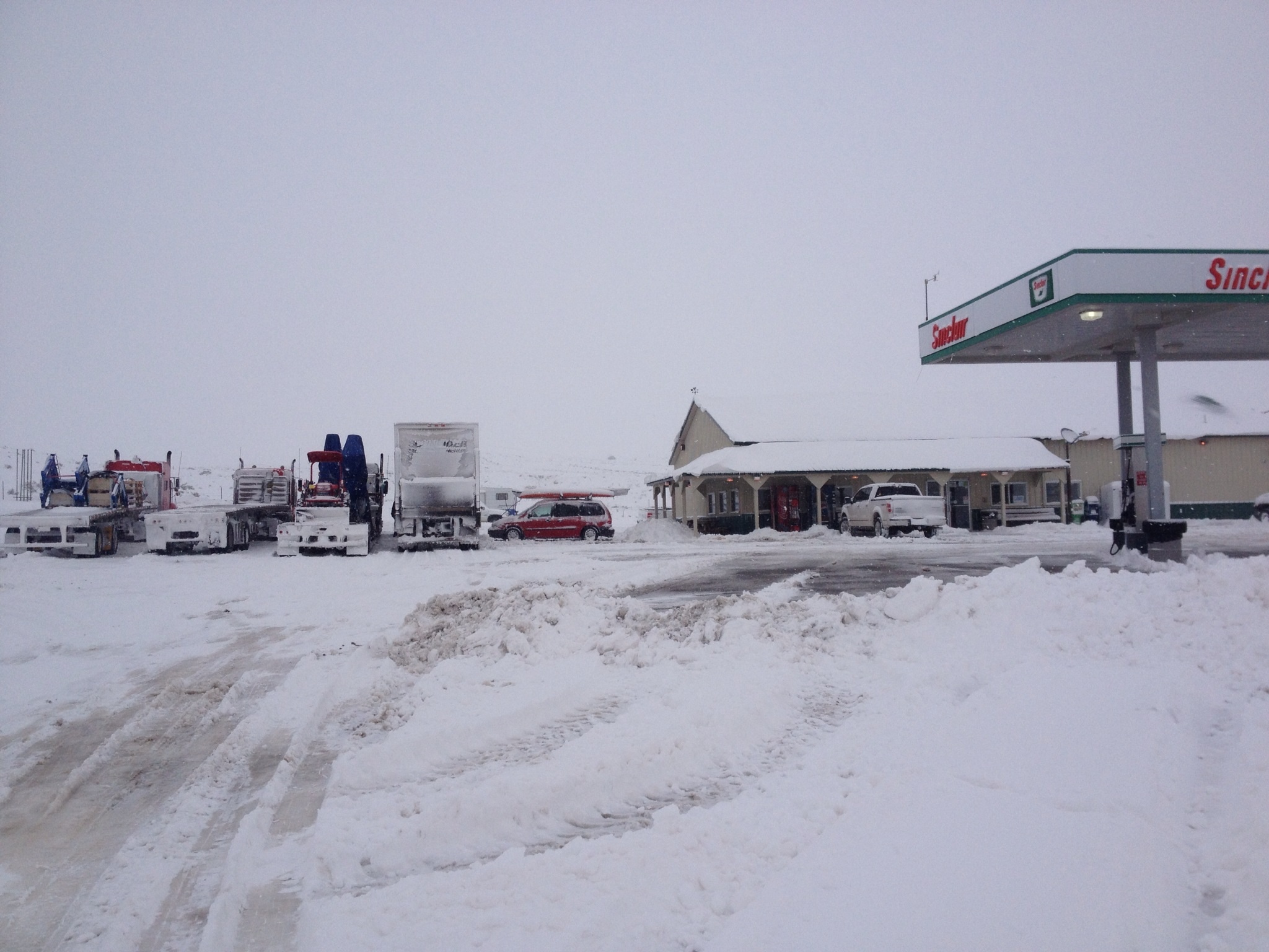
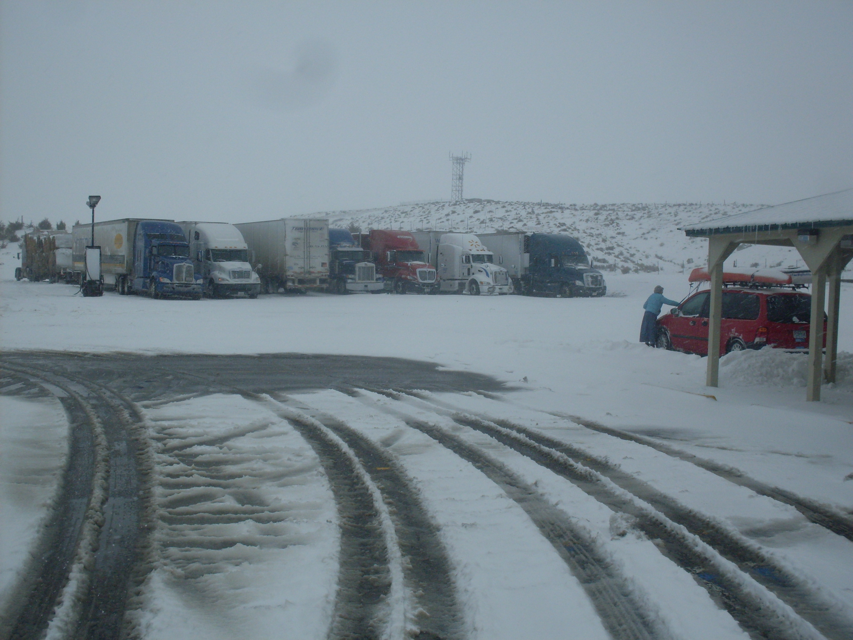
Yes, they had the part but all deliveries had already left town. The best estimate for departure after car work would be about 5:30 that evening. However, I offered to drive to Hays myself and, as it turned out, that is what happened. Galen loaned me his truck so I could pick up the part. Galen estimated a possible 1:00 departure as a result. WOW! Ending up at Galen’s shop was just short of a miracle! We were back on the road by 2:00. Not only that, he was so intrigued by our expedition, he told his mom and dad and brother about it, and they all chipped in to pay for the repair. Now, when does THAT ever happen?? Thanks again, Wickham family. You guys ROCK! I will be telling this story for years. Ron from the local paper, The Advocate of Phillips County, stopped by to ask a few questions about the expedition. Off we went and arrived in Scottsbluff, NE, that night. We got a lovely room and Holiday Inn Express, and enjoyed a hot tub, swim, and had pizza delivered. The next morning we watched the weather channel very closely while sitting in the breakfast nook at the hotel. A winter storm was coming up through the panhandle of NE starting today, Tuesday, which is right where we were. We debated for a couple hours, literally, whether to try and outrun the storm going north, as some guests had already left for Casper, WY. Eventually, we decided to go for it. Turns out the storm would envelope the entire southeastern portion of WY, and over a foot of snow fell. We ended up making it as far as Orin Junction, WY, and the roads all around us began to close. We were 60 miles short of our Casper, WY, destination. Fortunately, there was a small truck stop at the junction, and we immediately settled in once we knew forward progress was no longer available.
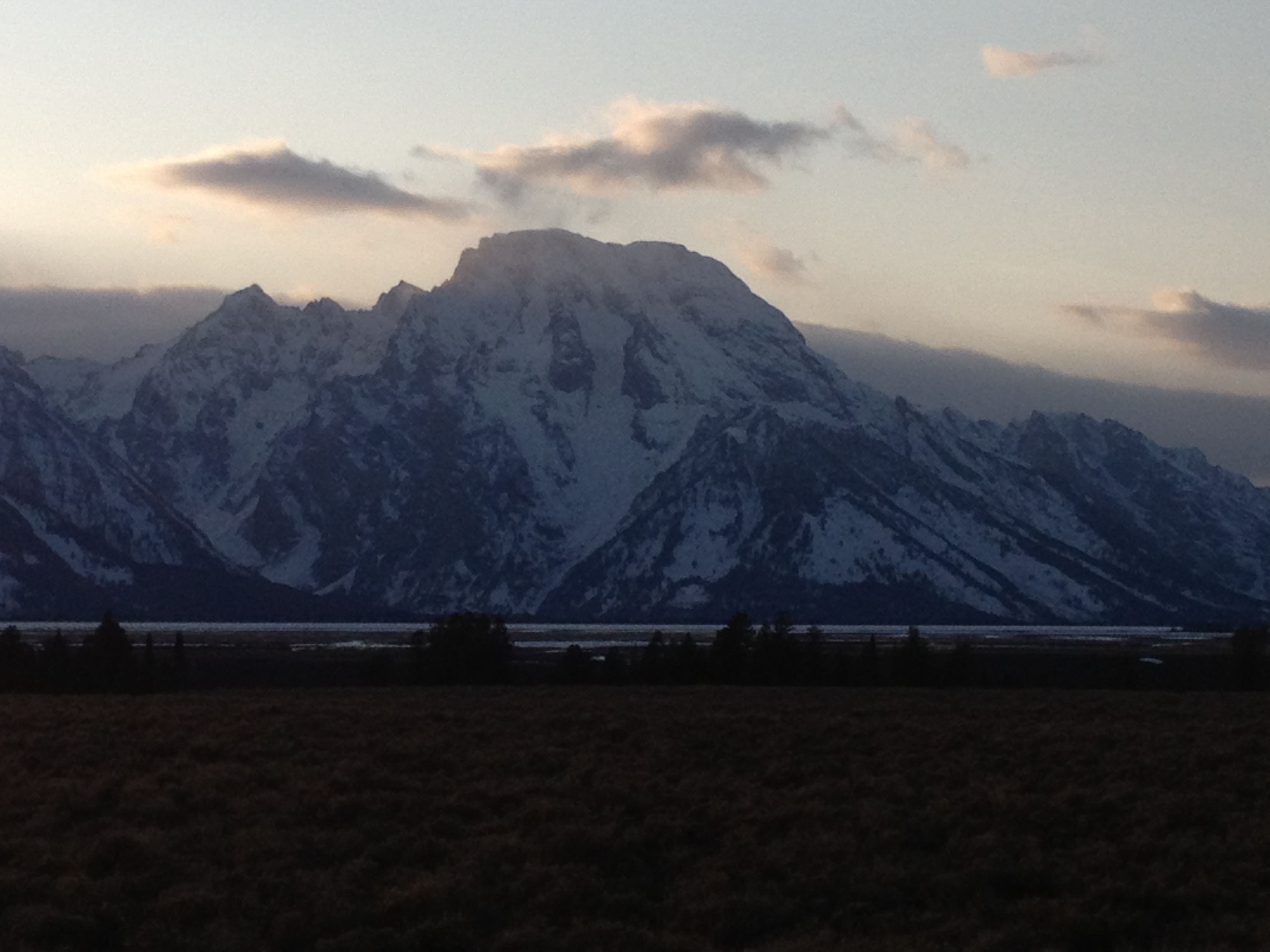
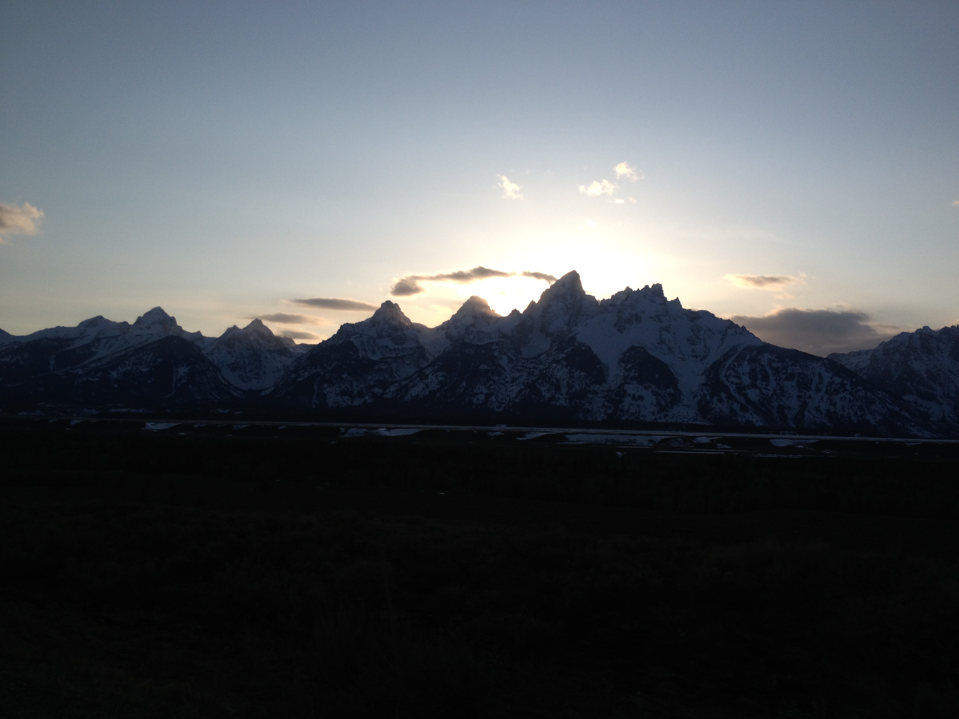
Sinclair Truck Stop at Orin Junction, WYThe glorious Teton Mountain Range!The Grand Teton
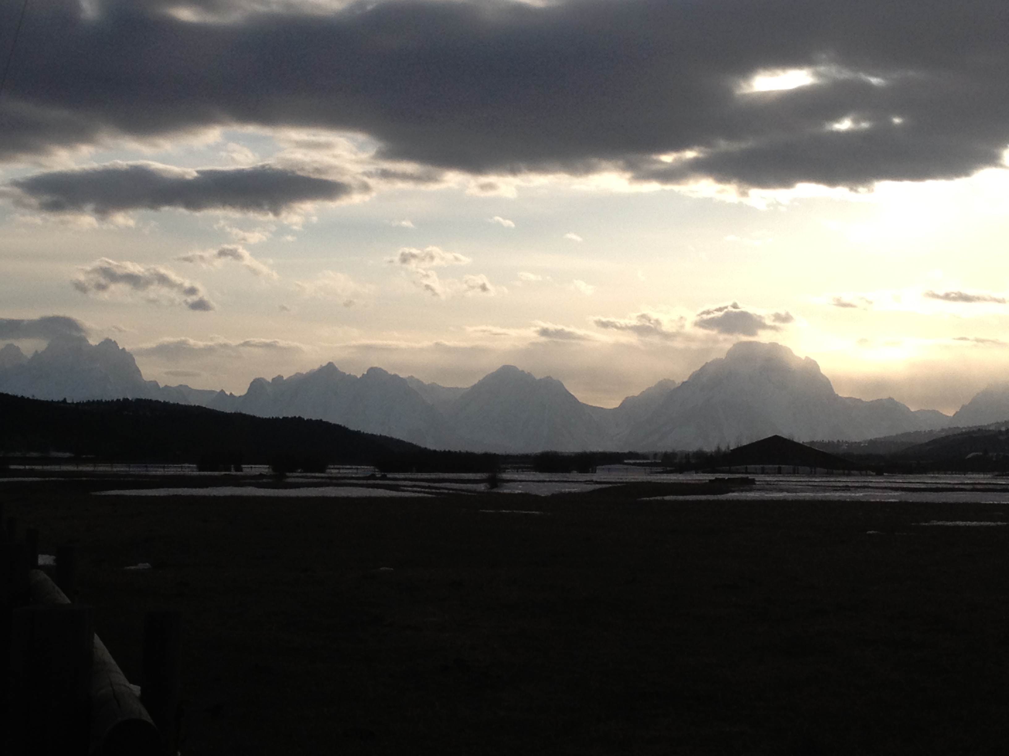
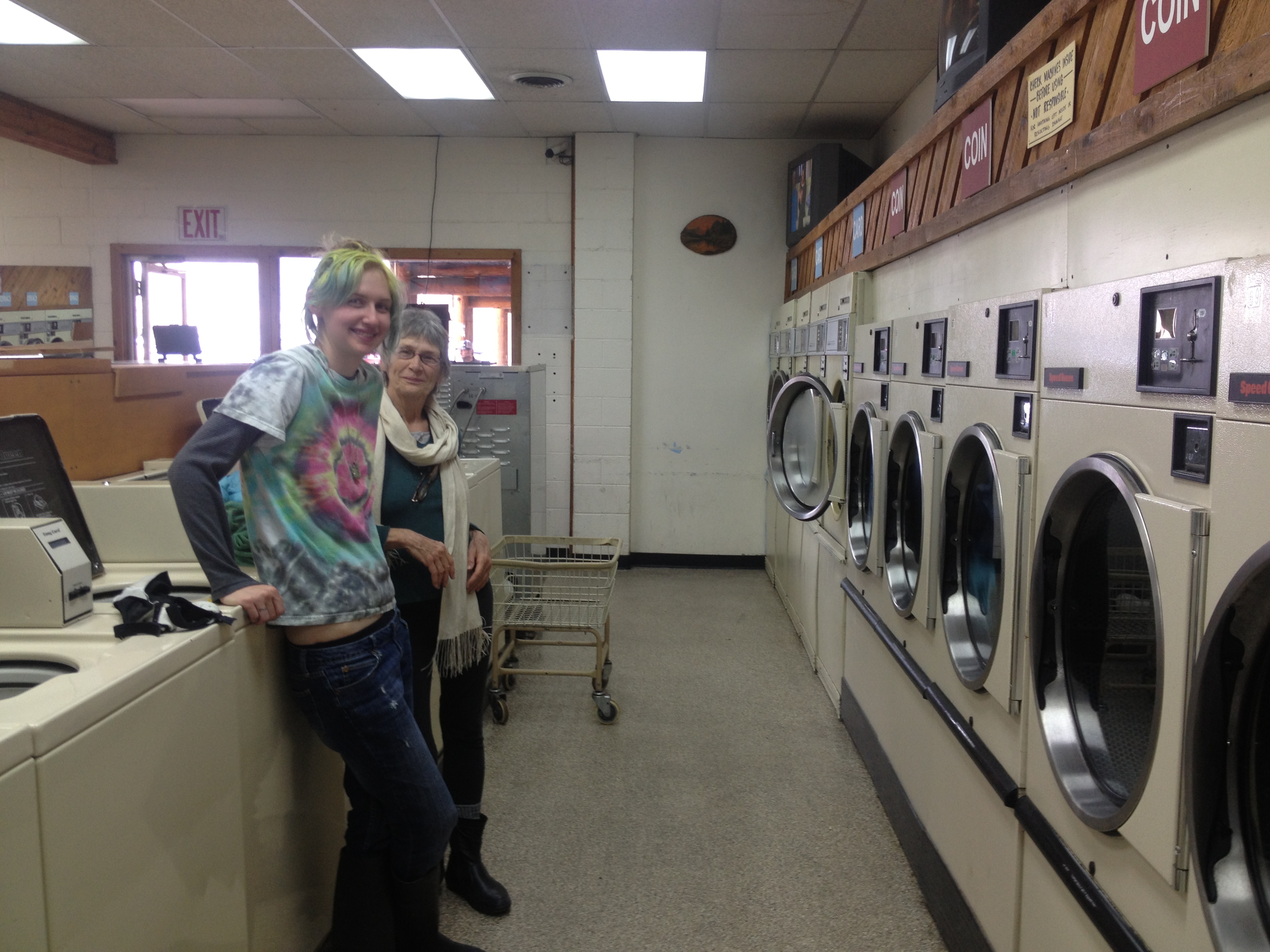
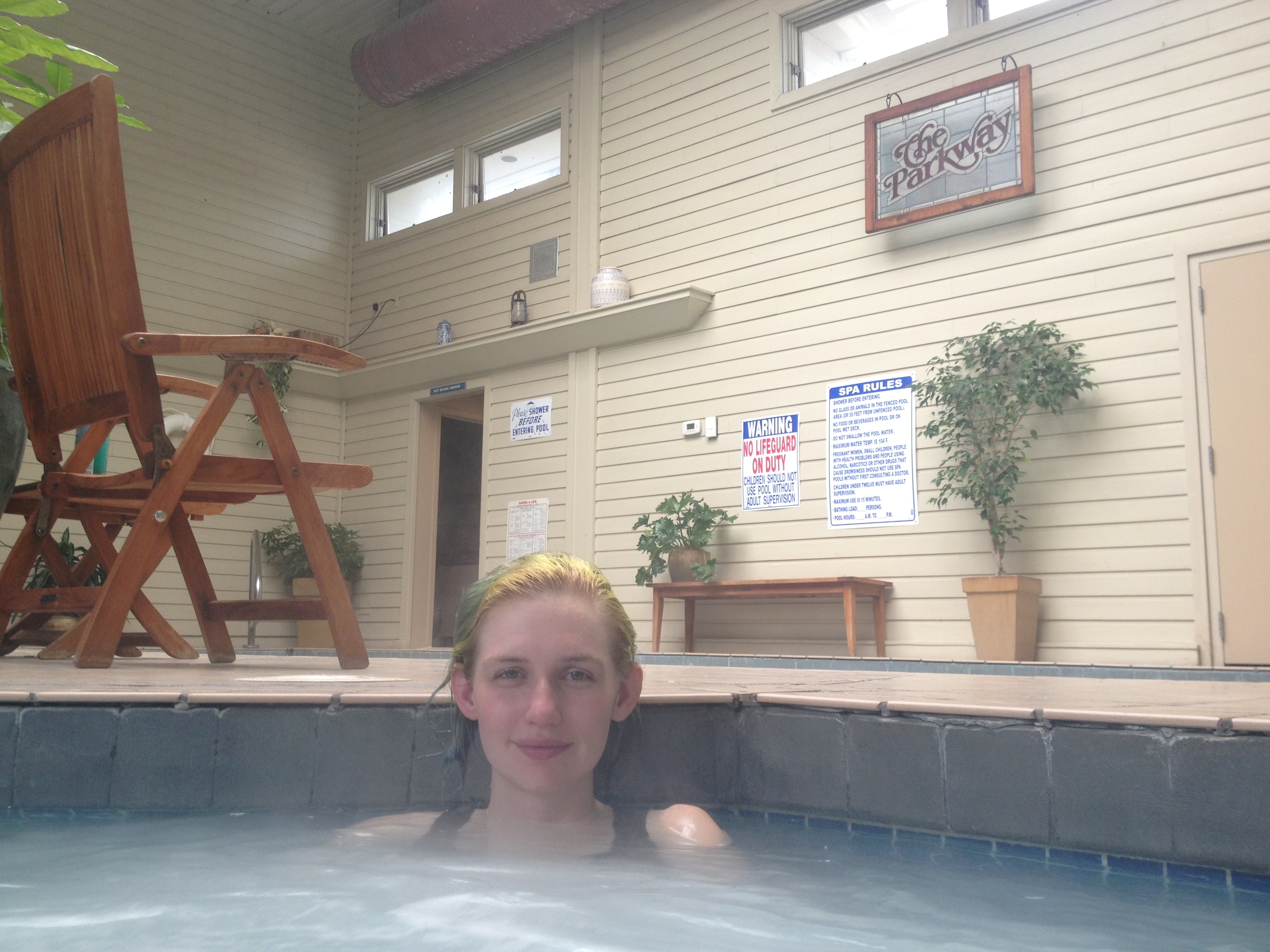
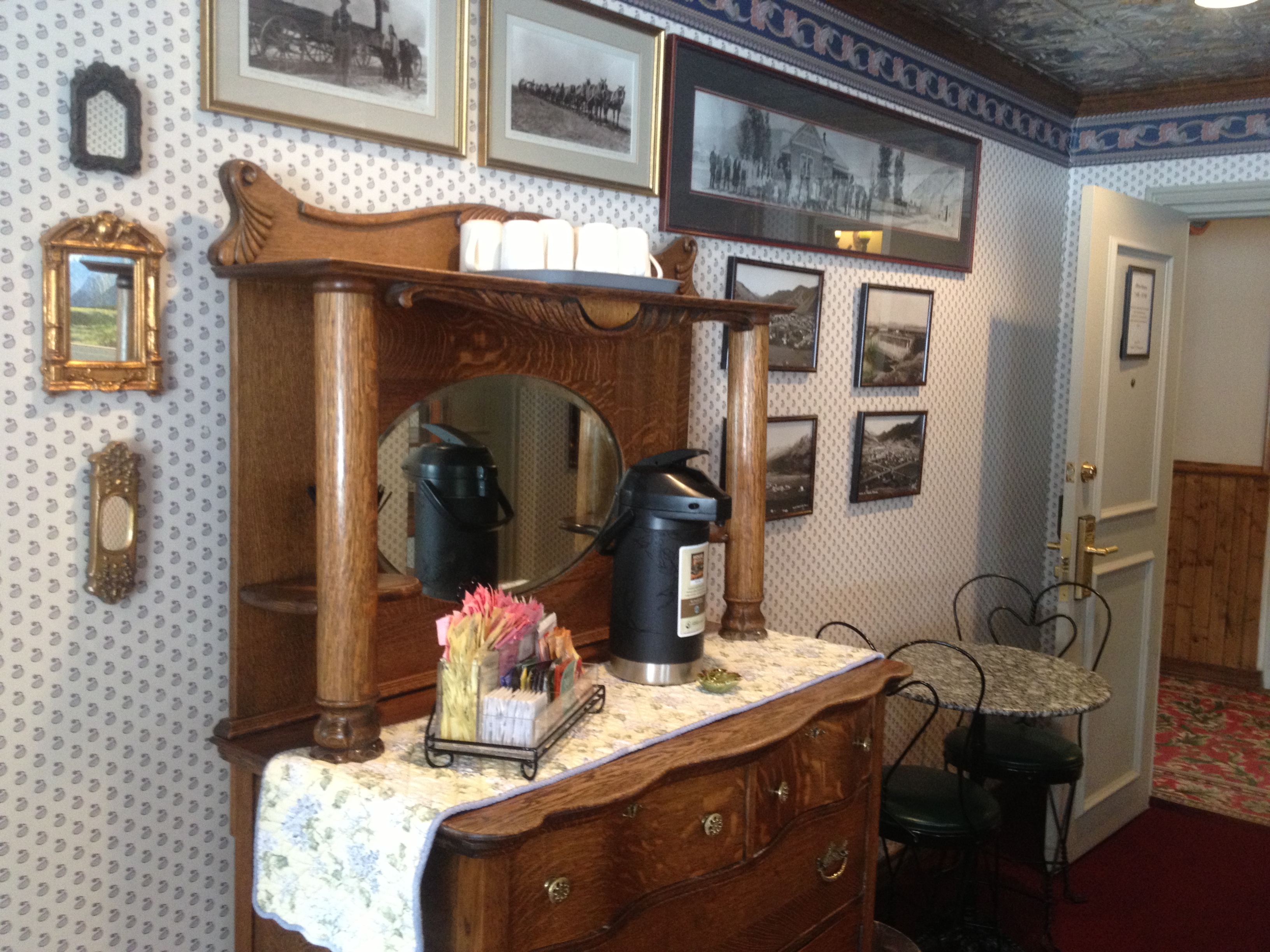
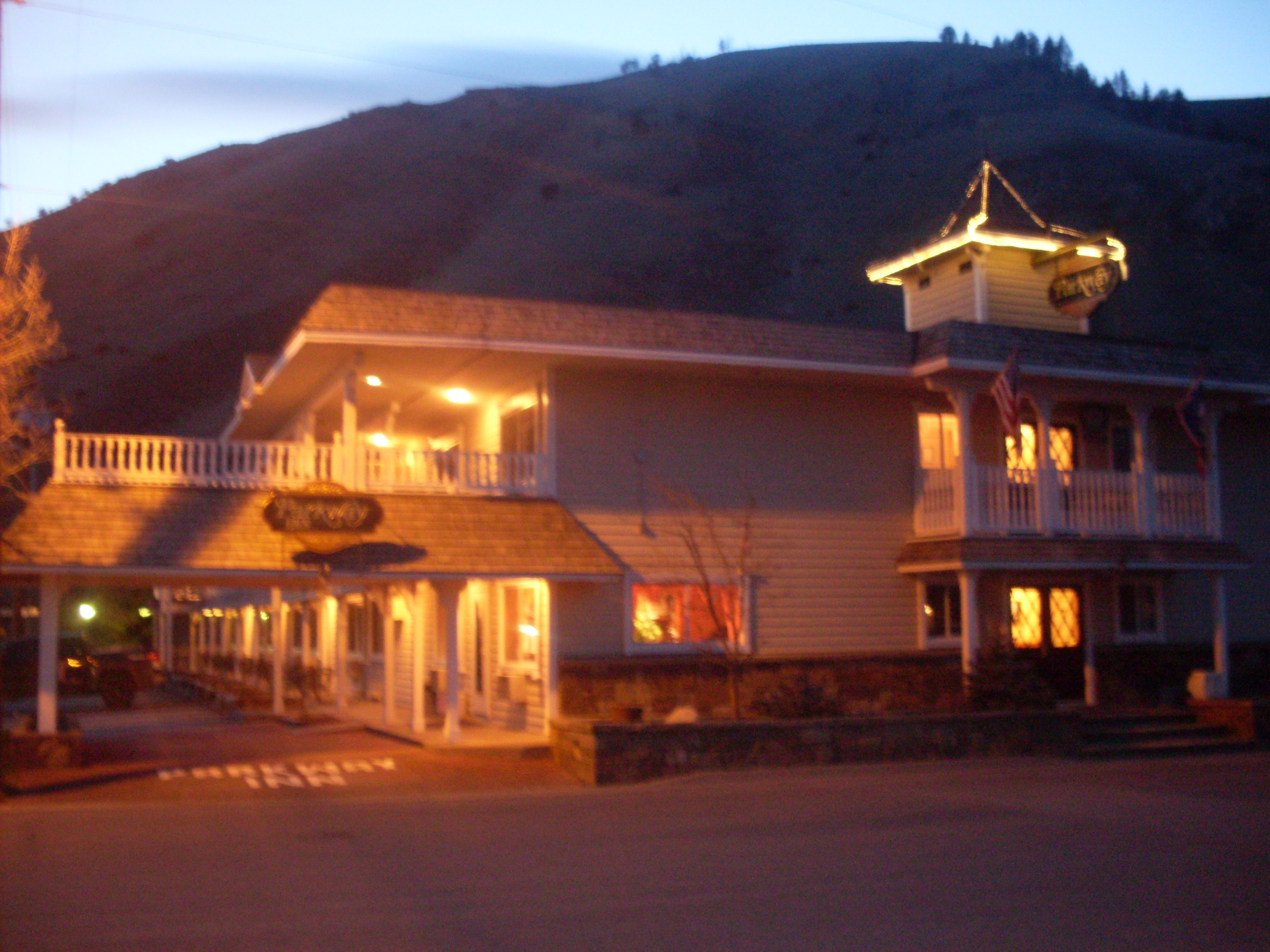
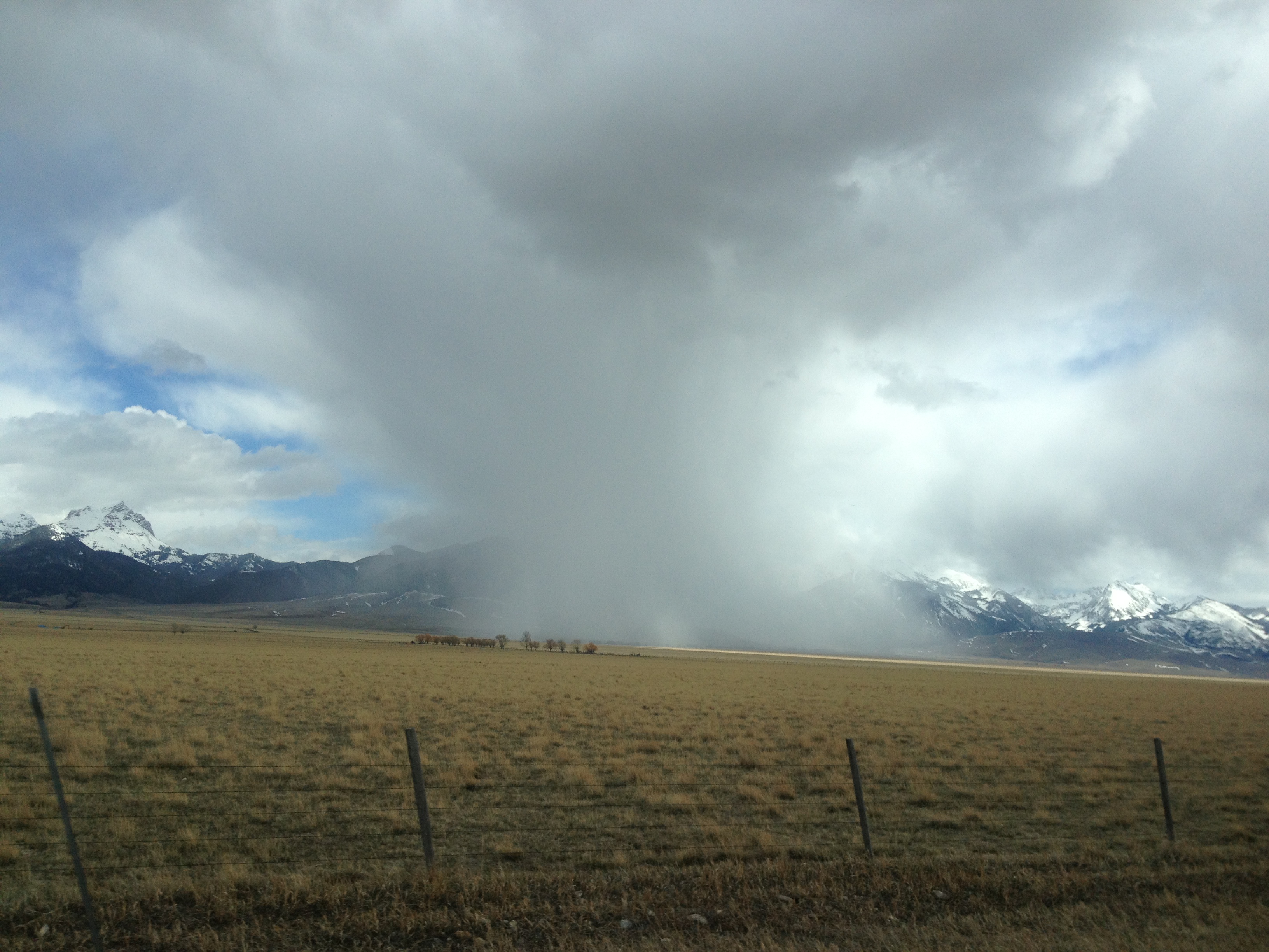
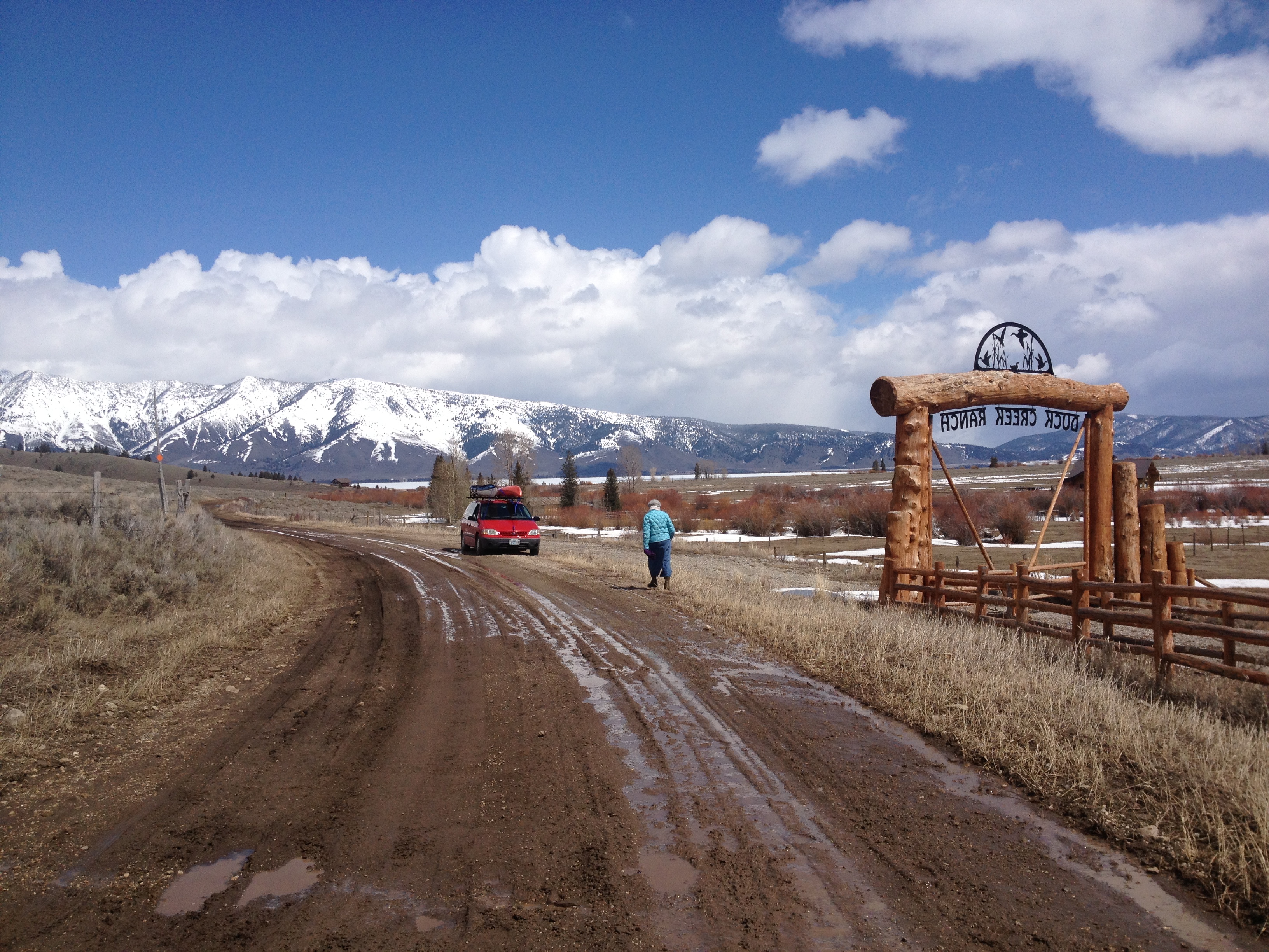
We thoroughly enjoyed our layover at the truck stop, despite the fact we had to sleep in the car that night. The truck stop closed at 10:00 and reopened at 5:00 AM. We spent seven hours in the car as the snow fell all around us. The car turned into a makeshift igloo, it appeared, and we stayed warm and cozy wrapped in down sleeping bags, jackets, and a comforter. What an adventure! Strangers are just an opportunity to make friends, and that’s what we all did at the truck stop. We were thankful that we had such a pleasant and cozy place to hang out, and the food was to beat all. Finally on Wednesday the road opened up to Douglas, which was 12 miles up the road. We opted to make the drive and get a hotel. Being able to sleep on a bed was nice, but the hotel was less than desirable. We got out of there first thing in the morning and drove all the way to Jackson, Wyoming. Our progress was somewhat slowed because of the photo opportunities along the way. We found it difficult to pass up such beautiful countryside without stopping to take pictures. I am sure we will not regret the many stops we made. Jackson was a significant destination that we were all looking forward to, and very excited about. We were finally in some serious mountain country! We were grateful for the chance to view the Teton Mountain Range, which appeared through the clouds majestically and with great grandeur! We loved our stay in Jackson, and our accommodations at the Parkway Inn. Because this time of year is considered the off-season, we were able to get discounted rates at the hotel. We loved it! We stayed two nights and refreshed ourselves by going for a walk, swimming, sitting in the hot tub, and doing laundry. Saturday morning we embarked upon a full ‘day of travel. We drove north up to Sawtelle Peak so I could check out the conditions of the road we plan on driving up to begin our ski into Brower’s Spring. We then started driving down Red Rock Road towards Red Rock Pass, which is very close to the exit point of our ski. Since it was 1:30 PM and temperatures were mild, we opted to stop short of the pass because of the mud. We stopped and walked down the road and enjoyed a snack lunch while viewing the awesome mountains around which we were surrounded.
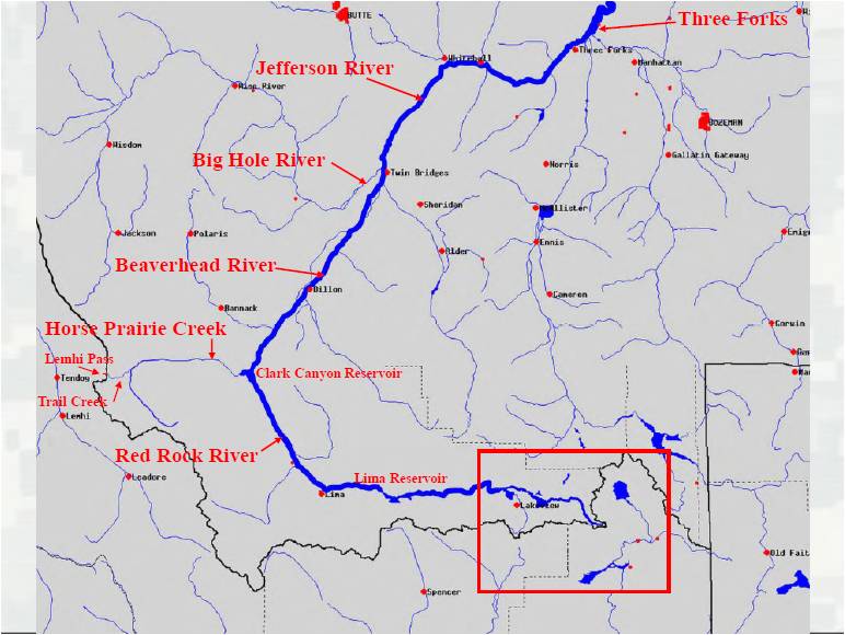
We will be skiing in to Brower’s Spring from Sawtelle Peak tomorrow morning! The spring is behind the mts on the right.This was spotted out my car window in Idaho.The muddy road into Centennial Valley, where our ski trip will end at Hell Roaring Creek.Mountains are everywhere in Montana! Madison RangeJefferson RiverBeaver head River at Three Forks
We then drove up towards the Beaverhead and Jefferson River so I could take a look at the rivers I will be paddling within a week, or so. This was a chance for me to connect with my route and visualize the environment of which I would soon become a part. Finally, we arrived at Base Camp International, Norm Miller and Kristen Walker’s house in Livingston, MT, where all paddlers of the Missouri River, or any river, are welcome to stop and regroup before setting out on the river.
Norm and I have been in email and phone contact since I decided to embark upon this adventure, so despite the fact we had never met, I felt like we were good friends already. Our stay here has been nothing less that warm and cozy. We immediately felt like family, and have enjoyed each others’ company immensely.
Tomorrow we begin our journey into Brower’s Spring. Then, the bike ride to Clark Canyon Dam and finally, Blue Moon hits the water.
The day has finally arrived. I have been losing sleep for nine months since I made the decision to paddle down the Missouri. Once I decided to take on this challenge, it was another month, or two or three, before I made the decision to start at the source. I knew I would regret not making the extra 298 miles if I started at Three Forks instead of Brower’s Spring.
The base of the mountains Norm and I will be coming out of after our ski into Brower’s Spring. (Photo by Norm Miller)
The time is 3:23 AM. My alarm is set for 4:30 AM. I feel like I have an extra hour so I’m trying to get in one last “quick” blog post before we take off. Now, THAT’s a challenge!
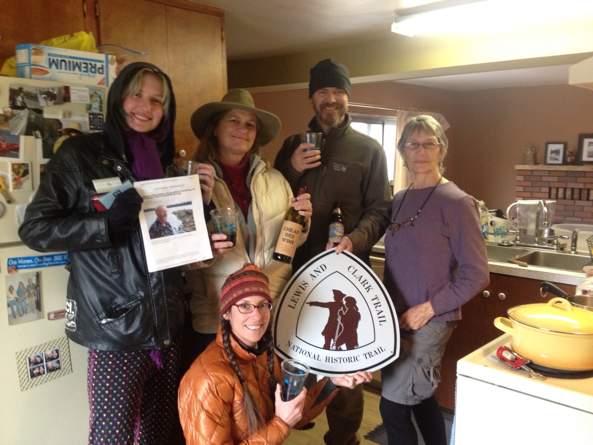
The Columbia Daily Tribune, our local newspaper, is supposed to publish a story this morning. I just checked on it. Yep, it’s there. Here is the link for “PRIMED TO PADDLE: Kayaker ready to tackle river’s entire length.” I will post the story under my Media page once the article becomes NOT available online, unless you have a subscription.
Yesterday was a very busy day packing. I actually spent two days hard at it. Three and one half months requires thinking through all of your needs, and wants, then trying to downsize the load. I’m not very good at that. Thankfully, Haley arrived after lunch and really helped me accomplish this daunting task. She is very organized and more rational than me when it comes to, “Is it really a need, or merely a want.”
We took a moment to take a picture with our matching “Say YES More” T-shirts. ‘Say Yes More’ is Dave Cornthwaite’s campaign, of which I am an ambassador. The first medium T-shirt was itty-bitty, so I gave it to Haley and he sent me a larger one. Find out more about Dave’s exciting adventures on his Website.
T-shirts for Dave Cornthwaite’s “Say Yes More” ambassador program.
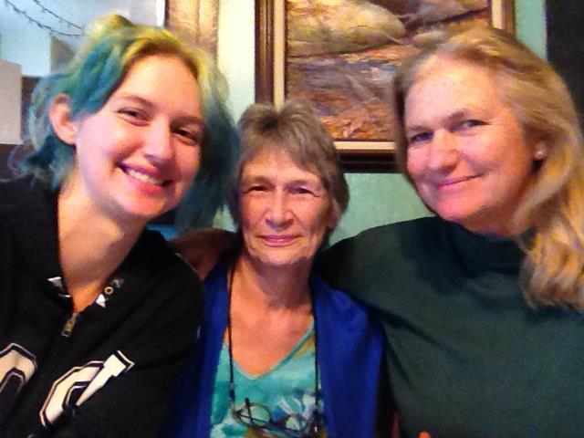
Last night we enjoyed spending time with my niece, Rene Freels, and her husband, Kyle, and son, Sam. We enjoyed fabulous food (as usual) at El Maguey, not to mention their $1.25 margaritas. This is my favorite restaurant in town.
We then enjoyed going down to the river to meet a lot of my river friends who were enjoying a campfire, pot luck barbeque, and acoustic guitar music. We have access to a spot right next to Cooper’s Landing where we have get-togethers sometimes. We also stopped by Cooper’s and I was able to introduce them to many more wonderful people in our river community. We had a great evening. I was happy to introduce them to a little slice of my world. Unfortunately, no photos.
Once home again, I began to round up all of the little loose-end items such as dental floss, water bottles, hairbrush, shampoo and other things that I actually use until I leave. I started a batch of strawberry/banana fruit roll-ups in the dehydrator, too.
This morning I will do one last batch of laundry, gather all of my food and try to sort some of it out into portions. I need to make my custom trail mix as well. Then, once light starts dawning on this part of the earth, the kayaks will go on the car, and I’ll pack the car with all of my stuff. We just left everything on the porch since the weather is good and we have Minnie, our wonderful, and loud, watchdog. No one can approach the house without her approval.
Minnie
The weather looks rough for the next few days in this area, and on our drive up north. It is my understanding that snow has been falling in Montana. I try not to let the weather reports get me emotionally stirred up. I am taking things one step at a time, and making decisions as opportunities present themselves. You might say I am “Going with the Flow.” Yes, I like the sound of that. Here is my awesome road crew, Haley, Jeannie Kuntz, and me.
Haley, Jeannie, and Me: Hittin’ the road this morning at 10:00.
My extra hour has turned into two after posting photos. Still, not bad. But, gotta go!
Cheers! See you on the water! Montana here we come! YeeHaw!
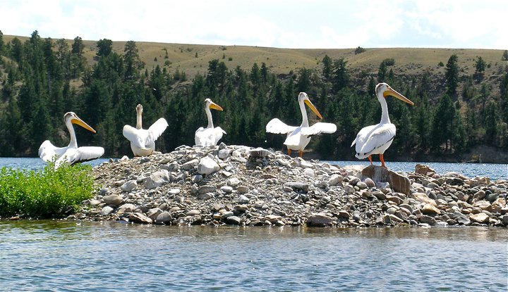
Pelicans Dancing (Photo by Norm Miller)
(One hour, 30-minute blog post! That is a new personal record. That is good, real good.) 🙂
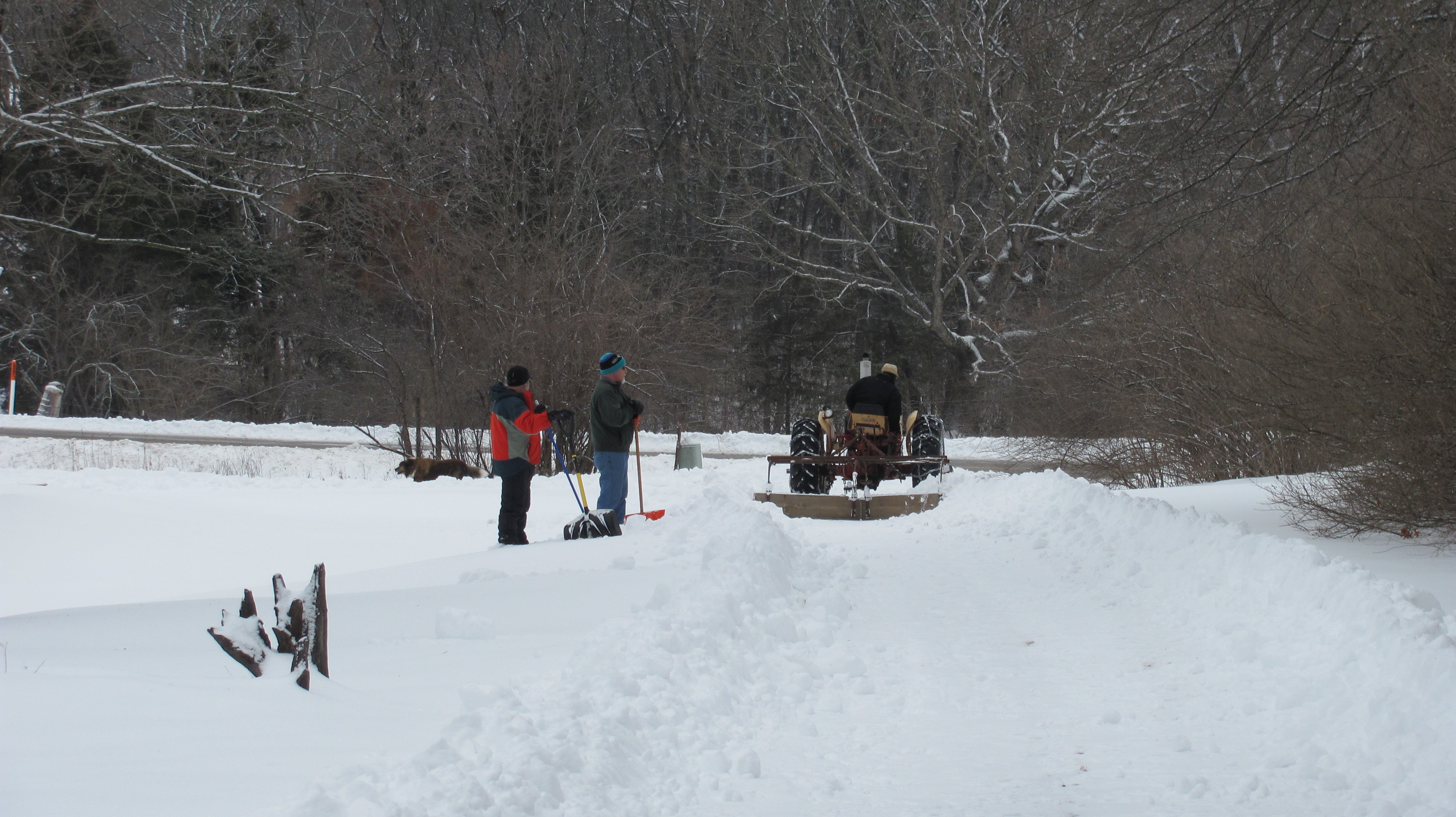
It has been a couple of weeks since I started removing the old name and website from the Shasta. Slight delay because of a heap of snow dumped on us over the course of two weeks. It has been cold and the snow still covers the majority of ground. This photo is from BEFORE the first storm, which dumped around 8-10 inches on February 21.
Before February 21.
And after February 21…
Photo taken on February 22
And after another 5 or more inches, which fell on February 26:
Photo taken on March 2
But, speaking of snow, I talked to the person in charge of the gate to the road up Sawtelle Peak. Because the Federal Aviation Administration (FAA) has an Air Traffic radar tower at the top, the road is gated to keep cars off the mountain when snow is present.
FAA Radar on top of the mountain
However, they plow the road for the employees, although 4-wheel drive is often necessary. The gentleman I spoke with was very favorable to helping us access the mountain road. He will get us past the gate so that we can ski to Brower’s from the switchback located in the upper right of this photo, below “Sawtelle Peak.”
Sawtelle Road switchback upper right, and Brower’s Spring under the “3” in the center, at the end of Hellroaring Creek where white meets green on the map.
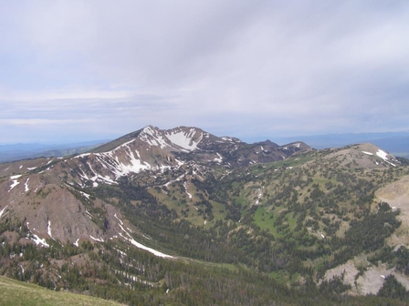
Here is a photo of Sawtelle Peak:
Summit of Sawtelle Peak NOT in April
And, a 3-D version from Google Earth, with switchback on far right straight across from Brower’s Spring (the green dot is the radar):
We’ll ski down Hell Roaring Canyon which sweeps left from Brower’s Spring through the center of the photo.
Next month I will be sipping from the waters of
Photo taken in June 2012 by Rod Wellington.
Brower’s Spring, the ultimate source of the Missouri River near the Continental Divide! Of course, we will be digging through many feet of snow, no doubt. Norm Miller and I will be packing shovels.
So, that is great news!
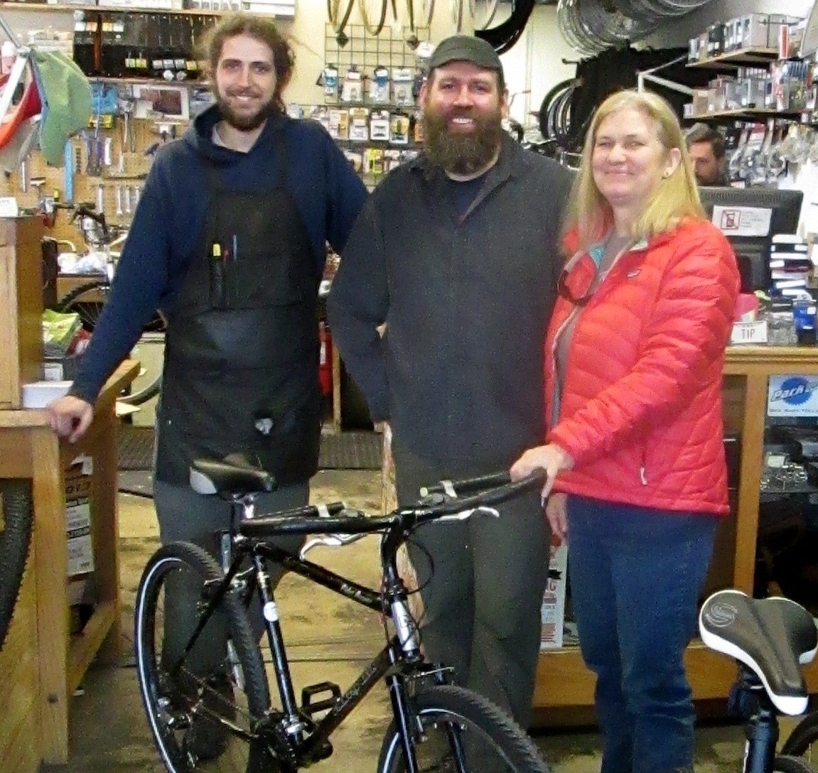
I picked up my on/off road bike that Carl and Josh at Klunk Bicycle and Repair built for my stretch in the beginning when the waterway is frozen over. It is anticipated that this will be the case in the Centennial Valley, which is where we will come out of the mountains. There is a gravel road that follows right along the creeks and rivers and through the Red Rock Lakes National Wildlife Refuge.
I may have to ride my bike as far as 80 miles to Clark Canyon Reservoir. Good to be prepared for any situation.
Carl has offered to loan me the bike with the option to buy it. I became a bit attached after just a few loops around the parking lot. I am hoping to purchase it at some point. I look forward to riding it until I leave. Must practice, right? Here is a photo of the bike and crew:
L-R Josh, Carl, and me. The bike, of course, is front and center.
We had a great meeting last week to discuss fundraising. What a wonderful group of supporters: Heidi Branaugh, Steve Schnarr, Melanie Cheney, Suzanne Cooper, Dory Colbert, Roger and Barb Giles, Jeff Barrow, and Ginger Masters. We agreed that a Love Your Big Muddy Blues Benefit would be great, particularly because Columbia, Missouri, is a mecca for musicians. We have a whole bunch of great musical artists, so we hope to have a dynamite show. We would like to hold the event at a local club, MoJo’s, on Wednesday, March 27, during happy hours: 5:00 to 8:30. We’ll provide appetizers and lots of stuff to raffle away. This is the same day that my expedition story will be featured in the Columbia Missourian. Should be a good day. Still waiting for confirmation on the location.
The outpouring of financial contributions is humbling. I am very grateful for my friends and their desire to help. Without their contributions, the expedition would still go on, but the financial burden would be difficult. Thank you to all who are able and willing to donate their precious moneys. I am very grateful. If you would like to donate, you may do so here on my Donations Opportunities Page, or go to my GoFundMe page at LoveYourBigMuddyExpedition 4 Education.
Here is one of Norm Miller’s re-supply packs from his trip UP the Missouri River.
I am currently focusing on foods to take. I looked at dehydrators today and will likely purchase one to make jerky and dried vegetables. I have received a fantastic response to my request for food ideas on the Facebook Paddlers Pages that I am a part of. This has been very helpful, and relieves quite a bit of anxiety as to what I will be packing for food.
Comfort foods
That’s it for now. Things are getting busy, sleep is difficult, writing blog posts takes time. I appreciate all of you who are following me. Thank you. Still trying to figure out the tweeting thing on Twitter.
The seed displays are out at the stores, and that can mean only one thing: SPRING is right around the corner!! So, WOW, it will be time to go soon. Am I nervous? Sometimes yes, and sometimes yes.
And, speaking of seeds, I have a crazy idea to grow some leafy greens on the trip. I mean, 3 ½ months on the river? Some leafy greens would be nice. That said, the planting season in Montana doesn’t start until the first two weeks in June. My little portable terrarium might be ideal for some early planting! I have been brainstorming the perfect container for such a thing and currently have narrowed the choices down to a couple of good ones. Any suggestions out there? I’ll take them.
Today, I am going to build a “kayanoe” cradle for my kayak. The design is Michael Clark’s of Big Muddy Adventures. I took a picture while there so that I could build a set just like his. Once complete, I can lay my boat in it and get started removing the keel strip that needs replacing, and install the rudder. Eddyline Kayaks gave me a new strip to apply, and I am to call them when ready to put it on. Today is supposed to be 70 degrees, so I have picked up the lumber and will begin cutting wood this afternoon.
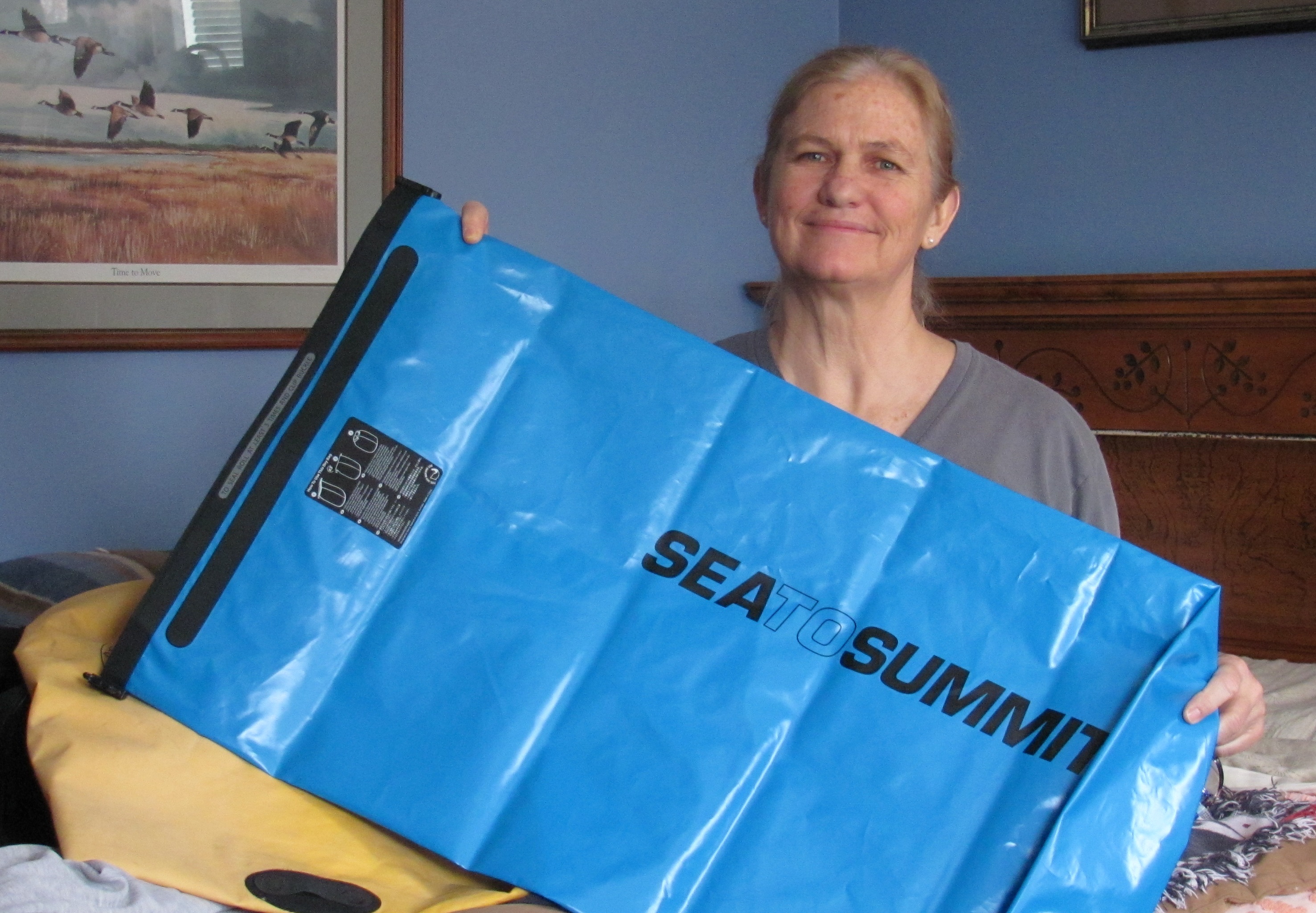
Thanks to Steve Schnarr and Melanie Cheney, my new neighbors and humble managers of Missouri River Relief, for the use of their large detached garage and electrical power. Another HUGE THANKS to them for giving me a dry bag. And Maryellen Self, THANK YOU, GIRL, for purchasing a new large dry bag for me from Sea to Summit. I am very grateful for all of your generosity.
Thank you, Maryellen! Maryellen is a Kentucky kayaker and enthusiastic supporter.
Bill West of Red Rock Lakes National Wildlife Refuge, located in the Centennial Valley just below Hell Roaring Canyon (the route to Brower’s Spring), sent me a link in which one can look up current snow depth Lakeview Ridge Snowtel Site as well as historical data from years past (also mentioned in a previous post). This will help me determine how much snow is in the area, and if we can drive up to the base of Hell Roaring Canyon, where it appears as though we will have to ski in the seven miles to Brower’s Spring, and out again.
Sawtelle Peak Road
The lookout road on Sawtelle Peak will undoubtedly be snow-covered and we have no way of getting up the switchbacks in order to ski over to Brower’s Spring. [Unless someone out there has snowmobile contacts in Montana, Idaho, or Yellowstone…?? Helicopter ride? Of course, it would have to be an in-kind donation :)]
The Rock Creek basin area on Sawtell’s west side. Hell Roaring Canyon, and Brower’s Spring, would be a little south of here and off to the left. (Wow, I’m seeing some good backcountry skiing in this photo.)
These photos of Sawtelle Peak were taken from the website SummitPost.org
The following photos are taken from the Refuge Virtual Tour site that is not yet official. Bill Smith provided me with this link as well. You really should check it out. James Perdue has some gorgeous photos on that site.
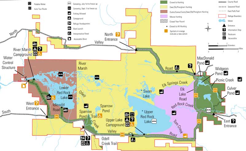
Trumpeter Swans (photo by James N. Perdue)Headquarters at the Red Rock Lakes National Refuge (Photo by James N. Perdue)Hell Roaring Canyon is off to the East, or right, of this map, up Centennial Valley. The road I will hopefully bike ride down snow free runs along the bottom of this map.
Down in the Centennial Valley, the upper and lower lakes in the refuge will more than likely be frozen until May, so I am planning on riding a bike from Hell Roaring Canyon down to Clark Canyon Reservoir. The road follows right alongside the waterway. The ride will be approximately 80 miles. Praying that the road into that area is free of SNOW and not muddy sloshy. Plus, we REALLY need to be able to drive up to the base of Hell Roaring Canyon. The snow data link that Bill sent me is my life-line to the start of my expedition. In 2012 on April 20, the area had 11 inches of snow. In 2011 on April 20, the area had 47 inches of snow, nearly four feet! What will 2013 have in store for us???
South Valley road in winter is often only passable using a snowmobile. This is looking east into the refuge. Lakeview is in the distance. (photo by James N. Perdue)
My new motto for the expedition: GO WITH THE FLOW!
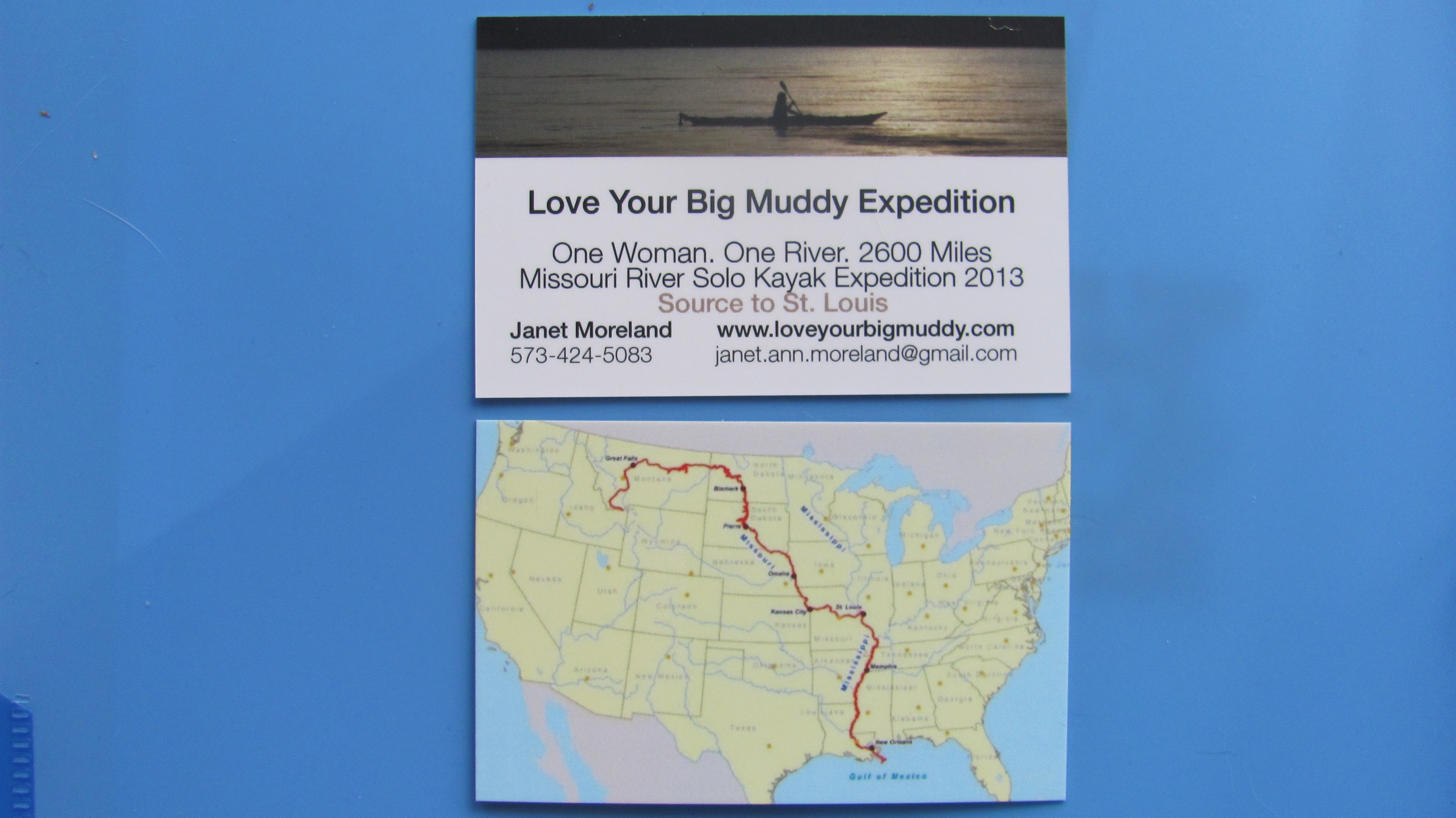
My new expedition cards
A draft of the promotion video will be sent to me on Friday. My new expedition cards came in last week, and I have a new batch of stickers with a larger web address for bumpers. Did I tell you about my terrarium? Crazy, I know. However, having something that is alive to take care of may be good for the soul. We’ll see. Nothing is set in stone. Heck, I may not have room. I am just going to GO WITH THE FLOW! 🙂
View of Lower Red Rock Lake in February. The lake is frozen over and looks like one large flat meadow.
Based on my camping experience in Missouri, I know that the threat of cold weather is present in mid-Missouri until AT LEAST after Mother’s Day, which is usually end of May (last hard frost date is late April). So, starting my trip in mid-April in the Montana Centennial Mountains at the Continental Divide pretty much necessitates winter conditions planning. Okay, got that. However, I did not really consider the Centennial Valley being covered with snow down to the Red Rock Lakes National Wildlife Refuge.
I received an email response from Bill Smith, project leader at the Wildlife Refuge, which is located down the Centennial Valley from where I’ll exit the mountains after skiing to Brower’s Spring. He writes: The refuge is not closed in April, it is just closed to boating. In addition, the two big wetland lakes (Upper and Lower Red Rock Lakes) are still frozen until about May 1st. I suggest you snowshoe to Brower Spring from the Centennial Valley floor. Then you could cross country ski down the valley if there is still snow available. No refuge restrictions on ski travel.
(Norm Miller and I are planning to ski in to Brower’s Spring from Sawtelle Peak, a two-mile ski to the spring, and seven miles down to the valley floor.)
Nemesis Mountain The exit from Brower’s Spring, Hell Roaring Canyon, is on the right side of Nemesis Mt. (out of this photo) where Hell Roaring Creek empties into the valley, and soon becomes Red Rock Creek.Hell Roaring Canyon and Creek, exiting the mountains. (Nemesis Mt. on the left)Winter view of the Centennials here. Wind blows frequently to obscure the road completely with snow in February.
SO, the good news is: The refuge is not closed to paddlers in April, only motorized boats. Yay!
And, the not necessarily bad news: The entire valley MAY be covered in snow and the lakes covered with ice until May 1st. Dang, this is starting to become quite the adventure. And, I like it!
Centennial Mountains cloaked in a winter storm. (All of these photos taken from the virtual tour site-link below)
Bill sent me some valuable links that are critical to my planning of this upper upper portion of the expedition. Here is what he wrote:
I’ve attached two web sites. The Lakeview Ridge Snowtel site will allow you to look at graphs and charts of average snow depth during the annual cycle here. Look at historical April. It will also give you the current year.
The 2nd link is to the water gauge on Red Rock Creek. It will give you historical and real time measurements of stream flow in the creek. The gauge is on the Creek at the very Eastern boundary of the refuge.
NRCS is upgrading this website this weekend so it may not work well until Monday.
Virtual tour!!? How awesome is that! I hit every spot on the tour, and let me just say this, “It IS the next best thing to being there!” When you click on the link, the map on the left has a white dotted line sweeping along the bottom and then up towards Henry Lake. That dotted line is the Continental Divide, and Brower’s Spring is inside the lower right-hand u-turn area where the white line starts to head north. On the right side of the page, the names of the mountains will show up when you scroll over them. You can sweep 360 degrees! Enjoy! It is a fantastic site. Big huge thanks to Bill West and his willingness to help me out. We will talk by phone soon.
All photos on this post are taken from the virtual tour site.
That’s all I got for now. Lots to think about.
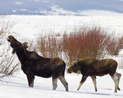
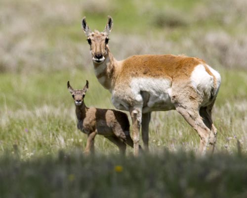
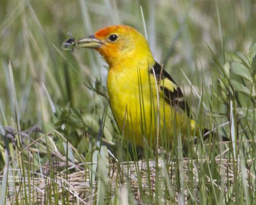
The willows growing from Tom Creek provide browsing for Moose in the deep of winter here. In summer, moose are attracted to marshes and creek banks to both collect suitable vegetation to eat and water to wet and cool themselves in. Moose are not usually aggressive towards humans, but can be provoked or frightened to behave with aggression. Due to their disposition and size, it’s best to keep a wide berth from them.Pronghorn and calfThe beautiful Western Tanager (Piranga ludoviciana) has found a bug in the grasses near Red Rock Creek. The tanager is classified in the same family as the cardinal. Western tanagers eat fruits (~18%) and a wide range of insects (~82%) They are a welcome visitor in the spring and early summer here in the refuge, though not especially numerous (like the blackbirds or sparrows, etc).
…Woke up midnight last night and imagined Brower’s Spring with perfect spring corn snow skiing conditions in April, which is when we used to ski peaks on the east side of the Sierra Nevada Mts in the 80’s. I broke out into a huge smile. Then, repeating over and over, “pray, believe…pray, believe…”, I drifted back to sleep.
I will be starting at the source. That’s it. No more wavering.
My stickers are in the mail. I modified them by changing the color to blue, from black, and the miles to 2600, from 2300.
Met with Jim Karpowicz today and we are on the move to create a promo video in order to generate some wide-reaching support and, hopefully, funding. It’s going to be great!
If you haven’t already, please “like” my loveyourbigmuddy Facebook page. I can post little updates there with a bit more spontaneity.
Starting at the source of the Missouri River will entail getting to Brower’s Spring, which is at the top of Hell Roaring Canyon. From the bottom of the canyon (left-center) the hike is seven miles in and seven out, over SNOW in April. If Sawtelle Peak access road is plowed (doubtful) in April (right), the ski over is only a couple of miles along the Continental Divide, then down the canyon. I see ski-mountaineering revisiting my life this spring. Breaking out the 3-pin bindings!
Canadian paddler Rod Wellington passed through Cooper’s Landing last Monday and Tuesday, Dec 17-18. He is paddling from the source of the Missouri River at Brower’s Spring, MT, to the Gulf of Mexico, all self-propelled. This is the longest river system in North America, and fourth longest in the world. Rod will be the first Canadian to paddle the MO from source to sea. Australian paddler Mark Kalch completed the route earlier this year.
Norm Miller (left) and Mark Kalch (right) at Hell Roaring Creek in June 2012
Altogether, Rod will paddle seven of the longest rivers on seven different continents. The Missouri River is his first. He has been on the river since June, a total of six months. His river systems project could take up to 15 years.
Photo by Rod Wellington
After a pot luck dinner and visiting with many interested locals, he graciously sat with me and poured over photos and a map from the Brower’s Spring area, the Missouri River source, to Three Forks, the headwaters of the MO Riv, a 298 miles stretch and one in which I am debating whether to include on my trip.
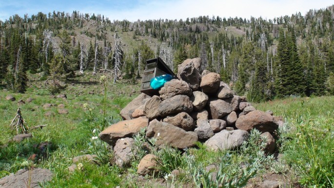
Cairn at Brower’s Spring with Continental Divide behind. Photo taken in August 2011 while scouting the source (photo by Rod Wellington)Continental Divide at Brower’s Spring in June 2012 (photo by Rod Wellington)Looking down from the spring in June 2012. Undoubtedly, April will have a LOT more snow. (photo by Rod Wellington)
No firm decisions yet as there are a few dicey stretches, like hiking/skiing/snowshoeing over snow for seven miles into Brower’s Spring, and seven miles out. And, a few days of dodging and portaging around farmers’ barbed wire/electrical/corrugated panel fences which cross a mere 20′ wide water way below the Lima Reservoir on the Red Rock River. Not to mention that the Red Rock Lakes Wildlife Refuge, located above the Lima Reservoir, is closed in April.
At least now I have a greater understanding of what my obstacles and options are. I have an unrelenting desire to capture some of that 298-mile stretch for its sheer beauty. Some of it may have to be biked. Thanks, Rod, for spending that time with me.
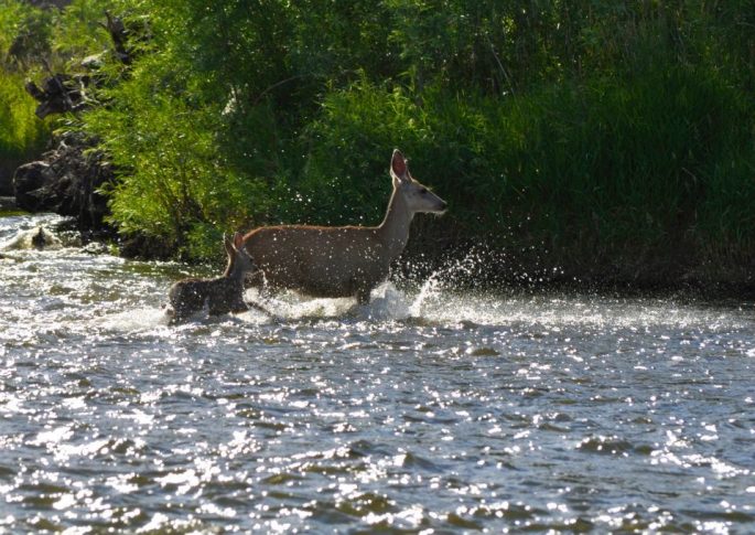
Jefferson River below Twin Bridges (photo by Norm Miller)Deer on Jefferson River (photo by Norm Miller)Rain approaching Jefferson River (photo by Norm Miller)
Understandably, Rod needed to leave Cooper’s Landing and continue
Rod and Jonathan at Cooper’s Landing. Notice the wood-carved hawk that is Jonathan’s handiwork.
paddling towards the Gulf of Mexico. However, our first major storm
of the season hit yesterday, the day after he left. Winds gusted to 50 or 60 mph, and snow was blizzard-like. One caring and supportive local, Jonathan Lauten, set out to find Rod and make sure he was okay. He found him across the river below Jefferson City, but was not able to make contact. We learned that Rod was hunkered down in his tent, warm and dry.
Rod laying low in a miserably cold, very windy, and snowy storm (you can see the wind plowing into the side of his tent). (photo by Jonathan Lauten)
Jonathan’s comment from Facebook:
I found him, but I couldn’t get to him! This pic was taken from a bluff across the river 4:00 12/20/12. Of course, it was hard to pick him out amongst all those other campers on the Missouri River in a blizzard with 50 mph winds…
Here is a post from Rod yesterday morning, much to our relief:
Dec. 20, 10am – Currently hunkered down in my tent on a sandbar near Jefferson City, Missouri. Outside: blowing snow, sustained winds of 35-40 mph with gusts of 50 mph or more. Unable to keep tent and tent fly anchored. I’ve arranged heaviest gear on windy side of tent to act as a buffer. I’m warm and dry. No paddling today. Expected low tonight: 5F with windchill. Thanks to Steve Schnarr, Gary Leabman, Robin Kalthoff and Jessica Giard for checking on me via phone. Still smiling!
Great meeting Rod and spending some time together. I think I speak for lots of other folks who met him as well.
Rod and me (photo by Jonathan Lauten)
You can read posts and watch videos from his trip thus far, and track his current progress on his FB page: “Rod Wellington.”


