Biking and, finally, paddling

The base of Hell Roaring Canyon, and on down the creek of the same name.

I am sitting in the Shack in Twin Bridges on Tuesday, May 7, a layover day for me after 6 days on the Beaverhead River. I really want to post some photos for my blog followers before I head down the Jefferson River tomorrow. I am running short on time so I will do the best I can here. Of course, my Facebook page contains much more frequent updates. Please like the page if you can. Thanks, all! I appreciate your interest in my adventure!

Long stretches of exquisite beauty. And, a little bit of push.
Long stretches of exquisite beauty. And, a little bit of push, as in stamina.
Starting at the base of Hell Roaring Canyon, and on down Hell Roaring Creek.
Beautiful vistas
Beautiful vistas
image
What an incredible bike ride! Just breathtaking!
image
Long gorgeous and gradual downhills.
image
Our stop at the end of the first day. Red Rock Creek below the Red Rock Lakes National Wildlife Refuge.


The start of the second day began with a, yes, flat tire out in the middle of NOwhere! We got 'er done, though. Survival of the fittest.
The start of the second day began with a, yes, flat tire out in the middle of NOwhere! We got ‘er done, though. Survival of the fittest.


Long stretches of exquisite beauty. And, a little bit of push, as in stamina.
Finally made it to Lima Dam. Still, onward to the town of Lima.
Lima Dam
Lima Dam
The windy, as in lots of turns, Red Rock River.
From the town of Lima I followed the old Highway 191 all but seven miles of the 31 mile stretch. Very peaceful. My support crew followed me closely.
From the town of Lima I followed the old Highway 191 all but seven miles of the 31 mile stretch to Clark Canyon Dam. Very peaceful. My support crew followed me closely.
Two bison mommas and their babies. They had their eye on my from afar.
Finally, after 90-somethin' miles, we made it to Clark Canyon Reservoir and Dam.
Finally, after 90-somethin’ miles, we made it to Clark Canyon Reservoir and Dam in 3 days.
Clark Canyon Reservoir

Finally, on Wednesday, May 1st, I started paddling. The Beaverhead River was quite a challenge. It is shallow with tight turns and lots of brush producing strainers in which to get entangled if not careful. I came close to dumping my first day, but was saved by the wheel of my wheeleez, my portaging device. I may have sprained my hand in the entanglement, but still paddling. I was worn out for the first three days trying to save Blue Moon from sheer destruction. I have two holes from the second day just above waterline. Duct tape is the miracle cure!

After 3 days of hard paddling, on Saturday I had 25 mph headwinds challenging me. I stayed strong and true to course, though, and after a 9 and a half hour paddle, and close to Beaverhead Rock, I finally found an island to camp on.  Turns out that Robert and Donna were out cruizing around on Robert’s property and they ended up inviting me up for cocktails and chicken dinner. And, a shower, laundry, and place to sleep on their couch!  What a wonderful miracle! Strangers are TRULY an opportunity to make friends. What a great visit we had, which included Paul, too. The three of them are long-time friends from Helena.

My first night out. Cozy camp!
My first rapids. I skipped the upper and paddled through the lower parts of this.
Strainer, Grrrr! They can flip you over, swamp your boat, punch holes in your ship, and twist your hands and arms. I am happy to be through this challenging part of the Beaverhead River.
Strainers, Grrrr! They can flip you over, swamp your boat, punch holes in your ship, and twist your hands and arms. I am happy to be through this challenging part of the Beaverhead River.
My pelican friends followed me all day Saturday, and after many bends, they finally decided I was okay. They stayed put until I got this photo. Then, they split for the day. Good companions they were.
Good bye, my friends.
Diversion dams force me to unload, carry stuff to the other side, place my boat on my wheeleez, pull it over, reload stuff, and take off again.  This particular easy portage took me an hour and a half.
Diversion dams force me to unload, carry stuff to the other side, place my boat on my wheeleez, pull it over, reload stuff, and take off again. This particular easy portage took me an hour and a half.
AFter a long day of paddling on Saturday against 25 mph winds, Robert and Donna happen to be cruizing Robert's property adjacent to Beaverhead Rock. After seeing their Private Propertay signs, with notice that the property was patrolled, I was concerned and so immediately set off to do some peace talking. Turned out they invited me up for cocktails, dinner, laundry, shower, couch, and steak and eggs for dinner. What a wonderful find these folks were, however it happened. L-R, Robert, Donna, and Paul.
AFter a long day of paddling on Saturday against 25 mph winds, Robert and Donna happen to be cruizing Robert’s property adjacent to Beaverhead Rock when I found an island to camp on. After seeing their Private Property signs, with notice that the property was patrolled, I was concerned and so immediately set off to do some peace talking. Turned out they invited me up for cocktails, dinner, laundry, shower, couch, and steak and eggs for breakfast. What a wonderful find these folks were, however it happened. L-R, Robert, Donna, and Paul.
View of Beaverhead Rock from Robert's "cabin"
View of Beaverhead Rock from Robert’s “cabin”
And, another view from the cabin.
Not sure what's up with this rancher. Makin' life difficult.
Not sure what’s up with this rancher. Makin’ life difficult.
Besides the pelicans, the muskrats, and sometimes beavers, are my favorite companions. The muskrats are the dolphins of the river. They lead you around the bends. I adore them!
Onward towards Twin Bridges. Tomorrow, Wednesday, May 8, I head out on the Jefferson River, my long awaited premium stretch of river.

Finally, I have successfully updated this blog. You are a concern of mine, and I want to keep you posted. It is getting dark now. I have finished most of my pizza, a couple of glasses of wine, had a shower earlier today, and have a nice cozy tent to sleep in tonight. I look forward to resuming paddling on the Jefferson River tomorrow. Twin Bridges is an awesome small town of 400. Come and stay if you ever have the chance. I understand the fishing cannot be beat!

My camp at this very cool Bike Park on the waterfront in Twin Bridges, MT. Loved my stay here. Hope to come back. Plus, Mayor Tom is totally laid back, hence the mellow river community of 400 people. Love it!

I hope you are enjoying my adventure. I am comforted knowing you are following me and interested in my journey. It has truly turned out to be an epic adventure, and it has only just begun.

Live fast ~ Paddle slow. Be safe and cherish the moment!

A source start means a snow start, but ice-covered lakes?

ViewFromSouthValleyRoadSnow_112142
View of Lower Red Rock Lake in February. The lake is frozen over and looks like one large flat meadow.

Based on my camping experience in Missouri, I know that the threat of cold weather is present in mid-Missouri until AT LEAST after Mother’s Day, which is usually end of May (last hard frost date is late April).  So, starting my trip in mid-April in the Montana Centennial Mountains at the Continental Divide pretty much necessitates winter conditions planning. Okay,  got that.  However, I did not really consider the Centennial Valley being covered with snow down to the Red Rock Lakes National Wildlife Refuge.

I received an email response from Bill Smith, project leader at the Wildlife Refuge, which is located down the Centennial Valley from where I’ll exit the mountains after skiing to Brower’s Spring.    He writes:  The refuge is not closed in April, it is just closed to boating.   In addition, the two big wetland lakes (Upper and Lower Red Rock Lakes) are still frozen until about May 1st.    I suggest you snowshoe to Brower Spring from the Centennial Valley floor.   Then you could cross country ski down the valley if there is still snow available.   No refuge restrictions on ski travel.

(Norm Miller and I are planning to ski in to Brower’s Spring from Sawtelle Peak, a two-mile ski to the spring, and seven miles down to the valley floor.)

Nemesis Mountain
Nemesis Mountain The exit from Brower’s Spring, Hell Roaring Canyon, is on the right side of Nemesis Mt. (out of this photo) where Hell Roaring Creek empties into the valley, and soon becomes Red Rock Creek.
Hell Roaring Canyon and Creek, exiting the mountains. (Nemesis Mt. to the left of canyon.)
Hell Roaring Canyon and Creek, exiting the mountains. (Nemesis Mt. on the left)
Winter view of the Centennials here. Wind blows frequently to obscure the road completely with snow in February.

SO, the good news is:  The refuge is not closed to paddlers in April, only motorized boats.  Yay!

And, the not necessarily bad news:  The entire valley MAY be covered in snow and the lakes covered with ice until May 1st.   Dang, this is starting to become quite the adventure.  And, I like it!

Centennial Mountains cloaked in a snow storm.  (All of these photos taken from the virtual tour site-link is below)
Centennial Mountains cloaked in a winter storm. (All of these photos taken from the virtual tour site-link below)

Bill sent me some valuable links that are critical to my planning of this upper upper portion of the expedition.  Here is what he wrote:

I’ve attached two web sites.   The Lakeview Ridge Snowtel site will allow you to look at graphs and charts of average snow depth during the annual cycle here.   Look at historical April.   It will also give you the current year.

http://www.wcc.nrcs.usda.gov/nwcc/site?sitenum=568&state=mt

The 2nd link is to the water gauge on Red Rock Creek.   It will give you historical and real time measurements of stream flow in the creek.   The gauge is on the Creek at the very Eastern boundary of the refuge.

NRCS is upgrading this website this weekend so it may not work well until Monday.

http://waterdata.usgs.gov/mt/nwis/uv?site_no=06006000

I assume you have the refuge website.   Here is a link to a virtual tour of the Centennial Valley.

http://www.fws.gov/redrocks/virtualtour/

Virtual tour!!?  How awesome is that!  I hit every spot on the tour, and let me just say this, “It IS the next best thing to being there!”  When you click on the link, the map on the left has a white dotted line sweeping along the bottom and then up towards Henry Lake.  That dotted line is the Continental Divide, and Brower’s Spring is inside the lower right-hand u-turn area where the white line starts to head north.  On the right side of the page, the names of the mountains will show up when you scroll over them.  You can sweep 360 degrees!  Enjoy!  It is a fantastic site.  Big huge thanks to Bill West and his willingness to help me out.  We will talk by phone soon.

All photos on this post are taken from the virtual tour site.

That’s all I got for now.  Lots to think about.

The willows growing from Tom Creek provide browsing for Moose in the deep of winter here. In summer, moose are attracted to marshes and creek banks to both collect suitable vegetation to eat and water to wet and cool themselves in. Moose are not usually aggressive towards humans, but can be provoked or frightened to behave with aggression. Due to their disposition and size, it's best to keep a wide berth from them.
The willows growing from Tom Creek provide browsing for Moose in the deep of winter here. In summer, moose are attracted to marshes and creek banks to both collect suitable vegetation to eat and water to wet and cool themselves in. Moose are not usually aggressive towards humans, but can be provoked or frightened to behave with aggression. Due to their disposition and size, it’s best to keep a wide berth from them.
Pronghorn and calf
Pronghorn and calf
The beautiful Western Tanager (Piranga ludoviciana) has found a bug in the grasses near Red Rock Creek. The tanager is classified in the same family as the cardinal. Western tanagers eat fruits (~18%) and a wide range of insects (~82%) They are a welcome visitor in the spring and early summer here in the refuge, though not especially numerous (like the blackbirds or sparrows, etc).

Let the adventure begin! | Mizzou Wire | University of Missouri

Sunset on the Missouri River, Cooper's Landing, Columbia, MO

Let the adventure begin! | Mizzou Wire | University of Missouri.

Let the adventure begin!

New Mizzou graduate plans record-setting kayaking expedition

  • Story by Nancy Moen
  • Photos by Shane Epping
  • Published: Dec. 7, 2012

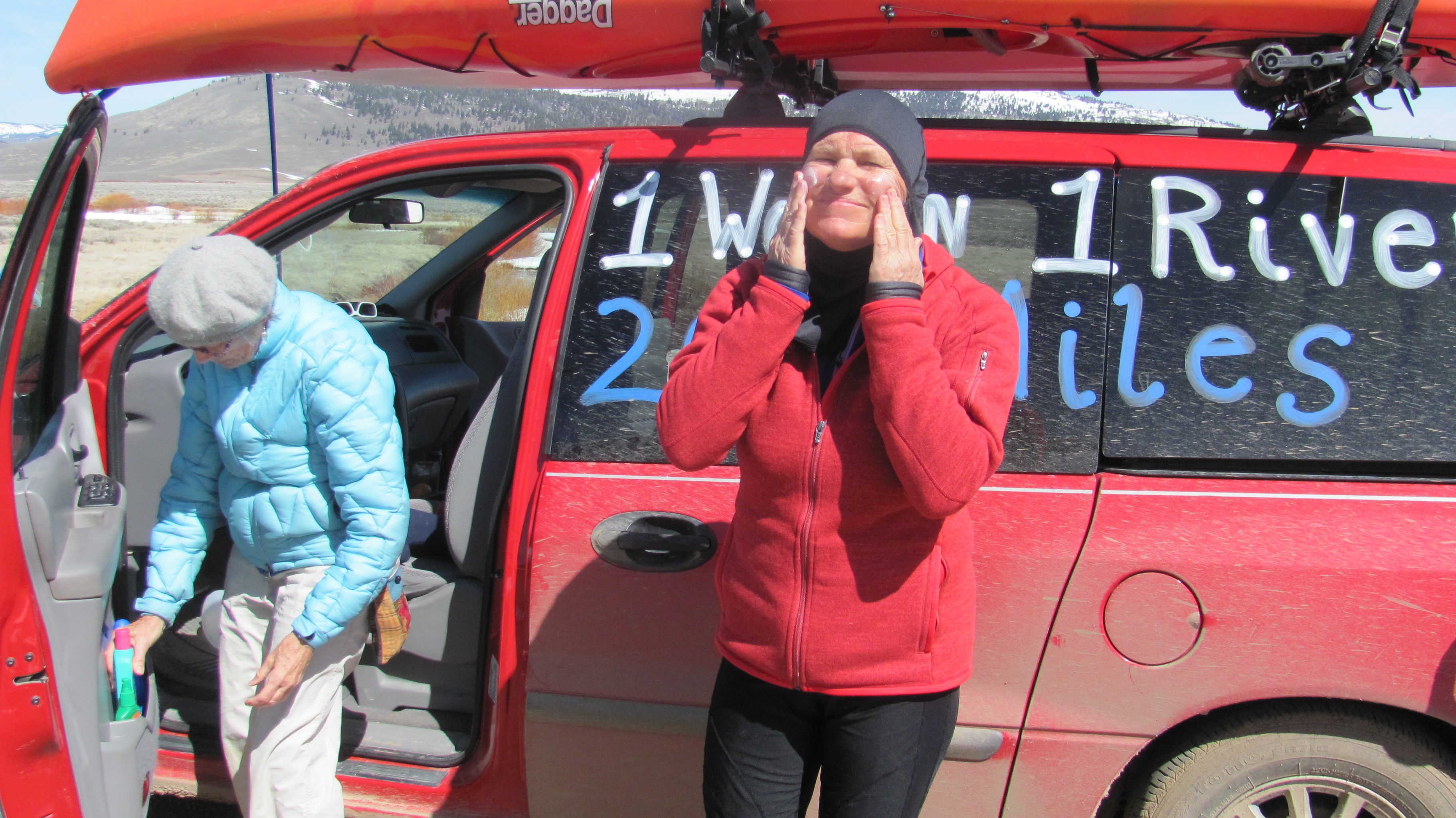
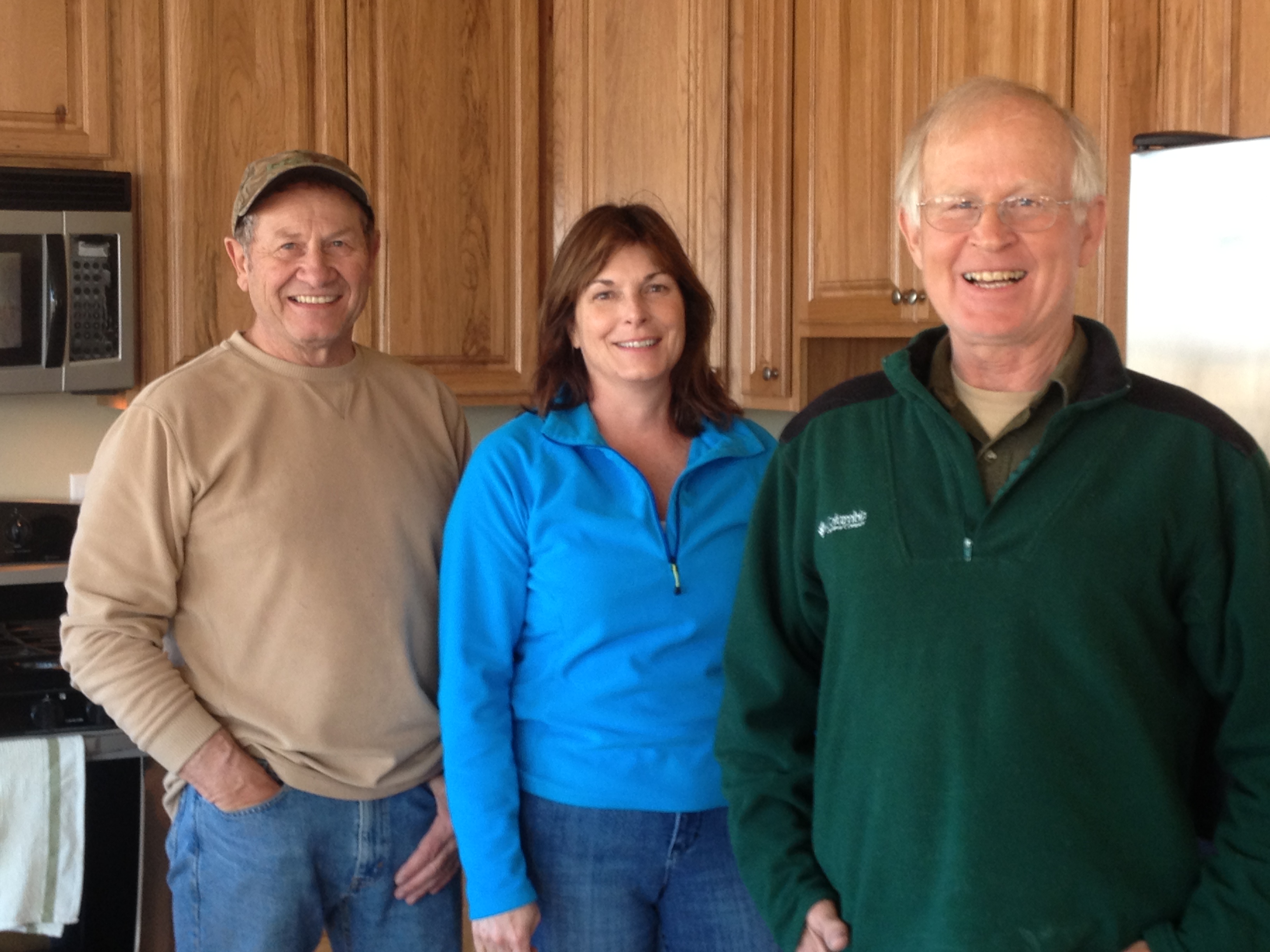
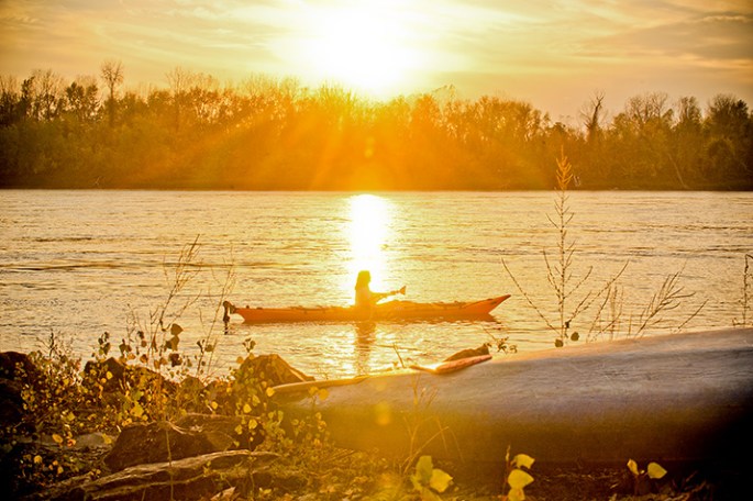
December Mizzou graduate Janet Moreland plans to make history on a solo kayaking expedition this spring — and hopes to incorporate her adventures into a middle school curriculum. She’s equipped with 16 years of kayaking experience and a brand-new bachelor’s degree from the MU College of Education.

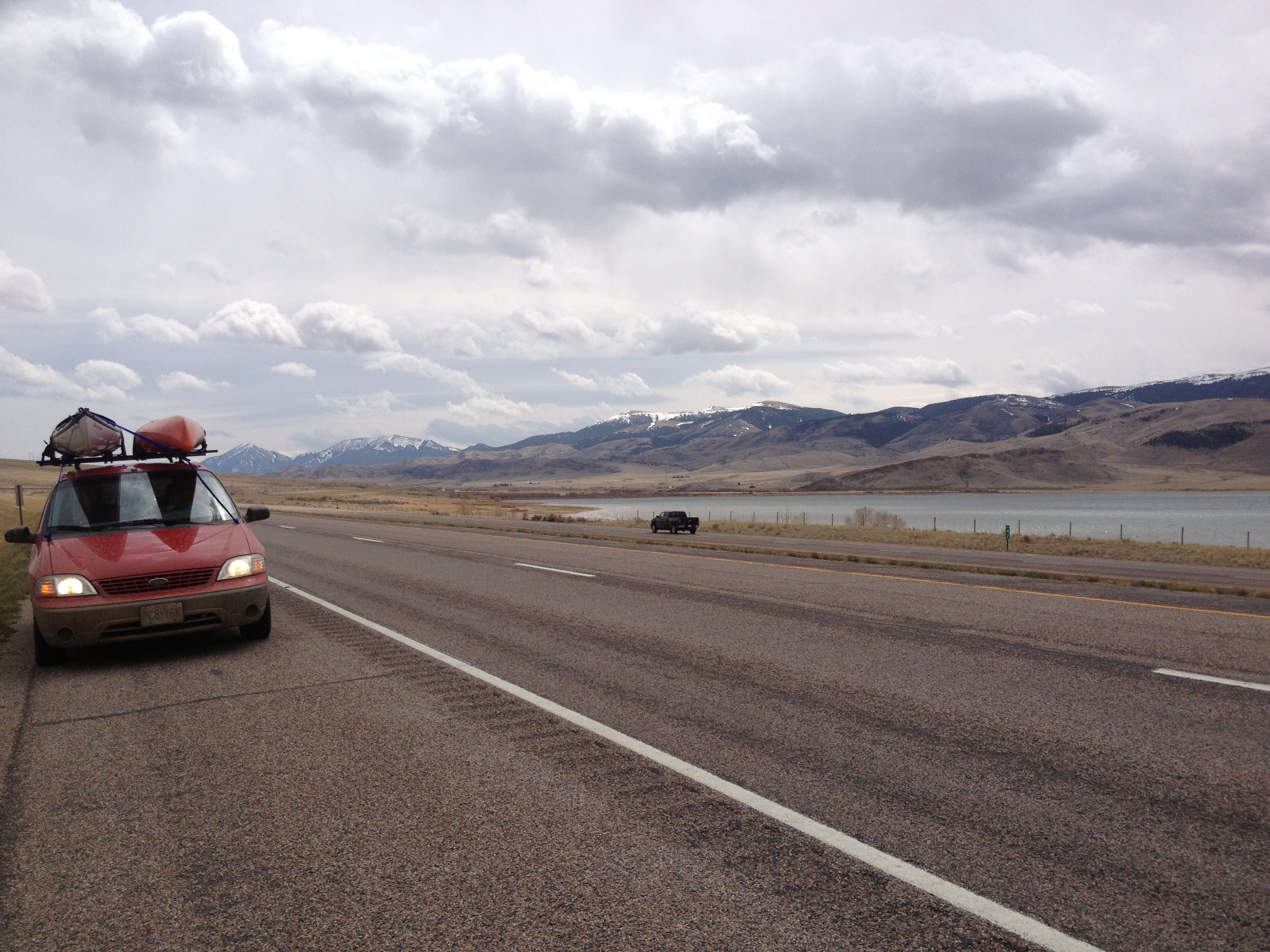
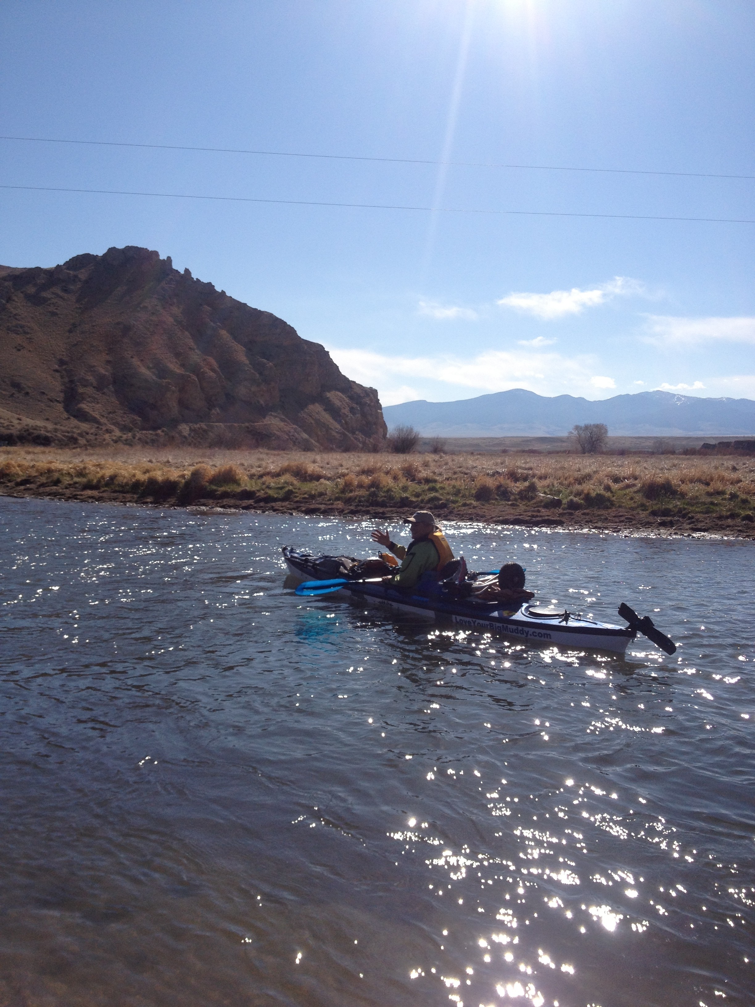
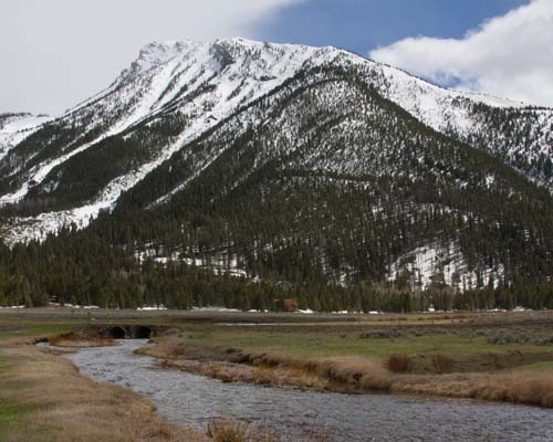
At 56 and with a new bachelor’s degree from the MU College of Education, one nontraditional student leaves Mizzou to pursue an adventure she’s been dreaming of for years. In May, Janet Moreland will embark on a solo kayaking expedition of the Missouri River from its headwaters at Three Forks, Mont., to St. Louis, a 2,320-mile span of paddling and portaging.

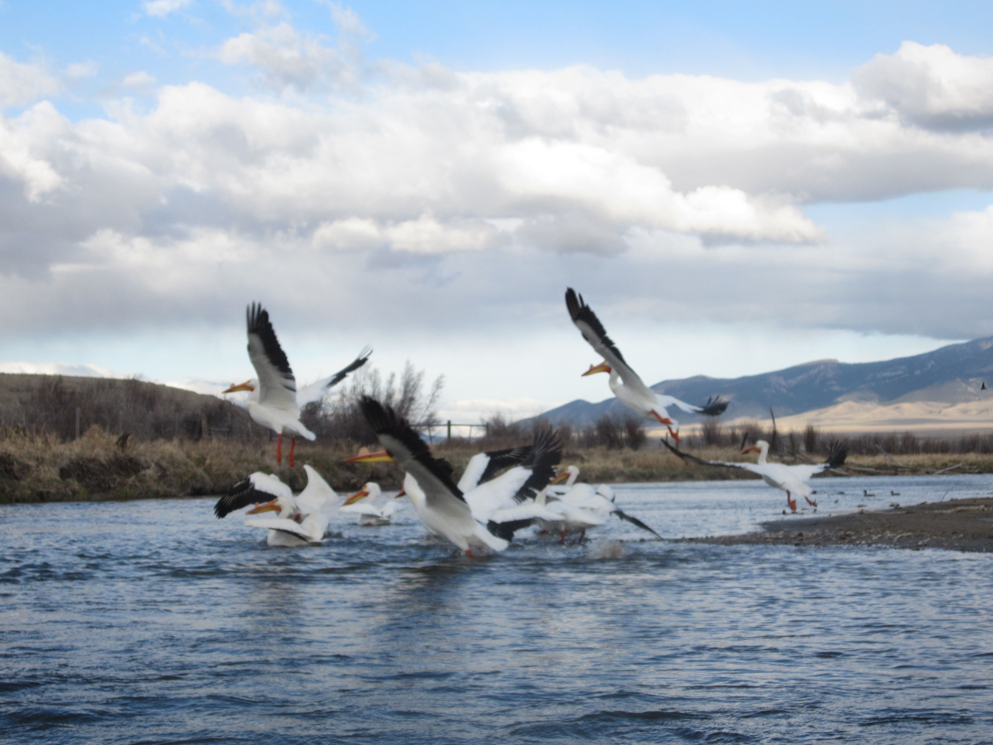
Moreland hopes to become the first woman to navigate that length of the Missouri River solo by kayak and to use the expedition as a teaching tool for social studies and science classes. She views the river as a “living laboratory” for teaching middle-school students about cultural history, geography, the natural environment and social interactions.

Just the thought of the approaching adventure wakes her up at night. “Maybe I’m an adrenalin junkie,” Moreland says.

Moreland’s journey will take three months, far less time than the 20 years she invested in working on a bachelor’s degree in education.

Extreme journey

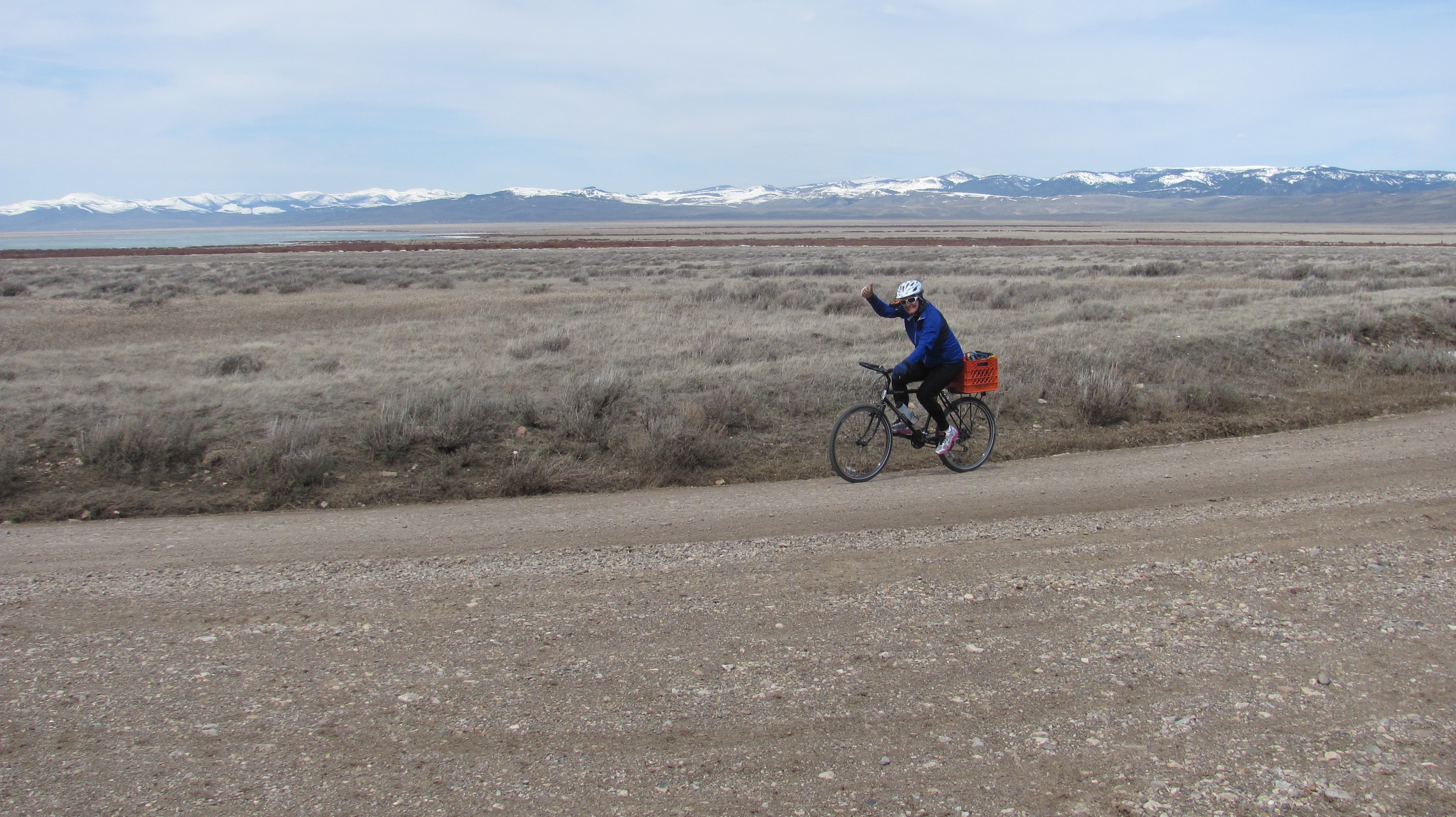
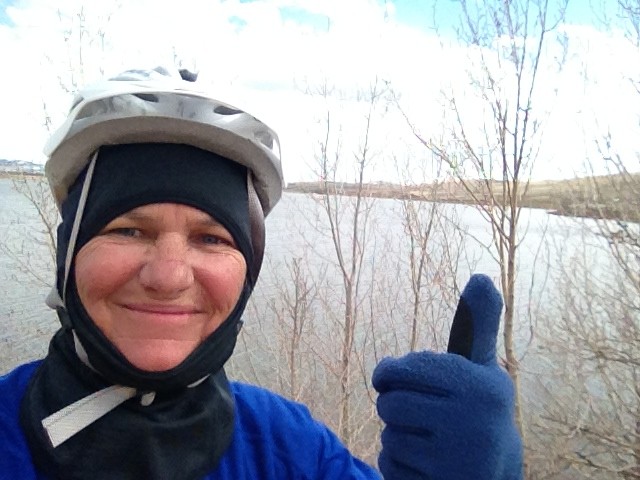
Moreland has been training for her river adventure for years. The self-described river rat has been kayaking for 16 years, with nine of those on the Missouri River. She runs two miles every other day and has been jogging most of her life.

Moreland will need mental endurance as well as physical stamina to be on the river for days on end. As lonely as the expedition seems, Moreland will find support from a network of kayakers.

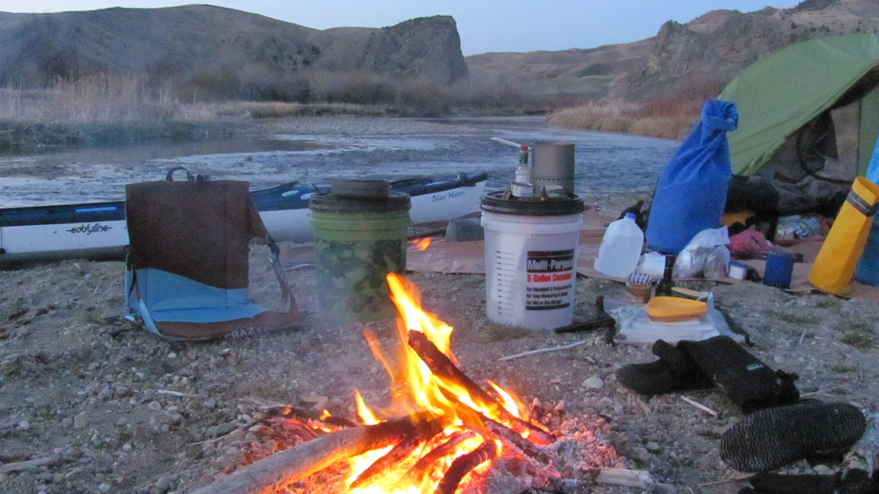
There will be fishermen, boaters and towns along the way, but Moreland could spend 10 days to two weeks on the river with no sign of civilization. She says solitude doesn’t bother her; she once lived alone in a house on 220 acres: “I’ve always been extremely independent. The solitude is something I look forward to.”

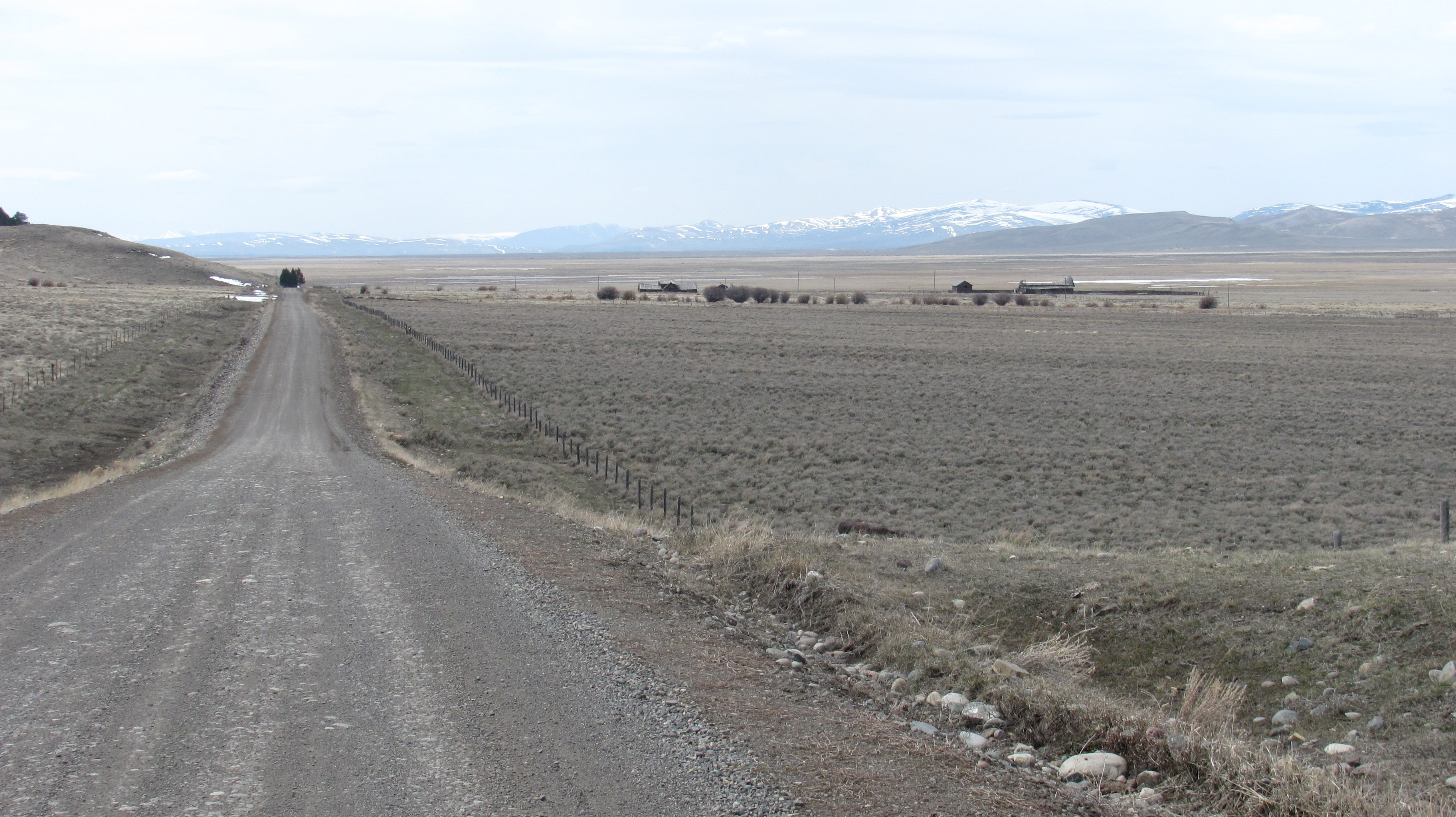
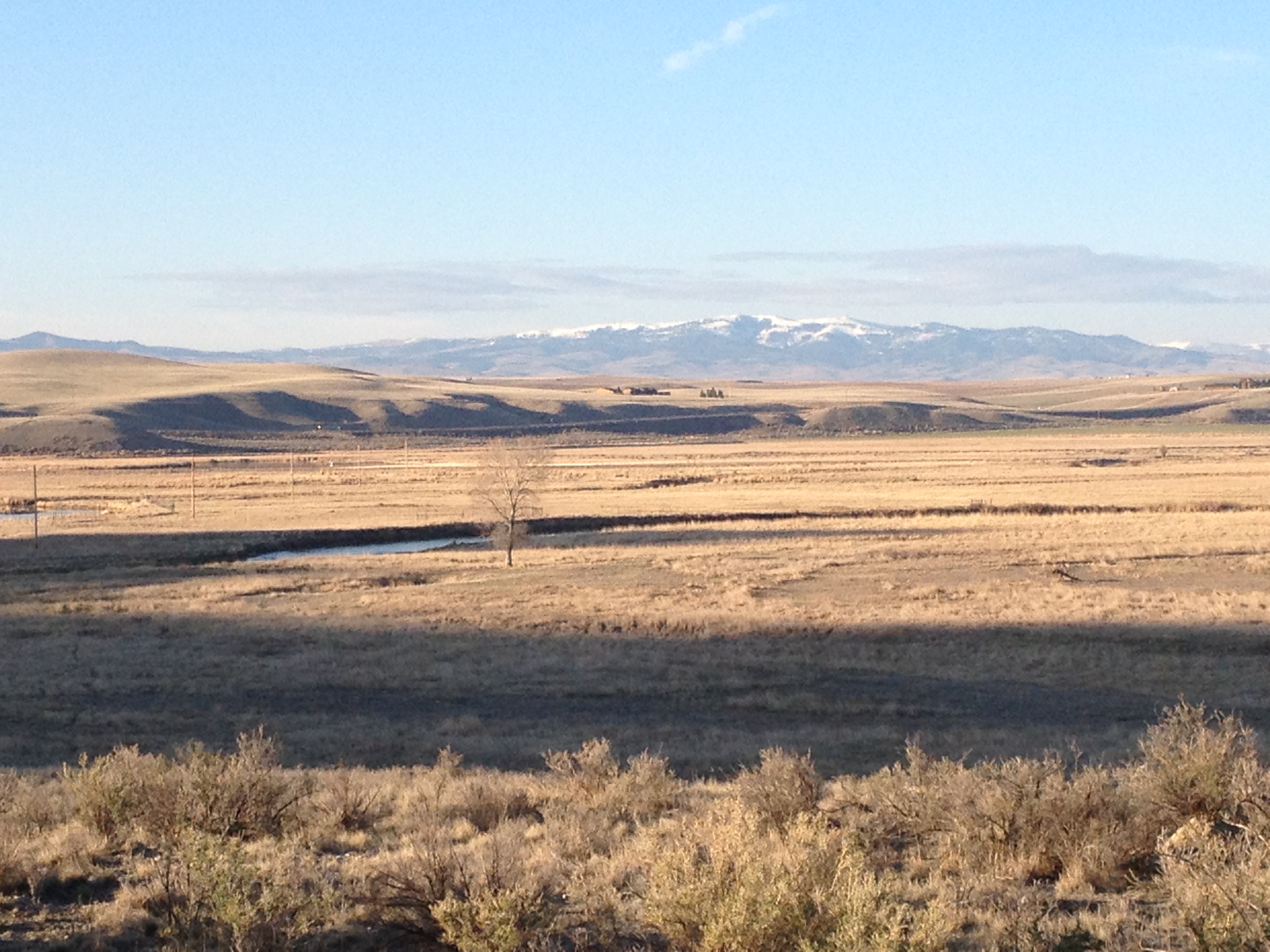
The tradeoff is the extraordinary beauty she’ll experience. The first 300 miles of the expedition will be engagingly scenic, and if she’s paddling on a cloudy night, light from the towns will reflect off the clouds to show her the way.

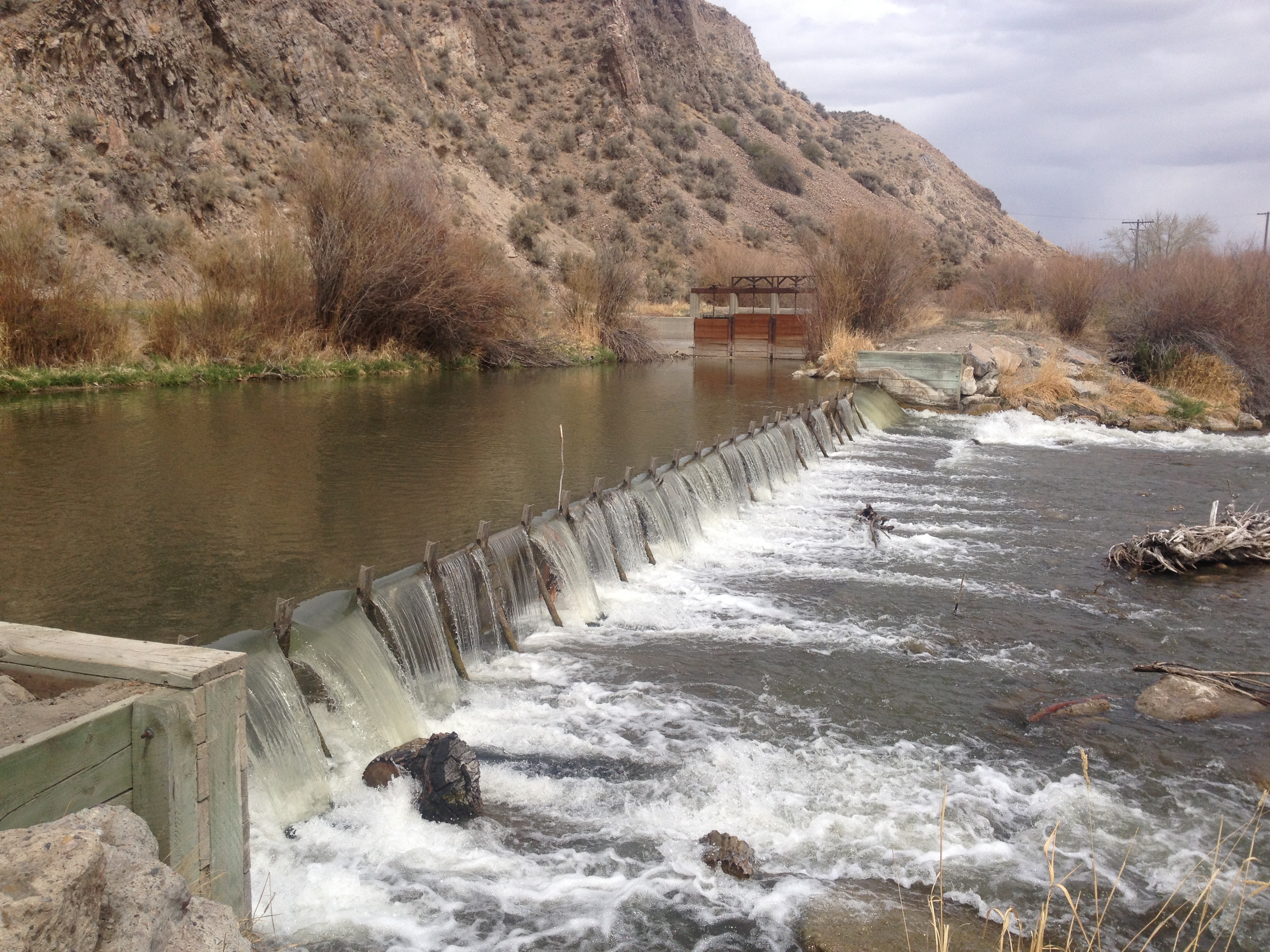
But the seven to nine big lakes along the route will offer challenges. One of those lakes is 230 miles long. Moreland’s major concern, however, is wind. Gusts along the river can reach 70 miles an hour, and if the winds are too strong, she’ll need to paddle at night when they die down.

Moreland caught the lure of extreme kayaking seven years ago after meeting paddler Dave Miller, author of The Complete Paddler. Miller had stopped for breakfast at Cooper’s Landing on the Missouri River, where Moreland cooked on Saturday mornings.

She was further hooked after another paddler, Norm Miller of Montana, said he believed she could be the first woman to kayak the entire length of the river solo. In 2004, Norm Miller (no relation to Dave Miller) paddled and hiked the Lewis and Clark route.

Janet MorelandIn September Moreland retired from her job in the MU Sustainability Office. A longtime environmentalist, Moreland thrives on outdoor adventures.

Wilderness and wildlife

Moreland will take an assortment of essential supplies for her journey, and she’ll refresh her two-week food and water supply in the river towns.

She’ll pack an expedition tent that can handle wind, a cook stove, a two-wheel trailer to portage her kayak around the dams, a sleeping bag, warm clothes and boots. She’ll take a flint stone as an emergency fire starter and a hatchet for chopping firewood, building windbreaks and cutting her way through river brush and vegetation.

She’ll keep bear spray on hand for any encounters with grizzly bears.

Because cell phone service will be scarce, she’ll use a laptop to post blogs and update her journal, forming the basis of a book she plans to write. A video camera attached to her kayak will capture images.

Moreland’s students and the public can follow her adventures at loveyourbigmuddy.com.

Trailblazing teacher

“Life is a journey. Live fast. Paddle slow,” sums up Moreland’s philosophy of life and love of adventure. Her goal as a teacher is to show students that it’s possible to follow their dreams, even those dreams considered out of reach.

“Children need to learn to believe they can make things happen they didn’t think were possible, and I want women to know that, too,” she says.

A lifetime of challenges that would test any adventurous spirit has seriously overqualified Moreland for extreme adventure.

She lived alone in Hawaii in the most remote part of the island and in Yosemite National Park. She worked as the first certified female member of a ski patrol in California’s Sierra Nevada Mountains, routinely doing avalanche control with dynamite and sometimes “under-the-rope” skiing on unpatrolled slopes.

She taught wind surfing and tried skydiving. She worked as a commercial salmon fisher in Southeast Alaska and as a carpenter in Bear Valley, Calif., repairing snow-damaged houses and, with two other carpenters, building a redwood house “from the ground up.”

Moreland’s quest for an education degree began in San Francisco, when her daughter, Haley Rose, was in preschool. Attending college part time, Moreland took classes here and there, fitting course work between moves, jobs and family responsibilities.

She moved to Columbia in 1996 after two years in Springfield, Mo., and, in 2005, decided to get serious about a Mizzou degree while working at the university. She retired recently from the Sustainability Office, where she worked on MU’s projects in environmental responsibility.

Her interest in kayaking developed after she learned her house was just down the road from the Missouri River. She drove to Coopers Landing and discovered the river.

“All of a sudden Columbia became home for me,” she says.

Teachable moments

Moreland plans to use her solo kayaking adventure as the basis of a curriculum on river sustainability and stewardship, as well as to build self-esteem in adolescents.

She’s greatly appreciative of and works locally with Missouri River Relief, a volunteer nonprofit organization dedicated to the health of the Missouri River. The organization connects children, teachers and the public to the Missouri River through clean-up activities and educational events.

Partly because of that group, the Missouri River is an “incredibly clean, beautiful wilderness waterway,” Moreland says.

Moreland’s river explorations will continue after she completes this summer’s expedition. She plans to paddle down the Mississippi River, from St. Louis to New Orleans, in summer 2014.

Moreland completed a student-teaching internship during the fall semester at Jefferson Junior High School. She will work as a substitute teacher for Columbia Public Schools in spring semester, while applying for a permanent position after her adventure.