Fort Peck Reservoir-Finally We Meet

Plenty of beavers in the refuge. And, they are BIG! They pretty much own that refuge.


A beaver swimming out to size me up. I'm ready for their water slaps these days. I've seen and heard many of them trying to warn me not to mess with them or their dens.
A beaver swimming out to size me up. I’m ready for their water slaps these days. I’ve seen and heard many of them trying to warn me not to mess with them or their dens.

I hated to leave the Roundup boys without saying good bye, but I had to get on the water early in order to make it through UL Bend on Fort Peck Reservoir, approximately 48 miles away. UL Bend is the river-to-lake transition area, and not without its challenges. I was packed and in my boat at 7:00 AM. As I was pushing off, Eli appeared on the shore. I was so happy because I got to say good bye. I also let him know that I left my card on the ice chest for him. It is always bittersweet leaving new friends and river brothers. These boys, young men, are my river brothers.

I packed up early and was on the water at 7:00. The air was still, but the banks were muddy for miles. I was extra thankful I had found the RoundUp Boys.
I packed up early and was on the water at 7:00. The air was still, but the banks were muddy for miles. I was extra thankful I had found the RoundUp Boys last night.


Nowhere to pull over for miles and miles.


This was a typical site for many miles of the river below the Breaks, and in the refuge. There was nowhere to land the boat, let alone camp. Thankfully, the glassy conditions helped me to paddle 10.5 hours and 48 miles this day.


The relentless rain in the previous weeks had saturated the land. This big landslide had occured recently.


On the approach to the lake their were numerous springs flowing into the river.

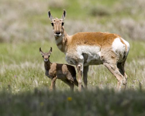
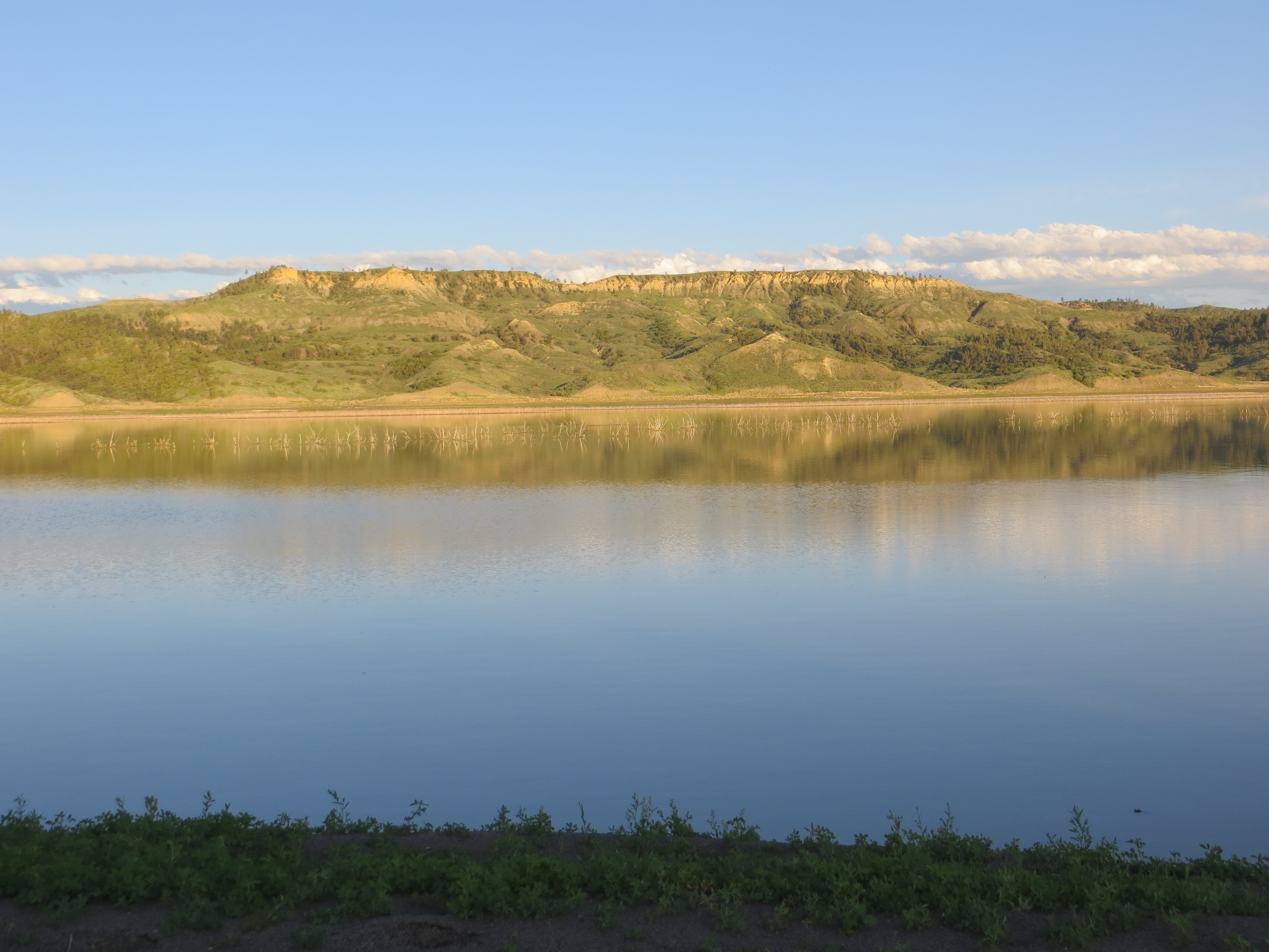
The Fort Peck Reservoir is 245,000 acres in size.  Extending up 125 miles from the Fort Peck Dam is the Charles M. Russell National Wildlife, which encompasses 1,100,000 acres and all of the Fort Peck Reservoir. The refuge contains a multitude of habitats which include native prairie, wooded coulees, wetlands, river bottoms and badlands.  “Given the size and remoteness of the Refuge, the area has changed very little from the historic voyage of the Lewis and Clark expedition…” [http://www.fws.gov/refuges/profiles/index.cfm?id=61520]

I enjoyed a warm and beautiful day with glassy waters all day.
This is a gorgeous Pronghorn deer buck, also known as an antelope (but there is some controversy about that). He had a herd of six females with him.
This is a gorgeous Pronghorn deer buck, also known as an antelope (but there is some controversy about that). He had a herd of six females with him. He was not comfortable with my presence.


Here is the buck's females (I assume they were all females). The buck was very protective of them and they were very obedient to his signals to stay clear of me. I was so happy to get pictures of these beautiful animals.
Here is the buck’s females (I assume they were all females). The buck was very protective of them and they were very obedient to his signals to stay clear of me. I was so happy to get pictures of these beautiful animals.


This smooth oval rock struck me as peculiar sitting at the base of a dark muddy-looking hillside.

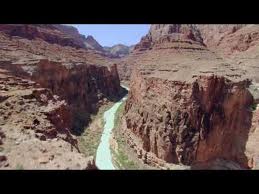
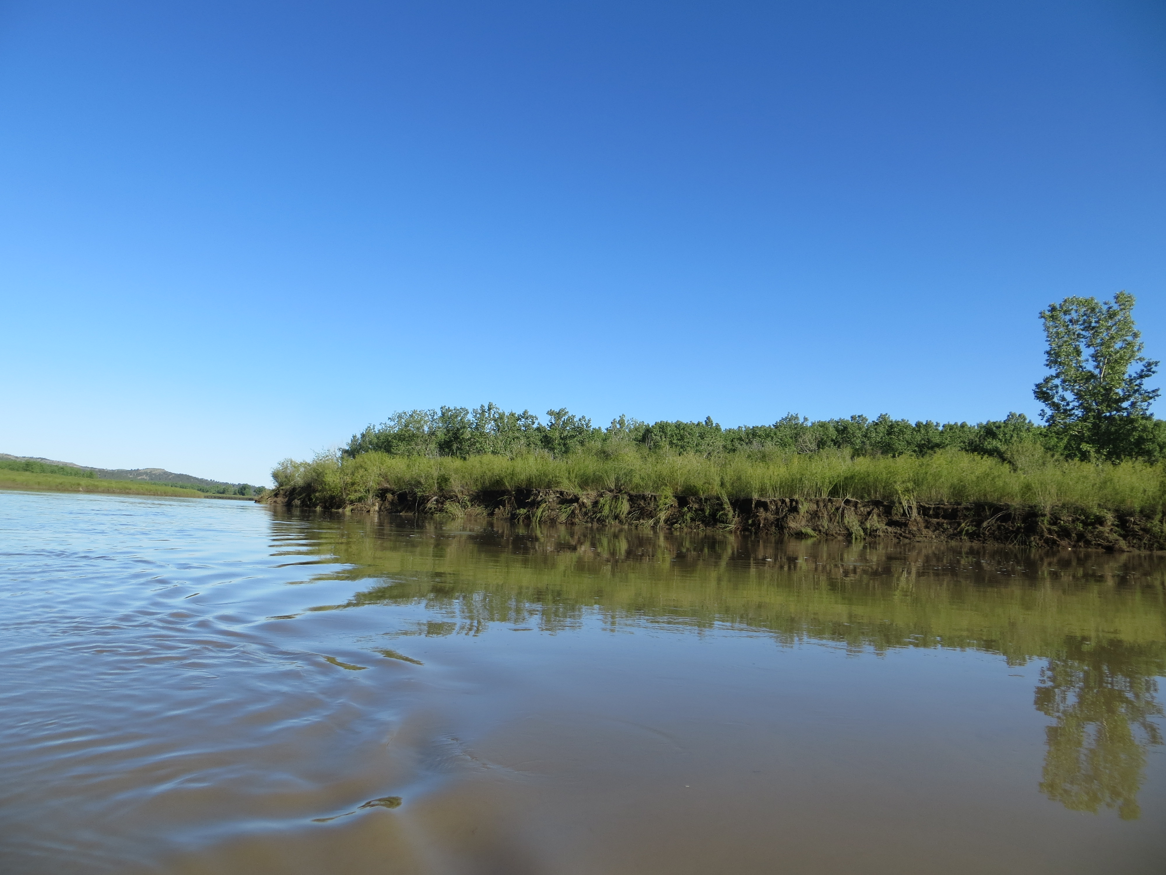
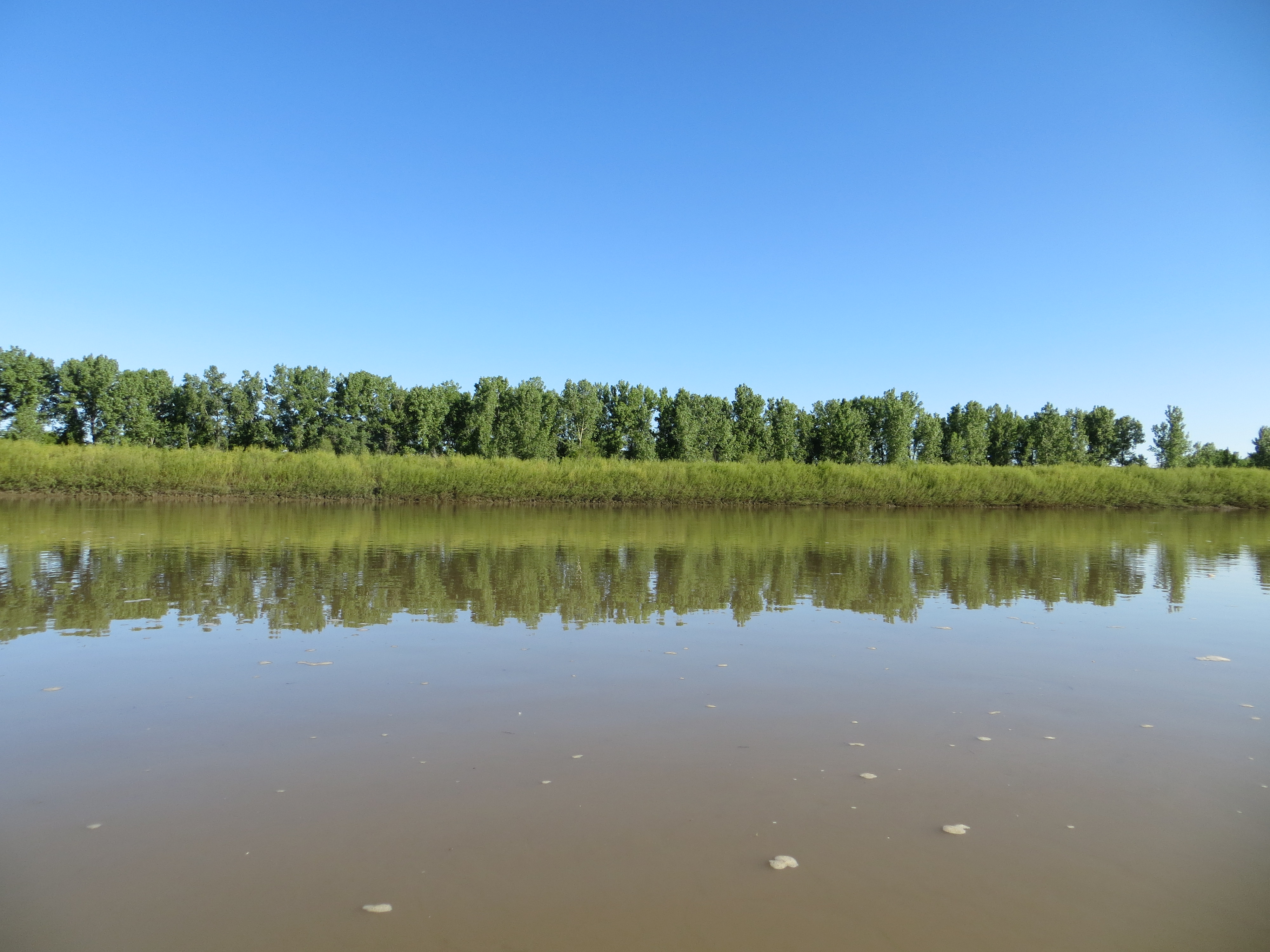
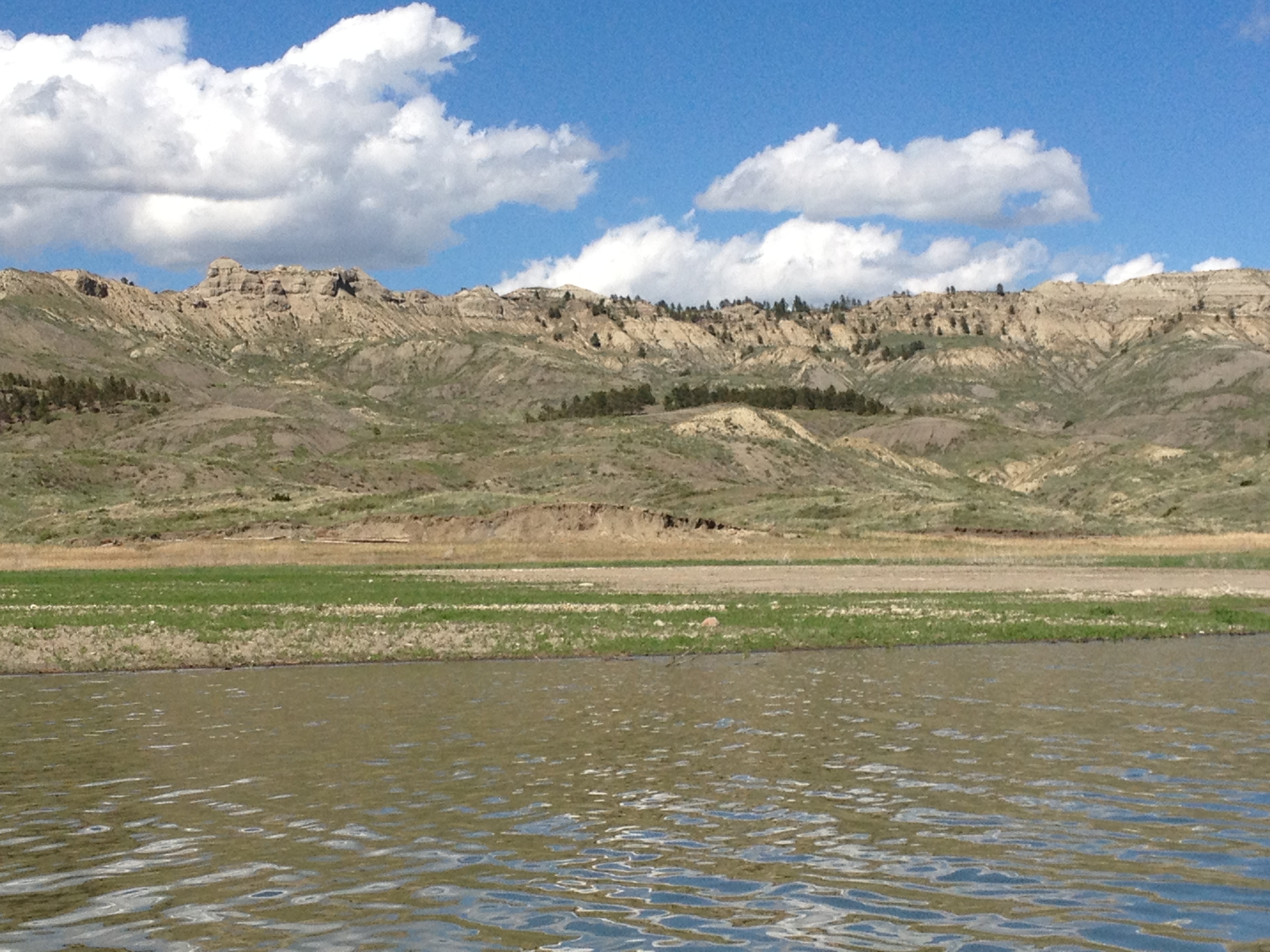
These river-to-lake transition areas are kind of spooky because the river shoreline slowly disappears into the water and before you know it, you are out in the middle of a lake. This can be daunting if the wind is blowing. Fort Peck Reservoir’s transition section also has shallow sand bars and mud to deal with. Thankfully, I was somewhat unaware of these things or else I would have been intimidated and  stressed. They say ignorance is bliss. In this case, this was true. It did not take long, however, before I realized I had to pay close attention so I would not get stuck on a sand/mud bar.

IMG_3521

These gulls were a good indication of shallow waters around me.
These pelicans were a good indication of shallow waters around me.


Pelican sitting on a sandbar that was just barely showing.

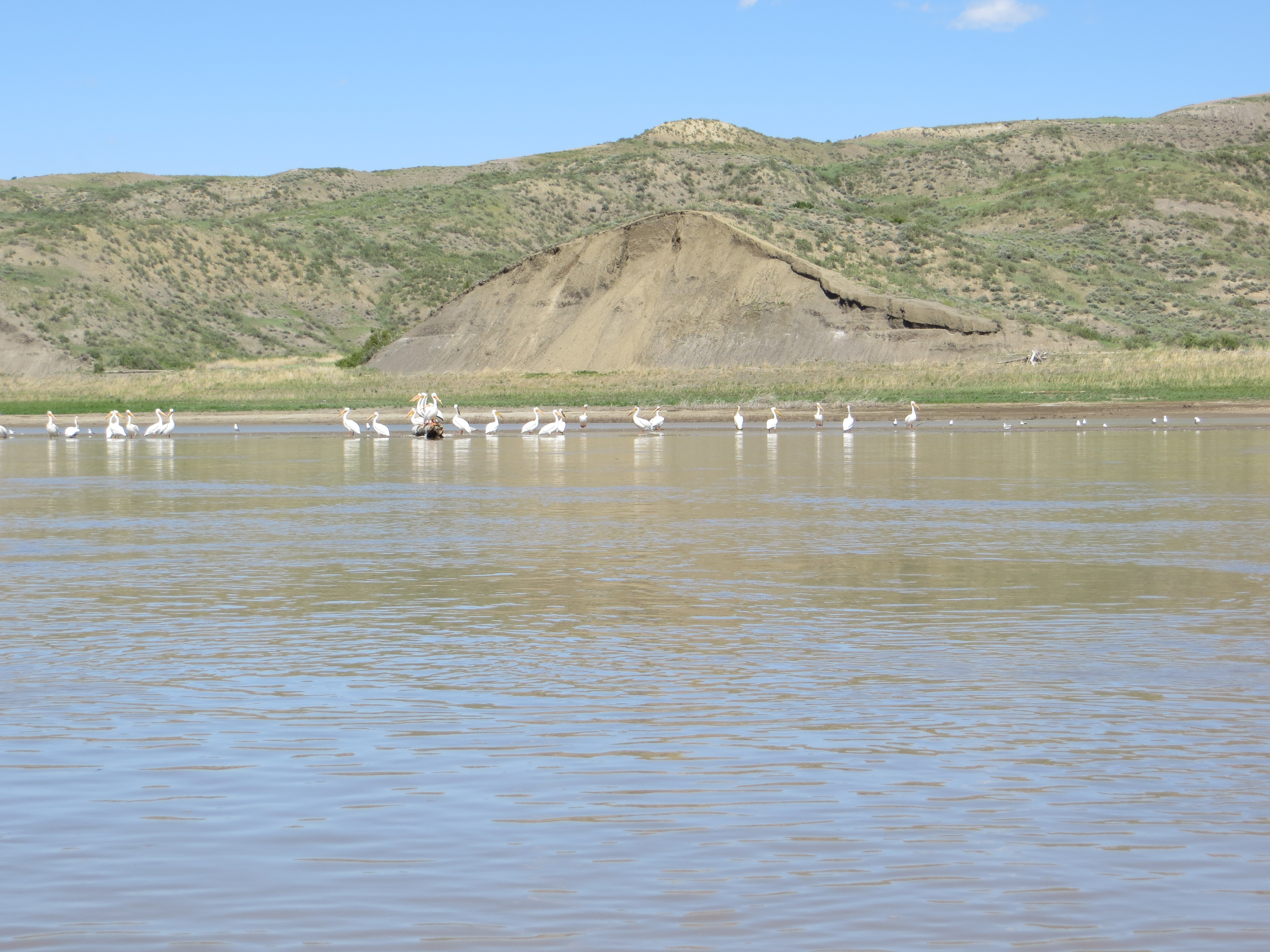
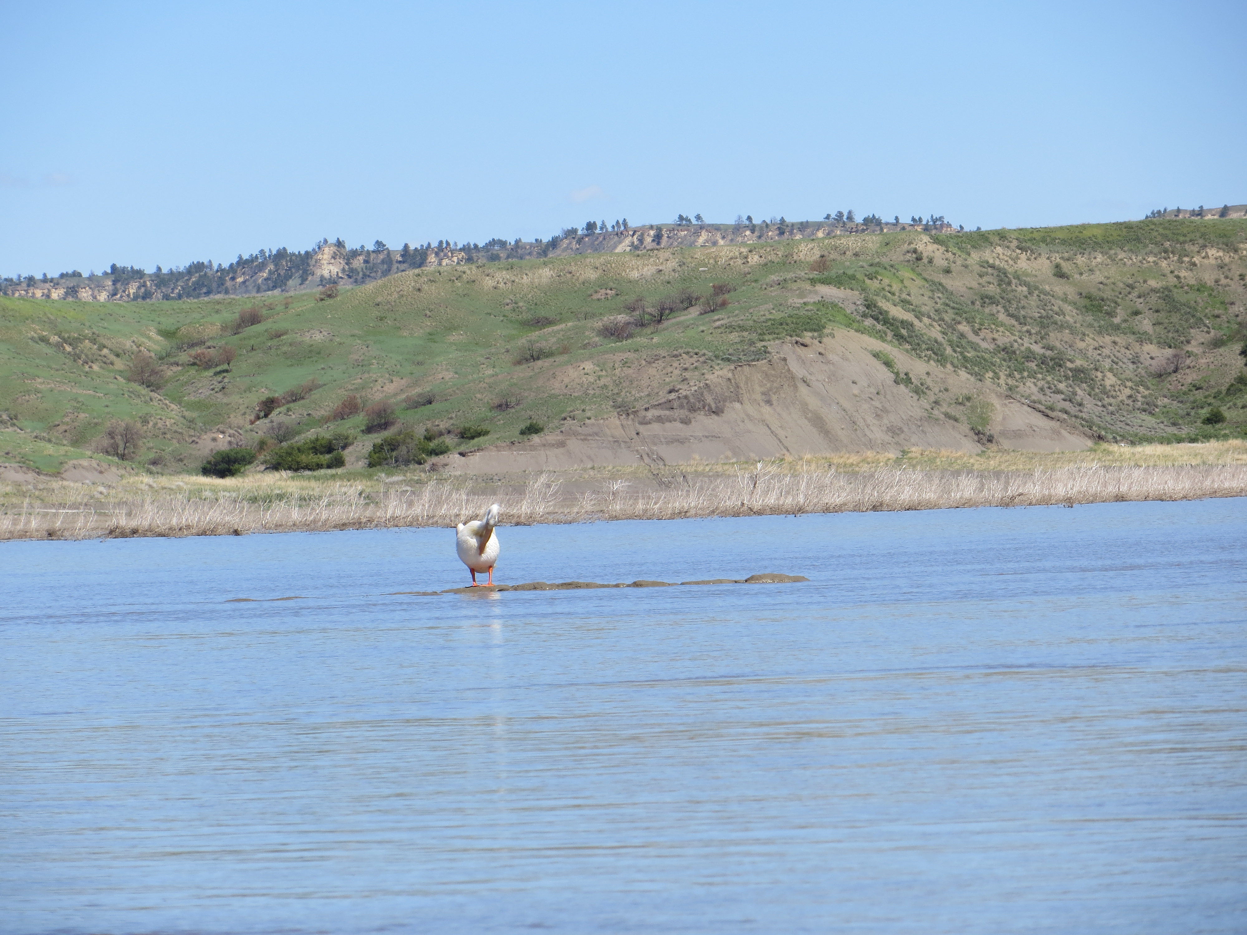
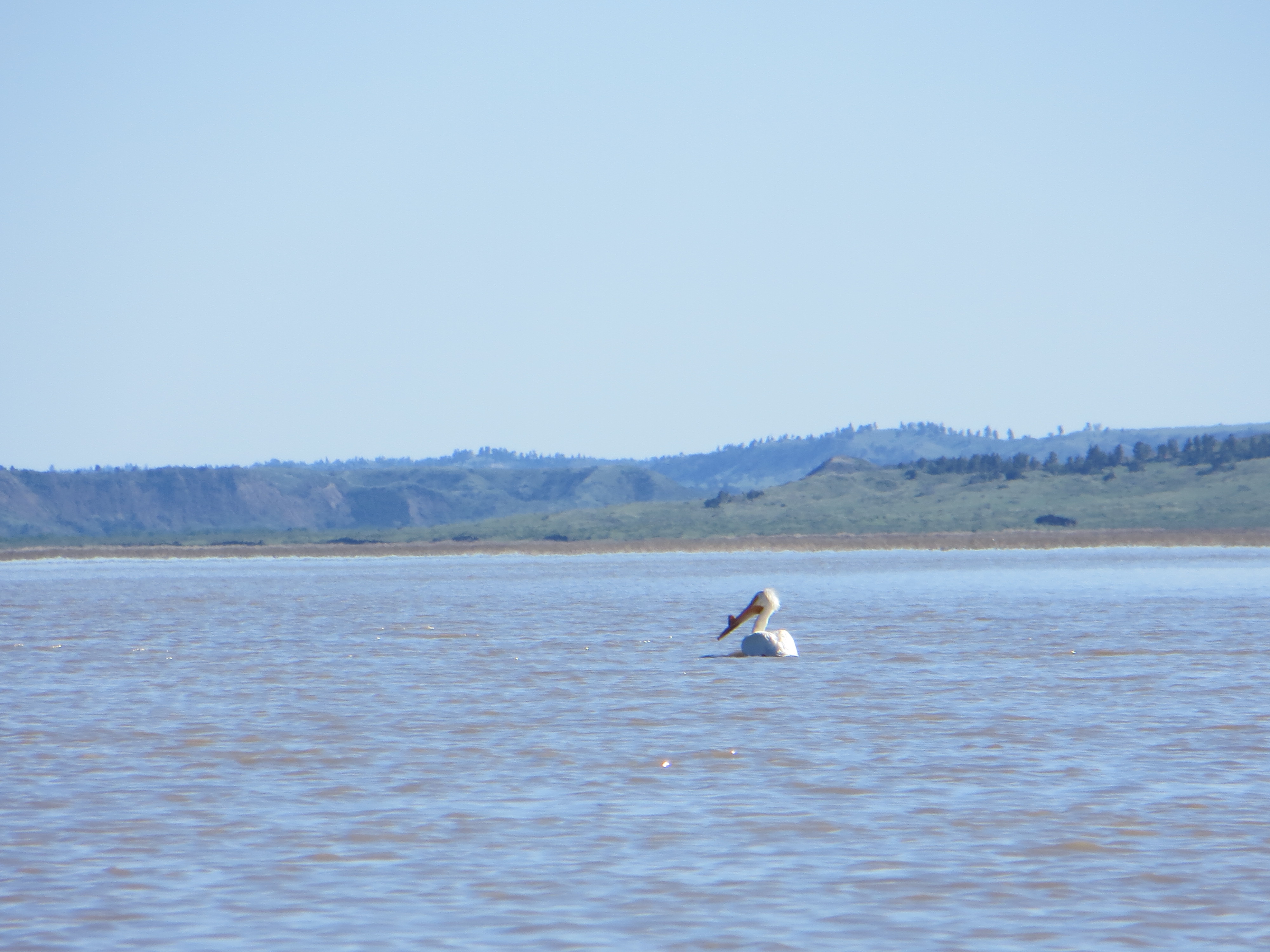
Once the shoreline has disappeared, it can be very difficult following the channel of the river, especially when the current is slowing down and spreading out, and the river transforms into a lake.  This pelican, I believed, helped to show me the way and I made it around the daunting UL Bend to a campsite.

This was my river angel. Once the shoreline disappeared, this guy led the way for me when I found myself in the middle of a lake with shallow sand/mud bars all around me. He was a guiding white light for me.
This was my river angel. Once the shoreline disappeared, this guy led the way for me when I found myself in the middle of a lake with shallow sand/mud bars all around me. He was a guiding white light for me, and one of the reasons I hold pelicans dear to my heart.

I made it to Fort Peck Reservoir!  I paddled 48 miles for 10.5 hours. This was a really productive paddling day and, boy, was I tired, but very very happy. I was especially joyful because my campsite was not muddy. Well, not too bad, anyway.

My first campsite on Fort Peck Reservoir, photo taken from my tent. I took a sponge bath here and washed some clothes. I was feeling really good.

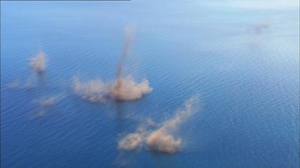
Later this evening I witnessed the power of a northerly squall line coming across the lake. I had been warned about sudden fierce winds coming out of nowhere. Thankfully, I was safe on shore with my tent and Blue Moon secure. At first it sounded like a motor boat across the lake, then it grew louder like a truck, then a train, and finally a jet plane. It was awesome to watch the wind line move rapidly over the water toward me. I knew what was happening, so I was intrigued, rather than fearful. Seeing this occur helped me to be cautious, aware, and respectful of the wind and water while on this lake.

A northerly wind appeared suddenly and engulfed the entire lake near me. Paddlers must keep one eye looking toward the north at all times.

I left the RoundUp boys on June 9 and made camp the same evening on the Fort Peck Reservoir 10.5 hours later. I would journey across this 135-mile lake for the next eight days. A lot can happen in eight days. I was immersed in wilderness and forced to use my own judgment and decision-making skills in order to progress safely to the dam. High winds, snakes, electrical storms, wildlife, zero cell service, hours of waiting out the wind, picturesque scenery, and the giving hearts of the few people I met would make this one of my most memorable experiences of my life. Stay tuned for part two, the next eight days to Fort Peck Dam, through some awesome and incredible wilderness.

IMG_1831

IMG_1834

Do what you love, and love what you do.

You CAN do it.

Teach Your Children Well

NewStickers_crop

Yesterday, I passed out some expedition stickers to my 8th grade science students. Well, they are not mine literally, but I spent an entire semester at Jefferson Junior High School with many of them, ten weeks as a student teacher of 8th-grade social studies, and six weeks of 8th-grade science. I kind of consider them mine, at least figuratively.

jjhs
Jefferson Junior High School. Columbia, Missouri’s first high school in 1911.

I was substitute teaching yesterday for my science students and we watched a marvelous Planet Earth video called “Fresh Water.” I watched the movie five times as I had five classes to teach. Never was I bored with it, but with each viewing became totally immersed in the photography of the wildlife and the waterways highlighted in the movie.

GrandCanyon
Grand Canyon’s Colorado River

One river highlighted was the Amazon River in South America. The Amazon carries more water than the next top-ten biggest rivers combined. It empties into the Atlantic Ocean after meandering 4,000 miles eastward from its source in the Peruvian Andes.

The Amazon River
The Amazon River

The students enjoyed the video, too. We saw grizzly bears feeding on salmon in British Columbia, a team of smooth-coated otters harassing a 13-foot crocodile in an Indian River, eight-foot fresh water dolphins, Botos,

Fresh water dolphins of the Amazon River.

navigating by sonar in the murky waters of the Amazon River, the falling waters of Venezuela’s Angel Falls, the highest in the world, mating lake flies producing smoke-like columns extending hundreds of yards up in the sky on one of the world’s largest lakes in the East African Rift Valley, and a red-bellied piranha feeding frenzy in the underwater forests of Brazil’s Pantanal – the world’s largest wetland.

Angel Falls
Angel Falls
Lake Flies mating before dropping eggs on water and dying.

Honestly, I had not planned to give away my stickers and tell them about my expedition, but the opportunity presented itself perfectly after watching “Fresh Water.”

“Ladies and Gentlemen (the line I use to get their attention), I don’t know when I will be back in this classroom, so I have a small announcement to make:  I have been planning an expedition since last June. I will be leaving in 2 ½ months, on April 14th, to solo kayak the entire length of the Missouri River, which starts in Montana.  The Missouri River is the longest river in North America and the fourth longest in the world, and flows about 2600 miles from its ‘source’ in the Centennial Mountains to St. Louis.”

Missouririvermap

Their response:

WHAT are you doing? What’s a kayak? Where are you going to sleep? What will you do for food? Who is going with you? How long will it take you? You’ll have a motor, won’t you? Won’t you be scared? The river is dangerous. That’s crazy. I could never do that!  Good luck.

My response:

“This is one of my objectives: I want you, and kids like you, to know that “you can do anything”, if you have the desire, a positive attitude, and support to help you. I want to model that for you by doing this trip.”

Now, I would like to add:

So listen up:  chase negatives away, just like the smooth-coated otters did with the crocodile, and “Make It Happen,” no matter what the “It” may be. Got it, guys?

Teach Your Children Well

cropped-nextgenerationtrashgetters-omaha-9-22-2012.jpg

A source start means a snow start, but ice-covered lakes?

ViewFromSouthValleyRoadSnow_112142
View of Lower Red Rock Lake in February. The lake is frozen over and looks like one large flat meadow.

Based on my camping experience in Missouri, I know that the threat of cold weather is present in mid-Missouri until AT LEAST after Mother’s Day, which is usually end of May (last hard frost date is late April).  So, starting my trip in mid-April in the Montana Centennial Mountains at the Continental Divide pretty much necessitates winter conditions planning. Okay,  got that.  However, I did not really consider the Centennial Valley being covered with snow down to the Red Rock Lakes National Wildlife Refuge.

I received an email response from Bill Smith, project leader at the Wildlife Refuge, which is located down the Centennial Valley from where I’ll exit the mountains after skiing to Brower’s Spring.    He writes:  The refuge is not closed in April, it is just closed to boating.   In addition, the two big wetland lakes (Upper and Lower Red Rock Lakes) are still frozen until about May 1st.    I suggest you snowshoe to Brower Spring from the Centennial Valley floor.   Then you could cross country ski down the valley if there is still snow available.   No refuge restrictions on ski travel.

(Norm Miller and I are planning to ski in to Brower’s Spring from Sawtelle Peak, a two-mile ski to the spring, and seven miles down to the valley floor.)

Nemesis Mountain
Nemesis Mountain The exit from Brower’s Spring, Hell Roaring Canyon, is on the right side of Nemesis Mt. (out of this photo) where Hell Roaring Creek empties into the valley, and soon becomes Red Rock Creek.
Hell Roaring Canyon and Creek, exiting the mountains. (Nemesis Mt. to the left of canyon.)
Hell Roaring Canyon and Creek, exiting the mountains. (Nemesis Mt. on the left)
Winter view of the Centennials here. Wind blows frequently to obscure the road completely with snow in February.

SO, the good news is:  The refuge is not closed to paddlers in April, only motorized boats.  Yay!

And, the not necessarily bad news:  The entire valley MAY be covered in snow and the lakes covered with ice until May 1st.   Dang, this is starting to become quite the adventure.  And, I like it!

Centennial Mountains cloaked in a snow storm.  (All of these photos taken from the virtual tour site-link is below)
Centennial Mountains cloaked in a winter storm. (All of these photos taken from the virtual tour site-link below)

Bill sent me some valuable links that are critical to my planning of this upper upper portion of the expedition.  Here is what he wrote:

I’ve attached two web sites.   The Lakeview Ridge Snowtel site will allow you to look at graphs and charts of average snow depth during the annual cycle here.   Look at historical April.   It will also give you the current year.

http://www.wcc.nrcs.usda.gov/nwcc/site?sitenum=568&state=mt

The 2nd link is to the water gauge on Red Rock Creek.   It will give you historical and real time measurements of stream flow in the creek.   The gauge is on the Creek at the very Eastern boundary of the refuge.

NRCS is upgrading this website this weekend so it may not work well until Monday.

http://waterdata.usgs.gov/mt/nwis/uv?site_no=06006000

I assume you have the refuge website.   Here is a link to a virtual tour of the Centennial Valley.

http://www.fws.gov/redrocks/virtualtour/

Virtual tour!!?  How awesome is that!  I hit every spot on the tour, and let me just say this, “It IS the next best thing to being there!”  When you click on the link, the map on the left has a white dotted line sweeping along the bottom and then up towards Henry Lake.  That dotted line is the Continental Divide, and Brower’s Spring is inside the lower right-hand u-turn area where the white line starts to head north.  On the right side of the page, the names of the mountains will show up when you scroll over them.  You can sweep 360 degrees!  Enjoy!  It is a fantastic site.  Big huge thanks to Bill West and his willingness to help me out.  We will talk by phone soon.

All photos on this post are taken from the virtual tour site.

That’s all I got for now.  Lots to think about.

The willows growing from Tom Creek provide browsing for Moose in the deep of winter here. In summer, moose are attracted to marshes and creek banks to both collect suitable vegetation to eat and water to wet and cool themselves in. Moose are not usually aggressive towards humans, but can be provoked or frightened to behave with aggression. Due to their disposition and size, it's best to keep a wide berth from them.
The willows growing from Tom Creek provide browsing for Moose in the deep of winter here. In summer, moose are attracted to marshes and creek banks to both collect suitable vegetation to eat and water to wet and cool themselves in. Moose are not usually aggressive towards humans, but can be provoked or frightened to behave with aggression. Due to their disposition and size, it’s best to keep a wide berth from them.
Pronghorn and calf
Pronghorn and calf
The beautiful Western Tanager (Piranga ludoviciana) has found a bug in the grasses near Red Rock Creek. The tanager is classified in the same family as the cardinal. Western tanagers eat fruits (~18%) and a wide range of insects (~82%) They are a welcome visitor in the spring and early summer here in the refuge, though not especially numerous (like the blackbirds or sparrows, etc).