Upper Missouri River Breaks-continued

I decided not to stop at Judith Landing, the approximate middle of the Breaks. I regret that move a little, but I was yearning to get in some solitary camping. I knew that all of the others on the river were getting out at Judith because of the James Kipp closing, so I kind of felt that I would have the lower section to myself. I saw James and Klaus loading up at the Judith Landing boat ramp, and we were able to wave and say our last good-byes.

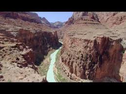
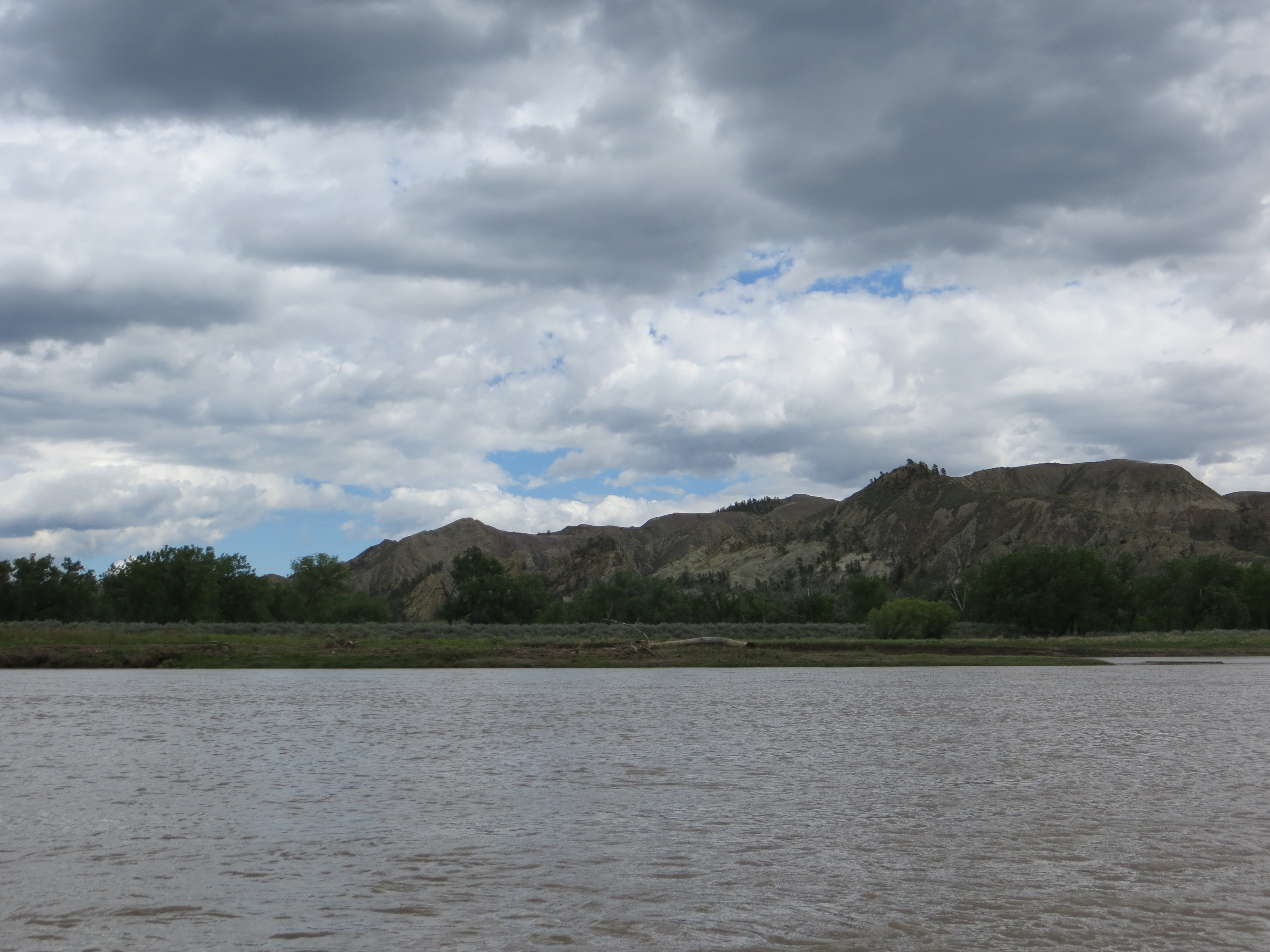
I decided to camp at Gist Campground. I was right. No one was around beyond Judith Landing. The campground was located on a beautiful stretch of river with a steep rock wall that plunged straight down into the river. I knew then that I was going to like this place.

The wall across the river
The wall across the river from Gist Campground

The river banks were muddy because of the recent rains. I decided I could not avoid it no matter what, so I just took off my shoes and let it squish between my toes. The Big Muddy’s mud is actually soft and silky and washed off the skin quite easily. What are you gonna do?  You just have to deal with it. No sense in getting anxious and frustrated about it.

The mud at Gist Campground was extensive. The river had flooded during all of the rain, and now it was dropping leaving a lot of shoreline with mid-calf to knee-high mud.
The mud at Gist Campground was extensive. The river had flooded during all of the rain, and now the river was dropping leaving a lot of shoreline with mid-calf to knee-high mud.
My camp at Gist
My camp at Gist
This is the river as it runs down towards the front of Gist Campground. I was very much isolated in this area. However, in the evening just before dusk, a solo canoer paddled by quietly. It is amazing I happened to see him. Although, I always keep one eye on the river and can spot any living thing that is nearby. Had I been inside my tent for any reason, I may have missed him.
This is the river as it runs down towards the front of Gist Campground. I was very much isolated in this area. However, in the afternoon as I was leaving on another hike, I saw a solo canoer approaching. It is amazing I happened to see him. Although, I always keep one eye on the river and can spot any living thing that is nearby. Had I left a minute earlier, I may have missed seeing him upriver. I went ahead and took off on my hike. He was not there when I got back. He must have paddled on.
This is the view from the campsite looking inland downriver. I wanted to walk up to the lookout in which Lewis claimed he saw the Rocky Mountains for the first time. I would have to walk a mile and a half in that direction. No problem.
These are the Gist Homestead remnants just behind the campground. It was fascinating to see inside and imagine what life was like in the 1800s. I was electrified considering these things as I used to dream about being an early settler.
These are the Gist Homestead remnants just behind the campground. It was fascinating to see inside and imagine what life was like living out here in the 1800s. I was electrified considering these things as I used to dream about being an early settler.
When I walked the mile and one half down towards the lookout hiking area, this weather blew in and looked ominous. It proved to be nothing, but I canceled my hike to as to not get in thundersorm and hail trouble.
When I walked the mile and one half down towards the lookout hiking area, this weather blew in and looked ominous. It proved to be nothing, but I canceled my hike to the top so as to avoid thundersorm and hail trouble.

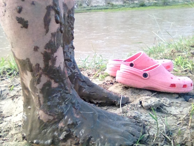
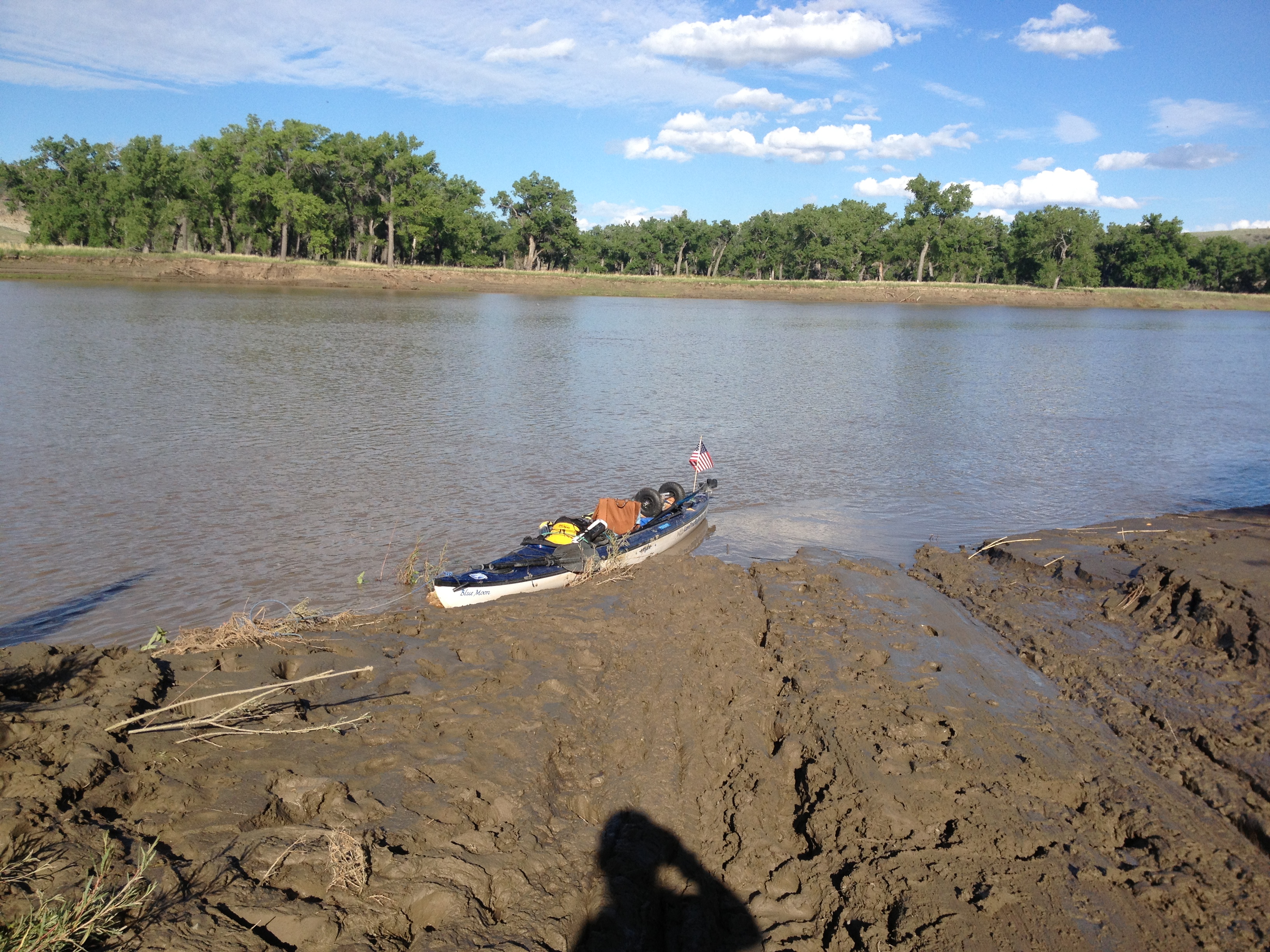
After staying for two nights and several small hikes later, I moved on. The river had dropped three or four feet since I had arrived. This beached my boat fairly high above the waterline, and you know what that means? It was time to get muddy again. Off came the shoes and I moved the boat up the river to where I was camped since there was no difference now in the mud situation. The riverbank was muddy everywhere. I would soon find out that the mud was prevalent for miles and miles to come. Finding campsites downriver would prove to be extremely challenging.

Yes, the river dropped. I knew it would, but never thought it would look like this.
You can make up your own caption for this one.

I learned about some historic events as I was actually paddling down the river. The Cow Creek Crossing was one such event. As I read about the Nez Perce Indians, led by Chief Joseph, marching towards Canada in order to escape confinement to a reservation, I was moved. 750 men, women and children, now refugees in their own country, trying to escape the American military and the inevitable tragedy that would follow. Unfortunately, they were close to Canada, but not close enough to escape. I followed their trail through this entire section and stopped every so often to just imagine where exactly they walked and what they must have looked like. I was filled with emotion.

A page from Otto Schumacher and Lee Woodword's Magnificent Journey, providing a little information about the Nez Perce Crossing of Cow Island.
A page from Otto Schumacher and Lee Woodword’s Magnificent Journey, providing a little information about the Nez Perce Crossing of Cow Island.

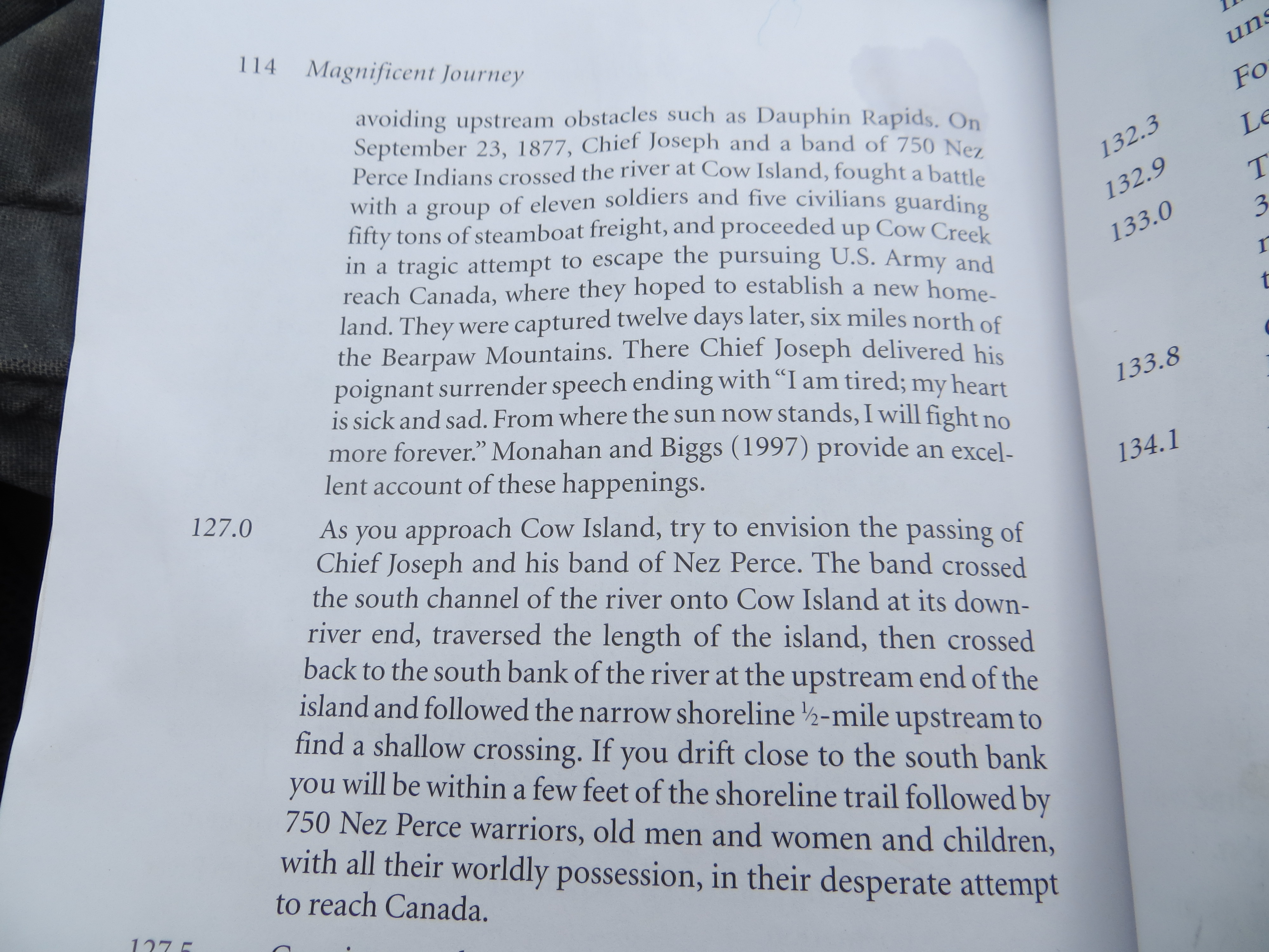
I paddled slowly past the Nez Perce National Historic Trail where, in 1877, approximately 750 men, women, and children of their “nontreaty” tribe tried to make their way to Canada to reach asylum.  I saw the many water crossings they likely took, and a narrow trail along the river on which they walked near Cow Island. They were so close to freedom before they were stopped and 200 Nez Perce braves fought to defend the fleeing tribe. My heart bleeds for them. This section proved to be very melancholy for me, and unforgettable.

The trail of the Nez Perce
The Nez Perce likely walked along this narrow shoreline. The geography of the river and mountains is still very similar, based on records of the route they walked.
The Nez Perce likely walked along this narrow shoreline and through that flat area on their way to the Cow Island Crossing. The geography of the river and mountains is still very similar, based on the map of the route they walked.
The Nez Perce Trail come this way from those mountains and their journey involved many river crossings. The trail seems to cross right at the most narrow spots, indicating the river must still be similar to what it was then.
The Nez Perce Trail comes this way from those mountains and their journey involved many river crossings. The trail seems to cross right at the most narrow spots, indicating the river must still be similar to what it was it was like then.
The Nez Perce crossed Cow Island and headed north towards Canada in attempt to acquire assylum from the American military.
The Nez Perce crossed Cow Island and headed north towards Canada in attempt to escape the American military.

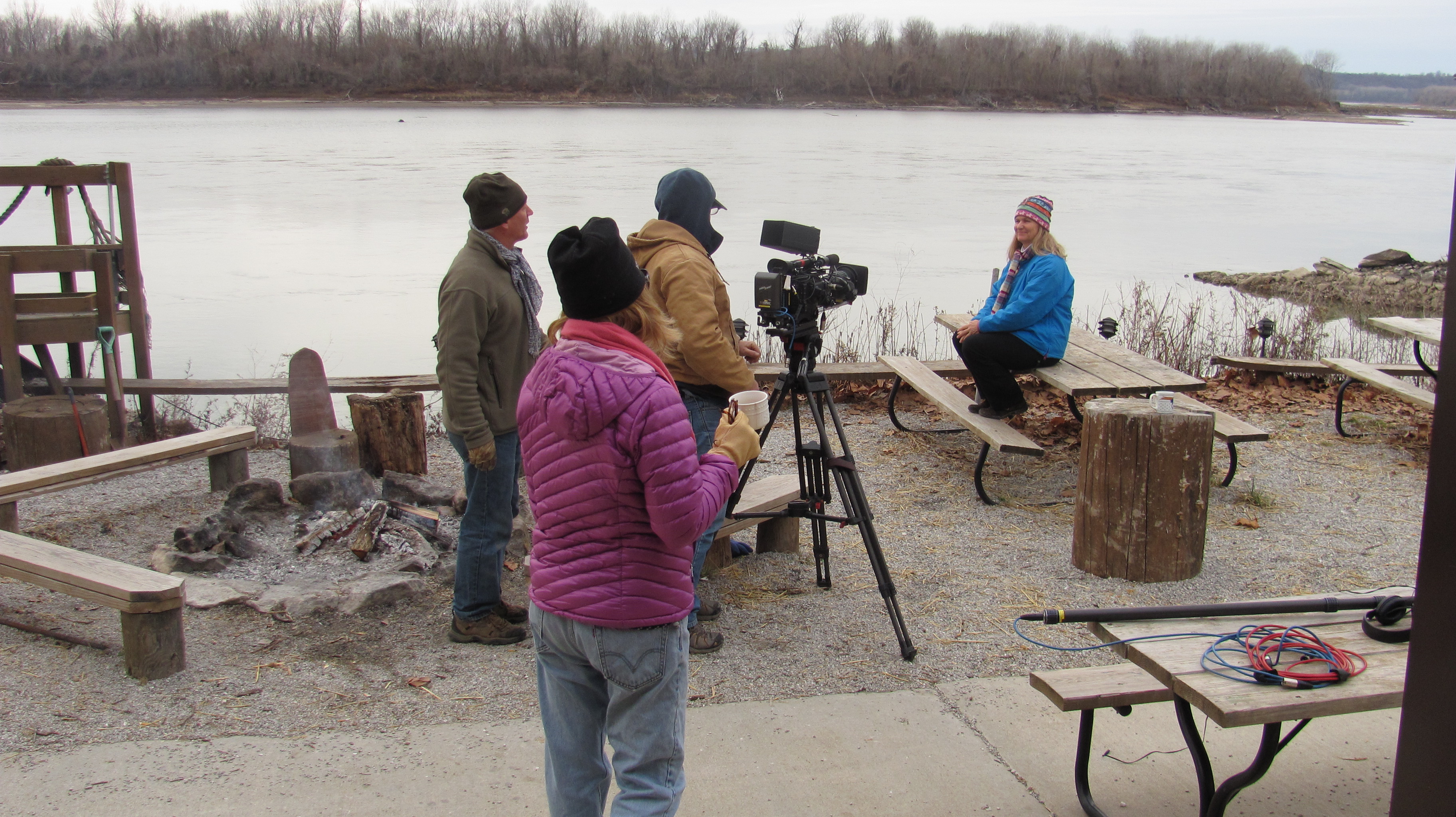
My plan was to stop at the James Kipp Recreation Area. This is considered the end of the road for the Upper Missouri River Breaks National Monument. I planned on refilling my water here, and camping the night. I had no idea the flooding wreaked such havok on the campground. Not only were the roads closed just a few days previous, but the electricity was still out and that meant the water pumps were not working. A fisherman took me around to find water to no avail. But in order for him to do that, I had to get up this boat ramp. “Apparently, they have not cleared the ramp yet.” I chided. That got a good laugh. The camp host eventually came to the ramp with a ten-gallon bottle of water and filled my five gallon bottles.

The James Kipp Campground boat ramp
"What a bloody mess," as they would say in England.
“What a bloody mess,” as they would say in England.

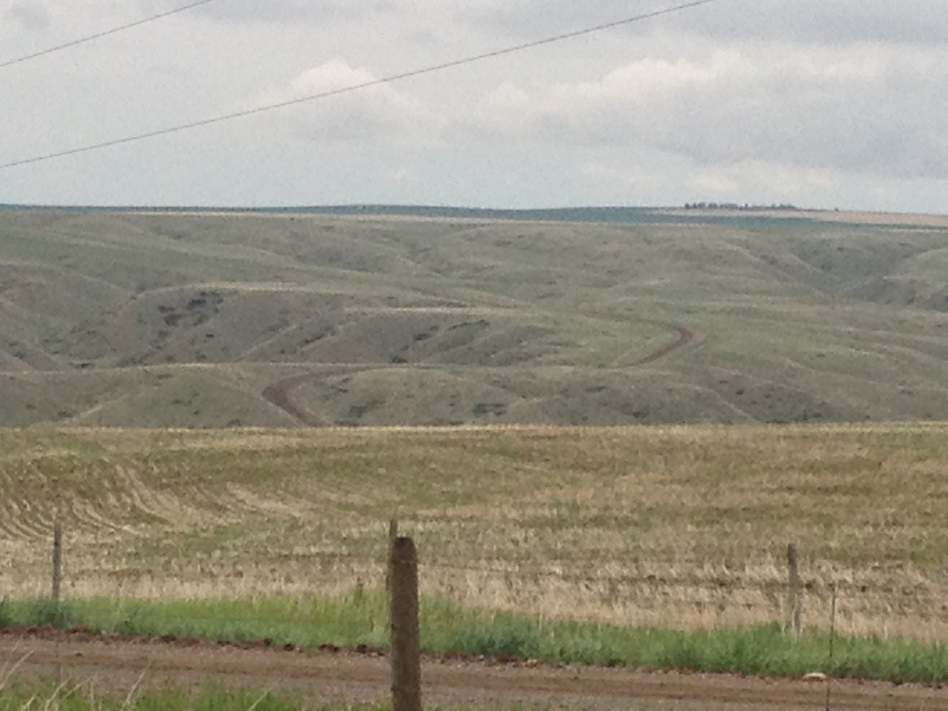
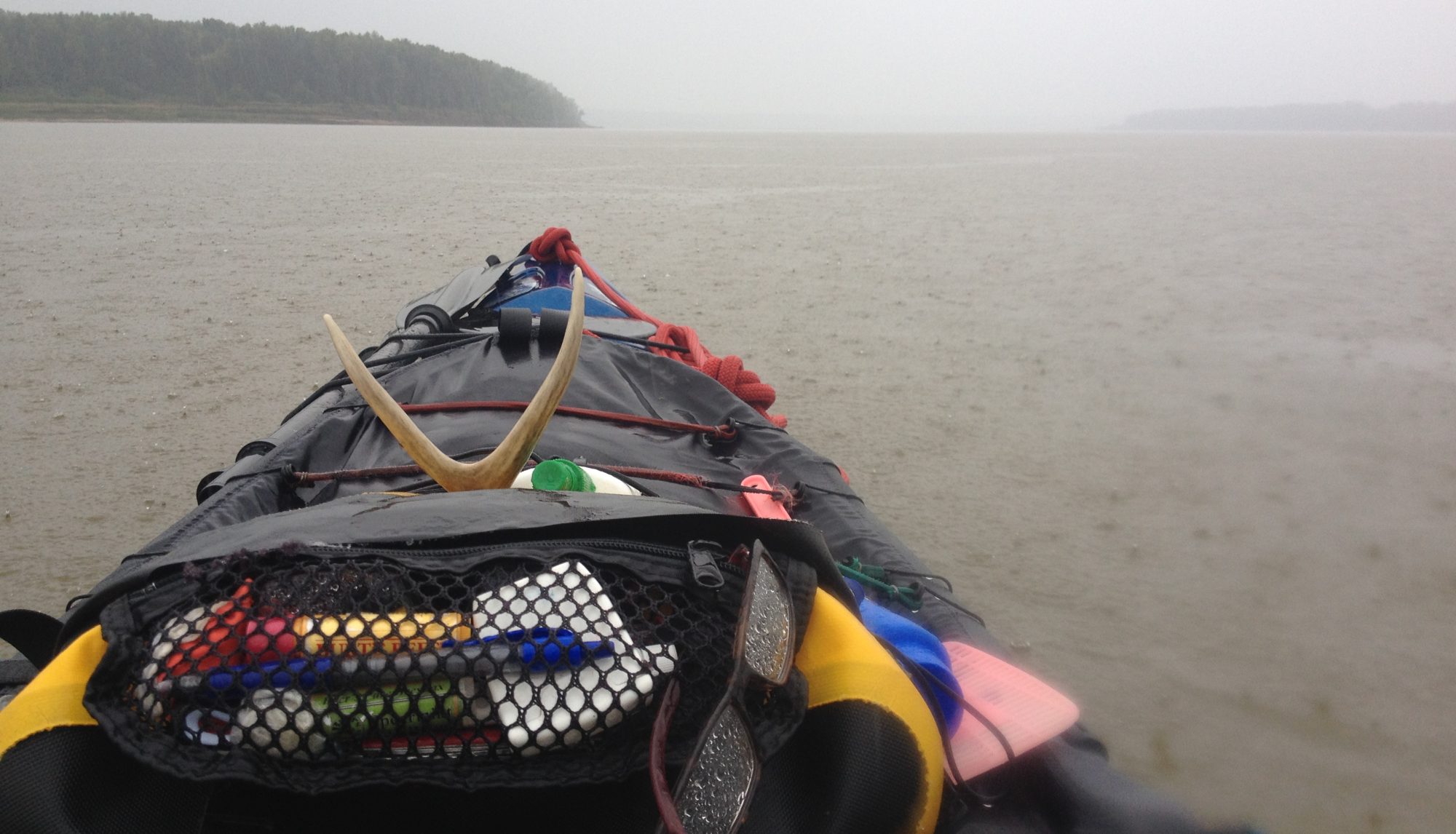
It’s 4:00 PM and I’m outta here, I thought. I’ll just paddle on down the river and find myself a campsite. Oh dear. That turned out to be the greatest challenge of this trip. It took about 15 minutes for me to realize I better start looking hard. Four hours later there were still NO sites to be found, and I had stopped to investigate several areas. This was the first time I thought I might have to sleep in my kayak. OMG!

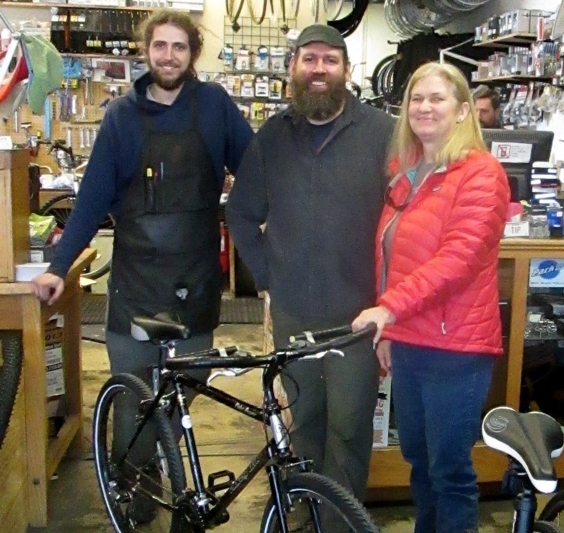
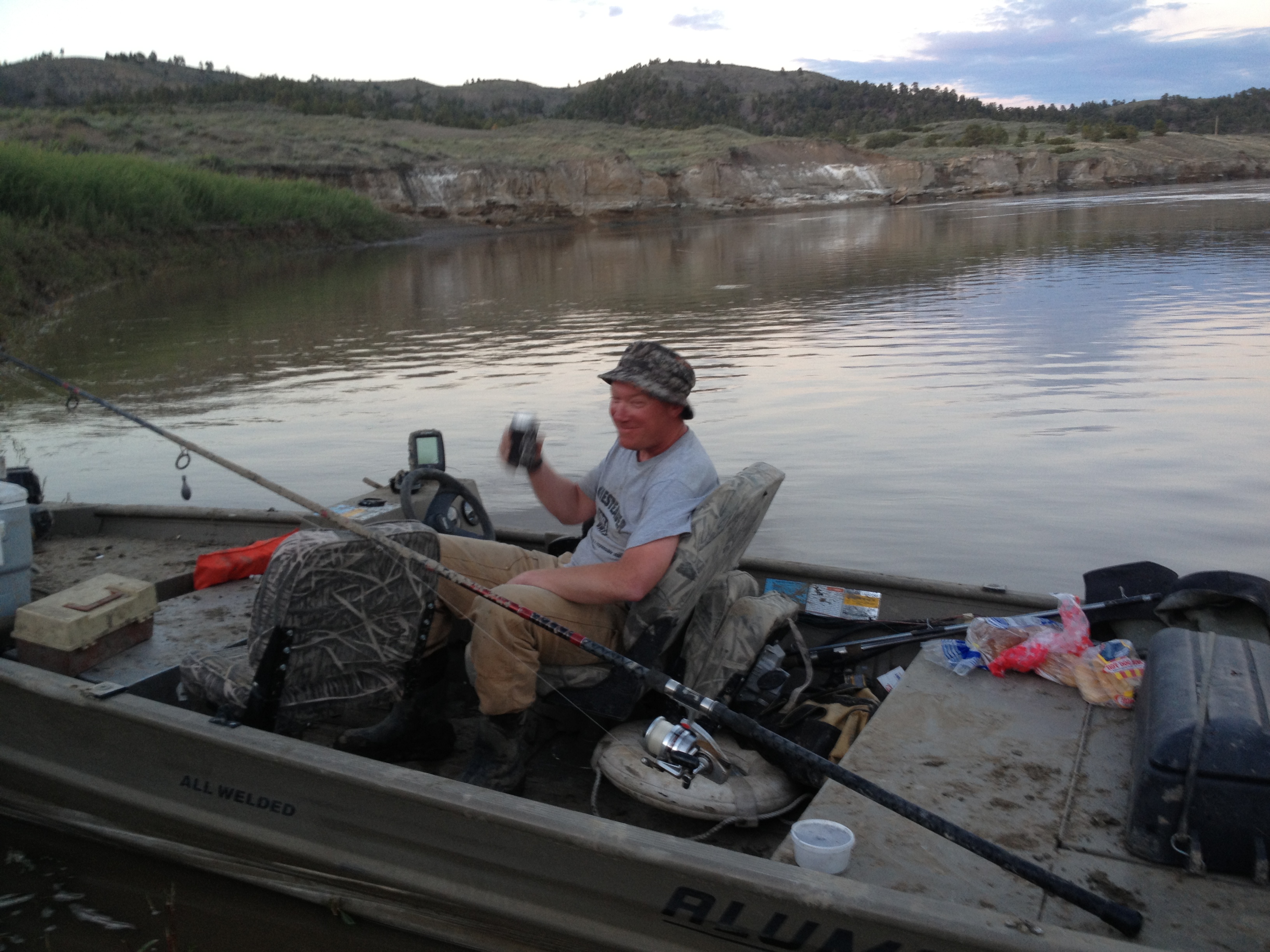
Just as dusk was falling on the land, I came around a bend and saw something unusual. Three men were walking, yes walking, on the riverbank. How are they doing that?! I exclaimed to my brain. Is it not muddy in that spot. I paddled in a straight line over to their boat, and them. I made friends fast. Actually, I had no intention of going any further. Thankfully, Eli, Brandon, and Travis turned out to be river angels, river angels from Roundup, Montana.

Eli, left, and Brandon on the riverbank. They had been paddlefish fishing there all day long. They stomped out a sizable trail down the riverbank. I've never been so happy to see anyone in my life!
Eli, left, and Brandon on the riverbank. They had been paddlefish fishing there all day long. They stomped out a sizable trail down the riverbank. I’ve never been so happy to see anyone in my life!
Travis, Brandon's older brother. These guys turned out to be so wonderful!  I'll never forget them.
Travis, Brandon’s older brother. These guys turned out to be so wonderful!
I’ll never forget them.

Soon, darkness was upon us, and Eli helped me carry my gear down the bank, through the willow forest, and up the hill where I set up my tent with a gorgeous view of the river. I went from rags to riches, and was thrilled. The boys ended up camping at their truck that night, which was located at the top of the hill, and we had a fire and passed around a bottle of JD (only a couple of times). When in Montana, you do as the Roundup Boys do. I was so happy! And, Brandon gave me his Leatherman to take with me. Now, THAT’S special!

Eli helped me carry my tent and gear down the bank, through the willows and up the hill where I set up my tent overlooking the river. I was so thankful.
Eli helped me carry my tent and gear down the bank, through the willows and up the hill where I set up my tent overlooking the river. I was so thankful. He also explained to me that the screaming animal I kept hearing during the evenings was merely a toad. Whew!

I had a long day of paddling the next day in order to get to Fort Peck Lake. I rose up at sunrise and was in my boat at 7:00 AM. I waved to Eli from the shore. I was sad to leave these river angels.

The RoundUp boys' fishing boat on the shore of my oasis.
The RoundUp boys’ fishing boat and Blue Moon on the shore of our oasis.

It is so easy to get attached to kindred spirits that share their life with the river. There is a bond that is undeniable. We share riverblood.

Beautiful coyote
Beautiful coyote

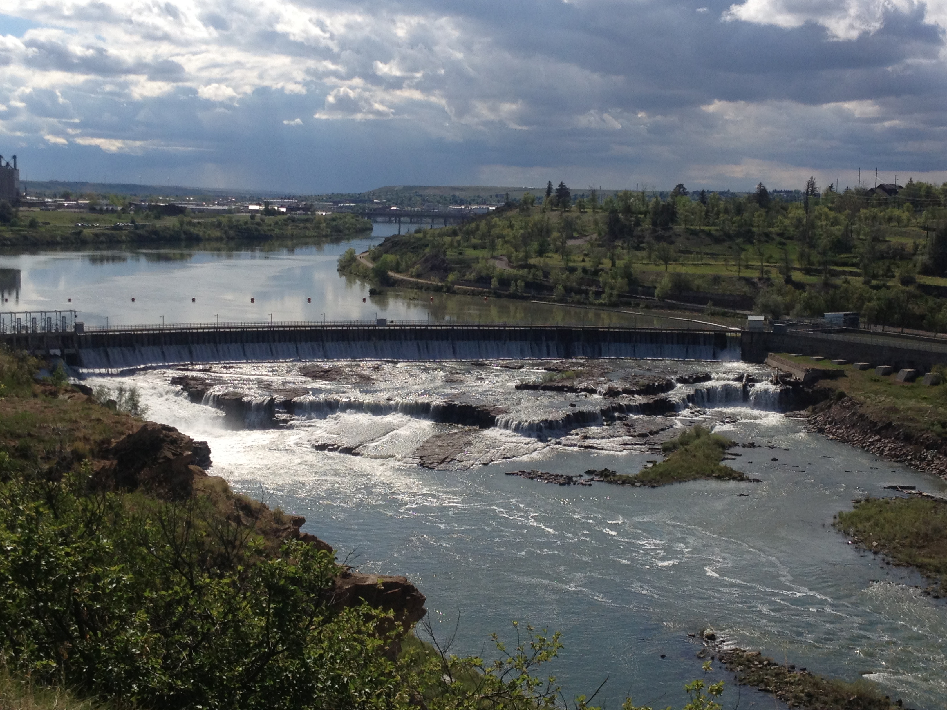
43 miles later this day, I arrived at Fort Peck Lake. I had had no internet service for nearly a week, and would not for almost another. I found myself immersed in mountainous wilderness. I was in heaven.

Prickly Pear Cactus blooming

More to come.

Check in at LoveYourBigMuddy Expedition on Facebook for current events.

Do what you love, and love what you do. Peace out, Janet

Fort Peck Lake, June 10, 2013

Paddling into Great Falls! Monday, May 27.

Thank You, John and Keely Schukei, for taking such good care of me the couple days I stayed in Great Falls. Your hospitality was heart warming. My stay with you, unforgettable. (I am loving my gloves and my pink crocs!)

I absolutely LOVE this photo of John, Keely and Hazel, the dog. I kinda like all of them alot!

When John, Sherri, and Bob came to paddle with me, John had offered me a place to stay and a ride around the dams. I phoned him shortly before I arrived and told him I would love to take him up on his offer. He said, “Great, I’ll be right there to pick you up.” Then, when I told him I could not get a clear visual in my mind about the Great Falls and what they look like, he drove straight over to the first two falls to take a look. This was a tremendous help. Plus, we saw some other really cool things, too, like Giant Spring and Great Horned Owl babies.

This is Black Eagle Falls, the uppermost falls of the five dams comprising the "Great Falls." The city of Great Falls is in the background.
This is Black Eagle Falls, the uppermost falls of the five dams comprising the “Great Falls.” The city of Great Falls is in the background.
This is the second from the top falls, Rainbow Falls. All of the water is diverted through the power house so no water runs through it except on weekends, when they let extra water out.
Here is a view looking down stream from Rainbow Falls.
This is Giant Spring located within Giant Spring State Park between Black Eagle and Rainbow Falls. It is the source of the shortest river in the country, the Rogue River. It empties into the Missouri River after about 100 yards or so.
Here is one of two places the spring empties into the Missouri River


Watercress growing in the spring. Look how clear that water is!


This is a nest with three Great Horned Owl babies. If you don't know they are there, you probably won't see them. John knew where they were and we were fortunate to get a good clear sighting, let alone an awesome photos!
This is a nest with three Great Horned Owl babies. If you don’t know they are there, you probably won’t see them. John knew where they were and we were fortunate to get a good clear sighting, let alone an awesome photos!
This is John and Keely's back screened in porch which has a double bed. This was my bivy in Great Falls. Sweet, eh?
This is John and Keely’s back screened in porch which has a double bed. This was my bivy in Great Falls. Sweet, eh?

We enjoyed a fun evening eating pizza (YUM!) and Bob came over and joined us. He, along with John, gave me a lot of tips on paddling, particularly how to power stroke. “Why do you hold your paddle with you hands so close together? You look like you are dog paddling.” I don’t know. I’m just holding it. Well, they showed me how to hold my elbows at 90 degrees before grabbing the paddle, and then how to use your whole body to stroke strong and efficiently. WOW! (This was incredibly useful for me on Fort Peck Lake, a couple weeks later.) Bob also showed me some stretches. I told them my back was having a bit of difficulty, and he explained that it was more likely my hamstrings from sitting in the kayak. His doctor told him the same thing.

Here is a picture of Bob (right), and John and Sherri from when they came up and paddled with me a couple days previous.
Here is a picture of Bob (right), and John and Sherri from when they came up and paddled with me a couple days previous. They are part of a kayaking group that organizes fun kayaking events and races.

I was able to hang out at the house and update my blog while Keely and John went about their business. That was really nice, since blog posts take lots of time. I couldn’t help but notice, and love, this backyard spa (chuckle).

I love this. John and Keely's hot tub in the back yard. How cool is that?
I love this. John and Keely’s hot tub in the back yard. How cool is that?

During the afternoon, John took me to get some “must have” synthetic golfing gloves for paddling. We went to Meadow Lark Country Club where Michael very graciously gave me a pro deal on the gloves. They are great, both the Country Club and the gloves! John had so much great advice for me.  Then we went to his store, Bighorn Outdoor Specialists, that he owned for 38 years. The staff there were friendly and willing to offer a pro deal for the supplies I needed. If you are EVER in Great Falls, be sure to stop at this awesome sports store.

The staff at Bighorn Outdoor Specialists. They gave me a sweet pro deal on supplies I needed, like a water filter, Cliff Bars, stove fuel and new sunglasses. Thanks, guys!

I headed to the put in the next day. It was quite a drive, and John was so nice to take care of me. Unfortunately, the road became so muddy we had to turn back and go all the way around town to Carter Ferry. This is often the case, but we thought we could make it. The area had seen a lot of rain recently.

The mud on the road to Widow Coulee prevented us from getting to this put in. We had to drive about 45 minutes back to Great Falls, and down the other side of the river to Carter Ferry. John was such an incredible host. I'm forevever grateful for all he did for me. He and Keely, both.
The mud on the road to Widow Coulee prevented us from getting to this put in. We had to drive about 45 minutes back to Great Falls, and down the other side of the river to Carter Ferry. This wasn’t even the steep part as you drive into the river canyon. We would have never made it.

Before we got to far, though, John stopped and let me photograph these historical information signs telling about the Corps of Discovery’s portage around the Great Falls.

You can find a series of educational signs way out in the middle of nowhere, but right in the vicinity that the Corps of Discovery staged their portage. No easy feat it was.
Another historical information sign regarding the Corps of Discovery portage around the falls.
Looking out over the area where the Corps of Discovery conducted their portage. That is the river valley.

And finally, John has such great ideas. He thought this would make a great photo opportunity. He was right. Enjoy:

John thought this would make a classic photo. I think he was right. Pretty funny.
John thought this would make a classic photo. I think he was right. Pretty funny. Problem here is, I’m going the other way!

Boat, Brower’s, Bike and the Blues

It has been a couple of weeks since I started removing the old name and website from the Shasta.  Slight delay because of a heap of snow dumped on us over the course of two weeks.  It has been cold and the snow still covers the majority of ground.  This photo is from BEFORE the first storm, which dumped around 8-10 inches on February 21.

Before February 21.
Before February 21.

And after February 21…

PlowingSnowFeb22
Photo taken on February 22

And after another 5 or more inches, which fell on February 26:

Photo taken on March 2

But, speaking of snow, I talked to the person in charge of the gate to the road up Sawtelle Peak.  Because the Federal Aviation Administration (FAA) has an Air Traffic radar tower at the top, the road is gated to keep cars off the mountain when snow is present.

FAA Radar on top of the mountain

However, they plow the road for the employees, although 4-wheel drive is often necessary.  The gentleman I spoke with was very favorable to helping us access the mountain road.  He will get us past the gate so that we can ski to Brower’s from the switchback located in the upper right  of this photo, below “Sawtelle Peak.”

Sawtelle Road switchback upper right, and Brower's Spring under the "3" in the center, at the end of Hellroaring Creek where white meets green on the map.
Sawtelle Road switchback upper right, and Brower’s Spring under the “3” in the center, at the end of Hellroaring Creek where white meets green on the map.

Here is a photo of Sawtelle Peak:

Summit of Sawtelle Peak
Summit of Sawtelle Peak NOT in April

And, a 3-D version from Google Earth, with switchback on far right straight across from Brower’s Spring (the green dot is the radar):

HiketoBrowers3D
We’ll ski down Hell Roaring Canyon which sweeps left from Brower’s Spring through the center of the photo.

Next month I will be sipping from the waters of

Photo taken in June 2012 by Rod Wellington.

Brower’s Spring, the ultimate source of the Missouri River near the Continental Divide!  Of course, we will be digging through many feet of snow, no doubt.  Norm Miller and I will be packing shovels.

So, that is great news!

I picked up my on/off road bike that Carl and Josh at Klunk Bicycle and Repair built for my stretch in the beginning when the waterway is frozen over.  It is anticipated that this will be the case in the Centennial Valley, which is where we will come out of the mountains.  There is a gravel road that follows right along the creeks and rivers and through the Red Rock Lakes National Wildlife Refuge.

publicMap

I may have to ride my bike as far as 80 miles to Clark Canyon Reservoir.  Good to be prepared for any situation.

browers2threeforks

Carl has offered to loan me the bike with the option to buy it.  I became a bit attached after just a few loops around the parking lot.  I am hoping to purchase it at some point.  I look forward to riding it until I leave.  Must practice, right?  Here is a photo of the bike and crew:

L-R Josh, Carl, and me.  The bike, of course, is front and center.
L-R Josh, Carl, and me. The bike, of course, is front and center.

We had a great meeting last week to discuss fundraising.  What a wonderful group of supporters:  Heidi Branaugh, Steve Schnarr, Melanie Cheney, Suzanne Cooper, Dory Colbert, Roger and Barb Giles, Jeff Barrow, and Ginger Masters.  We agreed that a Love Your Big Muddy Blues Benefit would be great, particularly because Columbia, Missouri, is a mecca for musicians.  We have a whole bunch of great musical artists, so we hope to have a dynamite show.  We would like to hold the event at a local club, MoJo’s, on Wednesday, March 27, during happy hours: 5:00 to 8:30.  We’ll provide appetizers and lots of stuff to raffle away.  This is the same day that my expedition story will be featured in the Columbia Missourian.  Should be a good day. Still waiting for confirmation on the location.

The outpouring of financial contributions is humbling.  I am very grateful for my friends and their desire to help.  Without their contributions, the expedition would still go on, but the financial burden would be difficult.  Thank you to all who are able and willing to donate their precious moneys.  I am very grateful.  If you would like to donate, you may do so here on my Donations Opportunities Page, or go to my GoFundMe page at LoveYourBigMuddyExpedition 4 Education.

Here is one of Norm Miller's re-supply packs from his trip UP the Missouri River.
Here is one of Norm Miller’s re-supply packs from his trip UP the Missouri River.

I am currently focusing on foods to take.  I looked at dehydrators today and will likely purchase one to make jerky and dried vegetables.  I have received a fantastic response to my request for food ideas on the Facebook Paddlers Pages that I am a part of.  This has been very helpful, and relieves quite a bit of anxiety as to what I will be packing for food.

Comfort foods
Comfort foods

That’s it for now.  Things are getting busy, sleep is difficult, writing blog posts takes time.  I appreciate all of you who are following me.  Thank you.  Still trying to figure out the tweeting thing on Twitter.

Life is good.  Live fast ~ Paddle slow

See you on the river!

P.S.  Will post more soon.  It is getting exciting!

Teach Your Children Well

NewStickers_crop

Yesterday, I passed out some expedition stickers to my 8th grade science students. Well, they are not mine literally, but I spent an entire semester at Jefferson Junior High School with many of them, ten weeks as a student teacher of 8th-grade social studies, and six weeks of 8th-grade science. I kind of consider them mine, at least figuratively.

jjhs
Jefferson Junior High School. Columbia, Missouri’s first high school in 1911.

I was substitute teaching yesterday for my science students and we watched a marvelous Planet Earth video called “Fresh Water.” I watched the movie five times as I had five classes to teach. Never was I bored with it, but with each viewing became totally immersed in the photography of the wildlife and the waterways highlighted in the movie.

GrandCanyon
Grand Canyon’s Colorado River

One river highlighted was the Amazon River in South America. The Amazon carries more water than the next top-ten biggest rivers combined. It empties into the Atlantic Ocean after meandering 4,000 miles eastward from its source in the Peruvian Andes.

The Amazon River
The Amazon River

The students enjoyed the video, too. We saw grizzly bears feeding on salmon in British Columbia, a team of smooth-coated otters harassing a 13-foot crocodile in an Indian River, eight-foot fresh water dolphins, Botos,

Fresh water dolphins of the Amazon River.

navigating by sonar in the murky waters of the Amazon River, the falling waters of Venezuela’s Angel Falls, the highest in the world, mating lake flies producing smoke-like columns extending hundreds of yards up in the sky on one of the world’s largest lakes in the East African Rift Valley, and a red-bellied piranha feeding frenzy in the underwater forests of Brazil’s Pantanal – the world’s largest wetland.

Angel Falls
Angel Falls
Lake Flies mating before dropping eggs on water and dying.

Honestly, I had not planned to give away my stickers and tell them about my expedition, but the opportunity presented itself perfectly after watching “Fresh Water.”

“Ladies and Gentlemen (the line I use to get their attention), I don’t know when I will be back in this classroom, so I have a small announcement to make:  I have been planning an expedition since last June. I will be leaving in 2 ½ months, on April 14th, to solo kayak the entire length of the Missouri River, which starts in Montana.  The Missouri River is the longest river in North America and the fourth longest in the world, and flows about 2600 miles from its ‘source’ in the Centennial Mountains to St. Louis.”

Missouririvermap

Their response:

WHAT are you doing? What’s a kayak? Where are you going to sleep? What will you do for food? Who is going with you? How long will it take you? You’ll have a motor, won’t you? Won’t you be scared? The river is dangerous. That’s crazy. I could never do that!  Good luck.

My response:

“This is one of my objectives: I want you, and kids like you, to know that “you can do anything”, if you have the desire, a positive attitude, and support to help you. I want to model that for you by doing this trip.”

Now, I would like to add:

So listen up:  chase negatives away, just like the smooth-coated otters did with the crocodile, and “Make It Happen,” no matter what the “It” may be. Got it, guys?

Teach Your Children Well

cropped-nextgenerationtrashgetters-omaha-9-22-2012.jpg

Filming the Promo Video

PromoVideoShoot

It was with great pleasure and gratitude that I spent yesterday morning at the river with my daughter, Haley Moreland, Jim Karpowicz, and Tom Newcomb.  Jim and Tom volunteered their time, expertise, and film equipment to shoot a promotional video for the expedition.  Haley agreed to interview for the clip, and she helped by photographing the occasion.  The purpose for the video is to utilize one of the online fundraising programs, such as Kickstarter or GoFundMe, with the video.  Ideally, the donations generated will help pay for the trip and, ultimately, get a book started.  Getting the trip accomplished will be the first step in getting a book started.

TomandJim

HaleybytheFire

Jim and Tom are long-time colleagues creating films for the Missouri Department of Conservation (MDC), among other things.  They have recently been assigned a project with the MDC focused on Missouri mountain lions.  I know, right?! Mountain lions!  Good luck, guys.  Be careful out there.

Tom is a cameraman for CBS in STL, Jim has done work for The Documentary Group, and you can find other projects by going to Tom’s website at www.blacktruckpictures.com.  Among a host of other undertakings by them, you can find a fascinating video about Lewis and Clark from the website here.

lewis_clark

Although the morning was quite cold and crisp, I enjoyed getting in the kayak and paddling around a bit for the shoot.  And, the guys setting up the interviewing studio at the end of a wing dike was particularly intriguing, if not a little intimidating (they ran an extension cord all the way out there!).  We built a nice fire in Cooper’s bonfire ring, so the warmth from the fire made the experience quite comfortable and especially pleasant.  Although, that could be a result of the warm-hearted individuals present.  (That includes you, J.W., thanks for building the fire!)

wingdikeSetUp

mangoandsternwheeler

SnagPaddle

IMG_1848

Interviewing on film is not one of my strengths.  Jim and Tom will need to work their magic.  They assured me not to worry.  Really, I am just humbled by the experience, and extremely grateful for our Missouri River community and the support I am receiving for the expedition.  Not to mention the support I am receiving from my friends, some old, some new, some near and some far!  I may have to post a happy dance similar to Rod Wellington’s portage dances  :).

I love this quote from Lewis and Clark’s journals, as highlighted in Tom’s Lewis and Clark video.  Over and over again, despite the circumstances, they continued to write:  “We proceeded on.” I’m going to remember that one.

Dec11-2013_promoshoot

Thanks again Haley, Jim and Tom!  That was fun.

TheTeam

Thank you, Eddyline Kayaks

Eddyline_crop

I will be paddling an Eddyline Shasta kayak on my expedition.  Andy Bugh and Bob Bellingham both paddled a Shasta down the Missouri River and loved it.  I bought my boat from Bob Bellingham before he returned to Australia.  I will rechristen the boat, “Blue Moon.”  Likely, there will be a party surrounding the ceremony :).

Eddyline asked me to send them a “wish list” for items they would provide, since I bought Bob’s boat rather than purchasing a new boat at cost.  (Always good to “reduce, reuse, recycle”!)  They have graciously agreed to send me a brand new blue Swift (ultra-light) paddle, fix or replace the cockpit cover, and send out a skid strip to protect the keel.

I am very pleased to have Eddyline as a supporter.  They are a family-run grass roots company and put out a great product.  You can find Bob Bellingham and Andy Bugh’s Shasta testimonial here, just scroll down the page below the photo gallery.

Thank you Lisa, and your family at Eddyline Kayaks!

cropped-shasta-gear_bob1.jpg

2012 in review

The WordPress.com stats helper monkeys prepared a 2012 annual report for this blog.

Here’s an excerpt:

600 people reached the top of Mt. Everest in 2012. This blog got about 3,000 views in 2012. If every person who reached the top of Mt. Everest viewed this blog, it would have taken 5 years to get that many views.

Click here to see the complete report.