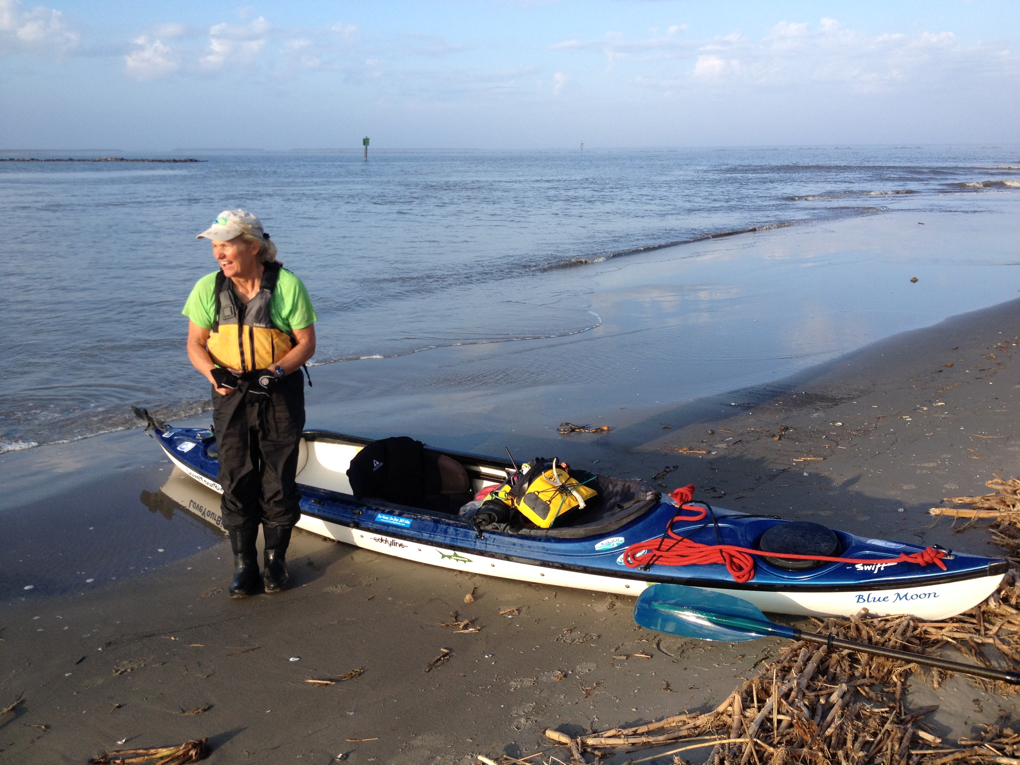
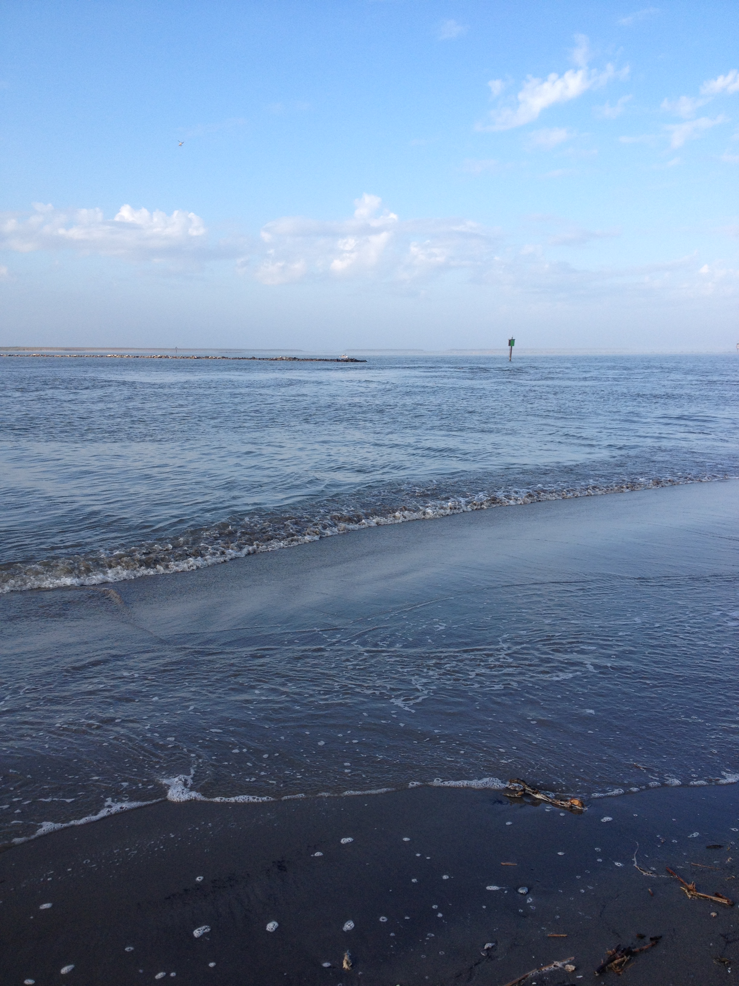
Arrival at the Gulf of Mexico on December 5, 2013.
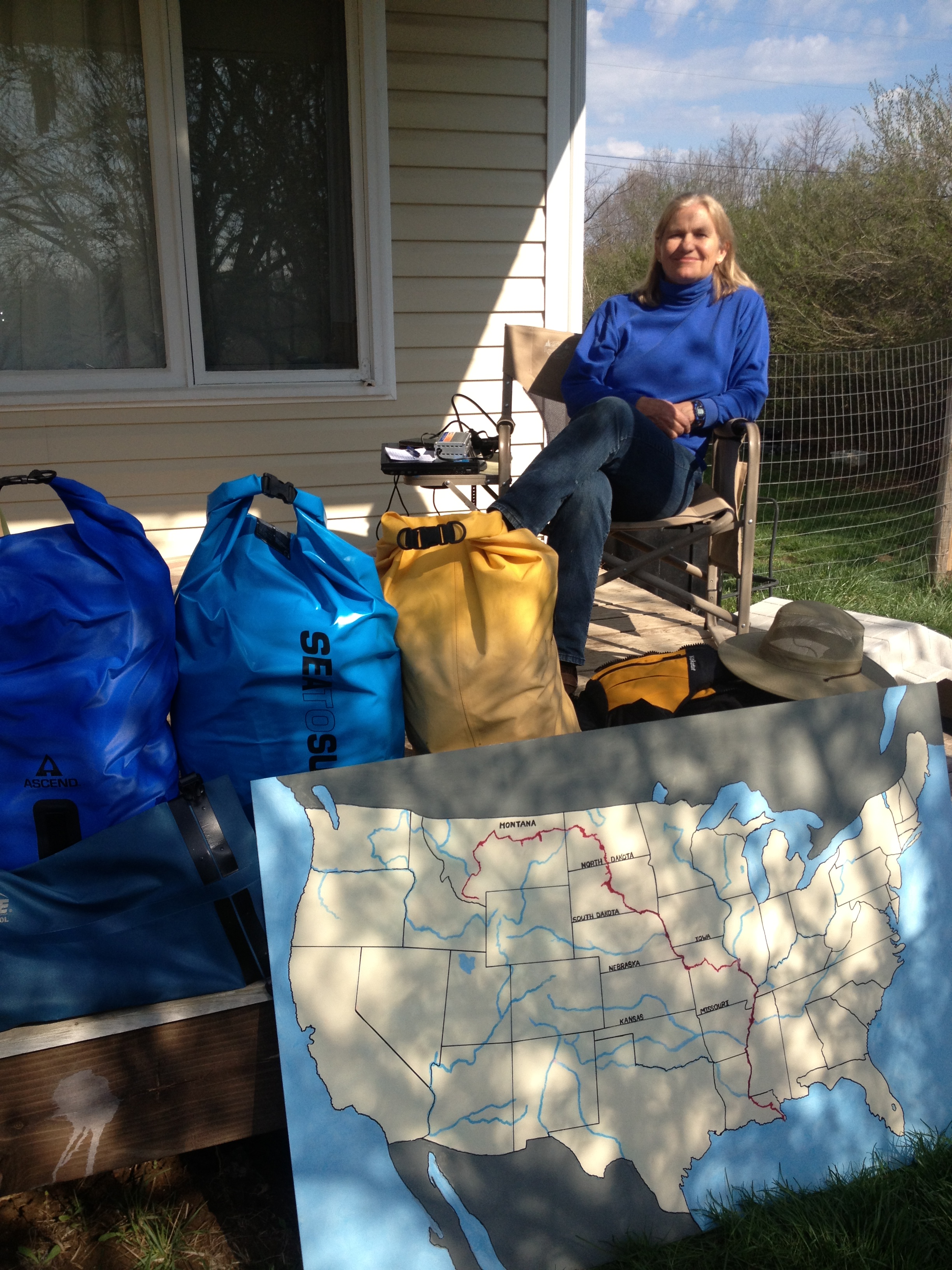
On April 14, 2013, I left Columbia, MO, and set out on an extraordinary solo kayak voyage down the 4th longest river system in the world, the 3,800-mile Missouri-Mississippi River System. Upon completing the expedition on December 5, 2013, I became the first American, and first woman, to traverse the entire river system from source to sea.
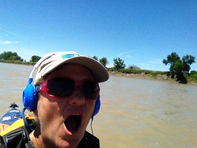
Okay. One step at a time. Breathe…Packed up and ready to go on April 14, 2013
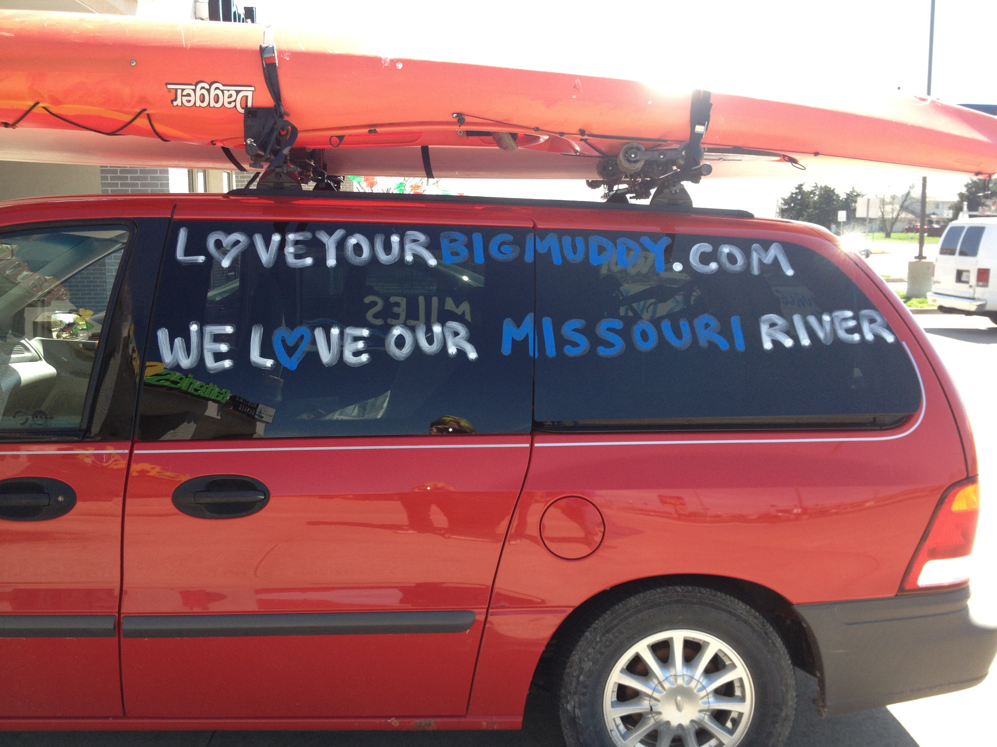
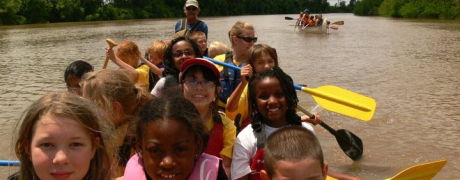
My mission began as an empowerment model for our nation’s youth, showing them that dreams can be achieved through decision, desire, and details (and hard work). The mission soon flourished into an empowerment model not only for youth, but for adult women and men as well. At 57 years old, I was living proof that neither gender nor age should prevent you from pursuing your dream. Not only that, the expedition embraced education and environmental stewardship by bringing awareness to Missouri River Relief, a not-for-profit river clean-up and education organization. Our hope is to bring the Missouri River into the classroom, and the classroom out to the river. Touching the river, knowing the river, and loving the river are key ingredients to sustaining the health and vitality of our planet’s veins and arteries.
Welcoming party in Memphis, TNBringing the classroom out to the river. Photo by Missouri River ReliefThe next generation-Photo by Missouri River Relief
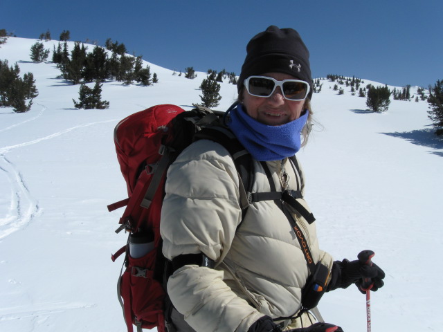
The adventure began on April 24, 2013, when Norman Miller and I skied into the ultimate source of the Missouri River, Brower’s Spring, in southern Montana near West Yellowstone. We planned for 7 hours and finished in 31 hours, much to our surprise. We spent the night in the mountains with no sleeping gear, food, or fire. Let the adventure begin!
After a 30-year absence I was delighted to be ski mountaineering again.Our impromptu shelter and our celebratory beer, now turned carbo provider.Conditions could have been life-threatening with any kind of weather. As it was, we just layed awake all night shivering.
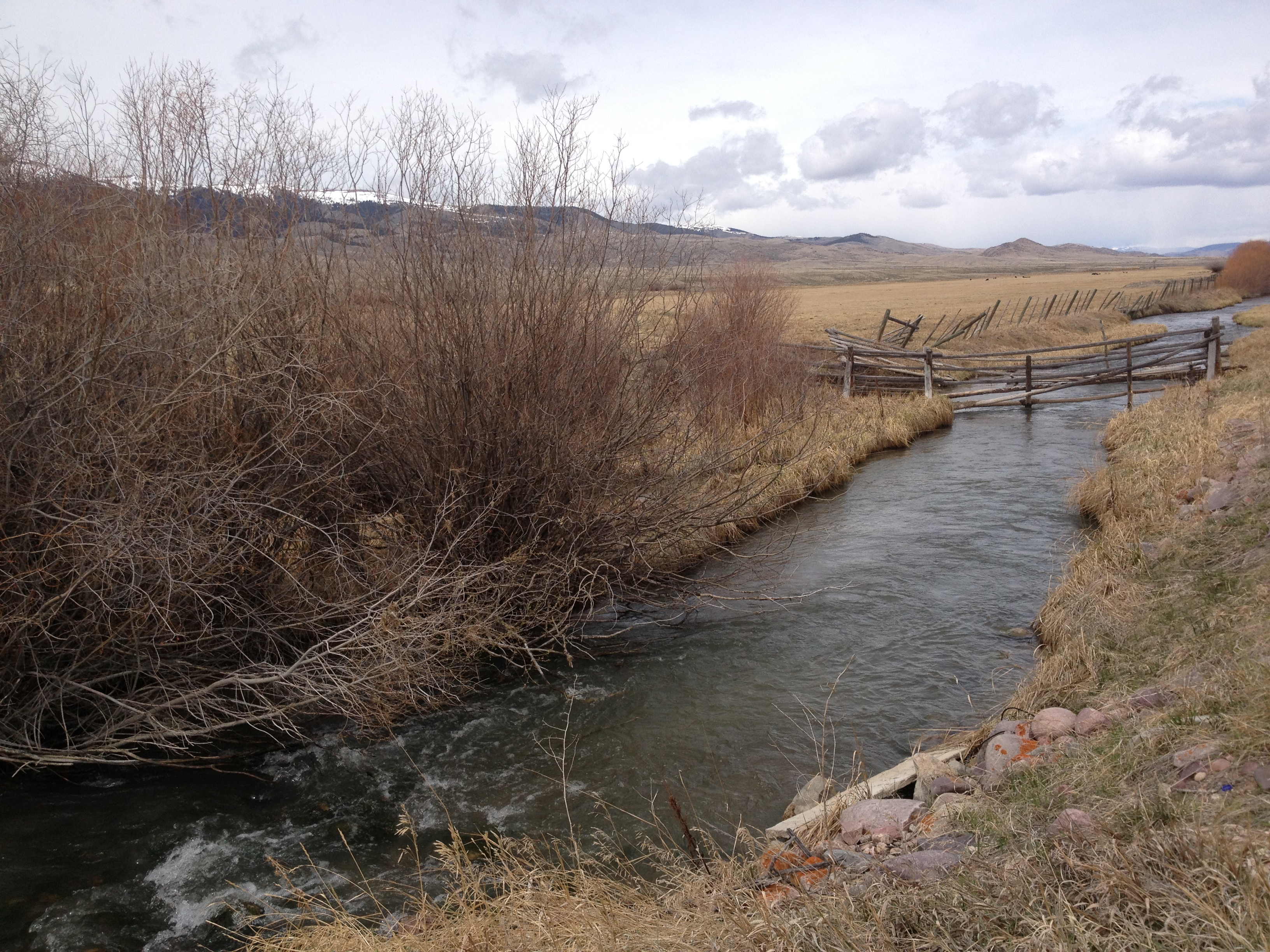
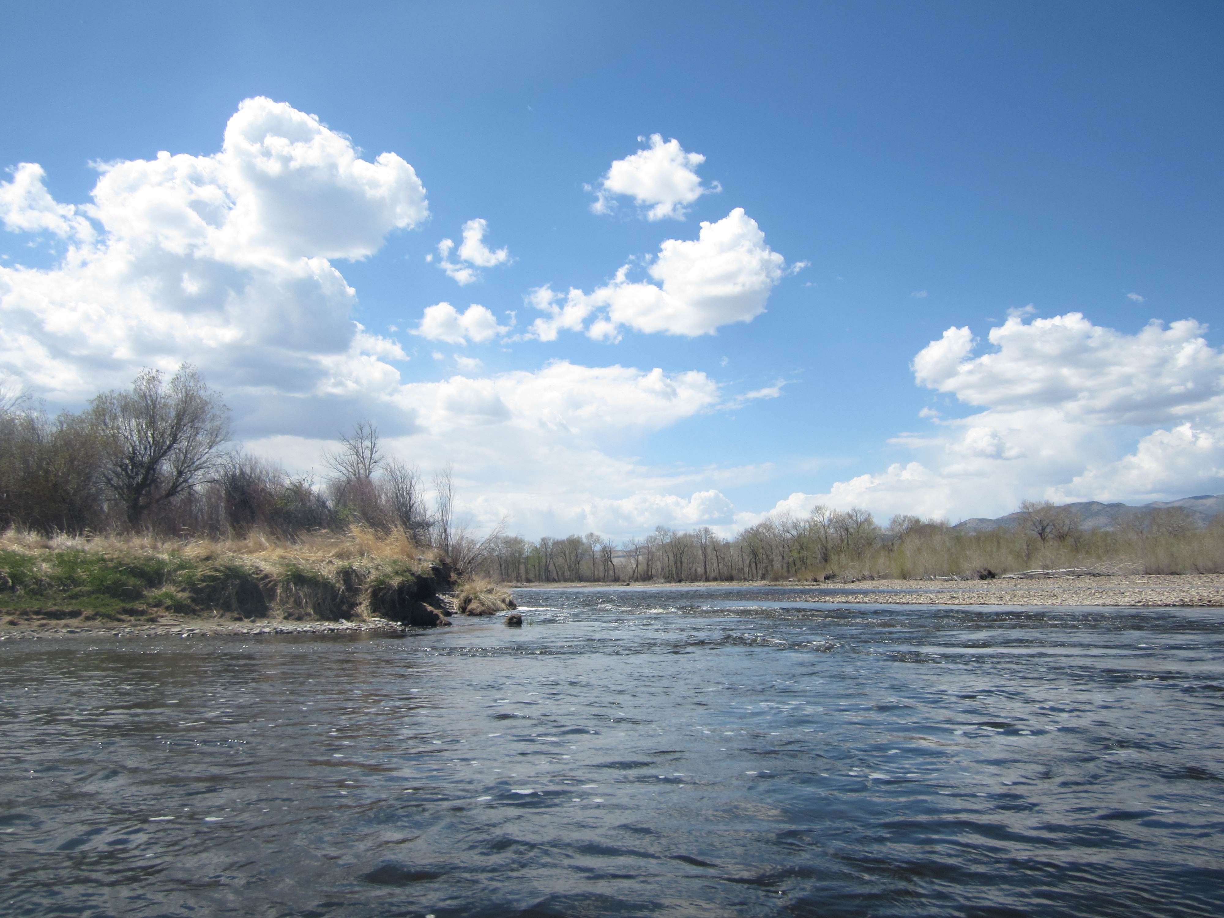
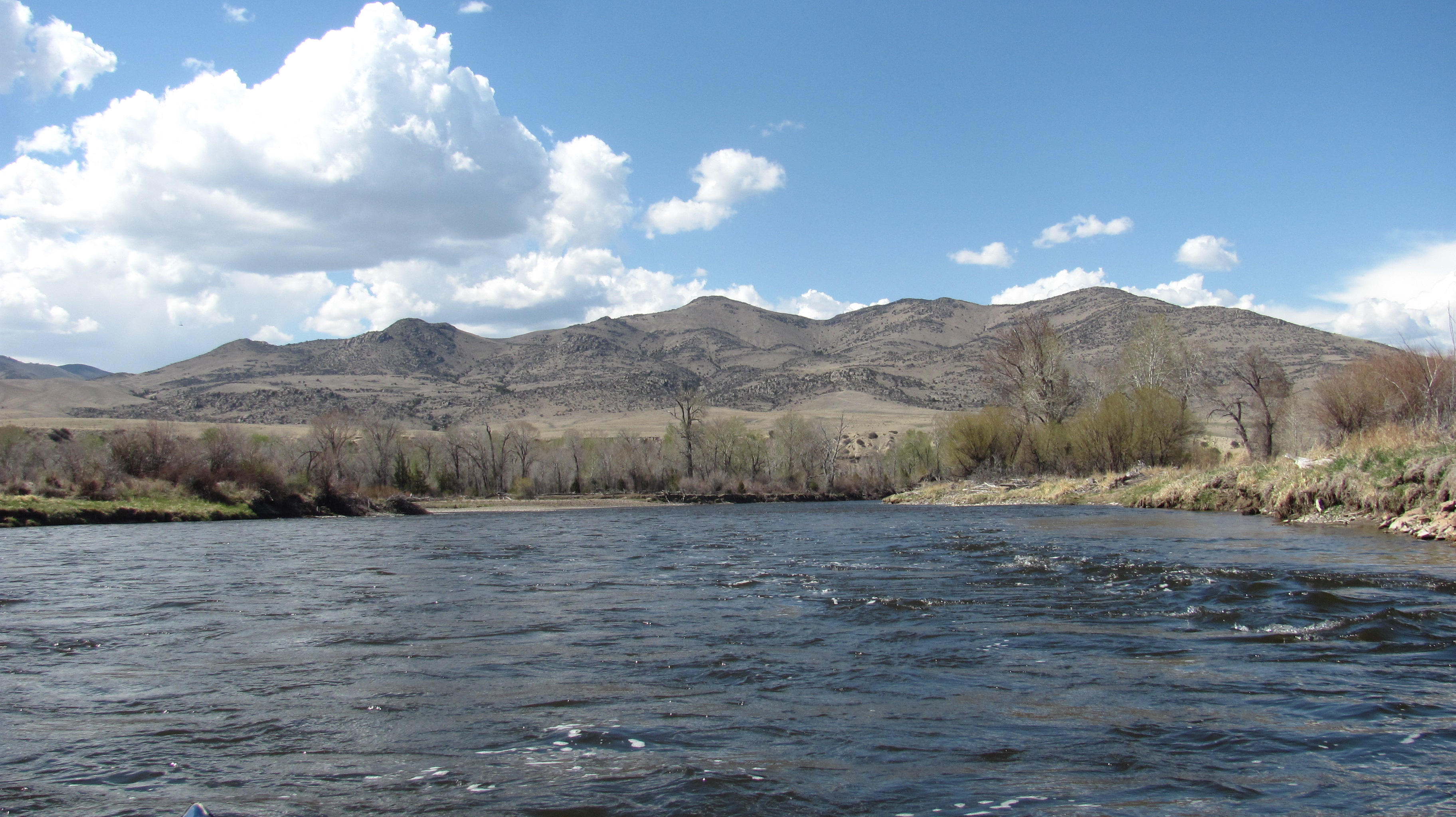
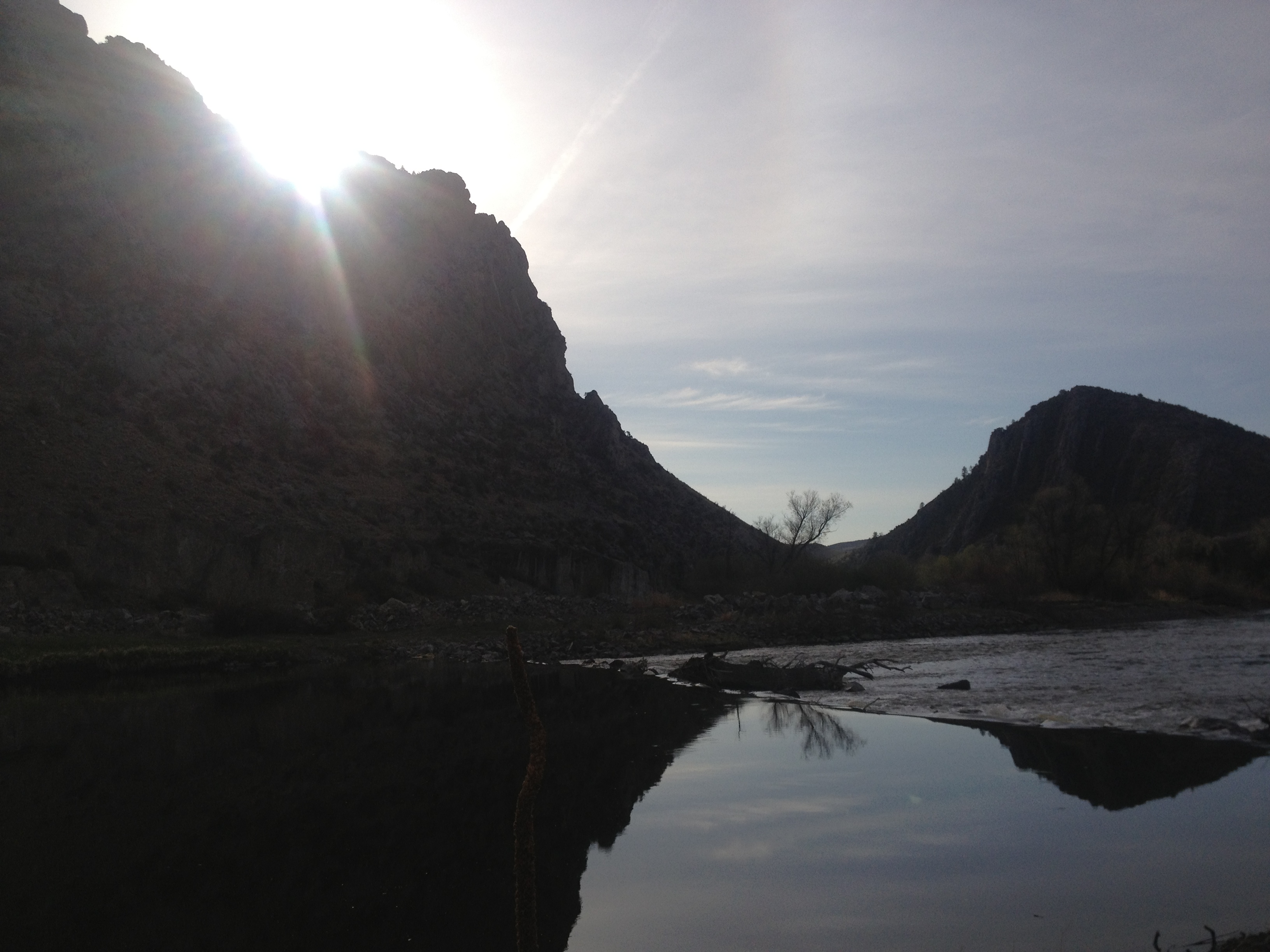
The next leg involved biking 100 miles through the Centennial Valley. This dirt road traversed Red Rock River to Clark Canyon Dam. The Red Rock River is not paddler friendly as it is full of man-made dams composed of barbed wire, wood, electrical wire, and corrugated sheet metal. I put my kayak in the Beaverhead River below Clark Canyon Dam on May 1, 2013. The Beaverhead eventually turns into the Jefferson River, which becomes the Missouri River about 200 miles downstream at Three Forks, MT.
Any amount of rain would have rendered this road useless for travel, car OR bike, because of the mud. My expedition was blessed with ideal weather conditions.Red Rock River obstruction, one of dozens, making paddling slow, laborious, and dangerous.
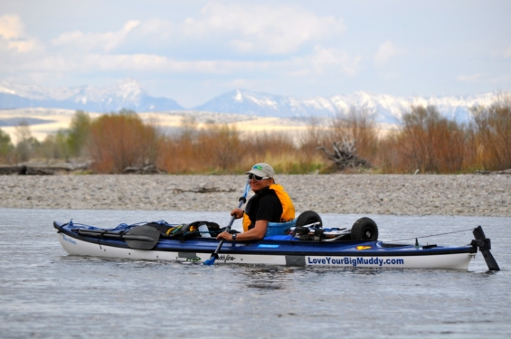
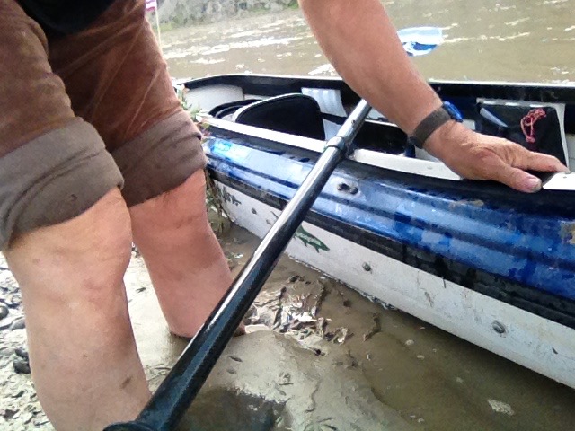
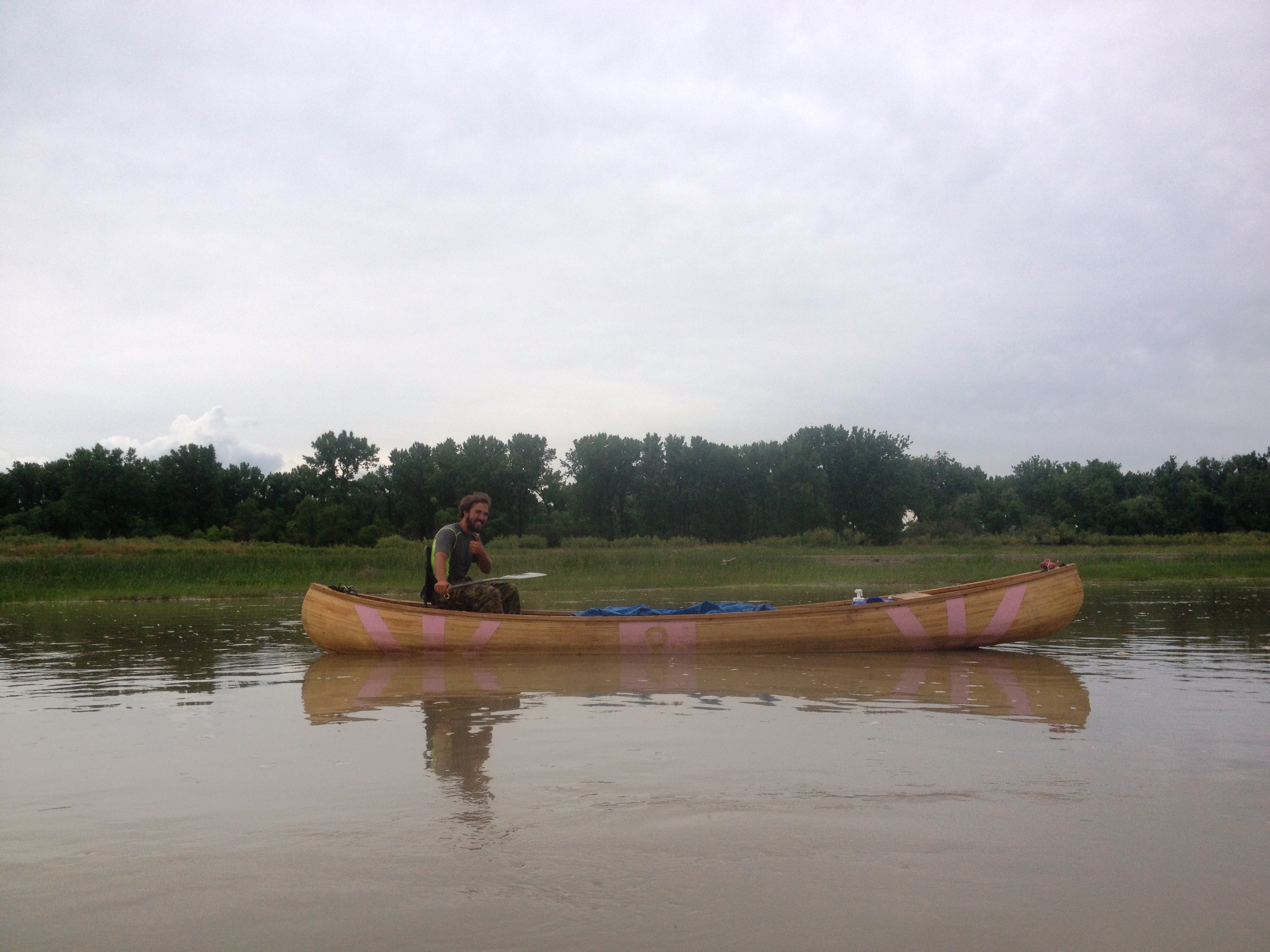
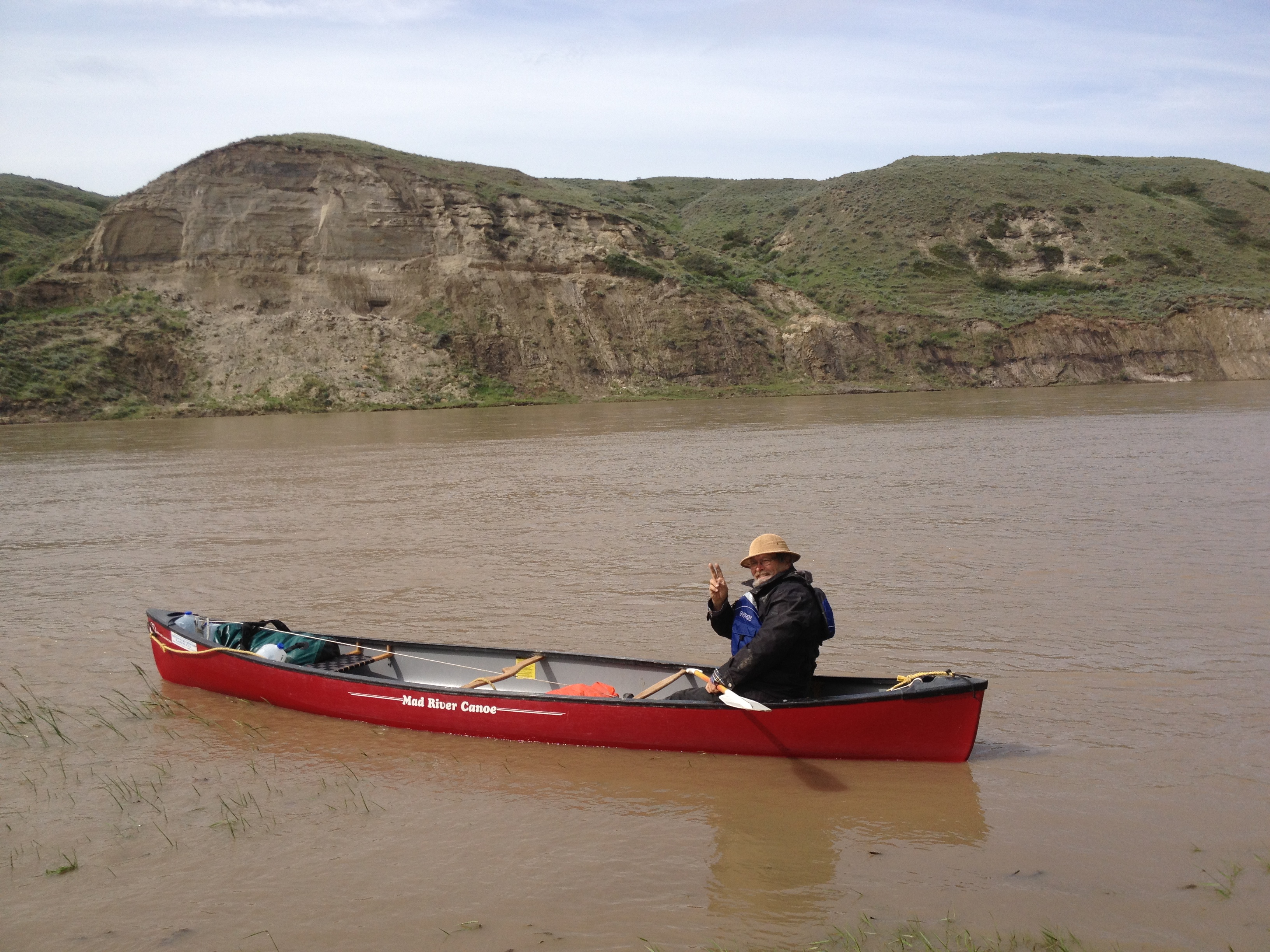
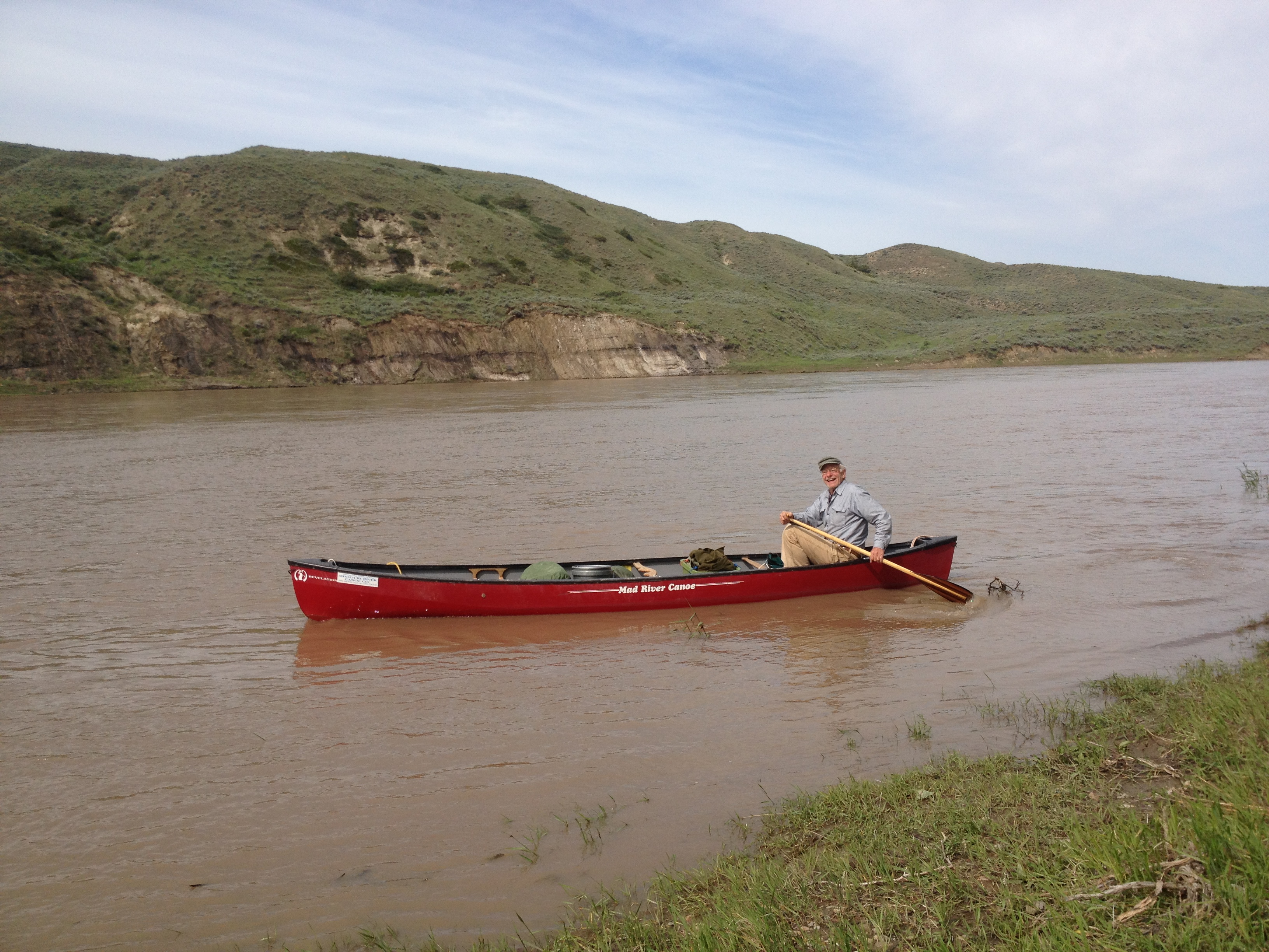
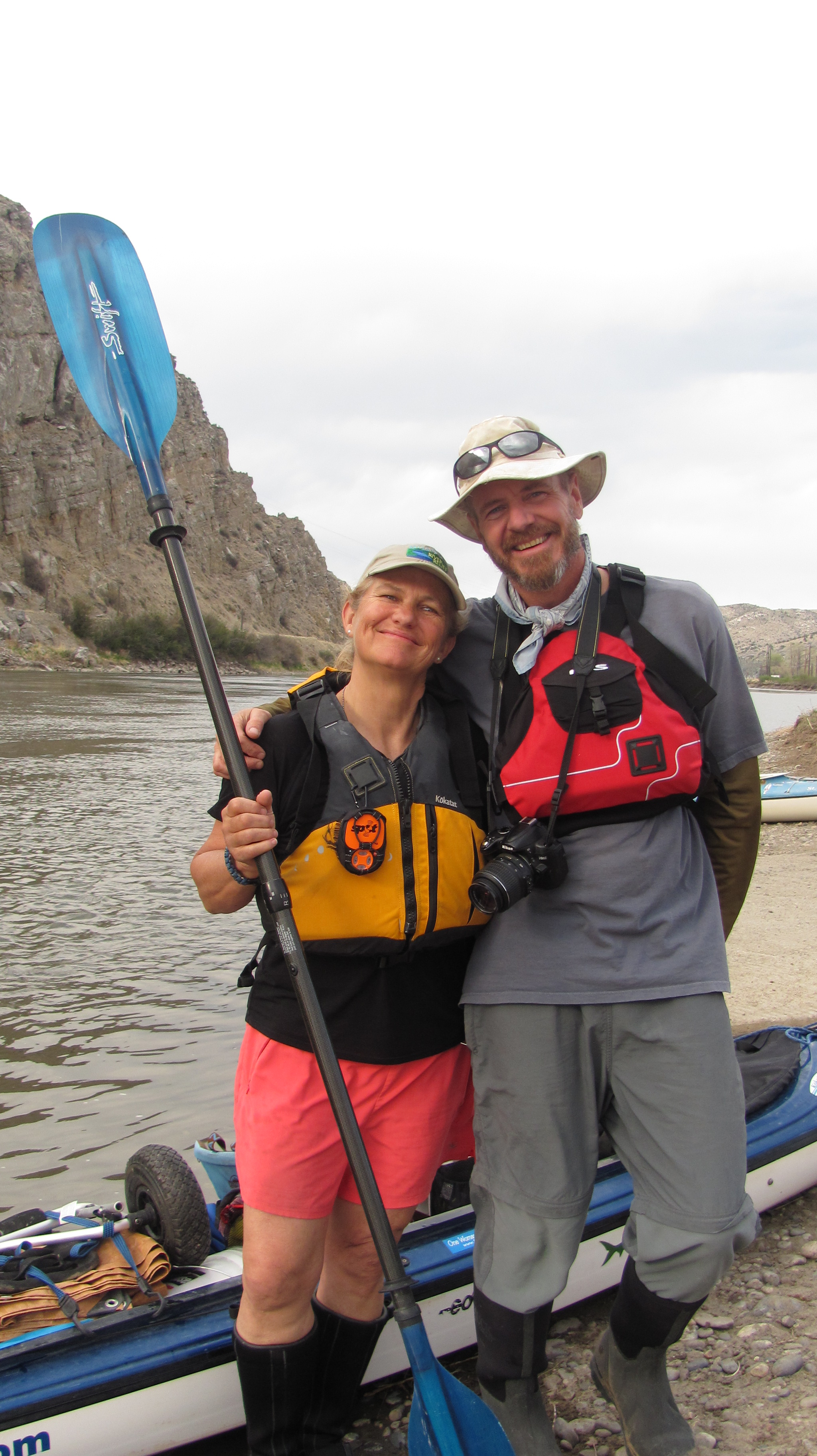
My first day was a test of will as I became entangled in a tree strainer, spraining my hand and nearly dumping my boat. On day two, I put two holes in my boat, thankfully above water line, as the swift and narrow Beaverhead River made it difficult to avoid collisions with snags along shore. Nothing a little duct tape couldn’t fix! After 11 days of paddling I arrived at Three Forks, where I then regrouped at Norm Millers’ Base Camp International in Livingston, MT, patched the holes in my boat, and set off down the Missouri River at Three Forks on May 15, 2013. The rest, really, is history as I proceeded to live life on the river, with simplicity and joy, for the next seven months.
A bad omen? Perish the thought. Onward! On the Beaverhead RiverThe Beaverhead River, where you can find a predicament around every corner.First-time fiberglass patcher-two holes, no less.On the Jefferson River (with duct tape patches). Photo courtesy of Norm Miller
I will cherish this expedition until the day I die. I experienced challenging decision-making, marvelously mellow mornings, exasperating electrical storms, wild wind and waves, stunning sunsets, random acts of kindness, unforgettable human river angels, the wonders of wildlife, big huge barges, even bigger and huger freighters ;), and frightening fog. Last but not least I met a whole world of beautiful and extraordinary supporters up and down the river to whom I cannot give enough thanks, and whom I now consider river family.
Please enjoy a few expedition photos I picked out, in no logical order, but which are among some of my favorites. You may remember…
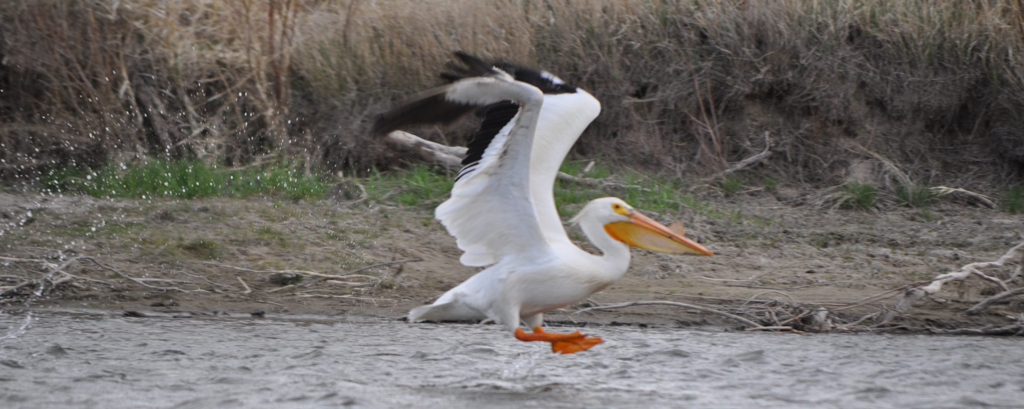
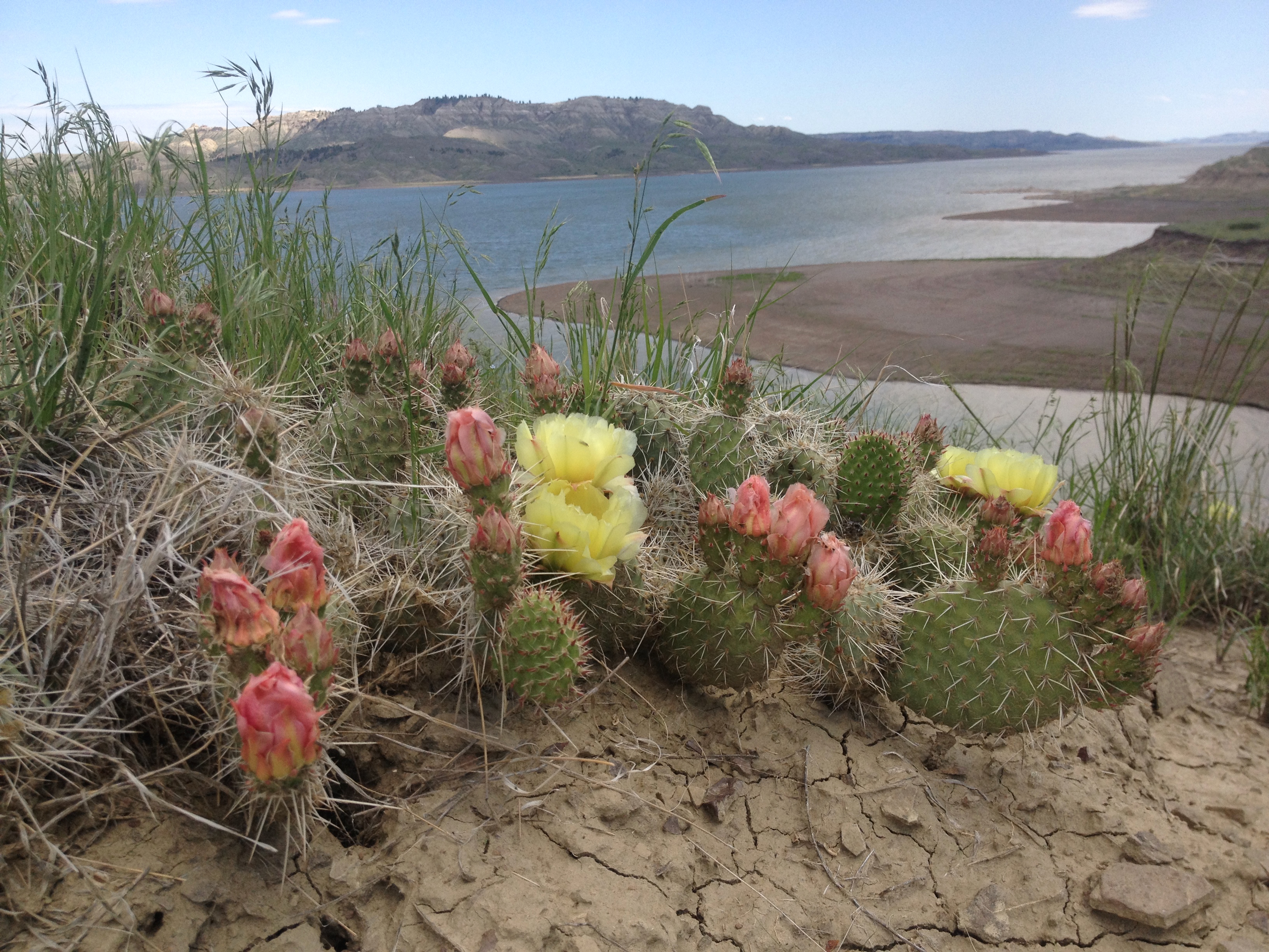
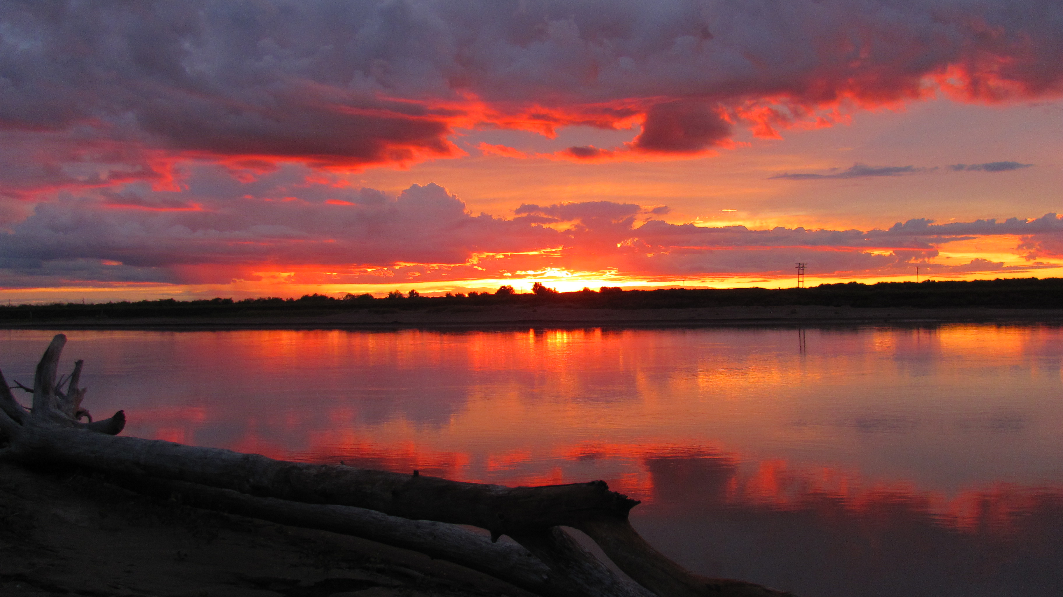
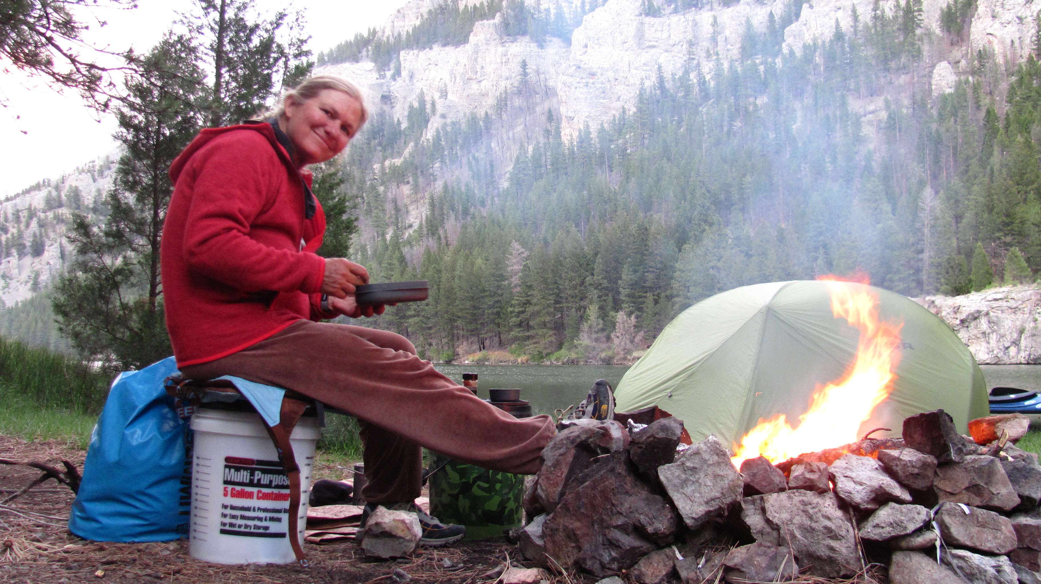
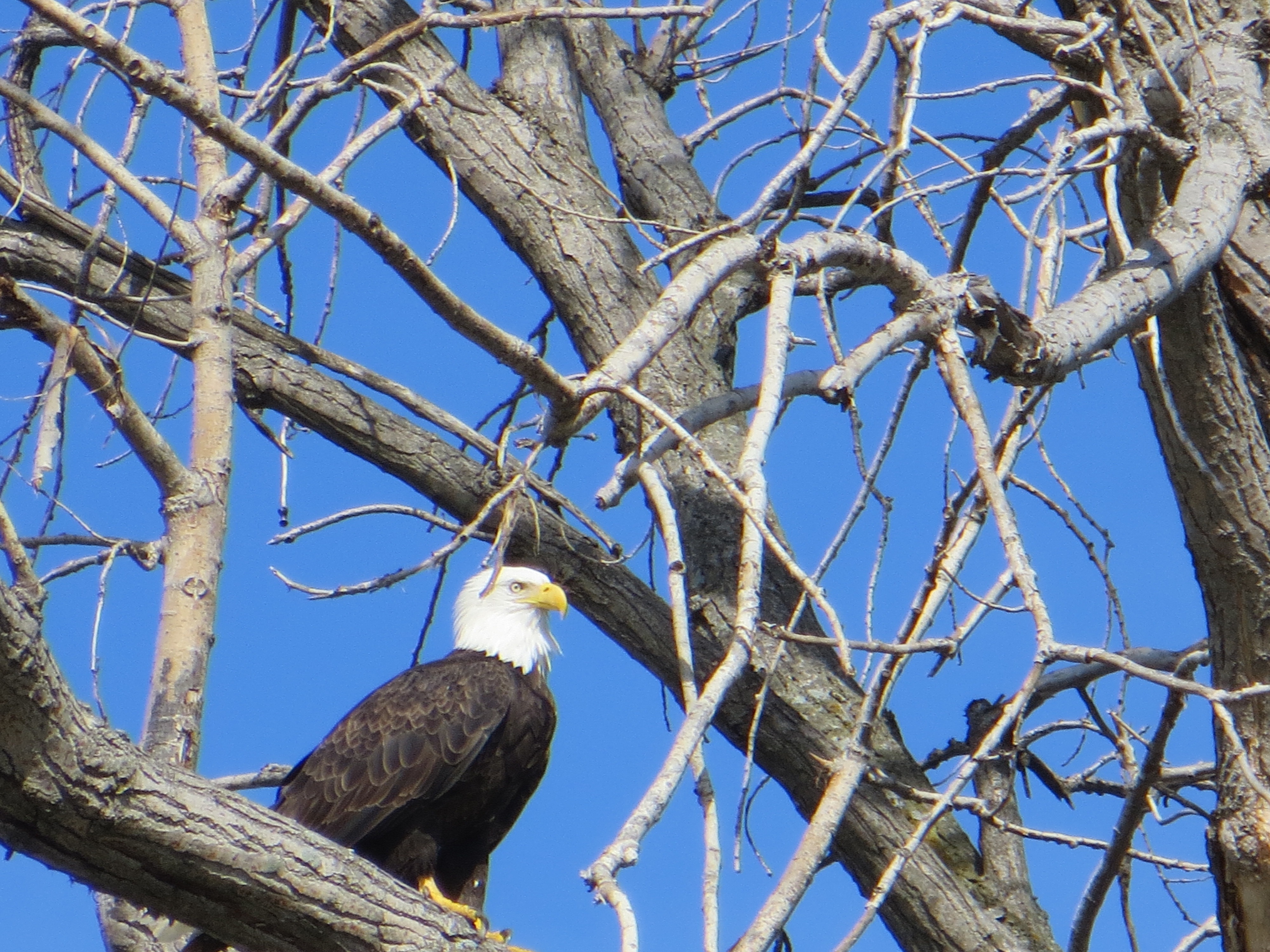
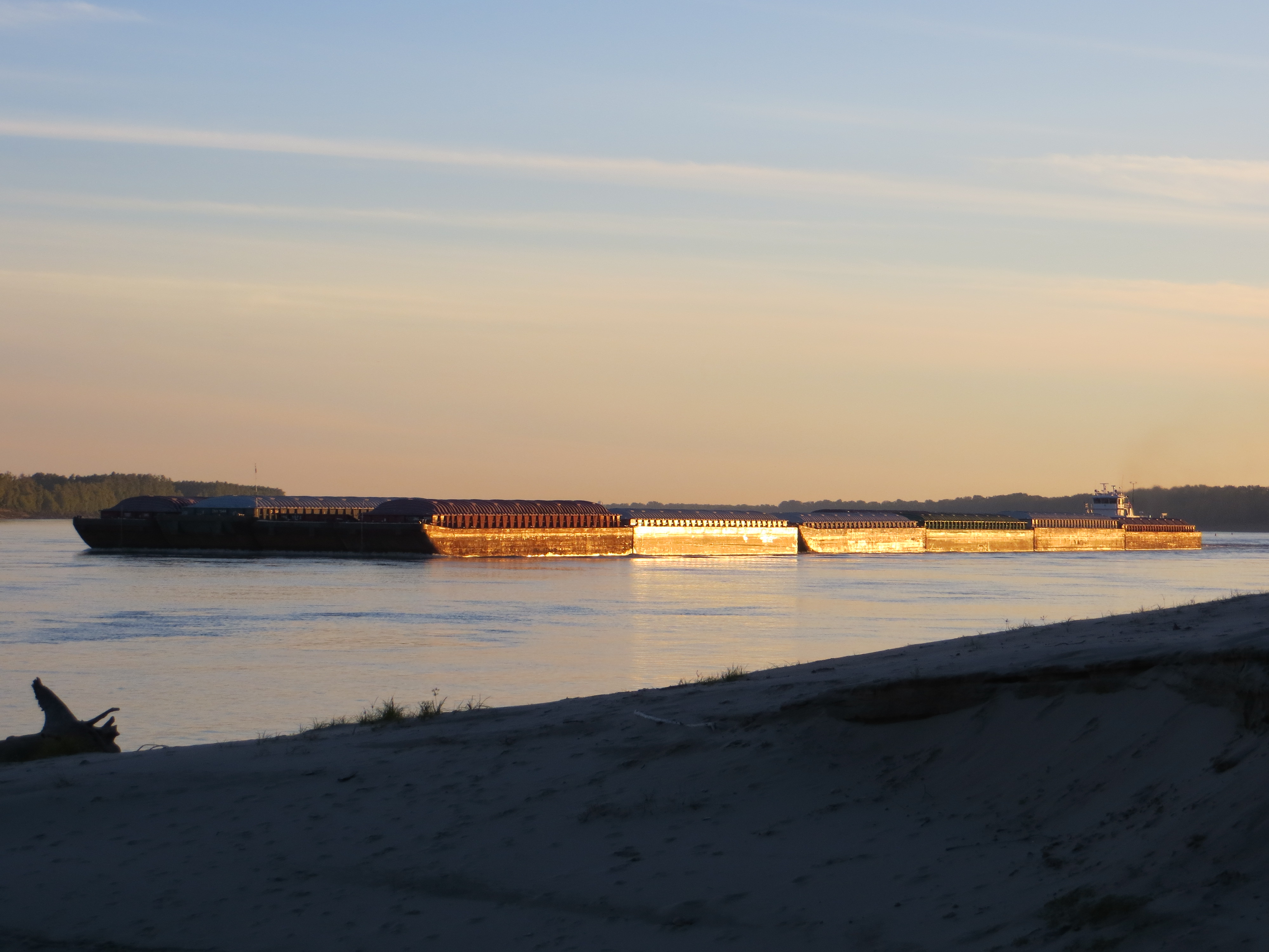
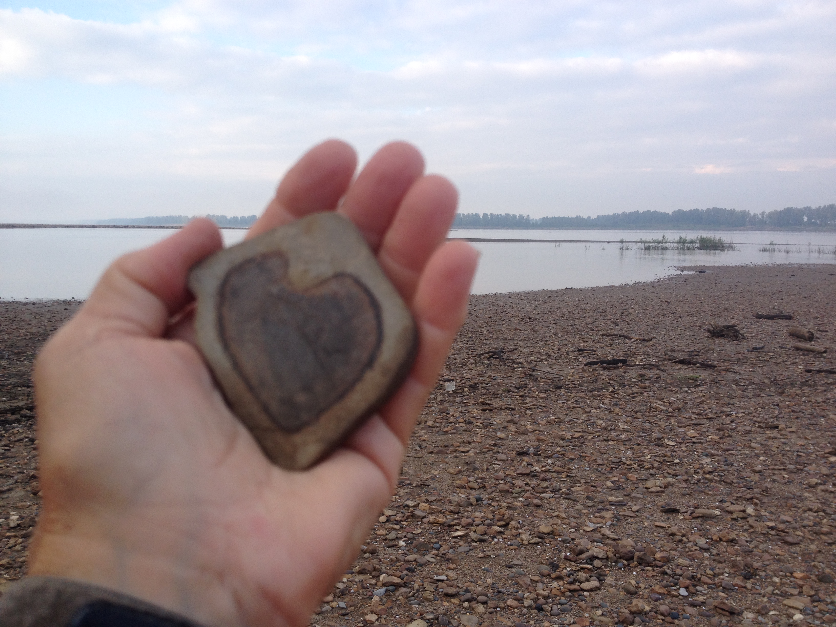
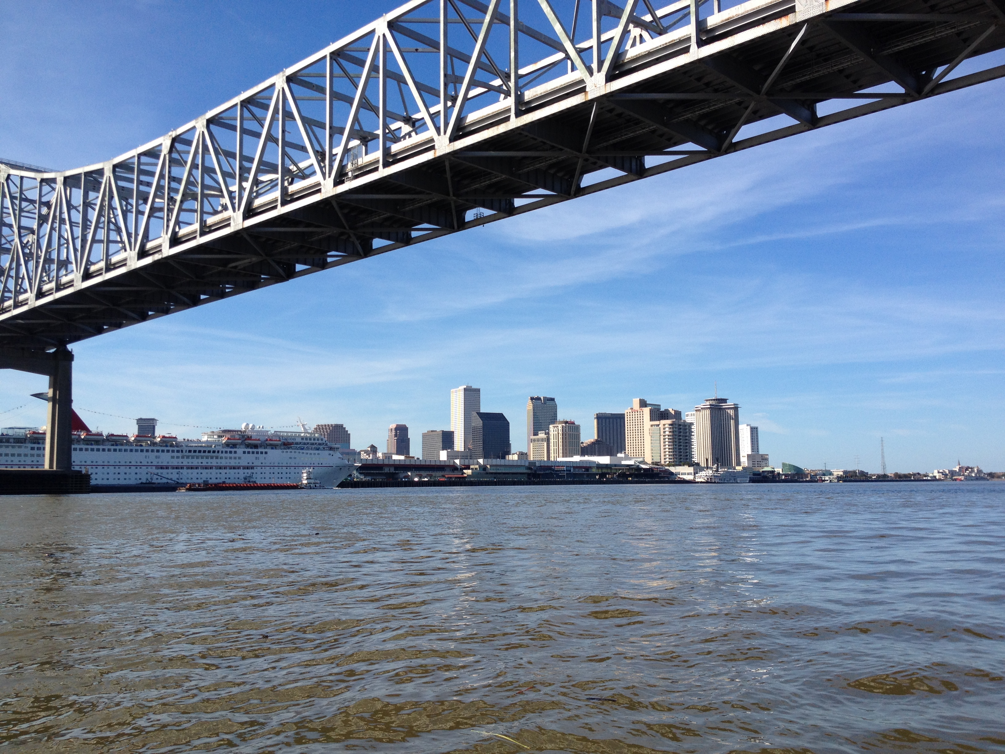
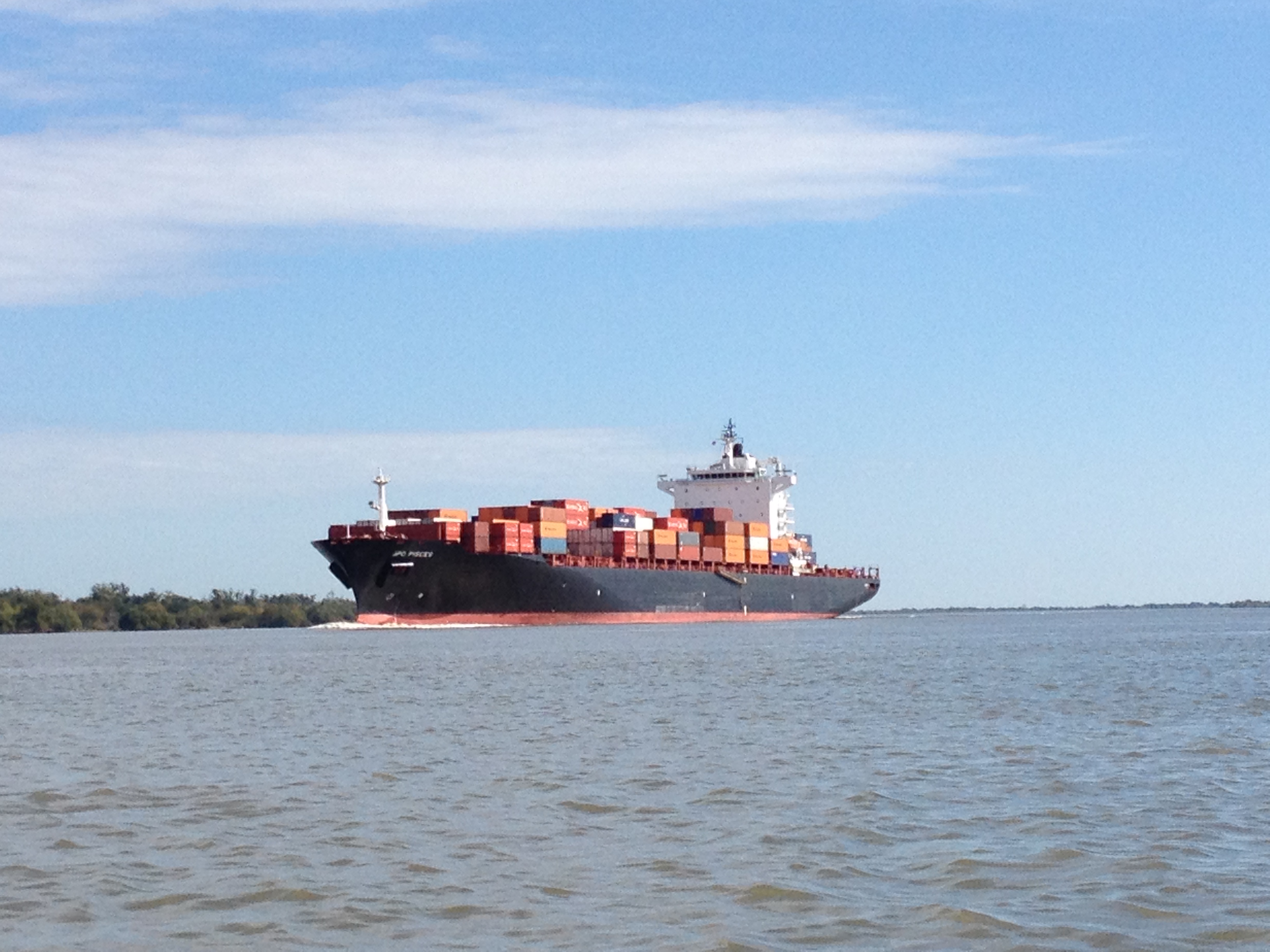
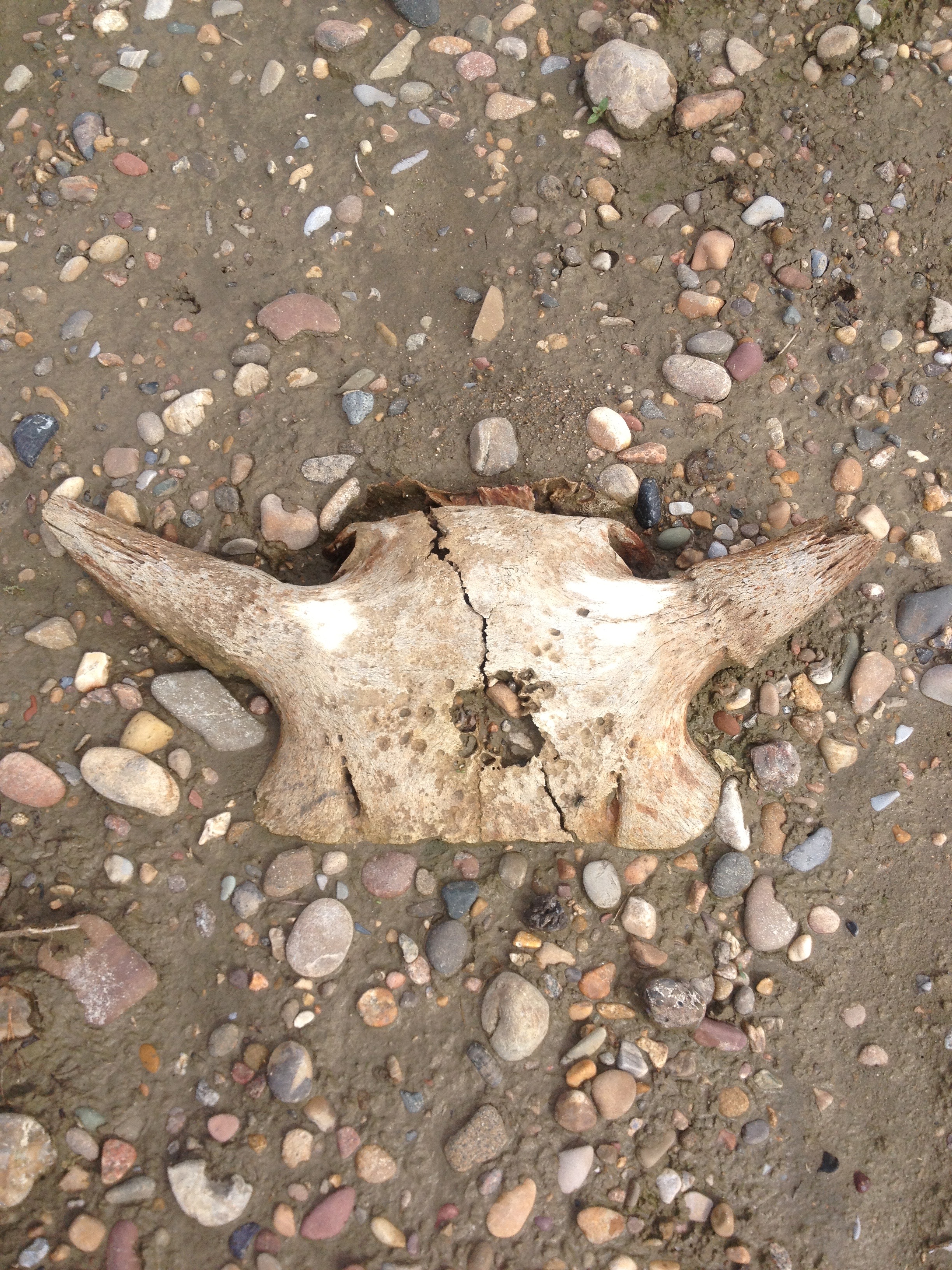
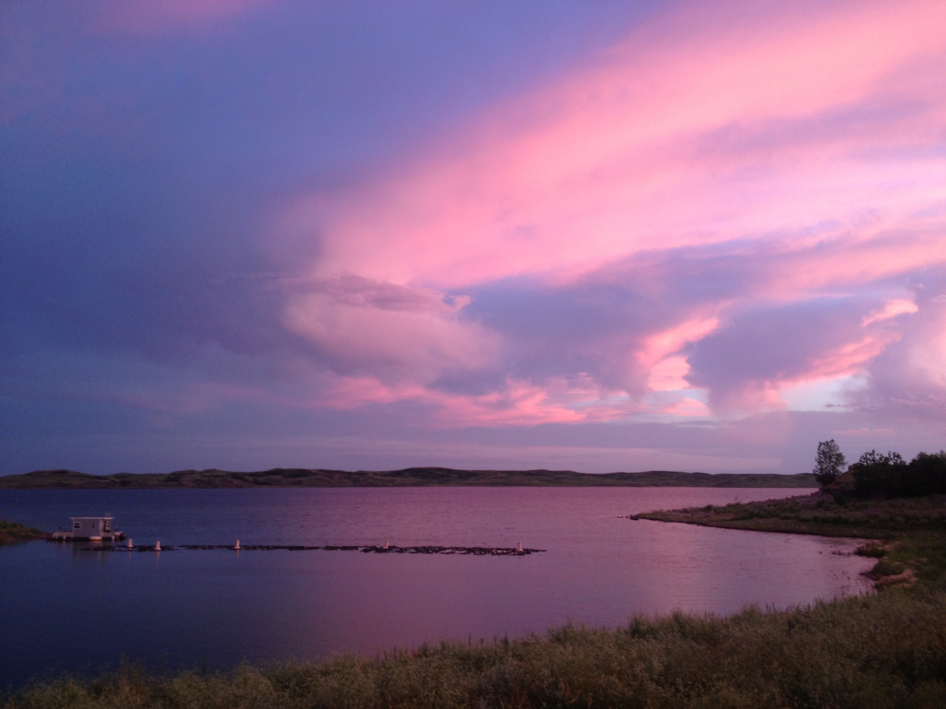
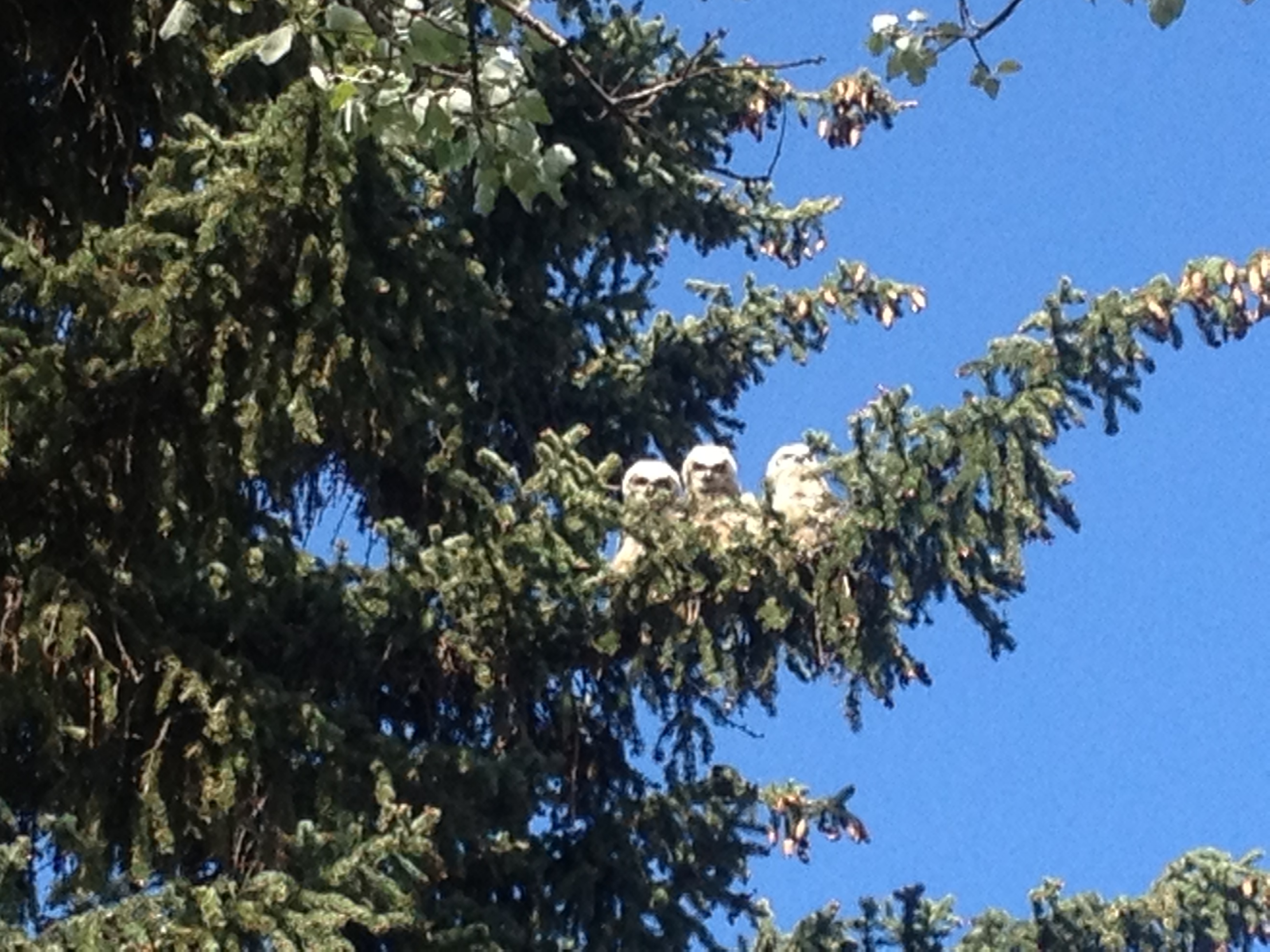
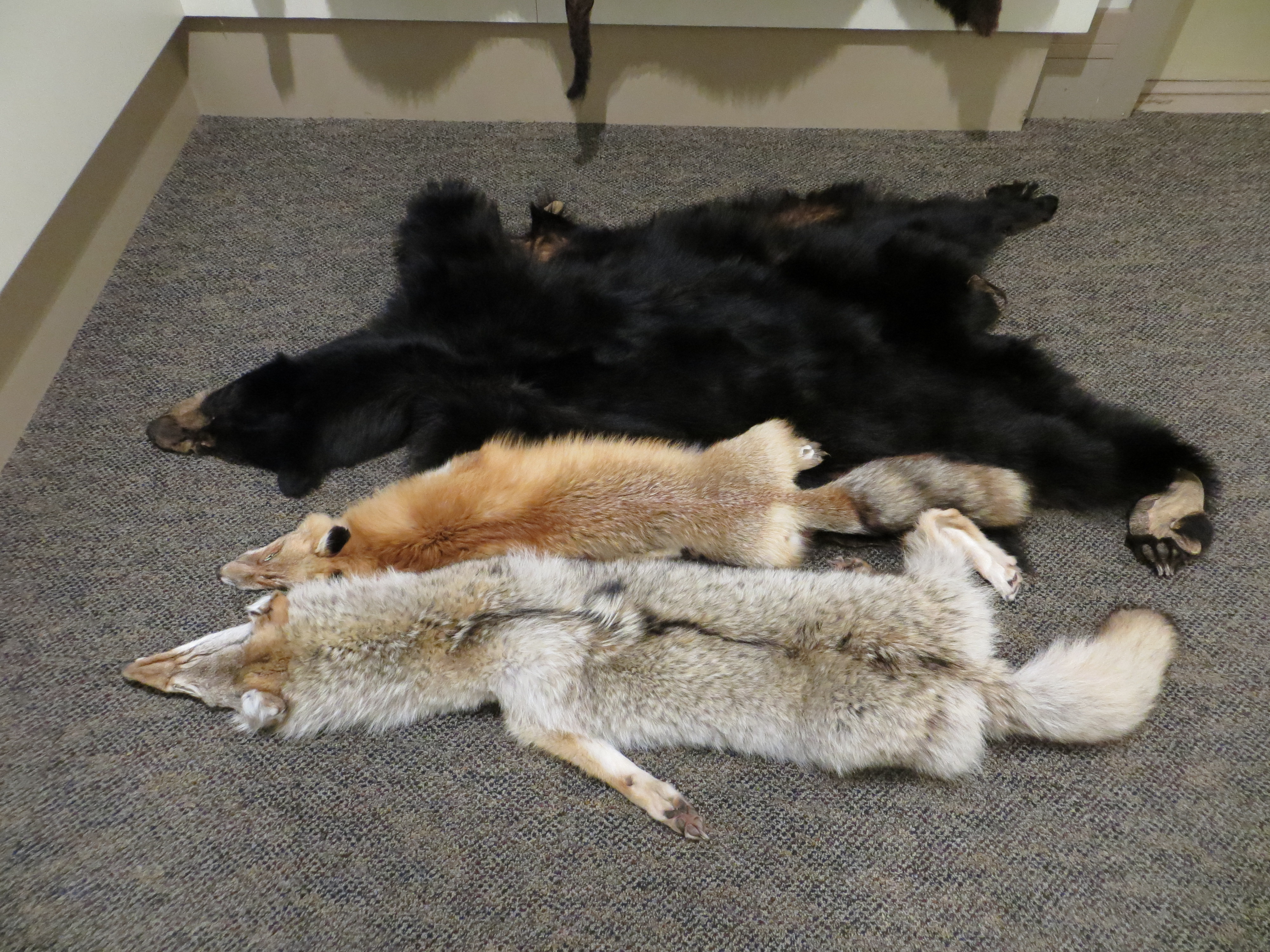
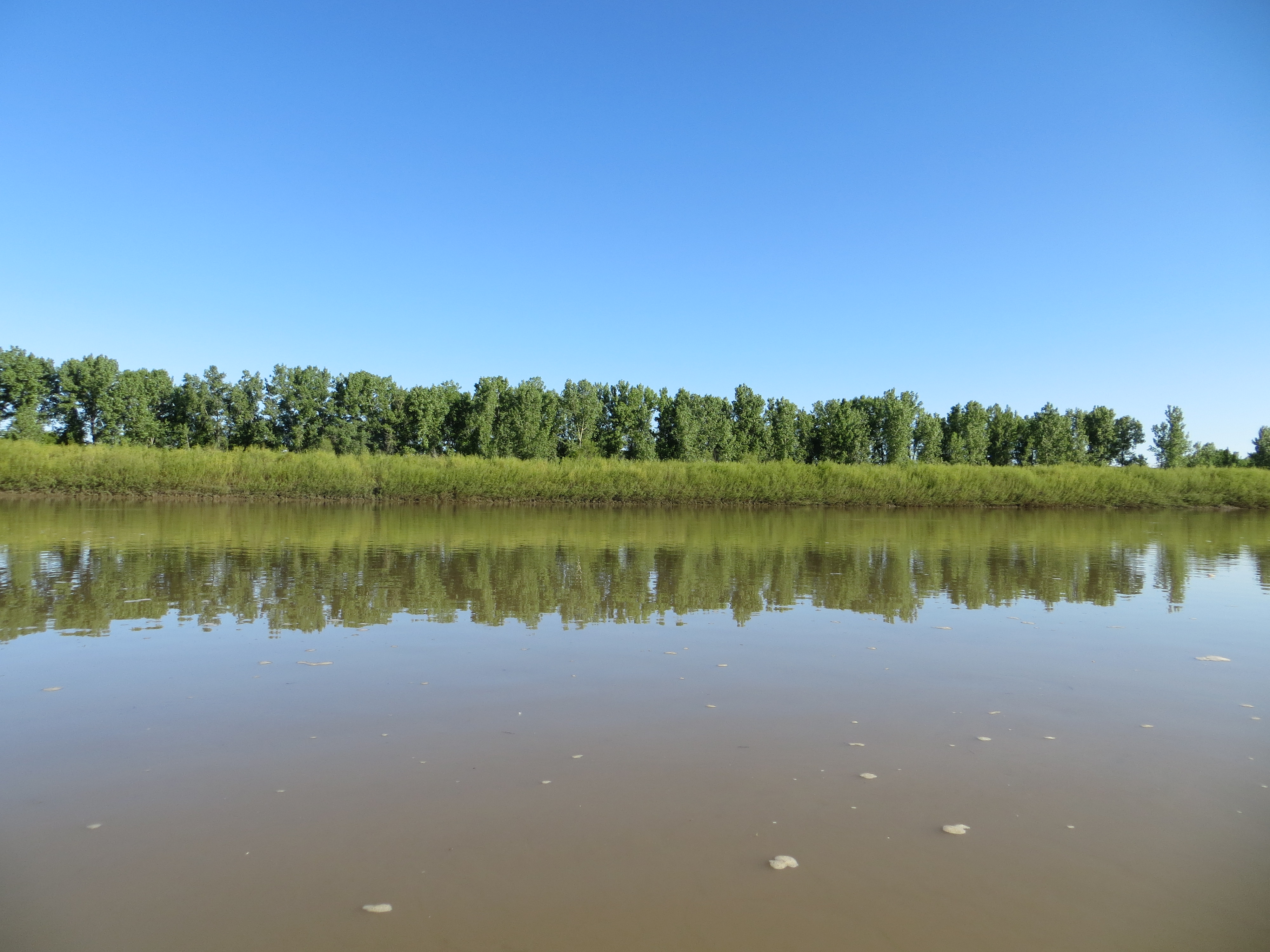
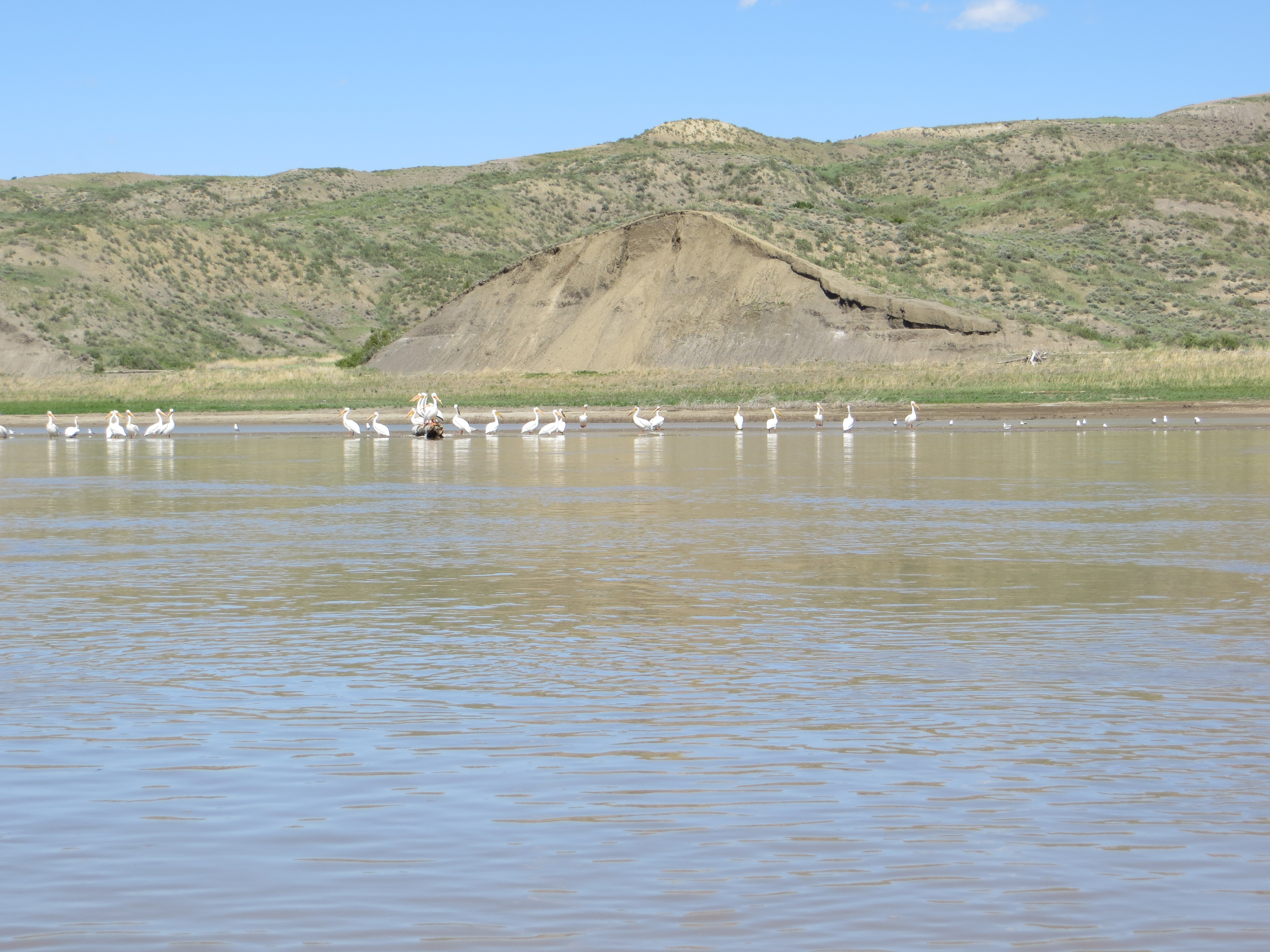
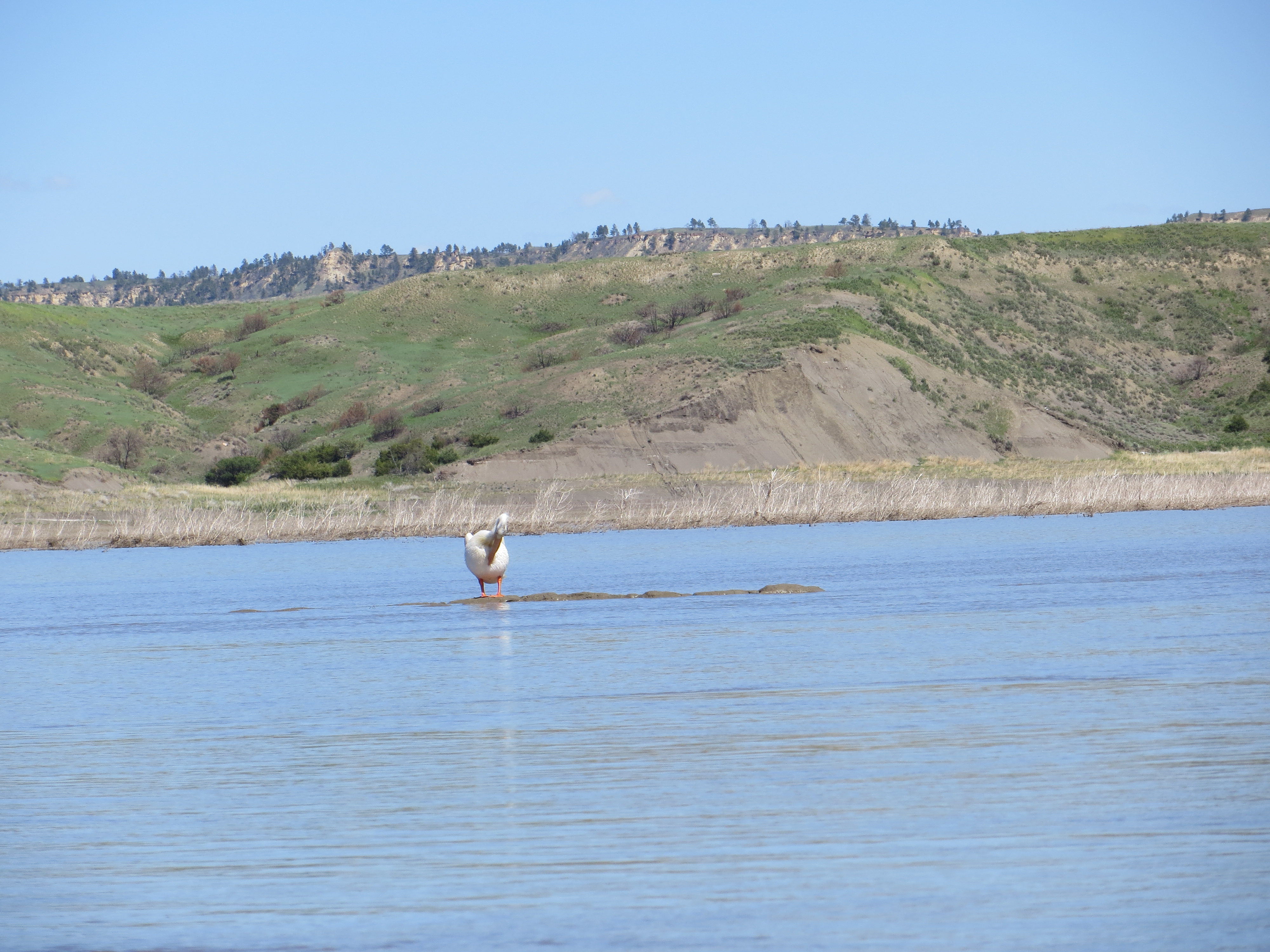
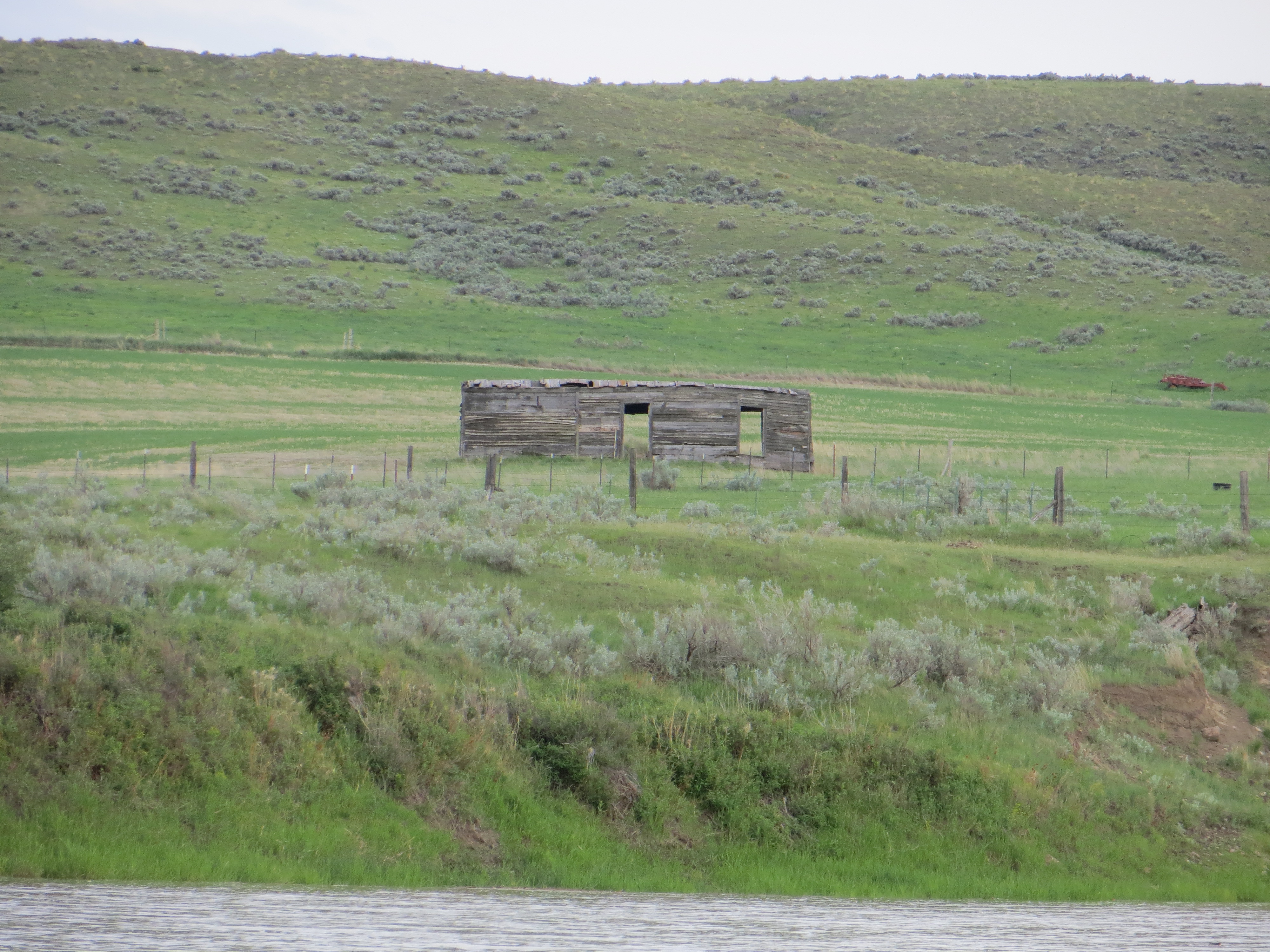
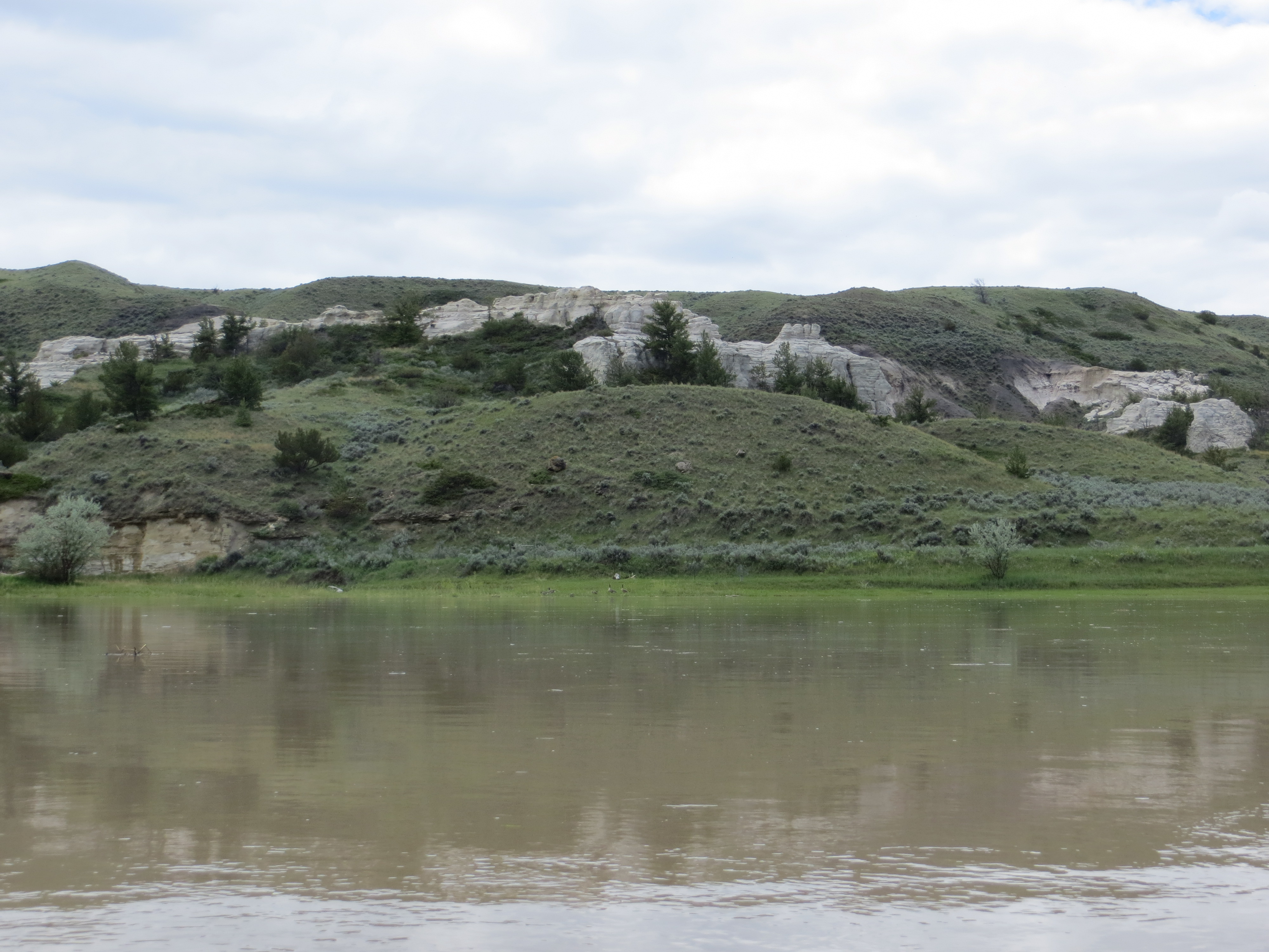
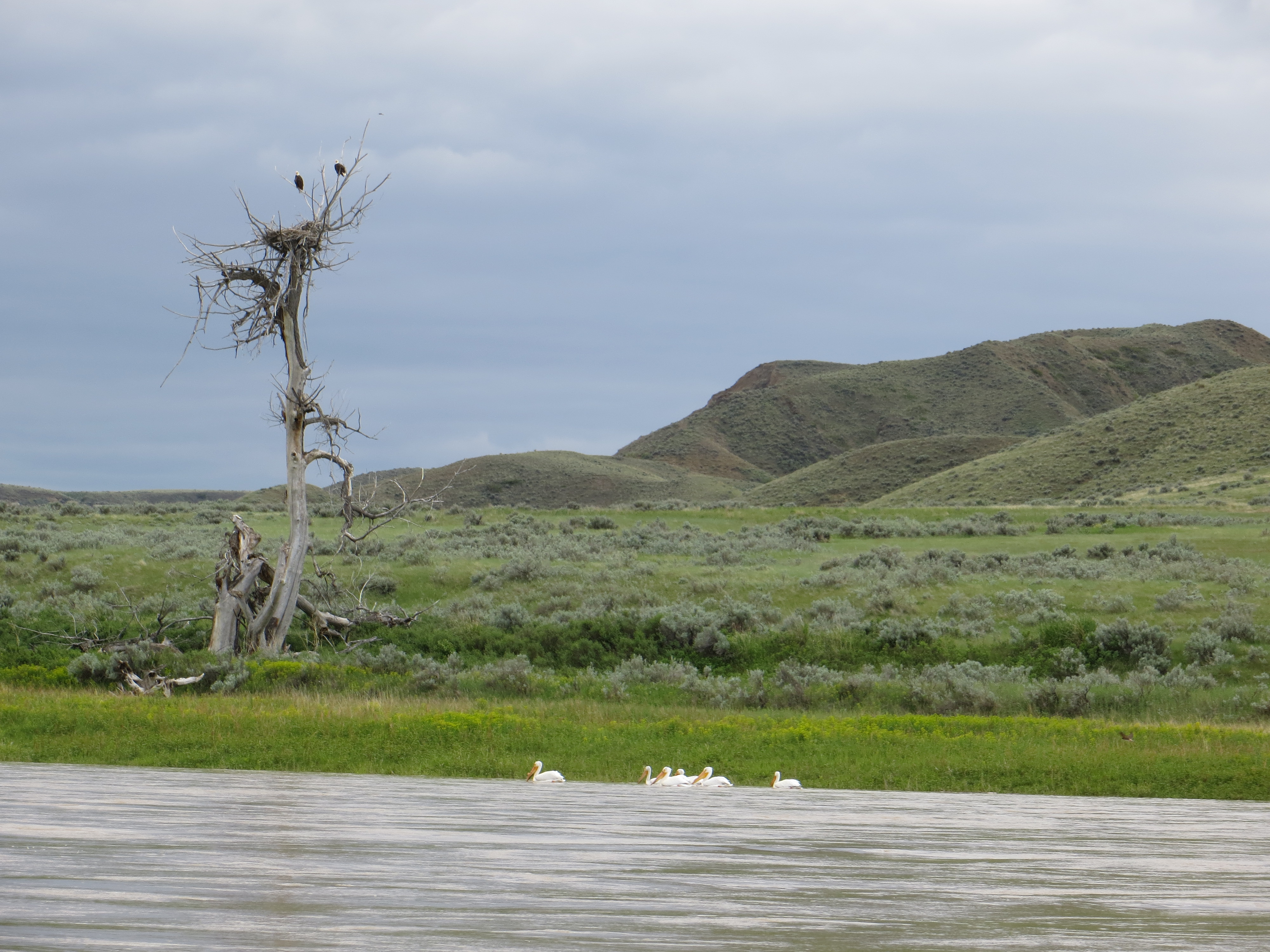
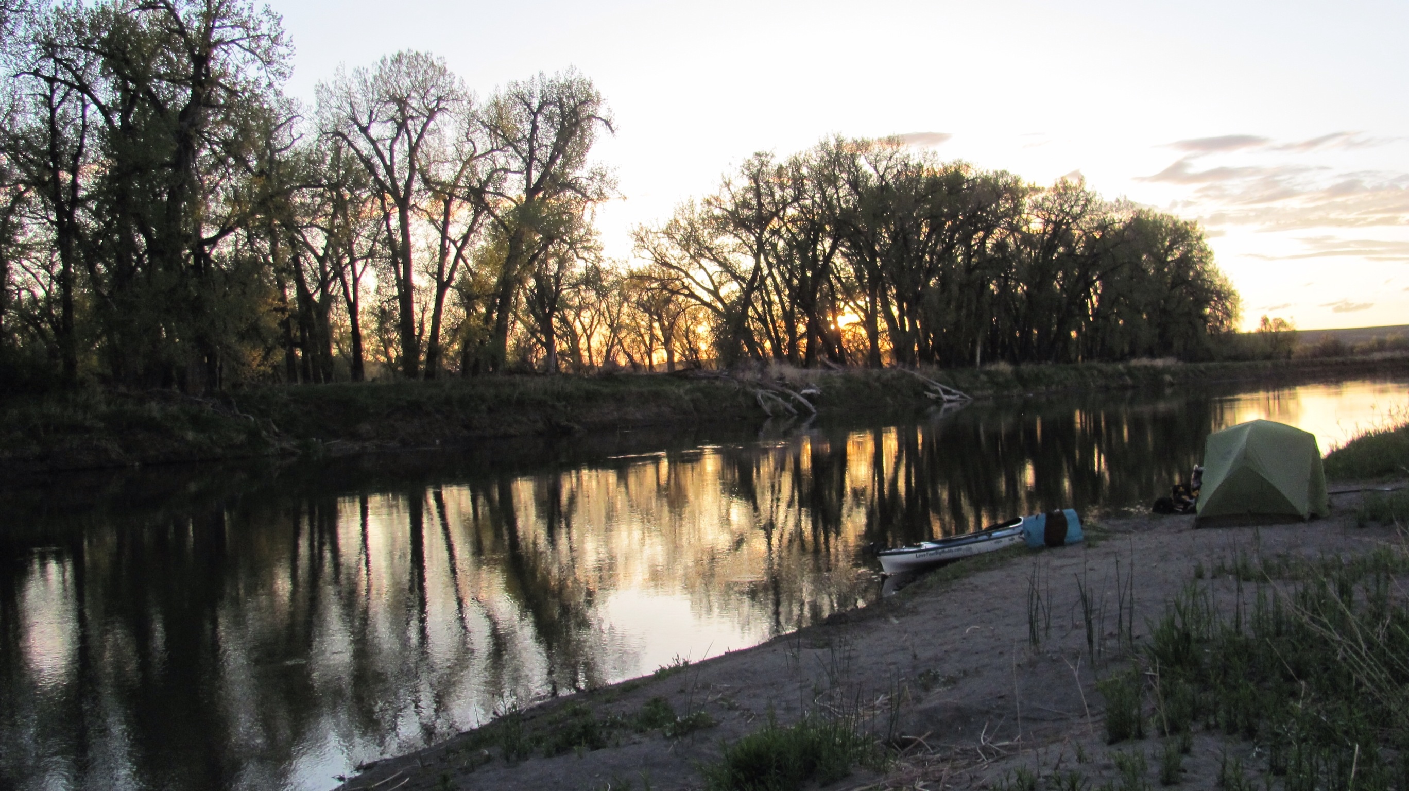
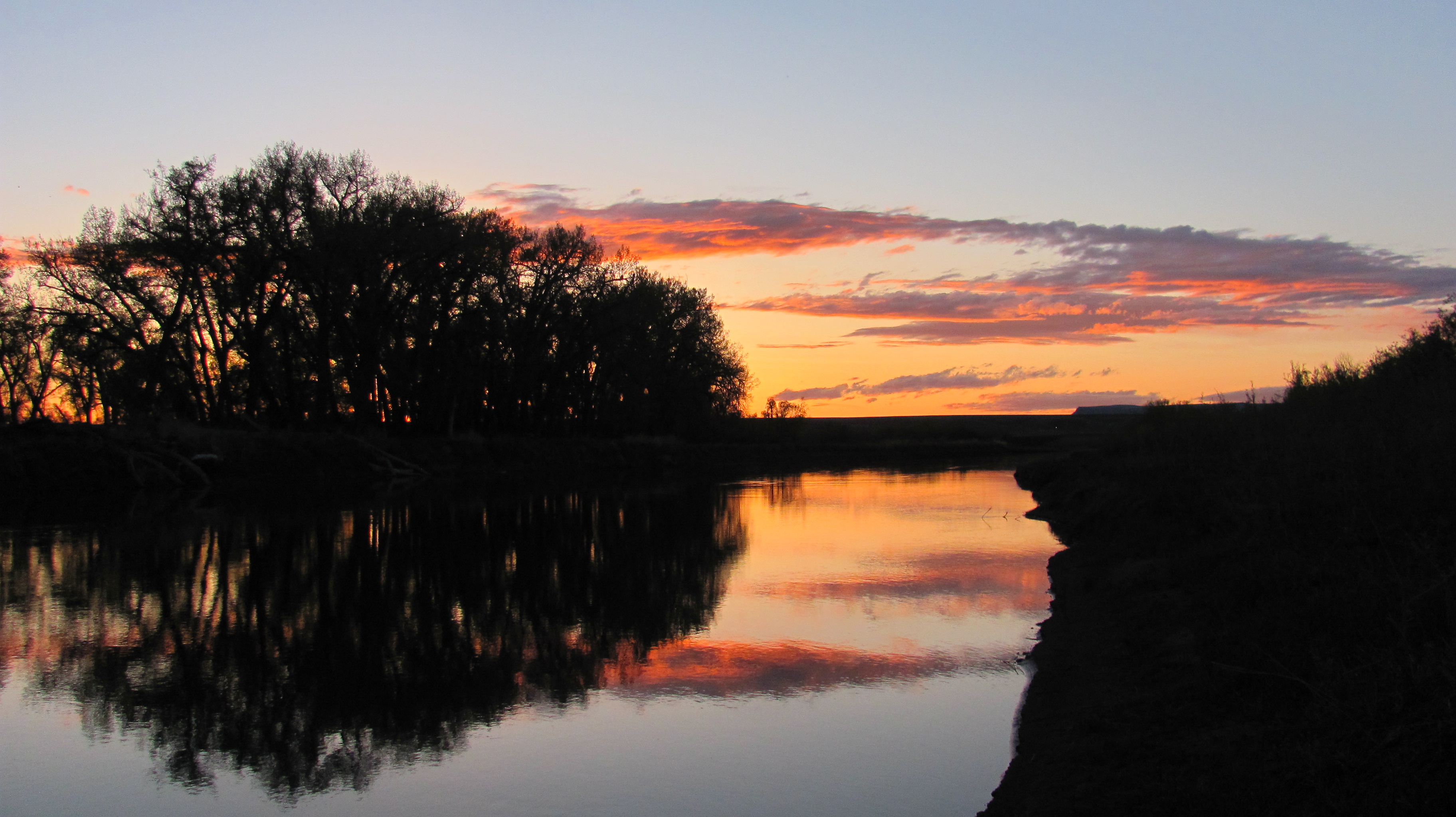
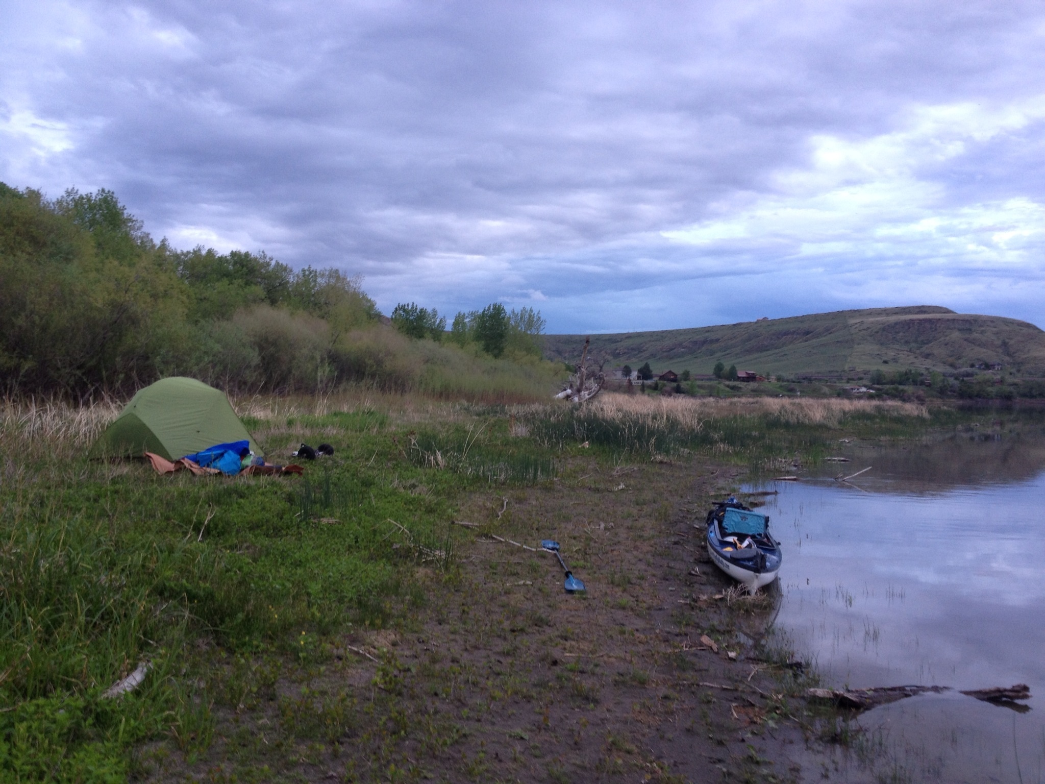
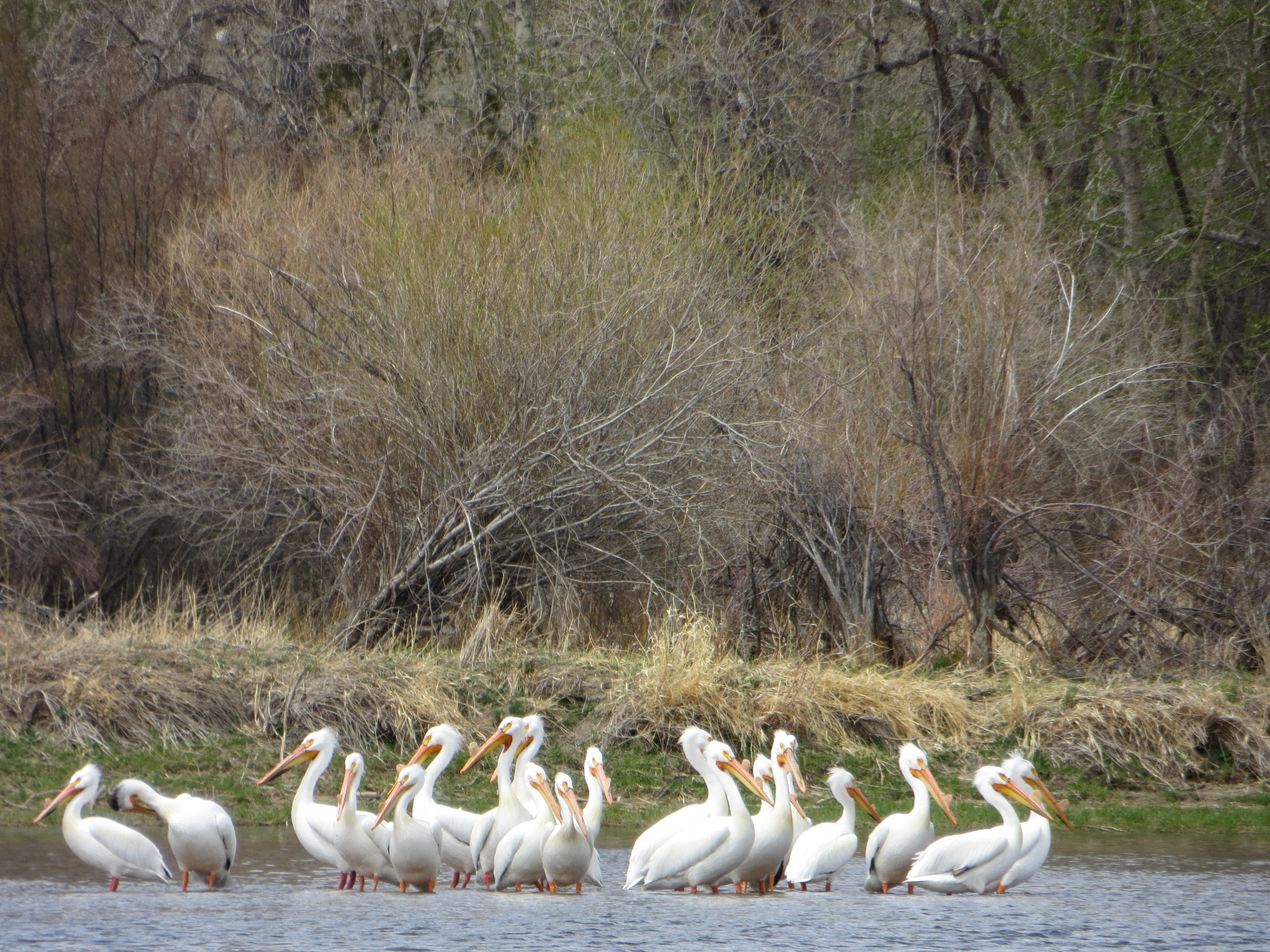
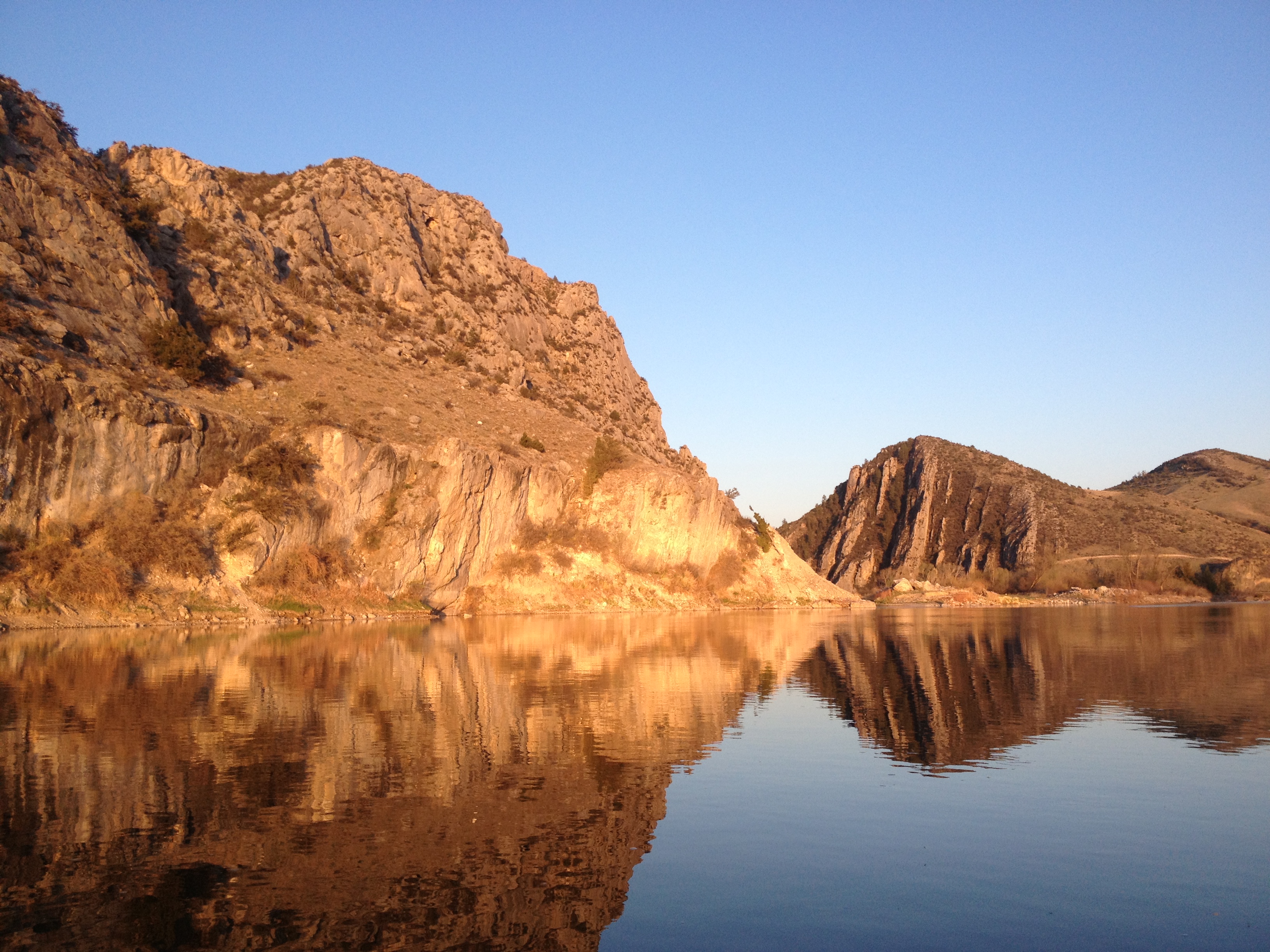
Friends from the first day to the last. Love my pelicans.Hiking on windy Fort Peck LakeHave never seen another quite so stunning as this sunsetWell, it IS the Big Muddy!The morning after the worst electrical storm of the trip. Fort Peck LakeBelow Fort Peck Lake, I think. Still muddy, but getting better.Gates of the Rocky Mountains – Holter Lake, MTGates of the Rocky Mountains. Hard to leave this wondrous place. Corps of Discovery camped right across the river.The stoic bald eagleTow and barge on the Mississippi RiverA very special heart stone found just below the Ohio River confluenceNew OrleansSharing the lower Mississippi River with tankers and freighters, always keeping one eye in front and one eye to the rear. They are quiet vessels.My stellar Gulf support crew in the Gulf fogThe fog just lifted as we began crossing the Head of Passes using a hand-held GPS device. This was a super exhilarating moment. Unforgettable. Even the ship pilot crossing the pass remembers the moment I came into view.Yes, the pilot of this ship. Pilottown crew provided much comfort on this stretch with their radio communication and hospitality. I am so thankful for them.Grizzly bear track below Hell Roaring Canyon. Photo taken by my daughter Haley who was sleeping in a car with Jeannie, waiting for us to come out after a 24 hour delay.Buffalo skull found next to my camp below Fort Benton, MT, that speaks historical volumes.Bridge City Marina in Mobridge, SD, home of very special river angel, Michael Norder and his lovely family.Hole in the Wall, Upper Missouri River Breaks National Monument, MTMaking campCurious pronghorn antelope in Charles M. Russell National Wildlife RefugeSweet heart blue hole on the middle Mississippi RiverThe Natchez of New Orleans.Great Horned Owl Babies in Great Falls, MTOne of several lone pelicans escorting me down the South Pass to bid me farewell. BFF
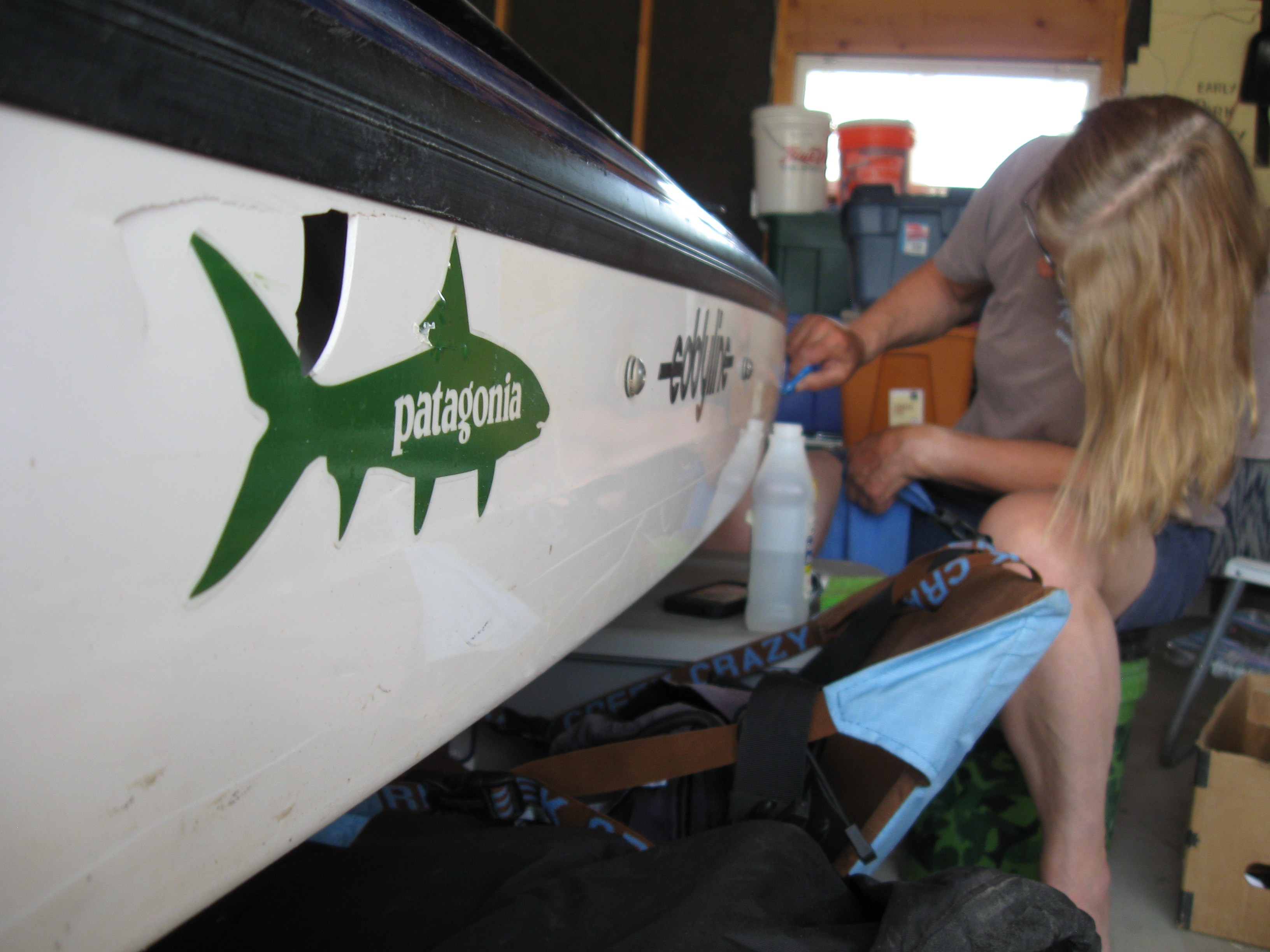
Please visit my sponsor page at the top of my site to see the wonderful companies that believed in me and helped me out in some way to ease the financial burden. Special thanks to Patagonia for their generous clothing sponsorship. Eddyline for their excellent service with my boat as well as donating the best paddle I could ever imaging taking, a Swift Paddle. Many heart-felt thanks to all of Columbia, Mo’s outdoor shops for donating items to LoveYourBigMuddy. Huge thanks especially to our Klunk Bikes for re’cycling’ me a bike, which I love very much to this day.
And to every person that was able to donate financially, I know who you are and you will NOT be forgotten. Particularly my local Riverbilly family and those contributing to the Blues Benefit. Click here to see who these tremendous supporters of LoveYourBigMuddy are. This was YOUR expedition! THANK YOU! If you see a photo you would like on this post and it is part of your donation reward, please email me and let me know. I will be posting more photos shortly.
For a comprehensive view of media articles and podcasts, click here to visit my media page, located at the top of the site.
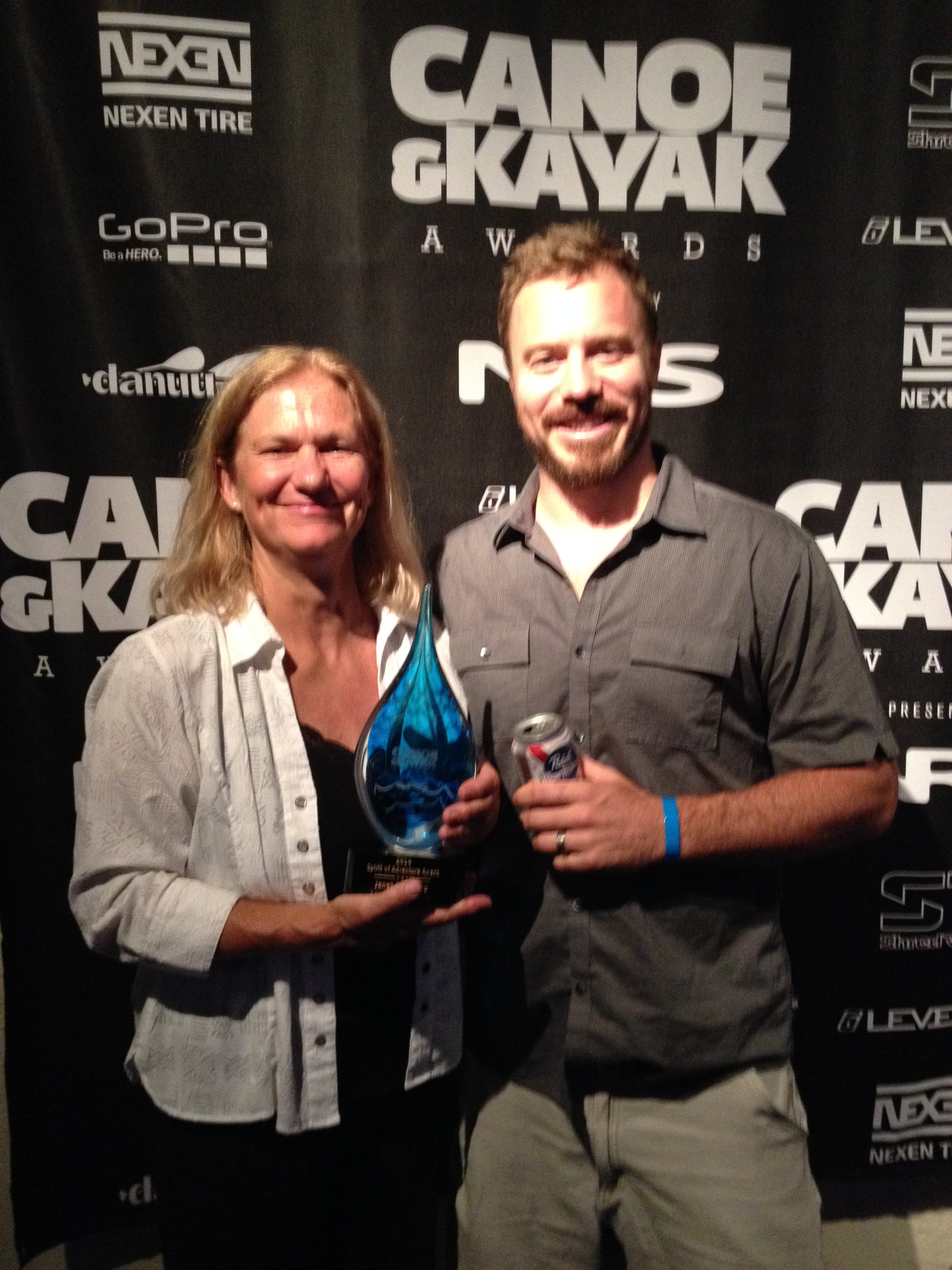
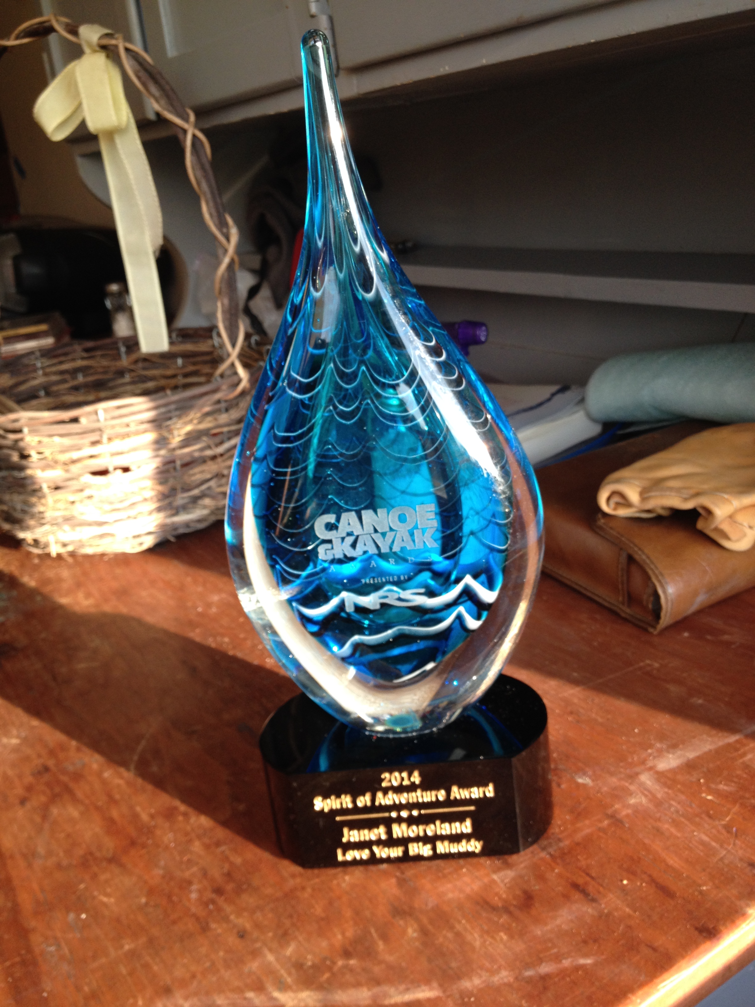
Lastly, warm thoughts go out to the crew at Canoe and Kayak Magazine, and to all of the individuals who took a moment to vote LoveYourBigMuddy Expedition into the “Spirit of Adventure” Award arena for 2014. Certainly, the honor was all mine to receive the award in the midst of an incredible paddling family. YOU, too, can be a candidate for such a cool recognition. Just…
Dave Shively, editor, and one of many very cool people who have created this outstanding paddling magazine and helped to create an international paddling family. Three cheers!!! Click here to visit the award ceremony.
…remember to keep your eyes on the road ahead. Don’t quit your DayDream. And, dream BIG!
LoveYourBigMuddy Expedition on Facebook. see what’s up…
“So, Janet, what’s your next adventure?” A popular question about which I have been asked many times. For awhile there I began to believe I could go on another expedition. I began researching the Amazon River and contacted my friends on Facebook who have paddled it already, namely Mark Kalch and West Hanson. Man oh man, what an awesome adventure THAT would be! Not only do I have an interest in South America, but to paddle the second longest river in the world??? Solo?! We are talking real-deal adventure! Too bad about the Class V+ white water on that 500-mile section…hmmm, do I REALLY want to risk my life? How could I ever pay for such a thing? How long will it take? How DO those adventurers DO it???
Back to reality. Spending 7.5 months on an expedition is costly. I am so thankful for my supporters along the way who carried me through financially, but the money hole that awaited me post-expedition was, or is, enormous. I left on my expedition with pocket change, and came home with the same.
That said, I began researching an adventure that was drifting around in the back of my mind, something I have always been interested in and have wanted to learn more about. I needed to find an adventure during which I could work and make some money. To begin my inquiry I made the initial phone call to the Lower Brule Sioux Indian Reservation School in south-central South Dakota. I wondered if they needed any teachers. This could be a cultural journey for which I could get paid while immersed in it. I had started the ball rolling, one that is currently moving right along at a pretty good clip. In fact, I will be moving to South Dakota next month to teach 6th-grade at the Lower Brule Day school. Now, ask me what my next adventure is going to be! 🙂
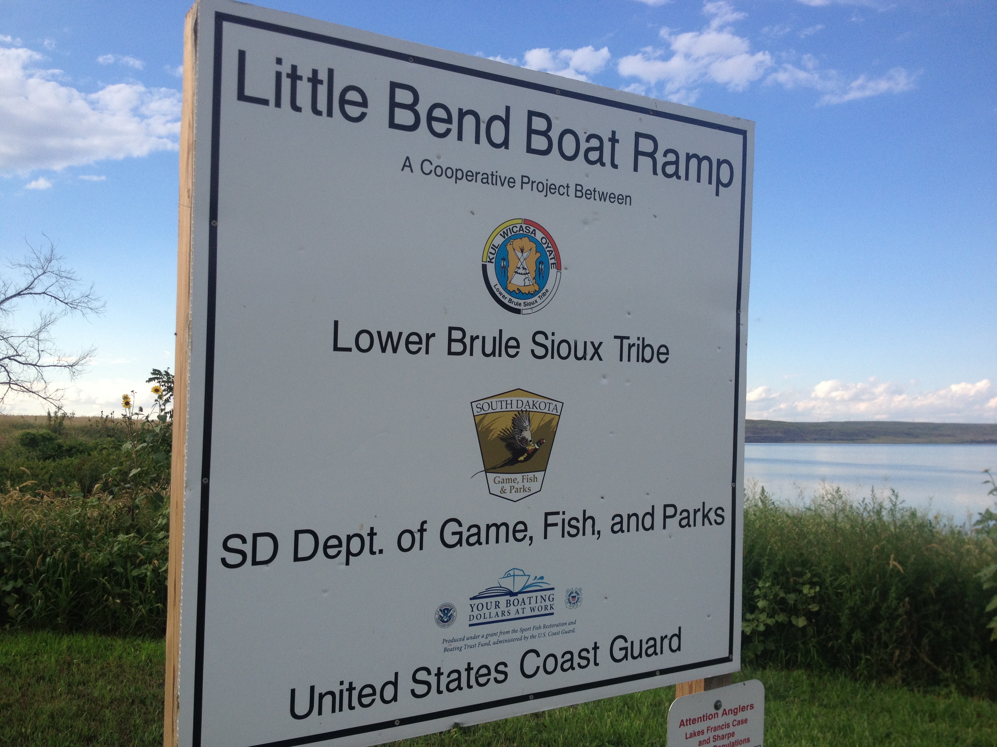
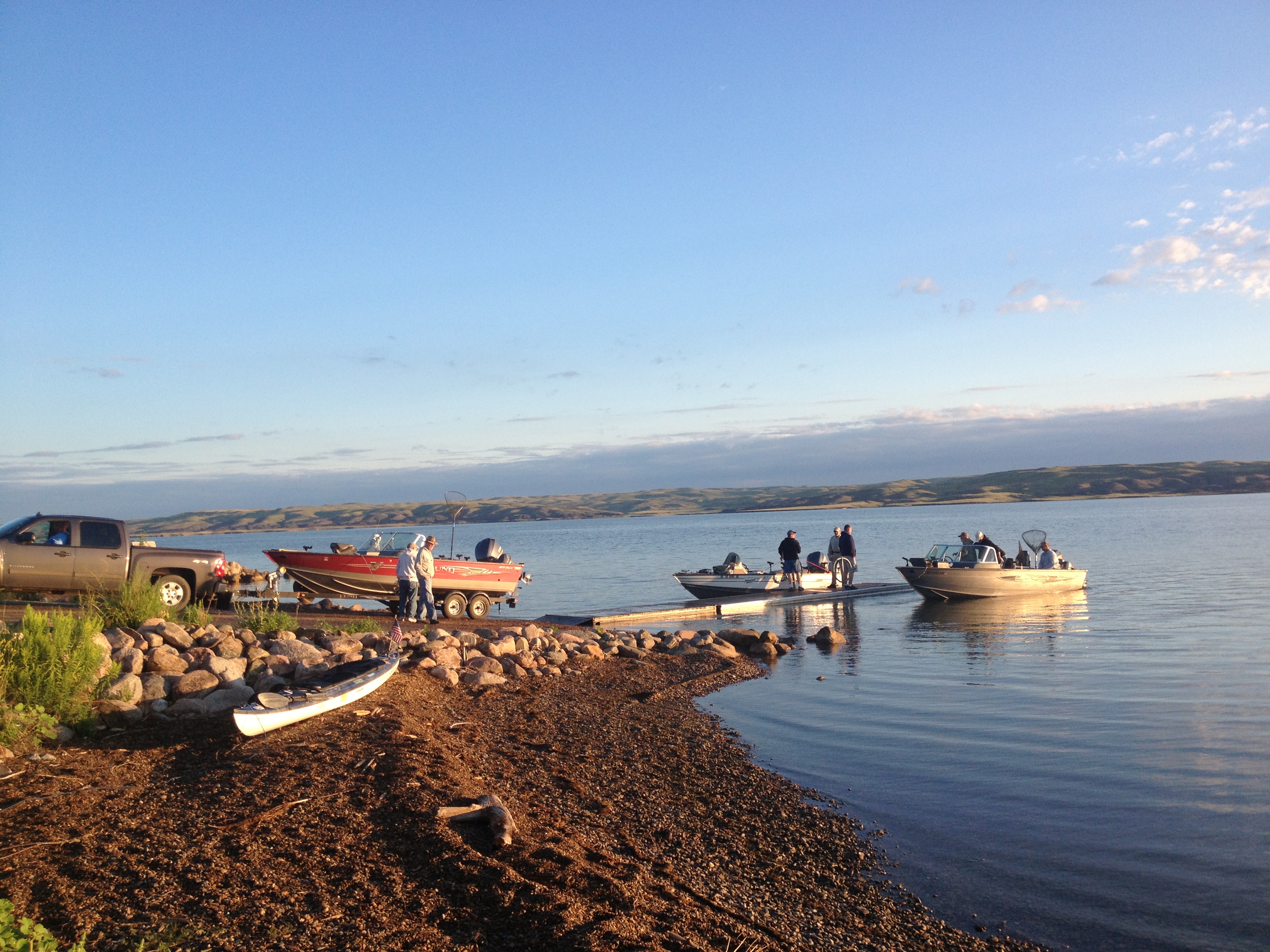
Upriver from the town of Lower Brule, this boat ramp was not on my map but a welcome sight since I did not have time to make it to Lower Brule this day.This boat ramp was so beautiful and a pleasant place to camp.Not a whole lot to do once I set up camp at the Little Bend Boat Ramp, so I picked up trash.I had lots of company at the boat ramp campBusy boat ramp popular with the fishermen and families. Everyone was very friendly, that night and the next morning. The fishermen were there at the crack of dawn, as I recall.
I visited Lower Brule Sioux reservation while on expedition. I landed in Chamberlain, South Dakota, on Thursday, August 9, 2013, which is downstream a few hours, below Big Bend Dam. My campsite was at the beautiful American Creek Campground located on the waterfront shore of Lake Francis Case. Jessica Giard was my river contact in Chamberlain, at that time the editor of the local town paper. We enjoyed each other’s company very much and made arrangements to drive to the Powwow at Lower Brule on Sunday, August 11, 2013.
A photo of me during expedition taken by fellow long-distance paddler David Forbes. We met at Big Bend Dam and paddled to Chamberlain together.David Forbes, me, and Jessica Andrews Giard, Chamberlain River Angel, enjoying dinner together at the Marina in Chamberlain, SD.
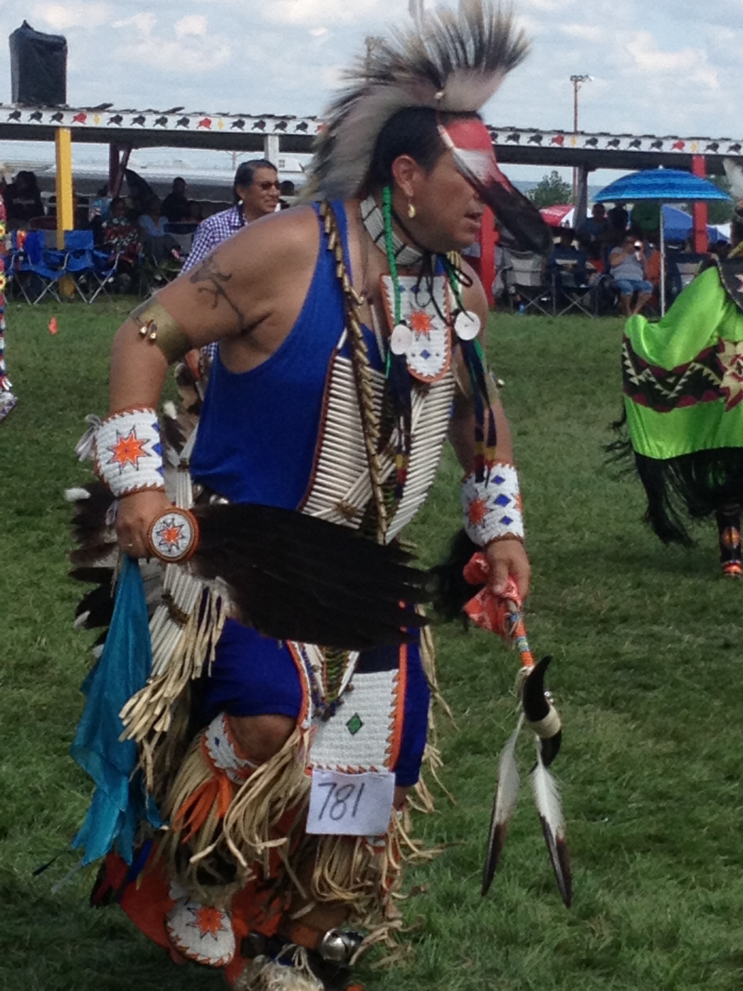
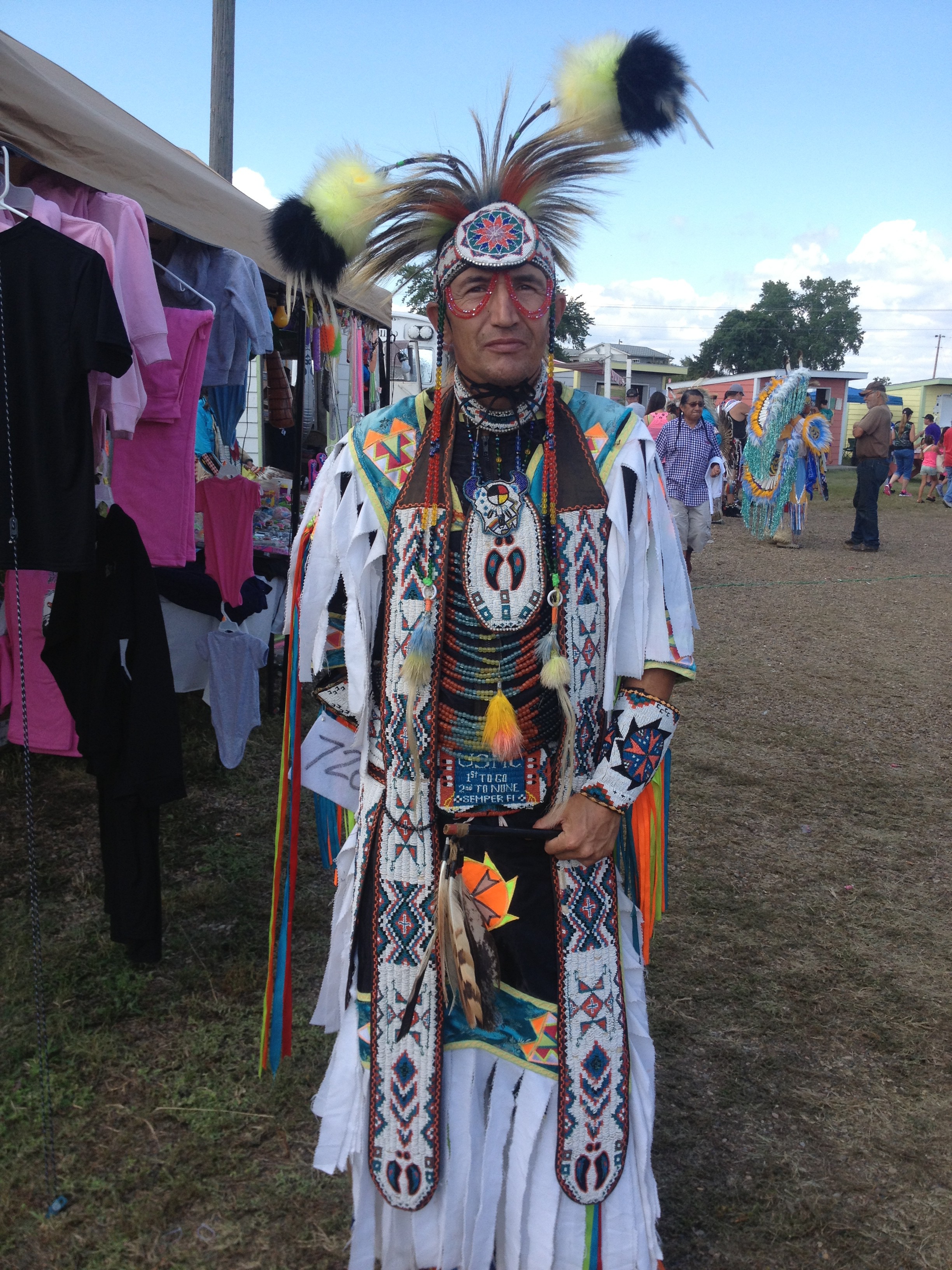
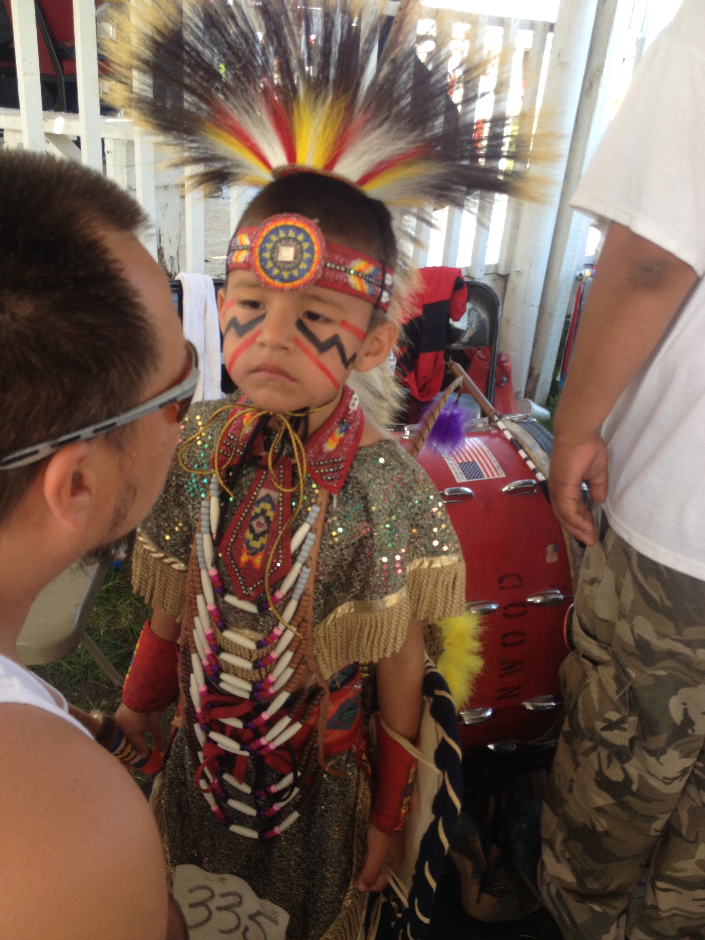
I was intrigued with the Powwow event and the display of American Indian culture. Lower Brule reservation is located right on the shores of Lake Sharpe. I took lots of photos, met some unique and interesting individuals, and thoroughly enjoyed the regalia, dancing and music at the event, the latter of which consisted of many different drum circles. This was a highlight of my expedition.
My favorite photo of the journey, these American Indian girls smiled so big for the photo. They appear to be near the age I will be teaching this year, which is 6th grade.I think this was the opening dance when all participate. Spectacular!The regalia, drums and dance made for some spell-binding events.One of the many drum circles competing at the Powwow
Jessica Andrews Giard, Chamberlain river angel, asking a few questions for a write-up in the Chamberlain newspaper.I was awestruck at the traditional regalia on display this day.Truth be known, this one melted my heart.
Lower Brule is reorganizing its school system to achieve sustainable success. The Tribal Council is working with AIII (A-Triple i), the American Indian Institute for Innovation, making uplifting and relevant changes to achieve post-secondary attendance by graduating high school students who will, ultimately, return to the reservation with their education, leadership skills and innovative ideas. The schools are hoping to achieve an increase in performance standards. I believe the changes in-progress will manifest success and benefits to the Lower Brule community.
Preferring not to commute the 30 minutes to Chamberlain to live, leaving school at the bell and returning at 7:00 AM, I asked the consulting team leading the reorganization if they could find me housing on the reservation. Indeed, they DID find for me a modest inexpensive home to rent just a few blocks from the school. I felt this arrangement was important for immersion with the community and building relationships.
LoveYourBigMuddy Expedition was a life-changing journey like I never expected. After seven and one-half months living simply on the Missouri and Mississippi Rivers, I now know that my days will continue to be unique while trying to avoid ordinary affairs. Living life outside of the box is stimulating and rewarding. I refuse to melt into an armchair positioned in front of a television or a desk chair in front of a computer screen (well, maybe a little of the latter). Life is so short and at 57 years I can feel the pressure of time passing. So much to do and so little time!
I took this photo on glassy waters as I paddled past Lower Brule.It did not take long for this northern squall to move in. Luckily it broke up over the river after I had moved my boat and gear and me away from the water.
The journey is not over until the mission bears fruit. The goals of LoveYourBigMuddy Expedition include 1) empowering youth (women and men) to confidently pursue their dreams and desires 2) conducting effective education in the natural environment, which includes bringing the Missouri River into the classroom and the classroom out to the river and 3) preparing the next generation for impactful stewardship of our nation’s waterways. Purposeful living embodies the spirit of adventure. Yep, that’s my story and I’m sticking to it.
Coming out from under my tarp which I used to cover myself in a squall.
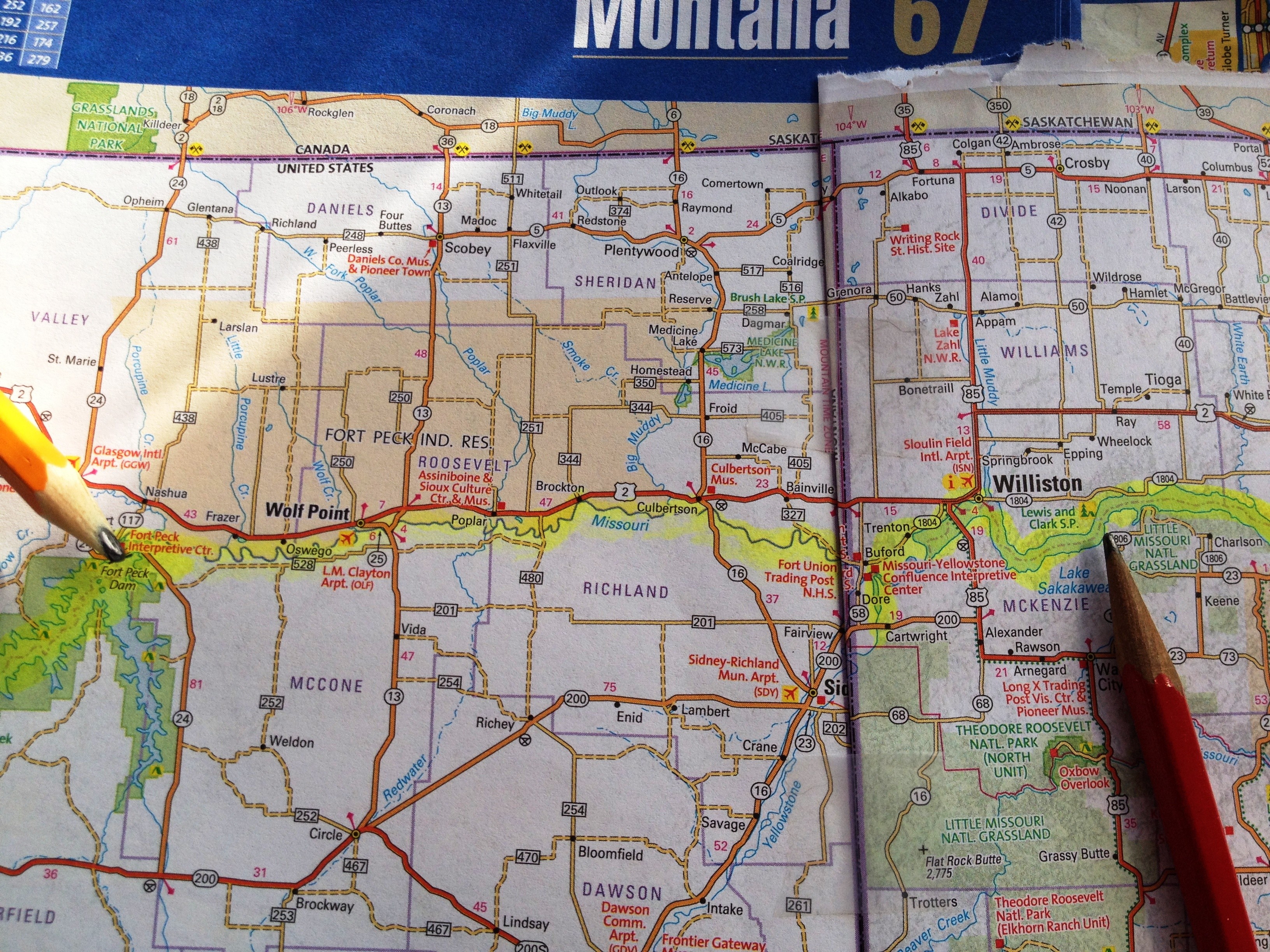
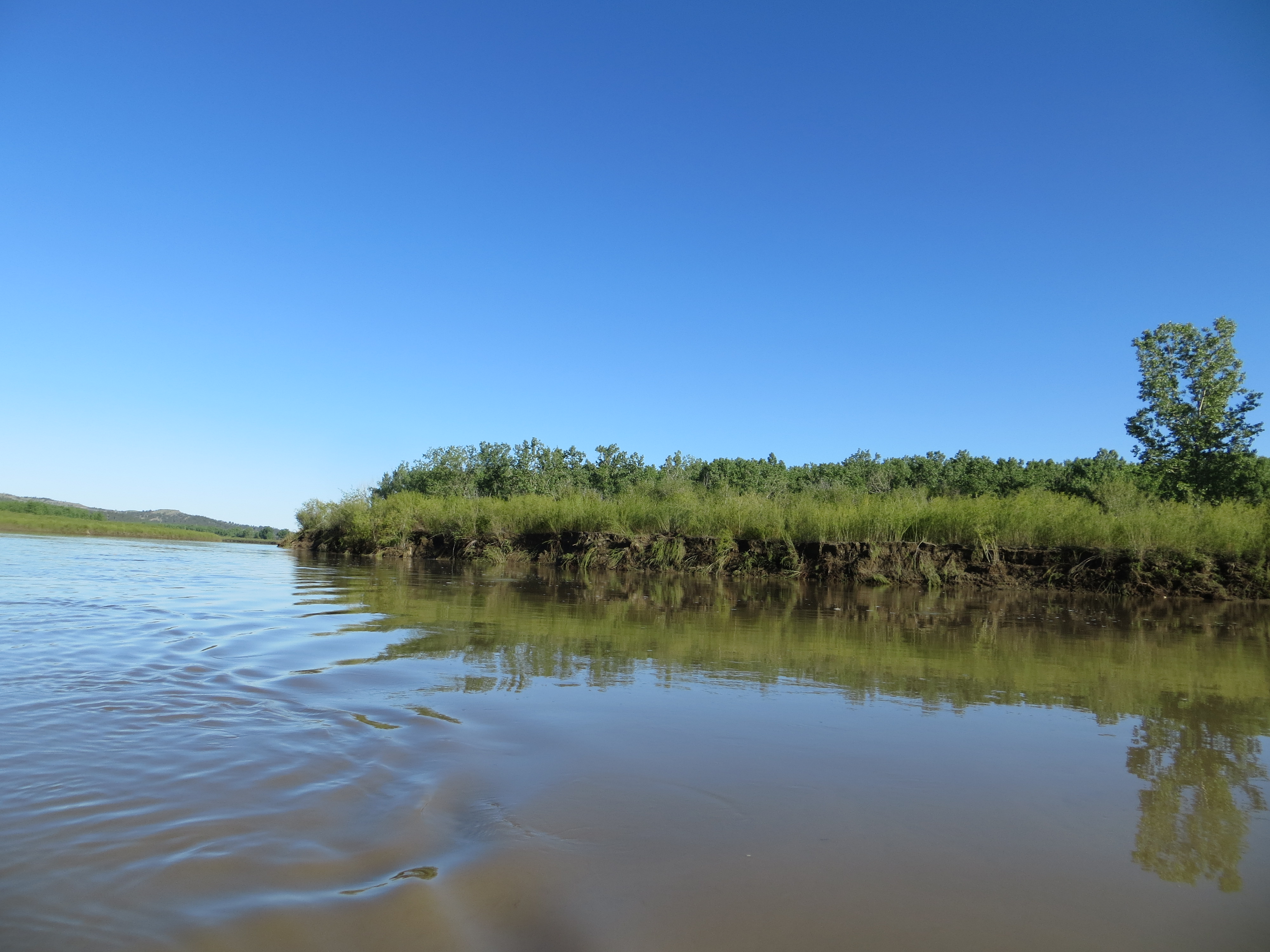
The Missouri River between Peck Lake Dam and Lake Sakakawea. The border of Montana and North Dakota is located right on the crease of the Road Atlas. I crossed the border at Fort Union on June 26.
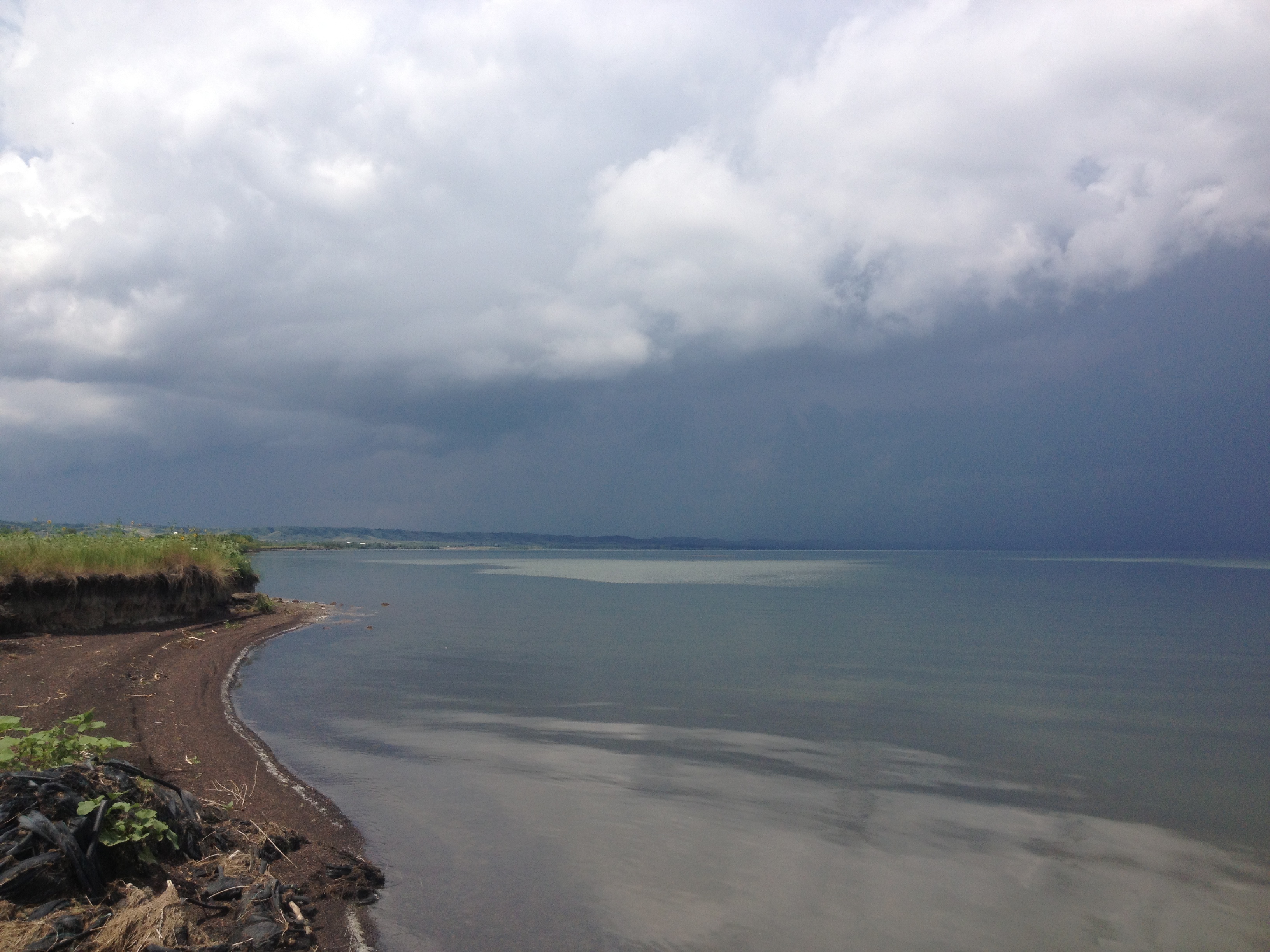
On Monday, June 17, I paddled my final day on Fort Peck Lake. The winds were dead calm and the water so glassy I could see myself in the reflection. I owned the lake that day. I could go anywhere without fear of swamping. I felt I could cross to the opposite shore all morning long if I wanted, a feeling never before experienced on Fort Peck Lake. This lake is intimidating. We left with a mutual respect for each other. Yes, friends.
Sunrise on my last day on Fort Peck LakeNearing the end of my Fort Peck Lake journey
I knew from Dave Miller’s “The Complete Paddler” that the owner of the marina rented out some RVs with showers. I longed for the moment I could shower and relax. It had been a couple of weeks since I immersed myself in the luxury of running hot water. I did take a sponge bath the first day on the lake, but that was a looooong time ago. Immediately upon pulling in next to the ramp I headed for the office.
I asked for the owner, expecting an elderly lady who had been managing the resort for, well, at least ten years. I was surprised to find the owner to be a young woman.
“I am paddling the entire length of the Missouri River and I have not taken a shower in a couple of weeks. I really need a shower and a place to sleep and do laundry. Can you help me”? I asked with determination. “Please say ‘yes.’”
Michelle, the new owner, no longer provided the RVs to accommodate overnight visitors. She did have a house, however, in which she was not living. She and her daughter, and husband when he was here, stayed in a large recreational vehicle and used the house for storage, laundry, and showering. Her husband spent half his time working in nearby Sidney, a town near Williston that was also experiencing a massive oil and gas boom. The marina was a new purchase and investment for this young family. And, they relocated Michelle’s mom, DeeAnne, to live with them and help take care of their young daughter, Allison. I sure appreciated them letting me hang out for a day or two.
Me, Michelle, DeeAnne, and AllisonThe house Michelle let me stay in. I helped out with cleaning, babysitting and laundry in return.The wind blew hard the day after I arrived. I could have cared less… 🙂
I enjoyed feeling safe and secure and out of the elements after the two long weeks on the lake and in the Breaks. However, by the third day I was ready to get going. I arrived at the marina on June 17. Today was June 19. An intense wind and electrical storm was forecasted to sweep through the area tonight, and I was strongly advised not to go until it passed. Jack, retired Air Force and new staff at the marina, helped me put my boat in their warehouse. Winds were forecasted to blow 75 mph that night. I survived the storm easily, but soon got word that campers at Eagle Creek in the Breaks did not fare so well. Their tents got ripped to shreds, and a paddler on the Marias River lost his canoe and all his gear, including a case of beer(!) when the wind swept it up and away. The owner neglected to tie his boat down, a first-time and devastating mistake. I never left Blue Moon unsecured after this night.
I was grateful for Jack as he took the time to show me around Fort Peck on Tuesday, June 18, and also took me to the Lewis and Clark Interpretive Center below the dam. It was here that I saw the most incredible dinosaur skeletons! Unfortunately, my phone ran out of juice and I couldn’t take any photos. Oh well. Today was Jack’s day off and I was happy he offered to show me around. He also agreed to drive me to the put in below the dam the next day, but this was delayed one day due to the big storm forecasted to hit our area, a perfect example of living on “river time.” You just go with the flow and try to stay flexible.
Jack Willis
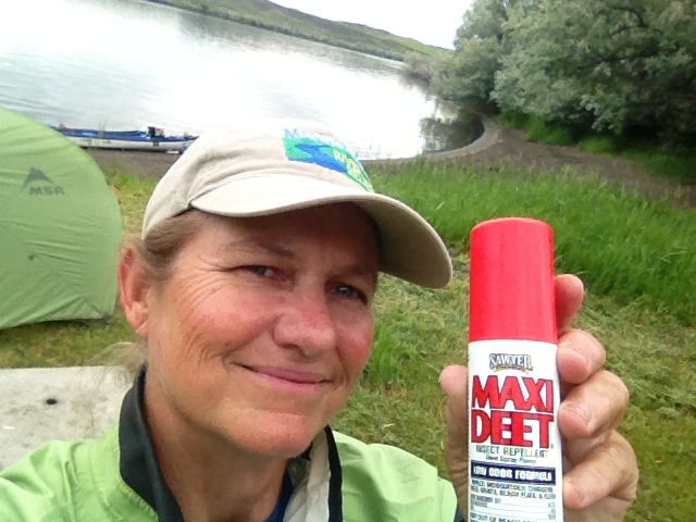
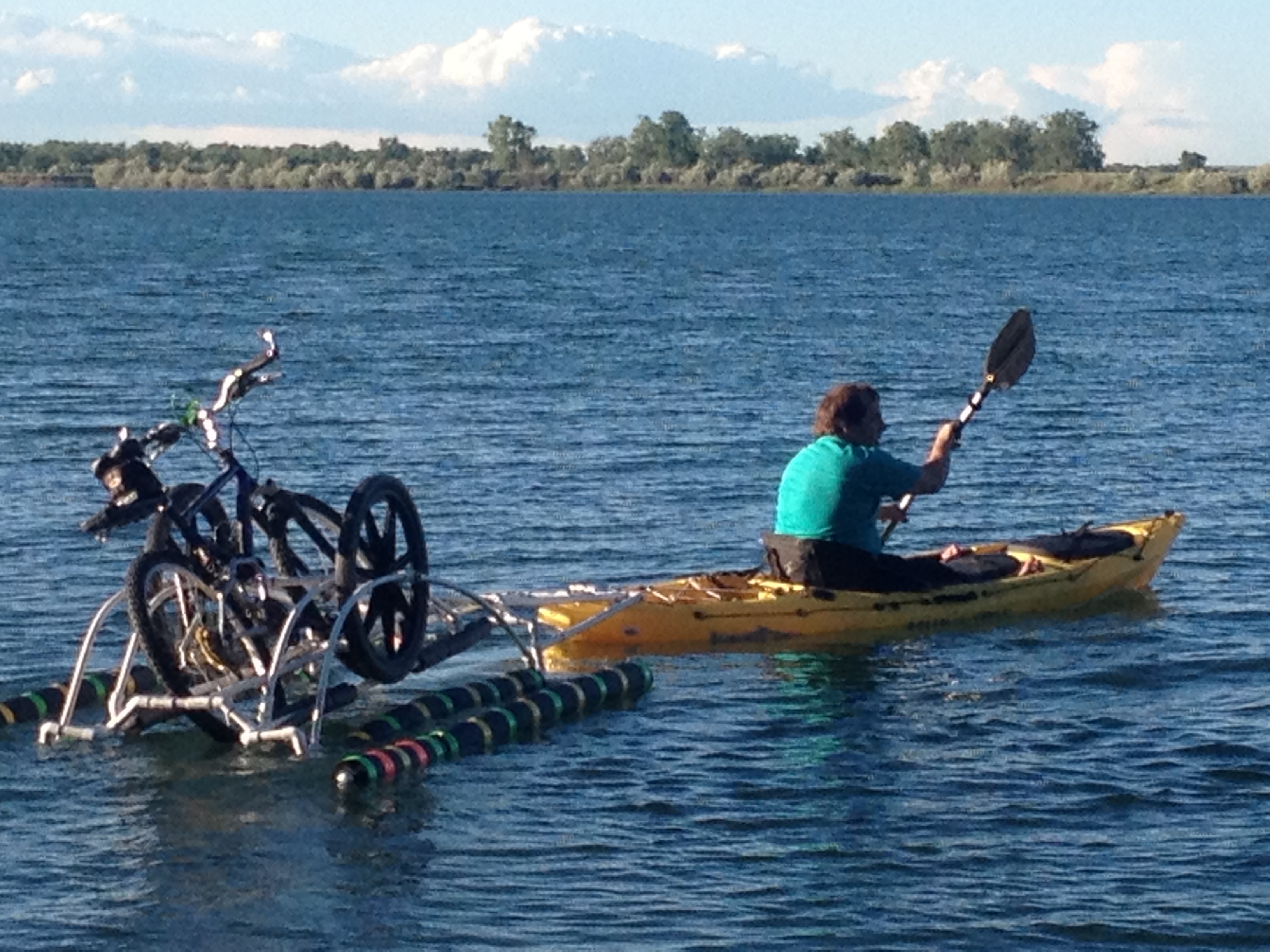
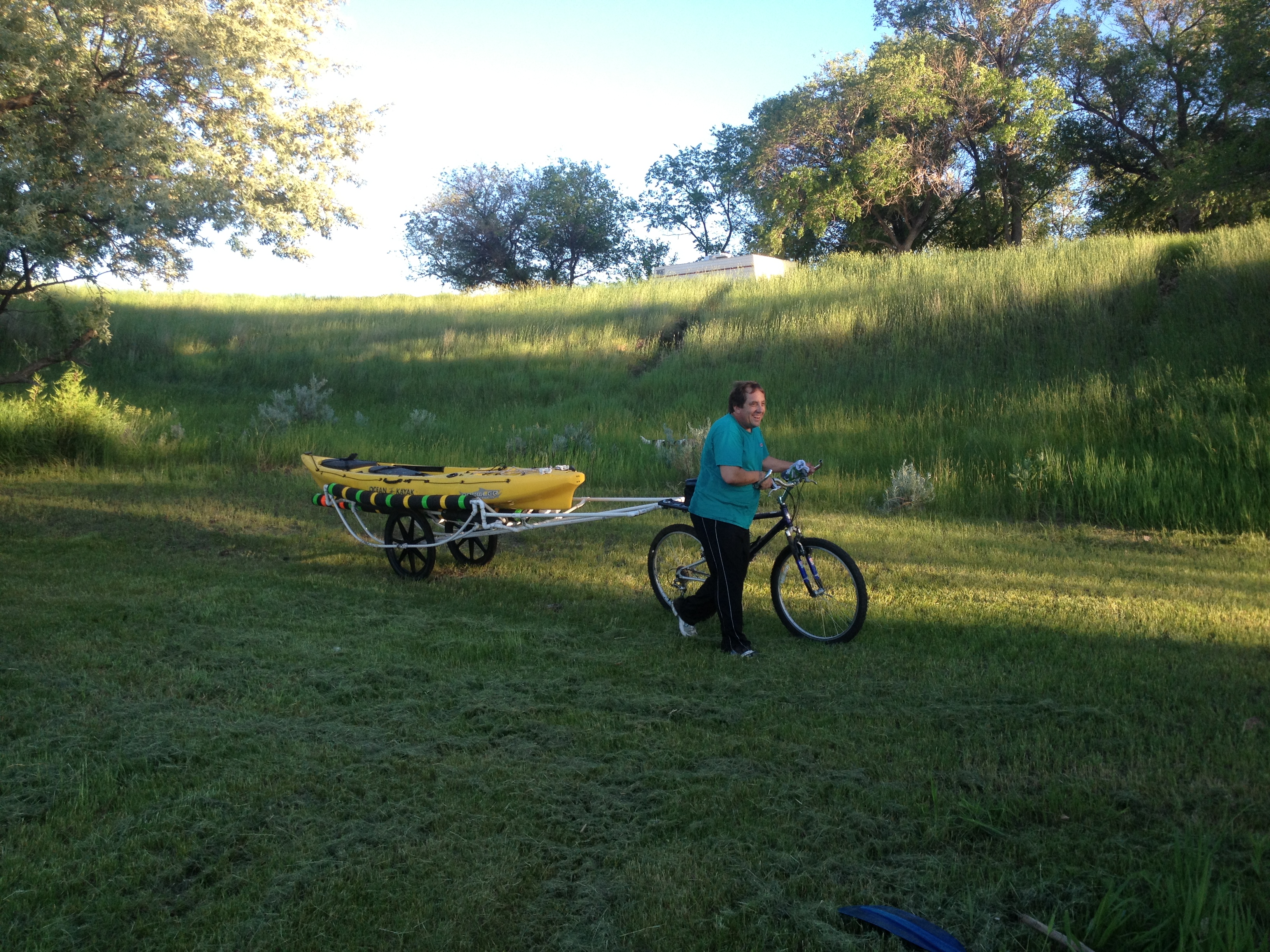
We arrived at the campground below the dam around 6:00 PM on Thursday, June 20. I planned to take off on the river early the next morning. I was getting very excited in anticipation. The thrill of adventure is intoxicating and addicting. But, the mosquitos were sobering and annoying. All part of the total experience. Jack and I sprayed Deet on ourselves and finished our beers sitting on the tailgate of his pickup truck. Hot summer fun! Next thing I knew I was being entertained by a local who had brought his new invention down to the beach to test the waters, so to speak…
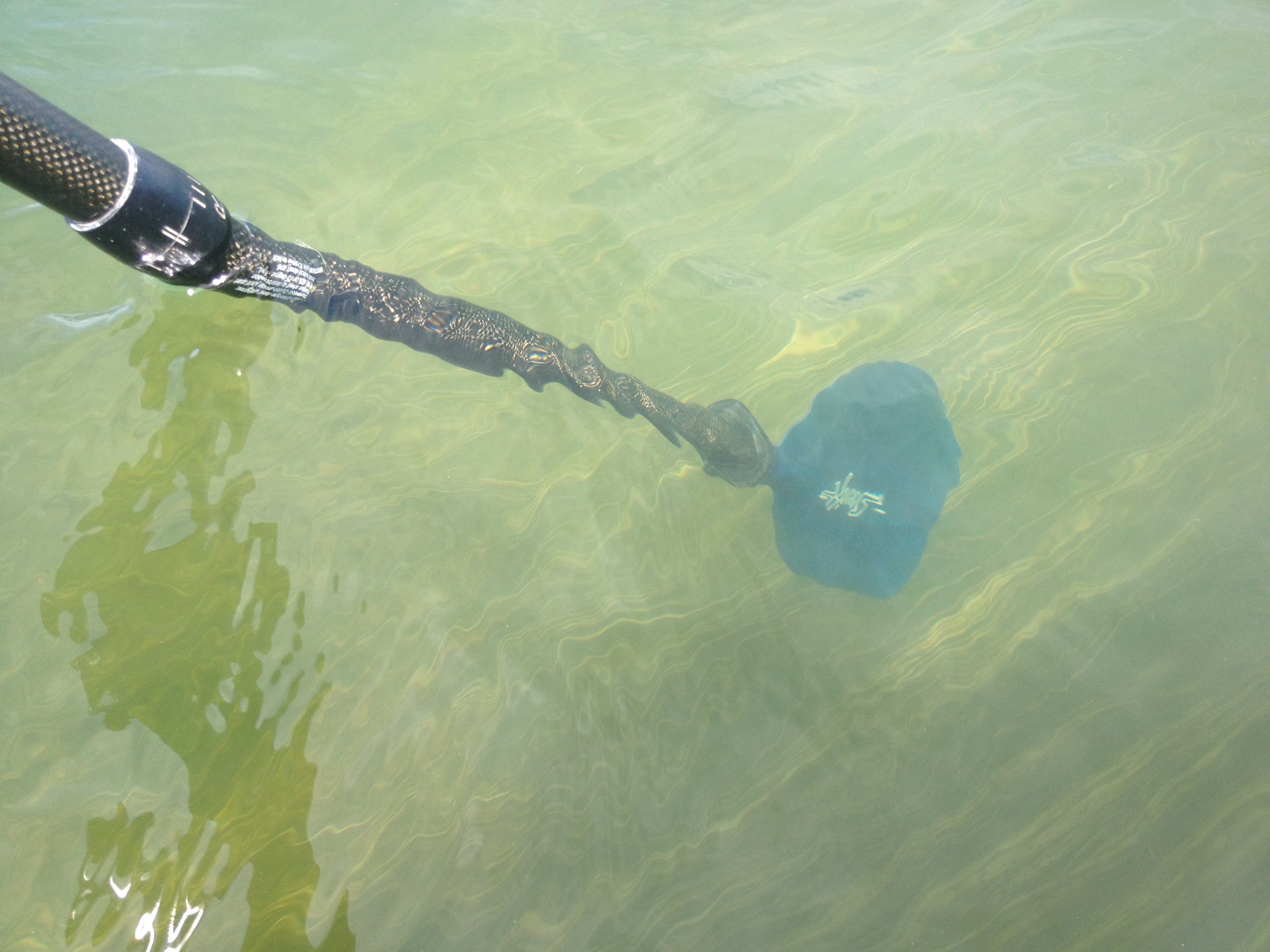
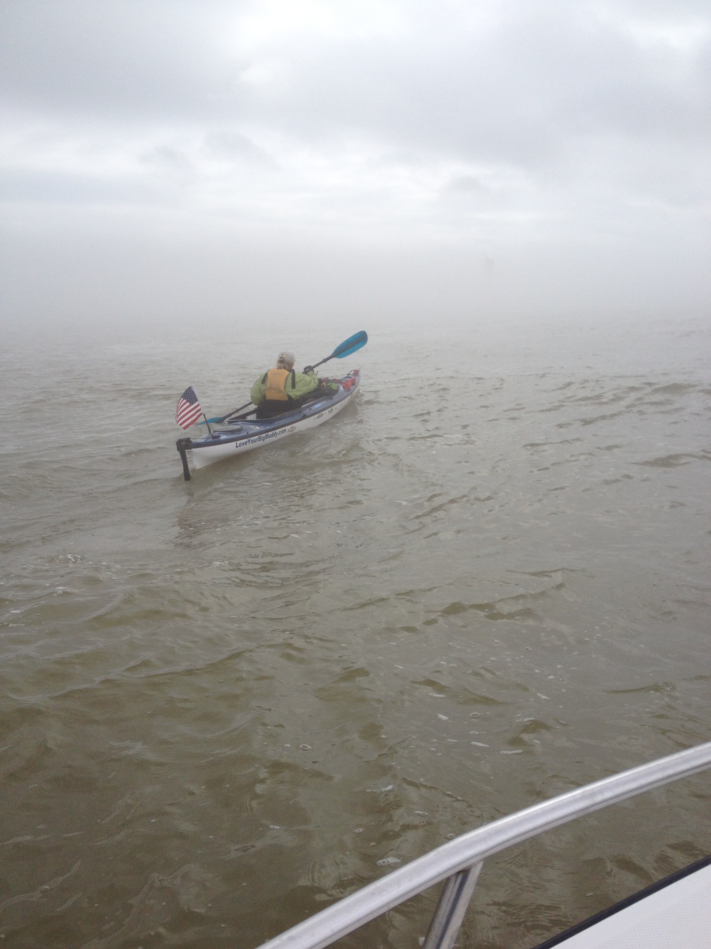
My best friend on the Missouri River. Don’t leave home without it.
Local testing his new invention.
Seemed to work just fine.
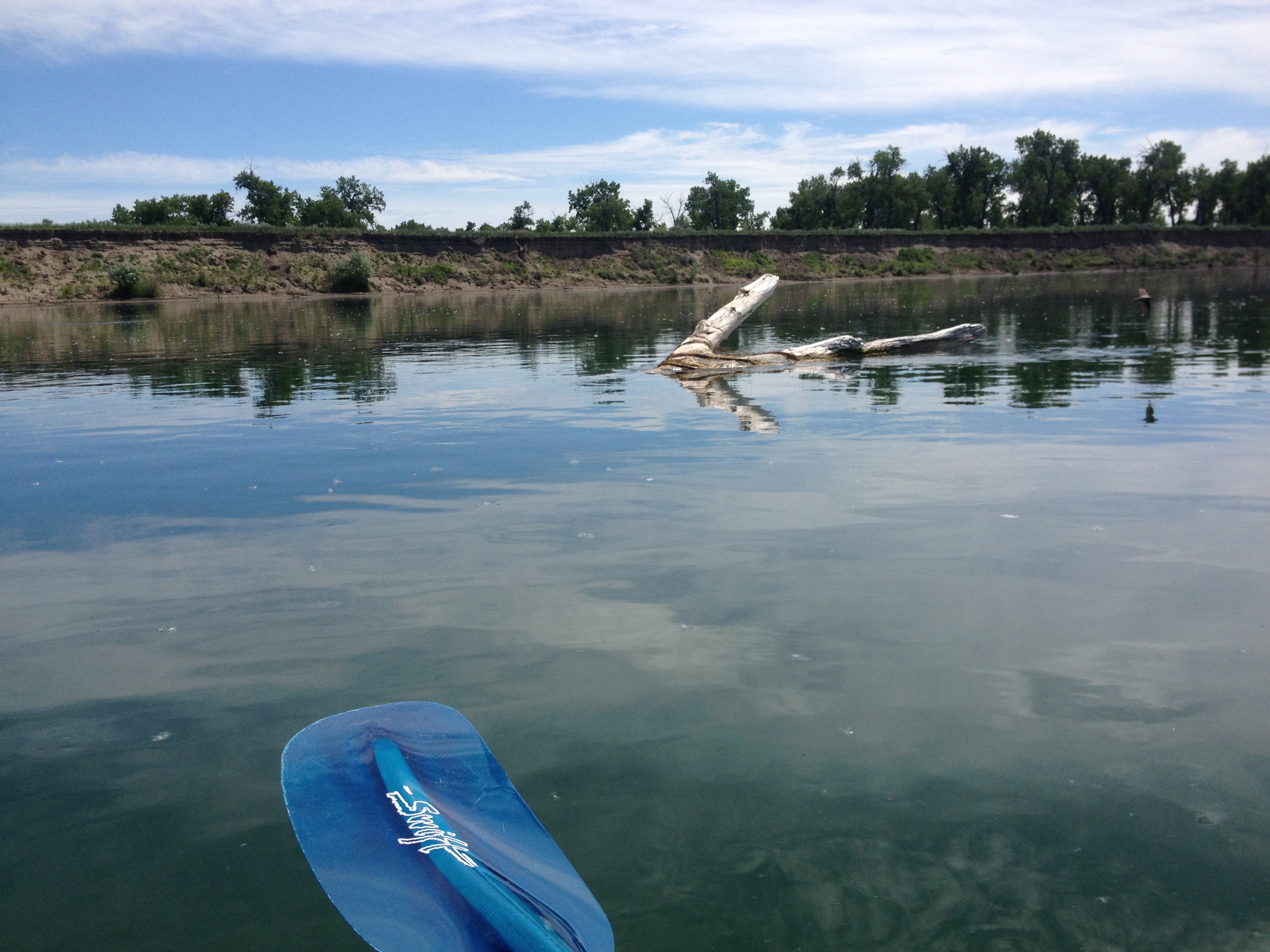
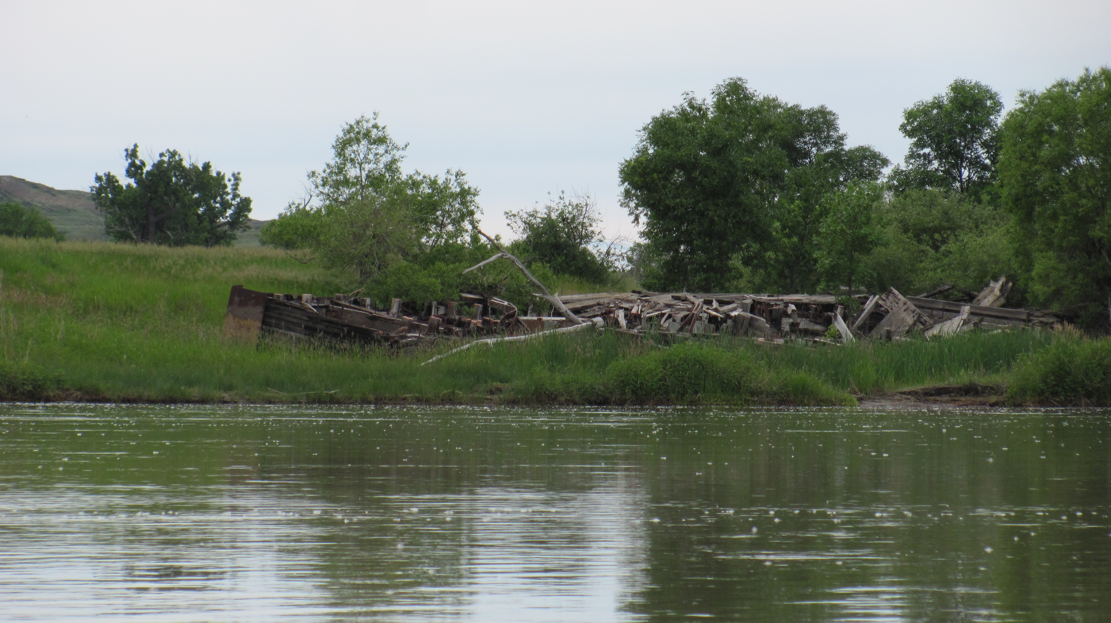
I left about 9:30 in the morning with sunny skies and glassy water, my favorite conditions. From my journal I wrote, “Good paddling today…The first day back on the water it seems like there are soooo many miles you just want to knock some out. Paddled all day. Saw lots of ship sinkers (my name for snags in the river with pointed ends facing down river) and two shipwrecks, one in the river on a sandbar, the other laying on shore…I paddled about 30-35 miles. The current is about 5 mph, so very quick. I found a decent sandy campsite with creamy mud at the shore. I guess that’s because of the Milk River, it is sooo creamy! Marginal cell, but got some postings up.”
I looked forward to passing the Milk River. One reason was because I had heard of the stark contrast in clear water of the MO and the milky water of the Milk. I also looked out for it because my friend, Dominique Liboiron, who had paddled a canoe down from Saskatchewan the summer before, had camped right on the point at the confluence. I remember he told me that he was so intimidated by the Missouri River that he camped for three days at the confluence before paddling on down. Of course, all of his fears disappeared once he started downstream and realized the Missouri River was actually just one big “lazy river.”
I call these snags “shipsinkers.” 300 steamships met their demise because of the damage caused by these snags.
Believed to be the remains of a steamship
Steamship that met its demise
Clear waters before the Milk River
Contrast in water after the Milk River enters the Missouri River
Camp the first night back on the river
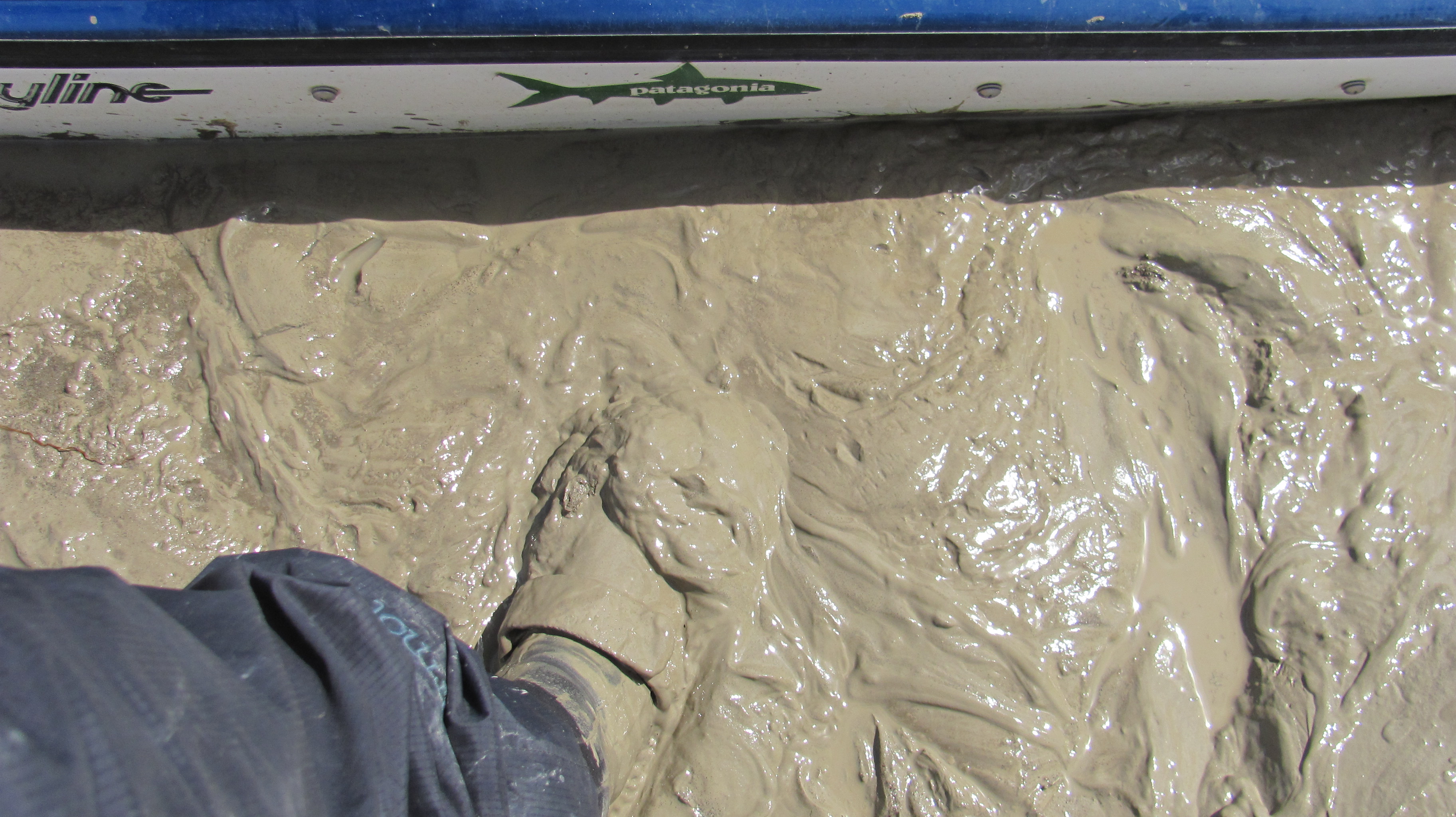
Creamy mud
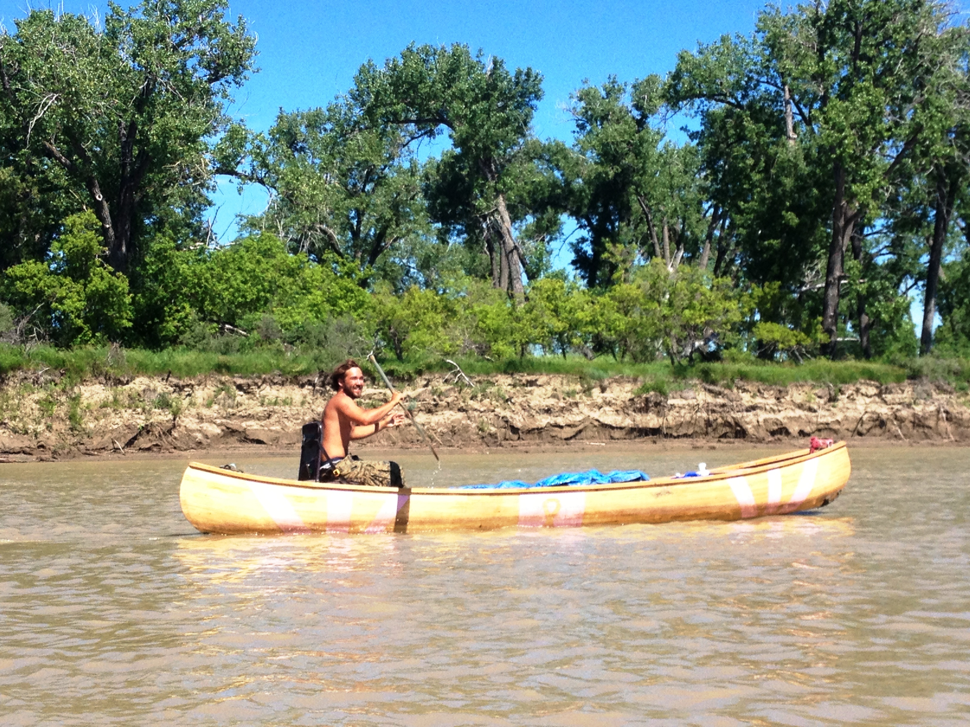
I spent about a week or so paddling the stretch of river between Fort Peck Lake and Lake Sakakawea. I had heard a lot about Wolf Point on the Fort Peck Indian Reservation, and that it was probably not best to stop there. Well, I passed by at 5:00 in the afternoon on Saturday with no real reason to stop. I did not see anyone around, either. Well, I saw one guy. He was in a big beautiful canoe paddling down the river. Wow! Who are you?? I asked , surprised to see another paddler of whom I was totally unaware.
“I’m Shawn Hollingsworth,” he replied.
“Where are you from, paddling from, and to where are you paddling?” I asked, standard questions asked of any paddler you meet on the river.
“I am from Virginia Beach, VA, I started at Three Forks, and I am paddling to the Gulf of Mexico.”
“Wow, all by yourself in that big canoe?”
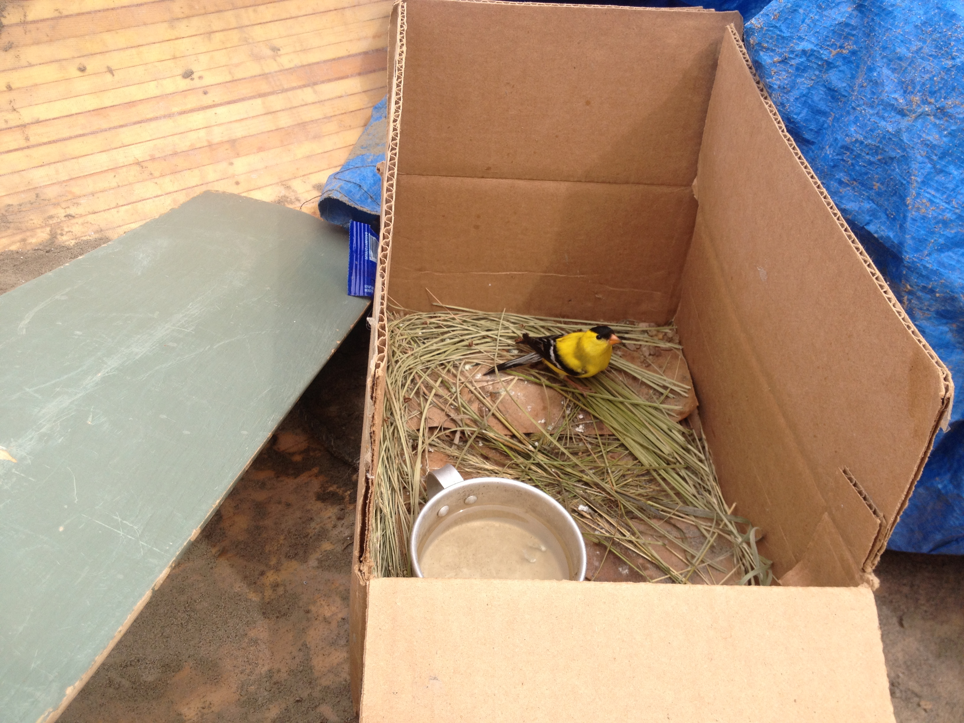
“No, I’ve got a travelling companion.” He then told me about his little bird in a box inside his canoe. He picked up the injured bird while walking down the street in Fort Peck. “He has an injured wing, and his name is Bob (Bird On a Boat).”
He asked me if I was a school teacher. “Actually, I am. Umm, how did you know?”
“Ya, my mom is following you on Facebook.”
“Really? That is too funny!”
This was the beginning of a real sweet friendship. Shawn and I paddled off and on for the next week, until we were both situated on windy Lake Sakakawea. I remember Shawn telling me that Bob finally flew off when Shawn was behind me, paddling through the river-to-lake transition onto Lake Sakakawea on June 28. Most days we did not paddle much together since he was slower in the canoe, but he always seemed to make it to my camp in the evening, much to my delight. He was such good company and, at 23 years old, was on the adventure of his life.
Shawn Hollingsworth in his self-made canoe. Shawn was raising awareness for breast cancer.Bob
I loved spending time with Shawn. I was so proud of him embarking on this adventure alone after his two buddies left him. One left him two weeks before leaving Virginia Beach, the other left him after a harrowing crossing of Fort Peck Lake. Shawn had never paddled before and now was left to skipper a three-man canoe, which he made all by himself. Plus, he was raising awareness for breast cancer.
The Pink Canoe
I was happy to share with him some tips on reading the river and waiting patiently during high winds, the latter of which guys find most challenging. Paddling in extremely high winds on Fort Peck Lake nearly killed Shawn and his paddling partner. They ended up getting towed off the lake and his partner decided to call it quits. Another paddler had swamped a couple of weeks earlier in big swell generated by high winds. He lost his tent, sleeping bag, cell phone, and his adventurous spirit. He nearly died from hypothermia, and ended up leaving his partner as well. Waiting through big wind sessions on these big lakes is all part of the game. Impatience must be replaced with going for a walk, reading a good book, exploring the beaches and hills, or whatever else one does to entertain themselves. It is a matter of life and death on these big lakes.
Fort Peck Lake-Hiking the hills was a good way to wait out the wind.Fort Peck Lake-Patience is a virtue, difficult to master at times, but necessary. Great hiking areas help.
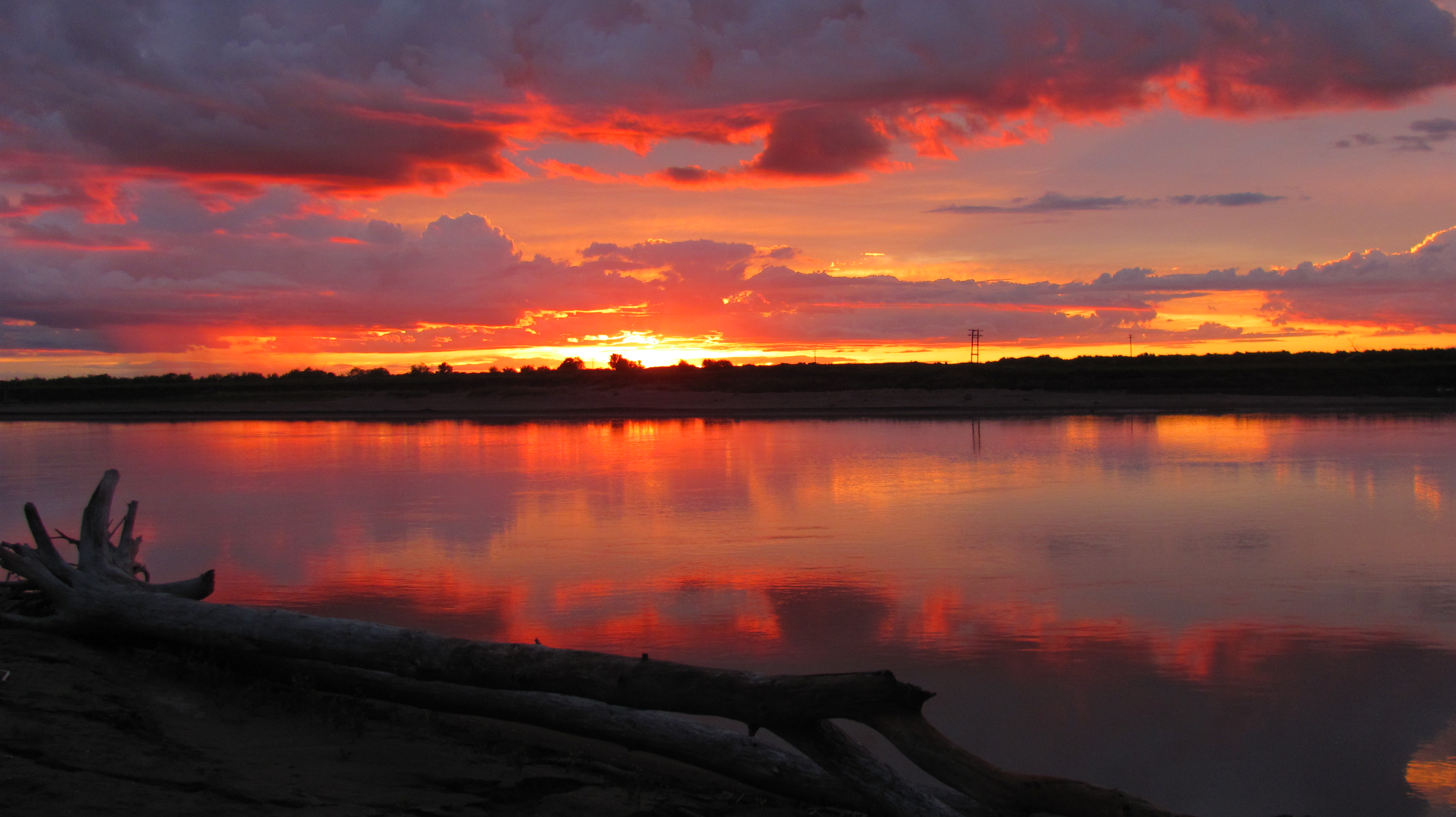
On my second night of camping back on the river I saw the most exquisite sunset I had ever seen. I almost missed it while putting up my tent and battling the mosquitoes. I think this is the worst mosquito deluge of the whole trip. Thank God for my 98% Deet. And, for the stunning sunset that night. I think this photo generated more hits on Facebook than any other during my whole trip. Well, except for the skeleton plastered up against the snags on the Beaverhead River. That was a good one, too.
This photo, along with the sunset pic below, were the most popular expedition posts. Taken on the Beaverhead River, Day 1 on the water.
Sunset near Frazier, MT
Here is a little video I shot just prior to taking this photo. After the little video, I began setting up my tent and packing everything in it. I just happened to turn around and noticed the sunset was in full swing. I grabbed my camera right away and got several good shots. I was stunned at the magnitude of colors displayed.
I made it to the Highway 16-Culbertson Bridge on June 24th. Situated just past the reservation, I decided to camp here after some locals said they thought it would be safe. Not long after I landed I met Glenn Stewart, who hollered down from atop the bridge. He was working on the road crew and, after talking to him, he immediately became interested in my journey. If you need to go into town and have breakfast or go to the grocery store, we’ll be here tomorrow and you can just take my car into town. Wow! A true river angel with a generous heart to help. Thanks, Glenn! Glenn and his son, Kelly, and his wife ended up following the rest of my trip on Facebook. Shawn showed up the next morning when I was getting ready to leave. Glenn offered him his car and he was able to make it into town, too. Shawn wanted to stay here and rest up. I did not know when I would see him again.
Highway 16 Culbertson Bridge campKelly (left), Glenn and fellow road crew coworker. Good people!
Beautiful terrain around Culbertson, MT
I ended up going into town the next morning after a pretty good storm hit. Some kids came down to the bridge that night and played some decent country music and lit off fireworks. I almost got up to join them, but didn’t want to spoil their summertime river experience. I’m old, you know…LoL! It’s what memories are made of, right? I slept good after they left, woke up with sand in my tent, but forgot about any discomforts as I ate my ham and eggs breakfast at the Wild West Diner in town.
The day was cloudy and a bit windy from the west, which is not too bad. Once paddling, I got out my iPod and listened to music, which is so much fun, but I hesitated to do it too often. As I wrote in my journal, “I listened to more music, just for a little while. I don’t want to get lulled into complacency while on the water, too dangerous.”
I loved singing along to river songs while on the river. Too fun!Crocodile, hippo or snag?
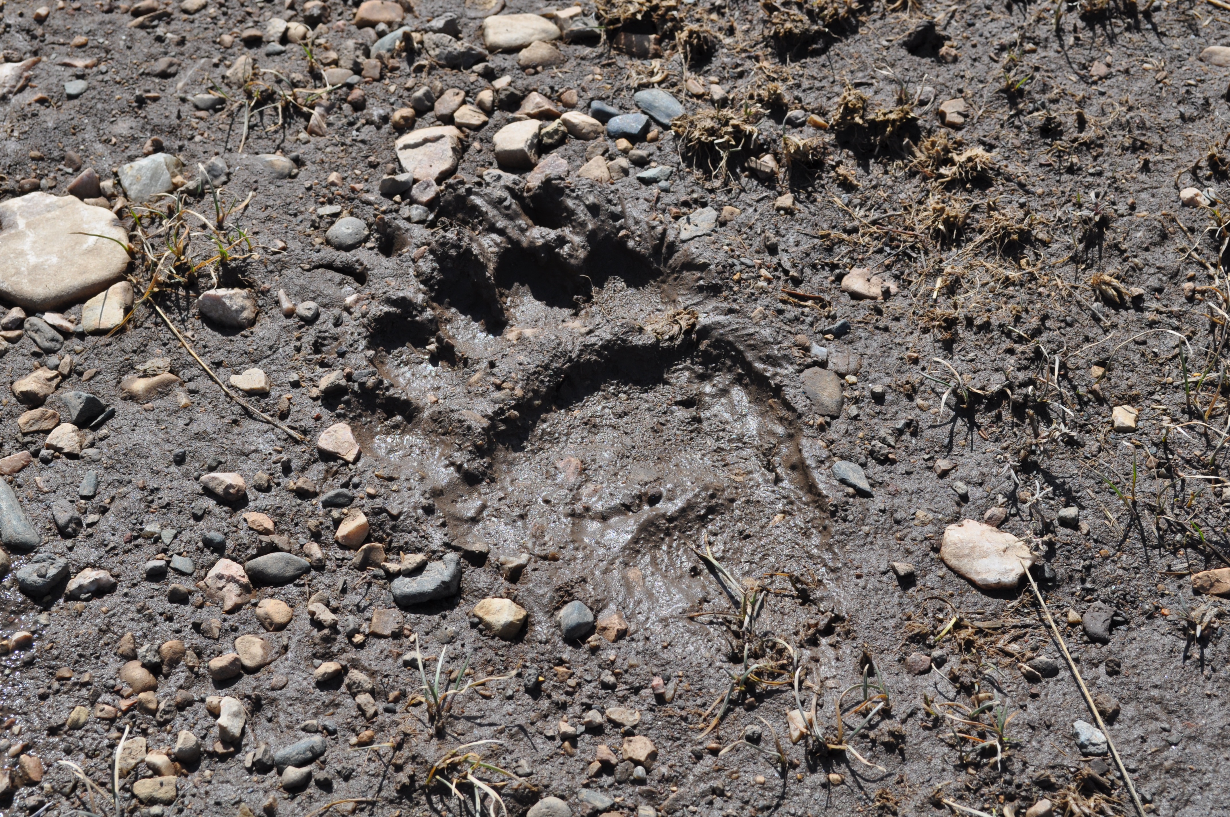
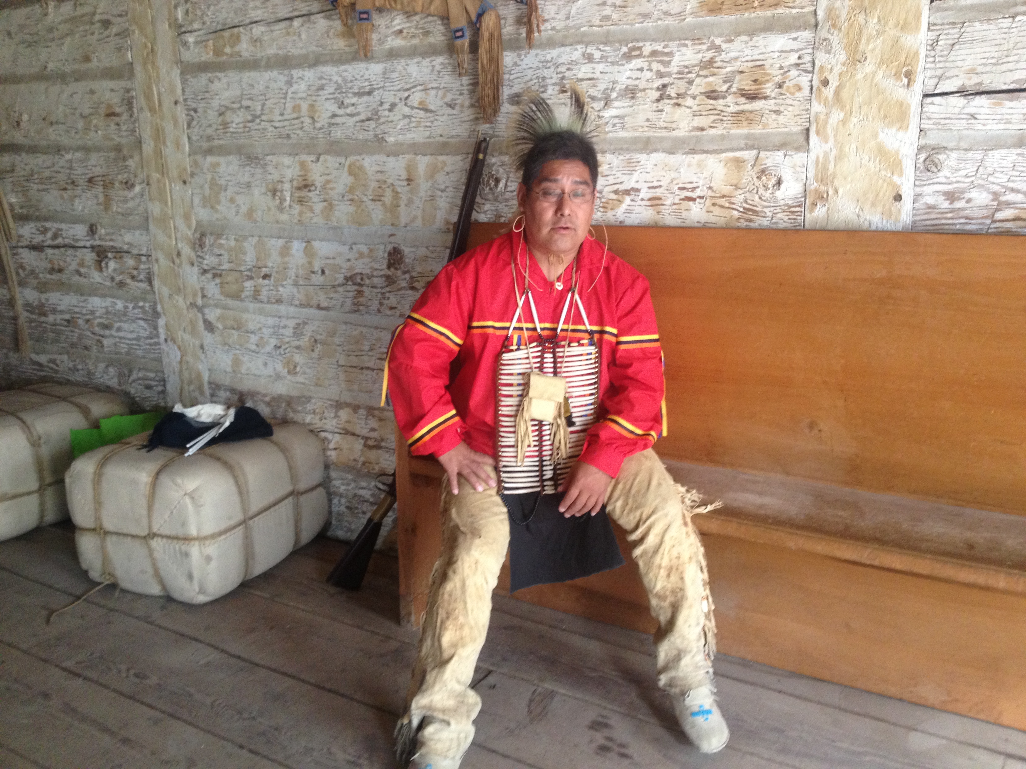
I camped just a few hundred yards from the Montana/North Dakota border. Also situated at this location is Fort Union. Norm Miller encouraged me to bushwack into the fort, which I did, and had the pleasure of meeting Yellow Bird, an Arikara Native American working at the Fort. I spent an hour or two visiting with him. I enjoyed immersing myself in the history that surrounds this mighty Missouri River.
Yellow Bird of the Arikara Tribe. Yellow Bird holds two college degrees and is the father of five.
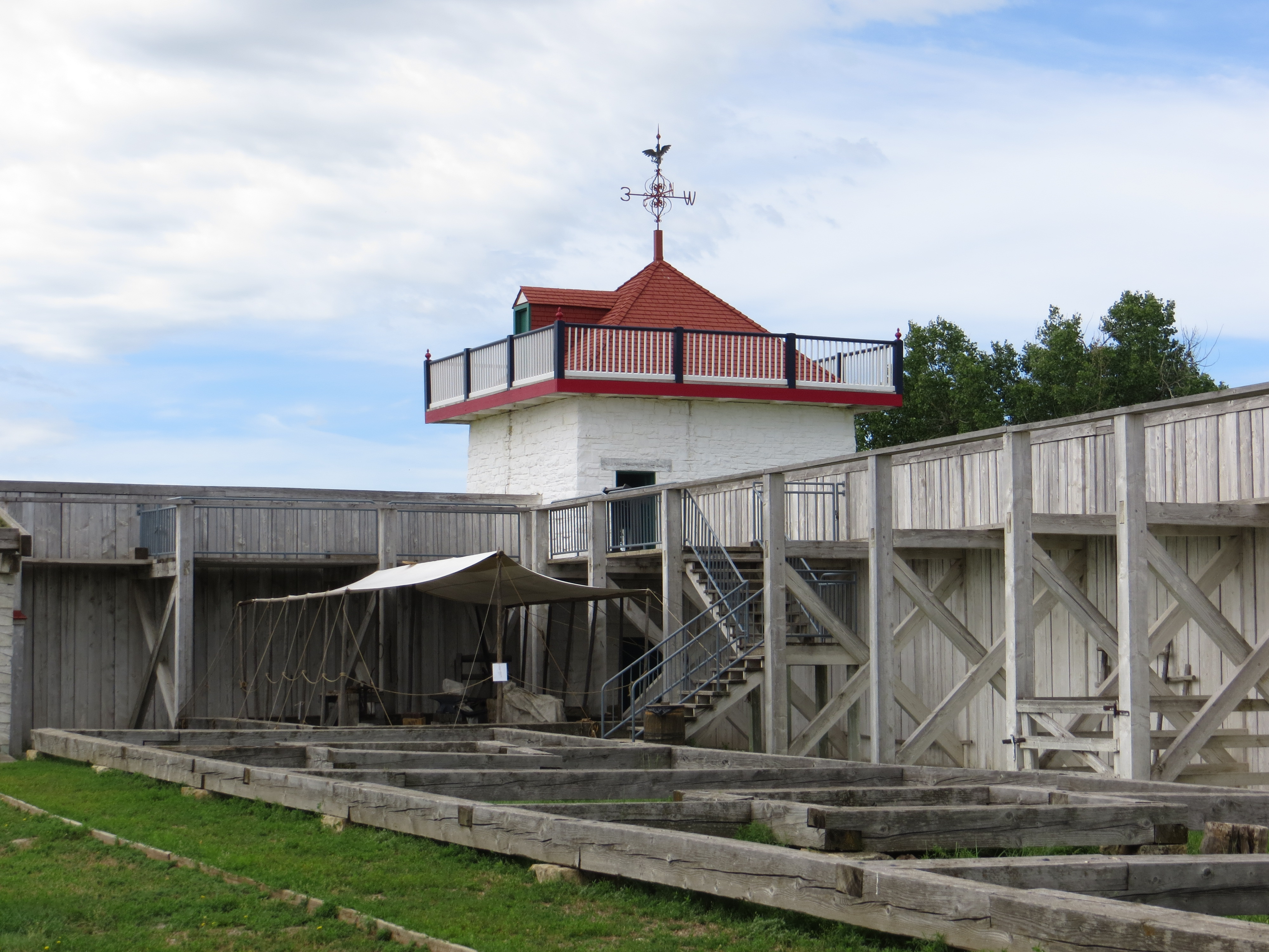
“The Grandest Fort on the Upper Missouri River
Between 1828 and 1867, Fort Union was the most important fur trade post on the Upper Missouri River. Here, the Assiniboine and six other Northern Plains Indian Tribes exchanged buffalo robes and smaller furs for goods from around the world, including cloth, guns, blankets, and beads. A bastion of peaceful coexistence, the post annually traded over 25,000 buffalo robes and $100,000 in merchandise.” -http://www.nps.gov/fous/index.htm
Fort Union looking easily accessible. It is an illusion. You cannot see the muddy water-swamped mosquito-infested slog that you will encounter if you start walking toward the fort. Poor Shawn. He was not a happy camper.
Norm had sent me aerial photos so I could find the easiest access to the Fort. After two attempts, I followed the deer trail up to the outskirts of the Fort property. Some water but not bad with boots. This was 1/4 mile up river from the other photo.
Approaching Fort UnionA look from the inside
An artist’s rendition during the Fort’s hay day
An underground resident enjoying the safety of a gated community. Watch out, or someone might get your hide!
The confluence of the Yellowstone River is just a short paddle away. The staff at the Fort Buford Interpretive Center, located there, were kind enough to buy my camp site for me. I will continue my next blog post at the confluence. I will then be just a couple of days away from starting my trek across Lake Sakakawea. Shawn and I will meet up for the next few days, but then we begin our own journeys down the Mighty Missouri River. Sad parting with him, but not without a promise to reunite and share stories someday.
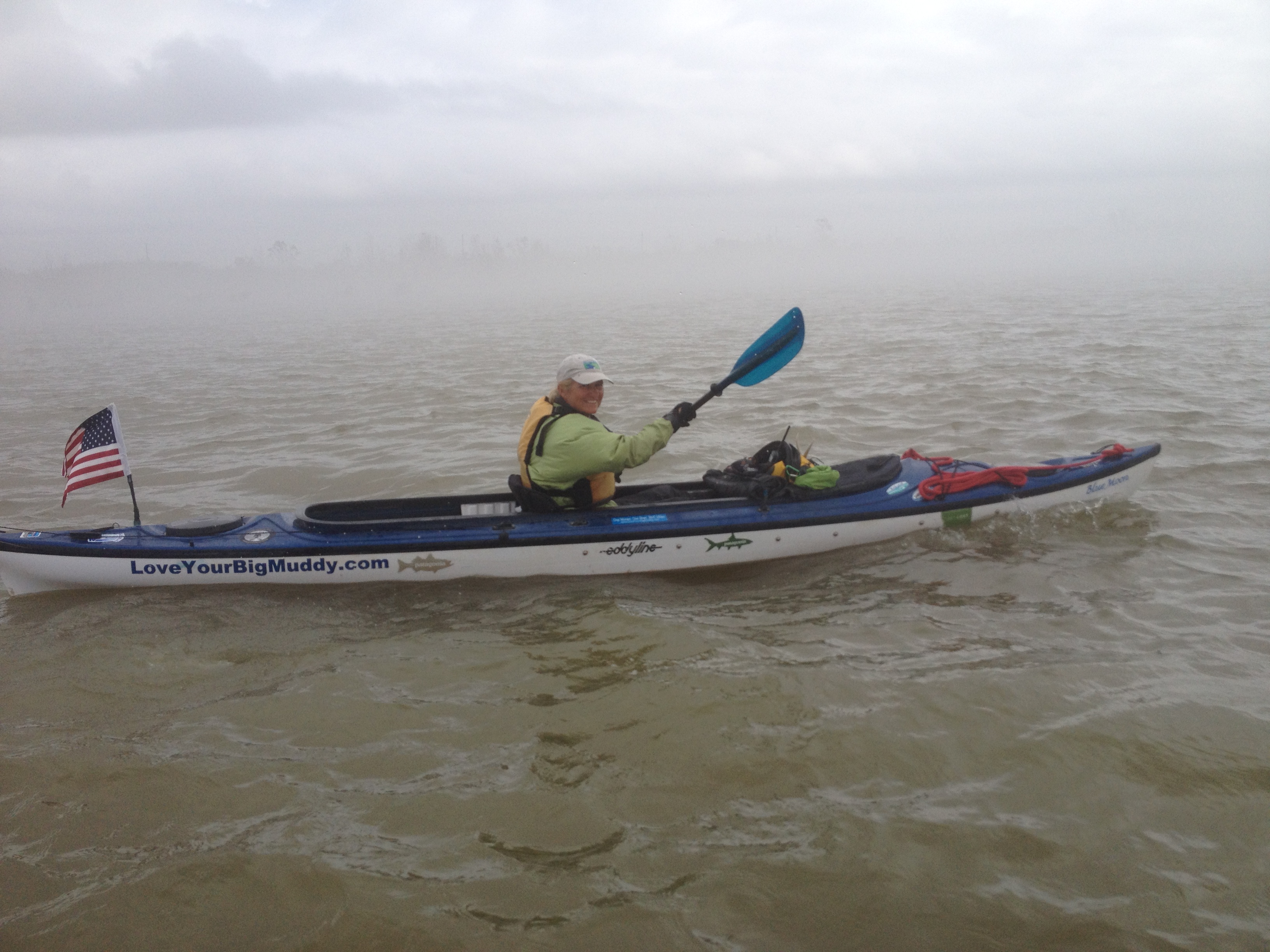
I finally did it! I made it all the way to the Gulf if Mexico, but not without some very harrowing and tense moments in the Southern Louisiana fog. Fog? Who knew? That was an oversight on my part. Forgot about the fog.
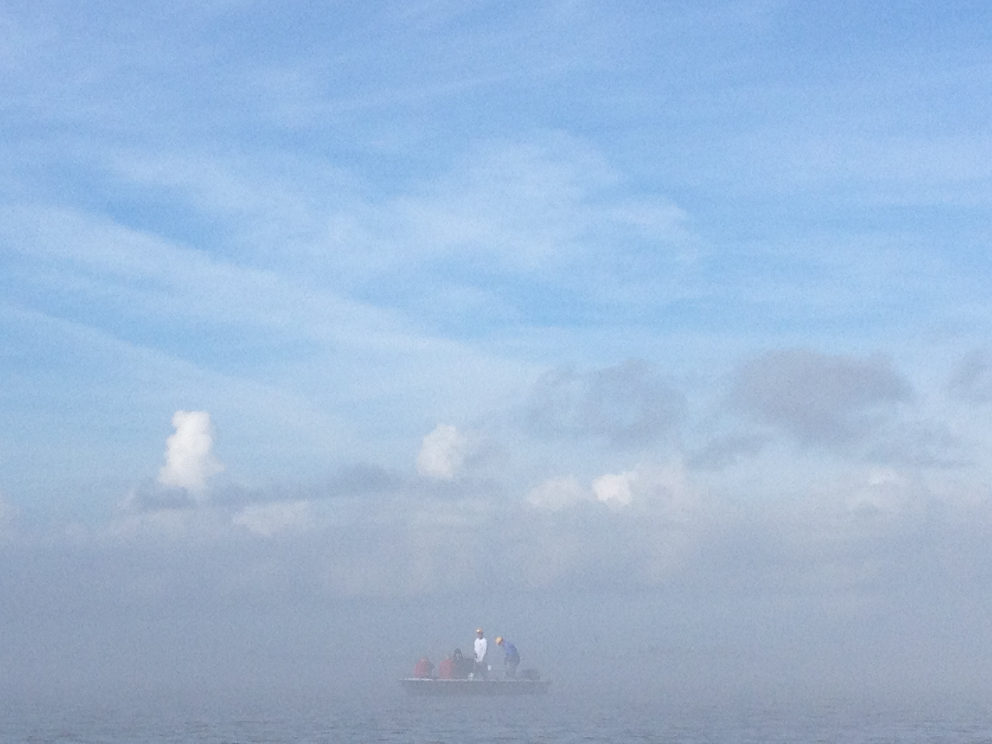
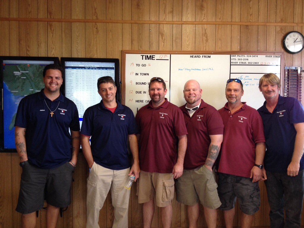
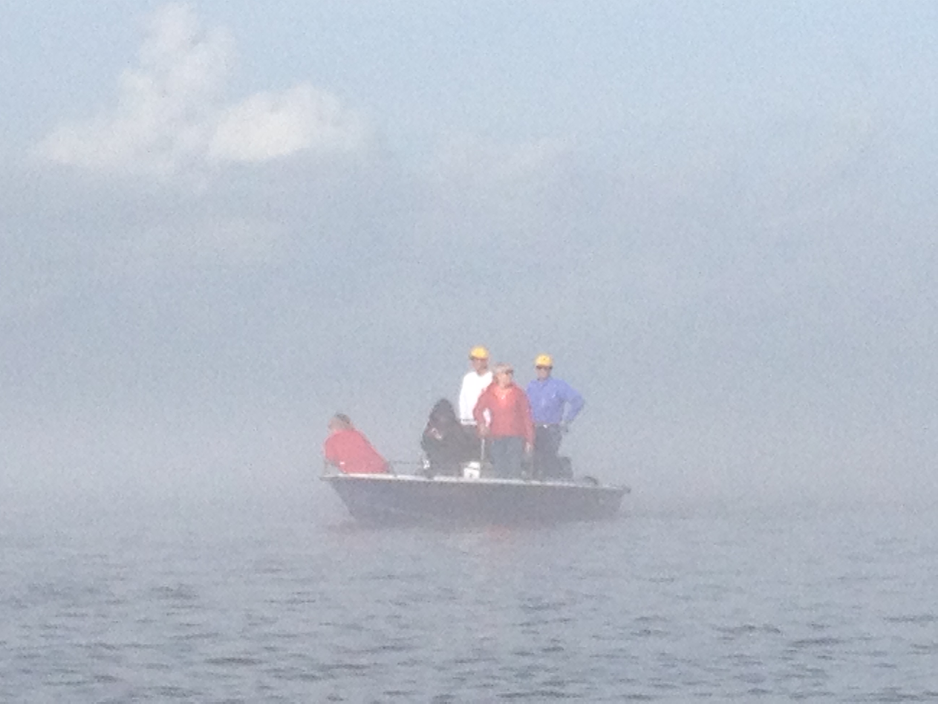
This is my amazing support crew that helped get me through the fog, through the Head of Passes, down South Pass to the Gulf, and back to Venice in a thick fog bank. What an epic finish to an unforgettable journey. Big THANKS to my support crew, the Bar Pilots and their crews in Venice and Pilottown, and to all of my supporters who cheered me on every single day!
My unforgettable crew and dear friends and daughter:
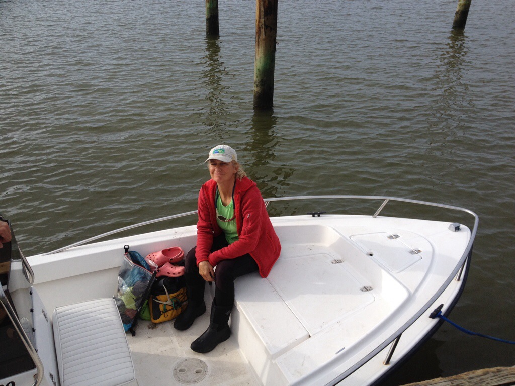
L-R: Mark Dierking, Denise Goforth, Mwah, Jamie Stevenson, Haley Moreland (my sweet daughter), and Deb Miller. Extraordinary!!
And the stellar crew at Pilottown:
Pilottown Crew to the rescue! L-R: Josh, Eric, Adam, Booher, Leon and Shawn. What a comfort these guys were after being in a very uncomfortable fog. Thank you, gentlemen! You are the best!
Pilots at Venice Bar Pilot’s Association:
Bear (R) and Allen (L)
Our first attempt to make it to the Gulf was on December 4. We were doing pretty good on the East shore, although the fog was lingering on that side. By the time we passed Pilottown in the fog, we were engulfed. At one point we all heard a boat coming right toward us. I was out of the channel, and so was my support boat, but I didn’t know it. They were in only three feet of water. Hearing the boat coming closer and closer, but not seeing it, I was terrified they would be run down by a big fishing boat. I screamed at them to turn around. They appeared to be frozen staring into the fog. Oh. My. God. Will I witness their demise???? Thankfully, no. After the boat passed us by, we all knew we were finished for now. I got on the phone to Pilottown and asked them if we could come ashore.
“Of course, we will be expecting you,” they replied.
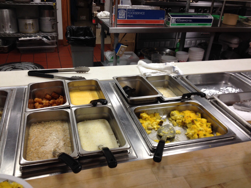
When we arrived 15 minutes later, they immediately took us under their wing, brought us inside, fed us from a smorgasborg outlay of food, shared their ‘mission control,’ and educated us on their system for bringing big ships up from the Gulf to New Orleans. Most importantly, they explained the Fog Predictor, which indicated a lift in the fog at 9:00AM until midnight tomorrow, December 5. We set our goal to the Gulf for tomorrow. They invited to breakfast, too. So nice and comforting, these river angels.
The Pilottown crew directed us to the back room where we feasted. From sadness to gladness, comfort on many levels.The fog predictor. The gap in the red and green lines on the top indicates our window to shoot the pass and get back home. I tell ya, adventure in its purest form.
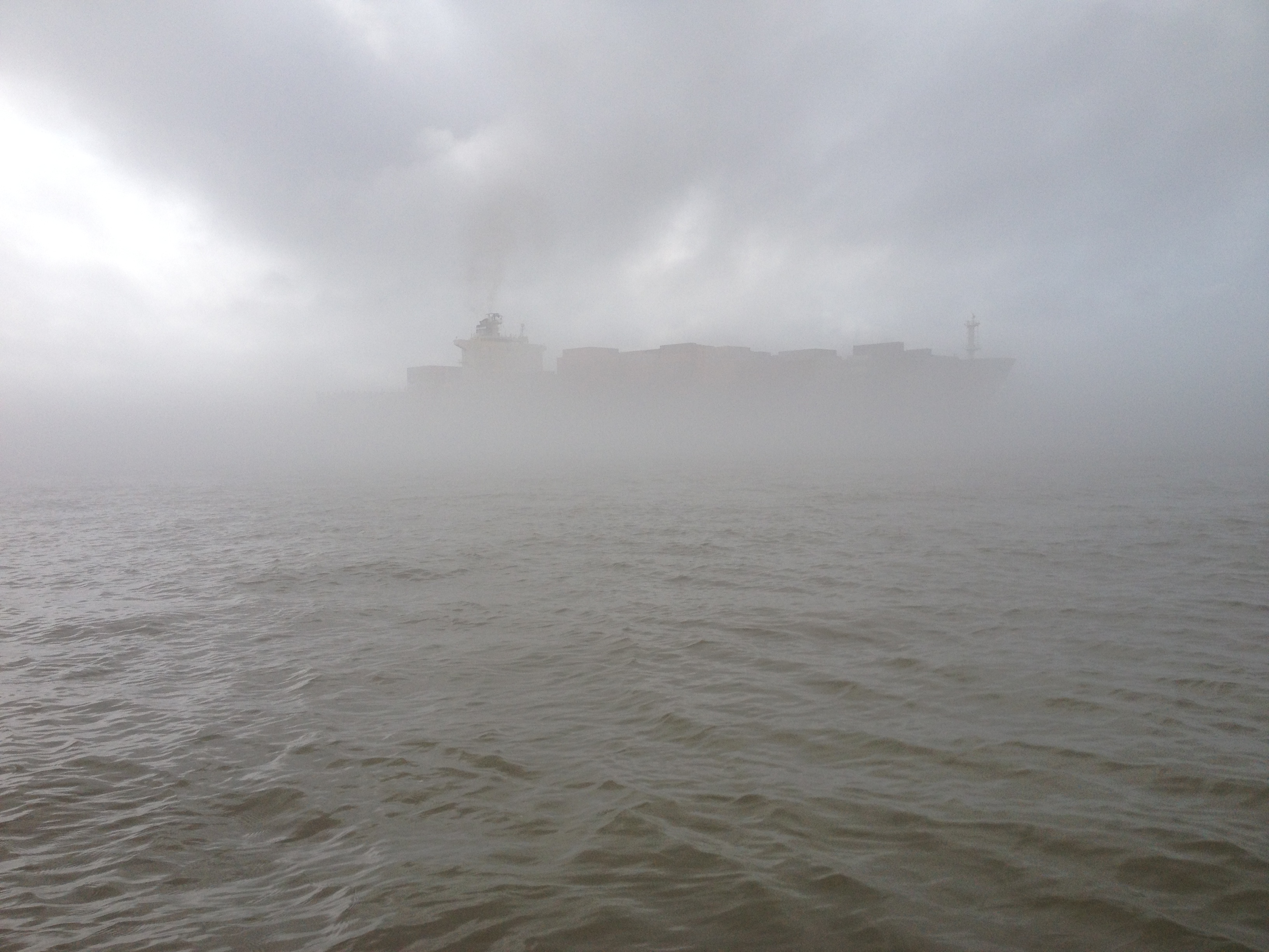
As you can imagine, I was VERY ready to reach the Gulf of Mexico the next morning.A tiny portion of the breakfast offered to us by the Pilottown crew.The fog was thick the 10 miles from Venice to Pilottown, which is located one mile above Mile Zero. The Gulf of Mexico is 12 miles from Mile Zero down South Pass. South Pass is the route I had chosen to reach the Gulf.
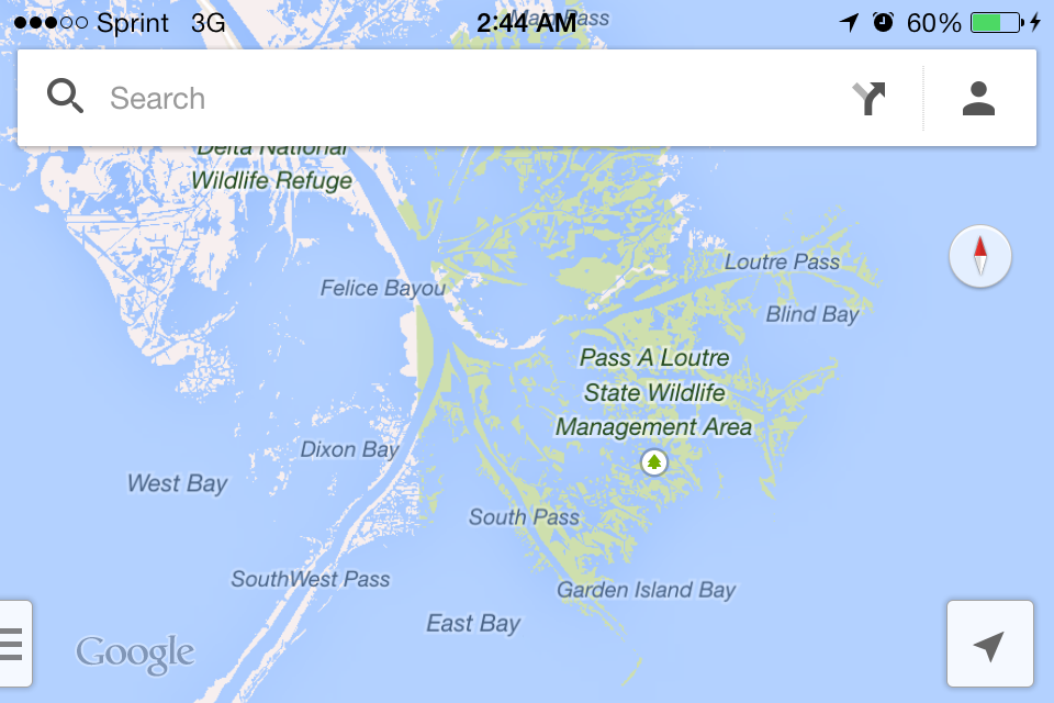
On the final dash to the Gulf, my greatest concern was the fog in the Head of Passes. This is a wide open space from which three branches of channelized water run to the Gulf. The Southwest Pass is the shipping lane for tankers, freighters, and container ships, Loutre Pass is mainly small craft and fishing boats, and South Pass fishing craft. Tankers come up SW Pass and cross through the Head of Passes to the West Bank near Pilottown. As you can imagine, in the fog, this is a dangerous route through which to paddle.
Just prior to leaving Pilottown, three Plaquemines Parish Marine Sheriffs pull up in their boat on their way down to Port Eads, located one mile upriver from the Gulf down South Pass. When I found this out, I somewhat pleaded with them to guide us through the fog through the Head of Passes with their radar. As you can see in this photo, I was gravely concerned. I could not get them to commit, for whatever reason, so we determined to just go for it with the support we had from the Pilottown crew, and the Venice pilots, who drive the ships up the Pass.
I asked them if they would guide us through the Head of Passes with their radar. They could not commit. We had to go ahead on our own.Off we went with great apprehension coupled with extraordinary determination.I took this photo the day before. But, you get the picture. Tense moments to say the least.
The Pilottown crew were phenomenal in communicating our whereabouts to the best of their ability. However, when they began asking the ship pilots if they had seen us, I knew we were on our own, so to speak. We had to navigate wisely through this stretch or catastrophe would be imminent. What we did know from my marine radio, was when a ship was coming up through the fog out of SW Pass, or down into the Head of Passes past Pilottown. Mark used his depth finder to try and avoid the channel, but at some point we had to cross.
Ship coming into view through the fog.
There was a moment when we were immersed in fog and very vulnerable. I began to paddle with my GPS as my guide, which is what the crew told us to do. How scary is that in the fog???? Very! As my heart began to sink further into my gut, I mustered everything I had to keep my composure, as we all were doing at that time. At that very moment, we heard a boat coming right for us. Oh my God! Will it see us in time to stop??? All we can do is wait as it gets closer. Then, appearing as though angels from the spiritual realm, the Sheriff’s boat appears and immediately they begin pointing out the channel light at South Pass.
Marine Sheriffs of Plaquemines Parish. I couldn’t believe my eyes.
Miraculously, the fog began lifting at that moment and we could then see all three passes! What a moment of joy and relief that was, never to be forgotten.
Extreme JOY! I can see all of the Passes!
I paddled harder than I had paddled on the entire journey, the 12-13 miles down South Pass. I took out my iPod and played river songs and sang at the top of my lungs, particularly Black Water by the Doobie Brothers. Playing music always gives me a much-needed boost of energy.
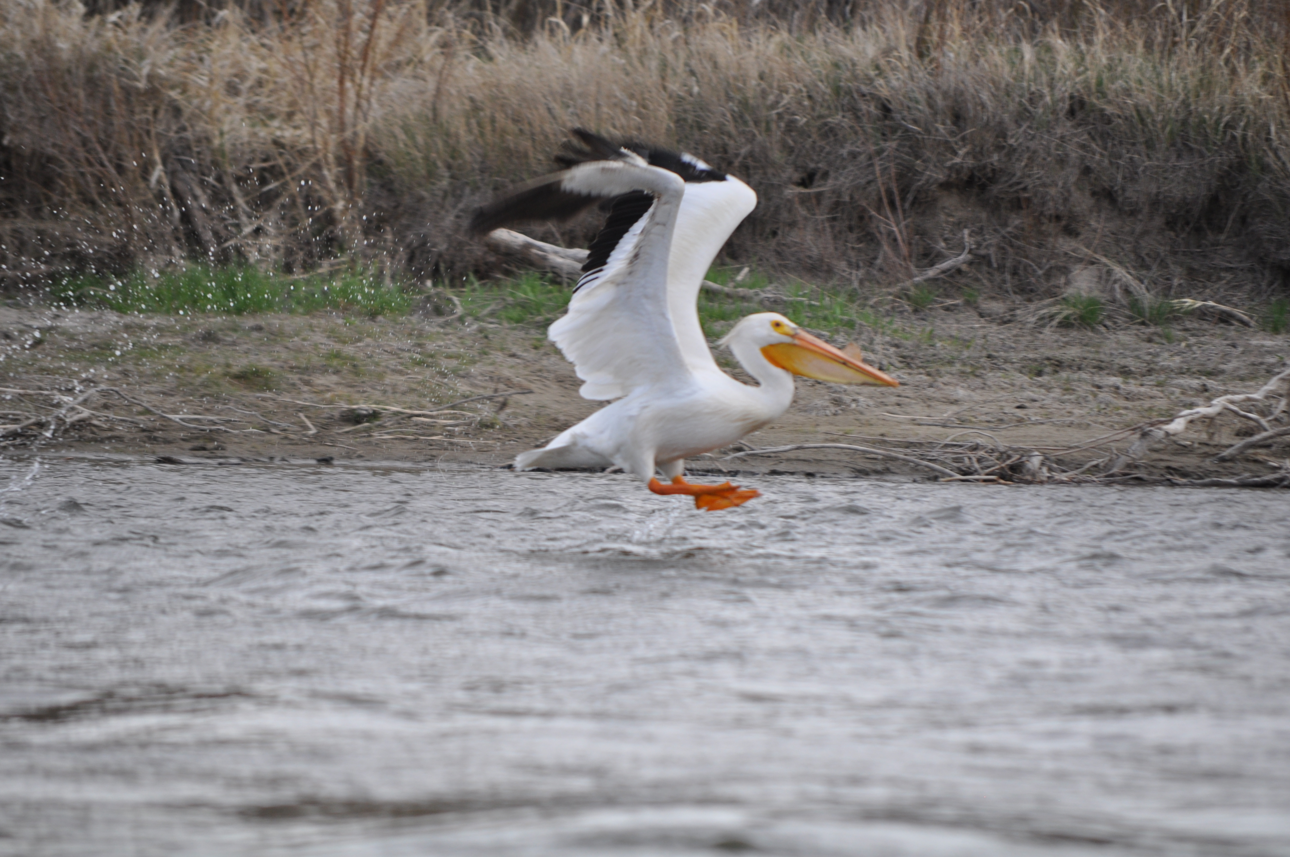
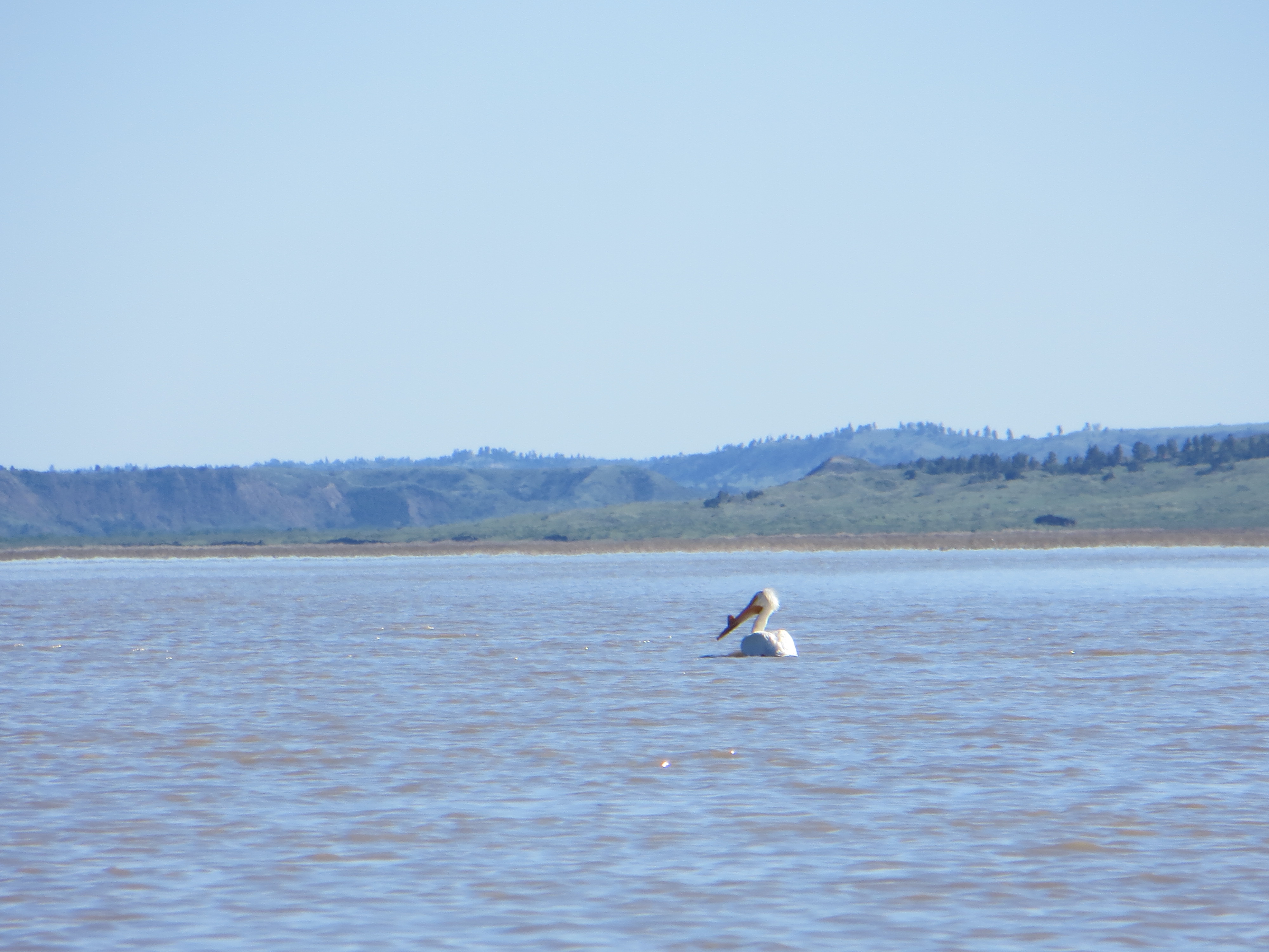
The highlight of my entire trip had to be when I saw my white pelican near the shore in South Pass. I couldn’t believe my eyes! He had come to see me through to the end, and provided that quiet comfort we both understood, that he had provided since day one of my paddling journey. I still shed a tear when I think about how perfect and complete this trip has been.
The perfect good bye and congratulations. I was immersed in joy and supercharged with energy after seeing my pelican friend.
We had a clear shot to the Gulf, and most of the way back up the pass. We were not out of the woods yet. But we had made it to the Gulf of Mexico!
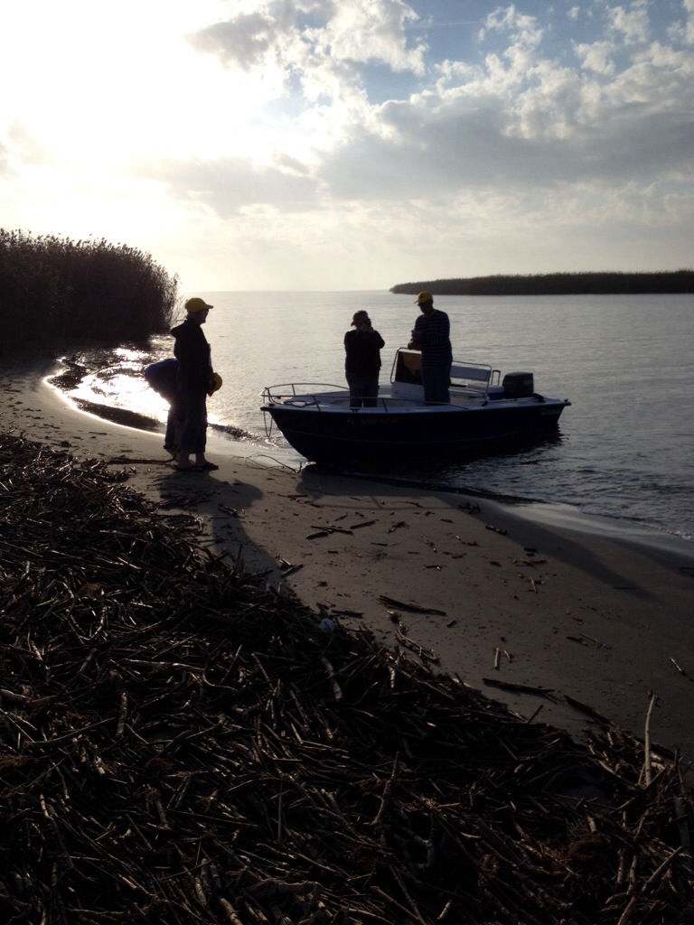
The crew landed before me so they could scope it out and take some photos of my arrival.The Gulf of MexicoWhat a sweet moment of victory, seasoned with a dash of bittersweet. I had run out of river. A new chapter in my life was about to begin. I was thrilled.Champagne, a swim in the water, and a big heartfelt thank you to all of my dear supporters. Then, we were “outta there!”
We made it about 2/3 the way up South Pass when the fog settled in again. We were on a race against time and fog. We absolutely HAD to get back to Venice before dark. We moved as one with eyes and minds on high alert. As you can imagine, the victory was oh so sweet.
We made it back to Venice safe and sound, just in the nick of time. It was dark when we pulled up to the dock.My faithful horse, Blue Moon, an Eddyline Shasta Kayak. What a sweet ride and loyal companion. I love my boat.Thank you, Mark Dierking, for a stellar job piloting the support boat and keeping us all safe and alive. You are the best!Jamie Stevenson, Denise’s boyfriend, was the premium first mate and pillar of strength throughout. LoL! No, really, he was. We all were. (Inside, we were all feeling like he looks.)Haley (L) and Denise (R) We were bonded and quite frankly, family, after these few days together. What an unforgettable experience!Deb, one of my dearest and closest friends. Wow, what a ride, eh girlfriend?! We did it!
Our home away from home in Venice, Louisiana. The Lighthouse Lodge and Villas comped our villa for all but one night, the night that April donated to the expedition. Big thanks to April Durnin for donating to the expedition two free nights of lodging (one night for two rooms) at this fabulous hotel. We could not think of one single complaint. The villa was extraordinarily lovely.
The Lighthouse Lodge and Villas in Venice, LA. We give the villas five bright and golden stars. Loved it!
I will be updating this blog in the days to come. That will help me sort through my photos and videos, and reminisce on the pleasures of this incredible journey. Then, of course, I will write a book, or books. I would like to write a memoir, a curriculum book with lesson plans and activities focused on the rivers and natural environment, and a coffee table book with some of my best photographs. Oh, and T-shirts. I want t-shirts made ASAP. Maybe a calendar right away. So much to do!
I will follow up this post with some videos as soon as possible. Until then, I hope you enjoyed the adventure of my final days. I’ll be back to fill in the gap.
Shouting out a huge THANK YOU to each and every one of you who believed in me, the expedition, and who gave their heart and soul to support the journey. MWAH!! Much love to all, Janet Moreland XOXO
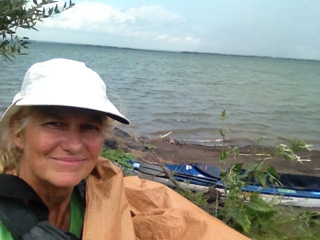
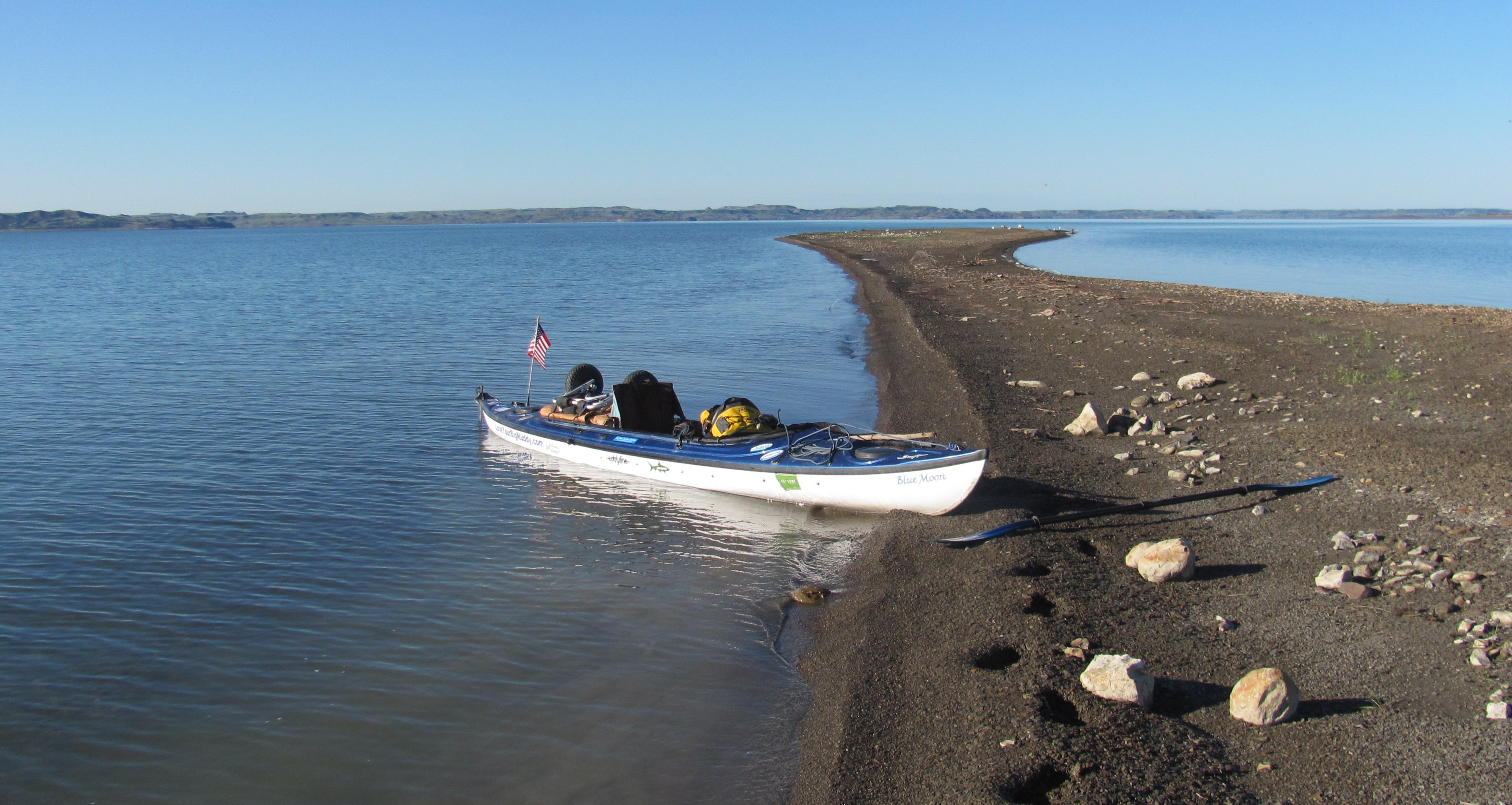
Yep, paddle through to the Gulf. It just makes sense. Photo taken August 21, 2013
Do what you love and love what you do.
Love Your Big Muddy Expedition
3,700 River Miles
April 24, 2013 – December 5, 2013
First American Source-to-Sea Missouri River
First Solo Woman Source-to-Sea Missouri River
The Missouri River is the Longest River in North America
The Missouri/Mississippi River System is the Fourth Longest in the World.
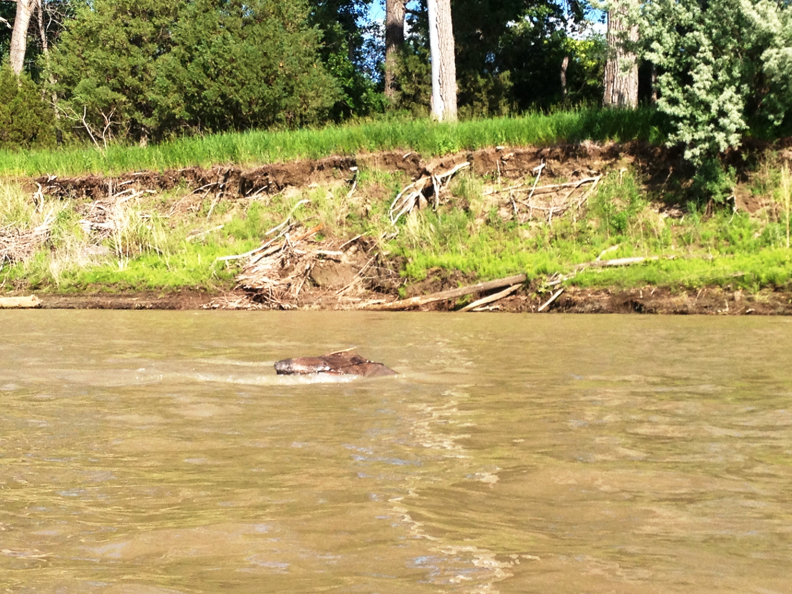
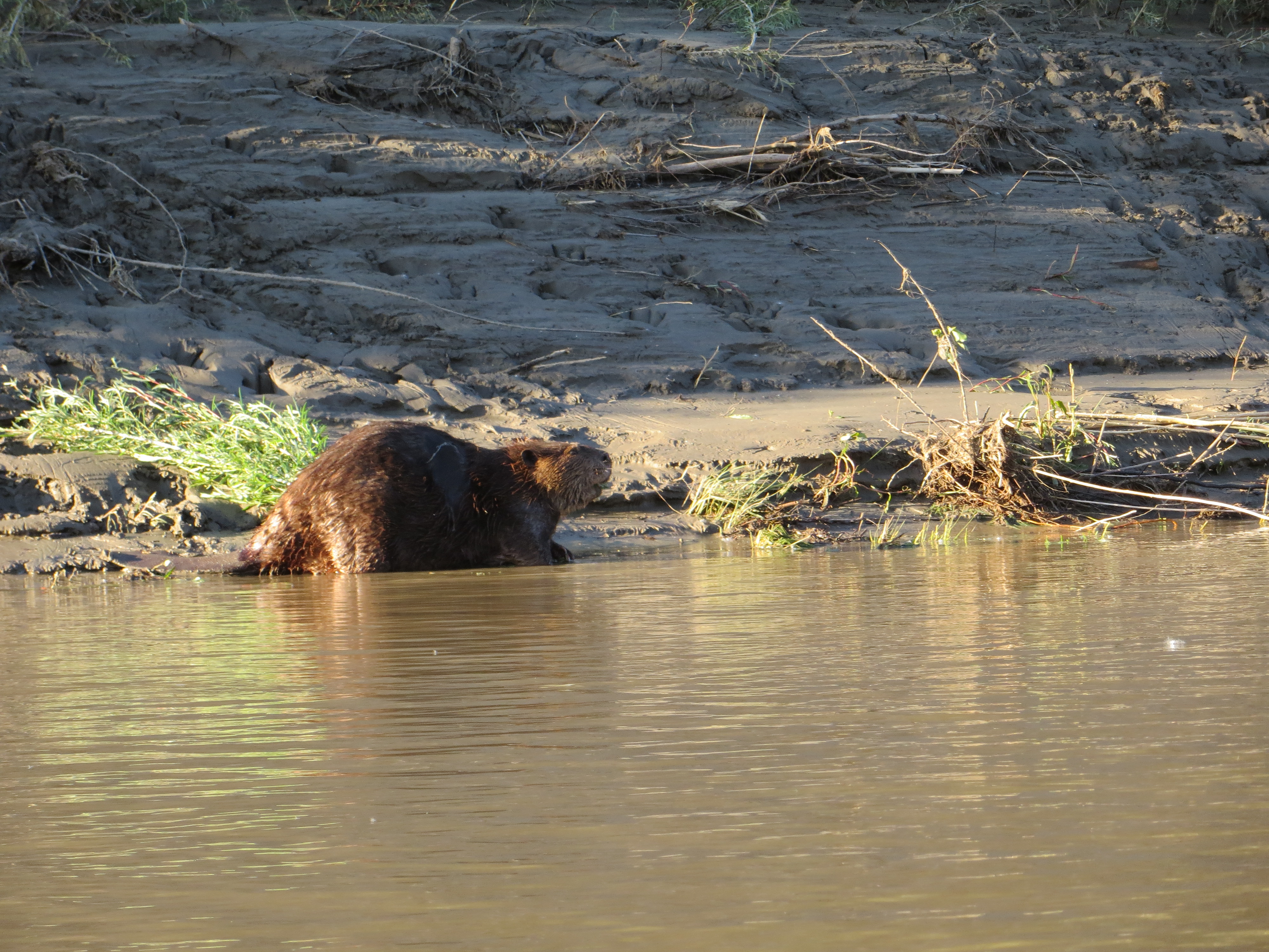
Plenty of beavers in the refuge. And, they are BIG! They pretty much own that refuge.
A beaver swimming out to size me up. I’m ready for their water slaps these days. I’ve seen and heard many of them trying to warn me not to mess with them or their dens.
I hated to leave the Roundup boys without saying good bye, but I had to get on the water early in order to make it through UL Bend on Fort Peck Reservoir, approximately 48 miles away. UL Bend is the river-to-lake transition area, and not without its challenges. I was packed and in my boat at 7:00 AM. As I was pushing off, Eli appeared on the shore. I was so happy because I got to say good bye. I also let him know that I left my card on the ice chest for him. It is always bittersweet leaving new friends and river brothers. These boys, young men, are my river brothers.
I packed up early and was on the water at 7:00. The air was still, but the banks were muddy for miles. I was extra thankful I had found the RoundUp Boys last night.
Nowhere to pull over for miles and miles.
This was a typical site for many miles of the river below the Breaks, and in the refuge. There was nowhere to land the boat, let alone camp. Thankfully, the glassy conditions helped me to paddle 10.5 hours and 48 miles this day.
The relentless rain in the previous weeks had saturated the land. This big landslide had occured recently.
On the approach to the lake their were numerous springs flowing into the river.
The Fort Peck Reservoir is 245,000 acres in size. Extending up 125 miles from the Fort Peck Dam is the Charles M. Russell National Wildlife, which encompasses 1,100,000 acres and all of the Fort Peck Reservoir. The refuge contains a multitude of habitats which include native prairie, wooded coulees, wetlands, river bottoms and badlands. “Given the size and remoteness of the Refuge, the area has changed very little from the historic voyage of the Lewis and Clark expedition…” [http://www.fws.gov/refuges/profiles/index.cfm?id=61520]
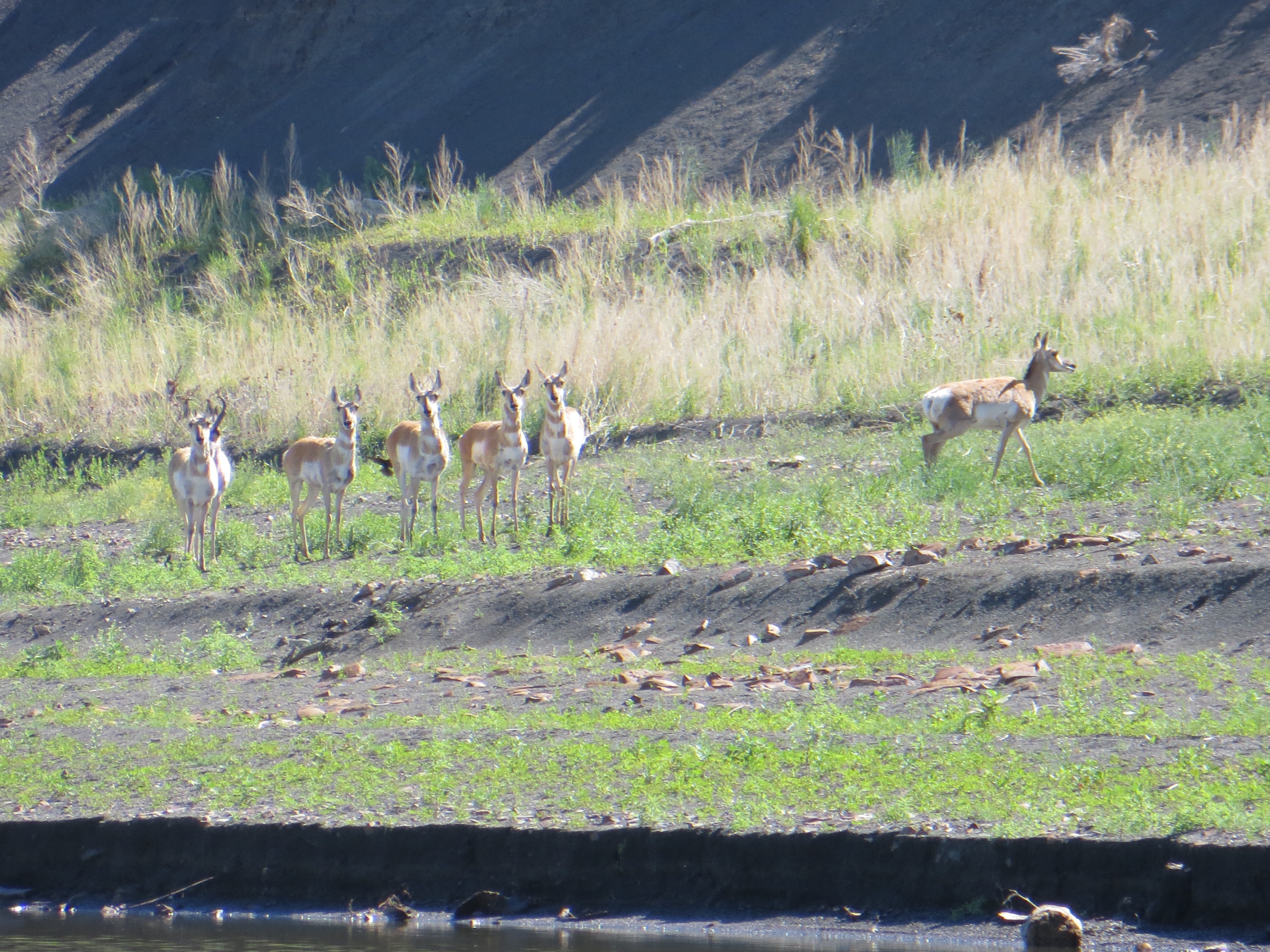
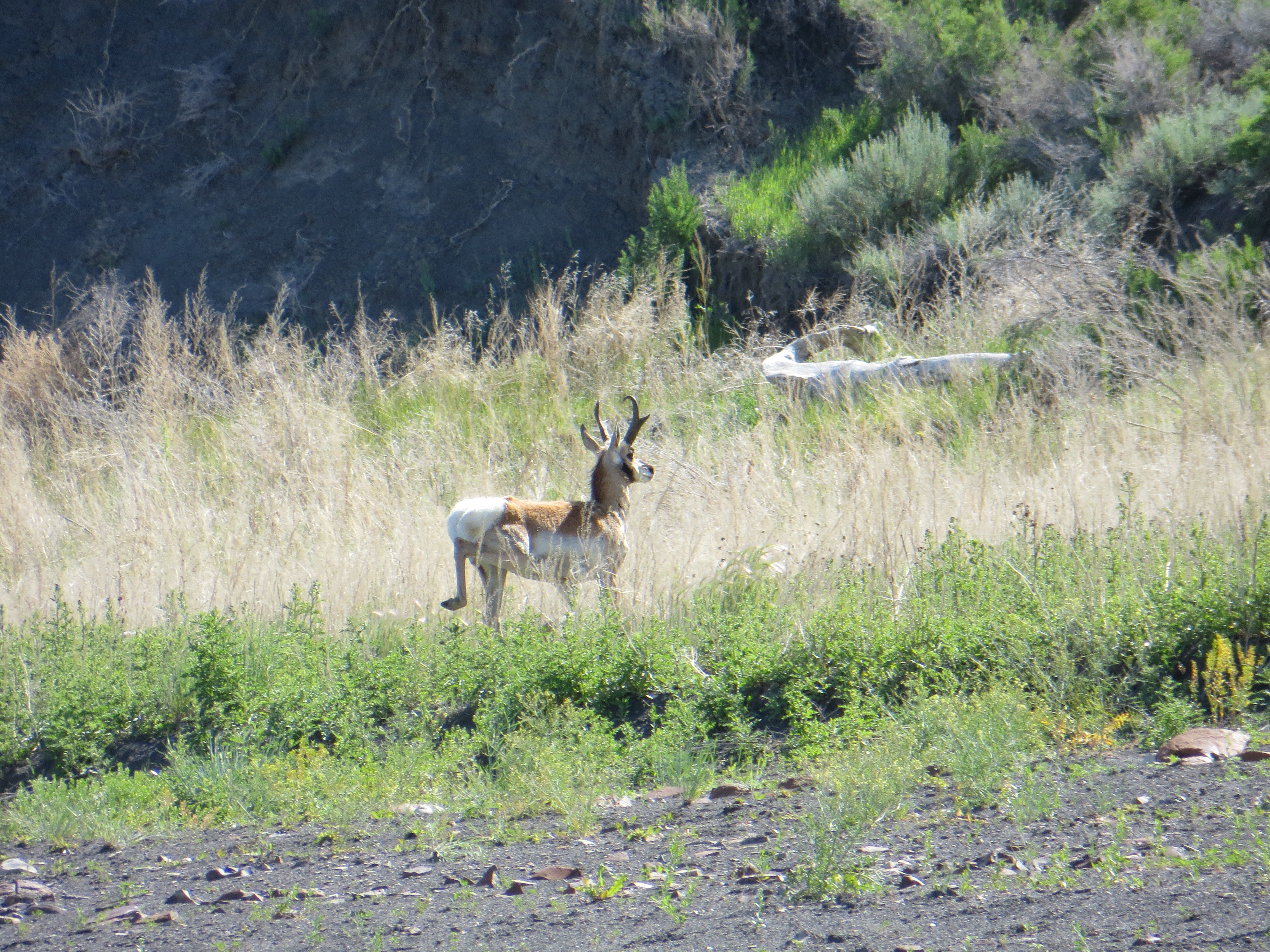
I enjoyed a warm and beautiful day with glassy waters all day.This is a gorgeous Pronghorn deer buck, also known as an antelope (but there is some controversy about that). He had a herd of six females with him. He was not comfortable with my presence.
Here is the buck’s females (I assume they were all females). The buck was very protective of them and they were very obedient to his signals to stay clear of me. I was so happy to get pictures of these beautiful animals.
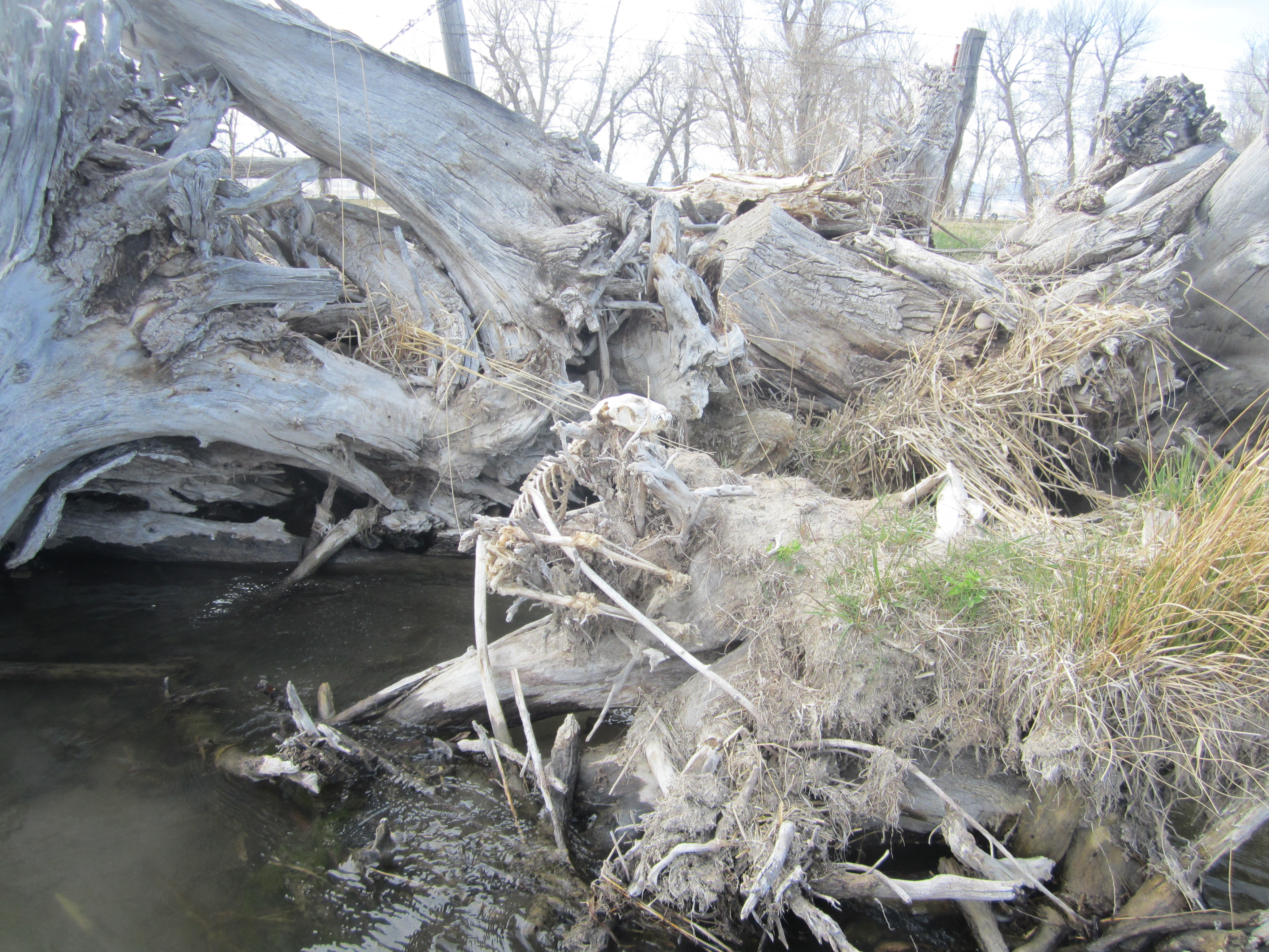
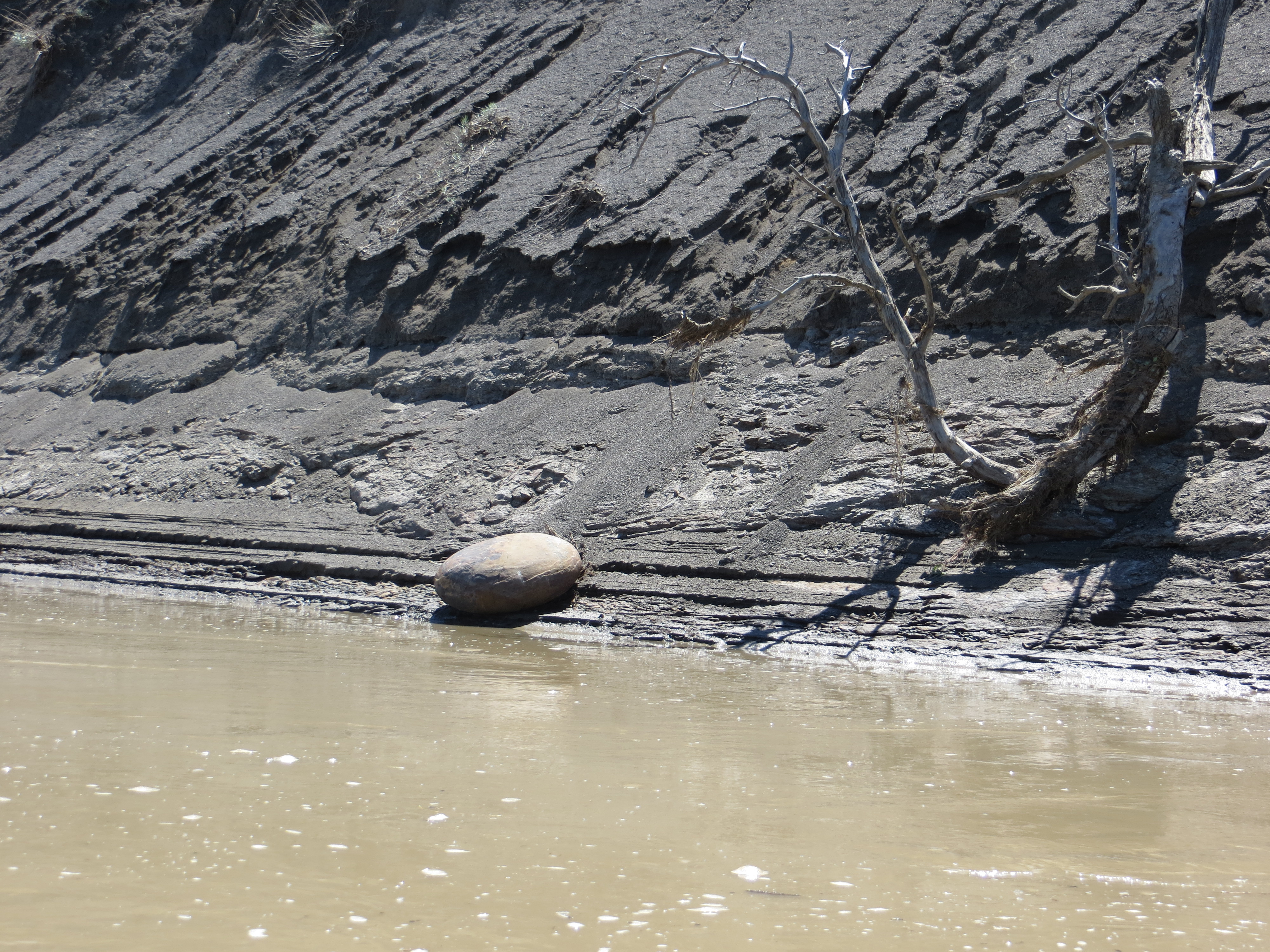
This smooth oval rock struck me as peculiar sitting at the base of a dark muddy-looking hillside.
These river-to-lake transition areas are kind of spooky because the river shoreline slowly disappears into the water and before you know it, you are out in the middle of a lake. This can be daunting if the wind is blowing. Fort Peck Reservoir’s transition section also has shallow sand bars and mud to deal with. Thankfully, I was somewhat unaware of these things or else I would have been intimidated and stressed. They say ignorance is bliss. In this case, this was true. It did not take long, however, before I realized I had to pay close attention so I would not get stuck on a sand/mud bar.
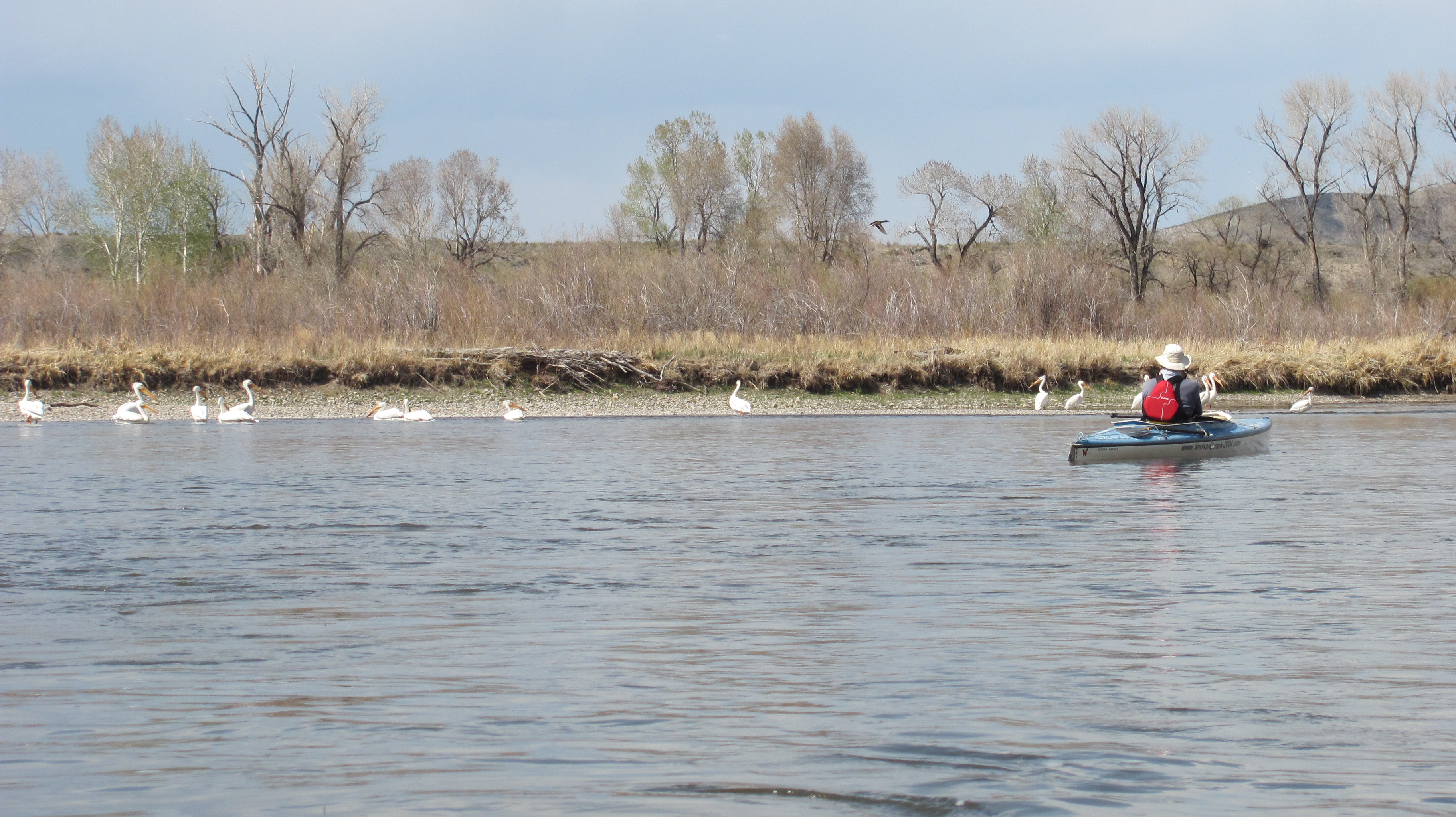
These pelicans were a good indication of shallow waters around me.
Pelican sitting on a sandbar that was just barely showing.
Once the shoreline has disappeared, it can be very difficult following the channel of the river, especially when the current is slowing down and spreading out, and the river transforms into a lake. This pelican, I believed, helped to show me the way and I made it around the daunting UL Bend to a campsite.
This was my river angel. Once the shoreline disappeared, this guy led the way for me when I found myself in the middle of a lake with shallow sand/mud bars all around me. He was a guiding white light for me, and one of the reasons I hold pelicans dear to my heart.
I made it to Fort Peck Reservoir! I paddled 48 miles for 10.5 hours. This was a really productive paddling day and, boy, was I tired, but very very happy. I was especially joyful because my campsite was not muddy. Well, not too bad, anyway.
My first campsite on Fort Peck Reservoir, photo taken from my tent. I took a sponge bath here and washed some clothes. I was feeling really good.
Later this evening I witnessed the power of a northerly squall line coming across the lake. I had been warned about sudden fierce winds coming out of nowhere. Thankfully, I was safe on shore with my tent and Blue Moon secure. At first it sounded like a motor boat across the lake, then it grew louder like a truck, then a train, and finally a jet plane. It was awesome to watch the wind line move rapidly over the water toward me. I knew what was happening, so I was intrigued, rather than fearful. Seeing this occur helped me to be cautious, aware, and respectful of the wind and water while on this lake.
A northerly wind appeared suddenly and engulfed the entire lake near me. Paddlers must keep one eye looking toward the north at all times.
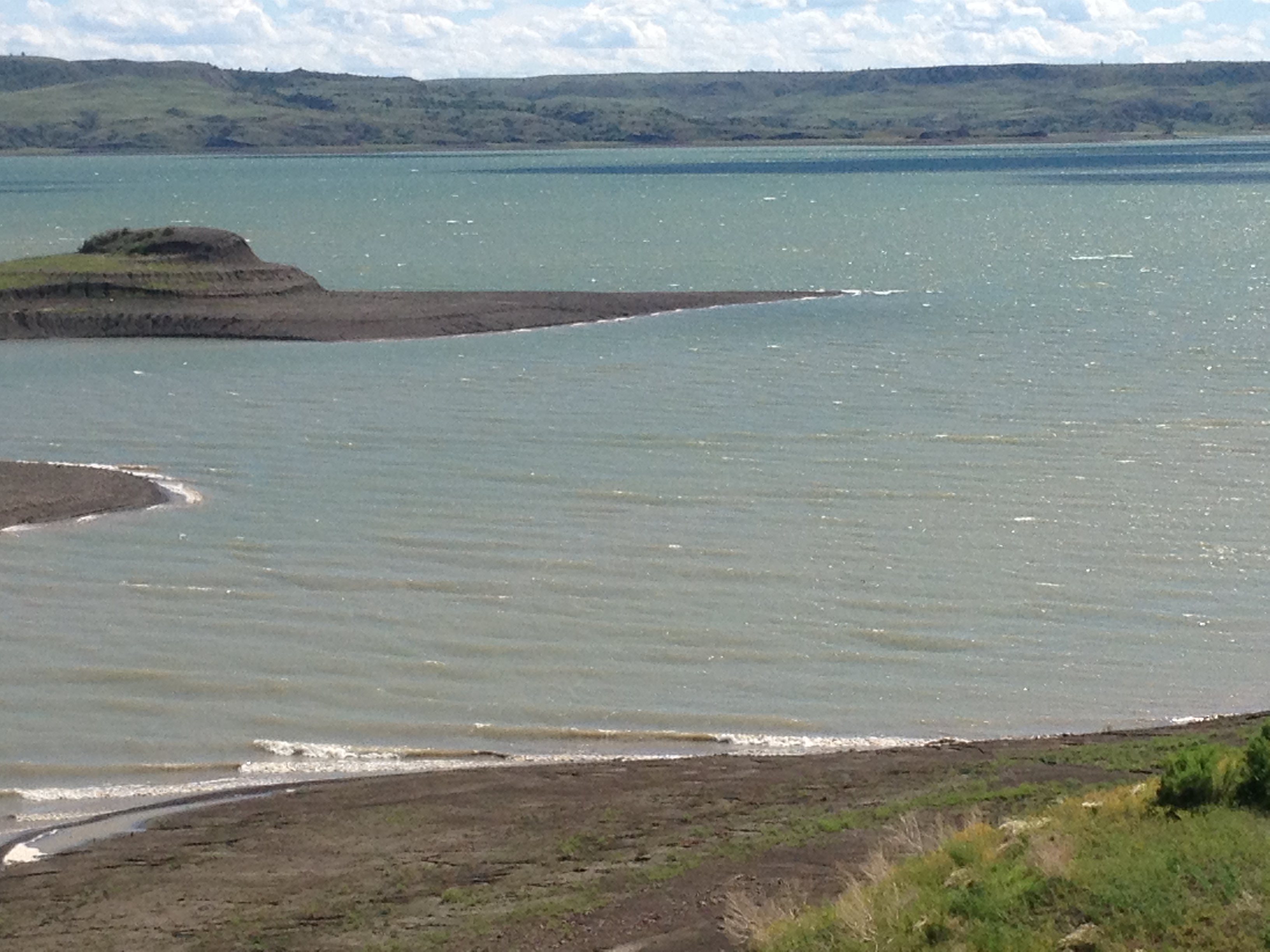
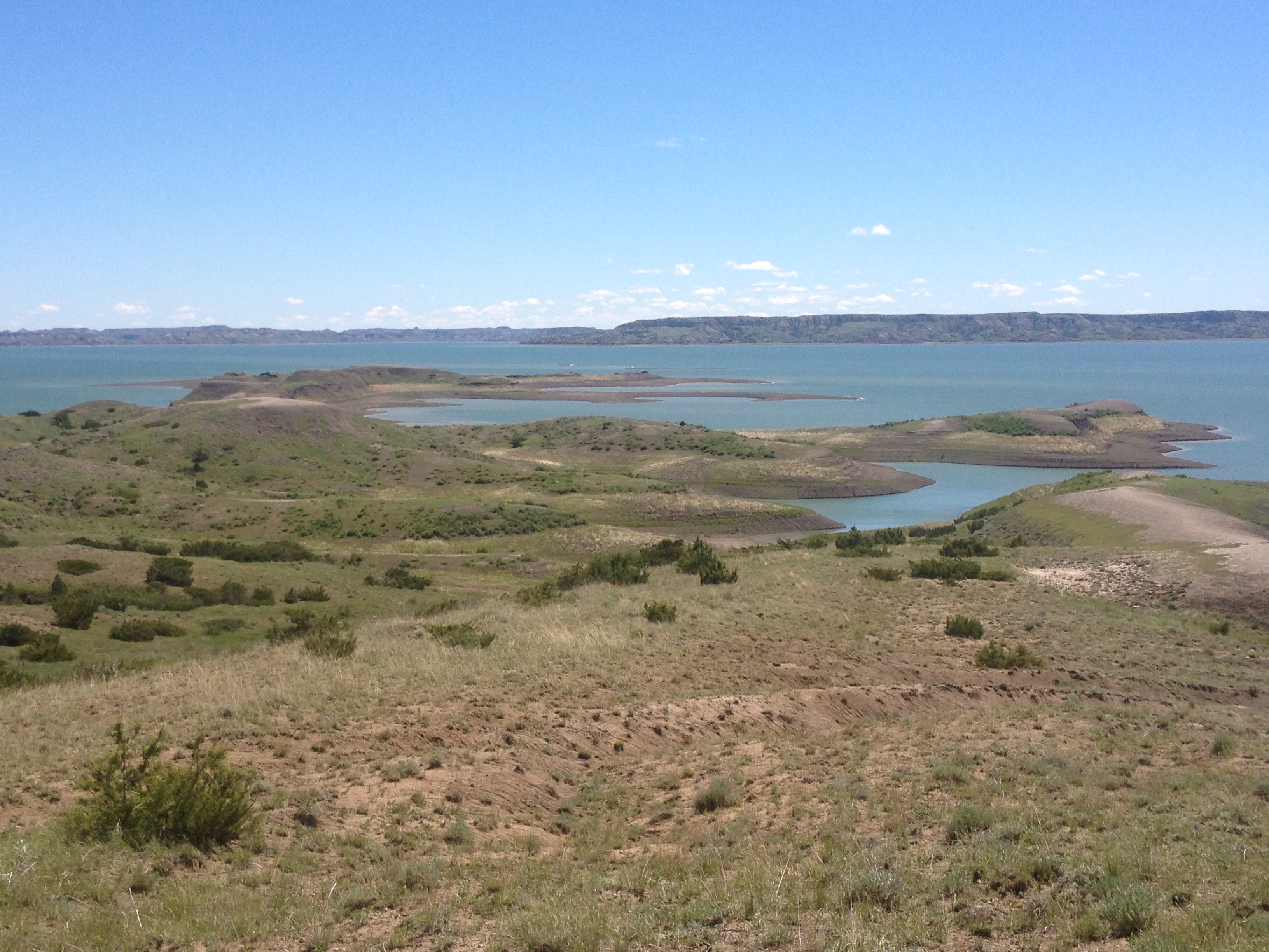
I left the RoundUp boys on June 9 and made camp the same evening on the Fort Peck Reservoir 10.5 hours later. I would journey across this 135-mile lake for the next eight days. A lot can happen in eight days. I was immersed in wilderness and forced to use my own judgment and decision-making skills in order to progress safely to the dam. High winds, snakes, electrical storms, wildlife, zero cell service, hours of waiting out the wind, picturesque scenery, and the giving hearts of the few people I met would make this one of my most memorable experiences of my life. Stay tuned for part two, the next eight days to Fort Peck Dam, through some awesome and incredible wilderness.
Bub and Tinker with one of the St. Louis/Fort Collins’ family members.
A busy morning at the Coal Banks Landing boat ramp once the storm left. The ramp was bustling with boats, paddlers, gear, and excitement. Special thanks again to Bub and Tinker Sandy for taking care of all of us wet river rats and opening up the visitor’s center to everyone for the lasts two days. I decided to hang back and wait for everyone to leave before I got ready to go. When I left, there was not a soul in sight. That’s the way I wanted it. I wanted to take it all in without a lot of external distractions. I had been waiting for this nearly a year.
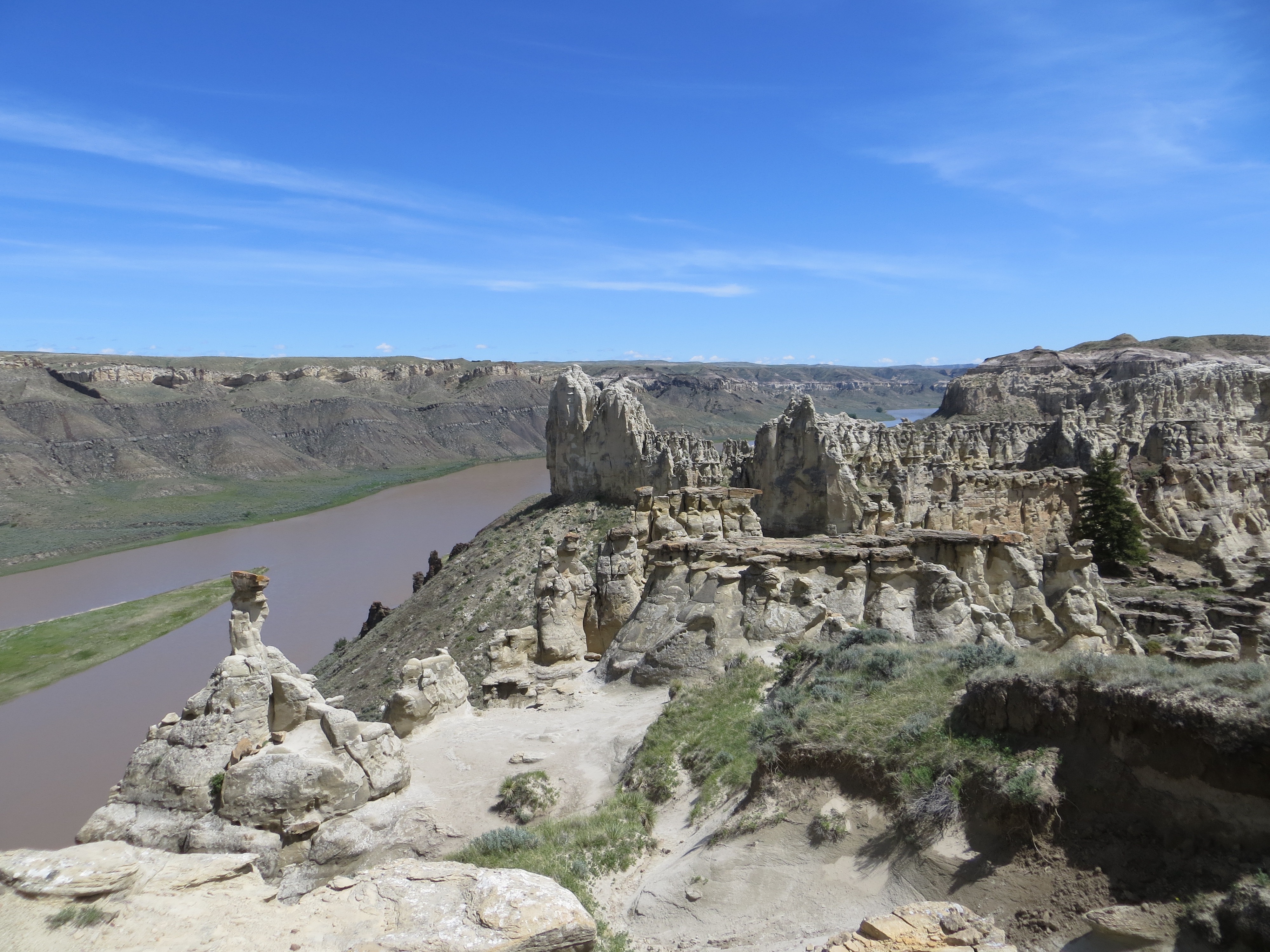
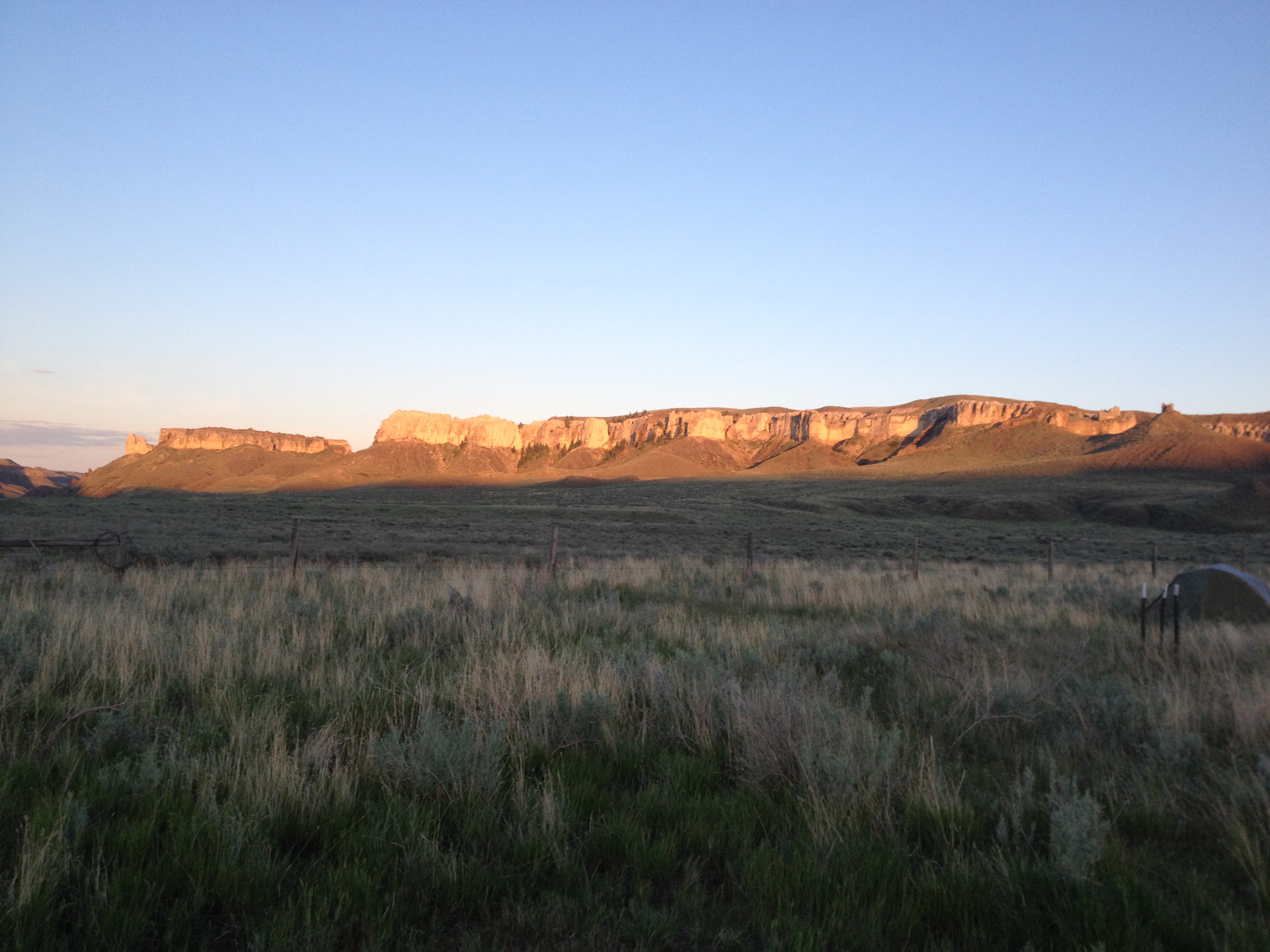
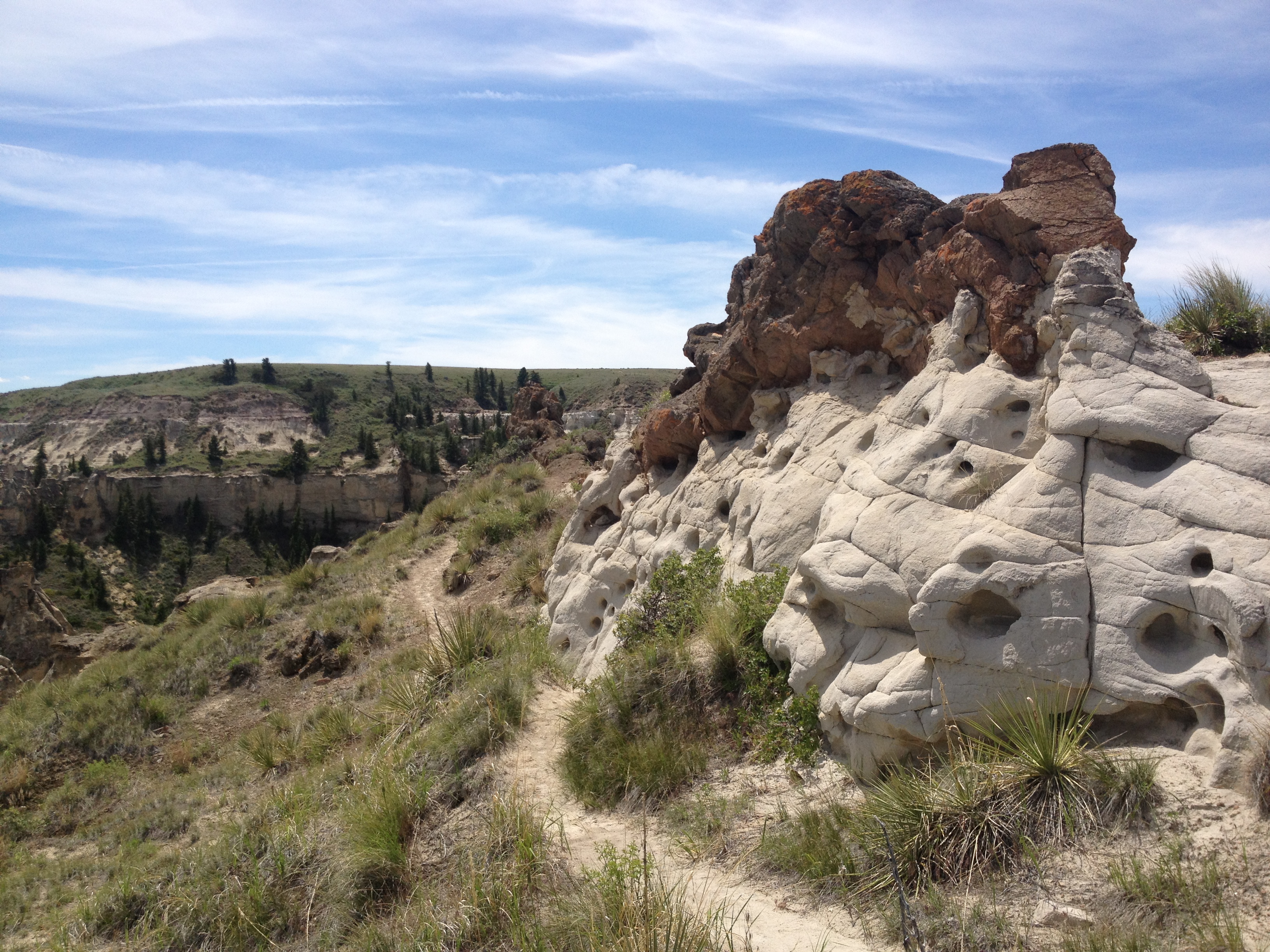
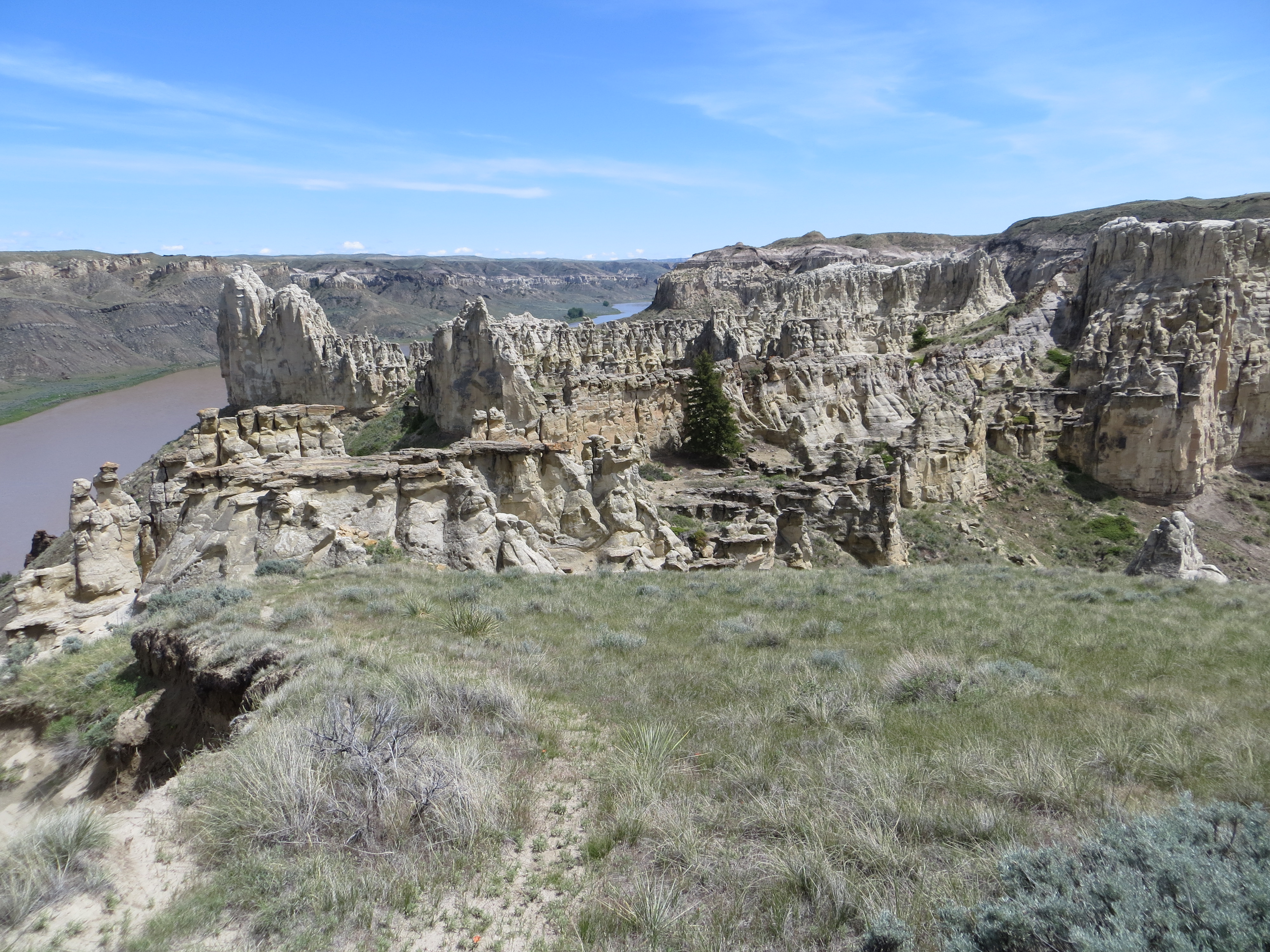
The White Cliffs section of the Upper Missouri River Breaks National Monument evolves as you paddle in to this stretch of river. The anticipation keeps you on the edge of your seat. Will there be cliffs around the next bend? They show themselves gradually. And, before you know it, you are immersed in this fabulous wonderland of rock castles, spires, hoodoos, magnificent walls and lone sentinals.
Leaving Coal Banks I could sense that something incredible, geologically, was going to unfold.I barely got my camera out in time to snap this photo. This looks like an old homestead cabin. My imagination soars when I see structures like this. What must it have been like over a century ago settling in the wild west?The cliffs gradually appeared in the riverside environment. It was somewhat like a geologic transformation.Some of the first signs of white cliffsWhite Cliffs emergingThe Boy Scouts made camp early in a beautiful area that was wide open with smaller cliffs surrounding the area.The surrounding area around the Boy Scouts first camp, just upriver from Eagle Creek camp. It was beginning to get interesting!
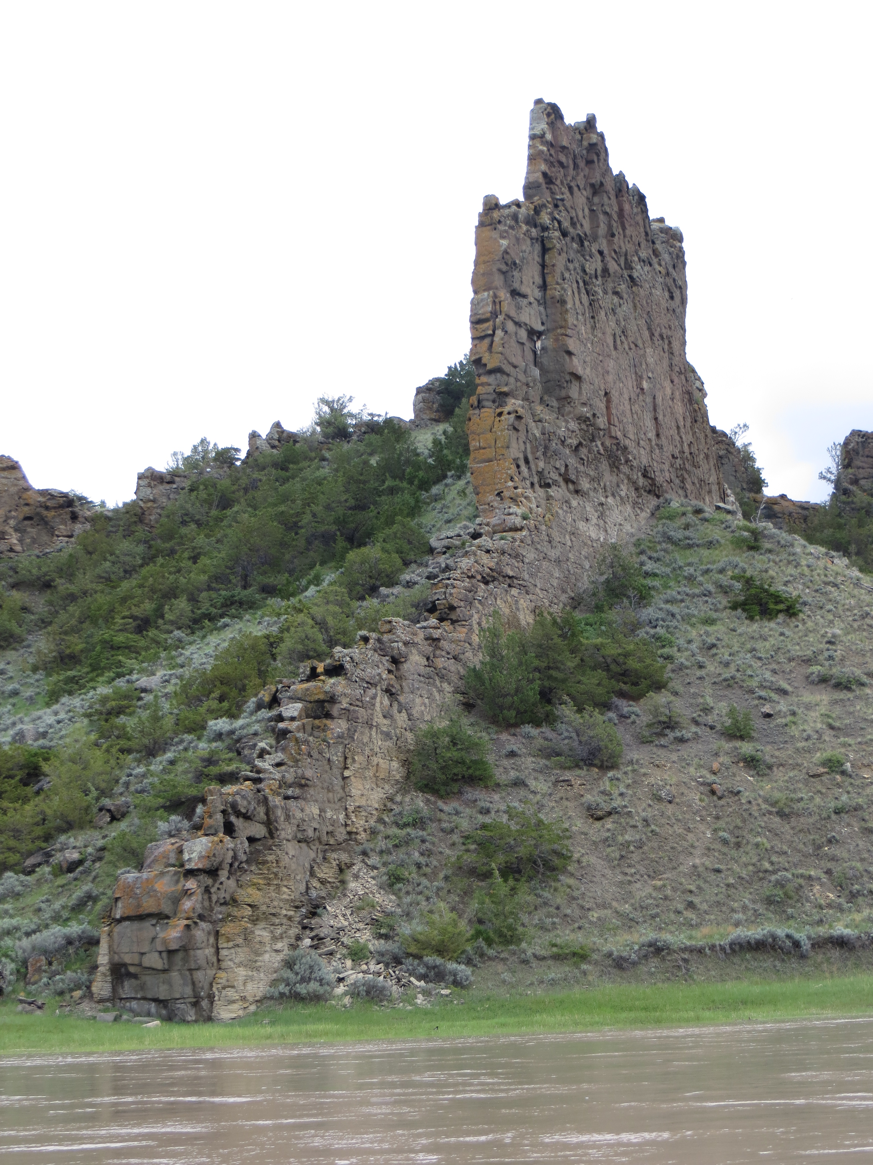
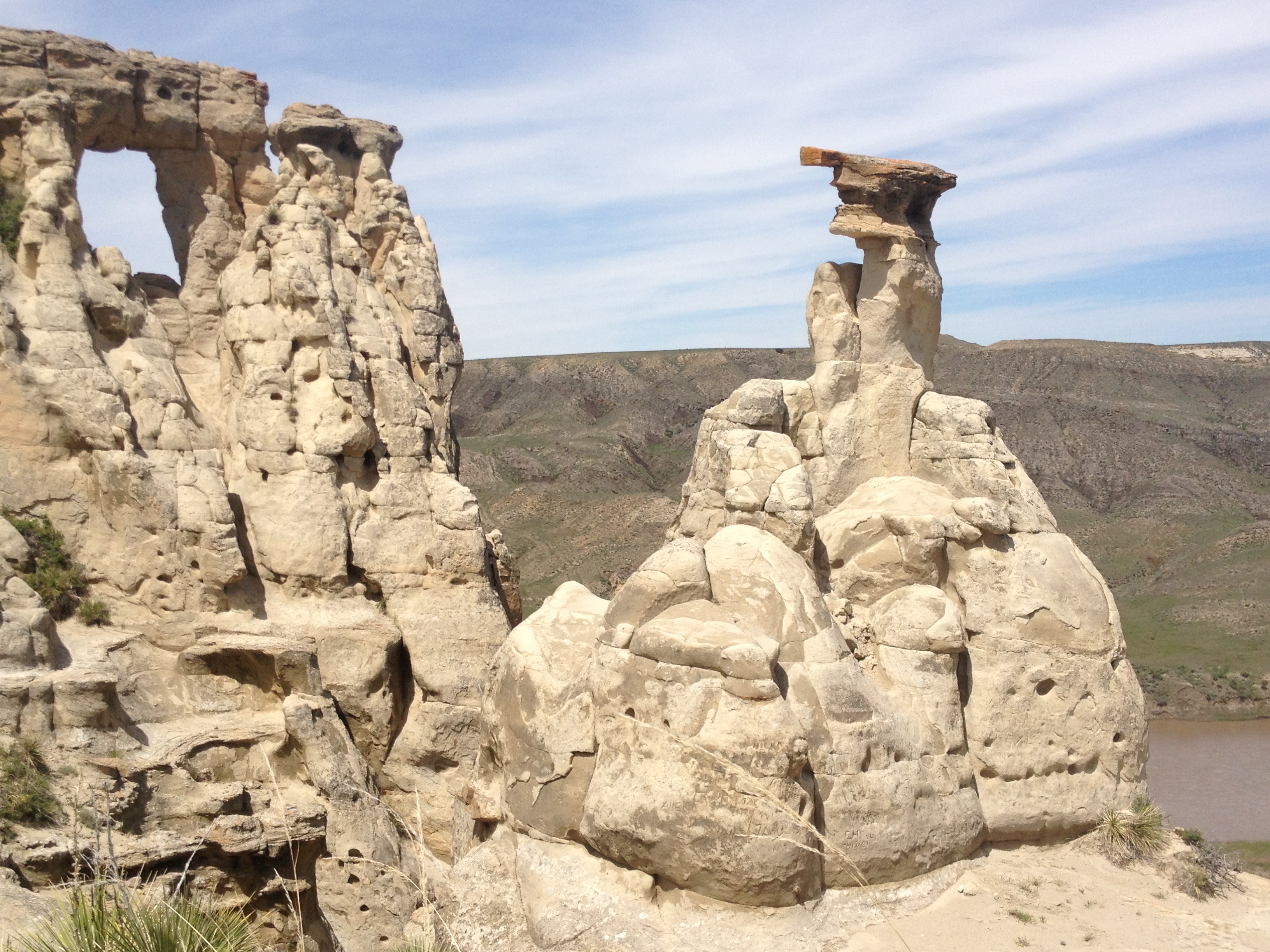
Labarge Rock is the dark rock outcropping in the distance. The rock was named after Captain Joseph LaBarge, one of the most famous of steamship captains. He never had an accident in his career commanding ships up to Fort Benton. This is remarkable after seeing a million snags downriver waiting to take the ships down at any given minute.Classic white cliffs with LaBarge Rock in the distance.Beautiful white cliffs, like a fortress or castleLaBarge Rock is an instrusion of dark igneous shonkinite. That’s about all I can tell you without getting technical and boring to the non-geologist.The Grand Natural Wall. This is an incredible sight to behold.Grand Natural WallCool looking, I think. Now that’s a grand white cliff!Eagle RockEagles at Eagle Rock?And, my best friends, the pelicans.
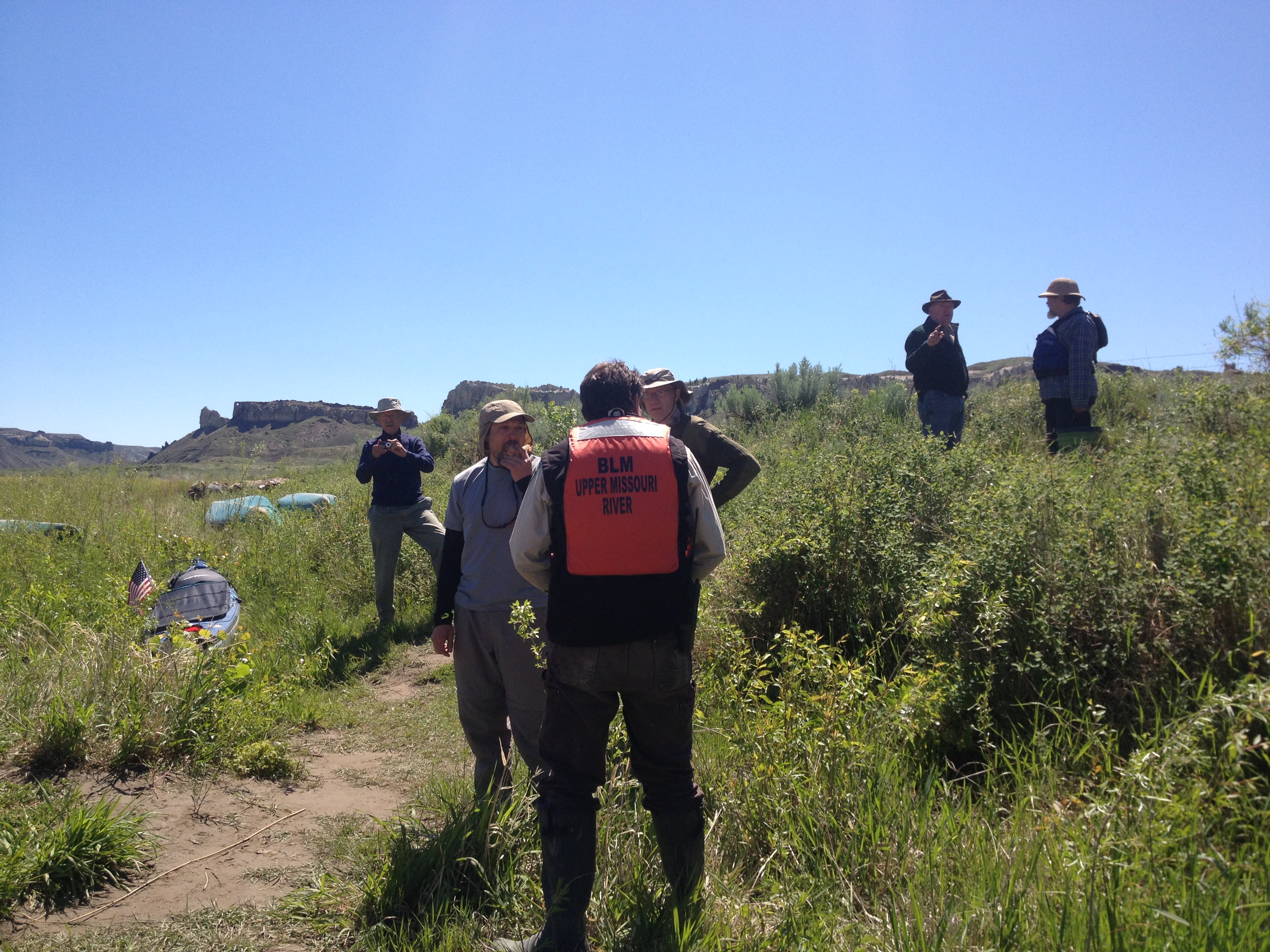
I arrived at Hole in the Wall thinking that everyone else would stay back at Eagle Creek, which is a popular camping area with great hiking and historical significance. The environment around Hole in the Wall is grandiose and quite spectacular. I was the only one there! I would have a wilderness experience in the midst of incredible beauty!! Well, not exactly. Withing an hour two paddlers arrived. Then, a party of seven or eight men showed up. Oh well, I can share. I will just set my tent off to the side and have my own wilderness experience. I learned something this day. When you meet good-hearted people, nothing else is really more desirable. The benefits are great when you share a part of your lives together. The experience becomes unforgettable. This day I met Klaus and James. I am so happy that I did.
Klaus (L) and James
I loved meeting Klaus and James. Klaus came over and invited me to sit around the fire with them that night. They said it wouldn’t be a long fire because firewood was scarce. That sounded good to me. After a couple of hours we gathered for a fire. Klaus had cups and wine and we toasted to my expedition. Then we spent a couple hours just enjoying each others’ company and conversation. THAT beats a solitary wilderness experience, any day. I am thankful for the time we had together.
The next day I met some of the others who had camped in the area. They were all very interesting gentlemen. One was from Bozeman, another from the Seattle area, and one also from San Diego, among others. The Bureau of Land Management officers showed up. They told us stories and were helpful in showing us good camping areas down river. Apparently, James Kipp Recreation Area had opened back up, at least the roads leading into the area. Because of all the rain, though, we could expect a lot of mud downriver. Oh well.
I was excited to hike to the top of Hole in the Wall. I said good by to Klaus and James. They were going to camp at the Wall camping area. I did not know if I would stop there. We took pictures to make sure we didn’t miss out on that opportunity, and we exchanged addresses.
Klause James and myself. Hole in the Wall is in the background.
And, off I went to hike to the top of the Hole in the Wall. Wow, what a grand experience!! Unforgettable.
I thoroughly enjoy my hike up to the top of Hole in the Wall. While I was standing up there looking around, I thought, I think I am experiencing breath-taking beauty. I had to stop and calm down I was so excited.
I paddled on and came to Klaus and James’ camp. It was getting late and they invited me over. I was happy to stop there. The camp was one of the best and most peaceful I have experienced thus far. Not to mention my new friends. We had another tremendous night telling stories, jokes, and laughing freely. When it was time for them to shove off the next day, I was truly sad. I’ve got their number. Happy about that.
The Wall Camp, 7 miles before Judith LandingPrairie dog town in back of the camping area. How cool is that!?
See ya, James!See ya, Klaus!See ya, everyone! Fair sailing to all!
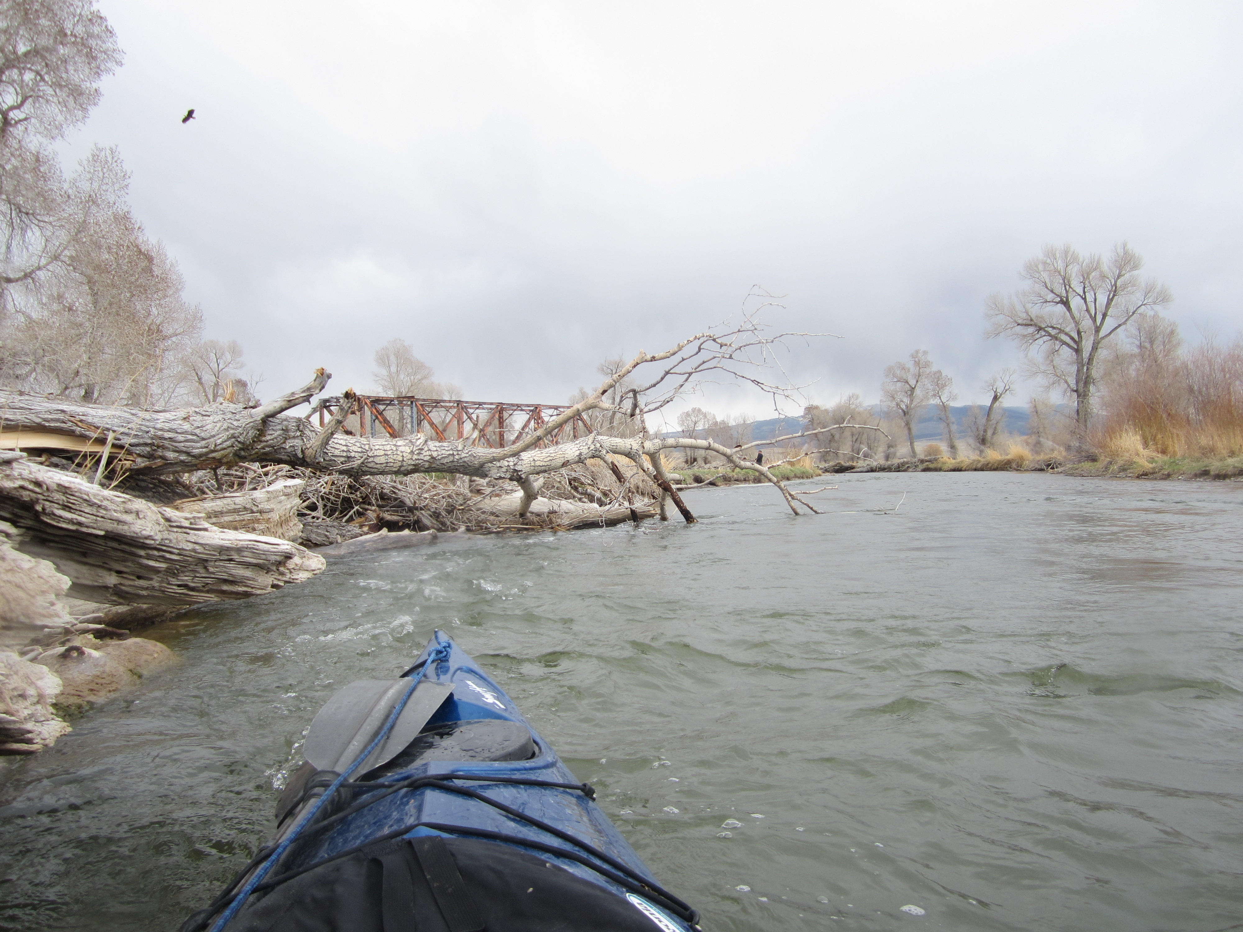
I arrived at Fort Benton the same day that I left Great Falls. The paddle only took a few hours from Carter Ferry. I knew rain was forecasted, so I planned on staying in Fort Benton for a least a couple of days, which I would have done anyway. This post is a photo story post. I hope you enjoy it.
Carter Ferry is one of only six cable ferries in existence. Another cable ferry is in Virgelle, between Fort Benton and Coal Banks Landing. There are also two others in the area, making four out of the six ferries that are functioning located here in northern Montana.
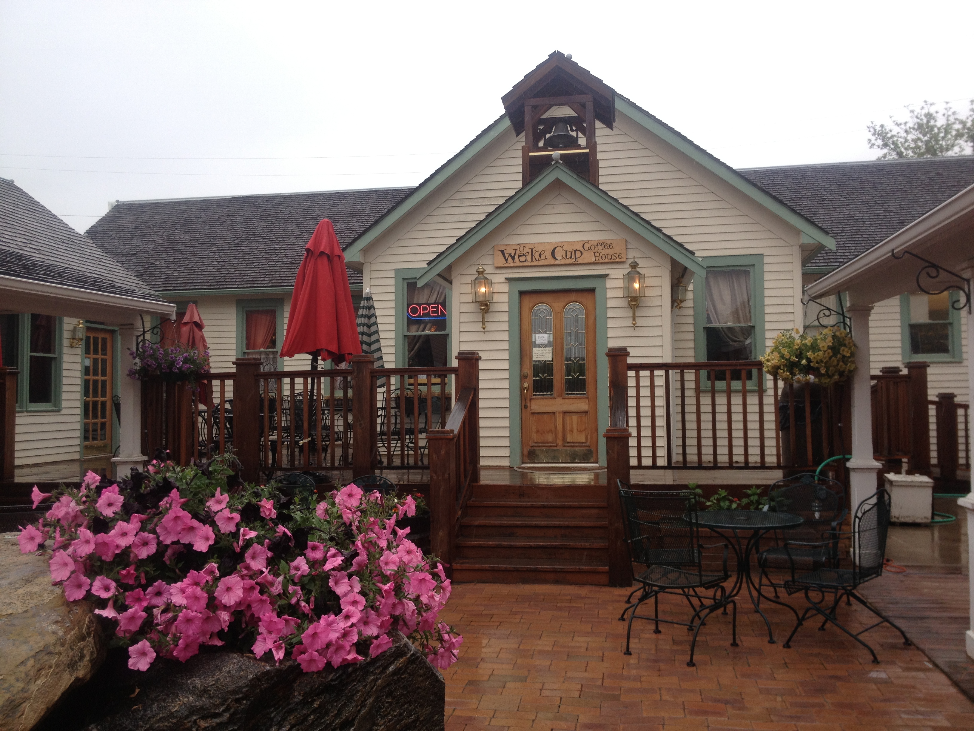
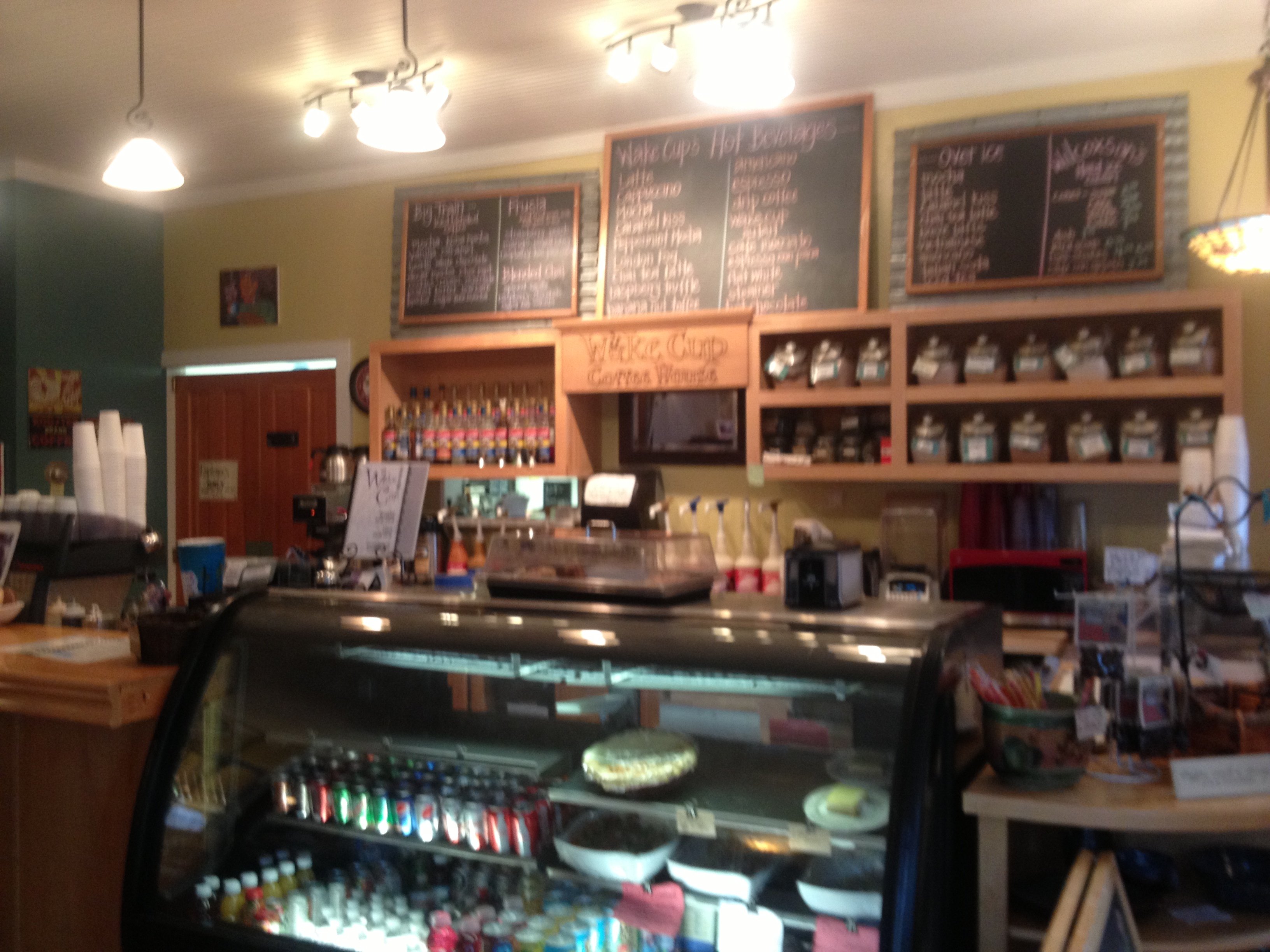
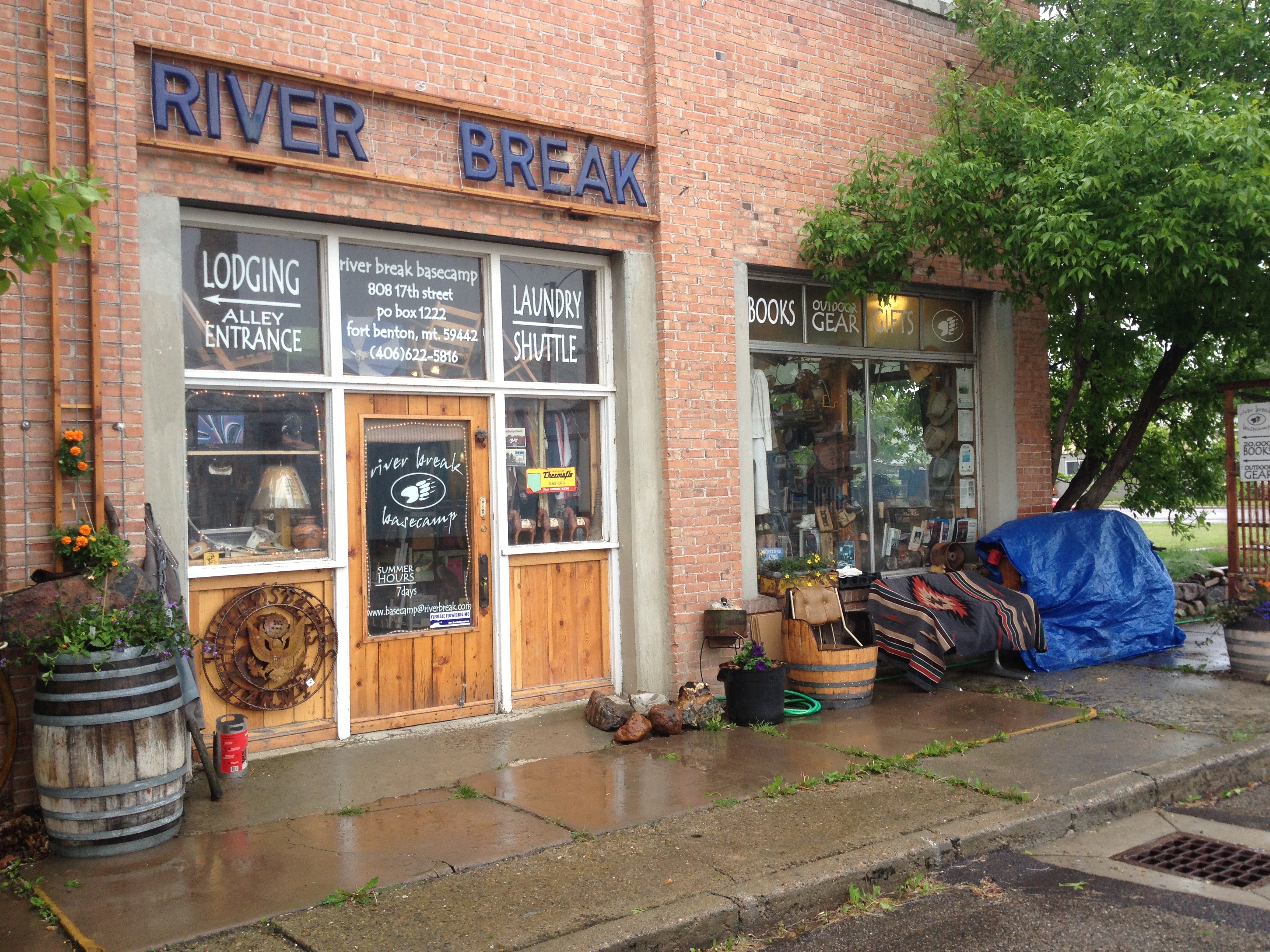
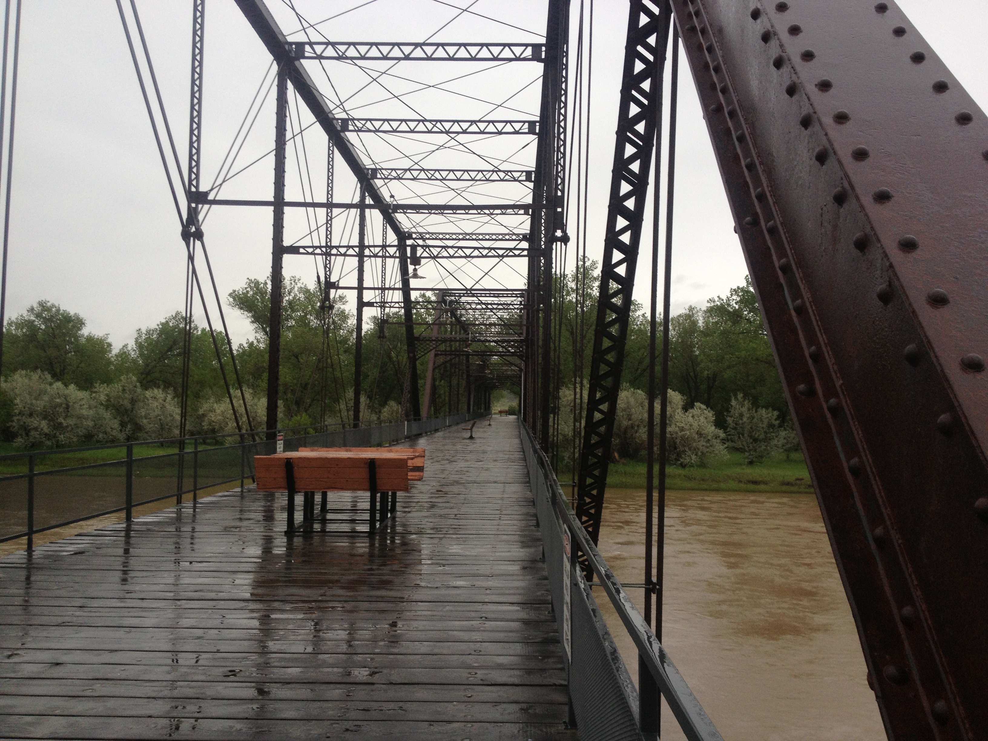
Carter FerryI opted to try and set up camp at the boat ramp in Fort Benton, rather than a mile upstream at the canoe camp. I was leary about it, but a police officer was sitting there in the parking lot, so I asked him and he said it would be fine. He said he and the night shift officer would keep an eye on me. Sweet!This is it, but the inside is cozy and dry. Well, except at 1:50 AM when the darn automatic sprinkler comes on for 40 or so minutes every night. Geez. The last night there I took off the tarp because the storm had passed, but I forgot about the sprinkler. My tent fly got soaked after staying dry through the whole storm. Kinda funny.Fort Benton’s riverside walk is lined with historic information signs for a long ways. It is fun learning about the town’s history while walking along the river, which is, of course, where most of the town’s historic events took place. That is a walking bridge in the background and has benches and picnic tables on it.Here is a view of the riverfront levee from the walking bridge.This sweet cafe was right across the street. The waitress was so nice, she let me stay there all day until closing at around 2:00. I didn’t stay there all day every day. Just the first day. The other days I left before closing, and I went to the library, too. It was a nice rainy day hang.The coffee was delicious and so were the breakfasts and lunches. I had an omelette two mornings in a row.This is Nikki, my very sweet waitress at the Wake Cup. I wanted a photo of her, for that reason. Unfortunately, it wasn’t until I was leaving that I learned she was the ranger in the Breaks National Monument for three years previous. It would have been nice to chat, but she was usually very busy. Very nice, though, and currently the volunteer coordinator for Friends of the Missouri River Breaks.River Break was the coolest little bookstore with all kinds of interesting books and used gear, rocks and stuff.Tom is the owner of River Breaks. He gave me a great deal on three books. What an interesting and knowledgeable guy. This is a must stop in Fort Benton. Please note, he does no have a hostel up and running, or showers, laundry and shuttle. These are part of his dream. Go for it, Tom!Side of the Upper Missouri River Museum building, located right next to my camp. Fort Benton was also next door.Outside of the Fort
The levee today with a view of the old bridge, which is now just for walking and sitting and contemplating.The walking bridge
The “block” today
TodayThis map shows my route coming up, all the way through the Missouri River Breaks National Monument. (Coal Banks to James Kipp Recreation Area)It rained and rained and rained. The rain stops eventually, and now it was time to move on down the river. Fort Benton is a town that will warm your heart, and get you interested in the Missouri River and its connection to our country’s history and culture.
It began raining again on June 2, the afternoon of the day I arrived at Coal Banks Landing. I have some interesting photos of the paddle down to Coal Banks, the paddlers laying over at Coal Banks, the proprietors of the Virgelle Mercantile Store, and my second visit to Fort Benton when I came with Dominique Liboiron, who came to visit me from Saskatchewan during this next rain delay before starting into the Breaks. Dominique paddled from Saskatchewan, Canada, to New Orleans last summer and winter, arriving just before Mardi Gras. We instantly became friends when he stopped over at Cooper’s Landing, my river hangout in Columbia, Missouri. My next post will share with you our visit together and some additional interesting things we discovered in Fort Benton.
Do what you love, and love what you do!
Live slow ~ Paddle fast (notice that is switching around a little. No, a lot.) 🙂
Once back on the river, I continued to be amazed by the rock cliffs and mountains.
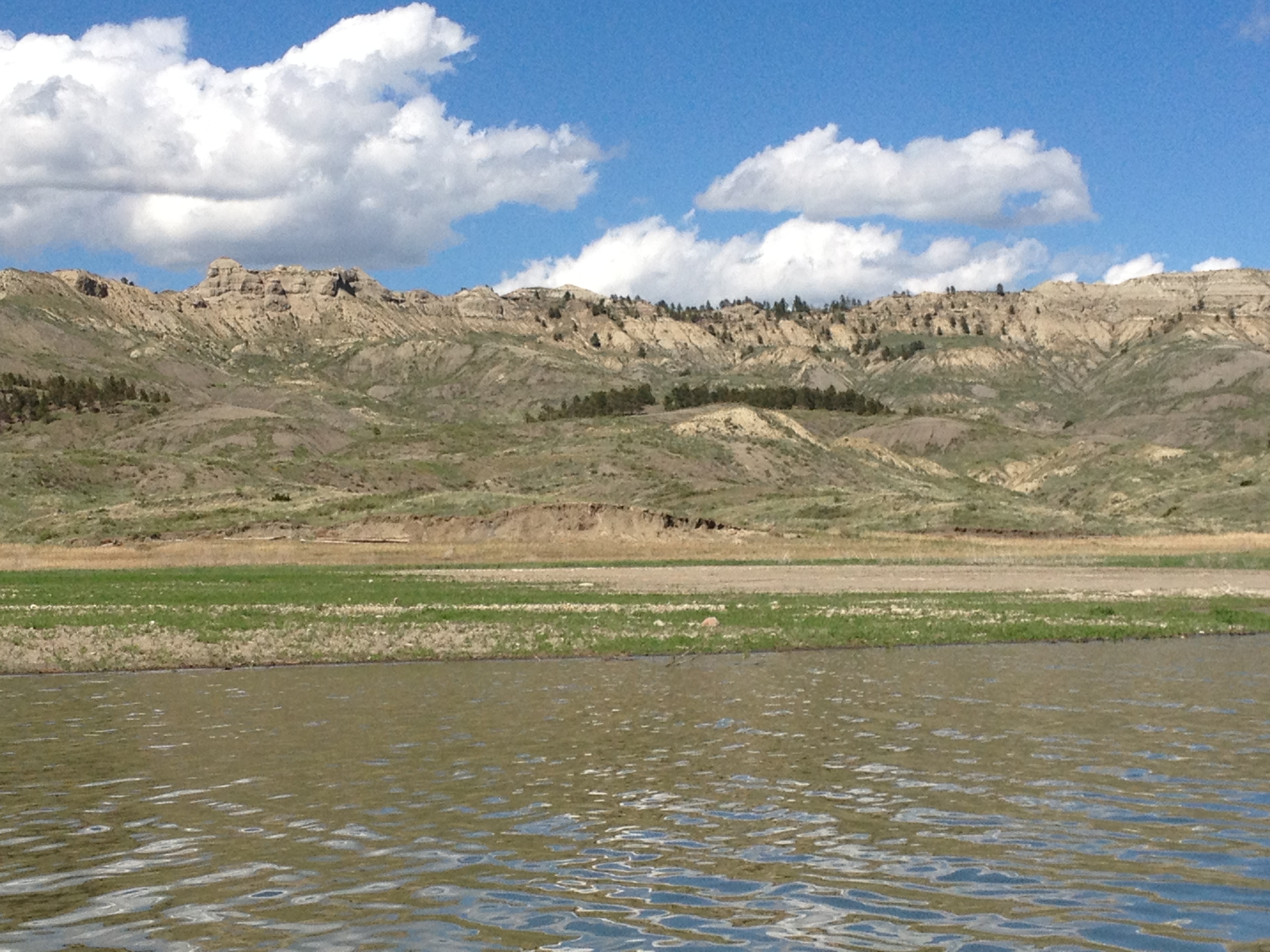
I think this post will be more of a photo post. I have captioned all of my photos and they will walk you through this stretch and phase of my adventure. Enjoy!
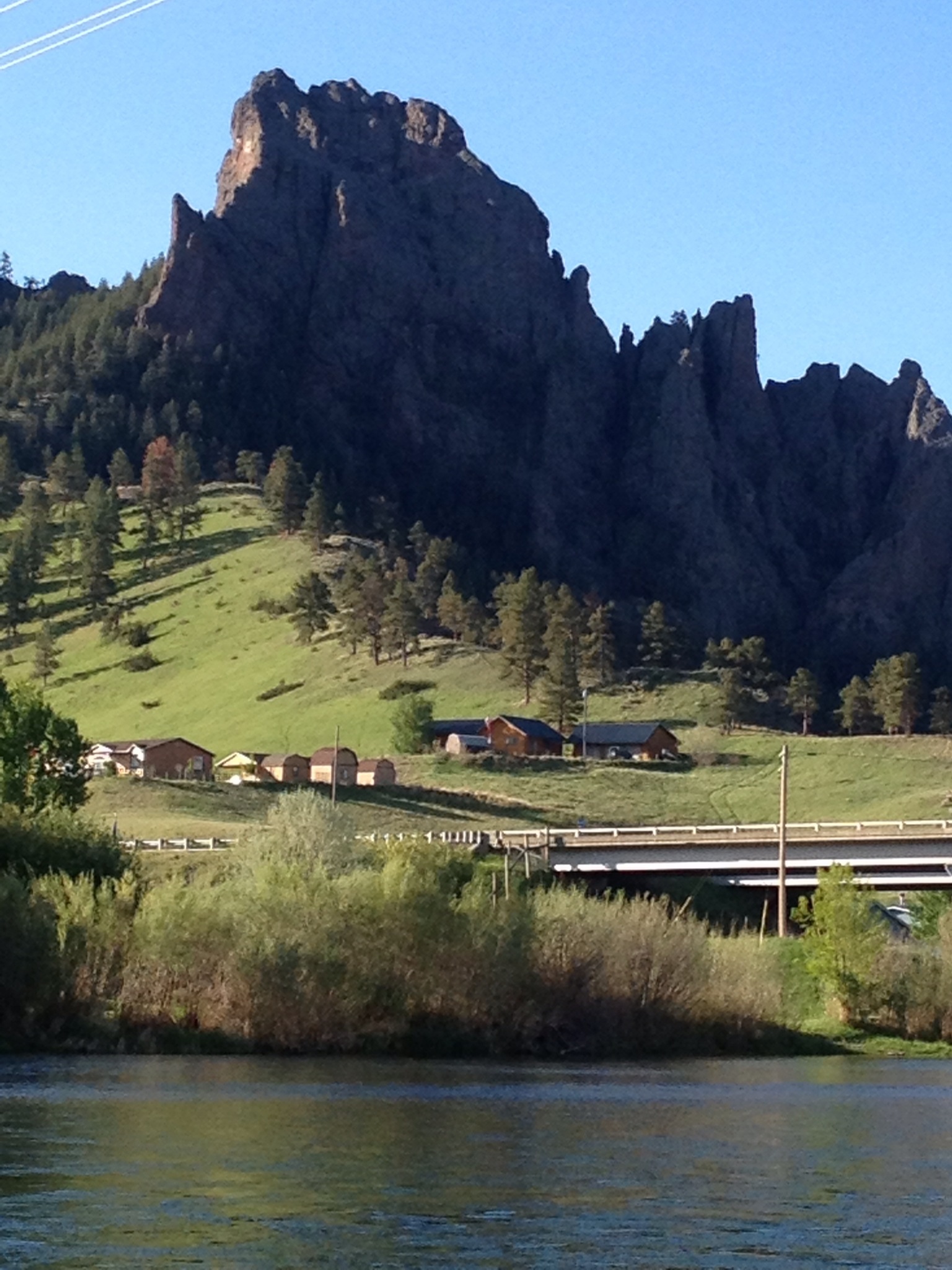
The Gates of the Rocky Mountains are on Holter Lake. I left the Gates and paddled almost to the dam. I camped before entering the last big stretch so I would not be exposed to potential storm winds. Rain fell that night, but enough sun shone the next morning that I could dry things out. My camp was on a pretty point, but the real estate was owned by a heard of black cows. It seemed I was camping in their watering hole. Luckily, I found a big enough patch of grass free of, well, you know, to pitch my tent. Some camps are better than others.
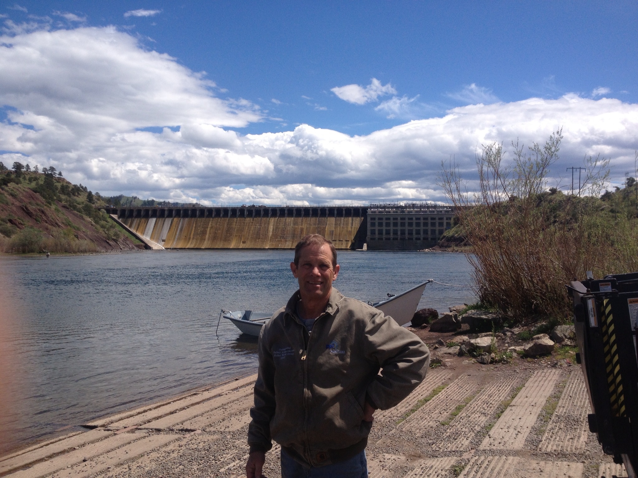
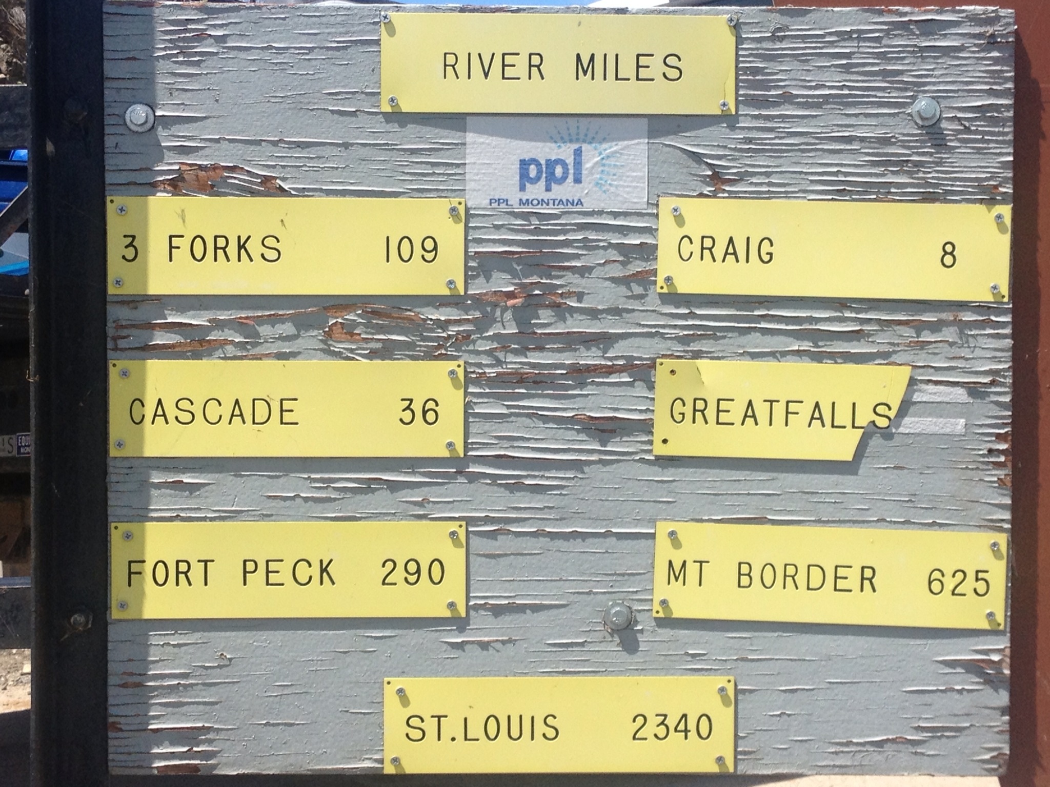
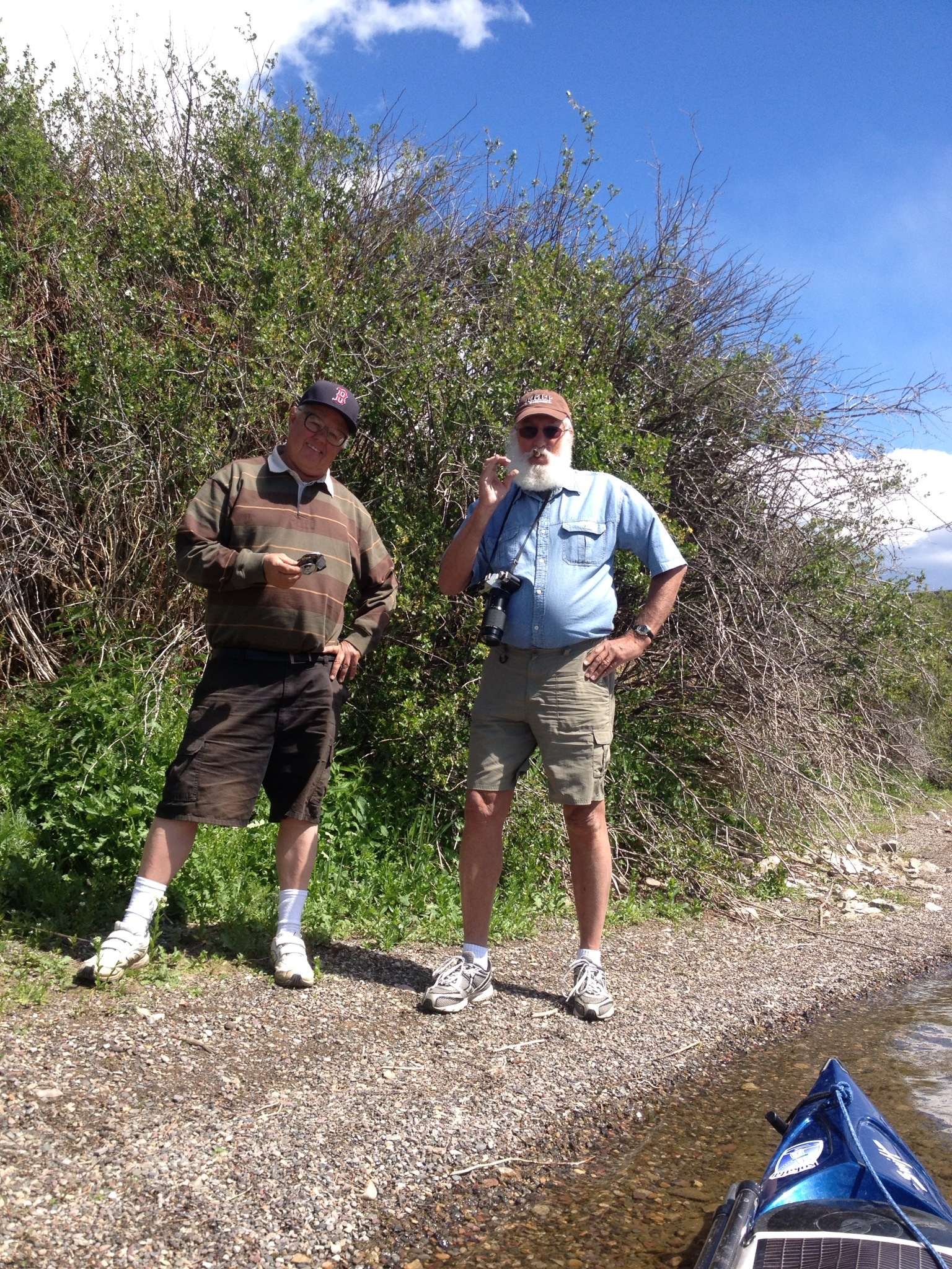
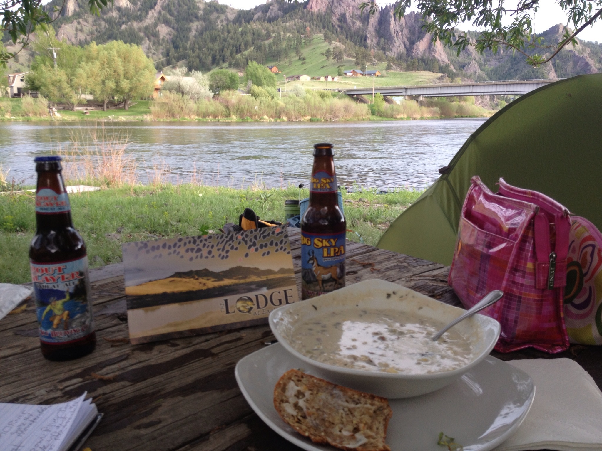
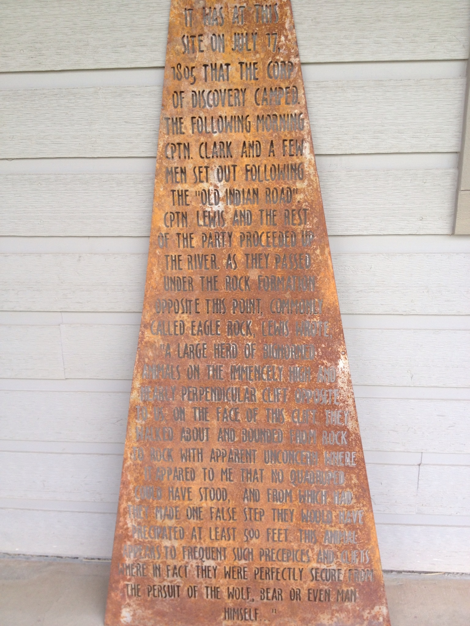
The watering hole.My buddies with whom I shared, sort of, my camp.Tim works for Pennsylvania Power and Light (PPL), and was more than happy to help me portage around Holter Dam. Dave’s (Dave from Hauser Dam) uncle was off work that day.This sign was hanging at the Holter Dam portage take out.My best friends forever!WOW! A PBR hanging from a bridge! Somebody pinch me. I must be dreaming! I got! I got it!Sometimes a beer tastes really, really good. This was one of those times!PBRs don’t hang from bridges without a support crew. These two, Will and Ron, are likely suspects. They told me they were going fishing. They say they’re just a couple of local dudes trolling for chicks. PBR was good bait,and they got me!I paddled hard just to get to the Dearborn Country Inn that Dave Miller wrote, in The Compete Paddler, is a must stop. Well, it is now a private fishing lodge: The Lodge at Eagle Rock. However, Courtney, who is appropriately charged with lodge hospitality, took very good care of me. She is a river, lakes, mountain loving gal. Thanks again, Courtney!Courtney and 5-star chef Jeffrey took great care of me while I was camped down by the river under the willow tree. The BEST corn chowder, buttered bread and Montana beers! I will never forget their kindness.The Corps of Discovery camped just upstream from the Lodge, and Lewis wrote this entry in his journal on Thursday, July 18, 1805: “previous to our departure saw a large her of the Bighorned anamals on the immensely high and nearly perpendicular clift opposite to us; on the fase of this clift they walked about and bounded from rock to rock with apparent unconcern where it appared to me that no quadruped could have stood, and from which had they made one false step they must have precipitated at least 500 feet. This anamal appears to frequent such precipes and clifts where in fact they are perfectly secure from the pursuit of the wolf, bear, or even man himself.”
p
I was so grateful for the opportunity to take a shower at the Lodge. And what beats all is the fact that it was the most wonderful outdoor shower with steamy hot water. What a blessing this magical place was!Then, sweet Courtney brought me breakfast the next morning. I wish you the best, dear. I hope your life brings you great joy! Do what you love, and love what you do!The next morning at the Lodge, I had the pleasure of meeting more staff: Monica (I hope that is correct), Heli, and Kat, shown here. Kat was enthusiastically interested in my adventure and had only been working at the Lodge for 13 days. She is from the Midwest ;).
p
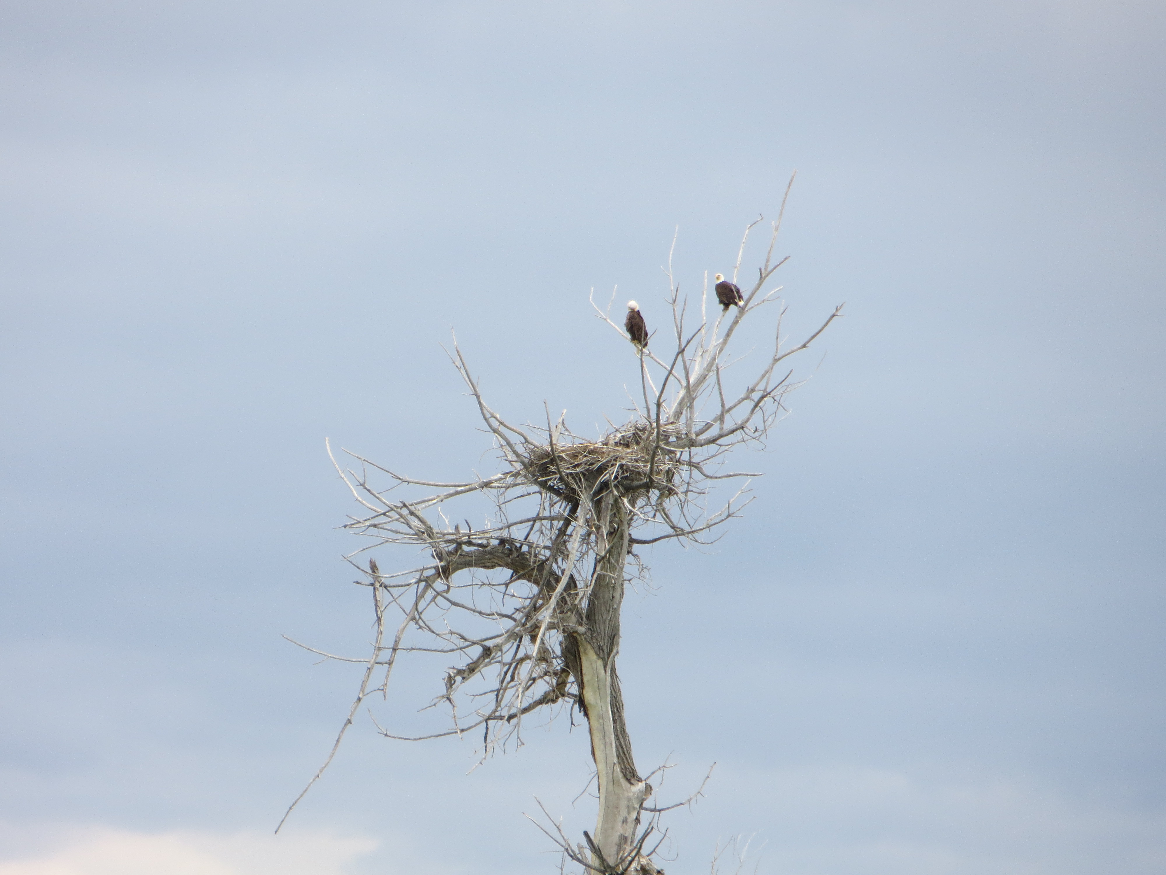
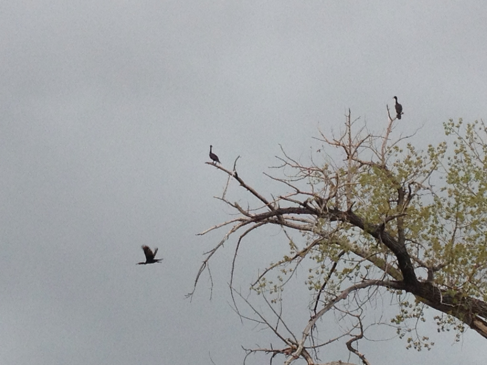
Kat showed me this monument that they had found buried in the river when renovating the Lodge. They dug it out of the sand and placed it above their fireplace. It has the same journal entry that I had posted on Facebook earlier that day.Before I left the lodge, a couple of Great Falls paddlers stopped by to say hi. Bob (r) and Mark. Nice kayaks, guys!Beautiful glassy waters were a much appreciated condition on the river.Not sure if these are cormorants or cranes. I think the former.This little white calf caught my attention because all of the others were black. Makes one think about genetics and chromosomes, a little middle-school science.Weather is always something to keep an eye on.As evening came on, that special light appeared. Taking photos was pure joy. I like starting later in the morning and paddling later in the evening.This is one of my favorites from that ‘special light’ evening.And, as the sun begins to set, the sky becomes painted with brush stroked of color.Stunningly gorgeous evening.The natural bird sanctuary across the way.Friday (May 24) night’s camp, and the grand finale of photo opportunities. Breathtaking sunset.John from Great Falls happened to call me on the phone as I came out of the canyon and there were ample cell towers. He and a couple of paddlers wanted to meet up and paddle with me. Great! I always welcome paddle companions. L-R: Sherri, John and Bob and, they DID find me thanks to my SPOT Tracker.That night I tried to paddle to the Corp of Discovery Canoe Camp. Turns out it was covered with homes. That is okay, I found a spot at dark and slept on a bed of mint. Soggy but no Mosquitos, and rather fragrant.I will leave you with one of my favorite photos. In the midst of premier fishing country, I realized fishing is definitely a family affair.
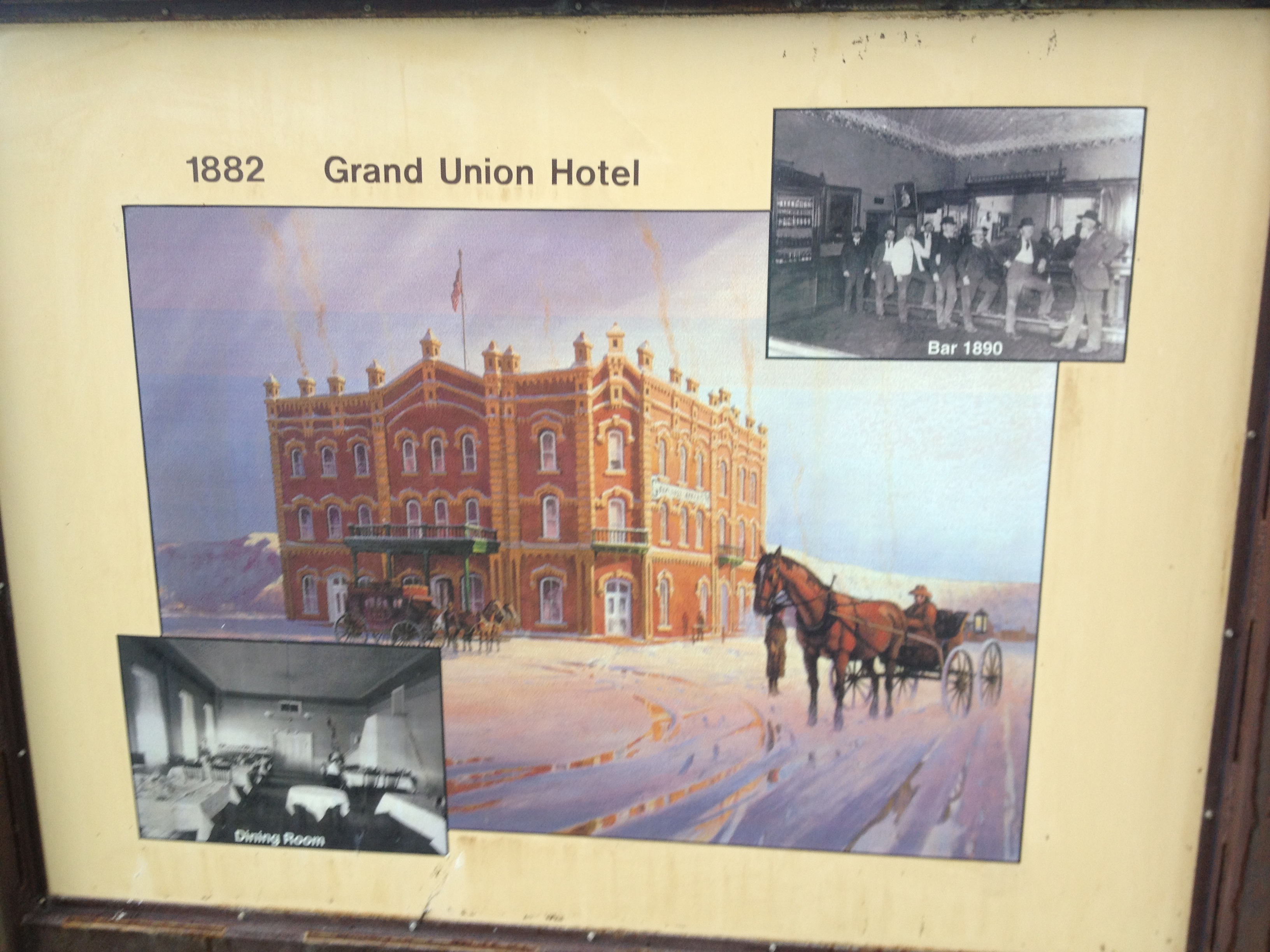
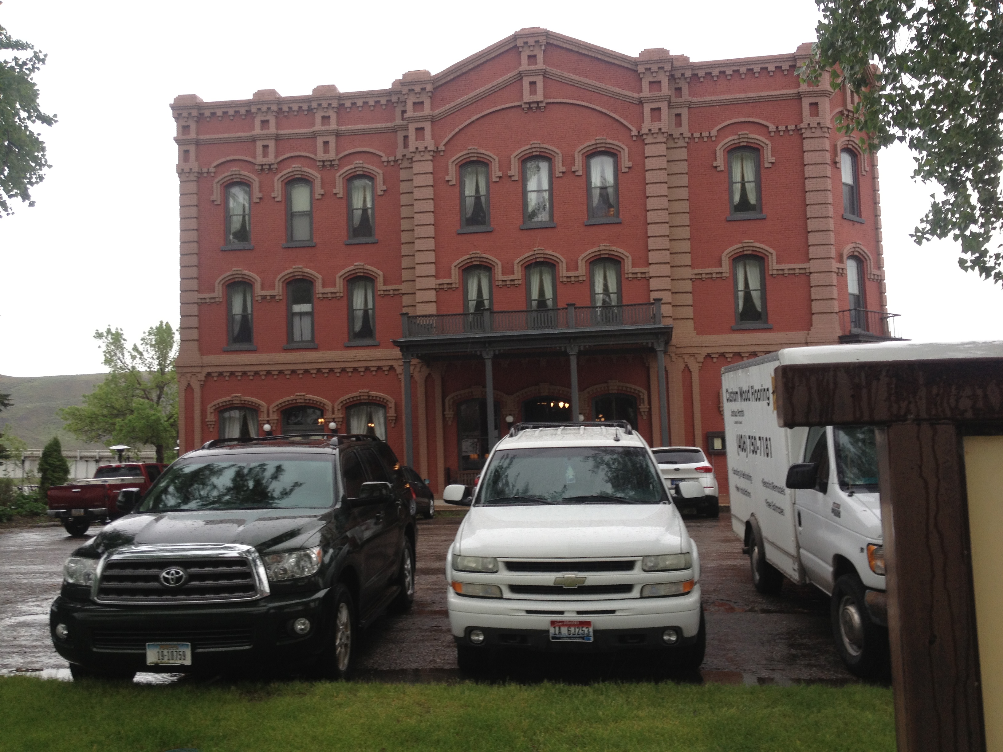
I hope you enjoyed this stretch of my journey as much as I did. Great Falls is deserving of its own post. I was able to paddle from there to Fort Benton in just a few hours, and here I sit in the Grand Union Hotel trying to finish this post. I feel good about this accomplishment and so, if the rain stops tomorrow, I will hit the river again. Fair warning, it may be awhile before I can post again as I am heading into some incredible wilderness area, including the Upper Missouri River Breaks National Monument. Be patient, and be sure and visit my Facebook page if you are able.
On Wednesday, May 8, I left my very public, yet cozy, camp at Twin Bridges. It was a little strange camping right on the river in a town park, but the park was designed for bik deners, so worked well for this paddler, too. I took my time packing so I would be rested, and well prepared, for this stretch on the Jefferson River. I grabbed a tomato, apple and three avocados, along with some cinnamon raisin English muffins, before I left. I also charged all of my electronic devices.
Leaving Twin Bridges after a pleasant two-day layover.Couple of local Twin Bridges fisher guys. They said fishing is just an excuse to get out on the river. I could totally relate. Really nice guys, kindred river spirits.
Danger of further harm to Blue Moon has diminished because of the much higher volume of water. The Ruby River empties in just upriver from Twin Bridges, and the Big Hole River just downstream. Now we are talking gorgeous and pleasurable paddling from here to Three Forks, which is where I anticipate arriving on Saturday. I have been looking forward to this stretch of river since I first decided to do a source start. I did not want to miss out on paddling the Jefferson River. I think you will see why:
Really fun river to paddle, the Jefferson.Thunderstorm brewingMontana mountainsTeepee on the Jefferson RiverTook this after applying suntan lotion to my face. As you can see, without a mirror I am kind of a mess.Eagle’s NestA beaver has just about nailed this tree.A beaver denA beaverI saw a lot of deer, but was never able to get my camera out in time. This one sure is pretty.Gorgeous scenery abounds!I thought these birds were snow geese, but it turns out (after we researched a little) they are Trumpeter Swans. Fantastic!A Great Blue Heron sitting in its nest high above in the trees.Nice man on the Jefferson, Jim Hicks, invited me up to his custom cabin once he found out I was headed for St. Louis. That about floored him.Jim Hicks’ custom cabin on the Jefferson River.Jim Hicks’ rescue dogs. Jim has 800 yards of Jefferson River frontage, three cabins, some horses, and is ex-military and currently employed as Ted Turner’s horticulturalist. Cool guy.Camped on a huge rock bar, I decided to take a walk before heading out for the day.Flock of pelicans sitting in the water.I love this bald eagle photo. He is looking right into your eyes, it seems!This is where I camped Friday night, at the diversion dam. Camping here made the portage around the rocks much easier. Plus, it was spectacularly gorgeous.This beaver came to greet me as I pulled into my diversion dam camp Friday night.Sun peaking out from behind the rock at my diversion dam camp. Everything is always better with a little sunshine.
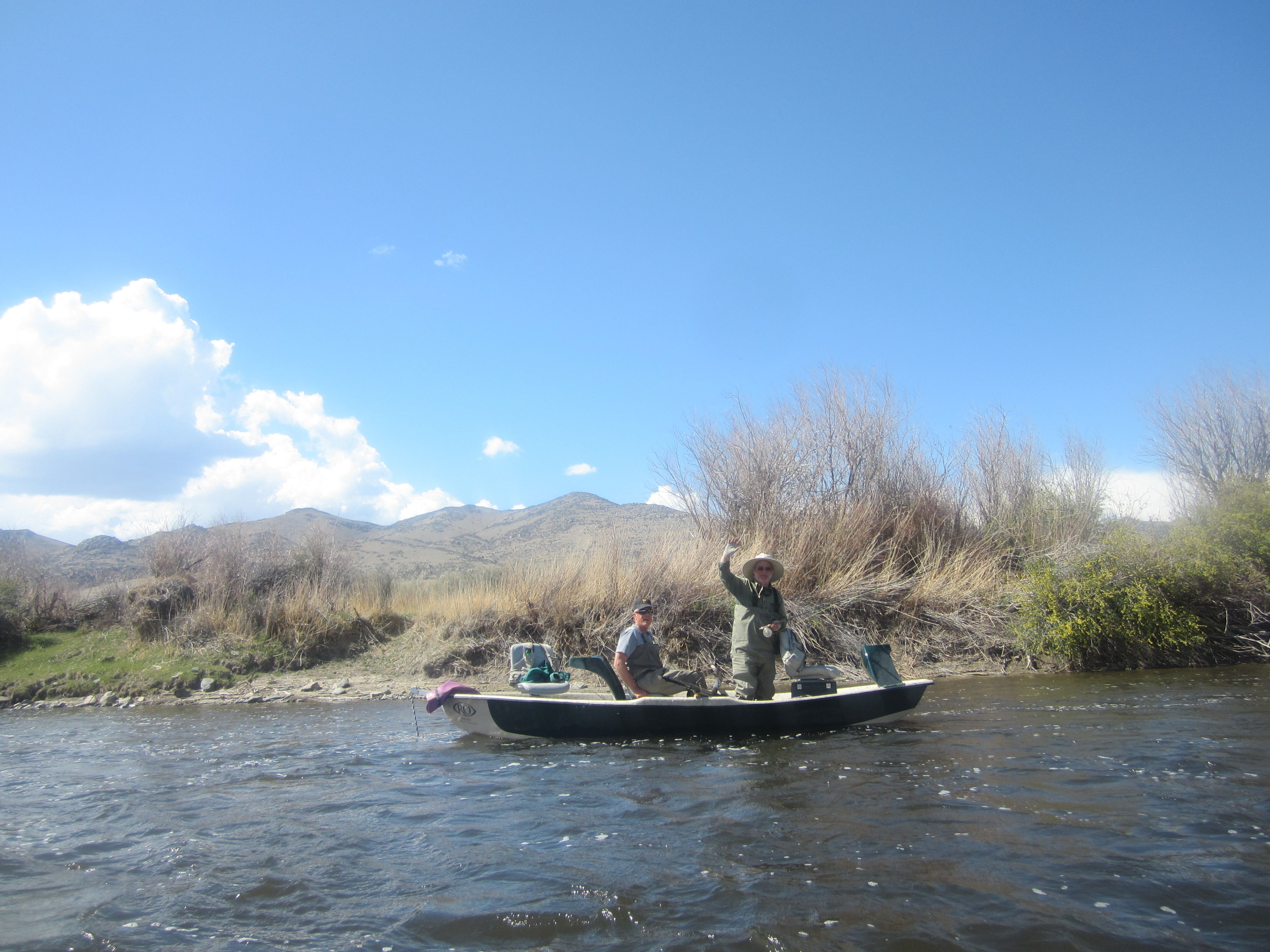
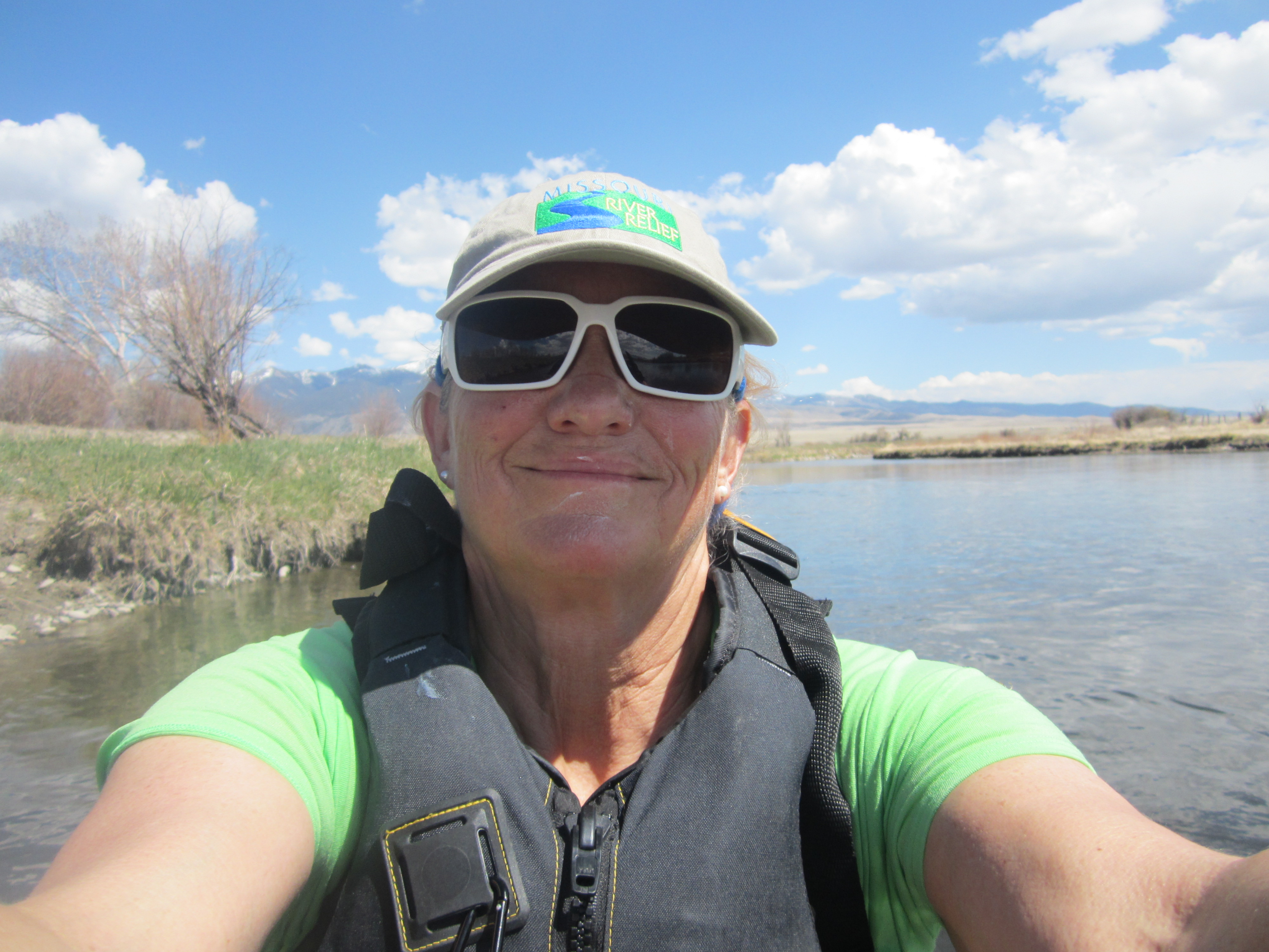
At 2:00 Norm and I met, miraculously within 4 minutes of each other, at Drouillard Bridge. Drouillard was a civil interpreter for Lewis and Clark. He was also half French and half Shawneed Indian from his mother’s side. There is a lot of history surrounding him in this area. Norm and I had about a 2 1/2 hour paddle together before we met Kristin at Three Forks, the headwaters of the Missouri River where the Jefferson, Madison, and Gallatin Rivers converge.
My pelicans even took to Norm and did not mind his photographing them.As a result, Norm got this beautiful photo of a pelican lifting off.
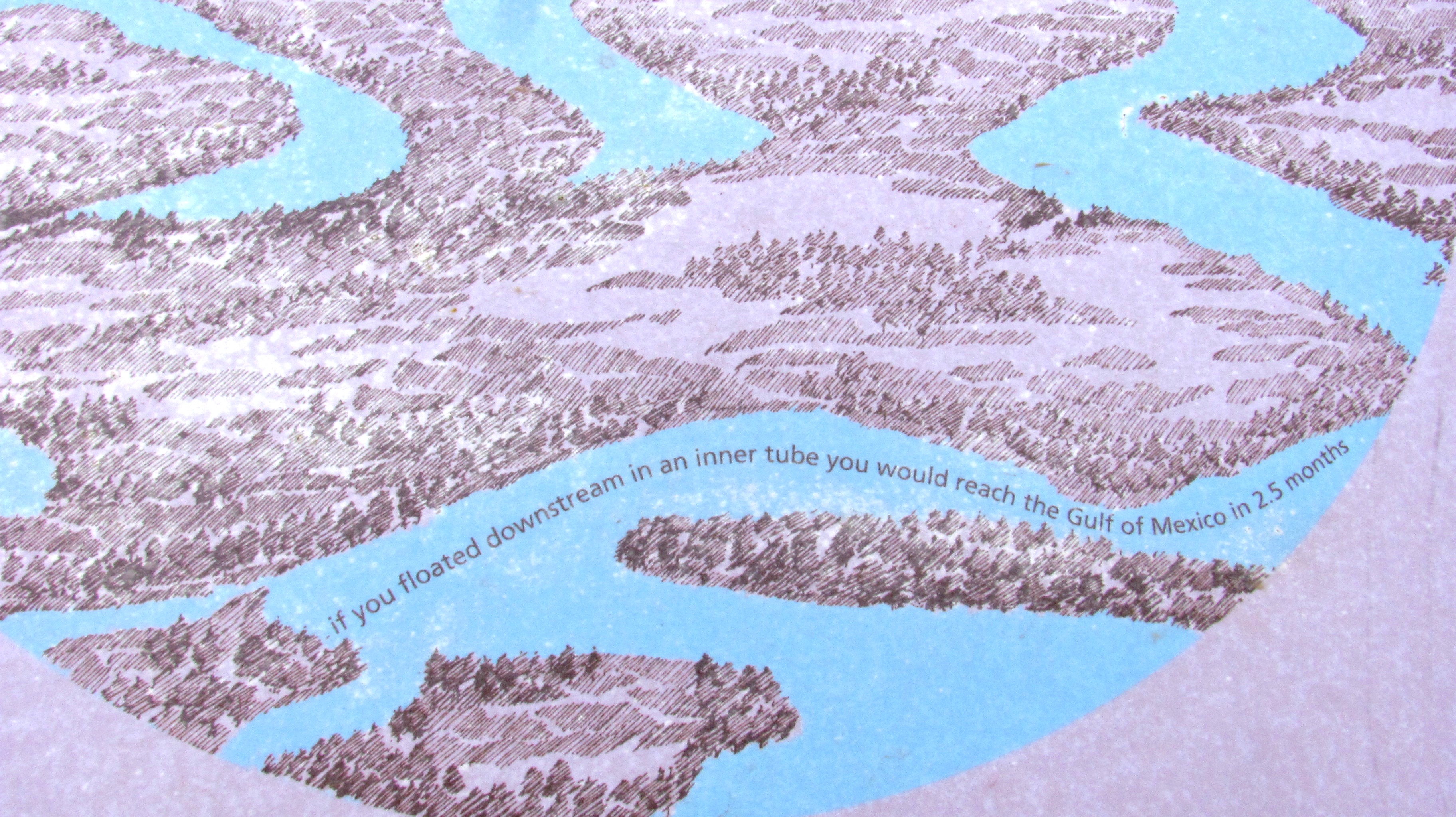
Norm and I at Three Forks, the headwaters of the Missouri River, after paddling together for about three hours.The lovely Kristin Walker, Norm’s girlfriend.Norm and girlfriend Kristin. I LOVE these guys!! Founders of the wonderful Base Camp International in Livingston, MT.Me and Norm. This moment we have been envisioning since last July.This sign at Three Forks claims you can reach the Mississippi in 2.5 months by inner tube. Umm, really?A glance at the first part of my paddle tomorrow, Wednesday, May 15.
I’ll be leaving tomorrow from Three Forks to head down the Big Muddy! I am not sure when I will be able to update with photos again. Please visit my Facebook Page, LoveYourBigMuddy Expedition, to stay tuned in.
A short video of our preparation at Base Camp International – Livingston, MT. Thank you very much to Norm Miller & Kris Walker for the video and their gracious hospitality!